351:
29:
673:. There are 4,768 bodies of water in the basin area; the largest of them is the Labuť pond with an area of 101 ha (250 acres), built on the stream of Kostratecký potok. In the area of the confluence of the Vltava and the Otava, the extensive
677:
is built on the Vltava, which also extends into the lower course of the Otava. Apart from this reservoir, no other reservoir or pond is built directly on the river.
421:
598:
851:
306:
and Křemelná rivers. Together with the Vydra, which is its main source, the Otava is 134.8 km (83.8 mi) long, which makes it the
322:
literally means "second harvest of grass", but the name of the river is probably of pre-Slavic origin and the resemblance to the word
378:, where it enters the Vltava River at the elevation of 348 m (1,142 ft). It is 134.8 km (83.8 mi) long. Its
158:
846:
374:, by the confluence of the Modravský potok, Filipohuťský potok and Roklanský potok at 975 m (3,199 ft) and flows to
719:
689:. It is still possible to find flakes of gold here. The sand panned for gold also gave the name to Písek (literally "sand").
307:
821:
366:, and is 111.7 km (69.4 mi) long. In a broader point of view, the Otava (as Vydra) arises in the territory of
836:
748:
562:
358:
From a water management point of view, the Otava and Vydra are two different rivers with separate numbering of
670:
554:
363:
57:
642:
658:
375:
856:
594:
841:
385:
The Otava has many relatively significant tributaries, the following being the longest ones:
362:. The Otava itself is formed by the confluence of the Vydra and Křemelná in the territory of
299:
70:
817:
330:, meaning "quick water". According to one theory, the name of the river is derived from the
8:
582:
772:
674:
610:
793:
698:
630:
590:
331:
701:. The course of the river is lined with many campsites for tourists and paddlers.
405:
371:
339:
271:
108:
295:
65:
379:
283:
50:
614:
830:
509:
303:
173:
160:
92:
350:
686:
570:
578:
326:
is only coincidental. A possible but unproven origin is the
Germanic word
129:
654:
638:
626:
618:
586:
558:
669:
The drainage basin is rich in fishponds, especially in the area of the
550:
359:
437:
287:
258:
723:
606:
566:
646:
634:
602:
546:
34:
367:
104:
574:
28:
291:
250:
144:
354:
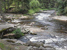
Confluence of the Vydra and Křemelná rivers, forming the Otava
310:. Without the Vydra, it is 111.7 km (69.4 mi) long.
650:
622:
279:
749:"Otava – skvělá řeka, kde vodácká doprava není příliš hustá"
254:
685:
In earlier times, the banks of the Otava were popular for
382:
has an area of 3,826.9 km (1,477.6 sq mi).
553:. The river flows through the municipal territories of
545:
The largest settlements on the river are the towns of
773:"Základní charakteristiky toku Otava a jeho povodí"
775:(in Czech). T. G. Masaryk Water Research Institute
233:26.0 m/s (920 cu ft/s) near estuary
828:
820:– Flood Warning and Forecasting Service of the
302:regions. It is formed by the confluence of the
318:The origin of the name is unclear. The word
767:
765:
211:3,826.9 km (1,477.6 sq mi)
349:
16:River in South Bohemian, Czech Republic
829:
762:
717:
743:
741:
739:
852:Rivers of the South Bohemian Region
822:Czech Hydrometeorological Institute
13:
664:
14:
868:
811:
736:
345:
308:13th longest river in the country
27:
338:, which meant "river with many
786:
711:
540:
152: • coordinates
1:
720:"Řeky si pojmenovali nejdřív"
704:
80:Physical characteristics
718:Loucká, Pavla (1997-09-05).
313:
294:River. It flows through the
203:134.8 km (83.8 mi)
191: • elevation
116: • elevation
7:
818:River flow at Písek station
140: • location
100: • location
10:
873:
847:Rivers of the Plzeň Region
697:The Otava is suitable for
692:
680:
229: • average
195:348 m (1,142 ft)
120:975 m (3,199 ft)
837:Tributaries of the Vltava
246:
241:
237:
227:
219:
215:
207:
199:
189:
150:
138:
128:
124:
114:
98:
88:
84:
79:
56:
46:
41:
26:
21:
751:(in Czech). CzechTourism
796:(in Czech). Město Písek
671:České Budějovice Basin
355:
275:
353:
174:49.02500°N 13.49639°E
242:Basin features
170: /
659:Zvíkovské Podhradí
495:Novosedelský potok
376:Zvíkovské Podhradí
356:
179:49.02500; 13.49639
538:
537:
264:
263:
864:
805:
804:
802:
801:
794:"Historie města"
790:
784:
783:
781:
780:
769:
760:
759:
757:
756:
745:
734:
733:
731:
730:
715:
595:Střelské Hoštice
388:
387:
360:river kilometres
230:
185:
184:
182:
181:
180:
175:
171:
168:
167:
166:
163:
117:
101:
31:
19:
18:
872:
871:
867:
866:
865:
863:
862:
861:
857:Bohemian Forest
827:
826:
814:
809:
808:
799:
797:
792:
791:
787:
778:
776:
771:
770:
763:
754:
752:
747:
746:
737:
728:
726:
716:
712:
707:
695:
683:
675:Orlík Reservoir
667:
665:Bodies of water
543:
372:Bohemian Forest
348:
316:
228:
192:
178:
176:
172:
169:
164:
161:
159:
157:
156:
153:
141:
115:
109:Bohemian Forest
99:
75:
37:
17:
12:
11:
5:
870:
860:
859:
854:
849:
844:
839:
825:
824:
813:
812:External links
810:
807:
806:
785:
761:
735:
709:
708:
706:
703:
694:
691:
682:
679:
666:
663:
605:, Strakonice,
542:
539:
536:
535:
532:
529:
526:
522:
521:
518:
515:
512:
506:
505:
502:
499:
496:
492:
491:
488:
485:
482:
481:Brložský potok
478:
477:
474:
471:
468:
464:
463:
460:
457:
454:
450:
449:
446:
443:
440:
434:
433:
430:
427:
424:
418:
417:
414:
411:
408:
402:
401:
398:
395:
392:
380:drainage basin
347:
346:Characteristic
344:
315:
312:
300:South Bohemian
284:Czech Republic
262:
261:
248:
244:
243:
239:
238:
235:
234:
231:
225:
224:
221:
217:
216:
213:
212:
209:
205:
204:
201:
197:
196:
193:
190:
187:
186:
154:
151:
148:
147:
142:
139:
136:
135:
132:
126:
125:
122:
121:
118:
112:
111:
102:
96:
95:
90:
86:
85:
82:
81:
77:
76:
74:
73:
71:South Bohemian
68:
62:
60:
54:
53:
51:Czech Republic
48:
44:
43:
39:
38:
32:
24:
23:
15:
9:
6:
4:
3:
2:
869:
858:
855:
853:
850:
848:
845:
843:
842:Otava (river)
840:
838:
835:
834:
832:
823:
819:
816:
815:
795:
789:
774:
768:
766:
750:
744:
742:
740:
725:
721:
714:
710:
702:
700:
699:river tourism
690:
688:
678:
676:
672:
662:
660:
656:
652:
648:
644:
640:
636:
632:
628:
624:
620:
616:
612:
608:
604:
600:
596:
592:
588:
584:
583:Velké Hydčice
580:
576:
572:
568:
564:
560:
556:
552:
548:
533:
530:
527:
525:Březový potok
524:
523:
519:
516:
513:
511:
508:
507:
503:
500:
497:
494:
493:
489:
486:
483:
480:
479:
475:
472:
469:
466:
465:
461:
458:
455:
452:
451:
447:
444:
441:
439:
436:
435:
431:
428:
425:
423:
420:
419:
415:
412:
409:
407:
404:
403:
399:
396:
393:
390:
389:
386:
383:
381:
377:
373:
369:
365:
361:
352:
343:
341:
337:
333:
329:
325:
321:
311:
309:
305:
301:
297:
293:
289:
285:
281:
277:
273:
269:
260:
256:
252:
249:
245:
240:
236:
232:
226:
222:
218:
214:
210:
206:
202:
198:
194:
188:
183:
155:
149:
146:
143:
137:
133:
131:
127:
123:
119:
113:
110:
106:
103:
97:
94:
91:
87:
83:
78:
72:
69:
67:
64:
63:
61:
59:
55:
52:
49:
45:
40:
36:
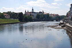
33:The Otava in
30:
25:
20:
798:. Retrieved
788:
777:. Retrieved
753:. Retrieved
727:. Retrieved
722:(in Czech).
713:
696:
687:gold panning
684:
668:
599:Horní Poříčí
544:
384:
357:
335:
327:
323:
319:
317:
267:
265:
591:Horažďovice
541:Settlements
394:Length (km)
247:Progression
177: /
831:Categories
800:2023-10-12
779:2023-10-12
755:2023-10-12
729:2023-10-12
705:References
611:Přešťovice
563:Dlouhá Ves
555:Hartmanice
551:Strakonice
364:Hartmanice
208:Basin size
165:13°29′47″E
629:, Písek,
579:Žichovice
391:Tributary
336:áth a ava
314:Etymology
288:tributary
286:, a left
259:North Sea
220:Discharge
162:49°1′30″N
47:Countries
655:Varvažov
647:Ostrovec
639:Vojníkov
635:Vrcovice
627:Kestřany
619:Čejetice
603:Katovice
587:Malý Bor
559:Rejštejn
467:Křemelná
453:Ostružná
397:River km
42:Location
693:Tourism
681:History
571:Dobršín
438:Volyňka
422:Lomnice
406:Blanice
370:in the
368:Modrava
328:Vatahva
290:of the
282:in the
278:) is a
276:Wottawa
105:Modrava
58:Regions
724:Vesmír
631:Čížová
615:Štěkeň
607:Slaník
567:Sušice
504:right
448:right
416:right
334:words
332:Celtic
292:Vltava
272:German
251:Vltava
223:
200:Length
145:Vltava
134:
89:Source
651:Oslov
623:Putim
547:Písek
534:left
517:111.7
510:Vydra
490:left
476:left
473:111.7
462:left
432:left
400:Side
340:fords
324:otava
320:otava
304:Vydra
296:Plzeň
280:river
268:Otava
130:Mouth
93:Vydra
66:Plzeň
35:Písek
22:Otava
657:and
643:Vráž
575:Rabí
549:and
531:62.9
528:21.3
514:23.1
501:60.5
498:24.3
487:35.5
484:27.0
470:30.3
459:88.9
456:41.3
445:54.6
442:46.1
429:24.9
426:59.3
413:32.8
410:94.7
298:and
266:The
255:Elbe
342:".
833::
764:^
738:^
661:.
653:,
649:,
645:,
641:,
637:,
633:,
625:,
621:,
617:,
613:,
609:,
601:,
597:,
593:,
589:,
585:,
581:,
577:,
573:,
569:,
565:,
561:,
557:,
520:–
274::
257:→
253:→
107:,
803:.
782:.
758:.
732:.
270:(
Text is available under the Creative Commons Attribution-ShareAlike License. Additional terms may apply.

