923:"}},"text\/plain":{"en":{"":"inception"}}},"{\"value\":{\"time\":\"+2008-10-09T00:00:00Z\",\"timezone\":0,\"before\":0,\"after\":0,\"precision\":11,\"calendarmodel\":\"http:\\\/\\\/www.wikidata.org\\\/entity\\\/Q1985727\"},\"type\":\"time\"}":{"text\/html":{"en":{"P571":"9 October 2008"}},"text\/plain":{"en":{"P571":"9 October 2008"}}}}": -->
283:
666:
43:
621:
672:
349:
677:
327:
99:
862:"}},"text\/plain":{"en":{"P275":"Creative Commons Attribution-ShareAlike 3.0 Unported"}}},"{\"value\":{\"entity-type\":\"item\",\"numeric-id\":50829104,\"id\":\"Q50829104\"},\"type\":\"wikibase-entityid\"}":{"text\/html":{"en":{"P275":"
306:
961:"}},"text\/plain":{"en":{"":"media type"}}},"{\"value\":\"image\\\/svg+xml\",\"type\":\"string\"}":{"text\/html":{"en":{"P1163":"image\/svg+xml"}},"text\/plain":{"en":{"P1163":"image\/svg+xml"}}}}": -->
858:"}},"text\/plain":{"en":{"":"copyright license"}}},"{\"value\":{\"entity-type\":\"item\",\"numeric-id\":14946043,\"id\":\"Q14946043\"},\"type\":\"wikibase-entityid\"}":{"text\/html":{"en":{"P275":"
814:"}},"text\/plain":{"en":{"":"copyright status"}}},"{\"value\":{\"entity-type\":\"item\",\"numeric-id\":50423863,\"id\":\"Q50423863\"},\"type\":\"wikibase-entityid\"}":{"text\/html":{"en":{"P6216":"
957:
1745:
1740:
730:– You must give appropriate credit, provide a link to the license, and indicate if changes were made. You may do so in any reasonable manner, but not in any way that suggests the licensor endorses you or your use.
317:
1760:
1730:
863:
859:
815:
958:
811:
920:
855:
1582:
1073:
638:
1820:
1879:
866:"}},"text\/plain":{"en":{"P275":"GNU Free Documentation License, version 1.2 or later"}}}}": -->
363:
636:; with no Invariant Sections, no Front-Cover Texts, and no Back-Cover Texts. A copy of the license is included in the section entitled
73:
69:
65:
61:
57:
53:
47:
906:
889:
841:
110:
1530:
237:
82:
1890:
This file contains additional information, probably added from the digital camera or scanner used to create or digitize it.
737:
1605:
273:
968:
825:
628:
930:
873:
800:
1600:
1370:
1090:
1062:}} Quadratische Plattkarte, N-S-Streckung 170 %. Geographische Begrenzung der Karte: * N: 61.0° N * S: 54.5° N * W:
282:
1525:
268:
687:
588:
1893:
If the file has been modified from its original state, some details may not fully reflect the modified file.
1140:
1072:
More than 100 pages use this file. The following list shows the first 100 pages that use this file only. A
633:
356:
1870:
1845:
1059:
158:
736:– If you remix, transform, or build upon the material, you must distribute your contributions under the
1790:
1835:
1455:
1330:
818:"}},"text\/plain":{"en":{"P6216":"copyrighted"}}}}": -->
1735:
1355:
1225:
1785:
1575:
118:
1450:
1860:
1510:
1505:
1500:
1170:
1165:
1160:
626:
Permission is granted to copy, distribute and/or modify this document under the terms of the
1755:
1865:
1465:
1420:
1365:
1085:
1036:
1031:
684:
42:
1260:
8:
1800:
1560:
1460:
348:
1350:
1190:
1155:
1130:
699:
253:
163:
Quadratische
Plattkarte, N-S-Streckung 170 %. Geographische Begrenzung der Karte:
1795:
1540:
1320:
1290:
1275:
1240:
1047:
612:
I, the copyright holder of this work, hereby publish it under the following licenses:
195:
Equirectangular projection, N/S stretching 170 %. Geographic limits of the map:
105:
790:
398:
1830:
1855:
1840:
1545:
1385:
1270:
1255:
1230:
1205:
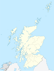
190:
1175:
1095:
506:
470:
1555:
1475:
1470:
1400:
1310:
1105:
1055:
578:
569:
560:
551:
542:
533:
524:
515:
497:
488:
479:
461:
452:
443:
434:
425:
416:
407:
389:
380:
371:
154:
1850:
1825:
1630:
1565:
1480:
1305:
1265:
1235:
1215:
1150:
1695:
1495:
1490:
1345:
1315:
1280:
1250:
1180:
1115:
1100:
978:
940:
900:
883:
835:
695:
241:
1680:
1620:
1515:
1435:
1430:
1405:
1390:
1380:
1195:
1185:
1805:
1550:
1535:
1440:
1220:
1125:
1120:
337:
312:
186:
1635:
615:
1520:
1485:
1445:
1395:
1375:
1360:
1325:
1295:
1210:
1145:
1135:
1080:
1004:
Click on a date/time to view the file as it appeared at that time.
1570:
1245:
1200:
326:
1775:
1770:
1685:
1425:
1415:
1335:
1285:
1615:
1410:
1340:
87:(SVG file, nominally 1,128 × 1,483 pixels, file size: 810 KB)
1655:
305:
1300:
333:
1640:
1110:
93:
1810:
1780:
1710:
1670:
1625:
784:
Add a one-line explanation of what this file represents
1665:
1660:
1645:
231:
United States
National Imagery and Mapping Agency data
1705:
1700:
1650:
1070:
355:
This SVG map has been made or improved in the German
1690:
1591:
1054:{{Information |Description= {{de|Positionskarte von
1002:
907:
890:
Creative
Commons Attribution-ShareAlike 3.0 Unported
864:
860:
Creative
Commons Attribution-ShareAlike 3.0 Unported
632:, Version 1.2 or any later version published by the
117:
Commons is a freely licensed media file repository.
1675:
1720:
1715:
1746:دوري كرة القدم الإسكتلندي الدرجة الأولى 2009–10
1791:Módulu:Mapa de llocalización/datos/Escocia/usu
747:https://creativecommons.org/licenses/by-sa/3.0
98:
753:Creative Commons Attribution-Share Alike 3.0
665:
214:
140:
259:
249:
222:
14:
713:– to copy, distribute and transmit the work
46:Size of this PNG preview of this SVG file:
1786:Módulu:Mapa de llocalización/datos/Escocia
765:You may select the license of your choice.
1606:Амодуль:Location map/data/UK Scotland/doc
1593:The following other wikis use this file:
1601:Амодуль:Location map/data/UK Scotland
1531:Scottish National League (ice hockey)
238:image:Scotland topographic map-fr.jpg
129:
688:Attribution-Share Alike 3.0 Unported
644:http://www.gnu.org/copyleft/fdl.html
1736:قالب:Location map/sandbox quick/doc
995:
676:
671:
13:
1888:
1741:نقاش المستخدم:ياسين الأسطى/أرشيف 3
789:
783:
764:
662:
611:
354:
331:
310:
179:
147:
130:
80:
1922:
1895:
1801:Plantía:Mapa de llocalización/doc
788:
1371:Hunterian Museum and Art Gallery
1091:Ancient universities of Scotland
774:
724:Under the following conditions:
683:This file is licensed under the
675:
670:
664:
620:
619:
347:
325:
304:
281:
97:
31:
21:
771:
399:
264:Derivative works of this file:
180:
1631:Sjabloon:Liggingkaart Skotland
1588:
1526:Scotland national cricket team
999:
770:
650:GNU Free Documentation License
639:GNU Free Documentation License
629:GNU Free Documentation License
148:
26:
1:
1796:Plantía:Mapa de llocalización
274:Western ferries route map.svg
36:
1696:Skotse nasionale krieketspan
1141:Battle of Nesbit Moor (1402)
1067:
796:Items portrayed in this file
605:
218:9 October 2008 (upload date)
7:
1885:
1817:Usage on azb.wikipedia.org
1806:Aeropuertu d'Inverness
1767:Usage on ast.wikipedia.org
1752:Usage on arz.wikipedia.org
1681:Verenigde Rugbykampioenskap
10:
1927:
1756:قالب:Location map Scotland
1727:Usage on ar.wikipedia.org
1612:Usage on af.wikipedia.org
1597:Usage on ab.wikipedia.org
738:same or compatible license
343:
137:
132:
1761:قالب:خريطة مواقع إسكتلندا
1731:قالب:خريطة مواقع إسكتلندا
1456:National Museum of Flight
1331:Glasgow Prestwick Airport
996:
507:
471:
143:Scotland location map.svg
16:
1356:Haddington, East Lothian
1226:Cockenzie and Port Seton
773:
704:
634:Free Software Foundation
579:
570:
561:
552:
543:
534:
525:
516:
498:
489:
480:
462:
453:
444:
435:
426:
417:
408:
390:
381:
372:
269:Flag map of Scotland.svg
104:This is a file from the
41:
1636:Aberdeen (dubbelsinnig)
1576:Turnberry (golf course)
1053:
288:Equivalent physical map
234:World Data Base II data
217:
108:. Information from its
1451:Morningside, Edinburgh
1060:Vereinigtes Königreich
159:Vereinigtes Königreich
111:description page there
1621:Rugbywêreldbeker 2007
1511:Royal Troon Golf Club
1506:Ralston, Renfrewshire
1501:Portobello, Edinburgh
1261:Davidson's Mains
1171:British Rail Class 47
1166:British Rail Class 26
1161:British Rail Class 17
1032:18:27, 9 October 2008
1466:Newington, Edinburgh
1421:Limes (Roman Empire)
1366:Haymarket, Edinburgh
1086:Achnashellach Forest
366:to improve as well.
296:SVG development
74:1,128 × 1,483 pixels
70:1,558 × 2,048 pixels
1821:همیلتون (ایسکاتلند)
1686:Aberfoyle, Stirling
1561:Swanston, Edinburgh
1461:Newhaven, Edinburgh
719:– to adapt the work
153:Positionskarte von
52:Other resolutions:
1776:Aniellu de Brodgar
1771:Roques de Stenness
1351:HM Prison Low Moss
1191:Camperdown, Dundee
1156:Bridgeton, Glasgow
1131:Barnton, Edinburgh
400:Deutsch (Sie-Form)
66:779 × 1,024 pixels
1914:
1913:
1880:more global usage
1616:Gebruiker:Laurens
1589:Global file usage
1541:South Queensferry
1321:Edinburgh Airport
1291:Dunfermline Abbey
1276:Drumlanrig Castle
1241:Craigievar Castle
1065:
874:copyright license
856:copyright license
782:
661:
660:
602:
601:
597:
596:
591:
336:was created with
227:own work, using
126:
125:
106:Wikimedia Commons
32:Global file usage
1918:
1896:
1044:
1006:
826:copyright status
812:copyright status
780:
760:
757:
754:
751:
748:
740:as the original.
702:
685:Creative Commons
679:
678:
674:
673:
668:
667:
657:
654:
651:
648:
645:
623:
622:
616:
592:
587:
351:
344:
329:
320:
308:
285:
185:Location map of
184:
152:
144:
138:
122:
101:
100:
94:
88:
77:
62:584 × 768 pixels
58:365 × 480 pixels
54:182 × 240 pixels
48:456 × 600 pixels
1926:
1925:
1921:
1920:
1919:
1917:
1916:
1915:
1884:
1656:Gruinard-eiland
1587:
1546:Stirling Castle
1386:John Knox House
1271:Delgatie Castle
1256:Cults, Aberdeen
1231:Corgarff Castle
1206:Carse of Gowrie
1066:
1050:
1042:
998:
997:
994:
993:
992:
991:
990:
989:
988:
987:
985:
975:
974:
973:
971:
956:
955:
954:
953:
952:
951:
950:
949:
947:
937:
936:
935:
933:
918:
917:
916:
915:
914:
913:
912:
911:
909:
898:
897:
896:
895:
894:
892:
880:
879:
878:
876:
853:
852:
851:
850:
849:
848:
847:
846:
844:
832:
831:
830:
828:
809:
808:
807:
806:
805:
803:
787:
786:
785:
768:
767:
766:
762:
761:
758:
755:
752:
749:
746:
745:
703:
694:
691:
680:
655:
652:
649:
646:
643:
614:
613:
608:
603:
598:
593:
581:
572:
563:
554:
545:
536:
527:
518:
509:
500:
491:
482:
473:
464:
455:
446:
437:
428:
419:
410:
401:
392:
383:
374:
370:
367:
357:Kartenwerkstatt
342:
341:
323:
322:
316:
299:
289:
286:
193:
161:
142:
135:
128:
127:
116:
115:
114:is shown below.
90:
86:
79:
78:
51:
12:
11:
5:
1924:
1912:
1911:
1908:
1904:
1903:
1900:
1887:
1882:of this file.
1876:
1875:
1874:
1873:
1868:
1863:
1858:
1853:
1848:
1843:
1838:
1833:
1828:
1823:
1815:
1814:
1813:
1808:
1803:
1798:
1793:
1788:
1783:
1778:
1773:
1765:
1764:
1763:
1758:
1750:
1749:
1748:
1743:
1738:
1733:
1725:
1724:
1723:
1718:
1713:
1708:
1703:
1698:
1693:
1688:
1683:
1678:
1673:
1668:
1663:
1658:
1653:
1648:
1643:
1638:
1633:
1628:
1623:
1618:
1610:
1609:
1608:
1603:
1590:
1585:to this file.
1579:
1578:
1573:
1568:
1563:
1558:
1553:
1548:
1543:
1538:
1533:
1528:
1523:
1518:
1513:
1508:
1503:
1498:
1493:
1488:
1483:
1478:
1473:
1468:
1463:
1458:
1453:
1448:
1443:
1438:
1433:
1428:
1423:
1418:
1413:
1408:
1403:
1398:
1393:
1388:
1383:
1378:
1373:
1368:
1363:
1358:
1353:
1348:
1343:
1338:
1333:
1328:
1323:
1318:
1313:
1308:
1303:
1298:
1293:
1288:
1283:
1278:
1273:
1268:
1263:
1258:
1253:
1248:
1243:
1238:
1233:
1228:
1223:
1218:
1213:
1208:
1203:
1198:
1193:
1188:
1183:
1178:
1176:Broughty Ferry
1173:
1168:
1163:
1158:
1153:
1148:
1143:
1138:
1133:
1128:
1123:
1118:
1113:
1108:
1103:
1098:
1096:Arbroath Abbey
1093:
1088:
1083:
1076:is available.
1069:
1064:
1063:
1052:
1048:
1045:
1041:1,128 × 1,483
1039:
1034:
1029:
1025:
1024:
1021:
1018:
1015:
1012:
1009:
1001:
986:
983:
981:
980:
979:
977:
976:
972:
967:
965:
964:
963:
962:
960:
948:
946:9 October 2008
945:
943:
942:
941:
939:
938:
934:
929:
927:
926:
925:
924:
922:
910:
905:
903:
902:
901:
899:
893:
888:
886:
885:
884:
882:
881:
877:
872:
870:
869:
868:
867:
865:
861:
857:
845:
840:
838:
837:
836:
834:
833:
829:
824:
822:
821:
820:
819:
817:
813:
804:
799:
797:
794:
793:
792:
791:
779:
778:
775:
772:
763:
744:
743:
742:
741:
731:
722:
721:
720:
714:
707:You are free:
692:
682:
681:
663:
659:
658:
624:
610:
609:
607:
604:
600:
599:
595:
594:
369:
352:
324:
303:
302:
300:
297:
293:
292:
291:
290:
287:
280:
277:
276:
271:
261:
260:Other versions
257:
256:
251:
247:
246:
245:
244:
235:
232:
224:
220:
219:
216:
212:
211:
210:
209:
206:
203:
200:
191:United Kingdom
178:
177:
174:
171:
168:
145:
136:
134:
131:
124:
123:
102:
92:
91:
45:
40:
39:
34:
29:
24:
19:
9:
6:
4:
3:
2:
1923:
1909:
1906:
1905:
1901:
1898:
1897:
1894:
1891:
1883:
1881:
1872:
1869:
1867:
1864:
1862:
1859:
1857:
1854:
1852:
1849:
1847:
1844:
1842:
1839:
1837:
1834:
1832:
1829:
1827:
1824:
1822:
1819:
1818:
1816:
1812:
1809:
1807:
1804:
1802:
1799:
1797:
1794:
1792:
1789:
1787:
1784:
1782:
1779:
1777:
1774:
1772:
1769:
1768:
1766:
1762:
1759:
1757:
1754:
1753:
1751:
1747:
1744:
1742:
1739:
1737:
1734:
1732:
1729:
1728:
1726:
1722:
1719:
1717:
1714:
1712:
1709:
1707:
1704:
1702:
1699:
1697:
1694:
1692:
1689:
1687:
1684:
1682:
1679:
1677:
1674:
1672:
1669:
1667:
1664:
1662:
1659:
1657:
1654:
1652:
1649:
1647:
1644:
1642:
1641:Auchtermuchty
1639:
1637:
1634:
1632:
1629:
1627:
1624:
1622:
1619:
1617:
1614:
1613:
1611:
1607:
1604:
1602:
1599:
1598:
1596:
1595:
1594:
1586:
1584:
1577:
1574:
1572:
1569:
1567:
1564:
1562:
1559:
1557:
1556:Sumburgh Head
1554:
1552:
1549:
1547:
1544:
1542:
1539:
1537:
1534:
1532:
1529:
1527:
1524:
1522:
1519:
1517:
1514:
1512:
1509:
1507:
1504:
1502:
1499:
1497:
1494:
1492:
1489:
1487:
1484:
1482:
1479:
1477:
1476:North Berwick
1474:
1472:
1471:Newton Mearns
1469:
1467:
1464:
1462:
1459:
1457:
1454:
1452:
1449:
1447:
1444:
1442:
1439:
1437:
1434:
1432:
1429:
1427:
1424:
1422:
1419:
1417:
1414:
1412:
1409:
1407:
1404:
1402:
1401:Kirkintilloch
1399:
1397:
1394:
1392:
1389:
1387:
1384:
1382:
1379:
1377:
1374:
1372:
1369:
1367:
1364:
1362:
1359:
1357:
1354:
1352:
1349:
1347:
1344:
1342:
1339:
1337:
1334:
1332:
1329:
1327:
1324:
1322:
1319:
1317:
1314:
1312:
1311:East Kilbride
1309:
1307:
1304:
1302:
1299:
1297:
1294:
1292:
1289:
1287:
1284:
1282:
1279:
1277:
1274:
1272:
1269:
1267:
1264:
1262:
1259:
1257:
1254:
1252:
1249:
1247:
1244:
1242:
1239:
1237:
1234:
1232:
1229:
1227:
1224:
1222:
1219:
1217:
1214:
1212:
1209:
1207:
1204:
1202:
1199:
1197:
1194:
1192:
1189:
1187:
1184:
1182:
1179:
1177:
1174:
1172:
1169:
1167:
1164:
1162:
1159:
1157:
1154:
1152:
1149:
1147:
1144:
1142:
1139:
1137:
1134:
1132:
1129:
1127:
1124:
1122:
1119:
1117:
1114:
1112:
1109:
1107:
1106:Auchenshuggle
1104:
1102:
1099:
1097:
1094:
1092:
1089:
1087:
1084:
1082:
1079:
1078:
1077:
1075:
1061:
1057:
1051:
1046:
1040:
1038:
1035:
1033:
1030:
1027:
1026:
1022:
1019:
1016:
1013:
1010:
1008:
1007:
1005:
984:image/svg+xml
982:
970:
966:
944:
932:
928:
908:
904:
891:
887:
875:
871:
843:
839:
827:
823:
802:
798:
795:
776:
769:
750:CC BY-SA 3.0
739:
735:
732:
729:
726:
725:
723:
718:
715:
712:
709:
708:
706:
705:
701:
697:
693:Attribution:
689:
686:
669:
641:
640:
635:
631:
630:
625:
618:
617:
590:
586:
582:
577:
573:
568:
564:
559:
555:
550:
546:
541:
537:
532:
528:
523:
519:
514:
510:
505:
501:
496:
492:
487:
483:
478:
474:
469:
465:
460:
456:
451:
447:
442:
438:
433:
429:
424:
420:
415:
411:
406:
402:
397:
393:
388:
384:
379:
375:
368:
365:
361:
358:
353:
350:
346:
345:
339:
335:
328:
319:
314:
307:
301:
295:
294:
284:
279:
278:
275:
272:
270:
267:
266:
265:
262:
258:
255:
252:
248:
243:
239:
236:
233:
230:
229:
228:
225:
221:
213:
207:
204:
201:
198:
197:
196:
192:
188:
183:
175:
172:
169:
166:
165:
164:
160:
156:
151:
146:
139:
120:
113:
112:
107:
103:
96:
95:
89:
84:
83:Original file
75:
71:
67:
63:
59:
55:
49:
44:
38:
35:
33:
30:
28:
25:
23:
20:
18:
15:
1892:
1889:
1877:
1592:
1580:
1566:Thornliebank
1481:Old Aberdeen
1306:East Fortune
1266:Dean Village
1236:Corstorphine
1216:Central Belt
1151:Bishopbriggs
1071:
1049:NordNordWest
1003:
1000:File history
733:
727:
716:
710:
700:NordNordWest
637:
627:
584:
575:
566:
557:
548:
539:
530:
521:
512:
503:
494:
485:
476:
472:Plattdüütsch
467:
458:
449:
440:
431:
422:
413:
404:
395:
386:
377:
373:azərbaycanca
364:propose maps
359:
263:
254:NordNordWest
226:
194:
181:
162:
149:
119:You can help
109:
81:
22:File history
1711:Bonnybridge
1496:Peterculter
1491:Pencaitland
1346:Grangemouth
1316:East Linton
1281:Duddingston
1251:Crossmyloof
1181:Bruntsfield
1116:Baillieston
1101:Archiestown
842:copyrighted
816:copyrighted
734:share alike
728:attribution
517:slovenščina
141:Description
1871:لوکقیلپهید
1846:مولینسبورن
1836:نیوتن مرنز
1811:Sule Stack
1781:Skara Brae
1671:Skara Brae
1626:Skerryvore
1583:more links
1516:Rutherglen
1436:Mannofield
1431:Longniddry
1406:Kirkliston
1391:Kilmarnock
1381:Iona Abbey
1196:Carmunnock
1186:Cambuslang
1068:File usage
1056:Schottland
1017:Dimensions
969:media type
959:media type
535:македонски
463:Nederlands
362:. You can
202:S: 54.5° N
199:N: 61.0° N
170:S: 54.5° N
167:N: 61.0° N
155:Schottland
27:File usage
1910:1483.4307
1666:Ben Nevis
1661:Lockerbie
1646:Inverness
1551:Stobswell
1536:Smoo Cave
1441:Marchmont
1221:Clydebank
1126:Barlanark
1121:Bargeddie
1074:full list
1014:Thumbnail
1011:Date/Time
931:inception
921:inception
696:Eric Gaba
606:Licensing
508:sicilianu
490:português
360:(Map Lab)
298:InfoField
242:Eric Gaba
208:E: 0.4° W
205:W: 8.8° W
182:English:
176:O: 0.4° W
173:W: 8.8° W
150:Deutsch:
1902:1127.532
1886:Metadata
1861:لینلیتقو
1706:Glen Coe
1701:Dumfries
1651:Kirkwall
1521:Sciennes
1486:Ormiston
1446:Maryhill
1396:Kilrenny
1376:Inveresk
1361:Hardgate
1326:Giffnock
1296:Dunglass
1211:Cathcart
1146:Bearsden
1136:Barrhead
1081:Aberlady
1043:(810 KB)
777:Captions
717:to remix
711:to share
690:license.
445:latviešu
436:italiano
427:français
338:Inkscape
315:code is
187:Scotland
37:Metadata
1866:لوکهبی
1831:ومیس بی
1691:Alloway
1571:Tranent
1246:Cramond
1201:Carmyle
1028:current
1023:Comment
801:depicts
781:English
562:հայերեն
553:ქართული
544:русский
418:español
409:English
391:Deutsch
382:čeština
133:Summary
85:
1907:Height
1856:مادرول
1841:میلقای
1426:Lochee
1416:Lenzie
1336:Gorgie
1286:Dunbar
583:
574:
565:
556:
547:
538:
529:
520:
511:
502:
499:română
493:
484:
481:polski
475:
466:
457:
454:magyar
448:
439:
430:
421:
412:
403:
394:
385:
376:
332:This
330:
309:
250:Author
223:Source
1899:Width
1878:View
1851:مالیق
1826:ویشاو
1676:Govan
1581:View
1411:Leith
1341:Govan
571:বাংলা
526:suomi
318:valid
1721:Luss
1301:Dyce
1020:User
759:true
756:true
656:true
653:true
647:GFDL
311:The
215:Date
17:File
1716:Ayr
1111:Ayr
589:+/−
580:ไทย
334:map
313:SVG
240:by
1058:,
698:,
189:,
157:,
72:|
68:|
64:|
60:|
56:|
50:.
642:.
585:∙
576:∙
567:∙
558:∙
549:∙
540:∙
531:∙
522:∙
513:∙
504:∙
495:∙
486:∙
477:∙
468:∙
459:∙
450:∙
441:∙
432:∙
423:∙
414:∙
405:∙
396:∙
387:∙
378:∙
340:.
321:.
121:.
76:.
Text is available under the Creative Commons Attribution-ShareAlike License. Additional terms may apply.

