Index
FileFile history
File usage
Global file usage
Road_hole_bunker.jpg
Wikimedia Commons
description page there
You can help
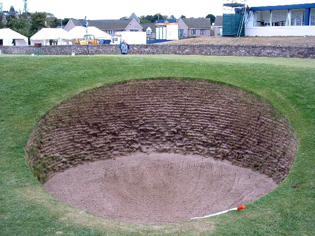
Road hole bunker - geograph.org.uk - 127606.jpg
Alan Stewart
Reusing this file
56° 21′ N, 2° 48′ W
_region:GB-GBN_&language=en)
OpenStreetMap
Creative Commons
Attribution-Share Alike 2.0 Generic
same or compatible license
depicts<\/a>"}},"text\/plain":{"en":{"":"depicts"}}},"{\"value\":{\"entity-type\":\"item\",\"numeric-id\":1048525,\"id\":\"Q1048525\"},\"type\":\"wikibase-entityid\"}":{"text\/html":{"en":{"P180":"golf course<\/a>"}},"text\/plain":{"en":{"P180":"golf course"}}}}">
Items portrayed in this file
depicts
golf course
creator<\/a>"}},"text\/plain":{"en":{"":"creator"}}},"{\"value\":{\"entity-type\":\"property\",\"numeric-id\":2699,\"id\":\"P2699\"},\"type\":\"wikibase-entityid\"}":{"text\/html":{"en":{"":"URL<\/a>"}},"text\/plain":{"en":{"":"URL"}}},"{\"value\":\"https:\\\/\\\/www.geograph.org.uk\\\/profile\\\/1594\",\"type\":\"string\"}":{"text\/html":{"en":{"P2699":"https:\/\/www.geograph.org.uk\/profile\/1594<\/a>"}},"text\/plain":{"en":{"P2699":"https:\/\/www.geograph.org.uk\/profile\/1594"}}},"{\"value\":{\"entity-type\":\"property\",\"numeric-id\":3831,\"id\":\"P3831\"},\"type\":\"wikibase-entityid\"}":{"text\/html":{"en":{"":"value of statement has role<\/a>"}},"text\/plain":{"en":{"":"value of statement has role"}}},"{\"value\":{\"entity-type\":\"item\",\"numeric-id\":33231,\"id\":\"Q33231\"},\"type\":\"wikibase-entityid\"}":{"text\/html":{"en":{"P3831":"photographer<\/a>"}},"text\/plain":{"en":{"P3831":"photographer"}}},"{\"value\":{\"entity-type\":\"property\",\"numeric-id\":2093,\"id\":\"P2093\"},\"type\":\"wikibase-entityid\"}":{"text\/html":{"en":{"":"author name string<\/a>"}},"text\/plain":{"en":{"":"author name string"}}},"{\"value\":\"Alan Stewart\",\"type\":\"string\"}":{"text\/html":{"en":{"P2093":"Alan Stewart"}},"text\/plain":{"en":{"P2093":"Alan Stewart"}}}}">creator
URL
https://www.geograph.org.uk/profile/1594
value of statement has role
photographer
author name string
copyright status<\/a>"}},"text\/plain":{"en":{"":"copyright status"}}},"{\"value\":{\"entity-type\":\"item\",\"numeric-id\":50423863,\"id\":\"Q50423863\"},\"type\":\"wikibase-entityid\"}":{"text\/html":{"en":{"P6216":"copyrighted<\/a>"}},"text\/plain":{"en":{"P6216":"copyrighted"}}}}">copyright status
copyrighted
copyright license<\/a>"}},"text\/plain":{"en":{"":"copyright license"}}},"{\"value\":{\"entity-type\":\"item\",\"numeric-id\":19068220,\"id\":\"Q19068220\"},\"type\":\"wikibase-entityid\"}":{"text\/html":{"en":{"P275":"Creative Commons Attribution-ShareAlike 2.0 Generic<\/a>"}},"text\/plain":{"en":{"P275":"Creative Commons Attribution-ShareAlike 2.0 Generic"}}}}">
Text is available under the Creative Commons Attribution-ShareAlike License. Additional terms may apply.
↑
creator
URL
https://www.geograph.org.uk/profile/1594
value of statement has role
photographer
author name string
copyright status<\/a>"}},"text\/plain":{"en":{"":"copyright status"}}},"{\"value\":{\"entity-type\":\"item\",\"numeric-id\":50423863,\"id\":\"Q50423863\"},\"type\":\"wikibase-entityid\"}":{"text\/html":{"en":{"P6216":"copyrighted<\/a>"}},"text\/plain":{"en":{"P6216":"copyrighted"}}}}">copyright status
copyrighted
copyright license<\/a>"}},"text\/plain":{"en":{"":"copyright license"}}},"{\"value\":{\"entity-type\":\"item\",\"numeric-id\":19068220,\"id\":\"Q19068220\"},\"type\":\"wikibase-entityid\"}":{"text\/html":{"en":{"P275":"Creative Commons Attribution-ShareAlike 2.0 Generic<\/a>"}},"text\/plain":{"en":{"P275":"Creative Commons Attribution-ShareAlike 2.0 Generic"}}}}">
Text is available under the Creative Commons Attribution-ShareAlike License. Additional terms may apply.
↑
copyright status
copyrighted
copyright license<\/a>"}},"text\/plain":{"en":{"":"copyright license"}}},"{\"value\":{\"entity-type\":\"item\",\"numeric-id\":19068220,\"id\":\"Q19068220\"},\"type\":\"wikibase-entityid\"}":{"text\/html":{"en":{"P275":"Creative Commons Attribution-ShareAlike 2.0 Generic<\/a>"}},"text\/plain":{"en":{"P275":"Creative Commons Attribution-ShareAlike 2.0 Generic"}}}}">
Text is available under the Creative Commons Attribution-ShareAlike License. Additional terms may apply.
↑
Text is available under the Creative Commons Attribution-ShareAlike License. Additional terms may apply.
↑