894:"}},"text\/plain":{"en":{"":"coordinates of depicted place"}}},"{\"value\":{\"latitude\":54.5039,\"longitude\":-2.781,\"altitude\":null,\"precision\":0.0001,\"globe\":\"http:\\\/\\\/www.wikidata.org\\\/entity\\\/Q2\"},\"type\":\"globecoordinate\"}":{"text\/html":{"en":{"P9149":"54\u00b030'14.0"N, 2\u00b046'51.6"W"}},"text\/plain":{"en":{"P9149":"54\u00b030'14.0\"N, 2\u00b046'51.6\"W"}}}}": -->
554:"}},"text\/plain":{"en":{"":"author name string"}}},"{\"value\":\"Mick Garratt\",\"type\":\"string\"}":{"text\/html":{"en":{"P2093":"Mick Garratt"}},"text\/plain":{"en":{"P2093":"Mick Garratt"}}},"{\"value\":{\"entity-type\":\"property\",\"numeric-id\":3831,\"id\":\"P3831\"},\"type\":\"wikibase-entityid\"}":{"text\/html":{"en":{"":"
737:"}},"text\/plain":{"en":{"":"inception"}}},"{\"value\":{\"time\":\"+2005-10-27T00:00:00Z\",\"timezone\":0,\"before\":0,\"after\":0,\"precision\":11,\"calendarmodel\":\"http:\\\/\\\/www.wikidata.org\\\/entity\\\/Q1985727\"},\"type\":\"time\"}":{"text\/html":{"en":{"P571":"27 October 2005"}},"text\/plain":{"en":{"P571":"27 October 2005"}}}}": -->
771:
538:
389:
237:
258:
296:
301:
72:
932:"}},"text\/plain":{"en":{"":"ISO speed"}}},"{\"value\":{\"amount\":\"+160\",\"unit\":\"1\"},\"type\":\"quantity\"}":{"text\/html":{"en":{"P6789":"160"}},"text\/plain":{"en":{"P6789":"160"}}}}": -->
1015:"}},"text\/plain":{"en":{"":"f-number"}}},"{\"value\":{\"amount\":\"+2.8\",\"unit\":\"1\"},\"type\":\"quantity\"}":{"text\/html":{"en":{"P6790":"2.8"}},"text\/plain":{"en":{"P6790":"2.8"}}}}": -->
970:"}},"text\/plain":{"en":{"":"exposure time"}}},"{\"value\":{\"amount\":\"+0.0029411764705882\",\"unit\":\"http:\\\/\\\/www.wikidata.org\\\/entity\\\/Q11574\"},\"type\":\"quantity\"}":{"text\/html":{"en":{"P6757":"0.0029411764705882
550:"}},"text\/plain":{"en":{"P2699":"https:\/\/www.geograph.org.uk\/profile\/343"}}},"{\"value\":{\"entity-type\":\"property\",\"numeric-id\":2093,\"id\":\"P2093\"},\"type\":\"wikibase-entityid\"}":{"text\/html":{"en":{"":"
779:"}},"text\/plain":{"en":{"P7482":"file available on the internet"}}},"{\"value\":{\"entity-type\":\"property\",\"numeric-id\":137,\"id\":\"P137\"},\"type\":\"wikibase-entityid\"}":{"text\/html":{"en":{"":"
787:"}},"text\/plain":{"en":{"P137":"Geograph Britain and Ireland"}}},"{\"value\":{\"entity-type\":\"property\",\"numeric-id\":7384,\"id\":\"P7384\"},\"type\":\"wikibase-entityid\"}":{"text\/html":{"en":{"":"
558:"}},"text\/plain":{"en":{"":"object of statement has role"}}},"{\"value\":{\"entity-type\":\"item\",\"numeric-id\":33231,\"id\":\"Q33231\"},\"type\":\"wikibase-entityid\"}":{"text\/html":{"en":{"P3831":"
693:"}},"text\/plain":{"en":{"":"copyright license"}}},"{\"value\":{\"entity-type\":\"item\",\"numeric-id\":19068220,\"id\":\"Q19068220\"},\"type\":\"wikibase-entityid\"}":{"text\/html":{"en":{"P275":"
649:"}},"text\/plain":{"en":{"":"copyright status"}}},"{\"value\":{\"entity-type\":\"item\",\"numeric-id\":50423863,\"id\":\"Q50423863\"},\"type\":\"wikibase-entityid\"}":{"text\/html":{"en":{"P6216":"
775:"}},"text\/plain":{"en":{"":"source of file"}}},"{\"value\":{\"entity-type\":\"item\",\"numeric-id\":74228490,\"id\":\"Q74228490\"},\"type\":\"wikibase-entityid\"}":{"text\/html":{"en":{"P7482":"
1053:"}},"text\/plain":{"en":{"":"focal length"}}},"{\"value\":{\"amount\":\"+12\",\"unit\":\"http:\\\/\\\/www.wikidata.org\\\/entity\\\/Q174789\"},\"type\":\"quantity\"}":{"text\/html":{"en":{"P2151":"12
783:"}},"text\/plain":{"en":{"":"operator"}}},"{\"value\":{\"entity-type\":\"item\",\"numeric-id\":1503119,\"id\":\"Q1503119\"},\"type\":\"wikibase-entityid\"}":{"text\/html":{"en":{"P137":"
795:"}},"text\/plain":{"en":{"P7384":"72907"}}},"{\"value\":{\"entity-type\":\"property\",\"numeric-id\":973,\"id\":\"P973\"},\"type\":\"wikibase-entityid\"}":{"text\/html":{"en":{"":"
542:"}},"text\/plain":{"en":{"":"creator"}}},"{\"value\":{\"entity-type\":\"property\",\"numeric-id\":2699,\"id\":\"P2699\"},\"type\":\"wikibase-entityid\"}":{"text\/html":{"en":{"":"
1049:
799:"}},"text\/plain":{"en":{"":"described at URL"}}},"{\"value\":\"https:\\\/\\\/www.geograph.org.uk\\\/photo\\\/72907\",\"type\":\"string\"}":{"text\/html":{"en":{"P973":"
546:"}},"text\/plain":{"en":{"":"URL"}}},"{\"value\":\"https:\\\/\\\/www.geograph.org.uk\\\/profile\\\/343\",\"type\":\"string\"}":{"text\/html":{"en":{"P2699":"
43:
791:"}},"text\/plain":{"en":{"":"geograph.org.uk image ID"}}},"{\"value\":\"72907\",\"type\":\"string\"}":{"text\/html":{"en":{"P7384":"
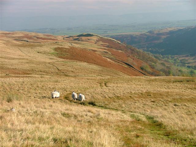
1153:== {{int:filedesc}} == {{Information |description={{en|1=Old Corpse Road. Before the Holy Trinity church was built in Mardale in 1736, the dead had to be carried by horseback along the Corpse Road for burial at Shap.}} |date=2005-10-27 |source=From [http:
214:
348:– You must give appropriate credit, provide a link to the license, and indicate if changes were made. You may do so in any reasonable manner, but not in any way that suggests the licensor endorses you or your use.
220:
1314:
776:
694:
650:
792:
784:
559:
1050:
1012:
967:
929:
891:
788:
772:
646:
555:
551:
543:
83:
796:
780:
734:
690:
539:
51:
800:
547:
414:
397:
126:
Old Corpse Road. Before the Holy
Trinity church was built in Mardale in 1736, the dead had to be carried by horseback along the Corpse Road for burial at Shap.
1146:
697:"}},"text\/plain":{"en":{"P275":"Creative Commons Attribution-ShareAlike 2.0 Generic"}}}}": -->
803:"}},"text\/plain":{"en":{"P973":"https:\/\/www.geograph.org.uk\/photo\/72907"}}}}": -->
1177:
826:
720:
676:
230:
846:
265:
1208:
This file contains additional information, probably added from the digital camera or scanner used to create or digitize it.
355:
631:
1064:
1022:
981:
939:
901:
854:
810:
660:
624:
611:
596:
490:
869:
839:
744:
704:
569:
528:
437:
974:"}},"text\/plain":{"en":{"P6757":"0.0029411764705882 second"}}}}": -->
429:
1397:
1135:
1130:
42:
311:
1211:
If the file has been modified from its original state, some details may not fully reflect the modified file.
410:
1195:
354:– If you remix, transform, or build upon the material, you must distribute your contributions under the
272:
on the
Geograph website for the photographer's contact details. The copyright on this image is owned by
1057:"}},"text\/plain":{"en":{"P2151":"12 millimetre"}}}}": -->
562:"}},"text\/plain":{"en":{"P3831":"photographer"}}}}": -->
653:"}},"text\/plain":{"en":{"P6216":"copyrighted"}}}}": -->
1163:
The following pages on the
English Knowledge use this file (pages on other projects are not listed):
418:
91:
183:
403:
Remove redundant categories and try to put this image in the most specific category/categories
1450:
308:
167:
876:
861:
603:
481:
8:
1486:
252:
485:
477:
473:
469:
465:
461:
457:
453:
449:
445:
236:
277:
78:
518:
1468:
1424:
1353:
1237:
1230:
1277:
156:
146:
1496:
1167:
1074:
1032:
991:
949:
911:
820:
754:
714:
670:
579:
257:
1257:
269:
1371:
1247:
1220:
1172:
1103:
Click on a date/time to view the file as it appeared at that time.
222:
215:
54° 30′ 14″ N, 2° 46′ 52″ W
135:
66:
512:
Add a one-line explanation of what this file represents
417:
combined with a database. You can also have a look at
409:
The location categories are based on information from
1161:
1186:
1101:
90:
Commons is a freely licensed media file repository.
721:
Creative
Commons Attribution-ShareAlike 2.0 Generic
695:
Creative
Commons Attribution-ShareAlike 2.0 Generic
1491:Flash did not fire, compulsory flash suppression
56:(640 × 480 pixels, file size: 66 KB, MIME type:
394:The categories of this image should be checked.
365:https://creativecommons.org/licenses/by-sa/2.0
71:
371:Creative Commons Attribution-Share Alike 2.0
289:
131:
116:Old Corpse Road - geograph.org.uk - 72907.jpg
113:
52:Old_Corpse_Road_-_geograph.org.uk_-_72907.jpg
152:
141:
14:
1054:
971:
801:https:\/\/www.geograph.org.uk\/photo\/72907
548:https:\/\/www.geograph.org.uk\/profile\/343
331:– to copy, distribute and transmit the work
1188:The following other wikis use this file:
1178:List of hill passes of the Lake District
877:https://www.geograph.org.uk/photo/72907
604:https://www.geograph.org.uk/profile/343
436:This image was uploaded as part of the
229:View this and other nearby images on:
424:The topic category from Geograph was
190:
102:
1315:Digital Camera FinePix S5000 Ver3.00
276:and is licensed for reuse under the
205:
1094:
312:Attribution-Share Alike 2.0 Generic
300:
295:
280:Attribution-ShareAlike 2.0 license.
13:
1206:
517:
511:
286:
263:
120:
103:
49:
1545:
1213:
516:
1268:Date and time of data generation
1162:
502:
387:
342:Under the following conditions:
307:This file is licensed under the
299:
294:
288:
256:
235:
221:
70:
31:
21:
499:
121:
46:No higher resolution available.
1242:1/340 sec (0.0029411764705882)
1183:
1098:
827:file available on the internet
777:file available on the internet
498:
264:This image was taken from the
26:
1:
902:coordinates of depicted place
892:coordinates of depicted place
36:
1158:
847:Geograph Britain and Ireland
785:Geograph Britain and Ireland
625:object of statement has role
556:object of statement has role
524:Items portrayed in this file
248:
7:
1522:Focal plane resolution unit
1408:Date and time of digitizing
1203:
10:
1550:
1533:One-chip color area sensor
1192:Usage on ar.wikipedia.org
356:same or compatible license
110:
105:
1321:File change date and time
1095:
917:54°30'14.0"N, 2°46'51.6"W
196:Mick Garratt /
177:Mick Garratt /
16:
1514:Focal plane Y resolution
1506:Focal plane X resolution
855:geograph.org.uk image ID
789:geograph.org.uk image ID
501:
419:this tool from mysociety
385:
384:
322:
77:This is a file from the
41:
1337:Custom image processing
1152:
415:this OpenStreetMap tool
168:required by the license
134:
81:. Information from its
1416:Image compression mode
1411:10:57, 27 October 2005
1381:Subject distance range
1324:10:57, 27 October 2005
1271:10:57, 27 October 2005
1131:17:44, 30 January 2010
270:this photograph's page
241:54.503900; -2.781000
84:description page there
1460:Maximum land aperture
1295:Horizontal resolution
438:Geograph batch upload
428:(find similar images
406:Remove this template
1329:Y and C positioning
1303:Vertical resolution
1217:Camera manufacturer
997:0.0029411764705882
482:português do Brasil
337:– to adapt the work
1363:Scene capture type
1358:Auto white balance
612:author name string
552:author name string
411:this geonames tool
1537:
1536:
1184:Global file usage
1156:
1056:
973:
705:copyright license
691:copyright license
510:
493:
440:
285:
284:
268:collection. See
246:
245:
203:
202:
171:
99:
98:
79:Wikimedia Commons
32:Global file usage
1541:
1389:Exposure Program
1214:
1143:
1105:
1083:
1000:
879:
874:
870:described at URL
864:
859:
849:
844:
797:described at URL
661:copyright status
647:copyright status
634:
629:
619:
616:
606:
601:
508:
494:
489:
435:
392:
391:
390:
378:
375:
372:
369:
366:
358:as the original.
320:
309:Creative Commons
303:
302:
298:
297:
292:
291:
278:Creative Commons
266:Geograph project
260:
253:
242:
239:
225:
224:
218:
217:
206:
165:
137:
125:
117:
111:
95:
74:
73:
67:
61:
59:
1549:
1548:
1544:
1543:
1542:
1540:
1539:
1538:
1463:3 APEX (f/2.83)
1442:APEX brightness
1202:
1182:
1164:
1157:
1149:
1141:
1097:
1096:
1093:
1092:
1091:
1090:
1089:
1088:
1087:
1086:
1084:
1081:
1071:
1070:
1069:
1067:
1048:
1047:
1046:
1045:
1044:
1043:
1042:
1041:
1039:
1029:
1028:
1027:
1025:
1010:
1009:
1008:
1007:
1006:
1005:
1004:
1003:
1001:
998:
988:
987:
986:
984:
965:
964:
963:
962:
961:
960:
959:
958:
956:
946:
945:
944:
942:
927:
926:
925:
924:
923:
922:
921:
920:
918:
908:
907:
906:
904:
889:
888:
887:
886:
885:
884:
883:
882:
881:
880:
875:
872:
866:
865:
860:
857:
851:
850:
845:
842:
833:
832:
831:
829:
817:
816:
815:
813:
770:
769:
768:
767:
766:
765:
764:
763:
761:
760:27 October 2005
751:
750:
749:
747:
732:
731:
730:
729:
728:
727:
726:
725:
723:
711:
710:
709:
707:
688:
687:
686:
685:
684:
683:
682:
681:
679:
667:
666:
665:
663:
644:
643:
642:
641:
640:
639:
638:
637:
636:
635:
630:
627:
621:
620:
617:
614:
608:
607:
602:
599:
590:
589:
588:
586:
576:
575:
574:
572:
537:
536:
535:
534:
533:
531:
515:
514:
513:
496:
444:
441:
398:Check them now!
388:
386:
380:
379:
376:
373:
370:
367:
364:
363:
321:
318:
315:
304:
281:
251:
240:
213:
212:
209:Object location
204:
198:Old Corpse Road
193:
186:
179:Old Corpse Road
174:
147:geograph.org.uk
136:27 October 2005
127:
115:
108:
101:
100:
89:
88:
87:is shown below.
63:
57:
55:
48:
47:
12:
11:
5:
1547:
1535:
1534:
1531:
1530:Sensing method
1527:
1526:
1523:
1519:
1518:
1515:
1511:
1510:
1507:
1503:
1502:
1499:
1493:
1492:
1489:
1483:
1482:
1479:
1475:
1474:
1471:
1465:
1464:
1461:
1457:
1456:
1453:
1447:
1446:
1443:
1439:
1438:
1435:
1431:
1430:
1427:
1421:
1420:
1417:
1413:
1412:
1409:
1405:
1404:
1401:
1394:
1393:
1392:Normal program
1390:
1386:
1385:
1382:
1378:
1377:
1374:
1368:
1367:
1364:
1360:
1359:
1356:
1350:
1349:
1346:
1342:
1341:
1340:Normal process
1338:
1334:
1333:
1330:
1326:
1325:
1322:
1318:
1317:
1312:
1308:
1307:
1304:
1300:
1299:
1296:
1292:
1291:
1288:
1284:
1283:
1280:
1273:
1272:
1269:
1265:
1264:
1261:
1254:
1253:
1250:
1244:
1243:
1240:
1234:
1233:
1231:FinePix S5000
1228:
1224:
1223:
1218:
1205:
1201:
1200:
1199:
1198:
1185:
1181:
1180:
1175:
1170:
1160:
1155:
1154:
1151:
1147:
1144:
1138:
1133:
1128:
1124:
1123:
1120:
1117:
1114:
1111:
1108:
1100:
1085:
1079:
1077:
1076:
1075:
1073:
1072:
1068:
1063:
1061:
1060:
1059:
1058:
1052:
1040:
1037:
1035:
1034:
1033:
1031:
1030:
1026:
1021:
1019:
1018:
1017:
1016:
1014:
1002:
996:
994:
993:
992:
990:
989:
985:
980:
978:
977:
976:
975:
969:
957:
954:
952:
951:
950:
948:
947:
943:
938:
936:
935:
934:
933:
931:
919:
916:
914:
913:
912:
910:
909:
905:
900:
898:
897:
896:
895:
893:
868:
867:
853:
852:
838:
837:
836:
835:
834:
830:
825:
823:
822:
821:
819:
818:
814:
811:source of file
809:
807:
806:
805:
804:
802:
798:
794:
790:
786:
782:
778:
774:
773:source of file
762:
759:
757:
756:
755:
753:
752:
748:
743:
741:
740:
739:
738:
736:
724:
719:
717:
716:
715:
713:
712:
708:
703:
701:
700:
699:
698:
696:
692:
680:
675:
673:
672:
671:
669:
668:
664:
659:
657:
656:
655:
654:
652:
648:
623:
622:
610:
609:
595:
594:
593:
592:
591:
587:
584:
582:
581:
580:
578:
577:
573:
568:
566:
565:
564:
563:
561:
557:
553:
549:
545:
541:
532:
527:
525:
522:
521:
520:
519:
507:
506:
503:
500:
434:
433:
422:
407:
404:
362:
361:
360:
359:
349:
340:
339:
338:
332:
325:You are free:
316:
306:
305:
287:
283:
282:
261:
250:
247:
244:
243:
233:
227:
210:
201:
200:
194:
191:
188:
187:
182:
175:
172:
160:
159:
154:
150:
149:
143:
139:
138:
133:
129:
128:
118:
109:
107:
104:
97:
96:
75:
65:
64:
45:
40:
39:
34:
29:
24:
19:
9:
6:
4:
3:
2:
1546:
1532:
1529:
1528:
1524:
1521:
1520:
1516:
1513:
1512:
1508:
1505:
1504:
1500:
1498:
1495:
1494:
1490:
1488:
1485:
1484:
1480:
1477:
1476:
1472:
1470:
1469:Metering mode
1467:
1466:
1462:
1459:
1458:
1454:
1452:
1451:Exposure bias
1449:
1448:
1444:
1441:
1440:
1436:
1434:APEX aperture
1433:
1432:
1428:
1426:
1425:Shutter speed
1423:
1422:
1418:
1415:
1414:
1410:
1407:
1406:
1402:
1399:
1396:
1395:
1391:
1388:
1387:
1383:
1380:
1379:
1375:
1373:
1370:
1369:
1365:
1362:
1361:
1357:
1355:
1354:White balance
1352:
1351:
1348:Auto exposure
1347:
1345:Exposure mode
1344:
1343:
1339:
1336:
1335:
1331:
1328:
1327:
1323:
1320:
1319:
1316:
1313:
1311:Software used
1310:
1309:
1305:
1302:
1301:
1297:
1294:
1293:
1289:
1286:
1285:
1281:
1279:
1275:
1274:
1270:
1267:
1266:
1262:
1259:
1256:
1255:
1251:
1249:
1246:
1245:
1241:
1239:
1238:Exposure time
1236:
1235:
1232:
1229:
1226:
1225:
1222:
1219:
1216:
1215:
1212:
1209:
1197:
1194:
1193:
1191:
1190:
1189:
1179:
1176:
1174:
1171:
1169:
1166:
1165:
1150:
1145:
1139:
1137:
1134:
1132:
1129:
1126:
1125:
1121:
1118:
1115:
1112:
1109:
1107:
1106:
1104:
1078:
1066:
1062:
1036:
1024:
1020:
995:
983:
982:exposure time
979:
968:exposure time
953:
941:
937:
915:
903:
899:
878:
871:
863:
856:
848:
841:
828:
824:
812:
808:
758:
746:
742:
722:
718:
706:
702:
678:
674:
662:
658:
633:
626:
613:
605:
598:
583:
571:
567:
530:
526:
523:
504:
497:
495:
492:
487:
483:
479:
475:
471:
467:
463:
459:
455:
451:
447:
442:
439:
431:
427:
423:
420:
416:
412:
408:
405:
402:
401:
400:
399:
395:
383:
382:
368:CC BY-SA 2.0
357:
353:
350:
347:
344:
343:
341:
336:
333:
330:
327:
326:
324:
323:
317:Attribution:
313:
310:
293:
279:
275:
271:
267:
262:
259:
255:
254:
238:
234:
232:
231:OpenStreetMap
228:
226:
216:
211:
208:
207:
199:
195:
189:
185:
181: /
180:
176:
169:
164:
162:
161:
158:
155:
151:
148:
144:
140:
130:
124:
119:
112:
93:
86:
85:
80:
76:
69:
68:
62:
53:
44:
38:
35:
33:
30:
28:
25:
23:
20:
18:
15:
1478:Light source
1278:focal length
1227:Camera model
1210:
1207:
1187:
1102:
1099:File history
1065:focal length
1051:focal length
632:photographer
618:Mick Garratt
560:photographer
443:
425:
396:
393:
381:
351:
345:
334:
328:
319:Mick Garratt
274:Mick Garratt
273:
197:
184:CC BY-SA 2.0
178:
157:Mick Garratt
122:
92:You can help
82:
50:
22:File history
1497:Color space
1287:Orientation
1196:مسار المشاة
1168:Corpse road
1148:GeographBot
677:copyrighted
651:copyrighted
430:at Geograph
352:share alike
346:attribution
163:Attribution
114:Description
1159:File usage
1140:640 × 480
1116:Dimensions
1082:millimetre
1055:millimetre
585:some value
470:македонски
58:image/jpeg
27:File usage
1372:Sharpness
1258:ISO speed
1113:Thumbnail
1110:Date/Time
940:ISO speed
930:ISO speed
745:inception
735:inception
478:português
249:Licensing
192:InfoField
173:InfoField
123:English:
1366:Standard
1332:Co-sited
1248:F-number
1221:FUJIFILM
1204:Metadata
1173:Footpath
1023:f-number
1013:f-number
840:operator
781:operator
505:Captions
488: |
484: |
480: |
476: |
472: |
468: |
464: |
460: |
456: |
454:français
452: |
448: |
426:Footpath
335:to remix
329:to share
314:license.
37:Metadata
1481:Unknown
1473:Pattern
1400:version
1384:Unknown
1142:(66 KB)
1127:current
1122:Comment
570:creator
540:creator
529:depicts
509:English
446:English
106:Summary
54:
1376:Normal
1306:72 dpi
1298:72 dpi
1290:Normal
1260:rating
999:second
972:second
486:Türkçe
474:മലയാളം
466:magyar
458:galego
219:
153:Author
142:Source
1517:2,405
1509:2,405
1487:Flash
1282:12 mm
1276:Lens
1252:f/2.8
862:72907
793:72907
462:עברית
450:suomi
145:From
1501:sRGB
1445:6.19
1398:Exif
1119:User
413:and
377:true
374:true
132:Date
17:File
1429:8.4
1403:2.2
1263:160
1080:12
1038:2.8
955:160
597:URL
544:URL
491:+/−
873::
858::
843::
628::
615::
600::
1525:3
1455:0
1437:3
1419:3
432:)
421:.
170:)
166:(
94:.
60:)
Text is available under the Creative Commons Attribution-ShareAlike License. Additional terms may apply.
_&language=en)
