700:"}},"text\/plain":{"en":{"":"coordinates of the point of view"}}},"{\"value\":{\"latitude\":38.0503,\"longitude\":-91.2363,\"altitude\":null,\"precision\":0.0001,\"globe\":\"http:\\\/\\\/www.wikidata.org\\\/entity\\\/Q2\"},\"type\":\"globecoordinate\"}":{"text\/html":{"en":{"P1259":"38\u00b03'1.1"N, 91\u00b014'10.7"W"}},"text\/plain":{"en":{"P1259":"38\u00b03'1.1\"N, 91\u00b014'10.7\"W"}}},"{\"value\":{\"entity-type\":\"property\",\"numeric-id\":7787,\"id\":\"P7787\"},\"type\":\"wikibase-entityid\"}":{"text\/html":{"en":{"":"
662:"}},"text\/plain":{"en":{"":"inception"}}},"{\"value\":{\"time\":\"+2012-08-12T00:00:00Z\",\"timezone\":0,\"before\":0,\"after\":0,\"precision\":11,\"calendarmodel\":\"http:\\\/\\\/www.wikidata.org\\\/entity\\\/Q1985727\"},\"type\":\"time\"}":{"text\/html":{"en":{"P571":"12 August 2012"}},"text\/plain":{"en":{"P571":"12 August 2012"}}}}": -->
440:
313:
162:
696:
154:
176:
319:
324:
99:
460:"}},"text\/plain":{"en":{"P2093":"Kbh3rd","P4174":"Kbh3rd"}}},"{\"value\":{\"entity-type\":\"property\",\"numeric-id\":4174,\"id\":\"P4174\"},\"type\":\"wikibase-entityid\"}":{"text\/html":{"en":{"":"
448:"}},"text\/plain":{"en":{"":"object of statement has role"}}},"{\"value\":{\"entity-type\":\"item\",\"numeric-id\":33231,\"id\":\"Q33231\"},\"type\":\"wikibase-entityid\"}":{"text\/html":{"en":{"P3831":"
618:"}},"text\/plain":{"en":{"":"copyright license"}}},"{\"value\":{\"entity-type\":\"item\",\"numeric-id\":14946043,\"id\":\"Q14946043\"},\"type\":\"wikibase-entityid\"}":{"text\/html":{"en":{"P275":"
574:"}},"text\/plain":{"en":{"":"copyright status"}}},"{\"value\":{\"entity-type\":\"item\",\"numeric-id\":50423863,\"id\":\"Q50423863\"},\"type\":\"wikibase-entityid\"}":{"text\/html":{"en":{"P6216":"
768:"}},"text\/plain":{"en":{"":"source of file"}}},"{\"value\":{\"entity-type\":\"item\",\"numeric-id\":66458942,\"id\":\"Q66458942\"},\"type\":\"wikibase-entityid\"}":{"text\/html":{"en":{"P7482":"
464:"}},"text\/plain":{"en":{"":"Wikimedia username"}}},"{\"value\":{\"entity-type\":\"property\",\"numeric-id\":2699,\"id\":\"P2699\"},\"type\":\"wikibase-entityid\"}":{"text\/html":{"en":{"":"
452:"}},"text\/plain":{"en":{"P3831":"photographer"}}},"{\"value\":{\"entity-type\":\"property\",\"numeric-id\":2093,\"id\":\"P2093\"},\"type\":\"wikibase-entityid\"}":{"text\/html":{"en":{"":"
704:"}},"text\/plain":{"en":{"":"heading"}}},"{\"value\":{\"amount\":\"+0\",\"unit\":\"http:\\\/\\\/www.wikidata.org\\\/entity\\\/Q28390\"},\"type\":\"quantity\"}":{"text\/html":{"en":{"P7787":"0
444:"}},"text\/plain":{"en":{"":"creator"}}},"{\"value\":{\"entity-type\":\"property\",\"numeric-id\":3831,\"id\":\"P3831\"},\"type\":\"wikibase-entityid\"}":{"text\/html":{"en":{"":"
764:
456:"}},"text\/plain":{"en":{"":"author name string"}}},"{\"value\":\"Kbh3rd\",\"type\":\"string\"}":{"text\/html":{"en":{"P2093":"Kbh3rd","P4174":"
468:"}},"text\/plain":{"en":{"":"URL"}}},"{\"value\":\"http:\\\/\\\/commons.wikimedia.org\\\/wiki\\\/User:Kbh3rd\",\"type\":\"string\"}":{"text\/html":{"en":{"P2699":"
365:– You must give appropriate credit, provide a link to the license, and indicate if changes were made. You may do so in any reasonable manner, but not in any way that suggests the licensor endorses you or your use.
159:
457:
145:
908:
769:
619:
575:
469:
449:
765:
701:
697:
571:
465:
461:
453:
445:
659:
615:
441:
290:
622:"}},"text\/plain":{"en":{"P275":"Creative Commons Attribution-ShareAlike 3.0 Unported"}}}}": -->
65:
61:
472:"}},"text\/plain":{"en":{"P2699":"http:\/\/commons.wikimedia.org\/wiki\/User:Kbh3rd"}}}}": -->
57:
53:
47:
943:
110:
78:
795:
645:
601:
169:
921:
This file contains additional information, probably added from the digital camera or scanner used to create or digitize it.
372:
513:
779:
742:
715:
585:
549:
534:
521:
506:
772:"}},"text\/plain":{"en":{"P7482":"original creation by uploader"}}}}": -->
669:
629:
479:
430:
1055:
334:
541:
924:
If the file has been modified from its original state, some details may not fully reflect the modified file.
283:
371:– If you remix, transform, or build upon the material, you must distribute your contributions under the
208:
578:"}},"text\/plain":{"en":{"P6216":"copyrighted"}}}}": -->
876:
The following pages on the
English Knowledge use this file (pages on other projects are not listed):
885:
708:"}},"text\/plain":{"en":{"P7787":"0 degree"}}}}": -->
118:
849:
844:
69:
42:
556:
331:
280:, which means that it has been digitally altered from its original version. Modifications:
8:
1095:
890:
175:
105:
420:
306:
I, the copyright holder of this work, hereby publish it under the following license:
272:
204:
880:
970:
244:
789:
725:
679:
639:
595:
489:
261:
1113:
860:
950:
212:
817:
Click on a date/time to view the file as it appeared at that time.
161:
146:
38° 03′ 01.08″ N, 91° 14′ 10.68″ W
933:
224:
93:
1174:
Lat 38.0503, Lon -91.2363 - Bearing: 0 - Altitude: 225m
414:
Add a one-line explanation of what this file represents
83:(2,048 × 1,150 pixels, file size: 1.29 MB, MIME type:
1015:
874:
899:
815:
646:
Creative
Commons Attribution-ShareAlike 3.0 Unported
620:
Creative
Commons Attribution-ShareAlike 3.0 Unported
117:
Commons is a freely licensed media file repository.
470:http:\/\/commons.wikimedia.org\/wiki\/User:Kbh3rd
382:https://creativecommons.org/licenses/by-sa/3.0
98:
388:Creative Commons Attribution-Share Alike 3.0
312:
220:
190:
240:
230:
14:
705:
348:– to copy, distribute and transmit the work
901:The following other wikis use this file:
557:http://commons.wikimedia.org/User:Kbh3rd
168:View this and other nearby images on:
1026:Meramec River near Leasburg, Missouri
129:
335:Attribution-Share Alike 3.0 Unported
255:
136:
1016:http://en.wikipedia.org/User:Kbh3rd
808:
323:
318:
273:
271:
13:
919:
419:
413:
309:
305:
197:
130:
76:
1218:
926:
418:
1131:Reference for direction of image
961:Date and time of data generation
875:
716:coordinates of the point of view
698:coordinates of the point of view
404:
359:Under the following conditions:
330:This file is licensed under the
322:
317:
311:
260:
174:
160:
152:
97:
31:
21:
401:
198:
896:
812:
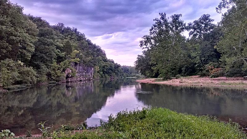
400:
193:Meramec River 12Aug2012 55.jpg
26:
1:
796:original creation by uploader
770:original creation by uploader
36:
871:
507:object of statement has role
446:object of statement has role
426:Items portrayed in this file
299:
7:
1066:Date and time of digitizing
916:
10:
1223:
1105:Supported Flashpix version
999:225 meters above sea level
905:Usage on fa.wikipedia.org
373:same or compatible license
187:
151:
132:
1179:Sublocation of city shown
1147:Geodetic survey data used
1074:Meaning of each component
909:پارک ایالتی غار اونونداگا
809:
234:
16:
1182:Onondaga Cave State Park
886:Onondaga Cave State Park
731:38°3'1.1"N, 91°14'10.7"W
403:
339:
209:Onondaga Cave State Park
104:This is a file from the
41:
1187:Province or state shown
1123:GPS time (atomic clock)
866:
223:
108:. Information from its
180:38.050300; -91.236300
111:description page there
46:Size of this preview:
1069:19:30, 12 August 2012
1031:Horizontal resolution
964:19:30, 12 August 2012
845:20:00, 14 August 2012
1171:Special instructions
70:2,048 × 1,150 pixels
1047:Y and C positioning
1039:Vertical resolution
930:Camera manufacturer
354:– to adapt the work
52:Other resolutions:
1139:Direction of image
1100:Flash did not fire
891:User:Kbh3rd/Images
535:Wikimedia username
522:author name string
462:Wikimedia username
454:author name string
66:1,280 × 719 pixels
62:1,024 × 575 pixels
1210:
1209:
897:Global file usage
869:
707:
630:copyright license
616:copyright license
412:
297:
296:
274:retouched picture
250:
249:
185:
184:
126:
125:
106:Wikimedia Commons
32:Global file usage
1214:
1012:Copyright holder
991:91° 14′ 10.68″ W
927:
857:
819:
753:
752:
747:
586:copyright status
572:copyright status
559:
554:
544:
539:
529:
526:
516:
511:
410:
395:
392:
389:
386:
383:
375:as the original.
332:Creative Commons
326:
325:
321:
320:
315:
314:
292:
277:
275:
264:
256:
236:
226:
202:
194:
188:
181:
178:
164:
163:
157:
156:
155:
149:
148:
137:
122:
101:
100:
94:
88:
86:
73:
58:640 × 359 pixels
54:320 × 180 pixels
48:800 × 449 pixels
1222:
1221:
1217:
1216:
1215:
1213:
1212:
1211:
1163:GPS tag version
1018:-- CC By-Sa 3.0
915:
895:
877:
870:
863:
855:
811:
810:
807:
806:
805:
804:
803:
802:
801:
800:
798:
786:
785:
784:
782:
763:
762:
761:
760:
759:
758:
757:
756:
755:
754:
750:
748:
745:
736:
735:
734:
732:
722:
721:
720:
718:
695:
694:
693:
692:
691:
690:
689:
688:
686:
676:
675:
674:
672:
657:
656:
655:
654:
653:
652:
651:
650:
648:
636:
635:
634:
632:
613:
612:
611:
610:
609:
608:
607:
606:
604:
592:
591:
590:
588:
569:
568:
567:
566:
565:
564:
563:
562:
561:
560:
555:
552:
546:
545:
540:
537:
531:
530:
527:
524:
518:
517:
512:
509:
500:
499:
498:
496:
486:
485:
484:
482:
439:
438:
437:
436:
435:
433:
417:
416:
415:
398:
397:
396:
393:
390:
387:
384:
381:
380:
338:
327:
308:
307:
302:
265:
251:
216:
192:
179:
153:
144:
143:
140:Camera location
135:
128:
127:
116:
115:
114:is shown below.
90:
84:
82:
75:
74:
51:
12:
11:
5:
1220:
1208:
1207:
1204:
1200:
1199:
1196:
1192:
1191:
1188:
1184:
1183:
1180:
1176:
1175:
1172:
1168:
1167:
1164:
1160:
1159:
1158:12 August 2012
1156:
1152:
1151:
1148:
1144:
1143:
1140:
1136:
1135:
1134:True direction
1132:
1128:
1127:
1124:
1120:
1119:
1116:
1110:
1109:
1106:
1102:
1101:
1098:
1092:
1091:
1090:
1089:
1088:does not exist
1086:
1083:
1080:
1075:
1071:
1070:
1067:
1063:
1062:
1059:
1052:
1051:
1048:
1044:
1043:
1040:
1036:
1035:
1032:
1028:
1027:
1024:
1020:
1019:
1013:
1009:
1008:
1005:
1001:
1000:
997:
993:
992:
989:
985:
984:
983:38° 3′ 1.08″ N
981:
977:
976:
973:
966:
965:
962:
958:
957:
954:
947:
946:
941:
937:
936:
931:
918:
914:
913:
912:
911:
898:
894:
893:
888:
883:
873:
868:
867:
865:
861:
858:
854:2,048 × 1,150
852:
847:
842:
838:
837:
834:
831:
828:
825:
822:
814:
799:
794:
792:
791:
790:
788:
787:
783:
780:source of file
778:
776:
775:
774:
773:
771:
767:
766:source of file
741:
740:
739:
738:
737:
733:
730:
728:
727:
726:
724:
723:
719:
714:
712:
711:
710:
709:
703:
699:
687:
685:12 August 2012
684:
682:
681:
680:
678:
677:
673:
668:
666:
665:
664:
663:
661:
649:
644:
642:
641:
640:
638:
637:
633:
628:
626:
625:
624:
623:
621:
617:
605:
600:
598:
597:
596:
594:
593:
589:
584:
582:
581:
580:
579:
577:
573:
548:
547:
533:
532:
520:
519:
505:
504:
503:
502:
501:
497:
494:
492:
491:
490:
488:
487:
483:
478:
476:
475:
474:
473:
471:
467:
463:
459:
455:
451:
447:
443:
434:
429:
427:
424:
423:
422:
421:
409:
408:
405:
402:
379:
378:
377:
376:
366:
357:
356:
355:
349:
342:You are free:
329:
328:
310:
304:
303:
301:
298:
295:
294:
266:
259:
248:
247:
242:
238:
237:
232:
228:
227:
225:12 August 2012
222:
218:
217:
195:
186:
183:
182:
172:
166:
141:
134:
131:
124:
123:
102:
92:
91:
45:
40:
39:
34:
29:
24:
19:
9:
6:
4:
3:
2:
1219:
1205:
1202:
1201:
1197:
1195:Country shown
1194:
1193:
1189:
1186:
1185:
1181:
1178:
1177:
1173:
1170:
1169:
1165:
1162:
1161:
1157:
1154:
1153:
1149:
1146:
1145:
1141:
1138:
1137:
1133:
1130:
1129:
1125:
1122:
1121:
1117:
1115:
1112:
1111:
1107:
1104:
1103:
1099:
1097:
1094:
1093:
1087:
1084:
1081:
1078:
1077:
1076:
1073:
1072:
1068:
1065:
1064:
1060:
1057:
1054:
1053:
1049:
1046:
1045:
1041:
1038:
1037:
1033:
1030:
1029:
1025:
1022:
1021:
1017:
1014:
1011:
1010:
1006:
1003:
1002:
998:
995:
994:
990:
987:
986:
982:
979:
978:
974:
972:
968:
967:
963:
960:
959:
955:
952:
949:
948:
945:
942:
939:
938:
935:
932:
929:
928:
925:
922:
910:
907:
906:
904:
903:
902:
892:
889:
887:
884:
882:
881:Meramec River
879:
878:
864:
859:
853:
851:
848:
846:
843:
840:
839:
835:
832:
829:
826:
823:
821:
820:
818:
797:
793:
781:
777:
744:
729:
717:
713:
683:
671:
667:
647:
643:
631:
627:
603:
599:
587:
583:
558:
551:
543:
536:
523:
515:
508:
493:
481:
477:
432:
428:
425:
406:
399:
385:CC BY-SA 3.0
374:
370:
367:
364:
361:
360:
358:
353:
350:
347:
344:
343:
341:
340:
336:
333:
316:
293:
287:
285:
279:
278:
276:
267:
263:
258:
257:
254:
253:
246:
243:
239:
233:
229:
219:
214:
210:
207:running past
206:
205:Meramec River
201:
196:
189:
177:
173:
171:
170:OpenStreetMap
167:
165:
147:
142:
139:
138:
120:
113:
112:
107:
103:
96:
95:
89:
80:
79:Original file
71:
67:
63:
59:
55:
49:
44:
38:
35:
33:
30:
28:
25:
23:
20:
18:
15:
971:focal length
940:Camera model
923:
920:
900:
816:
813:File history
514:photographer
450:photographer
368:
362:
351:
345:
289:
281:
270:
269:
252:
199:
150:
119:You can help
109:
77:
22:File history
1203:IIM version
1114:Color space
1023:Image title
602:copyrighted
576:copyrighted
369:share alike
363:attribution
268:This is a
191:Description
1004:City shown
872:File usage
830:Dimensions
495:some value
286:processing
282:in-camera
85:image/jpeg
27:File usage
988:Longitude
951:ISO speed
944:HTC VLE_U
856:(1.29 MB)
827:Thumbnail
824:Date/Time
670:inception
660:inception
300:Licensing
200:English:
1190:Missouri
1155:GPS date
1050:Centered
1007:Leasburg
996:Altitude
980:Latitude
917:Metadata
407:Captions
352:to remix
346:to share
337:license.
235:Own work
213:Missouri
37:Metadata
1166:2.2.0.0
1058:version
975:3.63 mm
841:current
836:Comment
743:heading
702:heading
480:creator
442:creator
431:depicts
411:English
133:Summary
81:
1150:WGS-84
1042:72 dpi
1034:72 dpi
953:rating
862:Kbh3rd
751:degree
706:degree
542:Kbh3rd
528:Kbh3rd
458:Kbh3rd
291:
245:Kbh3rd
241:Author
231:Source
158:
1126:19:30
1096:Flash
969:Lens
1118:sRGB
1056:Exif
833:User
394:true
391:true
221:Date
203:The
17:File
1061:2.2
956:181
934:HTC
550:URL
466:URL
284:HDR
211:in
1198:US
1085:Cr
1082:Cb
749:0
746::
553::
538::
525::
510::
288:.
68:|
64:|
60:|
56:|
50:.
1206:4
1142:0
1108:1
1079:Y
215:.
121:.
87:)
72:.
Text is available under the Creative Commons Attribution-ShareAlike License. Additional terms may apply.
