43:
592:"}},"text\/plain":{"en":{"":"inception"}}},"{\"value\":{\"time\":\"+2010-07-19T00:00:00Z\",\"timezone\":0,\"before\":0,\"after\":0,\"precision\":11,\"calendarmodel\":\"http:\\\/\\\/www.wikidata.org\\\/entity\\\/Q1985727\"},\"type\":\"time\"}":{"text\/html":{"en":{"P571":"19 July 2010"}},"text\/plain":{"en":{"P571":"19 July 2010"}}}}": -->
291:
319:
261:
325:
330:
99:
630:"}},"text\/plain":{"en":{"":"media type"}}},"{\"value\":\"image\\\/svg+xml\",\"type\":\"string\"}":{"text\/html":{"en":{"P1163":"image\/svg+xml"}},"text\/plain":{"en":{"P1163":"image\/svg+xml"}}}}": -->
548:"}},"text\/plain":{"en":{"":"copyright license"}}},"{\"value\":{\"entity-type\":\"item\",\"numeric-id\":14946043,\"id\":\"Q14946043\"},\"type\":\"wikibase-entityid\"}":{"text\/html":{"en":{"P275":"
504:"}},"text\/plain":{"en":{"":"copyright status"}}},"{\"value\":{\"entity-type\":\"item\",\"numeric-id\":50423863,\"id\":\"Q50423863\"},\"type\":\"wikibase-entityid\"}":{"text\/html":{"en":{"P6216":"
770:
737:
626:
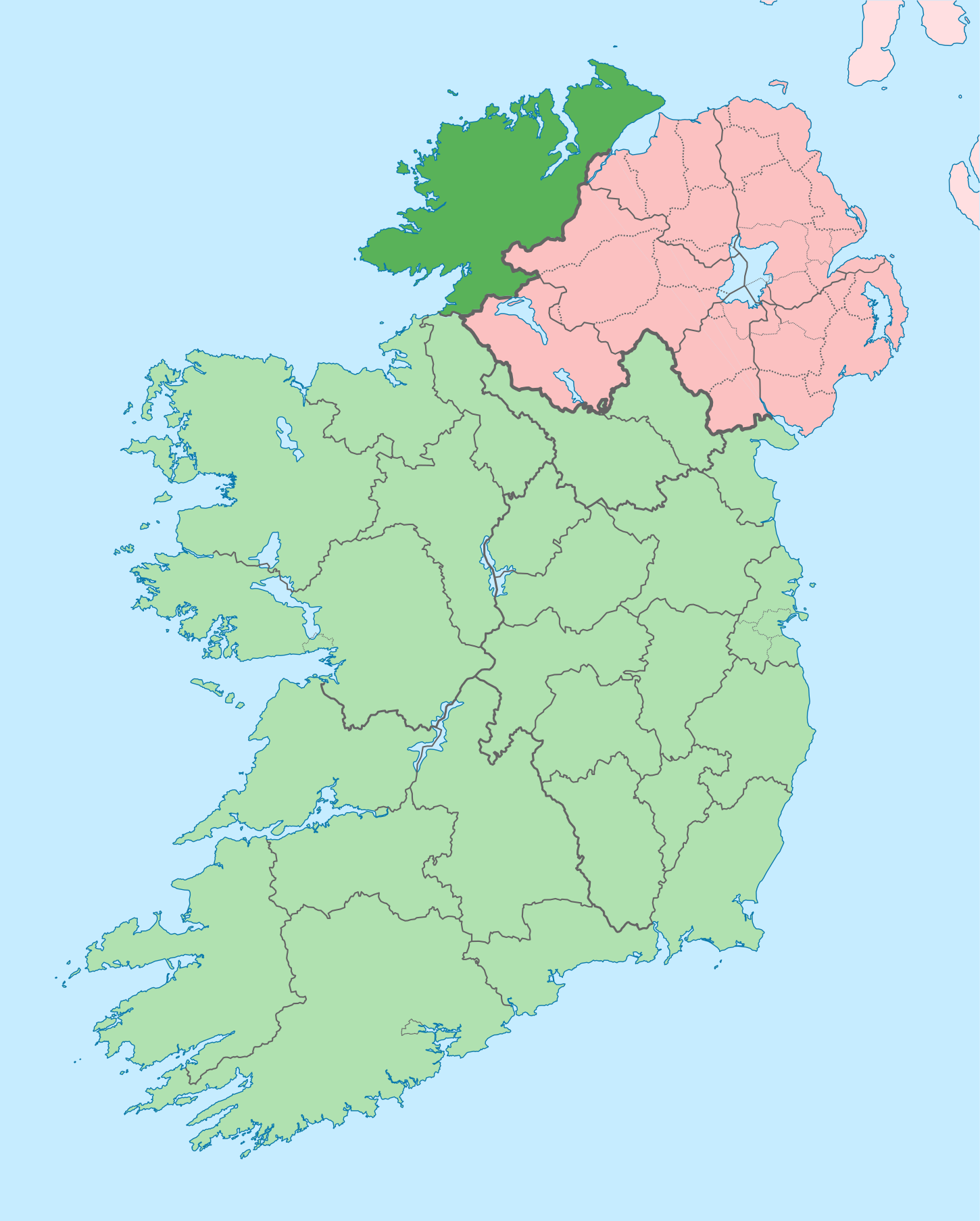
787:{{Information |Description={{en|The island of Ireland, showing international border between Northern Ireland and Republic of Ireland, traditional provinces, traditional counties, and local authority areas in the Republic of Ireland and Northern Ireland.}}
723:
Further edits per the Local
Government Reform Act 2014, joining both Tipperarys and both Waterfords (and removing Limerick City code). Colouring in islands, cleaning up and grouping code to remove stray objects and show Galway and Lough
371:– You must give appropriate credit, provide a link to the license, and indicate if changes were made. You may do so in any reasonable manner, but not in any way that suggests the licensor endorses you or your use.
437:{{Information |Description={{de|Positionskarte von ]}} Quadratische Plattkarte, N-S-Streckung 170 %. Geographische Begrenzung der Karte: * N: 55.6° N * S: 51.2° N * W: 11.0° W * O: 5.0° W {{en|Location
148:
The island of
Ireland, showing international border between Ireland and Northern Ireland, traditional provinces, traditional counties, and local authority areas in Ireland and Northern Ireland.
1307:
798:
1609:
549:
505:
301:
73:
69:
627:
501:
65:
61:
57:
53:
47:
589:
545:
110:
82:
552:"}},"text\/plain":{"en":{"P275":"Creative Commons Attribution-ShareAlike 3.0 Unported"}}}}": -->
1345:
769:
764:
736:
731:
415:
285:
184:
170:
197:
575:
531:
225:
206:
1620:
This file contains additional information, probably added from the digital camera or scanner used to create or digitize it.
1325:
970:
378:
637:
515:
599:
559:
490:
755:
432:
422:
221:
1260:
1155:
188:
340:
1623:
If the file has been modified from its original state, some details may not fully reflect the modified file.
705:
700:
42:
797:
More than 100 pages use this file. The following list shows the first 100 pages that use this file only. A
1070:
377:– If you remix, transform, or build upon the material, you must distribute your contributions under the
1165:
1085:
1045:
1275:
920:
508:"}},"text\/plain":{"en":{"P6216":"copyrighted"}}}}": -->
1185:
925:
118:
1600:
1265:
1110:
940:
855:
825:
820:
1205:
1175:
1100:
446:
1200:
1170:
1040:
960:
890:
870:
830:
337:
279:, which means that it has been digitally altered from its original version. Modifications:
8:
1225:
1220:
1210:
716:
238:
201:
192:
747:
105:
480:
312:
I, the copyright holder of this work, hereby publish it under the following license:
290:
1180:
1160:
271:
1270:
990:
975:
945:
865:
214:
210:
1255:
1075:
1050:
296:
234:
1190:
1130:
1120:
1095:
860:
780:
647:
609:
569:
525:
260:
1250:
1145:
1125:
1060:
980:
850:
1295:
1280:
1245:
1140:
1025:
1005:
995:
965:
950:
905:
900:
895:
845:
810:
1375:
1115:
1090:
1065:
930:
915:
910:
840:
835:
805:
1335:
1235:
1230:
1080:
1055:
1035:
1010:
985:
955:
935:
885:
880:
673:
Click on a date/time to view the file as it appeared at that time.
1590:
1535:
1530:
1515:
1500:
1480:
1430:
1215:
1195:
1150:
1000:
815:
1565:
1425:
1415:
1505:
1450:
1300:
1290:
1285:
1240:
1105:
1015:
875:
157:
1550:
1520:
1355:
1470:
1135:
1030:
1020:
466:
Karte von Irland mit der Region
Donegal (dunkelgrün markiert)
87:(SVG file, nominally 1,450 × 1,807 pixels, file size: 642 KB)
1580:
1525:
1465:
1460:
1420:
1440:
1510:
1475:
1360:
1455:
1380:
411:
This image is a derivative work of the following images:
93:
1490:
1370:
1540:
1400:
1395:
1570:
1560:
281:
Coloured in regions with county of article highlighted
1545:
1495:
1445:
1390:
1385:
795:
1601:
County
Donegal, Ireland crash kills one, injures two
1435:
1410:
1405:
1365:
1316:
671:
576:
Creative
Commons Attribution-ShareAlike 3.0 Unported
550:
Creative
Commons Attribution-ShareAlike 3.0 Unported
117:
Commons is a freely licensed media file repository.
1555:
1485:
388:https://creativecommons.org/licenses/by-sa/3.0
98:
394:Creative Commons Attribution-Share Alike 3.0
318:
153:
135:
178:
164:
14:
354:– to copy, distribute and transmit the work
46:Size of this PNG preview of this SVG file:
138:Island of Ireland location map Donegal.svg
1318:The following other wikis use this file:
283:. The original can be viewed here:
416:File:Island_of_Ireland_location_map.svg
406:
473:
129:
971:Donegal (UK Parliament constituency)
341:Attribution-Share Alike 3.0 Unported
254:
664:
329:
324:
272:
270:
13:
1618:
756:w:Local Government Reform Act 2014
479:
465:
315:
311:
286:Island of Ireland location map.svg
185:Island_of_Ireland_location_map.svg
171:Island_of_Ireland_location_map.svg
142:
130:
80:
1652:
1625:
478:
198:Northern_Ireland_location_map.svg
456:
427:Fix incorrectly coloured isands.
365:Under the following conditions:
336:This file is licensed under the
328:
323:
317:
289:
259:
97:
31:
21:
453:
207:Northern_Ireland_-_Counties.png
143:
1313:
1261:Rutland Island, County Donegal
1156:List of Ireland-related topics
754:to reflect the changes of the
668:
452:
26:
1:
36:
792:
486:Items portrayed in this file
7:
1615:
1577:Usage on ceb.wikipedia.org
1332:Usage on ast.wikipedia.org
1276:St Patrick's Purgatory
1071:Greencastle, County Donegal
418:licensed with Cc-by-sa-3.0
10:
1657:
1587:Usage on cs.wikipedia.org
1352:Usage on ca.wikipedia.org
1342:Usage on bg.wikipedia.org
1322:Usage on ar.wikipedia.org
1166:Lough Derg, County Donegal
1086:Inishbofin, County Donegal
1046:Glen River, County Donegal
379:same or compatible license
132:
1597:Usage on en.wikinews.org
921:Churchill, County Donegal
665:
435:1450x1807 (679744 Bytes)
425:1450x1807 (679207 Bytes)
16:
1376:Plantilla:Comtat Donegal
455:
345:
295:. Modifications made by
189:Ireland_location_map.svg
104:This is a file from the
41:
1186:Milford, County Donegal
926:Cloghan, County Donegal
786:
753:
722:
156:
108:. Information from its
1266:Seven Sisters, Donegal
1111:Killea, County Donegal
941:Convoy, County Donegal
856:Ballyraine Linear Park
826:Ardara, County Donegal
821:Ardagh, County Donegal
111:description page there
1516:Leitir Mhic an Bhaird
1206:Narin, County Donegal
1176:Malin, County Donegal
1101:Inver, County Donegal
433:Rannpháirtí anaithnid
431:2010-03-03T22:19:29Z
423:Rannpháirtí anaithnid
421:2010-03-06T20:43:33Z
222:Rannpháirtí anaithnid
211:Maximilian Dörrbecker
1431:Machaire Rabhartaigh
1221:Quigley's Point
1201:Muff, County Donegal
1171:Machaire Rabhartaigh
1041:Glen, County Donegal
961:Derryveagh Mountains
891:Burt, County Donegal
871:Blue Stack Mountains
831:Ardloughnabrackbaddy
74:1,450 × 1,807 pixels
70:1,643 × 2,048 pixels
1566:Corredor de Donegal
1416:Cloch Cheann Fhaola
1226:R236 road (Ireland)
765:00:43, 19 July 2010
701:13:41, 29 June 2020
407:Original upload log
360:– to adapt the work
158:19 July 2010, 00:35
52:Other resolutions:
1451:Gleann Cholm Cille
1346:Донигал (графство)
1211:Newtown Cunningham
66:822 × 1,024 pixels
1644:
1643:
1610:more global usage
1551:Milford (Donegal)
1356:Comtat de Donegal
1336:Condáu de Donegal
1314:Global file usage
790:
732:03:49, 6 May 2016
560:copyright license
546:copyright license
472:
464:
308:
307:
273:retouched picture
249:
248:
233:derivative work:
220:derivative work:
126:
125:
106:Wikimedia Commons
32:Global file usage
1648:
1626:
1591:Hrabství Donegal
1531:An Clochán Liath
1501:Ailt an Chorráin
1481:Oileán na Cruite
777:
744:
713:
675:
516:copyright status
502:copyright status
471:Chinese (Taiwan)
470:
462:
401:
398:
395:
392:
389:
381:as the original.
338:Creative Commons
332:
331:
327:
326:
321:
320:
303:
293:
276:
274:
263:
255:
241:
228:
159:
147:
139:
133:
122:
101:
100:
94:
88:
77:
62:616 × 768 pixels
58:385 × 480 pixels
54:192 × 240 pixels
48:481 × 599 pixels
1656:
1655:
1651:
1650:
1649:
1647:
1646:
1645:
1614:
1526:Rann na Feirste
1466:Cill Charthaigh
1421:Gort an Choirce
1312:
1181:Manorcunningham
791:
783:
775:
750:
742:
719:
711:
667:
666:
663:
662:
661:
660:
659:
658:
657:
656:
654:
644:
643:
642:
640:
625:
624:
623:
622:
621:
620:
619:
618:
616:
606:
605:
604:
602:
587:
586:
585:
584:
583:
582:
581:
580:
578:
566:
565:
564:
562:
543:
542:
541:
540:
539:
538:
537:
536:
534:
522:
521:
520:
518:
499:
498:
497:
496:
495:
493:
477:
476:
475:
468:
467:
409:
404:
403:
402:
399:
396:
393:
390:
387:
386:
344:
333:
314:
313:
264:
250:
239:
226:
149:
137:
128:
127:
116:
115:
114:is shown below.
90:
86:
79:
78:
51:
12:
11:
5:
1654:
1642:
1641:
1638:
1634:
1633:
1630:
1617:
1612:of this file.
1606:
1605:
1604:
1603:
1595:
1594:
1593:
1585:
1584:
1583:
1581:County Donegal
1575:
1574:
1573:
1568:
1563:
1558:
1553:
1548:
1543:
1538:
1533:
1528:
1523:
1518:
1513:
1508:
1503:
1498:
1493:
1488:
1483:
1478:
1473:
1468:
1463:
1458:
1453:
1448:
1443:
1441:Baile na Finne
1438:
1433:
1428:
1426:An Fál Carrach
1423:
1418:
1413:
1408:
1403:
1398:
1393:
1388:
1383:
1378:
1373:
1368:
1363:
1358:
1350:
1349:
1348:
1340:
1339:
1338:
1330:
1329:
1328:
1326:مقاطعة دونيجال
1315:
1310:to this file.
1304:
1303:
1298:
1293:
1288:
1283:
1278:
1273:
1271:Sheephaven Bay
1268:
1263:
1258:
1253:
1248:
1243:
1238:
1233:
1228:
1223:
1218:
1213:
1208:
1203:
1198:
1193:
1188:
1183:
1178:
1173:
1168:
1163:
1158:
1153:
1148:
1143:
1138:
1133:
1128:
1123:
1118:
1113:
1108:
1103:
1098:
1093:
1088:
1083:
1078:
1073:
1068:
1063:
1058:
1053:
1048:
1043:
1038:
1033:
1028:
1023:
1018:
1013:
1008:
1003:
998:
993:
991:Drumboe Castle
988:
983:
978:
976:Donegal (town)
973:
968:
963:
958:
953:
948:
946:County Donegal
943:
938:
933:
928:
923:
918:
913:
908:
903:
898:
893:
888:
883:
878:
873:
868:
866:Barnesmore Gap
863:
858:
853:
848:
843:
838:
833:
828:
823:
818:
813:
808:
801:is available.
794:
789:
788:
785:
781:
778:
774:1,450 × 1,807
772:
767:
762:
759:
758:
752:
748:
745:
741:1,450 × 1,807
739:
734:
729:
726:
725:
721:
717:
714:
710:1,450 × 1,807
708:
703:
698:
694:
693:
690:
687:
684:
681:
678:
670:
655:
652:
650:
649:
648:
646:
645:
641:
636:
634:
633:
632:
631:
629:
617:
614:
612:
611:
610:
608:
607:
603:
598:
596:
595:
594:
593:
591:
579:
574:
572:
571:
570:
568:
567:
563:
558:
556:
555:
554:
553:
551:
547:
535:
530:
528:
527:
526:
524:
523:
519:
514:
512:
511:
510:
509:
507:
503:
494:
489:
487:
484:
483:
482:
481:
469:
461:
460:
457:
454:
445:Uploaded with
442:
441:
440:
439:
429:
408:
405:
385:
384:
383:
382:
372:
363:
362:
361:
355:
348:You are free:
335:
334:
316:
310:
309:
306:
305:
265:
258:
247:
246:
245:
244:
231:
218:
204:
195:
180:
176:
175:
174:
173:
166:
162:
161:
155:
151:
150:
140:
131:
124:
123:
102:
92:
91:
45:
40:
39:
34:
29:
24:
19:
9:
6:
4:
3:
2:
1653:
1639:
1636:
1635:
1631:
1628:
1627:
1624:
1621:
1613:
1611:
1602:
1599:
1598:
1596:
1592:
1589:
1588:
1586:
1582:
1579:
1578:
1576:
1572:
1569:
1567:
1564:
1562:
1559:
1557:
1554:
1552:
1549:
1547:
1544:
1542:
1539:
1537:
1534:
1532:
1529:
1527:
1524:
1522:
1519:
1517:
1514:
1512:
1511:Cionn Caslach
1509:
1507:
1506:An Dúchoraidh
1504:
1502:
1499:
1497:
1494:
1492:
1489:
1487:
1484:
1482:
1479:
1477:
1474:
1472:
1469:
1467:
1464:
1462:
1459:
1457:
1454:
1452:
1449:
1447:
1444:
1442:
1439:
1437:
1434:
1432:
1429:
1427:
1424:
1422:
1419:
1417:
1414:
1412:
1409:
1407:
1404:
1402:
1399:
1397:
1394:
1392:
1389:
1387:
1384:
1382:
1379:
1377:
1374:
1372:
1369:
1367:
1364:
1362:
1361:Gaoth Dobhair
1359:
1357:
1354:
1353:
1351:
1347:
1344:
1343:
1341:
1337:
1334:
1333:
1331:
1327:
1324:
1323:
1321:
1320:
1319:
1311:
1309:
1302:
1299:
1297:
1294:
1292:
1289:
1287:
1284:
1282:
1279:
1277:
1274:
1272:
1269:
1267:
1264:
1262:
1259:
1257:
1256:Rotten Island
1254:
1252:
1249:
1247:
1244:
1242:
1239:
1237:
1234:
1232:
1229:
1227:
1224:
1222:
1219:
1217:
1214:
1212:
1209:
1207:
1204:
1202:
1199:
1197:
1194:
1192:
1189:
1187:
1184:
1182:
1179:
1177:
1174:
1172:
1169:
1167:
1164:
1162:
1159:
1157:
1154:
1152:
1149:
1147:
1144:
1142:
1139:
1137:
1134:
1132:
1129:
1127:
1124:
1122:
1119:
1117:
1114:
1112:
1109:
1107:
1104:
1102:
1099:
1097:
1094:
1092:
1089:
1087:
1084:
1082:
1079:
1077:
1076:Gweebarra Bay
1074:
1072:
1069:
1067:
1064:
1062:
1059:
1057:
1054:
1052:
1051:Glencolmcille
1049:
1047:
1044:
1042:
1039:
1037:
1034:
1032:
1029:
1027:
1024:
1022:
1019:
1017:
1014:
1012:
1009:
1007:
1004:
1002:
999:
997:
994:
992:
989:
987:
984:
982:
979:
977:
974:
972:
969:
967:
964:
962:
959:
957:
954:
952:
949:
947:
944:
942:
939:
937:
934:
932:
929:
927:
924:
922:
919:
917:
914:
912:
909:
907:
904:
902:
899:
897:
894:
892:
889:
887:
884:
882:
879:
877:
874:
872:
869:
867:
864:
862:
859:
857:
854:
852:
849:
847:
844:
842:
839:
837:
834:
832:
829:
827:
824:
822:
819:
817:
814:
812:
809:
807:
804:
803:
802:
800:
784:
779:
773:
771:
768:
766:
763:
761:
760:
757:
751:
746:
740:
738:
735:
733:
730:
728:
727:
720:
718:Chipmunkdavis
715:
709:
707:
704:
702:
699:
696:
695:
691:
688:
685:
682:
679:
677:
676:
674:
653:image/svg+xml
651:
639:
635:
613:
601:
597:
577:
573:
561:
557:
533:
529:
517:
513:
492:
488:
485:
458:
451:
450:
449:
448:
438:
434:
430:
428:
424:
420:
419:
417:
414:
413:
412:
391:CC BY-SA 3.0
380:
376:
373:
370:
367:
366:
364:
359:
356:
353:
350:
349:
347:
346:
342:
339:
322:
304:
298:
294:
292:
287:
282:
278:
277:
275:
266:
262:
257:
256:
253:
252:
242:
236:
232:
229:
223:
219:
216:
212:
208:
205:
203:
199:
196:
194:
190:
186:
183:
182:
181:
177:
172:
169:
168:
167:
163:
152:
146:
141:
134:
120:
113:
112:
107:
103:
96:
95:
89:
84:
83:Original file
75:
71:
67:
63:
59:
55:
49:
44:
38:
35:
33:
30:
28:
25:
23:
20:
18:
15:
1622:
1619:
1607:
1521:Loch an Iúir
1456:Carraig Airt
1381:Ballyshannon
1317:
1305:
1191:Mountcharles
1161:Loch an Iúir
1131:Kinnagoe Bay
1121:Kilmacrennan
1096:Inishtrahull
861:Ballyshannon
796:
749:Houdinipeter
672:
669:File history
615:19 July 2010
447:derivativeFX
444:
443:
436:
426:
410:
374:
368:
357:
351:
300:
284:
280:
269:
268:
251:
202:NordNordWest
193:NordNordWest
144:
119:You can help
109:
81:
22:File history
1536:Árainn Mhór
1491:An Bun Beag
1471:Doirí Beaga
1371:Letterkenny
1251:Rossnowlagh
1146:Letterkenny
1126:Kincasslagh
1061:Gola Island
981:Donegal Bay
851:Ballyliffin
532:copyrighted
506:copyrighted
375:share alike
369:attribution
267:This is a
136:Description
1632:1449.805px
1541:Rathmullan
1461:Na Dúnaibh
1401:Carndonagh
1396:Ballybofey
1308:more links
1296:The Rosses
1281:Stranorlar
1246:Rathmullan
1141:Leabgarrow
1026:Falcarragh
1006:Dunkineely
996:Dunfanaghy
966:Doe Castle
951:Creeslough
906:Carndonagh
901:Carnamoyle
896:Burtonport
846:Ballybofey
811:Aghla More
793:File usage
686:Dimensions
638:media type
628:media type
27:File usage
1640:1807.07px
1571:Killybegs
1561:Inishowen
1116:Killybegs
1091:Inishowen
1066:Gortahork
931:Clonglash
916:Castlefin
911:Carrigart
841:Ballintra
836:Arranmore
806:Aghla Beg
799:full list
683:Thumbnail
680:Date/Time
600:inception
590:inception
145:English:
1616:Metadata
1546:Ramelton
1496:Anagaire
1476:Croithlí
1446:Teileann
1391:Bundoran
1386:Buncrana
1236:Ranafast
1231:Ramelton
1081:Gweedore
1056:Glenties
1036:Glashedy
1011:Dunlewey
986:Downings
956:Derrybeg
936:Clonmany
886:Bundoran
881:Buncrana
776:(815 KB)
743:(833 KB)
712:(642 KB)
474:多尼哥郡的地圖。
459:Captions
358:to remix
352:to share
343:license.
37:Metadata
1436:Toraigh
1411:Na Rosa
1406:Donegal
1366:Lifford
1216:Pettigo
1196:Moville
1151:Lifford
1001:Dungloe
816:Annagry
782:Mabuska
697:current
692:Comment
491:depicts
463:English
297:Mabuska
288::
235:Mabuska
85:
1637:Height
1556:Raphoe
1486:Gabhla
1301:Tooban
1291:Termon
1286:Teelin
1241:Raphoe
1106:Kilcar
1016:Dunree
876:Bunbeg
302:
215:Chumwa
179:Author
165:Source
1629:Width
1608:View
1306:View
1136:Laghy
1031:Fanad
1021:Fahan
160:(UTC)
724:Ree.
689:User
400:true
397:true
240:talk
227:talk
154:Date
17:File
187:: *
299:.
209::
200::
191::
72:|
68:|
64:|
60:|
56:|
50:.
243:)
237:(
230:)
224:(
217:)
213:(
121:.
76:.
Text is available under the Creative Commons Attribution-ShareAlike License. Additional terms may apply.
