526:"}},"text\/plain":{"en":{"":"checksum"}}},"{\"value\":\"5d2deb3e6b012e1303cd79d6947f819ecaebba0e\",\"type\":\"string\"}":{"text\/html":{"en":{"P4092":"5d2deb3e6b012e1303cd79d6947f819ecaebba0e"}},"text\/plain":{"en":{"P4092":"5d2deb3e6b012e1303cd79d6947f819ecaebba0e"}}},"{\"value\":{\"entity-type\":\"property\",\"numeric-id\":459,\"id\":\"P459\"},\"type\":\"wikibase-entityid\"}":{"text\/html":{"en":{"":"
450:"}},"text\/plain":{"en":{"":"inception"}}},"{\"value\":{\"time\":\"+2011-03-10T00:00:00Z\",\"timezone\":0,\"before\":0,\"after\":0,\"precision\":11,\"calendarmodel\":\"http:\\\/\\\/www.wikidata.org\\\/entity\\\/Q1985727\"},\"type\":\"time\"}":{"text\/html":{"en":{"P571":"10 March 2011"}},"text\/plain":{"en":{"P571":"10 March 2011"}}}}": -->
221:
38:
522:
232:
94:
488:"}},"text\/plain":{"en":{"":"media type"}}},"{\"value\":\"image\\\/svg+xml\",\"type\":\"string\"}":{"text\/html":{"en":{"P1163":"image\/svg+xml"}},"text\/plain":{"en":{"P1163":"image\/svg+xml"}}}}": -->
530:"}},"text\/plain":{"en":{"":"determination method"}}},"{\"value\":{\"entity-type\":\"item\",\"numeric-id\":13414952,\"id\":\"Q13414952\"},\"type\":\"wikibase-entityid\"}":{"text\/html":{"en":{"P459":"
406:"}},"text\/plain":{"en":{"":"copyright license"}}},"{\"value\":{\"entity-type\":\"item\",\"numeric-id\":14946043,\"id\":\"Q14946043\"},\"type\":\"wikibase-entityid\"}":{"text\/html":{"en":{"P275":"
362:"}},"text\/plain":{"en":{"":"copyright status"}}},"{\"value\":{\"entity-type\":\"item\",\"numeric-id\":50423863,\"id\":\"Q50423863\"},\"type\":\"wikibase-entityid\"}":{"text\/html":{"en":{"P6216":"
593:"}},"text\/plain":{"en":{"":"data size"}}},"{\"value\":{\"amount\":\"+917190\",\"unit\":\"http:\\\/\\\/www.wikidata.org\\\/entity\\\/Q8799\"},\"type\":\"quantity\"}":{"text\/html":{"en":{"P3575":"917,190
683:"}},"text\/plain":{"en":{"":"width"}}},"{\"value\":{\"amount\":\"+1425\",\"unit\":\"http:\\\/\\\/www.wikidata.org\\\/entity\\\/Q355198\"},\"type\":\"quantity\"}":{"text\/html":{"en":{"P2049":"1,425
638:"}},"text\/plain":{"en":{"":"height"}}},"{\"value\":{\"amount\":\"+995\",\"unit\":\"http:\\\/\\\/www.wikidata.org\\\/entity\\\/Q355198\"},\"type\":\"quantity\"}":{"text\/html":{"en":{"P2048":"995
679:
279:– You must give appropriate credit, provide a link to the license, and indicate if changes were made. You may do so in any reasonable manner, but not in any way that suggests the licensor endorses you or your use.
531:
407:
363:
680:
635:
590:
523:
485:
359:
527:
447:
403:
867:
872:
410:"}},"text\/plain":{"en":{"P275":"Creative Commons Attribution-ShareAlike 3.0 Unported"}}}}": -->
68:
64:
60:
56:
210:
52:
48:
42:
105:
575:
433:
389:
77:
286:
694:
649:
604:
541:
495:
373:
568:
457:
417:
348:
183:
242:
285:– If you remix, transform, or build upon the material, you must distribute your contributions under the
597:"}},"text\/plain":{"en":{"P3575":"917,190 byte"}}}}": -->
687:"}},"text\/plain":{"en":{"P2049":"1,425 pixel"}}}}": -->
366:"}},"text\/plain":{"en":{"P6216":"copyrighted"}}}}": -->
805:
The following pages on the
English Knowledge use this file (pages on other projects are not listed):
877:
642:"}},"text\/plain":{"en":{"P2048":"995 pixel"}}}}": -->
170:
113:
791:
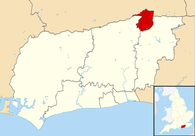
highlighted. Equirectangular map projection on WGS 84 datum, with N/S stretched 155% |Source=
534:"}},"text\/plain":{"en":{"P459":"SHA-1"}}}}": -->
765:
760:
37:
239:
8:
100:
338:
167:
827:
792:
198:
776:
187:
139:
704:
659:
614:
551:
505:
467:
427:
383:
784:
937:
148:
Equirectangular map projection on WGS 84 datum, with N/S stretched 155%
176:
Coastline and administrative boundary data from
Boundary-Line product.
733:
Click on a date/time to view the file as it appeared at that time.
143:
250:
Contains
Ordnance Survey data © Crown copyright and database right
809:
788:
837:
927:
897:
82:(SVG file, nominally 1,425 × 995 pixels, file size: 896 KB)
156:
88:
332:
Add a one-line explanation of what this file represents
803:
917:
907:
857:
847:
818:
731:
434:
Creative
Commons Attribution-ShareAlike 3.0 Unported
408:
Creative
Commons Attribution-ShareAlike 3.0 Unported
112:
Commons is a freely licensed media file repository.
887:
296:https://creativecommons.org/licenses/by-sa/3.0
93:
302:Creative Commons Attribution-Share Alike 3.0
220:
205:
152:
130:
194:
162:
14:
684:
639:
594:
262:– to copy, distribute and transmit the work
41:Size of this PNG preview of this SVG file:
820:The following other wikis use this file:
557:5d2deb3e6b012e1303cd79d6947f819ecaebba0e
124:
243:Attribution-Share Alike 3.0 Unported
201:, created using Ordnance Survey data
724:
231:
226:
13:
783:{{Information |Description=Map of
337:
331:
217:
179:Lake data from Meridian 2 product.
125:
75:
951:
336:
804:
322:
273:Under the following conditions:
238:This file is licensed under the
230:
225:
219:
92:
31:
21:
319:
815:
728:
318:
26:
1:
800:
795:[https://www.ordnancesurvey.
344:Items portrayed in this file
7:
824:Usage on azb.wikipedia.org
10:
956:
934:Usage on zh.wikipedia.org
924:Usage on sv.wikipedia.org
914:Usage on pt.wikipedia.org
904:Usage on no.wikipedia.org
894:Usage on nl.wikipedia.org
884:Usage on lv.wikipedia.org
864:Usage on ja.wikipedia.org
854:Usage on it.wikipedia.org
844:Usage on fi.wikipedia.org
834:Usage on cy.wikipedia.org
287:same or compatible license
133:Crawley UK locator map.svg
127:
725:
16:
321:
253:
184:England location map.svg
99:This is a file from the
36:
782:
155:
103:. Information from its
106:description page there
761:11:21, 10 March 2011
569:determination method
528:determination method
65:2,560 × 1,788 pixels
873:Category:クローリー出身の人物
838:Bwrdeistref Crawley
268:– to adapt the work
182:Inset derived from
47:Other resolutions:
928:Borough of Crawley
898:Crawley (district)
69:1,425 × 995 pixels
61:1,280 × 894 pixels
57:1,024 × 715 pixels
816:Global file usage
798:
686:
641:
596:
418:copyright license
404:copyright license
330:
315:
314:
214:
211:Reusing this file
121:
120:
101:Wikimedia Commons
32:Global file usage
947:
773:
735:
713:
668:
623:
578:
573:
374:copyright status
360:copyright status
328:
309:
306:
303:
300:
297:
289:as the original.
251:
240:Creative Commons
234:
233:
229:
228:
223:
222:
208:
158:
134:
128:
117:
96:
95:
89:
83:
72:
53:640 × 447 pixels
49:320 × 223 pixels
43:800 × 559 pixels
955:
954:
950:
949:
948:
946:
945:
944:
814:
806:
799:
793:Ordnance Survey
779:
771:
727:
726:
723:
722:
721:
720:
719:
718:
717:
716:
714:
711:
701:
700:
699:
697:
678:
677:
676:
675:
674:
673:
672:
671:
669:
666:
656:
655:
654:
652:
633:
632:
631:
630:
629:
628:
627:
626:
624:
621:
611:
610:
609:
607:
588:
587:
586:
585:
584:
583:
582:
581:
580:
579:
574:
571:
562:
561:
560:
558:
548:
547:
546:
544:
521:
520:
519:
518:
517:
516:
515:
514:
512:
502:
501:
500:
498:
483:
482:
481:
480:
479:
478:
477:
476:
474:
464:
463:
462:
460:
445:
444:
443:
442:
441:
440:
439:
438:
436:
424:
423:
422:
420:
401:
400:
399:
398:
397:
396:
395:
394:
392:
380:
379:
378:
376:
357:
356:
355:
354:
353:
351:
335:
334:
333:
316:
311:
310:
307:
304:
301:
298:
295:
294:
252:
249:
246:
235:
168:Ordnance Survey
132:
123:
122:
111:
110:
109:is shown below.
85:
81:
74:
73:
46:
12:
11:
5:
953:
943:
942:
941:
940:
932:
931:
930:
922:
921:
920:
912:
911:
910:
902:
901:
900:
892:
891:
890:
882:
881:
880:
878:Category:クローリー
875:
870:
868:クローリー (イングランド)
862:
861:
860:
852:
851:
850:
842:
841:
840:
832:
831:
830:
817:
813:
812:
802:
797:
796:
781:
777:
774:
768:
763:
758:
754:
753:
750:
747:
744:
741:
738:
730:
715:
709:
707:
706:
705:
703:
702:
698:
693:
691:
690:
689:
688:
682:
670:
664:
662:
661:
660:
658:
657:
653:
648:
646:
645:
644:
643:
637:
625:
619:
617:
616:
615:
613:
612:
608:
603:
601:
600:
599:
598:
592:
567:
566:
565:
564:
563:
559:
556:
554:
553:
552:
550:
549:
545:
540:
538:
537:
536:
535:
533:
529:
525:
513:
510:
508:
507:
506:
504:
503:
499:
494:
492:
491:
490:
489:
487:
475:
472:
470:
469:
468:
466:
465:
461:
456:
454:
453:
452:
451:
449:
437:
432:
430:
429:
428:
426:
425:
421:
416:
414:
413:
412:
411:
409:
405:
393:
388:
386:
385:
384:
382:
381:
377:
372:
370:
369:
368:
367:
365:
361:
352:
347:
345:
342:
341:
340:
339:
327:
326:
323:
320:
313:
312:
293:
292:
291:
290:
280:
271:
270:
269:
263:
256:You are free:
247:
237:
236:
218:
215:
203:
202:
196:
192:
191:
181:
180:
177:
164:
160:
159:
154:
150:
149:
135:
126:
119:
118:
97:
87:
86:
40:
35:
34:
29:
24:
19:
9:
6:
4:
3:
2:
952:
939:
936:
935:
933:
929:
926:
925:
923:
919:
916:
915:
913:
909:
906:
905:
903:
899:
896:
895:
893:
889:
886:
885:
883:
879:
876:
874:
871:
869:
866:
865:
863:
859:
856:
855:
853:
849:
846:
845:
843:
839:
836:
835:
833:
829:
826:
825:
823:
822:
821:
811:
808:
807:
794:
790:
786:
780:
775:
769:
767:
764:
762:
759:
756:
755:
751:
748:
745:
742:
739:
737:
736:
734:
708:
696:
692:
663:
651:
647:
618:
606:
602:
577:
570:
555:
543:
539:
511:image/svg+xml
509:
497:
493:
473:10 March 2011
471:
459:
455:
435:
431:
419:
415:
391:
387:
375:
371:
350:
346:
343:
324:
317:
299:CC BY-SA 3.0
288:
284:
281:
278:
275:
274:
272:
267:
264:
261:
258:
257:
255:
254:
248:Attribution:
244:
241:
224:
216:
212:
207:
204:
200:
197:
193:
189:
185:
178:
175:
174:
173:
172:
169:
165:
161:
157:10 March 2011
151:
147:
146:highlighted.
145:
141:
136:
129:
115:
108:
107:
102:
98:
91:
90:
84:
79:
78:Original file
70:
66:
62:
58:
54:
50:
44:
39:
33:
30:
28:
25:
23:
20:
18:
15:
819:
770:1,425 × 995
732:
729:File history
282:
276:
265:
259:
166:
137:
114:You can help
104:
76:
22:File history
785:West Sussex
390:copyrighted
364:copyrighted
283:share alike
277:attribution
140:West Sussex
131:Description
801:File usage
787:, UK with
746:Dimensions
496:media type
486:media type
206:Permission
142:, UK with
27:File usage
778:Nilfanion
743:Thumbnail
740:Date/Time
605:data size
591:data size
458:inception
448:inception
199:Nilfanion
772:(896 KB)
620:917,190
542:checksum
524:checksum
325:Captions
266:to remix
260:to share
245:license.
188:Spischot
171:OpenData
918:Crawley
908:Crawley
858:Crawley
848:Crawley
810:Crawley
789:Crawley
757:current
752:Comment
349:depicts
329:English
144:Crawley
138:Map of
80:
828:کراولی
710:1,425
650:height
636:height
195:Author
163:Source
888:Kroli
712:pixel
695:width
685:pixel
681:width
667:pixel
640:pixel
576:SHA-1
532:SHA-1
749:User
665:995
622:byte
595:byte
308:true
305:true
153:Date
17:File
938:克劳利
186:by
572::
67:|
63:|
59:|
55:|
51:|
45:.
213:)
209:(
190:.
116:.
71:.
