31:
48:
78:
367:
85:
55:
251:
The lake has a surface area of approximately 555 acres (225 ha) and a shoreline roughly six and a half miles long. It has a maximum depth of 50 feet (15 m) and is located at an elevation of 830 feet (250 m) above sea level. It is located near the Culver Gap, a wind gap in
Kittatinny
263:
Culver Gap near Culver's Lake in Sussex County, New Jersey, was an important route through the
Kittatinny Mountain from about 10,000 years ago to present. The gap is more than 400 feet (120 m) below the top of the mountain.
248:
was used for seasonal recreation. Today, it is a private year-round community owned and operated by the
Normanoch Association, a homeowners' association.
268:
Native
Americans used the gap to hunt and trade on both sides of the mountain. Early settlers from Pennsylvania used the water drop from Culvers Lake to
408:
47:
129:
432:
77:
442:
401:
447:
275:
The lake is named for a local clergyman, the
Reverend Jabez Collver (1731-1818), who led the Congregational Church in
394:
437:
225:
110:
316:
427:
276:
374:
229:
114:
30:
269:
272:
for a wide assortment of mills. Turnpikes followed the route of Lenape trails through the gap.
161:
8:
382:
288:
284:
280:
253:
208:
320:
378:
257:
421:
144:
131:
241:
237:
366:
335:. (Philadelphia: Everts & Peck, 1881), 297; and Stickney, Charles E.
233:
236:
and Bear Swamp, Culver's Lake is the source of the West Branch of the
292:
279:. On September 14, 1774, he purchased 163 acres of land east of
265:
313:
351:
245:
354:(the private lake community homeowners' association)
333:
A History of Sussex and Warren
Counties, New Jersey
244:"). In the late 19th and early 20th century, the
419:
122:
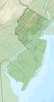
35:Culver's Lake in Frankford Township, New Jersey.
402:
287:, Collver fled to Ontario, Canada after the
409:
395:
339:. (Middletown, New York: s.n., 1867), 19.
84:
54:
420:
309:
307:
361:
304:
283:near the lake. However, after the
13:
433:Lakes of Sussex County, New Jersey
14:
459:
345:
314:Normanoch Association (main page)
18:Lake in Sussex County, New Jersey
365:
337:A History of the Minisink Region
83:
76:
53:
46:
29:
443:Frankford Township, New Jersey
325:
1:
298:
97:Show map of the United States
381:. You can help Knowledge by
377:state location article is a
277:Wantage Township, New Jersey
7:
10:
464:
448:New Jersey geography stubs
360:
209:not a well-defined measure
375:Sussex County, New Jersey
352:The Normanoch Association
319:October 22, 2012, at the
206:
198:
190:
182:
174:
170:
160:
121:
106:
40:
28:
23:
252:Mountain, and where the
194:6.5 miles (10.5 km)
178:555 acres (225 ha)
438:Paulins Kill watershed
232:, New Jersey. Fed by
67:Show map of New Jersey
202:830 feet (250 m)
240:(also known as the "
428:Lakes of New Jersey
289:American Revolution
285:American Revolution
281:Kittatinny Mountain
186:50 feet (15 m)
141: /
226:Frankford Township
111:Frankford Township
390:
389:
254:Appalachian Trail
215:
214:
199:Surface elevation
145:41.170°N 74.776°W
455:
411:
404:
397:
369:
362:
340:
331:Snell, James P.
329:
323:
311:
256:intersects with
224:) is located in
207:Shore length is
156:
155:
153:
152:
151:
146:
142:
139:
138:
137:
134:
124:
98:
87:
86:
80:
68:
57:
56:
50:
33:
21:
20:
463:
462:
458:
457:
456:
454:
453:
452:
418:
417:
416:
415:
358:
348:
343:
330:
326:
321:Wayback Machine
312:
305:
301:
150:41.170; -74.776
149:
147:
143:
140:
135:
132:
130:
128:
127:
102:
101:
100:
99:
96:
95:
94:
93:
92:
88:
71:
70:
69:
66:
65:
64:
63:
62:
58:
36:
19:
12:
11:
5:
461:
451:
450:
445:
440:
435:
430:
414:
413:
406:
399:
391:
388:
387:
370:
356:
355:
347:
346:External links
344:
342:
341:
324:
302:
300:
297:
258:U.S. Route 206
213:
212:
204:
203:
200:
196:
195:
192:
188:
187:
184:
180:
179:
176:
172:
171:
168:
167:
164:
158:
157:
125:
119:
118:
108:
104:
103:
90:
89:
82:
81:
75:
74:
73:
72:
60:
59:
52:
51:
45:
44:
43:
42:
41:
38:
37:
34:
26:
25:
17:
9:
6:
4:
3:
2:
460:
449:
446:
444:
441:
439:
436:
434:
431:
429:
426:
425:
423:
412:
407:
405:
400:
398:
393:
392:
386:
384:
380:
376:
371:
368:
364:
363:
359:
353:
350:
349:
338:
334:
328:
322:
318:
315:
310:
308:
303:
296:
294:
290:
286:
282:
278:
273:
271:
267:
261:
259:
255:
249:
247:
243:
239:
235:
231:
230:Sussex County
227:
223:
219:
218:Culver's Lake
210:
205:
201:
197:
193:
189:
185:
181:
177:
173:
169:
165:
163:
159:
154:
126:
120:
116:
115:Sussex County
112:
109:
105:
91:Culver's Lake
79:
61:Culver's Lake
49:
39:
32:
27:
24:Culver's Lake
22:
16:
383:expanding it
372:
357:
336:
332:
327:
295:sympathies.
274:
262:
250:
242:Culver Brook
238:Paulins Kill
221:
217:
216:
191:Shore length
175:Surface area
117:, New Jersey
15:
291:due to his
270:Branchville
234:Lake Owassa
148: /
123:Coordinates
422:Categories
299:References
222:Round Pond
220:(formerly
183:Max. depth
136:74°46′34″W
133:41°10′12″N
317:Archived
293:loyalist
107:Location
266:Lenape
373:This
228:, in
379:stub
246:lake
166:lake
162:Type
424::
306:^
260:.
113:,
410:e
403:t
396:v
385:.
211:.
Text is available under the Creative Commons Attribution-ShareAlike License. Additional terms may apply.


