67:
39:
74:
46:
305:, with a Kondō in the west, Pagoda in the east, and a large Lecture Hall in the north. The alignment of this later temple is on a north-south axis. Fragments of a silver Buddha image have been recovered from the site of the Lecture Hall. Inscriptions on excavated roof tiles give the dates of either 630 and 632 or 690 and 692 AD. This was either shortly before or after the construction of the
446:
123:
66:
336:
451:
423:
273:
which have been found in the vicinity, but was identified as the ruins of
Buddhist temple complex only in 1973, and was
461:
277:
in 1984. The site has two overlapping occupation layers. The earliest layer appears to have been patterned after
393:
38:
313:, although no details are mentioned in historical documentation, and even the name of the temple is unknown.
286:
360:
274:
238:
466:
321:
324:
317:
441:
415:
316:
The site, which was backfilled after excavation, is located about a five-minute walk from
297:, aligned slightly to the northeast. The second layer appears to have been patterned after
8:
231:
258:
201:
389:
309:, which was used from 667 to 672 AD. The temple is believed to have existed into the
246:
456:
356:
290:
306:
242:
97:
435:
302:
250:
138:
125:
111:
310:
235:
179:
282:
278:
270:
298:
269:
The Anō temple site has been known for a long time due to numerous
241:
located between the Anō and
Karasaki neighborhoods of the city of
294:
254:
101:
433:
223:
217:
386:(国指定史跡事典) National Historic Site Encyclopedia
383:
379:
377:
73:
45:
359:[Anō Haiji ato] (in Japanese).
337:List of Historic Sites of Japan (Shiga)
447:Buddhist archaeological sites in Japan
434:
384:Isomura, Yukio; Sakai, Hideya (2012).
374:
349:
13:
14:
478:
409:
72:
65:
44:
37:
259:National Historic Site of Japan
257:. The site was designated as a
202:National Historic Site of Japan
16:Buddhist temple in Ōtsu, Japan
1:
424:Shiga Department of Education
342:
293:in the east, surrounded by a
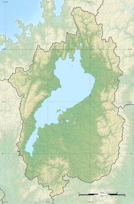
56:Show map of Shiga Prefecture
7:
452:History of Shiga Prefecture
361:Agency for Cultural Affairs
330:
264:
224:
10:
483:
194:Yes (no public facilities)
218:
198:
190:
185:
175:
170:
162:
154:
117:
107:
93:
31:
24:
81:Anō temple ruins (Japan)
462:Historic Sites of Japan
322:Keihan Electric Railway
416:Otsu Museum of History
325:Ishiyama Sakamoto Line
139:35.05333°N 135.86750°E
234:with the ruins of an
232:archaeological site
144:35.05333; 135.86750
135: /
21:
289:in the west and a
191:Public access
19:
209:
208:
84:Show map of Japan
474:
428:
420:
403:
402:
399:
381:
372:
371:
369:
367:
353:
247:Shiga Prefecture
229:
227:
221:
220:
213:Anō temple ruins
150:
149:
147:
146:
145:
140:
136:
133:
132:
131:
128:
85:
76:
75:
69:
57:
53:Anō temple ruins
48:
47:
41:
22:
20:Anō temple ruins
18:
482:
481:
477:
476:
475:
473:
472:
471:
432:
431:
426:
418:
412:
407:
406:
400:
396:
382:
375:
365:
363:
355:
354:
350:
345:
333:
307:Ōmi Ōtsu Palace
267:
239:Buddhist temple
215:
205:
204:
143:
141:
137:
134:
129:
126:
124:
122:
121:
89:
88:
87:
86:
83:
82:
79:
78:
77:
60:
59:
58:
55:
54:
51:
50:
49:
27:
17:
12:
11:
5:
480:
470:
469:
464:
459:
454:
449:
444:
430:
429:
421:
411:
410:External links
408:
405:
404:
394:
373:
347:
346:
344:
341:
340:
339:
332:
329:
266:
263:
207:
206:
200:
199:
196:
195:
192:
188:
187:
183:
182:
177:
173:
172:
168:
167:
164:
160:
159:
156:
152:
151:
119:
115:
114:
109:
105:
104:
95:
91:
90:
80:
71:
70:
64:
63:
62:
61:
52:
43:
42:
36:
35:
34:
33:
32:
29:
28:
25:
15:
9:
6:
4:
3:
2:
479:
468:
465:
463:
460:
458:
455:
453:
450:
448:
445:
443:
440:
439:
437:
427:(in Japanese)
425:
422:
419:(in Japanese)
417:
414:
413:
401:(in Japanese)
397:
391:
387:
380:
378:
362:
358:
352:
348:
338:
335:
334:
328:
326:
323:
319:
314:
312:
308:
304:
303:Ikaruga, Nara
300:
296:
292:
288:
284:
280:
276:
272:
262:
260:
256:
252:
251:Kansai region
248:
244:
240:
237:
233:
226:
225:Anō Haiji ato
214:
203:
197:
193:
189:
184:
181:
178:
174:
169:
165:
161:
157:
153:
148:
120:
116:
113:
112:Kansai region
110:
106:
103:
99:
96:
92:
68:
40:
30:
23:
467:Ōmi Province
442:Asuka period
385:
364:. Retrieved
351:
315:
311:Heian period
268:
236:Asuka period
212:
210:
180:Asuka period
158:temple ruins
318:Anō Station
279:Kawara-dera
166:33,028.5 m²
142: /
130:135°52′03″E
118:Coordinates
98:Ōtsu, Shiga
436:Categories
395:4311750404
366:August 20,
343:References
271:roof tiles
186:Site notes
127:35°03′12″N
285:, with a
275:excavated
261:in 1997.
249:, in the
331:See also
299:Hokki-ji
295:cloister
265:Overview
94:Location
388:. 学生社.
357:"穴太廃寺跡"
320:on the
176:Periods
171:History
392:
291:pagoda
230:is an
108:Region
287:Kondō
283:Asuka
255:Japan
219:穴太廃寺跡
102:Japan
26:穴太廃寺跡
457:Ōtsu
390:ISBN
368:2020
243:Ōtsu
211:The
163:Area
155:Type
301:in
281:in
253:of
438::
376:^
327:.
245:,
222:,
100:,
398:.
370:.
228:)
216:(
Text is available under the Creative Commons Attribution-ShareAlike License. Additional terms may apply.

