113:
137:
20:
125:
85:
according to the Trust for Public Land, although U.S. Geological Survey maps and documents based on them don't reflect this information. The upper part of the river, in
Westchester County, is also called Mill River, as shown in USGS maps Variant names for the Rippowam River include Mill River,
112:
86:
Collins Brook, Mud Pond Brook, Rippowan River, Scotts Corner Brook, Stamford Mill River, Stoneford Mill River, Tomok River, and Turn River, according to the US Board on
Geographic Names.
964:
74:
70:, crosses it. The river has been dammed to form both the North Stamford Reservoir in North Stamford, and the Laurel Reservoir on the Stamford/New Canaan border.
43:
and
Westchester County, New York (United States). It drains a catchment area of 37.5 square miles (97 km) and flows for 17 miles (27 km) from
237:
136:
1275:
1256:
957:
283:
1290:
315:
1280:
950:
1295:
1249:
218:
67:
1120:
870:
308:
124:
559:
1187:
189:
Mill River and Mill Pond
Habitat Restoration Project, Rippowam River, Stamford, Connecticut: Geotechnical Analysis
1242:
420:
328:
1285:
764:
554:
301:
324:
153:
40:
754:
608:
241:
769:
744:
564:
188:
1155:
1140:
1125:
890:
875:
860:
809:
729:
715:
480:
255:
269:
539:
200:
1100:
1014:
850:
652:
642:
465:
410:
996:
574:
524:
353:
98:
78:
44:
19:
223:
52:
24:
293:
63:
8:
509:
1230:
909:
1173:
1165:
1105:
1095:
1052:
1047:
1029:
1024:
1019:
942:
855:
814:
450:
405:
386:
368:
345:
336:
48:
118:
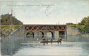
The river just south of the railroad bridge in the South End of
Stamford, about 1905
1110:
1085:
1062:
835:
779:
681:
647:
634:
593:
514:
504:
495:
445:
425:
400:
395:
376:
101:
in the late 1940s to take advantage of the view of the valley formed by the river.
1150:
804:
799:
749:
705:
691:
598:
579:
534:
529:
470:
415:
1226:
1067:
784:
700:
662:
624:
519:
460:
430:
90:
1269:
1202:
1189:
1135:
1130:
976:
927:
885:
880:
794:
789:
734:
676:
667:
603:
588:
549:
544:
485:
435:
358:
168:
1115:
918:
865:
819:
774:
739:
724:
475:
455:
440:
163:
1090:
1077:
1057:
980:
840:
158:
94:
191:, Bioengineering Group, Inc., for U.S. Army Corps of Engineers, May 2003
845:
759:
213:
58:
Streamflow in the
Rippowam River is controlled by several small
1039:
256:"MILL RIVER AT POUND RIDGE NY (USGS-01209797) site data in the"
23:
New Haven railroad line at the Mill (Rippowam) River crossing,
973:
36:
323:
1006:
988:
59:
972:
917:
97:
on the eastern slope of the
Rippowam River valley in
1225:
73:The lower eight miles of Rippowam River, from the
1267:
1250:
958:
309:
240:. The Trust for Public Land. Archived from
1257:
1243:
965:
951:
316:
302:
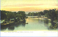
142:River scene from a postcard mailed in 1906
201:01209901 RIPPOWAM RIVER NEAR STAMFORD, CT
18:
1276:Rivers of Fairfield County, Connecticut
270:"CalTopo - Backcountry Mapping Evolved"
1291:Northeastern United States river stubs
1268:
214:"National Register Information System"
946:
297:
284:"Geographic Names Information System"
16:River in Connecticut and New York, US
1220:
238:"Mill River Park Plan, Stamford, CT"
219:National Register of Historic Places
68:National Register of Historic Places
206:
13:
1281:Geography of Stamford, Connecticut
14:
1307:
135:
123:
111:
276:
262:
248:
230:
194:
181:
1:
174:
154:List of rivers in Connecticut
41:Fairfield County, Connecticut
1229:. You can help Knowledge by
7:
1296:Connecticut geography stubs
147:
10:
1312:
1219:
130:Rippowam River, about 1905
104:
1164:
1076:
1038:
1005:
987:
908:
828:
714:
690:
661:
633:
617:
573:
494:
385:
367:
344:
335:
66:, which is listed on the
203:, U.S. Geological Survey
75:North Stamford Reservoir
997:Little Narragansett Bay
575:Little Narragansett Bay
79:Harbor Point (Stamford)
1121:Mill River (Fairfield)
871:Mill River (Fairfield)
28:
1286:Rivers of Connecticut
325:Rivers of Connecticut
224:National Park Service
51:, which it enters in
25:Stamford, Connecticut
22:
64:Turn-of-River Bridge
1203:41.0474°N 73.5450°W
1199: /
510:East Aspetuck River
910:Upper New York Bay
29:
1238:
1237:
1208:41.0474; -73.5450
1182:
1181:
1174:Long Island Sound
1106:Hammonasset River
1096:Connecticut River
1053:Bridgeport Harbor
1048:Black Rock Harbor
1025:Wethersfield Cove
1020:Wequetequock Cove
940:
939:
936:
935:
904:
903:
856:Hammonasset River
815:Willimantic River
451:Mattabesset River
406:Connecticut River
387:Connecticut River
369:Bridgeport Harbor
346:Black Rock Harbor
337:Long Island Sound
226:. March 13, 2009.
49:Long Island Sound
1303:
1259:
1252:
1245:
1221:
1214:
1213:
1211:
1210:
1209:
1204:
1200:
1197:
1196:
1195:
1192:
1111:Housatonic River
1086:Black Hall River
1063:New Haven Harbor
967:
960:
953:
944:
943:
915:
914:
836:Black Hall River
780:Mount Hope River
682:Silvermine River
648:Quinnipiac River
635:New Haven Harbor
594:Green Fall River
515:Housatonic River
505:Blackberry River
496:Housatonic River
446:Lieutenant River
426:Farmington River
401:Coginchaug River
396:Blackledge River
377:Pequonnock River
342:
341:
318:
311:
304:
295:
294:
288:
287:
280:
274:
273:
266:
260:
259:
252:
246:
245:
234:
228:
227:
210:
204:
198:
192:
185:
139:
127:
115:
1311:
1310:
1306:
1305:
1304:
1302:
1301:
1300:
1266:
1265:
1264:
1263:
1217:
1207:
1205:
1201:
1198:
1193:
1190:
1188:
1186:
1185:
1183:
1178:
1160:
1151:Saugatuck River
1072:
1034:
1001:
983:
971:
941:
932:
900:
824:
805:Shetucket River
800:Quinebaug River
750:Five Mile River
710:
706:Saugatuck River
692:Saugatuck River
686:
665:
657:
629:
613:
599:Pawcatuck River
580:Pawcatuck River
577:
569:
535:Pomperaug River
530:Naugatuck River
490:
471:Pequabuck River
416:Eightmile River
381:
363:
331:
329:drainage system
322:
292:
291:
282:
281:
277:
268:
267:
263:
254:
253:
249:
236:
235:
231:
212:
211:
207:
199:
195:
186:
182:
177:
150:
143:
140:
131:
128:
119:
116:
107:
81:, are known as
17:
12:
11:
5:
1309:
1299:
1298:
1293:
1288:
1283:
1278:
1262:
1261:
1254:
1247:
1239:
1236:
1235:
1180:
1179:
1177:
1176:
1170:
1168:
1162:
1161:
1159:
1158:
1153:
1148:
1146:Rippowam River
1143:
1138:
1133:
1128:
1123:
1118:
1113:
1108:
1103:
1098:
1093:
1088:
1082:
1080:
1074:
1073:
1071:
1070:
1068:Norwalk Harbor
1065:
1060:
1055:
1050:
1044:
1042:
1036:
1035:
1033:
1032:
1030:Ziegler's Cove
1027:
1022:
1017:
1011:
1009:
1003:
1002:
1000:
999:
993:
991:
985:
984:
970:
969:
962:
955:
947:
938:
937:
934:
933:
931:
930:
924:
922:
912:
906:
905:
902:
901:
899:
898:
896:Rippowam River
893:
888:
883:
878:
873:
868:
863:
858:
853:
848:
843:
838:
832:
830:
826:
825:
823:
822:
817:
812:
807:
802:
797:
792:
787:
785:Natchaug River
782:
777:
772:
767:
762:
757:
752:
747:
742:
737:
732:
727:
721:
719:
712:
711:
709:
708:
703:
701:Aspetuck River
697:
695:
688:
687:
685:
684:
679:
673:
671:
663:Norwalk Harbor
659:
658:
656:
655:
650:
645:
639:
637:
631:
630:
628:
627:
625:Wepawaug River
621:
619:
618:Milford Harbor
615:
614:
612:
611:
606:
601:
596:
591:
585:
583:
571:
570:
568:
567:
562:
560:Ten Mile River
557:
552:
547:
542:
537:
532:
527:
522:
520:Konkapot River
517:
512:
507:
501:
499:
492:
491:
489:
488:
483:
478:
473:
468:
463:
461:Pameacha Creek
458:
453:
448:
443:
438:
433:
431:Hockanum River
428:
423:
418:
413:
408:
403:
398:
392:
390:
383:
382:
380:
379:
373:
371:
365:
364:
362:
361:
356:
350:
348:
339:
333:
332:
321:
320:
313:
306:
298:
290:
289:
275:
261:
247:
244:on 2011-01-01.
229:
205:
193:
187:Martin Silva,
179:
178:
176:
173:
172:
171:
166:
161:
156:
149:
146:
145:
144:
141:
134:
132:
129:
122:
120:
117:
110:
106:
103:
91:Philip Johnson
33:Rippowam River
15:
9:
6:
4:
3:
2:
1308:
1297:
1294:
1292:
1289:
1287:
1284:
1282:
1279:
1277:
1274:
1273:
1271:
1260:
1255:
1253:
1248:
1246:
1241:
1240:
1234:
1232:
1228:
1223:
1222:
1218:
1215:
1212:
1175:
1172:
1171:
1169:
1167:
1163:
1157:
1154:
1152:
1149:
1147:
1144:
1142:
1139:
1137:
1136:Noroton River
1134:
1132:
1131:Niantic River
1129:
1127:
1124:
1122:
1119:
1117:
1114:
1112:
1109:
1107:
1104:
1102:
1099:
1097:
1094:
1092:
1089:
1087:
1084:
1083:
1081:
1079:
1075:
1069:
1066:
1064:
1061:
1059:
1056:
1054:
1051:
1049:
1046:
1045:
1043:
1041:
1037:
1031:
1028:
1026:
1023:
1021:
1018:
1016:
1013:
1012:
1010:
1008:
1004:
998:
995:
994:
992:
990:
986:
982:
978:
975:
968:
963:
961:
956:
954:
949:
948:
945:
929:
928:Titicus River
926:
925:
923:
920:
916:
913:
911:
907:
897:
894:
892:
889:
887:
886:Noroton River
884:
882:
881:Niantic River
879:
877:
874:
872:
869:
867:
864:
862:
859:
857:
854:
852:
849:
847:
844:
842:
839:
837:
834:
833:
831:
827:
821:
818:
816:
813:
811:
808:
806:
803:
801:
798:
796:
795:Pachaug River
793:
791:
790:Oxoboxo River
788:
786:
783:
781:
778:
776:
773:
771:
770:Merrick Brook
768:
766:
763:
761:
758:
756:
753:
751:
748:
746:
745:Fishers Brook
743:
741:
738:
736:
735:Bigelow Brook
733:
731:
728:
726:
723:
722:
720:
717:
713:
707:
704:
702:
699:
698:
696:
693:
689:
683:
680:
678:
677:Norwalk River
675:
674:
672:
669:
668:Norwalk River
664:
660:
654:
651:
649:
646:
644:
641:
640:
638:
636:
632:
626:
623:
622:
620:
616:
610:
607:
605:
604:Shunock River
602:
600:
597:
595:
592:
590:
589:Ashaway River
587:
586:
584:
581:
576:
572:
566:
565:Whiting River
563:
561:
558:
556:
553:
551:
550:Shepaug River
548:
546:
545:Schenob Brook
543:
541:
538:
536:
533:
531:
528:
526:
523:
521:
518:
516:
513:
511:
508:
506:
503:
502:
500:
497:
493:
487:
486:Scantic River
484:
482:
479:
477:
474:
472:
469:
467:
464:
462:
459:
457:
454:
452:
449:
447:
444:
442:
439:
437:
436:Hubbard River
434:
432:
429:
427:
424:
422:
419:
417:
414:
412:
409:
407:
404:
402:
399:
397:
394:
393:
391:
388:
384:
378:
375:
374:
372:
370:
366:
360:
359:Rooster River
357:
355:
352:
351:
349:
347:
343:
340:
338:
334:
330:
326:
319:
314:
312:
307:
305:
300:
299:
296:
285:
279:
271:
265:
257:
251:
243:
239:
233:
225:
221:
220:
215:
209:
202:
197:
190:
184:
180:
170:
169:Norwalk River
167:
165:
162:
160:
157:
155:
152:
151:
138:
133:
126:
121:
114:
109:
108:
102:
100:
96:
92:
87:
84:
80:
76:
71:
69:
65:
61:
56:
54:
50:
46:
42:
38:
34:
26:
21:
1231:expanding it
1224:
1216:
1184:
1156:Thames River
1145:
1141:Oyster River
1126:Mystic River
1116:Mianus River
1078:River mouths
919:Hudson River
895:
891:Oyster River
876:Mystic River
866:Mianus River
861:Indian River
820:Yantic River
810:Thames River
775:Moosup River
765:Little River
755:French River
740:Fenton River
730:Beaver Brook
725:Basset Brook
716:Thames River
481:Salmon River
476:Podunk River
456:Nepaug River
441:Jeremy River
278:
264:
250:
242:the original
232:
217:
208:
196:
183:
164:Mianus River
88:
82:
72:
57:
32:
30:
27:, about 1908
1206: /
1091:Byram River
1058:Kidd Harbor
981:Connecticut
977:waterbodies
841:Byram River
555:Still River
540:Rocky River
421:Falls River
159:Byram River
95:Glass House
55:'s harbor.
1270:Categories
1194:73°32′42″W
1191:41°02′51″N
1101:Farm River
1015:Smith Cove
851:Farm River
846:Cove River
670:Watershed)
653:West River
643:Mill River
609:Wood River
582:Watershed)
466:Park River
411:Duck River
175:References
99:New Canaan
93:built his
89:Architect
83:Mill River
45:Ridgefield
921:Watershed
760:Hop River
718:Watershed
694:Watershed
525:Mad River
498:Watershed
389:Watershed
354:Ash Creek
148:See also
53:Stamford
1040:Harbors
974:Coastal
105:Gallery
1166:Sounds
829:Others
62:. The
1007:Coves
37:river
35:is a
1227:stub
989:Bays
60:dams
31:The
979:of
327:by
77:to
47:to
39:in
1272::
222:.
216:.
1258:e
1251:t
1244:v
1233:.
966:e
959:t
952:v
666:(
578:(
317:e
310:t
303:v
286:.
272:.
258:.
Text is available under the Creative Commons Attribution-ShareAlike License. Additional terms may apply.


