38:
350:
326:
338:
362:
54:
126:
532:
61:
289:. In 1276–77, a hospital was established at the location. The abbey was declared bankrupt in 1783, and was later torn down. Parts of the abbey have been reconstructed in the 1980s and 1990s.
293:
268:
502:
557:
85:
388:
349:
562:
536:
53:
37:
325:
247:. The village officially changed its name from Petegem into Petegem-aan-de-Schelde in order to distinguish itself from
139:
337:
303:
near the location of the old castle. The castle and lands are nowadays owned by the Golf- and
Countryclub Oudenaarde.
314:. Most of the village has been rebuilt since the late 1940s. In 1971, the municipality merged into Wortegem-Petegem.
151:
418:
298:
168:
273:
163:
552:
361:
282:. Most of the castle was destroyed during warfare, and by the 17th century only a ruin remained.
476:
117:
224:
8:
248:
450:
285:
In the early 1270s, the Abbey of
Beaulieu was constructed as a women's abbey for the
264:
252:
236:
178:
144:
546:
292:
In 1847, Baron August Pycke de
Peteghem commissioned the construction of the
244:
156:
100:
87:
311:
307:
286:
219:
279:
263:
The village was first mentioned as
Wrattingem in 964. During the
240:
131:
531:
278:, was located in Petegem on the left bank of the River
306:
Petegem-aan-de-Schelde suffered major damage during
389:"Bevolking per statistische sector - Sector 45061A"
544:
60:
310:, and was nearly completely destroyed during
235:is a village and former municipality in the
445:
443:
122:
413:
411:
409:
251:. In 1971, the municipality merged into
558:Former municipalities of East Flanders
545:
440:
383:
381:
406:
267:, a castle which became later known
193:11.75 km (4.54 sq mi)
378:
13:
14:
574:
563:Populated places in East Flanders
524:
530:
360:
348:
336:
324:
124:
59:
52:
36:
355:House in Petegem-aan-de-Schelde
495:
469:
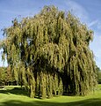
343:Tree in Petegem-aan-de-Schelde
1:
372:
481:Agentschap Onroerend Erfgoed
455:Agentschap Onroerend Erfgoed
7:
10:
579:
317:
258:
218:
210:
202:
197:
189:
184:
174:
162:
150:
138:
116:
81:
47:
35:
28:
21:
16:Village in Flemish Region
451:"Petegem-aan-de-Schelde"
419:"Toeristische Brochure"
214:180/km (470/sq mi)
537:Petegem-aan-de-Schelde
233:Petegem-aan-de-Schelde
67:Petegem-aan-de-Schelde
23:Petegem-aan-de-Schelde
503:"Kasteel van Petegem"
428:(in Dutch). p. 3
294:New Castle of Petegem
269:Old Castle of Petegem
539:at Wikimedia Commons
477:"Abdij van Beaulieu"
239:municipality in the
211: • Density
101:50.83290°N 3.55682°E
249:Petegem-aan-de-Leie
97: /
73:Location in Belgium
393:Statistics Belgium
331:St Martinus Church
203: • Total
190: • Total
535:Media related to
507:Burchten Kastelen
265:Early Middle Ages
230:
229:
106:50.83290; 3.55682
570:
553:Wortegem-Petegem
534:
519:
518:
516:
514:
499:
493:
492:
490:
488:
473:
467:
466:
464:
462:
447:
438:
437:
435:
433:
426:Wortegem-Petegem
423:
415:
404:
403:
401:
399:
385:
364:
352:
340:
328:
302:
277:
253:Wortegem-Petegem
237:Wortegem-Petegem
179:Wortegem-Petegem
134:
130:
128:
127:
112:
111:
109:
108:
107:
102:
98:
95:
94:
93:
90:
63:
62:
56:
40:
19:
18:
578:
577:
573:
572:
571:
569:
568:
567:
543:
542:
527:
522:
512:
510:
501:
500:
496:
486:
484:
475:
474:
470:
460:
458:
449:
448:
441:
431:
429:
421:
417:
416:
407:
397:
395:
387:
386:
379:
375:
368:
365:
356:
353:
344:
341:
332:
329:
320:
296:
271:
261:
125:
123:
105:
103:
99:
96:
91:
88:
86:
84:
83:
77:
76:
75:
74:
71:
70:
69:
68:
64:
43:
31:
24:
17:
12:
11:
5:
576:
566:
565:
560:
555:
541:
540:
526:
525:External links
523:
521:
520:
494:
468:
439:
405:
376:
374:
371:
370:
369:
366:
359:
357:
354:
347:
345:
342:
335:
333:
330:
323:
319:
316:
260:
257:
228:
227:
222:
216:
215:
212:
208:
207:
204:
200:
199:
195:
194:
191:
187:
186:
182:
181:
176:
172:
171:
166:
164:Arrondissement
160:
159:
154:
148:
147:
145:Flemish Region
142:
136:
135:
120:
114:
113:
79:
78:
72:
66:
65:
58:
57:
51:
50:
49:
48:
45:
44:
42:The New Castle
41:
33:
32:
29:
26:
25:
22:
15:
9:
6:
4:
3:
2:
575:
564:
561:
559:
556:
554:
551:
550:
548:
538:
533:
529:
528:
508:
504:
498:
482:
478:
472:
456:
452:
446:
444:
427:
420:
414:
412:
410:
394:
390:
384:
382:
377:
363:
358:
351:
346:
339:
334:
327:
322:
321:
315:
313:
309:
304:
300:
295:
290:
288:
283:
281:
275:
270:
266:
256:
254:
250:
246:
245:East Flanders
242:
238:
234:
226:
223:
221:
217:
213:
209:
205:
201:
196:
192:
188:
183:
180:
177:
173:
170:
167:
165:
161:
158:
157:East Flanders
155:
153:
149:
146:
143:
141:
137:
133:
121:
119:
115:
110:
82:Coordinates:
80:
55:
46:
39:
34:
27:
20:
511:. Retrieved
506:
497:
485:. Retrieved
480:
471:
459:. Retrieved
454:
430:. Retrieved
425:
396:. Retrieved
392:
312:World War II
305:
291:
284:
262:
243:province of
232:
231:
175:Municipality
308:World War I
297: [
287:Poor Clares
272: [
104: /
547:Categories
513:18 October
509:(in Dutch)
487:18 October
483:(in Dutch)
461:18 October
457:(in Dutch)
432:18 October
373:References
367:Old Castle
198:Population
169:Oudenaarde
89:50°49′58″N
220:Time zone
92:3°33′25″E
152:Province
318:Gallery
280:Scheldt
259:History
241:Belgian
132:Belgium
118:Country
30:Village
140:Region
129:
422:(PDF)
398:5 May
301:]
276:]
206:2,118
515:2020
489:2020
463:2020
434:2020
400:2022
185:Area
225:CET
549::
505:.
479:.
453:.
442:^
424:.
408:^
391:.
380:^
299:nl
274:nl
255:.
517:.
491:.
465:.
436:.
402:.
Text is available under the Creative Commons Attribution-ShareAlike License. Additional terms may apply.


