552:"}},"text\/plain":{"en":{"":"inception"}}},"{\"value\":{\"time\":\"+2012-12-14T00:00:00Z\",\"timezone\":0,\"before\":0,\"after\":0,\"precision\":11,\"calendarmodel\":\"http:\\\/\\\/www.wikidata.org\\\/entity\\\/Q1985727\"},\"type\":\"time\"}":{"text\/html":{"en":{"P571":"14 December 2012"}},"text\/plain":{"en":{"P571":"14 December 2012"}}}}": -->
43:
265:
362:
271:
276:
99:
1414:
590:"}},"text\/plain":{"en":{"":"media type"}}},"{\"value\":\"image\\\/jpeg\",\"type\":\"string\"}":{"text\/html":{"en":{"P1163":"image\/jpeg"}},"text\/plain":{"en":{"P1163":"image\/jpeg"}}}}": -->
508:"}},"text\/plain":{"en":{"":"copyright license"}}},"{\"value\":{\"entity-type\":\"item\",\"numeric-id\":14946043,\"id\":\"Q14946043\"},\"type\":\"wikibase-entityid\"}":{"text\/html":{"en":{"P275":"
464:"}},"text\/plain":{"en":{"":"copyright status"}}},"{\"value\":{\"entity-type\":\"item\",\"numeric-id\":50423863,\"id\":\"Q50423863\"},\"type\":\"wikibase-entityid\"}":{"text\/html":{"en":{"P6216":"
417:"}},"text\/plain":{"en":{"":"depicts"}}},"{\"value\":{\"entity-type\":\"item\",\"numeric-id\":4117787,\"id\":\"Q4117787\"},\"type\":\"wikibase-entityid\"}":{"text\/html":{"en":{"P180":"
1409:
586:
1399:
666:
1199:
1344:
317:– You must give appropriate credit, provide a link to the license, and indicate if changes were made. You may do so in any reasonable manner, but not in any way that suggests the licensor endorses you or your use.
1214:
1424:
1429:
1161:
1156:
1151:
1146:
1141:
1136:
1131:
509:
465:
1439:
418:
1419:
717:}} Quadratische Plattkarte, N-S-Streckung 104 %. Geographische Begrenzung der Karte: * N: 19.5° N * S: 11.4° N * W: 41.8° O * O: 54.7° O {{en|Physical location map of ...
587:
461:
549:
505:
414:
1434:
1189:
1454:
1478:
1469:
1449:
1444:
706:
512:"}},"text\/plain":{"en":{"P275":"Creative Commons Attribution-ShareAlike 3.0 Unported"}}}}": -->
1219:
65:
61:
57:
53:
47:
254:
110:
78:
535:
491:
1459:
1384:
447:
1369:
731:
1489:
This file contains additional information, probably added from the digital camera or scanner used to create or digitize it.
324:
1001:
695:
690:
597:
475:
1171:
559:
519:
431:
781:
1209:
1166:
286:
1525:
361:
1492:
If the file has been modified from its original state, some details may not fully reflect the modified file.
1404:
421:"}},"text\/plain":{"en":{"P180":"As Sayyani District"}}}}": -->
1126:
223:
776:
1224:
1194:
831:
741:
736:
323:– If you remix, transform, or build upon the material, you must distribute your contributions under the
1026:
806:
756:
468:"}},"text\/plain":{"en":{"P6216":"copyrighted"}}}}": -->
956:
727:
The following pages on the
English Knowledge use this file (pages on other projects are not listed):
1464:
1239:
946:
866:
118:
1269:
1234:
836:
665:
660:
69:
42:
1204:
861:
856:
851:
801:
746:
1334:
1066:
1036:
906:
283:
8:
1264:
791:
771:
1329:
1379:
896:
676:
227:
154:
Quadratische
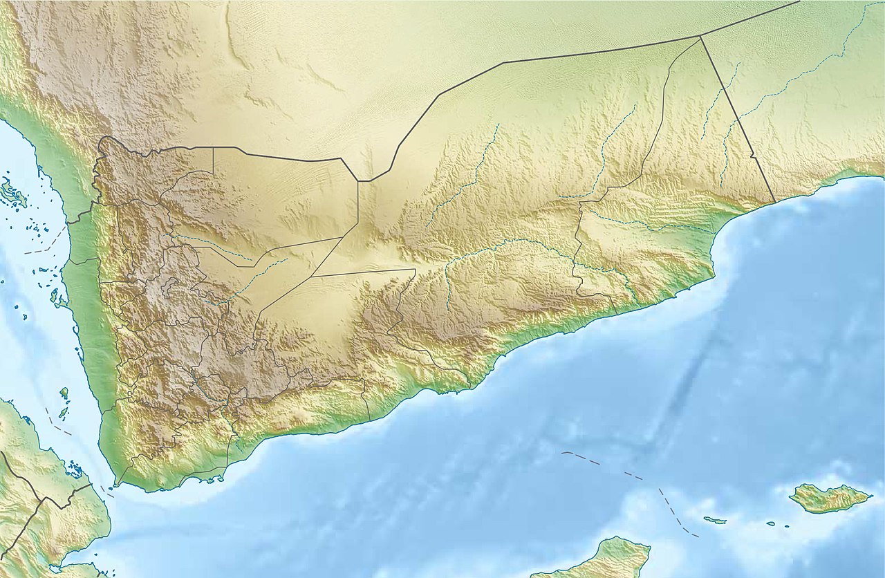
Plattkarte, N-S-Streckung 104 %. Geographische Begrenzung der Karte:
901:
811:
786:
182:
Equirectangular projection, N/S stretching 104 %. Geographic limits of the map:
105:
981:
916:
821:
1274:
1101:
951:
921:
886:
871:
826:
816:
1086:
1081:
1071:
1046:
926:
876:
846:
766:
243:
1389:
1364:
1121:
1096:
1011:
986:
841:
607:
569:
529:
485:
441:
1540:
1299:
1041:
976:
971:
966:
941:
796:
1289:
931:
1249:
1374:
1359:
1354:
1304:
961:
1284:
1162:
User:Ty654/List of earthquakes from 2015-2019 exceeding magnitude 6+
1157:
User:Ty654/List of earthquakes from 2005-2009 exceeding magnitude 6+
1152:
User:Ty654/List of earthquakes from 2000-2004 exceeding magnitude 6+
1147:
User:Ty654/List of earthquakes from 1980-1984 exceeding magnitude 6+
1142:
User:Ty654/List of earthquakes from 1970-1974 exceeding magnitude 6+
1137:
User:Ty654/List of earthquakes from 1965-1969 exceeding magnitude 6+
1132:
User:Ty654/List of earthquakes from 1955-1959 exceeding magnitude 6+
1031:
996:
936:
714:
633:
Click on a date/time to view the file as it appeared at that time.
149:
1111:
1076:
991:
891:
751:
1254:
177:
1294:
1279:
1061:
1056:
1021:
1016:
911:
881:
713:{{Information |Description= {{de|Physische Positionskarte vom
1314:
1309:
1116:
1106:
1051:
1006:
1091:
761:
1324:
205:
93:
725:
83:(1,693 × 1,106 pixels, file size: 958 KB, MIME type:
1180:
631:
536:
Creative
Commons Attribution-ShareAlike 3.0 Unported
510:
Creative
Commons Attribution-ShareAlike 3.0 Unported
117:
Commons is a freely licensed media file repository.
1335:Module:Mapa nin kinamumugtakan/datos/Yemen/doc
334:https://creativecommons.org/licenses/by-sa/3.0
98:
340:Creative Commons Attribution-Share Alike 3.0
264:
249:
201:
135:
353:
239:
211:
14:
1240:Módulu:Mapa de llocalización/datos/Yeme/usu
300:– to copy, distribute and transmit the work
1330:Module:Mapa nin kinamumugtakan/datos/Yemen
1415:মডিউল:অবস্থান মানচিত্র/উপাত্ত/ইয়েমেন/নথি
1182:The following other wikis use this file:
1235:Módulu:Mapa de llocalización/datos/Yeme
1410:মডিউল:অবস্থান মানচিত্র/উপাত্ত/ইয়েমেন
129:
1200:مستخدم:عبد المؤمن/مسودات/خرائط/اليمن
287:Attribution-Share Alike 3.0 Unported
1002:List of journalists killed in Yemen
624:
275:
270:
13:
1487:
1172:Module:Location map/data/Yemen/doc
412:
406:
398:
390:
261:
170:
142:
130:
76:
1589:
1494:
1400:টেমপ্লেট:অবস্থান মানচিত্র ইয়েমেন
1341:Usage on be-tarask.wikipedia.org
732:1931 Saudi–Yemeni border skirmish
411:
1345:Шаблён:Лякалізацыйная мапа Емэну
1210:وحدة:Location map/data/Yemen/شرح
782:Al-Masajid (archaeological site)
726:
381:
360:
311:Under the following conditions:
282:This file is licensed under the
274:
269:
263:
97:
31:
21:
1574:Date metadata was last modified
378:
171:
1215:قائمة الصحفيين القتلى في اليمن
1177:
1167:Module:Location map/data/Yemen
628:
377:
143:
26:
1:
1526:Adobe Photoshop CS3 Macintosh
777:Al-Hadi ila'l-Haqq Yahya
367:Equivalent administrative map
148:Physische Positionskarte vom
138:Yemen relief location map.jpg
36:
1205:وحدة:Location map/data/Yemen
1127:User:BengalEmpire767/sandbox
722:
427:Items portrayed in this file
7:
1566:Date and time of digitizing
1484:
1321:Usage on bcl.wikipedia.org
1246:Usage on azb.wikipedia.org
1231:Usage on ast.wikipedia.org
832:Ali ibn al-Fadl al-Jayshani
742:1982 North Yemen earthquake
737:1941 Jabal Razih earthquake
233:STRM-30 data for the relief
224:File:Yemen location map.svg
10:
1594:
1396:Usage on bn.wikipedia.org
1351:Usage on bg.wikipedia.org
1261:Usage on az.wikipedia.org
1186:Usage on ar.wikipedia.org
1027:Operation Blow to the Head
957:Jabal An-Nabi Shu'ayb
325:same or compatible license
132:
1532:File change date and time
1270:Şablon:Yer xəritəsi Yəmən
807:Al Shohada Mosque (Sanaa)
757:Abdulhadi as-Soudi Mosque
683:Soqotra and other islands
625:
216:
176:Physical location map of
16:
947:Islamic history of Yemen
867:Battle of Mukalla (2015)
380:
291:
104:This is a file from the
41:
712:
691:18:46, 14 December 2012
682:
204:
108:. Information from its
1425:আল শোহাদা মসজিদ (সানা)
1190:قالب:خريطة مواقع اليمن
837:Arwa al-Sulayhi Mosque
111:description page there
46:Size of this preview:
1506:Horizontal resolution
862:Battle of Al Hudaydah
857:Battle of Aden (2018)
852:Battle of Aden (2015)
802:Al Hudaydah offensive
747:1991 Yemen earthquake
1577:23:26, 3 August 2017
1569:23:18, 3 August 2017
1535:21:26, 3 August 2017
1067:Siege of Sanaa (570)
1037:Qubbat az-Zum Mosque
907:Hadhramaut Mountains
661:19:28, 3 August 2017
70:1,693 × 1,106 pixels
1514:Vertical resolution
1265:Babül-Məndəb boğazı
1220:المساجد (موقع أثري)
792:Al-Nahdayn Mountain
772:Al-Bakiriyya Mosque
448:As Sayyani District
419:As Sayyani District
306:– to adapt the work
52:Other resolutions:
1430:আল-বাকিরিয়া মসজিদ
1285:Ramlat-əs-Sabataym
982:Jabal al-'Awd
897:Geography of Yemen
66:1,280 × 836 pixels
62:1,024 × 669 pixels
1581:
1580:
1479:more global usage
1275:Yəmən coğrafiyası
1178:Global file usage
902:Ghubbah (Socotra)
812:Al Tawheed Mosque
787:Al-Muhdhar Mosque
720:
520:copyright license
506:copyright license
405:
397:
391:Republic of Yemen
389:
374:
373:
258:
255:Reusing this file
126:
125:
106:Wikimedia Commons
32:Global file usage
1585:
1495:
1455:সানা অবরোধ (৫৭০)
1440:আল বোলাইলি মসজিদ
1385:Сокотра (остров)
1290:Haniş arxipelaqı
917:Hajhir Mountains
822:Albolaily Mosque
703:
673:
635:
575:14 December 2012
476:copyright status
462:copyright status
403:
395:
387:
364:
347:
344:
341:
338:
335:
327:as the original.
284:Creative Commons
278:
277:
273:
272:
267:
266:
252:
218:
207:
206:14 December 2012
175:
147:
139:
133:
122:
101:
100:
94:
88:
86:
73:
58:640 × 418 pixels
54:320 × 209 pixels
48:800 × 523 pixels
1593:
1592:
1588:
1587:
1586:
1584:
1583:
1582:
1483:
1435:আত তাওহীদ মসজিদ
1420:ইয়েমেনের ভূগোল
1370:Шаблон:ПК Йемен
1225:زلزال صعدة 1941
1195:زلزال ذمار 1982
1176:
1102:Temple of Awwam
728:
721:
709:
701:
679:
671:
627:
626:
623:
622:
621:
620:
619:
618:
617:
616:
614:
604:
603:
602:
600:
585:
584:
583:
582:
581:
580:
579:
578:
576:
566:
565:
564:
562:
547:
546:
545:
544:
543:
542:
541:
540:
538:
526:
525:
524:
522:
503:
502:
501:
500:
499:
498:
497:
496:
494:
482:
481:
480:
478:
459:
458:
457:
456:
455:
454:
453:
452:
450:
438:
437:
436:
434:
410:
409:
408:
401:
400:
393:
392:
375:
368:
365:
349:
348:
345:
342:
339:
336:
333:
332:
290:
279:
180:
152:
137:
128:
127:
116:
115:
114:is shown below.
90:
84:
82:
75:
74:
51:
12:
11:
5:
1591:
1579:
1578:
1575:
1571:
1570:
1567:
1563:
1562:
1559:
1555:
1554:
1551:
1547:
1546:
1543:
1537:
1536:
1533:
1529:
1528:
1523:
1519:
1518:
1515:
1511:
1510:
1507:
1503:
1502:
1499:
1486:
1481:of this file.
1475:
1474:
1473:
1472:
1467:
1462:
1457:
1452:
1447:
1442:
1437:
1432:
1427:
1422:
1417:
1412:
1407:
1402:
1394:
1393:
1392:
1387:
1382:
1377:
1372:
1367:
1362:
1357:
1349:
1348:
1347:
1339:
1338:
1337:
1332:
1327:
1319:
1318:
1317:
1312:
1307:
1305:Zübeyr adaları
1302:
1297:
1292:
1287:
1282:
1277:
1272:
1267:
1259:
1258:
1257:
1252:
1244:
1243:
1242:
1237:
1229:
1228:
1227:
1222:
1217:
1212:
1207:
1202:
1197:
1192:
1179:
1175:
1174:
1169:
1164:
1159:
1154:
1149:
1144:
1139:
1134:
1129:
1124:
1119:
1114:
1109:
1104:
1099:
1094:
1089:
1084:
1079:
1074:
1069:
1064:
1059:
1054:
1049:
1044:
1039:
1034:
1029:
1024:
1019:
1014:
1009:
1004:
999:
994:
989:
984:
979:
974:
969:
964:
959:
954:
952:Jabal Al-Majaz
949:
944:
939:
934:
929:
924:
922:Hanthel Mosque
919:
914:
909:
904:
899:
894:
889:
887:Diksam Plateau
884:
879:
874:
872:Beihan Airport
869:
864:
859:
854:
849:
844:
839:
834:
829:
827:Alemaan Mosque
824:
819:
817:Alansar Mosque
814:
809:
804:
799:
794:
789:
784:
779:
774:
769:
764:
759:
754:
749:
744:
739:
734:
724:
719:
718:
711:
707:
704:
700:1,693 × 1,106
698:
693:
688:
685:
684:
681:
677:
674:
670:1,693 × 1,106
668:
663:
658:
654:
653:
650:
647:
644:
641:
638:
630:
615:
612:
610:
609:
608:
606:
605:
601:
596:
594:
593:
592:
591:
589:
577:
574:
572:
571:
570:
568:
567:
563:
558:
556:
555:
554:
553:
551:
539:
534:
532:
531:
530:
528:
527:
523:
518:
516:
515:
514:
513:
511:
507:
495:
490:
488:
487:
486:
484:
483:
479:
474:
472:
471:
470:
469:
467:
463:
451:
446:
444:
443:
442:
440:
439:
435:
430:
428:
425:
424:
423:
422:
420:
416:
407:اليمن الجمهوري
402:
399:Carte du Yémen
394:
386:
385:
382:
379:
372:
371:
370:
369:
366:
359:
355:
354:Other versions
351:
350:
331:
330:
329:
328:
318:
309:
308:
307:
301:
294:You are free:
281:
280:
262:
259:
247:
246:
241:
237:
236:
235:
234:
231:
213:
209:
208:
203:
199:
198:
197:
196:
193:
190:
187:
169:
168:
165:
162:
159:
140:
131:
124:
123:
102:
92:
91:
45:
40:
39:
34:
29:
24:
19:
9:
6:
4:
3:
2:
1590:
1576:
1573:
1572:
1568:
1565:
1564:
1560:
1557:
1556:
1552:
1549:
1548:
1544:
1542:
1539:
1538:
1534:
1531:
1530:
1527:
1524:
1522:Software used
1521:
1520:
1516:
1513:
1512:
1508:
1505:
1504:
1500:
1497:
1496:
1493:
1490:
1482:
1480:
1471:
1468:
1466:
1463:
1461:
1458:
1456:
1453:
1451:
1448:
1446:
1443:
1441:
1438:
1436:
1433:
1431:
1428:
1426:
1423:
1421:
1418:
1416:
1413:
1411:
1408:
1406:
1403:
1401:
1398:
1397:
1395:
1391:
1388:
1386:
1383:
1381:
1378:
1376:
1373:
1371:
1368:
1366:
1363:
1361:
1358:
1356:
1353:
1352:
1350:
1346:
1343:
1342:
1340:
1336:
1333:
1331:
1328:
1326:
1323:
1322:
1320:
1316:
1313:
1311:
1308:
1306:
1303:
1301:
1300:Cəbəl-ət-Tair
1298:
1296:
1295:Kamaran adası
1293:
1291:
1288:
1286:
1283:
1281:
1280:Sokotra adası
1278:
1276:
1273:
1271:
1268:
1266:
1263:
1262:
1260:
1256:
1253:
1251:
1248:
1247:
1245:
1241:
1238:
1236:
1233:
1232:
1230:
1226:
1223:
1221:
1218:
1216:
1213:
1211:
1208:
1206:
1203:
1201:
1198:
1196:
1193:
1191:
1188:
1187:
1185:
1184:
1183:
1173:
1170:
1168:
1165:
1163:
1160:
1158:
1155:
1153:
1150:
1148:
1145:
1143:
1140:
1138:
1135:
1133:
1130:
1128:
1125:
1123:
1120:
1118:
1115:
1113:
1110:
1108:
1105:
1103:
1100:
1098:
1095:
1093:
1090:
1088:
1087:Suq (Socotra)
1085:
1083:
1082:Sufyan Mosque
1080:
1078:
1075:
1073:
1072:Siege of Taiz
1070:
1068:
1065:
1063:
1060:
1058:
1055:
1053:
1050:
1048:
1047:Raid on Yakla
1045:
1043:
1040:
1038:
1035:
1033:
1030:
1028:
1025:
1023:
1020:
1018:
1015:
1013:
1010:
1008:
1005:
1003:
1000:
998:
995:
993:
990:
988:
985:
983:
980:
978:
975:
973:
970:
968:
965:
963:
960:
958:
955:
953:
950:
948:
945:
943:
940:
938:
935:
933:
930:
928:
927:Haram (Yemen)
925:
923:
920:
918:
915:
913:
910:
908:
905:
903:
900:
898:
895:
893:
890:
888:
885:
883:
880:
878:
877:Detwah Lagoon
875:
873:
870:
868:
865:
863:
860:
858:
855:
853:
850:
848:
847:Barran Temple
845:
843:
840:
838:
835:
833:
830:
828:
825:
823:
820:
818:
815:
813:
810:
808:
805:
803:
800:
798:
795:
793:
790:
788:
785:
783:
780:
778:
775:
773:
770:
768:
767:Aidrus Mosque
765:
763:
760:
758:
755:
753:
750:
748:
745:
743:
740:
738:
735:
733:
730:
729:
716:
710:
705:
699:
697:
694:
692:
689:
687:
686:
680:
675:
669:
667:
664:
662:
659:
656:
655:
651:
648:
645:
642:
639:
637:
636:
634:
611:
599:
595:
573:
561:
557:
537:
533:
521:
517:
493:
489:
477:
473:
449:
445:
433:
429:
426:
383:
376:
363:
358:
357:
356:
352:
337:CC BY-SA 3.0
326:
322:
319:
316:
313:
312:
310:
305:
302:
299:
296:
295:
293:
292:
288:
285:
268:
260:
256:
251:
248:
245:
242:
238:
232:
229:
225:
222:
221:
220:
214:
210:
200:
194:
191:
188:
185:
184:
183:
179:
174:
166:
163:
160:
157:
156:
155:
151:
146:
141:
134:
120:
113:
112:
107:
103:
96:
95:
89:
80:
79:Original file
71:
67:
63:
59:
55:
49:
44:
38:
35:
33:
30:
28:
25:
23:
20:
18:
15:
1558:Image height
1545:Uncalibrated
1491:
1488:
1476:
1470:সাবির পাহাড়
1450:হানছাল মসজিদ
1445:আলিমান মসজিদ
1181:
1122:Zubair Group
1097:Tarim, Yemen
1012:Mudhaykhirah
987:Jibla, Yemen
842:Ataq Airport
632:
629:File history
320:
314:
303:
297:
228:NordNordWest
215:
181:
172:
153:
144:
119:You can help
109:
77:
22:File history
1550:Image width
1541:Color space
1498:Orientation
1315:Perim adası
1310:Zukar adası
977:Jabal Tiyal
972:Jabal Sabir
967:Jabal Haraz
942:Ibn Hawshab
797:Al Hudaydah
492:copyrighted
466:copyrighted
321:share alike
315:attribution
136:Description
932:Hisn Murad
723:File usage
646:Dimensions
613:image/jpeg
598:media type
588:media type
250:Permission
195:E: 54.7° E
192:W: 41.8° E
189:S: 11.4° N
186:N: 19.5° N
167:O: 54.7° O
164:W: 41.8° O
161:S: 11.4° N
158:N: 19.5° N
85:image/jpeg
27:File usage
1460:হাজরামাউত
962:Jabal Din
643:Thumbnail
640:Date/Time
560:inception
550:inception
173:English:
145:Deutsch:
1561:1,106 px
1553:1,693 px
1485:Metadata
1032:Qabr Hud
997:Kaminahu
937:Hoq Cave
702:(751 KB)
678:Mélomène
672:(958 KB)
384:Captions
304:to remix
298:to share
289:license.
219:, using
217:Own work
37:Metadata
1405:অ্যাডেন
1380:Ходейда
1112:Yakhtul
1077:Socotra
992:Kamaran
892:Erissel
752:Aaragah
708:Carport
657:current
652:Comment
432:depicts
415:depicts
388:English
244:Carport
81:
1517:99 dpi
1509:99 dpi
1501:Normal
1465:আরাগাহ
1325:Sanaʽa
1062:Shibam
1057:Shabwa
1042:Qād̨ub
1022:Nashaq
1017:Nashan
912:Hadibu
882:Dhubab
404:Arabic
396:French
240:Author
212:Source
1477:View
1390:Перим
1365:Шибам
1117:Yemen
1107:Timna
1052:Sanaa
1007:Marib
715:Jemen
178:Yemen
150:Jemen
1375:Таиз
1360:Аден
1355:Сана
1250:صنعا
1092:Taiz
762:Aden
649:User
346:true
343:true
202:Date
17:File
1255:عدن
226:by
68:|
64:|
60:|
56:|
50:.
257:)
253:(
230:.
121:.
87:)
72:.

