441:"}},"text\/plain":{"en":{"":"inception"}}},"{\"value\":{\"time\":\"+2013-09-01T00:00:00Z\",\"timezone\":0,\"before\":0,\"after\":0,\"precision\":11,\"calendarmodel\":\"http:\\\/\\\/www.wikidata.org\\\/entity\\\/Q1985727\"},\"type\":\"time\"}":{"text\/html":{"en":{"P571":"1 September 2013"}},"text\/plain":{"en":{"P571":"1 September 2013"}}}}": -->
212:
43:
218:
223:
99:
397:"}},"text\/plain":{"en":{"":"copyright license"}}},"{\"value\":{\"entity-type\":\"item\",\"numeric-id\":14946043,\"id\":\"Q14946043\"},\"type\":\"wikibase-entityid\"}":{"text\/html":{"en":{"P275":"
353:"}},"text\/plain":{"en":{"":"copyright status"}}},"{\"value\":{\"entity-type\":\"item\",\"numeric-id\":50423863,\"id\":\"Q50423863\"},\"type\":\"wikibase-entityid\"}":{"text\/html":{"en":{"P6216":"
349:
270:– You must give appropriate credit, provide a link to the license, and indicate if changes were made. You may do so in any reasonable manner, but not in any way that suggests the licensor endorses you or your use.
398:
354:
350:
438:
394:
401:"}},"text\/plain":{"en":{"P275":"Creative Commons Attribution-ShareAlike 3.0 Unported"}}}}": -->
201:
73:
69:
65:
61:
57:
53:
47:
424:
380:
604:
742:
This file contains additional information, probably added from the digital camera or scanner used to create or digitize it.
277:
110:
82:
364:
448:
408:
339:
174:
233:
538:, UK with Wyre highlighted. Equirectangular map projection on WGS 84 datum, with N/S stretched 165% |Source=
745:
If the file has been modified from its original state, some details may not fully reflect the modified file.
276:– If you remix, transform, or build upon the material, you must distribute your contributions under the
679:
357:"}},"text\/plain":{"en":{"P6216":"copyrighted"}}}}": -->
552:
The following pages on the
English Knowledge use this file (pages on other projects are not listed):
170:
118:
173:. Most data from Boundary-Line product. Lake data from Meridian 2 product. Inset derived from
230:
8:
516:
511:
42:
105:
329:
167:
619:
609:
556:
539:
189:
527:
178:
458:
418:
374:
144:
535:
149:
Equirectangular map projection on WGS 84 datum, with N/S stretched 165%
729:
484:
Click on a date/time to view the file as it appeared at that time.
241:
Contains
Ordnance Survey data © Crown copyright and database right
709:
87:(SVG file, nominally 1,116 × 1,305 pixels, file size: 1.25 MB)
584:
689:
639:
629:
699:
649:
594:
157:
93:
659:
574:
323:
Add a one-line explanation of what this file represents
550:
719:
565:
482:
425:
Creative
Commons Attribution-ShareAlike 3.0 Unported
399:
Creative
Commons Attribution-ShareAlike 3.0 Unported
117:
Commons is a freely licensed media file repository.
669:
542:[https://www.ordnancesurvey.co.uk/opendatado...
287:https://creativecommons.org/licenses/by-sa/3.0
98:
293:Creative Commons Attribution-Share Alike 3.0
211:
196:
153:
135:
185:
163:
14:
253:– to copy, distribute and transmit the work
46:Size of this PNG preview of this SVG file:
567:The following other wikis use this file:
129:
234:Attribution-Share Alike 3.0 Unported
192:, created using Ordnance Survey data
475:
222:
217:
13:
740:
726:Usage on zh-min-nan.wikipedia.org
534:{{Information |Description=Map of
328:
322:
208:
130:
80:
774:
747:
327:
551:
313:
264:Under the following conditions:
229:This file is licensed under the
221:
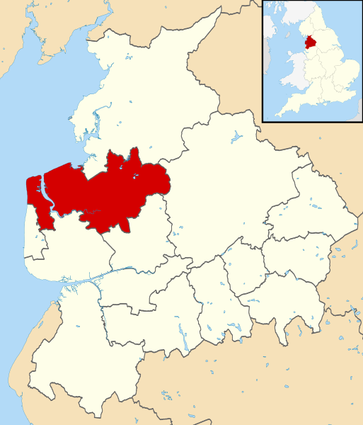
216:
210:
97:
31:
21:
310:
562:
479:
309:
26:
1:
36:
547:
335:Items portrayed in this file
147:, UK with Wyre highlighted.
7:
737:
10:
779:
716:Usage on www.wikidata.org
706:Usage on ur.wikipedia.org
696:Usage on tr.wikipedia.org
686:Usage on sv.wikipedia.org
676:Usage on ru.wikipedia.org
666:Usage on ro.wikipedia.org
656:Usage on pt.wikipedia.org
646:Usage on pl.wikipedia.org
636:Usage on nl.wikipedia.org
626:Usage on lt.wikipedia.org
616:Usage on ko.wikipedia.org
601:Usage on ja.wikipedia.org
591:Usage on fr.wikipedia.org
581:Usage on cy.wikipedia.org
571:Usage on ca.wikipedia.org
278:same or compatible license
132:
476:
16:
312:
244:
175:England location map.svg
104:This is a file from the
41:
533:
512:20:46, 1 September 2013
156:
138:Wyre UK locator map.svg
108:. Information from its
111:description page there
74:1,116 × 1,305 pixels
70:1,751 × 2,048 pixels
259:– to adapt the work
52:Other resolutions:
66:876 × 1,024 pixels
766:
765:
605:Category:ワイヤ出身の人物
563:Global file usage
545:
409:copyright license
395:copyright license
321:
306:
305:
205:
202:Reusing this file
126:
125:
106:Wikimedia Commons
32:Global file usage
770:
748:
585:Bwrdeistref Wyre
524:
486:
464:1 September 2013
365:copyright status
351:copyright status
319:
300:
297:
294:
291:
288:
280:as the original.
242:
231:Creative Commons
225:
224:
220:
219:
214:
213:
199:
159:
158:1 September 2013
139:
133:
122:
101:
100:
94:
88:
77:
62:657 × 768 pixels
58:410 × 480 pixels
54:205 × 240 pixels
48:513 × 600 pixels
778:
777:
773:
772:
771:
769:
768:
767:
736:
690:Borough of Wyre
640:Wyre (district)
561:
557:Borough of Wyre
553:
546:
540:Ordnance Survey
530:
522:
478:
477:
474:
473:
472:
471:
470:
469:
468:
467:
465:
455:
454:
453:
451:
436:
435:
434:
433:
432:
431:
430:
429:
427:
415:
414:
413:
411:
392:
391:
390:
389:
388:
387:
386:
385:
383:
371:
370:
369:
367:
348:
347:
346:
345:
344:
342:
326:
325:
324:
307:
302:
301:
298:
295:
292:
289:
286:
285:
243:
240:
237:
226:
168:Ordnance Survey
137:
128:
127:
116:
115:
114:is shown below.
90:
86:
79:
78:
51:
12:
11:
5:
776:
764:
763:
760:
756:
755:
752:
739:
735:
734:
733:
732:
724:
723:
722:
714:
713:
712:
704:
703:
702:
700:Wyre (borough)
694:
693:
692:
684:
683:
682:
674:
673:
672:
664:
663:
662:
654:
653:
652:
650:Wyre (borough)
644:
643:
642:
634:
633:
632:
624:
623:
622:
614:
613:
612:
607:
599:
598:
597:
595:Wyre (borough)
589:
588:
587:
579:
578:
577:
564:
560:
559:
549:
544:
543:
532:
528:
525:
521:1,116 × 1,305
519:
514:
509:
505:
504:
501:
498:
495:
492:
489:
481:
466:
463:
461:
460:
459:
457:
456:
452:
447:
445:
444:
443:
442:
440:
428:
423:
421:
420:
419:
417:
416:
412:
407:
405:
404:
403:
402:
400:
396:
384:
379:
377:
376:
375:
373:
372:
368:
363:
361:
360:
359:
358:
356:
352:
343:
338:
336:
333:
332:
331:
330:
318:
317:
314:
311:
304:
303:
284:
283:
282:
281:
271:
262:
261:
260:
254:
247:You are free:
238:
228:
227:
209:
206:
194:
193:
187:
183:
182:
165:
161:
160:
155:
151:
150:
140:
131:
124:
123:
102:
92:
91:
45:
40:
39:
34:
29:
24:
19:
9:
6:
4:
3:
2:
775:
761:
758:
757:
753:
750:
749:
746:
743:
731:
728:
727:
725:
721:
718:
717:
715:
711:
708:
707:
705:
701:
698:
697:
695:
691:
688:
687:
685:
681:
678:
677:
675:
671:
668:
667:
665:
661:
658:
657:
655:
651:
648:
647:
645:
641:
638:
637:
635:
631:
628:
627:
625:
621:
618:
617:
615:
611:
608:
606:
603:
602:
600:
596:
593:
592:
590:
586:
583:
582:
580:
576:
573:
572:
570:
569:
568:
558:
555:
554:
541:
537:
531:
526:
520:
518:
515:
513:
510:
507:
506:
502:
499:
496:
493:
490:
488:
487:
485:
462:
450:
446:
426:
422:
410:
406:
382:
378:
366:
362:
341:
337:
334:
315:
308:
290:CC BY-SA 3.0
279:
275:
272:
269:
266:
265:
263:
258:
255:
252:
249:
248:
246:
245:
239:Attribution:
235:
232:
215:
207:
203:
198:
195:
191:
188:
184:
180:
176:
172:
169:
166:
162:
152:
148:
146:
141:
134:
120:
113:
112:
107:
103:
96:
95:
89:
84:
83:Original file
75:
71:
67:
63:
59:
55:
49:
44:
38:
35:
33:
30:
28:
25:
23:
20:
18:
15:
744:
741:
680:Уайр (район)
610:Category:ワイヤ
566:
483:
480:File history
273:
267:
256:
250:
142:
119:You can help
109:
81:
22:File history
730:Wyre (koān)
381:copyrighted
355:copyrighted
274:share alike
268:attribution
136:Description
660:Lancashire
630:Lankašyras
575:Lancashire
548:File usage
536:Lancashire
497:Dimensions
197:Permission
145:Lancashire
27:File usage
529:Nilfanion
523:(1.25 MB)
494:Thumbnail
491:Date/Time
449:inception
439:inception
190:Nilfanion
738:Metadata
316:Captions
257:to remix
251:to share
236:license.
179:Spischot
171:OpenData
37:Metadata
720:Q894100
508:current
503:Comment
340:depicts
320:English
143:Map of
85:
759:Height
186:Author
164:Source
751:Width
762:1305
754:1116
670:Wyre
620:와이어구
500:User
299:true
296:true
154:Date
17:File
710:ویر
177:by
72:|
68:|
64:|
60:|
56:|
50:.
204:)
200:(
181:.
121:.
76:.
