847:"}},"text\/plain":{"en":{"":"coordinates of the point of view"}}},"{\"value\":{\"latitude\":51.618734,\"longitude\":-0.717326,\"altitude\":null,\"precision\":1.0e-6,\"globe\":\"http:\\\/\\\/www.wikidata.org\\\/entity\\\/Q2\"},\"type\":\"globecoordinate\"}":{"text\/html":{"en":{"P1259":"51\u00b037'7.442"N, 0\u00b043'2.374"W"}},"text\/plain":{"en":{"P1259":"51\u00b037'7.442\"N, 0\u00b043'2.374\"W"}}},"{\"value\":{\"entity-type\":\"property\",\"numeric-id\":7787,\"id\":\"P7787\"},\"type\":\"wikibase-entityid\"}":{"text\/html":{"en":{"":"
915:"}},"text\/plain":{"en":{"":"coordinates of depicted place"}}},"{\"value\":{\"latitude\":51.61909,\"longitude\":-0.71732,\"altitude\":null,\"precision\":1.0e-5,\"globe\":\"http:\\\/\\\/www.wikidata.org\\\/entity\\\/Q2\"},\"type\":\"globecoordinate\"}":{"text\/html":{"en":{"P9149":"51\u00b037'8.72"N, 0\u00b043'2.35"W"}},"text\/plain":{"en":{"P9149":"51\u00b037'8.72\"N, 0\u00b043'2.35\"W"}}},"{\"value\":{\"entity-type\":\"property\",\"numeric-id\":7787,\"id\":\"P7787\"},\"type\":\"wikibase-entityid\"}":{"text\/html":{"en":{"":"
507:"}},"text\/plain":{"en":{"":"author name string"}}},"{\"value\":\"Nigel Cox\",\"type\":\"string\"}":{"text\/html":{"en":{"P2093":"Nigel Cox"}},"text\/plain":{"en":{"P2093":"Nigel Cox"}}},"{\"value\":{\"entity-type\":\"property\",\"numeric-id\":2699,\"id\":\"P2699\"},\"type\":\"wikibase-entityid\"}":{"text\/html":{"en":{"":"
809:"}},"text\/plain":{"en":{"":"inception"}}},"{\"value\":{\"time\":\"+2012-06-05T00:00:00Z\",\"timezone\":0,\"before\":0,\"after\":0,\"precision\":11,\"calendarmodel\":\"http:\\\/\\\/www.wikidata.org\\\/entity\\\/Q1985727\"},\"type\":\"time\"}":{"text\/html":{"en":{"P571":"5 June 2012"}},"text\/plain":{"en":{"P571":"5 June 2012"}}}}": -->
686:
292:
242:
911:
234:
306:
256:
327:
365:
370:
67:
694:"}},"text\/plain":{"en":{"P7482":"file available on the internet"}}},"{\"value\":{\"entity-type\":\"property\",\"numeric-id\":137,\"id\":\"P137\"},\"type\":\"wikibase-entityid\"}":{"text\/html":{"en":{"":"
702:"}},"text\/plain":{"en":{"P137":"Geograph Britain and Ireland"}}},"{\"value\":{\"entity-type\":\"property\",\"numeric-id\":7384,\"id\":\"P7384\"},\"type\":\"wikibase-entityid\"}":{"text\/html":{"en":{"":"
499:"}},"text\/plain":{"en":{"":"object of statement has role"}}},"{\"value\":{\"entity-type\":\"item\",\"numeric-id\":33231,\"id\":\"Q33231\"},\"type\":\"wikibase-entityid\"}":{"text\/html":{"en":{"P3831":"
646:"}},"text\/plain":{"en":{"":"copyright license"}}},"{\"value\":{\"entity-type\":\"item\",\"numeric-id\":19068220,\"id\":\"Q19068220\"},\"type\":\"wikibase-entityid\"}":{"text\/html":{"en":{"P275":"
602:"}},"text\/plain":{"en":{"":"copyright status"}}},"{\"value\":{\"entity-type\":\"item\",\"numeric-id\":50423863,\"id\":\"Q50423863\"},\"type\":\"wikibase-entityid\"}":{"text\/html":{"en":{"P6216":"
690:"}},"text\/plain":{"en":{"":"source of file"}}},"{\"value\":{\"entity-type\":\"item\",\"numeric-id\":74228490,\"id\":\"Q74228490\"},\"type\":\"wikibase-entityid\"}":{"text\/html":{"en":{"P7482":"
1021:
503:"}},"text\/plain":{"en":{"P3831":"photographer"}}},"{\"value\":{\"entity-type\":\"property\",\"numeric-id\":2093,\"id\":\"P2093\"},\"type\":\"wikibase-entityid\"}":{"text\/html":{"en":{"":"
698:"}},"text\/plain":{"en":{"":"operator"}}},"{\"value\":{\"entity-type\":\"item\",\"numeric-id\":1503119,\"id\":\"Q1503119\"},\"type\":\"wikibase-entityid\"}":{"text\/html":{"en":{"P137":"
919:"}},"text\/plain":{"en":{"":"heading"}}},"{\"value\":{\"amount\":\"+0\",\"unit\":\"http:\\\/\\\/www.wikidata.org\\\/entity\\\/Q28390\"},\"type\":\"quantity\"}":{"text\/html":{"en":{"P7787":"0
851:"}},"text\/plain":{"en":{"":"heading"}}},"{\"value\":{\"amount\":\"+0\",\"unit\":\"http:\\\/\\\/www.wikidata.org\\\/entity\\\/Q28390\"},\"type\":\"quantity\"}":{"text\/html":{"en":{"P7787":"0
710:"}},"text\/plain":{"en":{"P7384":"3511076"}}},"{\"value\":{\"entity-type\":\"property\",\"numeric-id\":973,\"id\":\"P973\"},\"type\":\"wikibase-entityid\"}":{"text\/html":{"en":{"":"
495:"}},"text\/plain":{"en":{"":"creator"}}},"{\"value\":{\"entity-type\":\"property\",\"numeric-id\":3831,\"id\":\"P3831\"},\"type\":\"wikibase-entityid\"}":{"text\/html":{"en":{"":"
598:
275:
706:"}},"text\/plain":{"en":{"":"geograph.org.uk image ID"}}},"{\"value\":\"3511076\",\"type\":\"string\"}":{"text\/html":{"en":{"P7384":"
225:
417:– You must give appropriate credit, provide a link to the license, and indicate if changes were made. You may do so in any reasonable manner, but not in any way that suggests the licensor endorses you or your use.
239:
289:
46:
78:
707:
691:
647:
603:
699:
500:
916:
912:
848:
844:
703:
687:
599:
508:
504:
496:
715:
806:
711:
695:
643:
512:
492:
650:"}},"text\/plain":{"en":{"P275":"Creative Commons Attribution-ShareAlike 2.0 Generic"}}}}": -->
162:
718:"}},"text\/plain":{"en":{"P973":"https:\/\/www.geograph.org.uk\/photo\/3511076"}}}}": -->
515:"}},"text\/plain":{"en":{"P2699":"https:\/\/www.geograph.org.uk\/profile\/2798"}}}}": -->
741:
673:
629:
299:
249:
761:
334:
1020:
1015:
424:
37:
556:
957:
930:
889:
862:
769:
725:
613:
577:
564:
549:
816:
784:
754:
657:
522:
481:
380:
423:– If you remix, transform, or build upon the material, you must distribute your contributions under the
341:
on the
Geograph website for the photographer's contact details. The copyright on this image is owned by
606:"}},"text\/plain":{"en":{"P6216":"copyrighted"}}}}": -->
1048:
The following pages on the
English Knowledge use this file (pages on other projects are not listed):
923:"}},"text\/plain":{"en":{"P7787":"0 degree"}}}}": -->
855:"}},"text\/plain":{"en":{"P7787":"0 degree"}}}}": -->
86:
194:
791:
776:
584:
377:
178:
8:
321:
305:
255:
346:
73:
471:
1052:
1031:
141:
151:
940:
872:
826:
735:
667:
623:
532:
326:
338:
988:
Click on a date/time to view the file as it appeared at that time.
291:
241:
276:
51° 37′ 08.7″ N, 0° 43′ 02″ W
226:
51° 37′ 07.4″ N, 0° 43′ 02″ W
1070:
130:
61:
465:
Add a one-line explanation of what this file represents
1085:
1080:
1046:
111:
Wycombe Marsh- St Annes Church (geograph 3511076).jpg
47:
Wycombe_Marsh-_St_Annes_Church_(geograph_3511076).jpg
1061:
986:
169:
Creative
Commons Attribution Share-alike license 2.0
85:
Commons is a freely licensed media file repository.
674:
Creative
Commons Attribution-ShareAlike 2.0 Generic
648:
Creative
Commons Attribution-ShareAlike 2.0 Generic
51:(640 × 479 pixels, file size: 64 KB, MIME type:
434:https://creativecommons.org/licenses/by-sa/2.0
66:
716:https:\/\/www.geograph.org.uk\/photo\/3511076
440:Creative Commons Attribution-Share Alike 2.0
358:
157:
126:
108:
513:https:\/\/www.geograph.org.uk\/profile\/2798
147:
136:
14:
920:
852:
400:– to copy, distribute and transmit the work
1063:The following other wikis use this file:
792:https://www.geograph.org.uk/photo/3511076
585:https://www.geograph.org.uk/profile/2798
1038:Transferred from geograph.co.uk using
298:View this and other nearby images on:
248:View this and other nearby images on:
201:
97:
345:and is licensed for reuse under the
266:
216:
979:
381:Attribution-Share Alike 2.0 Generic
369:
364:
349:Attribution-ShareAlike 2.0 license.
13:
470:
464:
355:
332:
115:
98:
44:
1099:
469:
1047:
863:coordinates of the point of view
845:coordinates of the point of view
455:
411:Under the following conditions:
376:This file is licensed under the
368:
363:
357:
325:
304:
290:
282:
254:
240:
232:
65:
31:
21:
452:
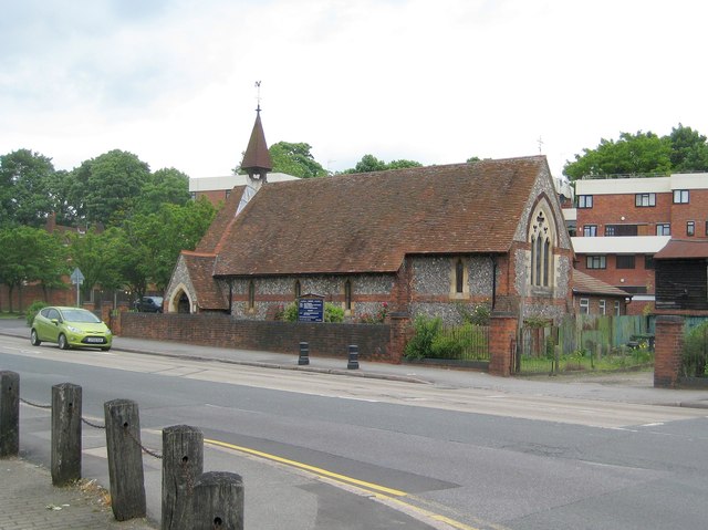
209:Wycombe Marsh: St Anne's Church
190:Wycombe Marsh: St Anne's Church
121:Wycombe Marsh: St Anne's Church
116:
41:No higher resolution available.
1058:
983:
742:file available on the internet
692:file available on the internet
451:
333:This image was taken from the
26:
1:
931:coordinates of depicted place
913:coordinates of depicted place
1043:
762:Geograph Britain and Ireland
700:Geograph Britain and Ireland
550:object of statement has role
497:object of statement has role
477:Items portrayed in this file
317:
7:
878:51°37'7.442"N, 0°43'2.374"W
10:
1104:
1077:Usage on www.wikidata.org
1067:Usage on pt.wikipedia.org
425:same or compatible license
281:
231:
105:
100:
980:
946:51°37'8.72"N, 0°43'2.35"W
16:
770:geograph.org.uk image ID
704:geograph.org.uk image ID
454:
391:
72:This is a file from the
36:
1037:
179:required by the license
129:
76:. Information from its
1016:17:11, 15 January 2018
339:this photograph's page
310:51.619090; -0.717320
260:51.618734; -0.717326
207:Nigel Cox /
188:Nigel Cox /
79:description page there
406:– to adapt the work
565:author name string
505:author name string
1059:Global file usage
1041:
922:
854:
658:copyright license
644:copyright license
463:
354:
353:
337:collection. See
315:
314:
265:
264:
214:
213:
182:
166:
163:Reusing this file
94:
93:
74:Wikimedia Commons
32:Global file usage
1095:
1028:
990:
968:
967:
962:
900:
899:
894:
794:
789:
785:described at URL
779:
774:
764:
759:
712:described at URL
614:copyright status
600:copyright status
587:
582:
572:
569:
559:
554:
461:
447:
444:
441:
438:
435:
427:as the original.
389:
378:Creative Commons
372:
371:
367:
366:
361:
360:
347:Creative Commons
335:Geograph project
329:
322:
311:
308:
294:
293:
287:
286:
285:
279:
278:
267:
261:
258:
244:
243:
237:
236:
235:
229:
228:
217:
176:
160:
132:
120:
112:
106:
90:
69:
68:
62:
56:
54:
1103:
1102:
1098:
1097:
1096:
1094:
1093:
1092:
1057:
1049:
1042:
1034:
1026:
982:
981:
978:
977:
976:
975:
974:
973:
972:
971:
970:
969:
965:
963:
960:
951:
950:
949:
947:
937:
936:
935:
933:
910:
909:
908:
907:
906:
905:
904:
903:
902:
901:
897:
895:
892:
883:
882:
881:
879:
869:
868:
867:
865:
842:
841:
840:
839:
838:
837:
836:
835:
833:
823:
822:
821:
819:
804:
803:
802:
801:
800:
799:
798:
797:
796:
795:
790:
787:
781:
780:
775:
772:
766:
765:
760:
757:
748:
747:
746:
744:
732:
731:
730:
728:
685:
684:
683:
682:
681:
680:
679:
678:
676:
664:
663:
662:
660:
641:
640:
639:
638:
637:
636:
635:
634:
632:
620:
619:
618:
616:
597:
596:
595:
594:
593:
592:
591:
590:
589:
588:
583:
580:
574:
573:
570:
567:
561:
560:
555:
552:
543:
542:
541:
539:
529:
528:
527:
525:
490:
489:
488:
487:
486:
484:
468:
467:
466:
449:
448:
445:
442:
439:
436:
433:
432:
390:
387:
384:
373:
350:
320:
309:
283:
274:
273:
270:Object location
259:
233:
224:
223:
220:Camera location
215:
204:
197:
185:
142:geograph.org.uk
122:
110:
103:
96:
95:
84:
83:
82:is shown below.
58:
52:
50:
43:
42:
12:
11:
5:
1101:
1091:
1090:
1089:
1088:
1083:
1075:
1074:
1073:
1060:
1056:
1055:
1045:
1040:
1039:
1036:
1032:
1029:
1023:
1018:
1013:
1009:
1008:
1005:
1002:
999:
996:
993:
985:
956:
955:
954:
953:
952:
948:
945:
943:
942:
941:
939:
938:
934:
929:
927:
926:
925:
924:
918:
914:
888:
887:
886:
885:
884:
880:
877:
875:
874:
873:
871:
870:
866:
861:
859:
858:
857:
856:
850:
846:
834:
831:
829:
828:
827:
825:
824:
820:
815:
813:
812:
811:
810:
808:
783:
782:
768:
767:
753:
752:
751:
750:
749:
745:
740:
738:
737:
736:
734:
733:
729:
726:source of file
724:
722:
721:
720:
719:
717:
713:
709:
705:
701:
697:
693:
689:
688:source of file
677:
672:
670:
669:
668:
666:
665:
661:
656:
654:
653:
652:
651:
649:
645:
633:
628:
626:
625:
624:
622:
621:
617:
612:
610:
609:
608:
607:
605:
601:
576:
575:
563:
562:
548:
547:
546:
545:
544:
540:
537:
535:
534:
533:
531:
530:
526:
521:
519:
518:
517:
516:
514:
510:
506:
502:
498:
494:
485:
480:
478:
475:
474:
473:
472:
460:
459:
456:
453:
431:
430:
429:
428:
418:
409:
408:
407:
401:
394:You are free:
385:
375:
374:
356:
352:
351:
330:
319:
316:
313:
312:
302:
296:
271:
263:
262:
252:
246:
221:
212:
211:
205:
202:
199:
198:
193:
186:
183:
171:
170:
167:
155:
154:
149:
145:
144:
138:
134:
133:
128:
124:
123:
113:
104:
102:
99:
92:
91:
70:
60:
59:
40:
35:
34:
29:
24:
19:
9:
6:
4:
3:
2:
1100:
1087:
1084:
1082:
1079:
1078:
1076:
1072:
1071:Wycombe Marsh
1069:
1068:
1066:
1065:
1064:
1054:
1053:Wycombe Marsh
1051:
1050:
1035:
1030:
1024:
1022:
1019:
1017:
1014:
1011:
1010:
1006:
1003:
1000:
997:
994:
992:
991:
989:
959:
944:
932:
928:
891:
876:
864:
860:
830:
818:
814:
793:
786:
778:
771:
763:
756:
743:
739:
727:
723:
675:
671:
659:
655:
631:
627:
615:
611:
586:
579:
566:
558:
551:
536:
524:
520:
483:
479:
476:
457:
450:
437:CC BY-SA 2.0
426:
422:
419:
416:
413:
412:
410:
405:
402:
399:
396:
395:
393:
392:
386:Attribution:
382:
379:
362:
348:
344:
340:
336:
331:
328:
324:
323:
307:
303:
301:
300:OpenStreetMap
297:
295:
277:
272:
269:
268:
257:
253:
251:
250:OpenStreetMap
247:
245:
227:
222:
219:
218:
210:
206:
200:
196:
192: /
191:
187:
180:
175:
173:
172:
168:
164:
159:
156:
153:
150:
146:
143:
139:
135:
125:
119:
114:
107:
88:
81:
80:
75:
71:
64:
63:
57:
48:
39:
33:
30:
28:
25:
23:
20:
18:
15:
1062:
987:
984:File history
557:photographer
501:photographer
420:
414:
403:
397:
342:
280:
230:
208:
195:CC BY-SA 2.0
189:
117:
87:You can help
77:
45:
22:File history
832:5 June 2012
630:copyrighted
604:copyrighted
421:share alike
415:attribution
174:Attribution
131:5 June 2012
109:Description
1044:File usage
1025:640 × 479
1001:Dimensions
538:some value
158:Permission
53:image/jpeg
27:File usage
1086:Q26597101
1081:Q15054211
998:Thumbnail
995:Date/Time
817:inception
807:inception
571:Nigel Cox
388:Nigel Cox
343:Nigel Cox
318:Licensing
203:InfoField
184:InfoField
152:Nigel Cox
118:English:
1033:Plucas58
755:operator
696:operator
458:Captions
404:to remix
398:to share
383:license.
1027:(64 KB)
1012:current
1007:Comment
958:heading
917:heading
890:heading
849:heading
777:3511076
708:3511076
523:creator
493:creator
482:depicts
462:English
101:Summary
49:
966:degree
921:degree
898:degree
853:degree
288:
238:
148:Author
137:Source
140:From
1004:User
446:true
443:true
127:Date
17:File
578:URL
509:URL
964:0
961::
896:0
893::
788::
773::
758::
581::
568::
553::
181:)
177:(
165:)
161:(
89:.
55:)
Text is available under the Creative Commons Attribution-ShareAlike License. Additional terms may apply.
.jpg)
.jpg¶ms=051.618734_N_-000.717326_E_globe:Earth_type:camera_source:geograph-osgb36(SU88909188)_heading:0.00&language=en)
.jpg¶ms=051.619090_N_-000.717320_E_globe:Earth_class:object_type:object_source:geograph-osgb36(SU88909192)_heading:0.00&language=en)
