1417:
1412:
43:
1050:"}},"text\/plain":{"en":{"":"inception"}}},"{\"value\":{\"time\":\"+2009-11-13T00:00:00Z\",\"timezone\":0,\"before\":0,\"after\":0,\"precision\":11,\"calendarmodel\":\"http:\\\/\\\/www.wikidata.org\\\/entity\\\/Q1985727\"},\"type\":\"time\"}":{"text\/html":{"en":{"P571":"13 November 2009"}},"text\/plain":{"en":{"P571":"13 November 2009"}}}}": -->
270:
456:
358:
851:
364:
561:
543:
445:
467:
369:
99:
863:"}},"text\/plain":{"en":{"P2093":"NordNordWest","P4174":"NordNordWest"}}},"{\"value\":{\"entity-type\":\"property\",\"numeric-id\":4174,\"id\":\"P4174\"},\"type\":\"wikibase-entityid\"}":{"text\/html":{"en":{"":"
1006:"}},"text\/plain":{"en":{"":"copyright license"}}},"{\"value\":{\"entity-type\":\"item\",\"numeric-id\":42716613,\"id\":\"Q42716613\"},\"type\":\"wikibase-entityid\"}":{"text\/html":{"en":{"P275":"
962:"}},"text\/plain":{"en":{"":"copyright status"}}},"{\"value\":{\"entity-type\":\"item\",\"numeric-id\":50423863,\"id\":\"Q50423863\"},\"type\":\"wikibase-entityid\"}":{"text\/html":{"en":{"P6216":"
1088:"}},"text\/plain":{"en":{"":"source of file"}}},"{\"value\":{\"entity-type\":\"item\",\"numeric-id\":66458942,\"id\":\"Q66458942\"},\"type\":\"wikibase-entityid\"}":{"text\/html":{"en":{"P7482":"
867:"}},"text\/plain":{"en":{"":"Wikimedia username"}}},"{\"value\":{\"entity-type\":\"property\",\"numeric-id\":2699,\"id\":\"P2699\"},\"type\":\"wikibase-entityid\"}":{"text\/html":{"en":{"":"
1230:
1200:
855:"}},"text\/plain":{"en":{"":"creator"}}},"{\"value\":{\"entity-type\":\"property\",\"numeric-id\":2093,\"id\":\"P2093\"},\"type\":\"wikibase-entityid\"}":{"text\/html":{"en":{"":"
1084:
859:"}},"text\/plain":{"en":{"":"author name string"}}},"{\"value\":\"NordNordWest\",\"type\":\"string\"}":{"text\/html":{"en":{"P2093":"NordNordWest","P4174":"
871:"}},"text\/plain":{"en":{"":"URL"}}},"{\"value\":\"http:\\\/\\\/commons.wikimedia.org\\\/wiki\\\/User:NordNordWest\",\"type\":\"string\"}":{"text\/html":{"en":{"P2699":"
508:– You must give appropriate credit, provide a link to the license, and indicate if changes were made. You may do so in any reasonable manner, but not in any way that suggests the licensor endorses you or your use.
410:– You must give appropriate credit, provide a link to the license, and indicate if changes were made. You may do so in any reasonable manner, but not in any way that suggests the licensor endorses you or your use.
860:
872:
1362:
1089:
1007:
963:
1596:
1085:
959:
868:
864:
856:
1047:
1003:
852:
73:
69:
65:
61:
57:
53:
47:
110:
82:
1332:
1304:
1279:
875:"}},"text\/plain":{"en":{"P2699":"http:\/\/commons.wikimedia.org\/wiki\/User:NordNordWest"}}}}": -->
1299:
1010:"}},"text\/plain":{"en":{"P275":"Creative Commons Attribution-ShareAlike 3.0 Germany"}}}}": -->
575:
1342:
257:
1229:
1224:
1199:
1194:
1115:
1033:
989:
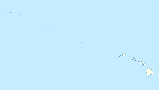
1255:}} Quadratische Plattkarte, N-S-Streckung 109 %. Geographische Begrenzung der Karte: * N: 30° N * S: 17° N * W: 179° W * O: 1
1607:
This file contains additional information, probably added from the digital camera or scanner used to create or digitize it.
515:
417:
1099:
973:
937:
922:
909:
1092:"}},"text\/plain":{"en":{"P7482":"original creation by uploader"}}}}": -->
1057:
1017:
882:
841:
477:
379:
929:
1392:
300:
A weblink to the original file is provided: //commons.wikimedia.org/File:USA_Hawaii_island_chain_location_map.svg
1517:
1512:
1294:
1269:
800:
1610:
If the file has been modified from its original state, some details may not fully reflect the modified file.
568:
1169:
1164:
42:
514:– If you remix, transform, or build upon the material, you must distribute your contributions under the
416:– If you remix, transform, or build upon the material, you must distribute your contributions under the
1322:
966:"}},"text\/plain":{"en":{"P6216":"copyrighted"}}}}": -->
1265:
The following pages on the
English Knowledge use this file (pages on other projects are not listed):
944:
118:
1352:
348:
PS: In case of refusal of the above terms the author reserves the right to take legal action.
321:
304:
1577:
1372:
279:
474:
376:
8:
1427:
1247:{{int:filedesc}} {{Information |Description= {{de|Positionskarte der gesamten Inselkette
560:
1387:
1382:
246:
163:
Quadratische
Plattkarte, N-S-Streckung 109 %. Geographische Begrenzung der Karte:
1240:
1180:
195:
Equirectangular projection, N/S stretching 109 %. Geographic limits of the map:
105:
1187:
Reverted to version as of 18:31, 13 November 2009; grey lines are reefs, not islands
831:
610:
1377:
1367:
330:
Please send me a specimen copy or the URL of the website where the file is used.
1210:
1572:
718:
682:
1418:মডিউল:অবস্থান মানচিত্র/উপাত্ত/মার্কিন যুক্তরাষ্ট্র হাওয়াইয়ান দ্বীপপুঞ্জ/নথি
790:
781:
772:
763:
754:
745:
736:
727:
709:
700:
691:
673:
664:
655:
646:
637:
628:
619:
601:
592:
583:
1402:
1397:
1284:
1497:
1413:মডিউল:অবস্থান মানচিত্র/উপাত্ত/মার্কিন যুক্তরাষ্ট্র হাওয়াইয়ান দ্বীপপুঞ্জ
1109:
1067:
1027:
983:
892:
1587:
1274:
1357:
1248:
154:
1507:
1137:
Click on a date/time to view the file as it appeared at that time.
186:
1518:
Kauhikoa Ditch (kanal sa
Tinipong Bansa, lat 20,86, long -156,36)
1513:
Kauhikoa Ditch (kanal sa
Tinipong Bansa, lat 20,84, long -156,37)
1567:
1542:
1452:
1252:
158:
1472:
1552:
1502:
1467:
1442:
1289:
1527:
1522:
1477:
1457:
1333:Şablon:Yer xəritəsi Amerika Birləşmiş Ştatları Havay adaları
276:
I have published this file as author NordNordWest under the
190:
1537:
322:
https://creativecommons.org/licenses/by-sa/3.0/de/legalcode
305:
https://creativecommons.org/licenses/by-sa/3.0/de/legalcode
1582:
1562:
1557:
1547:
1532:
1492:
1487:
1482:
1447:
1432:
87:(SVG file, nominally 1,476 × 837 pixels, file size: 33 KB)
1437:
525:
https://creativecommons.org/licenses/by-sa/3.0/de/deed.en
427:
https://creativecommons.org/licenses/by-sa/3.0/de/deed.en
218:
93:
1462:
1343:
ABŞ-də UNESCO-nun Ümumdünya irsi obyektlərinin siyahısı
873:
http:\/\/commons.wikimedia.org\/wiki\/User:NordNordWest
825:
Add a one-line explanation of what this file represents
1337:
236:
United States
National Imagery and Mapping Agency data
1263:
344:
have further questions about the terms of the licence
1313:
1135:
117:
Commons is a freely licensed media file repository.
1034:
Creative
Commons Attribution-ShareAlike 3.0 Germany
1008:
Creative
Commons Attribution-ShareAlike 3.0 Germany
567:This map has been made or improved in the German
341:need my postal address for sending a specimen copy
1305:Module:Location map/data/USA Hawaiian Islands/doc
1280:List of World Heritage Sites in the United States
288:is permitted under the following licence terms:
1578:Kittery Island (pulo sa Tinipong Bansa, Hawaii)
531:Creative Commons Attribution-Share Alike 3.0 de
433:Creative Commons Attribution-Share Alike 3.0 de
945:http://commons.wikimedia.org/User:NordNordWest
320:A copy of or the Uniform Resource Identifier (
303:A copy of or the Uniform Resource Identifier (
98:
1300:Module:Location map/data/USA Hawaiian Islands
455:
357:
252:
214:
140:
317:The author "NordNordWest/Wikipedia" is named
297:The author "NordNordWest/Wikipedia" is named
242:
224:
14:
1428:Plantilya:Location map USA Hawaiian Islands
491:– to copy, distribute and transmit the work
393:– to copy, distribute and transmit the work
286:free, commercial usage outside of Knowledge
46:Size of this PNG preview of this SVG file:
1315:The following other wikis use this file:
143:USA Hawaii island chain location map.svg
1217:more consistent line weights and colors
153:Positionskarte der gesamten Inselkette
1323:قالب:Location map USA Hawaiian Islands
129:
1128:
478:Attribution-Share Alike 3.0 Germany
466:
461:
380:Attribution-Share Alike 3.0 Germany
368:
363:
13:
1605:
830:
824:
566:
541:
452:
443:
354:
324:) for this licence with every copy
307:) for this licence with every copy
268:
179:
147:
130:
80:
1639:
1612:
829:
1573:Kipapa (kanal sa Tinipong Bansa)
1264:
815:
559:
502:Under the following conditions:
473:This file is licensed under the
465:
460:
454:
404:Under the following conditions:
375:This file is licensed under the
367:
362:
356:
97:
31:
21:
812:
611:
180:
1310:
1132:
811:
284:in Knowledge. This means that
148:
26:
1:
1295:Northwestern Hawaiian Islands
1270:French Frigate Shoals Airport
1116:original creation by uploader
1090:original creation by uploader
185:Location map of the complete
36:
1260:
837:Items portrayed in this file
7:
1602:
1424:Usage on ceb.wikipedia.org
10:
1644:
1409:Usage on bn.wikipedia.org
1349:Usage on be.wikipedia.org
1329:Usage on az.wikipedia.org
1319:Usage on ar.wikipedia.org
555:
516:same or compatible license
418:same or compatible license
137:
132:
1363:Шаблон:На карце/ЗША Гаваі
1129:
719:
683:
333:Please write an email to
229:
16:
814:
791:
782:
773:
764:
755:
746:
737:
728:
710:
701:
692:
674:
665:
656:
647:
638:
629:
620:
602:
593:
584:
482:
384:
104:This is a file from the
41:
1498:Kapālama Drainage Canal
1246:
1225:18:31, 13 November 2009
1216:
1186:
217:
108:. Information from its
1195:00:10, 14 October 2012
1165:17:24, 14 October 2012
546:
448:
273:
111:description page there
545:
447:
272:
578:to improve as well.
70:2,560 × 1,452 pixels
497:– to adapt the work
399:– to adapt the work
52:Other resolutions:
1568:Kemoo Ditch Tunnel
923:Wikimedia username
910:author name string
865:Wikimedia username
857:author name string
612:Deutsch (Sie-Form)
547:
449:
274:
74:1,476 × 837 pixels
66:1,280 × 726 pixels
62:1,024 × 581 pixels
1631:
1630:
1597:more global usage
1453:Kalaupapa Airport
1311:Global file usage
1258:
1018:copyright license
1004:copyright license
823:
809:
808:
803:
553:
552:
353:
352:
261:
258:Reusing this file
126:
125:
106:Wikimedia Commons
32:Global file usage
1635:
1613:
1473:Kamenehune Ditch
1237:
1207:
1177:
1139:
1073:13 November 2009
974:copyright status
960:copyright status
947:
942:
932:
927:
917:
914:
821:
804:
799:
563:
556:
544:
538:
535:
532:
529:
526:
518:as the original.
475:Creative Commons
469:
468:
464:
463:
458:
457:
446:
440:
437:
434:
431:
428:
420:as the original.
377:Creative Commons
371:
370:
366:
365:
360:
359:
271:
265:
264:
255:
231:
220:
219:13 November 2009
184:
152:
144:
138:
122:
101:
100:
94:
88:
77:
58:640 × 363 pixels
54:320 × 181 pixels
48:800 × 454 pixels
1643:
1642:
1638:
1637:
1636:
1634:
1633:
1632:
1601:
1553:Kekaha Airstrip
1503:Kapalua Airport
1468:Kamananui Ditch
1443:Kahului Airport
1309:
1266:
1259:
1243:
1235:
1213:
1205:
1183:
1175:
1131:
1130:
1127:
1126:
1125:
1124:
1123:
1122:
1121:
1120:
1118:
1106:
1105:
1104:
1102:
1083:
1082:
1081:
1080:
1079:
1078:
1077:
1076:
1074:
1064:
1063:
1062:
1060:
1045:
1044:
1043:
1042:
1041:
1040:
1039:
1038:
1036:
1024:
1023:
1022:
1020:
1001:
1000:
999:
998:
997:
996:
995:
994:
992:
980:
979:
978:
976:
957:
956:
955:
954:
953:
952:
951:
950:
949:
948:
943:
940:
934:
933:
928:
925:
919:
918:
915:
912:
903:
902:
901:
899:
889:
888:
887:
885:
850:
849:
848:
847:
846:
844:
828:
827:
826:
805:
793:
784:
775:
766:
757:
748:
739:
730:
721:
712:
703:
694:
685:
676:
667:
658:
649:
640:
631:
622:
613:
604:
595:
586:
582:
579:
569:Kartenwerkstatt
554:
549:
548:
542:
539:
536:
533:
530:
528:CC BY-SA 3.0 de
527:
524:
523:
481:
470:
451:
450:
444:
441:
438:
435:
432:
430:CC BY-SA 3.0 de
429:
426:
425:
383:
372:
280:CC-BY-SA-3.0-DE
269:
193:
161:
142:
135:
128:
127:
116:
115:
114:is shown below.
90:
86:
79:
78:
51:
12:
11:
5:
1641:
1629:
1628:
1625:
1621:
1620:
1617:
1604:
1599:of this file.
1593:
1592:
1591:
1590:
1585:
1580:
1575:
1570:
1565:
1560:
1555:
1550:
1545:
1540:
1535:
1530:
1528:Kawainui Canal
1525:
1520:
1515:
1510:
1508:Kaua‘ula Ditch
1505:
1500:
1495:
1490:
1485:
1480:
1478:Kamooloa Ditch
1475:
1470:
1465:
1460:
1458:Kaluanui Ditch
1455:
1450:
1445:
1440:
1435:
1430:
1422:
1421:
1420:
1415:
1407:
1406:
1405:
1400:
1395:
1393:Маўі (востраў)
1390:
1385:
1380:
1375:
1370:
1365:
1360:
1355:
1347:
1346:
1345:
1340:
1335:
1327:
1326:
1325:
1312:
1308:
1307:
1302:
1297:
1292:
1287:
1282:
1277:
1272:
1262:
1257:
1256:
1245:
1241:
1238:
1232:
1227:
1222:
1219:
1218:
1215:
1211:
1208:
1202:
1197:
1192:
1189:
1188:
1185:
1181:
1178:
1172:
1167:
1162:
1158:
1157:
1154:
1151:
1148:
1145:
1142:
1134:
1119:
1114:
1112:
1111:
1110:
1108:
1107:
1103:
1100:source of file
1098:
1096:
1095:
1094:
1093:
1091:
1087:
1086:source of file
1075:
1072:
1070:
1069:
1068:
1066:
1065:
1061:
1056:
1054:
1053:
1052:
1051:
1049:
1037:
1032:
1030:
1029:
1028:
1026:
1025:
1021:
1016:
1014:
1013:
1012:
1011:
1009:
1005:
993:
988:
986:
985:
984:
982:
981:
977:
972:
970:
969:
968:
967:
965:
961:
936:
935:
921:
920:
908:
907:
906:
905:
904:
900:
897:
895:
894:
893:
891:
890:
886:
881:
879:
878:
877:
876:
874:
870:
866:
862:
858:
854:
845:
840:
838:
835:
834:
833:
832:
820:
819:
816:
813:
807:
806:
581:
564:
551:
550:
540:
522:
521:
520:
519:
509:
500:
499:
498:
492:
485:You are free:
472:
471:
453:
442:
424:
423:
422:
421:
411:
402:
401:
400:
394:
387:You are free:
374:
373:
355:
351:
350:
346:
345:
342:
328:
327:
326:
325:
318:
310:
309:
308:
301:
298:
262:
250:
249:
244:
240:
239:
238:
237:
226:
222:
221:
216:
212:
211:
210:
209:
206:
203:
200:
189:island chain,
178:
177:
174:
171:
168:
145:
136:
134:
131:
124:
123:
102:
92:
91:
45:
40:
39:
34:
29:
24:
19:
9:
6:
4:
3:
2:
1640:
1626:
1623:
1622:
1618:
1615:
1614:
1611:
1608:
1600:
1598:
1589:
1586:
1584:
1581:
1579:
1576:
1574:
1571:
1569:
1566:
1564:
1561:
1559:
1556:
1554:
1551:
1549:
1546:
1544:
1541:
1539:
1538:Kawela Intake
1536:
1534:
1531:
1529:
1526:
1524:
1521:
1519:
1516:
1514:
1511:
1509:
1506:
1504:
1501:
1499:
1496:
1494:
1491:
1489:
1486:
1484:
1481:
1479:
1476:
1474:
1471:
1469:
1466:
1464:
1461:
1459:
1456:
1454:
1451:
1449:
1446:
1444:
1441:
1439:
1436:
1434:
1431:
1429:
1426:
1425:
1423:
1419:
1416:
1414:
1411:
1410:
1408:
1404:
1401:
1399:
1396:
1394:
1391:
1389:
1386:
1384:
1381:
1379:
1376:
1374:
1371:
1369:
1366:
1364:
1361:
1359:
1356:
1354:
1351:
1350:
1348:
1344:
1341:
1339:
1336:
1334:
1331:
1330:
1328:
1324:
1321:
1320:
1318:
1317:
1316:
1306:
1303:
1301:
1298:
1296:
1293:
1291:
1288:
1286:
1283:
1281:
1278:
1276:
1273:
1271:
1268:
1267:
1254:
1250:
1244:
1239:
1233:
1231:
1228:
1226:
1223:
1221:
1220:
1214:
1209:
1203:
1201:
1198:
1196:
1193:
1191:
1190:
1184:
1179:
1173:
1171:
1168:
1166:
1163:
1160:
1159:
1155:
1152:
1149:
1146:
1143:
1141:
1140:
1138:
1117:
1113:
1101:
1097:
1071:
1059:
1055:
1035:
1031:
1019:
1015:
991:
987:
975:
971:
946:
939:
931:
924:
911:
896:
884:
880:
843:
839:
836:
817:
810:
802:
798:
794:
789:
785:
780:
776:
771:
767:
762:
758:
753:
749:
744:
740:
735:
731:
726:
722:
717:
713:
708:
704:
699:
695:
690:
686:
681:
677:
672:
668:
663:
659:
654:
650:
645:
641:
636:
632:
627:
623:
618:
614:
609:
605:
600:
596:
591:
587:
580:
577:
573:
570:
565:
562:
558:
557:
517:
513:
510:
507:
504:
503:
501:
496:
493:
490:
487:
486:
484:
483:
479:
476:
459:
419:
415:
412:
409:
406:
405:
403:
398:
395:
392:
389:
388:
386:
385:
381:
378:
361:
349:
343:
340:
339:
338:
336:
331:
323:
319:
316:
315:
314:
311:
306:
302:
299:
296:
295:
294:
293:Online media:
291:
290:
289:
287:
283:
281:
267:
266:
263:
259:
254:
251:
248:
245:
241:
235:
234:
233:
227:
223:
213:
207:
204:
201:
198:
197:
196:
192:
188:
183:
175:
172:
169:
166:
165:
164:
160:
156:
151:
146:
139:
120:
113:
112:
107:
103:
96:
95:
89:
84:
83:Original file
75:
71:
67:
63:
59:
55:
49:
44:
38:
35:
33:
30:
28:
25:
23:
20:
18:
15:
1609:
1606:
1594:
1588:Kōke‘e Ditch
1583:Kohala Ditch
1563:Kelana Ditch
1558:Kekaha Ditch
1548:Kehena Ditch
1543:Keālia Ditch
1533:Kawano Ditch
1493:Kapahi Ditch
1488:Kaneha Ditch
1483:Kanaha Ditch
1448:Kailua Ditch
1433:Kahoma Ditch
1314:
1285:Midway Atoll
1242:NordNordWest
1234:1,476 × 837
1204:1,476 × 837
1182:NordNordWest
1174:1,476 × 837
1136:
1133:File history
930:NordNordWest
916:NordNordWest
861:NordNordWest
796:
787:
778:
769:
760:
751:
742:
733:
724:
715:
706:
697:
688:
684:Plattdüütsch
679:
670:
661:
652:
643:
634:
625:
616:
607:
598:
589:
585:azərbaycanca
576:propose maps
571:
511:
505:
494:
488:
413:
407:
396:
390:
347:
335:nnwestweb.de
334:
332:
329:
313:Print media:
312:
292:
285:
277:
275:
247:NordNordWest
228:
194:
181:
162:
149:
119:You can help
109:
81:
22:File history
1438:Kahua Ditch
990:copyrighted
964:copyrighted
729:slovenščina
512:share alike
506:attribution
414:share alike
408:attribution
141:Description
1463:Kama Ditch
1275:Kure Atoll
1261:File usage
1150:Dimensions
898:some value
747:македонски
675:Nederlands
574:. You can
253:Permission
27:File usage
1619:1476.3691
1353:Мауна-Кеа
1338:Mauna Kea
1212:Grolltech
1147:Thumbnail
1144:Date/Time
1058:inception
1048:inception
720:sicilianu
702:português
572:(Map Lab)
232:, using
208:E: 154° W
205:W: 179° W
182:English:
176:O: 154° W
173:W: 179° W
150:Deutsch:
1627:836.8103
1603:Metadata
1373:Ганалулу
818:Captions
657:latviešu
648:italiano
639:français
495:to remix
489:to share
480:license.
397:to remix
391:to share
382:license.
230:Own work
202:S: 17° N
199:N: 30° N
187:Hawaiian
170:S: 17° N
167:N: 30° N
37:Metadata
1388:Малакаі
1383:Кілаўэа
1236:(33 KB)
1206:(33 KB)
1176:(33 KB)
1161:current
1156:Comment
883:creator
853:creator
842:depicts
822:English
774:հայերեն
765:ქართული
756:русский
630:español
621:English
603:Deutsch
594:čeština
337:if you
133:Summary
85:
1624:Height
1523:Ka‘ula
1378:Лайсан
1368:Мідуэй
1249:Hawaii
795:
786:
777:
768:
759:
750:
741:
732:
723:
714:
711:română
705:
696:
693:polski
687:
678:
669:
666:magyar
660:
651:
642:
633:
624:
615:
606:
597:
588:
243:Author
225:Source
155:Hawaii
1616:Width
1595:View
1403:Ланаі
1398:Каўаі
1290:Nihoa
783:বাংলা
738:suomi
1358:Ааху
1153:User
537:true
534:true
439:true
436:true
215:Date
17:File
1253:USA
938:URL
869:URL
801:+/−
792:ไทย
191:USA
159:USA
1251:,
941::
926::
913::
157:,
72:|
68:|
64:|
60:|
56:|
50:.
797:∙
788:∙
779:∙
770:∙
761:∙
752:∙
743:∙
734:∙
725:∙
716:∙
707:∙
698:∙
689:∙
680:∙
671:∙
662:∙
653:∙
644:∙
635:∙
626:∙
617:∙
608:∙
599:∙
590:∙
282:"
278:"
260:)
256:(
121:.
76:.
Text is available under the Creative Commons Attribution-ShareAlike License. Additional terms may apply.
