904:"}},"text\/plain":{"en":{"":"coordinates of depicted place"}}},"{\"value\":{\"latitude\":53.33786,\"longitude\":-6.54,\"altitude\":null,\"precision\":1.0e-5,\"globe\":\"http:\\\/\\\/www.wikidata.org\\\/entity\\\/Q2\"},\"type\":\"globecoordinate\"}":{"text\/html":{"en":{"P9149":"53\u00b020'16.30"N, 6\u00b032'24.00"W"}},"text\/plain":{"en":{"P9149":"53\u00b020'16.30\"N, 6\u00b032'24.00\"W"}}},"{\"value\":{\"entity-type\":\"property\",\"numeric-id\":7787,\"id\":\"P7787\"},\"type\":\"wikibase-entityid\"}":{"text\/html":{"en":{"":"
679:"}},"text\/plain":{"en":{"":"coordinates of the point of view"}}},"{\"value\":{\"latitude\":53.3383,\"longitude\":-6.5394,\"altitude\":null,\"precision\":0.0001,\"globe\":\"http:\\\/\\\/www.wikidata.org\\\/entity\\\/Q2\"},\"type\":\"globecoordinate\"}":{"text\/html":{"en":{"P1259":"53\u00b020'17.9"N, 6\u00b032'21.8"W"}},"text\/plain":{"en":{"P1259":"53\u00b020'17.9\"N, 6\u00b032'21.8\"W"}}},"{\"value\":{\"entity-type\":\"property\",\"numeric-id\":7787,\"id\":\"P7787\"},\"type\":\"wikibase-entityid\"}":{"text\/html":{"en":{"":"
488:"}},"text\/plain":{"en":{"":"author name string"}}},"{\"value\":\"Ian Paterson\",\"type\":\"string\"}":{"text\/html":{"en":{"P2093":"Ian Paterson"}},"text\/plain":{"en":{"P2093":"Ian Paterson"}}},"{\"value\":{\"entity-type\":\"property\",\"numeric-id\":3831,\"id\":\"P3831\"},\"type\":\"wikibase-entityid\"}":{"text\/html":{"en":{"":"
747:"}},"text\/plain":{"en":{"":"inception"}}},"{\"value\":{\"time\":\"+2008-10-15T00:00:00Z\",\"timezone\":0,\"before\":0,\"after\":0,\"precision\":11,\"calendarmodel\":\"http:\\\/\\\/www.wikidata.org\\\/entity\\\/Q1985727\"},\"type\":\"time\"}":{"text\/html":{"en":{"P571":"15 October 2008"}},"text\/plain":{"en":{"P571":"15 October 2008"}}}}": -->
781:
281:
231:
900:
223:
295:
245:
316:
354:
359:
72:
789:"}},"text\/plain":{"en":{"P7482":"file available on the internet"}}},"{\"value\":{\"entity-type\":\"property\",\"numeric-id\":7384,\"id\":\"P7384\"},\"type\":\"wikibase-entityid\"}":{"text\/html":{"en":{"":"
492:"}},"text\/plain":{"en":{"":"object of statement has role"}}},"{\"value\":{\"entity-type\":\"item\",\"numeric-id\":33231,\"id\":\"Q33231\"},\"type\":\"wikibase-entityid\"}":{"text\/html":{"en":{"P3831":"
805:"}},"text\/plain":{"en":{"P137":"Geograph Britain and Ireland"}}},"{\"value\":{\"entity-type\":\"property\",\"numeric-id\":973,\"id\":\"P973\"},\"type\":\"wikibase-entityid\"}":{"text\/html":{"en":{"":"
972:"}},"text\/plain":{"en":{"":"media type"}}},"{\"value\":\"image\\\/jpeg\",\"type\":\"string\"}":{"text\/html":{"en":{"P1163":"image\/jpeg"}},"text\/plain":{"en":{"P1163":"image\/jpeg"}}}}": -->
635:"}},"text\/plain":{"en":{"":"copyright license"}}},"{\"value\":{\"entity-type\":\"item\",\"numeric-id\":19068220,\"id\":\"Q19068220\"},\"type\":\"wikibase-entityid\"}":{"text\/html":{"en":{"P275":"
591:"}},"text\/plain":{"en":{"":"copyright status"}}},"{\"value\":{\"entity-type\":\"item\",\"numeric-id\":50423863,\"id\":\"Q50423863\"},\"type\":\"wikibase-entityid\"}":{"text\/html":{"en":{"P6216":"
785:"}},"text\/plain":{"en":{"":"source of file"}}},"{\"value\":{\"entity-type\":\"item\",\"numeric-id\":74228490,\"id\":\"Q74228490\"},\"type\":\"wikibase-entityid\"}":{"text\/html":{"en":{"P7482":"
496:"}},"text\/plain":{"en":{"P3831":"photographer"}}},"{\"value\":{\"entity-type\":\"property\",\"numeric-id\":2699,\"id\":\"P2699\"},\"type\":\"wikibase-entityid\"}":{"text\/html":{"en":{"":"
908:"}},"text\/plain":{"en":{"":"heading"}}},"{\"value\":{\"amount\":\"+225\",\"unit\":\"http:\\\/\\\/www.wikidata.org\\\/entity\\\/Q28390\"},\"type\":\"quantity\"}":{"text\/html":{"en":{"P7787":"225
801:"}},"text\/plain":{"en":{"":"operator"}}},"{\"value\":{\"entity-type\":\"item\",\"numeric-id\":1503119,\"id\":\"Q1503119\"},\"type\":\"wikibase-entityid\"}":{"text\/html":{"en":{"P137":"
683:"}},"text\/plain":{"en":{"":"heading"}}},"{\"value\":{\"amount\":\"+225\",\"unit\":\"http:\\\/\\\/www.wikidata.org\\\/entity\\\/Q28390\"},\"type\":\"quantity\"}":{"text\/html":{"en":{"P7787":"225
1048:
797:"}},"text\/plain":{"en":{"P7384":"1008068"}}},"{\"value\":{\"entity-type\":\"property\",\"numeric-id\":137,\"id\":\"P137\"},\"type\":\"wikibase-entityid\"}":{"text\/html":{"en":{"":"
484:"}},"text\/plain":{"en":{"":"creator"}}},"{\"value\":{\"entity-type\":\"property\",\"numeric-id\":2093,\"id\":\"P2093\"},\"type\":\"wikibase-entityid\"}":{"text\/html":{"en":{"":"
968:
264:
793:"}},"text\/plain":{"en":{"":"geograph.org.uk image ID"}}},"{\"value\":\"1008068\",\"type\":\"string\"}":{"text\/html":{"en":{"P7384":"
214:
406:– You must give appropriate credit, provide a link to the license, and indicate if changes were made. You may do so in any reasonable manner, but not in any way that suggests the licensor endorses you or your use.
228:
1167:
278:
1065:== {{int:filedesc}} == {{Information |description={{en|1=The Mill, Celbridge Part used as a Community Centre.}} |date=2008-10-15 |source=From |author=[http://www.geograph.org.uk/profile/13639 Ian
83:
51:
794:
786:
636:
592:
802:
493:
969:
905:
901:
790:
782:
680:
676:
588:
497:
489:
485:
810:
501:
806:
798:
744:
632:
481:
1058:
639:"}},"text\/plain":{"en":{"P275":"Creative Commons Attribution-ShareAlike 2.0 Generic"}}}}": -->
504:"}},"text\/plain":{"en":{"P2699":"https:\/\/www.geograph.org.uk\/profile\/13639"}}}}": -->
813:"}},"text\/plain":{"en":{"P973":"https:\/\/www.geograph.org.uk\/photo\/1008068"}}}}": -->
836:
662:
618:
288:
238:
871:
323:
1250:
This file contains additional information, probably added from the digital camera or scanner used to create or digitize it.
413:
558:
979:
946:
919:
849:
820:
721:
694:
602:
566:
551:
538:
1047:
1042:
42:
879:
864:
754:
646:
511:
470:
369:
1253:
If the file has been modified from its original state, some details may not fully reflect the modified file.
412:– If you remix, transform, or build upon the material, you must distribute your contributions under the
330:
on the
Geograph website for the photographer's contact details. The copyright on this image is owned by
595:"}},"text\/plain":{"en":{"P6216":"copyrighted"}}}}": -->
1075:
The following pages on the
English Knowledge use this file (pages on other projects are not listed):
912:"}},"text\/plain":{"en":{"P7787":"225 degree"}}}}": -->
687:"}},"text\/plain":{"en":{"P7787":"225 degree"}}}}": -->
91:
183:
1207:
886:
856:
573:
366:
167:
8:
310:
294:
244:
335:
78:
460:
1227:
1127:
156:
146:
989:
929:
830:
764:
704:
656:
612:
521:
315:
327:
1079:
1015:
Click on a date/time to view the file as it appeared at that time.
280:
230:
1197:
1147:
265:
53° 20′ 16″ N, 6° 32′ 24″ W
215:
53° 20′ 18″ N, 6° 32′ 22″ W
135:
66:
1097:
454:
Add a one-line explanation of what this file represents
1217:
1187:
1177:
1157:
1137:
1117:
1107:
1073:
1237:
1088:
1013:
126:
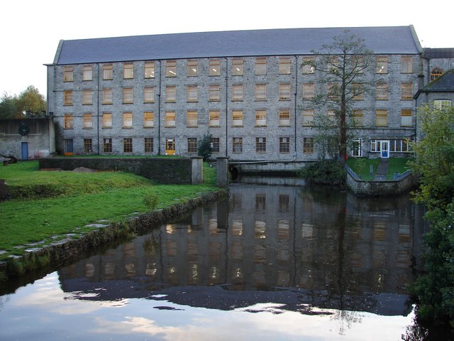
The Mill, Celbridge Part used as a
Community Centre.
90:
Commons is a freely licensed media file repository.
663:
Creative
Commons Attribution-ShareAlike 2.0 Generic
637:
Creative
Commons Attribution-ShareAlike 2.0 Generic
116:
The Mill, Celbridge - geograph.org.uk - 1008068.jpg
52:
The_Mill,_Celbridge_-_geograph.org.uk_-_1008068.jpg
56:(640 × 480 pixels, file size: 76 KB, MIME type:
423:https://creativecommons.org/licenses/by-sa/2.0
71:
811:https:\/\/www.geograph.org.uk\/photo\/1008068
502:https:\/\/www.geograph.org.uk\/profile\/13639
429:Creative Commons Attribution-Share Alike 2.0
347:
131:
113:
152:
141:
14:
909:
684:
389:– to copy, distribute and transmit the work
1090:The following other wikis use this file:
887:https://www.geograph.org.uk/photo/1008068
574:https://www.geograph.org.uk/profile/13639
287:View this and other nearby images on:
237:View this and other nearby images on:
190:
102:
334:and is licensed for reuse under the
255:
205:
1006:
370:Attribution-Share Alike 2.0 Generic
358:
353:
338:Attribution-ShareAlike 2.0 license.
13:
1248:
459:
453:
344:
321:
120:
103:
49:
1274:
1255:
458:
1074:
695:coordinates of the point of view
677:coordinates of the point of view
444:
400:Under the following conditions:
365:This file is licensed under the
357:
352:
346:
314:
293:
279:
271:
243:
229:
221:
70:
31:
21:
441:
121:
46:No higher resolution available.
1085:
1010:
837:file available on the internet
787:file available on the internet
440:
322:This image was taken from the
26:
1:
1168:פורטל:אירלנד/כל הערכים החסרים
920:coordinates of depicted place
902:coordinates of depicted place
36:
1070:
872:Geograph Britain and Ireland
803:Geograph Britain and Ireland
552:object of statement has role
490:object of statement has role
466:Items portrayed in this file
306:
270:
220:
7:
1245:
1094:Usage on ceb.wikipedia.org
935:53°20'16.30"N, 6°32'24.00"W
10:
1279:
1234:Usage on www.wikidata.org
1224:Usage on ur.wikipedia.org
1214:Usage on sv.wikipedia.org
1204:Usage on ru.wikipedia.org
1194:Usage on lt.wikipedia.org
1184:Usage on it.wikipedia.org
1174:Usage on id.wikipedia.org
1164:Usage on he.wikipedia.org
1154:Usage on gl.wikipedia.org
1144:Usage on ga.wikipedia.org
1134:Usage on fr.wikipedia.org
1124:Usage on fa.wikipedia.org
1114:Usage on eu.wikipedia.org
1104:Usage on es.wikipedia.org
414:same or compatible license
110:
105:
1007:
710:53°20'17.9"N, 6°32'21.8"W
196:Ian Paterson /
177:Ian Paterson /
16:
850:geograph.org.uk image ID
791:geograph.org.uk image ID
443:
380:
77:This is a file from the
41:
1064:
1043:08:43, 23 February 2011
168:required by the license
134:
81:. Information from its
328:this photograph's page
299:53.337860; -6.540000
249:53.338300; -6.539400
84:description page there
395:– to adapt the work
198:The Mill, Celbridge
179:The Mill, Celbridge
539:author name string
486:author name string
1266:
1265:
1086:Global file usage
1068:
911:
686:
647:copyright license
633:copyright license
452:
343:
342:
326:collection. See
304:
303:
254:
253:
203:
202:
171:
99:
98:
79:Wikimedia Commons
32:Global file usage
1270:
1256:
1055:
1017:
957:
956:
951:
889:
884:
880:described at URL
874:
869:
859:
854:
807:described at URL
732:
731:
726:
603:copyright status
589:copyright status
576:
571:
561:
556:
546:
543:
450:
436:
433:
430:
427:
424:
416:as the original.
378:
367:Creative Commons
361:
360:
356:
355:
350:
349:
336:Creative Commons
324:Geograph project
318:
311:
300:
297:
283:
282:
276:
275:
274:
268:
267:
256:
250:
247:
233:
232:
226:
225:
224:
218:
217:
206:
165:
137:
125:
117:
111:
95:
74:
73:
67:
61:
59:
1278:
1277:
1273:
1272:
1271:
1269:
1268:
1267:
1244:
1084:
1076:
1069:
1061:
1053:
1009:
1008:
1005:
1004:
1003:
1002:
1001:
1000:
999:
998:
996:
986:
985:
984:
982:
967:
966:
965:
964:
963:
962:
961:
960:
959:
958:
954:
952:
949:
940:
939:
938:
936:
926:
925:
924:
922:
899:
898:
897:
896:
895:
894:
893:
892:
891:
890:
885:
882:
876:
875:
870:
867:
861:
860:
855:
852:
843:
842:
841:
839:
827:
826:
825:
823:
780:
779:
778:
777:
776:
775:
774:
773:
771:
770:15 October 2008
761:
760:
759:
757:
742:
741:
740:
739:
738:
737:
736:
735:
734:
733:
729:
727:
724:
715:
714:
713:
711:
701:
700:
699:
697:
674:
673:
672:
671:
670:
669:
668:
667:
665:
653:
652:
651:
649:
630:
629:
628:
627:
626:
625:
624:
623:
621:
609:
608:
607:
605:
586:
585:
584:
583:
582:
581:
580:
579:
578:
577:
572:
569:
563:
562:
557:
554:
548:
547:
544:
541:
532:
531:
530:
528:
518:
517:
516:
514:
479:
478:
477:
476:
475:
473:
457:
456:
455:
438:
437:
434:
431:
428:
425:
422:
421:
379:
376:
373:
362:
339:
309:
298:
272:
263:
262:
259:Object location
248:
222:
213:
212:
209:Camera location
204:
193:
186:
174:
147:geograph.org.uk
136:15 October 2008
127:
115:
108:
101:
100:
89:
88:
87:is shown below.
63:
57:
55:
48:
47:
12:
11:
5:
1276:
1264:
1263:
1260:
1247:
1243:
1242:
1241:
1240:
1232:
1231:
1230:
1222:
1221:
1220:
1212:
1211:
1210:
1202:
1201:
1200:
1192:
1191:
1190:
1182:
1181:
1180:
1172:
1171:
1170:
1162:
1161:
1160:
1152:
1151:
1150:
1142:
1141:
1140:
1132:
1131:
1130:
1122:
1121:
1120:
1112:
1111:
1110:
1102:
1101:
1100:
1087:
1083:
1082:
1072:
1067:
1066:
1063:
1059:
1056:
1050:
1045:
1040:
1036:
1035:
1032:
1029:
1026:
1023:
1020:
1012:
997:
994:
992:
991:
990:
988:
987:
983:
978:
976:
975:
974:
973:
971:
945:
944:
943:
942:
941:
937:
934:
932:
931:
930:
928:
927:
923:
918:
916:
915:
914:
913:
907:
903:
878:
877:
863:
862:
848:
847:
846:
845:
844:
840:
835:
833:
832:
831:
829:
828:
824:
821:source of file
819:
817:
816:
815:
814:
812:
808:
804:
800:
796:
792:
788:
784:
783:source of file
772:
769:
767:
766:
765:
763:
762:
758:
753:
751:
750:
749:
748:
746:
720:
719:
718:
717:
716:
712:
709:
707:
706:
705:
703:
702:
698:
693:
691:
690:
689:
688:
682:
678:
666:
661:
659:
658:
657:
655:
654:
650:
645:
643:
642:
641:
640:
638:
634:
622:
617:
615:
614:
613:
611:
610:
606:
601:
599:
598:
597:
596:
594:
590:
565:
564:
550:
549:
537:
536:
535:
534:
533:
529:
526:
524:
523:
522:
520:
519:
515:
510:
508:
507:
506:
505:
503:
499:
495:
491:
487:
483:
474:
469:
467:
464:
463:
462:
461:
449:
448:
445:
442:
420:
419:
418:
417:
407:
398:
397:
396:
390:
383:You are free:
374:
364:
363:
345:
341:
340:
319:
308:
305:
302:
301:
291:
285:
260:
252:
251:
241:
235:
210:
201:
200:
194:
191:
188:
187:
182:
175:
172:
160:
159:
154:
150:
149:
143:
139:
138:
133:
129:
128:
118:
109:
107:
104:
97:
96:
75:
65:
64:
45:
40:
39:
34:
29:
24:
19:
9:
6:
4:
3:
2:
1275:
1261:
1258:
1257:
1254:
1251:
1239:
1236:
1235:
1233:
1229:
1226:
1225:
1223:
1219:
1216:
1215:
1213:
1209:
1206:
1205:
1203:
1199:
1196:
1195:
1193:
1189:
1186:
1185:
1183:
1179:
1176:
1175:
1173:
1169:
1166:
1165:
1163:
1159:
1156:
1155:
1153:
1149:
1148:Cill Droichid
1146:
1145:
1143:
1139:
1136:
1135:
1133:
1129:
1126:
1125:
1123:
1119:
1116:
1115:
1113:
1109:
1106:
1105:
1103:
1099:
1096:
1095:
1093:
1092:
1091:
1081:
1078:
1077:
1062:
1057:
1051:
1049:
1046:
1044:
1041:
1038:
1037:
1033:
1030:
1027:
1024:
1021:
1019:
1018:
1016:
993:
981:
977:
948:
933:
921:
917:
888:
881:
873:
866:
858:
851:
838:
834:
822:
818:
768:
756:
752:
723:
708:
696:
692:
664:
660:
648:
644:
620:
616:
604:
600:
575:
568:
560:
553:
540:
525:
513:
509:
472:
468:
465:
446:
439:
426:CC BY-SA 2.0
415:
411:
408:
405:
402:
401:
399:
394:
391:
388:
385:
384:
382:
381:
375:Attribution:
371:
368:
351:
337:
333:
329:
325:
320:
317:
313:
312:
296:
292:
290:
289:OpenStreetMap
286:
284:
266:
261:
258:
257:
246:
242:
240:
239:OpenStreetMap
236:
234:
216:
211:
208:
207:
199:
195:
189:
185:
181: /
180:
176:
169:
164:
162:
161:
158:
155:
151:
148:
144:
140:
130:
124:
119:
112:
93:
86:
85:
80:
76:
69:
68:
62:
53:
44:
38:
35:
33:
30:
28:
25:
23:
20:
18:
15:
1252:
1249:
1089:
1014:
1011:File history
559:photographer
545:Ian Paterson
494:photographer
409:
403:
392:
386:
377:Ian Paterson
332:Ian Paterson
331:
269:
219:
197:
184:CC BY-SA 2.0
178:
157:Ian Paterson
122:
92:You can help
82:
50:
22:File history
1060:GeographBot
619:copyrighted
593:copyrighted
410:share alike
404:attribution
163:Attribution
114:Description
1259:_error
1198:Selbridžas
1071:File usage
1052:640 × 480
1028:Dimensions
995:image/jpeg
980:media type
970:media type
527:some value
58:image/jpeg
27:File usage
1218:Celbridge
1188:Celbridge
1178:Celbridge
1158:Celbridge
1138:Celbridge
1118:Celbridge
1108:Celbridge
1098:Celbridge
1080:Celbridge
1025:Thumbnail
1022:Date/Time
755:inception
745:inception
307:Licensing
192:InfoField
173:InfoField
123:English:
1246:Metadata
1208:Селбридж
865:operator
799:operator
447:Captions
393:to remix
387:to share
372:license.
37:Metadata
1238:Q629881
1054:(76 KB)
1039:current
1034:Comment
947:heading
906:heading
857:1008068
795:1008068
722:heading
681:heading
512:creator
482:creator
471:depicts
451:English
106:Summary
54:
1228:سلبریج
1128:سلبریج
955:degree
910:degree
730:degree
685:degree
277:
227:
153:Author
142:Source
145:From
1031:User
953:225
728:225
435:true
432:true
132:Date
17:File
567:URL
498:URL
950::
883::
868::
853::
725::
570::
555::
542::
1262:0
170:)
166:(
94:.
60:)
Text is available under the Creative Commons Attribution-ShareAlike License. Additional terms may apply.
_heading:225.00&language=en)
_heading:225.00&language=en)
