621:"}},"text\/plain":{"en":{"":"coordinates of the point of view"}}},"{\"value\":{\"latitude\":51.752293,\"longitude\":-0.339336,\"altitude\":null,\"precision\":1.0e-6,\"globe\":\"http:\\\/\\\/www.wikidata.org\\\/entity\\\/Q2\"},\"type\":\"globecoordinate\"}":{"text\/html":{"en":{"P1259":"51\u00b045'8.255"N, 0\u00b020'21.610"W"}},"text\/plain":{"en":{"P1259":"51\u00b045'8.255\"N, 0\u00b020'21.610\"W"}}},"{\"value\":{\"entity-type\":\"property\",\"numeric-id\":7787,\"id\":\"P7787\"},\"type\":\"wikibase-entityid\"}":{"text\/html":{"en":{"":"
689:"}},"text\/plain":{"en":{"":"coordinates of depicted place"}}},"{\"value\":{\"latitude\":51.7522,\"longitude\":-0.33905,\"altitude\":null,\"precision\":1.0e-5,\"globe\":\"http:\\\/\\\/www.wikidata.org\\\/entity\\\/Q2\"},\"type\":\"globecoordinate\"}":{"text\/html":{"en":{"P9149":"51\u00b045'7.92"N, 0\u00b020'20.58"W"}},"text\/plain":{"en":{"P9149":"51\u00b045'7.92\"N, 0\u00b020'20.58\"W"}}},"{\"value\":{\"entity-type\":\"property\",\"numeric-id\":7787,\"id\":\"P7787\"},\"type\":\"wikibase-entityid\"}":{"text\/html":{"en":{"":"
583:"}},"text\/plain":{"en":{"":"inception"}}},"{\"value\":{\"time\":\"+2008-08-23T00:00:00Z\",\"timezone\":0,\"before\":0,\"after\":0,\"precision\":11,\"calendarmodel\":\"http:\\\/\\\/www.wikidata.org\\\/entity\\\/Q1985727\"},\"type\":\"time\"}":{"text\/html":{"en":{"P571":"23 August 2008"}},"text\/plain":{"en":{"P571":"23 August 2008"}}}}": -->
359:
292:
242:
685:
234:
306:
256:
327:
365:
370:
67:
539:"}},"text\/plain":{"en":{"":"copyright license"}}},"{\"value\":{\"entity-type\":\"item\",\"numeric-id\":19068220,\"id\":\"Q19068220\"},\"type\":\"wikibase-entityid\"}":{"text\/html":{"en":{"P275":"
495:"}},"text\/plain":{"en":{"":"copyright status"}}},"{\"value\":{\"entity-type\":\"item\",\"numeric-id\":50423863,\"id\":\"Q50423863\"},\"type\":\"wikibase-entityid\"}":{"text\/html":{"en":{"P6216":"
625:"}},"text\/plain":{"en":{"":"heading"}}},"{\"value\":{\"amount\":\"+112.0\",\"unit\":\"http:\\\/\\\/www.wikidata.org\\\/entity\\\/Q28390\"},\"type\":\"quantity\"}":{"text\/html":{"en":{"P7787":"112.0
693:"}},"text\/plain":{"en":{"":"heading"}}},"{\"value\":{\"amount\":\"+112\",\"unit\":\"http:\\\/\\\/www.wikidata.org\\\/entity\\\/Q28390\"},\"type\":\"quantity\"}":{"text\/html":{"en":{"P7787":"112
491:
38:
275:
225:
417:– You must give appropriate credit, provide a link to the license, and indicate if changes were made. You may do so in any reasonable manner, but not in any way that suggests the licensor endorses you or your use.
239:
289:
540:
496:
690:
686:
622:
618:
492:
580:
536:
46:
78:
543:"}},"text\/plain":{"en":{"P275":"Creative Commons Attribution-ShareAlike 2.0 Generic"}}}}": -->
162:
566:
522:
299:
249:
826:
334:
424:
731:
704:
663:
636:
506:
590:
550:
481:
794:
789:
37:
380:
423:– If you remix, transform, or build upon the material, you must distribute your contributions under the
341:
on the
Geograph website for the photographer's contact details. The copyright on this image is owned by
629:"}},"text\/plain":{"en":{"P7787":"112.0 degree"}}}}": -->
499:"}},"text\/plain":{"en":{"P6216":"copyrighted"}}}}": -->
822:
The following pages on the
English Knowledge use this file (pages on other projects are not listed):
697:"}},"text\/plain":{"en":{"P7787":"112 degree"}}}}": -->
86:
377:
178:
8:
836:
321:
305:
255:
346:
73:
471:
194:
805:
151:
141:
714:
646:
600:
560:
516:
326:
338:
831:
762:
Click on a date/time to view the file as it appeared at that time.
291:
241:
276:
51° 45′ 07.9″ N, 0° 20′ 21″ W
226:
51° 45′ 08.3″ N, 0° 20′ 22″ W
130:
61:
854:
465:
Add a one-line explanation of what this file represents
820:
845:
760:
169:
Creative
Commons Attribution Share-alike license 2.0
85:
Commons is a freely licensed media file repository.
567:
Creative
Commons Attribution-ShareAlike 2.0 Generic
541:
Creative
Commons Attribution-ShareAlike 2.0 Generic
51:(800 × 535 pixels, file size: 104 KB, MIME type:
434:https://creativecommons.org/licenses/by-sa/2.0
66:
440:Creative Commons Attribution-Share Alike 2.0
358:
157:
126:
108:
147:
136:
14:
694:
626:
400:– to copy, distribute and transmit the work
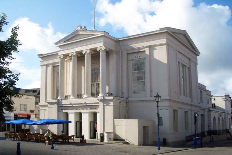
111:St Albans Town Hall (geograph 5236751).jpg
47:St_Albans_Town_Hall_(geograph_5236751).jpg
847:The following other wikis use this file:
827:List of city and town halls in England
298:View this and other nearby images on:
248:View this and other nearby images on:
201:
97:
345:and is licensed for reuse under the
266:
216:
753:
381:Attribution-Share Alike 2.0 Generic
369:
364:
349:Attribution-ShareAlike 2.0 license.
13:
470:
464:
355:
332:
115:
98:
44:
868:
469:
821:
637:coordinates of the point of view
619:coordinates of the point of view
455:
411:Under the following conditions:
376:This file is licensed under the
368:
363:
357:
325:
304:
290:
282:
254:
240:
232:
65:
31:
21:
452:
116:
41:No higher resolution available.
842:
757:
451:
333:This image was taken from the
26:
1:
705:coordinates of depicted place
687:coordinates of depicted place
817:
652:51°45'8.255"N, 0°20'21.610"W
477:Items portrayed in this file
317:
281:
231:
207:Des Blenkinsopp /
188:Des Blenkinsopp /
7:
10:
873:
851:Usage on lv.wikipedia.org
720:51°45'7.92"N, 0°20'20.58"W
425:same or compatible license
105:
100:
754:
16:
454:
391:
72:This is a file from the
36:
811:
179:required by the license
129:
76:. Information from its
790:13:08, 31 January 2022
339:this photograph's page
310:51.752200; -0.339050
260:51.752293; -0.339336
79:description page there
837:St Albans Town Hall
406:– to adapt the work
209:St Albans Town Hall
190:St Albans Town Hall
121:St Albans Town Hall
843:Global file usage
815:
696:
628:
551:copyright license
537:copyright license
463:
354:
353:
337:collection. See
315:
314:
265:
264:
214:
213:
182:
166:
163:Reusing this file
94:
93:
74:Wikimedia Commons
32:Global file usage
864:
802:
764:
742:
741:
736:
674:
673:
668:
507:copyright status
493:copyright status
461:
447:
444:
441:
438:
435:
427:as the original.
389:
378:Creative Commons
372:
371:
367:
366:
361:
360:
347:Creative Commons
335:Geograph project
329:
322:
311:
308:
294:
293:
287:
286:
285:
279:
278:
267:
261:
258:
244:
243:
237:
236:
235:
229:
228:
217:
176:
160:
132:
120:
112:
106:
90:
69:
68:
62:
56:
54:
872:
871:
867:
866:
865:
863:
862:
861:
841:
823:
816:
808:
800:
756:
755:
752:
751:
750:
749:
748:
747:
746:
745:
744:
743:
739:
737:
734:
725:
724:
723:
721:
711:
710:
709:
707:
684:
683:
682:
681:
680:
679:
678:
677:
676:
675:
671:
669:
666:
657:
656:
655:
653:
643:
642:
641:
639:
616:
615:
614:
613:
612:
611:
610:
609:
607:
597:
596:
595:
593:
578:
577:
576:
575:
574:
573:
572:
571:
569:
557:
556:
555:
553:
534:
533:
532:
531:
530:
529:
528:
527:
525:
513:
512:
511:
509:
490:
489:
488:
487:
486:
484:
468:
467:
466:
449:
448:
445:
442:
439:
436:
433:
432:
390:
388:Des Blenkinsopp
387:
384:
373:
350:
343:Des Blenkinsopp
320:
309:
283:
274:
273:
270:Object location
259:
233:
224:
223:
220:Camera location
215:
204:
197:
185:
152:Des Blenkinsopp
142:geograph.org.uk
122:
110:
103:
96:
95:
84:
83:
82:is shown below.
58:
52:
50:
43:
42:
12:
11:
5:
870:
860:
859:
858:
857:
844:
840:
839:
834:
829:
819:
814:
813:
810:
806:
803:
797:
792:
787:
783:
782:
779:
776:
773:
770:
767:
759:
730:
729:
728:
727:
726:
722:
719:
717:
716:
715:
713:
712:
708:
703:
701:
700:
699:
698:
692:
688:
662:
661:
660:
659:
658:
654:
651:
649:
648:
647:
645:
644:
640:
635:
633:
632:
631:
630:
624:
620:
608:
606:23 August 2008
605:
603:
602:
601:
599:
598:
594:
589:
587:
586:
585:
584:
582:
570:
565:
563:
562:
561:
559:
558:
554:
549:
547:
546:
545:
544:
542:
538:
526:
521:
519:
518:
517:
515:
514:
510:
505:
503:
502:
501:
500:
498:
494:
485:
480:
478:
475:
474:
473:
472:
460:
459:
456:
453:
431:
430:
429:
428:
418:
409:
408:
407:
401:
394:You are free:
385:
375:
374:
356:
352:
351:
330:
319:
316:
313:
312:
302:
296:
271:
263:
262:
252:
246:
221:
212:
211:
205:
202:
199:
198:
193:
186:
183:
171:
170:
167:
155:
154:
149:
145:
144:
138:
134:
133:
131:23 August 2008
128:
124:
123:
113:
104:
102:
99:
92:
91:
70:
60:
59:
40:
35:
34:
29:
24:
19:
9:
6:
4:
3:
2:
869:
856:
853:
852:
850:
849:
848:
838:
835:
833:
830:
828:
825:
824:
809:
804:
798:
796:
793:
791:
788:
785:
784:
780:
777:
774:
771:
768:
766:
765:
763:
733:
718:
706:
702:
665:
650:
638:
634:
604:
592:
588:
568:
564:
552:
548:
524:
520:
508:
504:
483:
479:
476:
457:
450:
437:CC BY-SA 2.0
426:
422:
419:
416:
413:
412:
410:
405:
402:
399:
396:
395:
393:
392:
386:Attribution:
382:
379:
362:
348:
344:
340:
336:
331:
328:
324:
323:
307:
303:
301:
300:OpenStreetMap
297:
295:
277:
272:
269:
268:
257:
253:
251:
250:OpenStreetMap
247:
245:
227:
222:
219:
218:
210:
206:
200:
196:
192: /
191:
187:
180:
175:
173:
172:
168:
164:
159:
156:
153:
150:
146:
143:
139:
135:
125:
119:
114:
107:
88:
81:
80:
75:
71:
64:
63:
57:
48:
39:
33:
30:
28:
25:
23:
20:
18:
15:
846:
761:
758:File history
420:
414:
403:
397:
342:
280:
230:
208:
195:CC BY-SA 2.0
189:
117:
87:You can help
77:
45:
22:File history
855:Sentolbansa
523:copyrighted
497:copyrighted
421:share alike
415:attribution
174:Attribution
109:Description
818:File usage
799:800 × 535
775:Dimensions
158:Permission
53:image/jpeg
27:File usage
832:St Albans
807:Dormskirk
772:Thumbnail
769:Date/Time
591:inception
581:inception
318:Licensing
203:InfoField
184:InfoField
118:English:
801:(104 KB)
458:Captions
404:to remix
398:to share
383:license.
786:current
781:Comment
732:heading
691:heading
664:heading
623:heading
482:depicts
462:English
101:Summary
49:
740:degree
695:degree
672:degree
670:112.0
627:degree
288:
238:
148:Author
137:Source
140:From
778:User
738:112
446:true
443:true
127:Date
17:File
735::
667::
181:)
177:(
165:)
161:(
89:.
55:)
Text is available under the Creative Commons Attribution-ShareAlike License. Additional terms may apply.
.jpg)
.jpg¶ms=051.752293_N_-000.339336_E_globe:Earth_type:camera_source:geograph-osgb36(TL14730726)_heading:112.00&language=en)
.jpg¶ms=051.752200_N_-000.339050_E_globe:Earth_class:object_type:object_source:geograph-osgb36(TL14750725)_heading:112.00&language=en)
