38:
450:"}},"text\/plain":{"en":{"":"inception"}}},"{\"value\":{\"time\":\"+2011-08-02T00:00:00Z\",\"timezone\":0,\"before\":0,\"after\":0,\"precision\":11,\"calendarmodel\":\"http:\\\/\\\/www.wikidata.org\\\/entity\\\/Q1985727\"},\"type\":\"time\"}":{"text\/html":{"en":{"P571":"2 August 2011"}},"text\/plain":{"en":{"P571":"2 August 2011"}}}}": -->
221:
227:
232:
94:
406:"}},"text\/plain":{"en":{"":"copyright license"}}},"{\"value\":{\"entity-type\":\"item\",\"numeric-id\":14946043,\"id\":\"Q14946043\"},\"type\":\"wikibase-entityid\"}":{"text\/html":{"en":{"P275":"
362:"}},"text\/plain":{"en":{"":"copyright status"}}},"{\"value\":{\"entity-type\":\"item\",\"numeric-id\":50423863,\"id\":\"Q50423863\"},\"type\":\"wikibase-entityid\"}":{"text\/html":{"en":{"P6216":"
358:
642:
279:– You must give appropriate credit, provide a link to the license, and indicate if changes were made. You may do so in any reasonable manner, but not in any way that suggests the licensor endorses you or your use.
647:
407:
363:
592:
359:
447:
403:
68:
64:
60:
56:
52:
48:
42:
105:
77:
737:
410:"}},"text\/plain":{"en":{"P275":"Creative Commons Attribution-ShareAlike 3.0 Unported"}}}}": -->
210:
717:
622:
433:
389:
286:
373:
457:
417:
348:
657:
183:
242:
587:
285:– If you remix, transform, or build upon the material, you must distribute your contributions under the
525:
520:
37:
366:"}},"text\/plain":{"en":{"P6216":"copyrighted"}}}}": -->
565:
The following pages on the
English Knowledge use this file (pages on other projects are not listed):
170:
113:
687:
551:
highlighted. Equirectangular map projection on WGS 84 datum, with N/S stretched 160% |Source=
239:
8:
143:
569:
548:
100:
338:
167:
552:
198:
536:
187:
139:
467:
427:
383:
667:
544:
148:
Equirectangular map projection on WGS 84 datum, with N/S stretched 160%
757:
176:
Coastline and administrative boundary data from
Boundary-Line product.
602:
493:
Click on a date/time to view the file as it appeared at that time.
250:
Contains
Ordnance Survey data © Crown copyright and database right
727:
707:
697:
677:
632:
612:
82:(SVG file, nominally 1,077 × 1,266 pixels, file size: 921 KB)
156:
88:
332:
Add a one-line explanation of what this file represents
747:
563:
578:
491:
434:
Creative
Commons Attribution-ShareAlike 3.0 Unported
408:
Creative
Commons Attribution-ShareAlike 3.0 Unported
112:
Commons is a freely licensed media file repository.
688:Kategori:Personer fra distriktet South Oxfordshire
296:https://creativecommons.org/licenses/by-sa/3.0
93:
302:Creative Commons Attribution-Share Alike 3.0
220:
205:
152:
130:
194:
162:
14:
262:– to copy, distribute and transmit the work
41:Size of this PNG preview of this SVG file:
580:The following other wikis use this file:
124:
243:Attribution-Share Alike 3.0 Unported
201:, created using Ordnance Survey data
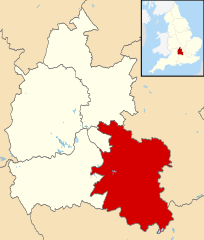
133:South Oxfordshire UK locator map.svg
484:
231:
226:
13:
754:Usage on zh-min-nan.wikipedia.org
543:{{Information |Description=Map of
337:
331:
217:
179:Lake data from Meridian 2 product.
125:
75:
771:
336:
564:
322:
273:Under the following conditions:
238:This file is licensed under the
230:
225:
219:
92:
31:
21:
319:
575:
488:
318:
26:
1:
643:Category:サウス・オックスフォードシャー出身の人物
560:
344:Items portrayed in this file
7:
10:
776:
744:Usage on www.wikidata.org
734:Usage on ur.wikipedia.org
724:Usage on sv.wikipedia.org
714:Usage on ru.wikipedia.org
704:Usage on ro.wikipedia.org
694:Usage on pl.wikipedia.org
684:Usage on no.wikipedia.org
674:Usage on nl.wikipedia.org
664:Usage on lv.wikipedia.org
654:Usage on ko.wikipedia.org
639:Usage on ja.wikipedia.org
629:Usage on fr.wikipedia.org
619:Usage on fa.wikipedia.org
609:Usage on es.wikipedia.org
599:Usage on cy.wikipedia.org
584:Usage on bg.wikipedia.org
287:same or compatible license
127:
485:
16:
648:Category:サウス・オックスフォードシャー
593:Южен Оксфордшър (община)
321:
253:
184:England location map.svg
99:This is a file from the
36:
603:Ardal De Swydd Rydychen
542:
155:
103:. Information from its
106:description page there
521:10:01, 2 August 2011
69:1,077 × 1,266 pixels
65:1,742 × 2,048 pixels
268:– to adapt the work
182:Inset derived from
47:Other resolutions:
668:Dienvidoksfordšīra
61:871 × 1,024 pixels
758:South Oxfordshire
738:جنوبی اوکسفرڈشائر
728:South Oxfordshire
708:South Oxfordshire
698:South Oxfordshire
678:South Oxfordshire
633:South Oxfordshire
613:South Oxfordshire
576:Global file usage
570:South Oxfordshire
558:
549:South Oxfordshire
418:copyright license
404:copyright license
330:
315:
314:
214:
211:Reusing this file
144:South Oxfordshire
121:
120:
101:Wikimedia Commons
32:Global file usage
767:
533:
495:
374:copyright status
360:copyright status
328:
309:
306:
303:
300:
297:
289:as the original.
251:
240:Creative Commons
234:
233:
229:
228:
223:
222:
208:
158:
134:
128:
117:
96:
95:
89:
83:
72:
57:653 × 768 pixels
53:408 × 480 pixels
49:204 × 240 pixels
43:510 × 599 pixels
775:
774:
770:
769:
768:
766:
765:
764:
718:Саут-Оксфордшир
623:آکسفوردشر جنوبی
574:
566:
559:
553:Ordnance Survey
539:
531:
487:
486:
483:
482:
481:
480:
479:
478:
477:
476:
474:
464:
463:
462:
460:
445:
444:
443:
442:
441:
440:
439:
438:
436:
424:
423:
422:
420:
401:
400:
399:
398:
397:
396:
395:
394:
392:
380:
379:
378:
376:
357:
356:
355:
354:
353:
351:
335:
334:
333:
316:
311:
310:
307:
304:
301:
298:
295:
294:
252:
249:
246:
235:
168:Ordnance Survey
132:
123:
122:
111:
110:
109:is shown below.
85:
81:
74:
73:
46:
12:
11:
5:
773:
763:
762:
761:
760:
752:
751:
750:
742:
741:
740:
732:
731:
730:
722:
721:
720:
712:
711:
710:
702:
701:
700:
692:
691:
690:
682:
681:
680:
672:
671:
670:
662:
661:
660:
652:
651:
650:
645:
637:
636:
635:
627:
626:
625:
617:
616:
615:
607:
606:
605:
597:
596:
595:
590:
577:
573:
572:
562:
557:
556:
541:
537:
534:
530:1,077 × 1,266
528:
523:
518:
514:
513:
510:
507:
504:
501:
498:
490:
475:
472:
470:
469:
468:
466:
465:
461:
456:
454:
453:
452:
451:
449:
437:
432:
430:
429:
428:
426:
425:
421:
416:
414:
413:
412:
411:
409:
405:
393:
388:
386:
385:
384:
382:
381:
377:
372:
370:
369:
368:
367:
365:
361:
352:
347:
345:
342:
341:
340:
339:
327:
326:
323:
320:
313:
312:
293:
292:
291:
290:
280:
271:
270:
269:
263:
256:You are free:
247:
237:
236:
218:
215:
203:
202:
196:
192:
191:
181:
180:
177:
164:
160:
159:
154:
150:
149:
135:
126:
119:
118:
97:
87:
86:
40:
35:
34:
29:
24:
19:
9:
6:
4:
3:
2:
772:
759:
756:
755:
753:
749:
746:
745:
743:
739:
736:
735:
733:
729:
726:
725:
723:
719:
716:
715:
713:
709:
706:
705:
703:
699:
696:
695:
693:
689:
686:
685:
683:
679:
676:
675:
673:
669:
666:
665:
663:
659:
656:
655:
653:
649:
646:
644:
641:
640:
638:
634:
631:
630:
628:
624:
621:
620:
618:
614:
611:
610:
608:
604:
601:
600:
598:
594:
591:
589:
586:
585:
583:
582:
581:
571:
568:
567:
554:
550:
546:
540:
535:
529:
527:
524:
522:
519:
516:
515:
511:
508:
505:
502:
499:
497:
496:
494:
473:2 August 2011
471:
459:
455:
435:
431:
419:
415:
391:
387:
375:
371:
350:
346:
343:
324:
317:
299:CC BY-SA 3.0
288:
284:
281:
278:
275:
274:
272:
267:
264:
261:
258:
257:
255:
254:
248:Attribution:
244:
241:
224:
216:
212:
207:
204:
200:
197:
193:
189:
185:
178:
175:
174:
173:
172:
169:
165:
161:
157:2 August 2011
151:
147:
146:highlighted.
145:
141:
136:
129:
115:
108:
107:
102:
98:
91:
90:
84:
79:
78:Original file
70:
66:
62:
58:
54:
50:
44:
39:
33:
30:
28:
25:
23:
20:
18:
15:
579:
492:
489:File history
282:
276:
265:
259:
166:
137:
114:You can help
104:
76:
22:File history
545:Oxfordshire
390:copyrighted
364:copyrighted
283:share alike
277:attribution
140:Oxfordshire
131:Description
588:Оксфордшър
561:File usage
547:, UK with
506:Dimensions
206:Permission
142:, UK with
27:File usage
538:Nilfanion
503:Thumbnail
500:Date/Time
458:inception
448:inception
199:Nilfanion
748:Q1776967
658:사우스옥스퍼드셔
555:[https:/
532:(921 KB)
325:Captions
266:to remix
260:to share
245:license.
188:Spischot
171:OpenData
517:current
512:Comment
349:depicts
329:English
138:Map of
80:
195:Author
163:Source
509:User
308:true
305:true
153:Date
17:File
186:by
67:|
63:|
59:|
55:|
51:|
45:.
213:)
209:(
190:.
116:.
71:.
