38:
548:"}},"text\/plain":{"en":{"":"inception"}}},"{\"value\":{\"time\":\"+2011-05-01T00:00:00Z\",\"timezone\":0,\"before\":0,\"after\":0,\"precision\":11,\"calendarmodel\":\"http:\\\/\\\/www.wikidata.org\\\/entity\\\/Q1985727\"},\"type\":\"time\"}":{"text\/html":{"en":{"P571":"1 May 2011"}},"text\/plain":{"en":{"P571":"1 May 2011"}}}}": -->
256:
347:
262:
267:
94:
487:"}},"text\/plain":{"en":{"P275":"Creative Commons Attribution-ShareAlike 3.0 Unported"}}},"{\"value\":{\"entity-type\":\"item\",\"numeric-id\":50829104,\"id\":\"Q50829104\"},\"type\":\"wikibase-entityid\"}":{"text\/html":{"en":{"P275":"
483:"}},"text\/plain":{"en":{"":"copyright license"}}},"{\"value\":{\"entity-type\":\"item\",\"numeric-id\":14946043,\"id\":\"Q14946043\"},\"type\":\"wikibase-entityid\"}":{"text\/html":{"en":{"P275":"
439:"}},"text\/plain":{"en":{"":"copyright status"}}},"{\"value\":{\"entity-type\":\"item\",\"numeric-id\":50423863,\"id\":\"Q50423863\"},\"type\":\"wikibase-entityid\"}":{"text\/html":{"en":{"P6216":"
435:
308:– You must give appropriate credit, provide a link to the license, and indicate if changes were made. You may do so in any reasonable manner, but not in any way that suggests the licensor endorses you or your use.
1153:
1165:
656:
488:
484:
440:
1462:
436:
953:
68:
64:
60:
545:
480:
56:
52:
48:
42:
645:
region showing the administrative districts. Equirectangular map projection on WGS 84 datum, with N/S stretched 160% Geographic limits: *West: 2.0W *East: 1.
105:
933:
77:
364:
226:
231:
491:"}},"text\/plain":{"en":{"P275":"GNU Free Documentation License, version 1.2 or later"}}}}": -->
362:; with no Invariant Sections, no Front-Cover Texts, and no Back-Cover Texts. A copy of the license is included in the section entitled
1018:
531:
514:
466:
1053:
315:
450:
354:
555:
498:
425:
1143:
1243:
1138:
1133:
1128:
1123:
1118:
277:
1183:
893:
748:
655:
More than 100 pages use this file. The following list shows the first 100 pages that use this file only. A
623:
618:
359:
37:
728:
723:
718:
713:
708:
703:
698:
693:
688:
683:
678:
673:
668:
663:
314:– If you remix, transform, or build upon the material, you must distribute your contributions under the
808:
858:
443:"}},"text\/plain":{"en":{"P6216":"copyrighted"}}}}": -->
1238:
1113:
1193:
190:
113:
1218:
1203:
1078:
1003:
998:
848:
798:
743:
352:
Permission is granted to copy, distribute and/or modify this document under the terms of the
1008:
818:
793:
788:
778:
768:
763:
274:
8:
1158:
1083:
973:
963:
948:
943:
938:
838:
833:
813:
758:
144:
1063:
1038:
1033:
993:
853:
843:
773:
753:
642:
1043:
828:
783:
249:
I, the copyright holder of this work, hereby publish it under the following licenses:
100:
1328:
415:
1148:
1098:
1088:
918:
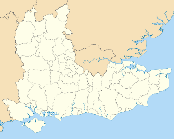
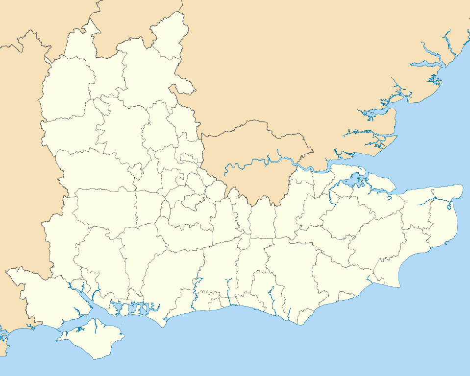
823:
803:
187:
1073:
1013:
888:
210:
1154:
Knowledge:WikiProject
Countries/Templates/Navboxes/European country subdivisions
1093:
928:
873:
868:
634:
923:
908:
738:
733:
1058:
565:
525:
508:
460:
1278:
1213:
1068:
1048:
983:
968:
878:
150:
Equirectangular map projection on WGS 84 datum, with N/S stretched 160%
988:
883:
1423:
1418:
1028:
903:
1453:
341:
1108:
1023:
913:
591:
Click on a date/time to view the file as it appeared at that time.
1403:
1388:
1333:
1258:
1438:
1383:
898:
863:
1413:
1363:
1348:
1228:
1448:
1393:
1103:
978:
958:
1443:
1433:
1428:
1368:
1323:
1233:
82:(SVG file, nominally 1,425 × 1,141 pixels, file size: 2.18 MB)
1338:
200:
Coastline data for Great
Britain (from Boundary-Line product)
1408:
1378:
1298:
1263:
954:
London and South East Women's
Regional Football League
1244:
Modèle:Géolocalisation/Angleterre du Sud-Est/Documentation
1353:
176:
88:
1373:
1318:
1293:
1288:
1283:
1343:
1273:
409:
Add a one-line explanation of what this file represents
1398:
1358:
1308:
934:
List of districts in South East
England by population
653:
1313:
1174:
641:== Summary == {{Information |Description=Map of the
589:
532:
515:
Creative
Commons Attribution-ShareAlike 3.0 Unported
489:
485:
Creative
Commons Attribution-ShareAlike 3.0 Unported
358:, Version 1.2 or any later version published by the
112:
Commons is a freely licensed media file repository.
1303:
1253:
1268:
1219:Vorlage:Positionskarte England South East England
1204:Plantilya:Location map UK England Southeast close
1194:Šablon:Lokacijska karta Engleska jugoistok blizu
325:https://creativecommons.org/licenses/by-sa/3.0
197:County boundaries (from Boundary-Line product)
93:
331:Creative Commons Attribution-Share Alike 3.0
255:
172:
147:region showing the administrative districts.
135:
1239:Modèle:Géolocalisation/Angleterre du Sud-Est
1184:قالب:Location map UK England Southeast close
227:NUTS 3 regions of South East England map.svg
217:
206:
182:
14:
291:– to copy, distribute and transmit the work
41:Size of this PNG preview of this SVG file:
390:You may select the license of your choice.
1176:The following other wikis use this file:
138:South East England districts 2011 map.svg
232:South East England counties 2009 map.svg
1329:Royal Borough of Windsor and Maidenhead
1019:Royal Borough of Windsor and Maidenhead
124:
1054:Southern Combination Football League
370:http://www.gnu.org/copyleft/fdl.html
278:Attribution-Share Alike 3.0 Unported
213:, created using Ordnance Survey data
582:
266:
261:
13:
414:
408:
389:
252:
248:
125:
75:
1474:
1144:User:Phildav76/Regional templates
413:
399:
346:
345:
302:Under the following conditions:
273:This file is licensed under the
265:
260:
254:
92:
31:
21:
1279:Distretti dell'Inghilterra
1139:User:OldSpot61/Sandbox/ESussex4
1134:User:OldSpot61/Sandbox/ESussex3
1129:User:OldSpot61/Sandbox/ESussex2
1124:User:OldSpot61/Sandbox/ESussex1
396:
222:Derivative works of this file:
1171:
1119:User:OldSpot61/Sandbox/ESussex
749:Berks/Bucks & Oxon Premier
586:
395:
376:GNU Free Documentation License
365:GNU Free Documentation License
355:GNU Free Documentation License
26:
1:
894:Folkestone and Hythe District
650:
421:Items portrayed in this file
242:
7:
1210:Usage on frr.wikipedia.org
1200:Usage on ceb.wikipedia.org
10:
1479:
1250:Usage on it.wikipedia.org
1225:Usage on fr.wikipedia.org
1190:Usage on bs.wikipedia.org
1180:Usage on ar.wikipedia.org
809:Borough of Tunbridge Wells
316:same or compatible license
132:
127:
1424:Tunbridge Wells (borough)
859:Counties 1 Southern North
583:
16:
1114:Talk:Crossrail/Archive 1
398:
360:Free Software Foundation
282:
99:This is a file from the
36:
1454:Milton Keynes (borough)
729:2014–15 Isthmian League
724:2013–14 Isthmian League
719:2012–13 Isthmian League
714:2011–12 Isthmian League
709:2010–11 Isthmian League
704:2009–10 Isthmian League
699:2008–09 Isthmian League
694:2007–08 Isthmian League
689:2006–07 Isthmian League
684:2005–06 Isthmian League
679:2004–05 Isthmian League
674:2003–04 Isthmian League
669:2002–03 Isthmian League
664:2001–02 Isthmian League
640:
175:
103:. Information from its
106:description page there
1404:Tonbridge and Malling
1389:Tandridge (distretto)
1334:Sevenoaks (distretto)
1259:Sud Est (Inghilterra)
1079:Tonbridge and Malling
1004:Regional 2 South East
999:Regional 1 South East
849:City of Milton Keynes
799:Borough of Spelthorne
744:Basingstoke and Deane
1439:Folkestone and Hythe
1384:Reigate and Banstead
1009:Reigate and Banstead
819:Borough of Wokingham
794:Borough of Runnymede
789:Borough of Maidstone
779:Borough of Guildford
769:Borough of Elmbridge
764:Borough of Eastleigh
69:1,425 × 1,141 pixels
65:2,558 × 2,048 pixels
61:1,279 × 1,024 pixels
1419:Città di Canterbury
1414:Maidstone (borough)
1364:Guildford (borough)
1349:Runnymede (borough)
1324:Brighton & Hove
1229:Prison de Parkhurst
1159:Template:SE England
1084:Vale of White Horse
974:New Forest District
964:Mid Sussex District
949:London 3 South East
944:London 2 South West
939:London 2 South East
839:Chichester District
834:Cherwell (district)
814:Borough of Waverley
759:Borough of Dartford
297:– to adapt the work
153:Geographic limits:
47:Other resolutions:
1449:Thanet (distretto)
1394:Dartford (borough)
1064:Tandridge District
1039:South East England
1034:Sevenoaks District
994:Reading, Berkshire
854:City of Winchester
844:City of Canterbury
774:Borough of Fareham
754:Borough of Ashford
643:South East England
145:South East England
1463:more global usage
1444:Swale (distretto)
1434:Dover (distretto)
1429:Ashford (borough)
1369:Waverley (Surrey)
1234:Prison de Reading
1214:Süüd Uast Ingelun
1172:Global file usage
1044:South Oxfordshire
829:Brighton and Hove
784:Borough of Havant
648:
619:19:04, 1 May 2011
499:copyright license
481:copyright license
407:
387:
386:
239:
238:
121:
120:
101:Wikimedia Commons
32:Global file usage
1470:
1339:Woking (borough)
1149:User talk:Frelke
1099:West Oxfordshire
1089:Wealden District
919:Horsham District
824:Bracknell Forest
804:Borough of Swale
631:
593:
451:copyright status
437:copyright status
405:
383:
380:
377:
374:
371:
349:
348:
342:
338:
335:
332:
329:
326:
318:as the original.
275:Creative Commons
269:
268:
264:
263:
258:
257:
178:
139:
133:
117:
96:
95:
89:
83:
72:
57:959 × 768 pixels
53:600 × 480 pixels
49:300 × 240 pixels
43:749 × 600 pixels
1478:
1477:
1473:
1472:
1471:
1469:
1468:
1467:
1409:Borgo di Medway
1379:Epsom and Ewell
1299:Buckinghamshire
1170:
1074:Thanet District
1014:Rother District
889:Epsom and Ewell
649:
637:
629:
585:
584:
581:
580:
579:
578:
577:
576:
575:
574:
572:
562:
561:
560:
558:
543:
542:
541:
540:
539:
538:
537:
536:
534:
523:
522:
521:
520:
519:
517:
505:
504:
503:
501:
478:
477:
476:
475:
474:
473:
472:
471:
469:
457:
456:
455:
453:
434:
433:
432:
431:
430:
428:
412:
411:
410:
393:
392:
391:
381:
378:
375:
372:
369:
340:
339:
336:
333:
330:
327:
324:
323:
281:
270:
251:
250:
245:
240:
188:Ordnance Survey
137:
130:
123:
122:
111:
110:
109:is shown below.
85:
81:
74:
73:
46:
12:
11:
5:
1476:
1465:of this file.
1459:
1458:
1457:
1456:
1451:
1446:
1441:
1436:
1431:
1426:
1421:
1416:
1411:
1406:
1401:
1396:
1391:
1386:
1381:
1376:
1371:
1366:
1361:
1356:
1351:
1346:
1341:
1336:
1331:
1326:
1321:
1316:
1311:
1306:
1301:
1296:
1291:
1286:
1281:
1276:
1271:
1266:
1264:Isola di Wight
1261:
1256:
1248:
1247:
1246:
1241:
1236:
1231:
1223:
1222:
1221:
1216:
1208:
1207:
1206:
1198:
1197:
1196:
1188:
1187:
1186:
1173:
1168:to this file.
1162:
1161:
1156:
1151:
1146:
1141:
1136:
1131:
1126:
1121:
1116:
1111:
1106:
1101:
1096:
1094:West Berkshire
1091:
1086:
1081:
1076:
1071:
1066:
1061:
1056:
1051:
1046:
1041:
1036:
1031:
1026:
1021:
1016:
1011:
1006:
1001:
996:
991:
986:
981:
976:
971:
966:
961:
956:
951:
946:
941:
936:
931:
929:Lewes District
926:
921:
916:
911:
906:
901:
896:
891:
886:
881:
876:
874:East Hampshire
871:
869:Dover District
866:
861:
856:
851:
846:
841:
836:
831:
826:
821:
816:
811:
806:
801:
796:
791:
786:
781:
776:
771:
766:
761:
756:
751:
746:
741:
736:
731:
726:
721:
716:
711:
706:
701:
696:
691:
686:
681:
676:
671:
666:
659:is available.
652:
647:
646:
639:
635:
632:
628:1,425 × 1,141
626:
621:
616:
612:
611:
608:
605:
602:
599:
596:
588:
573:
570:
568:
567:
566:
564:
563:
559:
554:
552:
551:
550:
549:
547:
535:
530:
528:
527:
526:
524:
518:
513:
511:
510:
509:
507:
506:
502:
497:
495:
494:
493:
492:
490:
486:
482:
470:
465:
463:
462:
461:
459:
458:
454:
449:
447:
446:
445:
444:
442:
438:
429:
424:
422:
419:
418:
417:
416:
404:
403:
400:
397:
388:
385:
384:
350:
322:
321:
320:
319:
309:
300:
299:
298:
292:
285:You are free:
272:
271:
253:
247:
246:
244:
241:
237:
236:
235:
234:
229:
219:
218:Other versions
215:
214:
208:
204:
203:
202:
201:
198:
184:
180:
179:
174:
170:
169:
168:
167:
164:
161:
158:
140:
131:
129:
126:
119:
118:
97:
87:
86:
40:
35:
34:
29:
24:
19:
9:
6:
4:
3:
2:
1475:
1466:
1464:
1455:
1452:
1450:
1447:
1445:
1442:
1440:
1437:
1435:
1432:
1430:
1427:
1425:
1422:
1420:
1417:
1415:
1412:
1410:
1407:
1405:
1402:
1400:
1397:
1395:
1392:
1390:
1387:
1385:
1382:
1380:
1377:
1375:
1372:
1370:
1367:
1365:
1362:
1360:
1357:
1355:
1352:
1350:
1347:
1345:
1342:
1340:
1337:
1335:
1332:
1330:
1327:
1325:
1322:
1320:
1317:
1315:
1312:
1310:
1307:
1305:
1302:
1300:
1297:
1295:
1292:
1290:
1287:
1285:
1282:
1280:
1277:
1275:
1272:
1270:
1267:
1265:
1262:
1260:
1257:
1255:
1252:
1251:
1249:
1245:
1242:
1240:
1237:
1235:
1232:
1230:
1227:
1226:
1224:
1220:
1217:
1215:
1212:
1211:
1209:
1205:
1202:
1201:
1199:
1195:
1192:
1191:
1189:
1185:
1182:
1181:
1179:
1178:
1177:
1169:
1167:
1160:
1157:
1155:
1152:
1150:
1147:
1145:
1142:
1140:
1137:
1135:
1132:
1130:
1127:
1125:
1122:
1120:
1117:
1115:
1112:
1110:
1107:
1105:
1102:
1100:
1097:
1095:
1092:
1090:
1087:
1085:
1082:
1080:
1077:
1075:
1072:
1070:
1067:
1065:
1062:
1060:
1057:
1055:
1052:
1050:
1047:
1045:
1042:
1040:
1037:
1035:
1032:
1030:
1027:
1025:
1022:
1020:
1017:
1015:
1012:
1010:
1007:
1005:
1002:
1000:
997:
995:
992:
990:
987:
985:
982:
980:
977:
975:
972:
970:
967:
965:
962:
960:
957:
955:
952:
950:
947:
945:
942:
940:
937:
935:
932:
930:
927:
925:
924:Isle of Wight
922:
920:
917:
915:
912:
910:
909:Hart District
907:
905:
902:
900:
897:
895:
892:
890:
887:
885:
882:
880:
877:
875:
872:
870:
867:
865:
862:
860:
857:
855:
852:
850:
847:
845:
842:
840:
837:
835:
832:
830:
827:
825:
822:
820:
817:
815:
812:
810:
807:
805:
802:
800:
797:
795:
792:
790:
787:
785:
782:
780:
777:
775:
772:
770:
767:
765:
762:
760:
757:
755:
752:
750:
747:
745:
742:
740:
739:Arun District
737:
735:
734:Adur District
732:
730:
727:
725:
722:
720:
717:
715:
712:
710:
707:
705:
702:
700:
697:
695:
692:
690:
687:
685:
682:
680:
677:
675:
672:
670:
667:
665:
662:
661:
660:
658:
644:
638:
633:
627:
625:
622:
620:
617:
614:
613:
609:
606:
603:
600:
597:
595:
594:
592:
569:
557:
553:
533:
529:
516:
512:
500:
496:
468:
464:
452:
448:
427:
423:
420:
401:
394:
367:
366:
361:
357:
356:
351:
344:
343:
328:CC BY-SA 3.0
317:
313:
310:
307:
304:
303:
301:
296:
293:
290:
287:
286:
284:
283:
279:
276:
259:
233:
230:
228:
225:
224:
223:
220:
216:
212:
209:
205:
199:
196:
195:
194:
192:
189:
185:
181:
171:
165:
163:North: 52.25N
162:
159:
156:
155:
154:
151:
148:
146:
141:
134:
115:
108:
107:
102:
98:
91:
90:
84:
79:
78:Original file
70:
66:
62:
58:
54:
50:
44:
39:
33:
30:
28:
25:
23:
20:
18:
15:
1460:
1354:Surrey Heath
1175:
1163:
1059:Surrey Heath
654:
590:
587:File history
363:
353:
311:
305:
294:
288:
221:
186:
166:South: 50.5N
152:
149:
142:
114:You can help
104:
76:
22:File history
1374:Mole Valley
1319:East Sussex
1294:West Sussex
1289:Southampton
1284:Oxfordshire
1069:Test Valley
1049:Southampton
984:Oxfordshire
969:Mole Valley
879:East Sussex
467:copyrighted
441:copyrighted
312:share alike
306:attribution
143:Map of the
136:Description
1344:Spelthorne
1274:Portsmouth
1166:more links
989:Portsmouth
884:Eastbourne
651:File usage
604:Dimensions
571:1 May 2011
177:1 May 2011
160:East: 1.5E
157:West: 2.0W
27:File usage
1399:Gravesham
1359:Elmbridge
1309:Berkshire
1029:Sevenoaks
904:Gravesham
657:full list
636:Nilfanion
630:(2.18 MB)
601:Thumbnail
598:Date/Time
556:inception
546:inception
243:Licensing
211:Nilfanion
1109:Worthing
1024:Rushmoor
914:Hastings
402:Captions
295:to remix
289:to share
280:license.
191:OpenData
1314:Reading
899:Gosport
864:Crawley
615:current
610:Comment
426:depicts
406:English
128:Summary
80:
1304:Surrey
1254:Oxford
1104:Woking
979:Oxford
959:Medway
207:Author
183:Source
1461:View
1164:View
1269:Kent
607:User
382:true
379:true
373:GFDL
337:true
334:true
173:Date
17:File
193::
67:|
63:|
59:|
55:|
51:|
45:.
368:.
116:.
71:.
