757:"}},"text\/plain":{"en":{"":"coordinates of the point of view"}}},"{\"value\":{\"latitude\":57.17841,\"longitude\":-2.0851,\"altitude\":null,\"precision\":1.0e-5,\"globe\":\"http:\\\/\\\/www.wikidata.org\\\/entity\\\/Q2\"},\"type\":\"globecoordinate\"}":{"text\/html":{"en":{"P1259":"57\u00b010'42.28"N, 2\u00b05'6.36"W"}},"text\/plain":{"en":{"P1259":"57\u00b010'42.28\"N, 2\u00b05'6.36\"W"}}},"{\"value\":{\"entity-type\":\"property\",\"numeric-id\":7787,\"id\":\"P7787\"},\"type\":\"wikibase-entityid\"}":{"text\/html":{"en":{"":"
944:"}},"text\/plain":{"en":{"":"coordinates of depicted place"}}},"{\"value\":{\"latitude\":57.17806,\"longitude\":-2.0838,\"altitude\":null,\"precision\":1.0e-5,\"globe\":\"http:\\\/\\\/www.wikidata.org\\\/entity\\\/Q2\"},\"type\":\"globecoordinate\"}":{"text\/html":{"en":{"P9149":"57\u00b010'41.02"N, 2\u00b05'1.68"W"}},"text\/plain":{"en":{"P9149":"57\u00b010'41.02\"N, 2\u00b05'1.68\"W"}}},"{\"value\":{\"entity-type\":\"property\",\"numeric-id\":7787,\"id\":\"P7787\"},\"type\":\"wikibase-entityid\"}":{"text\/html":{"en":{"":"
191:
536:"}},"text\/plain":{"en":{"":"author name string"}}},"{\"value\":\"Bill Harrison\",\"type\":\"string\"}":{"text\/html":{"en":{"P2093":"Bill Harrison"}},"text\/plain":{"en":{"P2093":"Bill Harrison"}}},"{\"value\":{\"entity-type\":\"property\",\"numeric-id\":2699,\"id\":\"P2699\"},\"type\":\"wikibase-entityid\"}":{"text\/html":{"en":{"":"
719:"}},"text\/plain":{"en":{"":"inception"}}},"{\"value\":{\"time\":\"+2009-09-17T00:00:00Z\",\"timezone\":0,\"before\":0,\"after\":0,\"precision\":11,\"calendarmodel\":\"http:\\\/\\\/www.wikidata.org\\\/entity\\\/Q1985727\"},\"type\":\"time\"}":{"text\/html":{"en":{"P571":"17 September 2009"}},"text\/plain":{"en":{"P571":"17 September 2009"}}}}": -->
821:
321:
271:
172:
313:
263:
940:
285:
356:
394:
399:
72:
829:"}},"text\/plain":{"en":{"P7482":"file available on the internet"}}},"{\"value\":{\"entity-type\":\"property\",\"numeric-id\":137,\"id\":\"P137\"},\"type\":\"wikibase-entityid\"}":{"text\/html":{"en":{"":"
837:"}},"text\/plain":{"en":{"P137":"Geograph Britain and Ireland"}}},"{\"value\":{\"entity-type\":\"property\",\"numeric-id\":7384,\"id\":\"P7384\"},\"type\":\"wikibase-entityid\"}":{"text\/html":{"en":{"":"
528:"}},"text\/plain":{"en":{"":"object of statement has role"}}},"{\"value\":{\"entity-type\":\"item\",\"numeric-id\":33231,\"id\":\"Q33231\"},\"type\":\"wikibase-entityid\"}":{"text\/html":{"en":{"P3831":"
675:"}},"text\/plain":{"en":{"":"copyright license"}}},"{\"value\":{\"entity-type\":\"item\",\"numeric-id\":19068220,\"id\":\"Q19068220\"},\"type\":\"wikibase-entityid\"}":{"text\/html":{"en":{"P275":"
631:"}},"text\/plain":{"en":{"":"copyright status"}}},"{\"value\":{\"entity-type\":\"item\",\"numeric-id\":50423863,\"id\":\"Q50423863\"},\"type\":\"wikibase-entityid\"}":{"text\/html":{"en":{"P6216":"
1050:
825:"}},"text\/plain":{"en":{"":"source of file"}}},"{\"value\":{\"entity-type\":\"item\",\"numeric-id\":74228490,\"id\":\"Q74228490\"},\"type\":\"wikibase-entityid\"}":{"text\/html":{"en":{"P7482":"
532:"}},"text\/plain":{"en":{"P3831":"photographer"}}},"{\"value\":{\"entity-type\":\"property\",\"numeric-id\":2093,\"id\":\"P2093\"},\"type\":\"wikibase-entityid\"}":{"text\/html":{"en":{"":"
948:"}},"text\/plain":{"en":{"":"heading"}}},"{\"value\":{\"amount\":\"+112\",\"unit\":\"http:\\\/\\\/www.wikidata.org\\\/entity\\\/Q28390\"},\"type\":\"quantity\"}":{"text\/html":{"en":{"P7787":"112
833:"}},"text\/plain":{"en":{"":"operator"}}},"{\"value\":{\"entity-type\":\"item\",\"numeric-id\":1503119,\"id\":\"Q1503119\"},\"type\":\"wikibase-entityid\"}":{"text\/html":{"en":{"P137":"
761:"}},"text\/plain":{"en":{"":"heading"}}},"{\"value\":{\"amount\":\"+112\",\"unit\":\"http:\\\/\\\/www.wikidata.org\\\/entity\\\/Q28390\"},\"type\":\"quantity\"}":{"text\/html":{"en":{"P7787":"112
845:"}},"text\/plain":{"en":{"P7384":"1500189"}}},"{\"value\":{\"entity-type\":\"property\",\"numeric-id\":973,\"id\":\"P973\"},\"type\":\"wikibase-entityid\"}":{"text\/html":{"en":{"":"
524:"}},"text\/plain":{"en":{"":"creator"}}},"{\"value\":{\"entity-type\":\"property\",\"numeric-id\":3831,\"id\":\"P3831\"},\"type\":\"wikibase-entityid\"}":{"text\/html":{"en":{"":"
627:
540:"}},"text\/plain":{"en":{"":"URL"}}},"{\"value\":\"https:\\\/\\\/www.geograph.org.uk\\\/profile\\\/15400\",\"type\":\"string\"}":{"text\/html":{"en":{"P2699":"
304:
254:
841:"}},"text\/plain":{"en":{"":"geograph.org.uk image ID"}}},"{\"value\":\"1500189\",\"type\":\"string\"}":{"text\/html":{"en":{"P7384":"
446:– You must give appropriate credit, provide a link to the license, and indicate if changes were made. You may do so in any reasonable manner, but not in any way that suggests the licensor endorses you or your use.
182:
318:
268:
83:
51:
842:
826:
676:
632:
834:
529:
945:
941:
838:
822:
758:
754:
628:
537:
533:
525:
850:
541:
846:
830:
716:
672:
521:
1060:
1159:
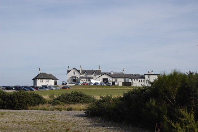
1067:== {{int:filedesc}} == {{Information |description={{en|1=Royal Aberdeen Golf Clubhouse}} |date=2009-09-17 |source=From |author= |permission=
679:"}},"text\/plain":{"en":{"P275":"Creative Commons Attribution-ShareAlike 2.0 Generic"}}}}": -->
190:
544:"}},"text\/plain":{"en":{"P2699":"https:\/\/www.geograph.org.uk\/profile\/15400"}}}}": -->
853:"}},"text\/plain":{"en":{"P973":"https:\/\/www.geograph.org.uk\/photo\/1500189"}}}}": -->
876:
702:
658:
328:
278:
1049:
1044:
42:
896:
1081:
363:
1172:
This file contains additional information, probably added from the digital camera or scanner used to create or digitize it.
453:
585:
986:
959:
904:
860:
799:
772:
642:
606:
593:
578:
919:
889:
726:
686:
551:
510:
409:
1175:
If the file has been modified from its original state, some details may not fully reflect the modified file.
452:– If you remix, transform, or build upon the material, you must distribute your contributions under the
370:
on the
Geograph website for the photographer's contact details. The copyright on this image is owned by
635:"}},"text\/plain":{"en":{"P6216":"copyrighted"}}}}": -->
1077:
The following pages on the
English Knowledge use this file (pages on other projects are not listed):
952:"}},"text\/plain":{"en":{"P7787":"112 degree"}}}}": -->
765:"}},"text\/plain":{"en":{"P7787":"112 degree"}}}}": -->
1086:
91:
223:
926:
911:
613:
406:
207:
8:
350:
334:
284:
375:
78:
500:
156:
146:
969:
870:
782:
736:
696:
652:
561:
355:
171:
183:
Royal
Aberdeen Golf Clubhouse - geograph.org.uk - 1500189 (cropped).jpg
367:
1134:
1124:
1017:
Click on a date/time to view the file as it appeared at that time.
320:
270:
116:
Royal
Aberdeen Golf Clubhouse - geograph.org.uk - 1500189.jpg
52:
Royal_Aberdeen_Golf_Clubhouse_-_geograph.org.uk_-_1500189.jpg
305:
57° 10′ 41″ N, 2° 05′ 02″ W
255:
57° 10′ 42″ N, 2° 05′ 06″ W
135:
66:
494:
Add a one-line explanation of what this file represents
1114:
1104:
1149:
1144:
1075:
1095:
1015:
90:
Commons is a freely licensed media file repository.
703:
Creative
Commons Attribution-ShareAlike 2.0 Generic
677:
Creative
Commons Attribution-ShareAlike 2.0 Generic
56:(640 × 426 pixels, file size: 44 KB, MIME type:
463:https://creativecommons.org/licenses/by-sa/2.0
71:
851:https:\/\/www.geograph.org.uk\/photo\/1500189
542:https:\/\/www.geograph.org.uk\/profile\/15400
469:Creative Commons Attribution-Share Alike 2.0
387:
131:
113:
162:
152:
141:
14:
949:
762:
429:– to copy, distribute and transmit the work
1097:The following other wikis use this file:
927:https://www.geograph.org.uk/photo/1500189
614:https://www.geograph.org.uk/profile/15400
327:View this and other nearby images on:
277:View this and other nearby images on:
1082:2005 Senior British Open Championship
230:
102:
374:and is licensed for reuse under the
295:
245:
166:
1008:
410:Attribution-Share Alike 2.0 Generic
398:
393:
378:Attribution-ShareAlike 2.0 license.
13:
1170:
499:
493:
384:
361:
120:
103:
49:
1196:
1177:
498:
1076:
773:coordinates of the point of view
755:coordinates of the point of view
484:
440:Under the following conditions:
405:This file is licensed under the
397:
392:
386:
354:
333:
319:
311:
283:
269:
261:
189:
170:
70:
31:
21:
481:
121:
46:No higher resolution available.
1092:
1012:
877:file available on the internet
827:file available on the internet
480:
362:This image was taken from the
26:
1:
960:coordinates of depicted place
942:coordinates of depicted place
238:Royal Aberdeen Golf Clubhouse
219:Royal Aberdeen Golf Clubhouse
126:Royal Aberdeen Golf Clubhouse
36:
1072:
897:Geograph Britain and Ireland
835:Geograph Britain and Ireland
579:object of statement has role
526:object of statement has role
506:Items portrayed in this file
346:
310:
260:
7:
1167:
1111:Usage on es.wikivoyage.org
1101:Usage on en.wikivoyage.org
10:
1201:
1156:Usage on zh.wikipedia.org
1141:Usage on www.wikidata.org
1131:Usage on nl.wikipedia.org
1121:Usage on fi.wikipedia.org
454:same or compatible license
236:Bill Harrison /
217:Bill Harrison /
110:
105:
1009:
975:57°10'41.02"N, 2°5'1.68"W
788:57°10'42.28"N, 2°5'6.36"W
16:
1135:Royal Aberdeen Golf Club
1125:Royal Aberdeen Golf Club
1087:Royal Aberdeen Golf Club
905:geograph.org.uk image ID
839:geograph.org.uk image ID
483:
420:
77:This is a file from the
41:
1066:
208:required by the license
169:
134:
81:. Information from its
368:this photograph's page
339:57.178060; -2.083800
289:57.178410; -2.085100
84:description page there
1045:21:33, 2 March 2011
435:– to adapt the work
594:author name string
534:author name string
1188:
1187:
1093:Global file usage
1070:
951:
764:
742:17 September 2009
687:copyright license
673:copyright license
492:
383:
382:
366:collection. See
344:
343:
294:
293:
243:
242:
211:
198:
197:
177:This file has an
136:17 September 2009
99:
98:
79:Wikimedia Commons
32:Global file usage
1192:
1178:
1057:
1019:
997:
996:
991:
929:
924:
920:described at URL
914:
909:
899:
894:
847:described at URL
810:
809:
804:
643:copyright status
629:copyright status
616:
611:
601:
598:
588:
583:
490:
476:
473:
470:
467:
464:
456:as the original.
418:
407:Creative Commons
401:
400:
396:
395:
390:
389:
376:Creative Commons
364:Geograph project
358:
351:
340:
337:
323:
322:
316:
315:
314:
308:
307:
296:
290:
287:
273:
272:
266:
265:
264:
258:
257:
246:
205:
193:
174:
167:
137:
125:
117:
111:
95:
74:
73:
67:
61:
59:
1200:
1199:
1195:
1194:
1193:
1191:
1190:
1189:
1166:
1091:
1078:
1071:
1063:
1055:
1011:
1010:
1007:
1006:
1005:
1004:
1003:
1002:
1001:
1000:
999:
998:
994:
992:
989:
980:
979:
978:
976:
966:
965:
964:
962:
939:
938:
937:
936:
935:
934:
933:
932:
931:
930:
925:
922:
916:
915:
910:
907:
901:
900:
895:
892:
883:
882:
881:
879:
867:
866:
865:
863:
820:
819:
818:
817:
816:
815:
814:
813:
812:
811:
807:
805:
802:
793:
792:
791:
789:
779:
778:
777:
775:
752:
751:
750:
749:
748:
747:
746:
745:
743:
733:
732:
731:
729:
714:
713:
712:
711:
710:
709:
708:
707:
705:
693:
692:
691:
689:
670:
669:
668:
667:
666:
665:
664:
663:
661:
649:
648:
647:
645:
626:
625:
624:
623:
622:
621:
620:
619:
618:
617:
612:
609:
603:
602:
599:
596:
590:
589:
584:
581:
572:
571:
570:
568:
558:
557:
556:
554:
519:
518:
517:
516:
515:
513:
497:
496:
495:
478:
477:
474:
471:
468:
465:
462:
461:
419:
416:
413:
402:
379:
349:
338:
312:
303:
302:
299:Object location
288:
262:
253:
252:
249:Camera location
244:
233:
226:
214:
194:
179:extracted image
147:geograph.org.uk
127:
115:
108:
101:
100:
89:
88:
87:is shown below.
63:
57:
55:
48:
47:
12:
11:
5:
1198:
1186:
1185:
1182:
1169:
1165:
1164:
1163:
1162:
1154:
1153:
1152:
1147:
1139:
1138:
1137:
1129:
1128:
1127:
1119:
1118:
1117:
1109:
1108:
1107:
1094:
1090:
1089:
1084:
1074:
1069:
1068:
1065:
1061:
1058:
1052:
1047:
1042:
1038:
1037:
1034:
1031:
1028:
1025:
1022:
1014:
985:
984:
983:
982:
981:
977:
974:
972:
971:
970:
968:
967:
963:
958:
956:
955:
954:
953:
947:
943:
918:
917:
903:
902:
888:
887:
886:
885:
884:
880:
875:
873:
872:
871:
869:
868:
864:
861:source of file
859:
857:
856:
855:
854:
852:
848:
844:
840:
836:
832:
828:
824:
823:source of file
798:
797:
796:
795:
794:
790:
787:
785:
784:
783:
781:
780:
776:
771:
769:
768:
767:
766:
760:
756:
744:
741:
739:
738:
737:
735:
734:
730:
725:
723:
722:
721:
720:
718:
706:
701:
699:
698:
697:
695:
694:
690:
685:
683:
682:
681:
680:
678:
674:
662:
657:
655:
654:
653:
651:
650:
646:
641:
639:
638:
637:
636:
634:
630:
605:
604:
592:
591:
577:
576:
575:
574:
573:
569:
566:
564:
563:
562:
560:
559:
555:
550:
548:
547:
546:
545:
543:
539:
535:
531:
527:
523:
514:
509:
507:
504:
503:
502:
501:
489:
488:
485:
482:
460:
459:
458:
457:
447:
438:
437:
436:
430:
423:You are free:
414:
404:
403:
385:
381:
380:
359:
348:
345:
342:
341:
331:
325:
300:
292:
291:
281:
275:
250:
241:
240:
234:
231:
228:
227:
222:
215:
212:
200:
199:
196:
195:
188:
186:
175:
164:
163:Other versions
160:
159:
154:
150:
149:
143:
139:
138:
133:
129:
128:
118:
109:
107:
104:
97:
96:
75:
65:
64:
45:
40:
39:
34:
29:
24:
19:
9:
6:
4:
3:
2:
1197:
1183:
1180:
1179:
1176:
1173:
1161:
1158:
1157:
1155:
1151:
1148:
1146:
1143:
1142:
1140:
1136:
1133:
1132:
1130:
1126:
1123:
1122:
1120:
1116:
1113:
1112:
1110:
1106:
1103:
1102:
1100:
1099:
1098:
1088:
1085:
1083:
1080:
1079:
1064:
1059:
1053:
1051:
1048:
1046:
1043:
1040:
1039:
1035:
1032:
1029:
1026:
1023:
1021:
1020:
1018:
988:
973:
961:
957:
928:
921:
913:
906:
898:
891:
878:
874:
862:
858:
801:
786:
774:
770:
740:
728:
724:
704:
700:
688:
684:
660:
656:
644:
640:
615:
608:
600:Bill Harrison
595:
587:
580:
565:
553:
549:
512:
508:
505:
486:
479:
466:CC BY-SA 2.0
455:
451:
448:
445:
442:
441:
439:
434:
431:
428:
425:
424:
422:
421:
417:Bill Harrison
415:Attribution:
411:
408:
391:
377:
373:
372:Bill Harrison
369:
365:
360:
357:
353:
352:
336:
332:
330:
329:OpenStreetMap
326:
324:
306:
301:
298:
297:
286:
282:
280:
279:OpenStreetMap
276:
274:
256:
251:
248:
247:
239:
235:
229:
225:
221: /
220:
216:
209:
204:
202:
201:
192:
187:
184:
180:
176:
173:
168:
165:
161:
158:
157:Bill Harrison
155:
151:
148:
144:
140:
130:
124:
119:
112:
93:
86:
85:
80:
76:
69:
68:
62:
53:
44:
38:
35:
33:
30:
28:
25:
23:
20:
18:
15:
1174:
1171:
1096:
1016:
1013:File history
586:photographer
530:photographer
449:
443:
432:
426:
371:
309:
259:
237:
224:CC BY-SA 2.0
218:
178:
122:
92:You can help
82:
50:
22:File history
1160:皇家阿伯丁高爾夫俱樂部
1062:GeographBot
659:copyrighted
633:copyrighted
450:share alike
444:attribution
203:Attribution
114:Description
1181:_error
1073:File usage
1054:640 × 426
1030:Dimensions
567:some value
58:image/jpeg
27:File usage
1027:Thumbnail
1024:Date/Time
727:inception
717:inception
347:Licensing
232:InfoField
213:InfoField
123:English:
1168:Metadata
1150:Q4622853
1145:Q2648620
1115:Aberdeen
1105:Aberdeen
890:operator
831:operator
487:Captions
433:to remix
427:to share
412:license.
37:Metadata
1056:(44 KB)
1041:current
1036:Comment
987:heading
946:heading
912:1500189
843:1500189
800:heading
759:heading
552:creator
522:creator
511:depicts
491:English
106:Summary
54:
995:degree
950:degree
808:degree
763:degree
317:
267:
153:Author
142:Source
145:From
1033:User
993:112
806:112
475:true
472:true
132:Date
17:File
607:URL
538:URL
990::
923::
908::
893::
803::
610::
597::
582::
181::
1184:0
210:)
206:(
185:.
94:.
60:)
Text is available under the Creative Commons Attribution-ShareAlike License. Additional terms may apply.
.jpg)
_heading:112.00&language=en)
_heading:112.00&language=en)
