43:
498:"}},"text\/plain":{"en":{"":"inception"}}},"{\"value\":{\"time\":\"+2011-03-04T00:00:00Z\",\"timezone\":0,\"before\":0,\"after\":0,\"precision\":11,\"calendarmodel\":\"http:\\\/\\\/www.wikidata.org\\\/entity\\\/Q1985727\"},\"type\":\"time\"}":{"text\/html":{"en":{"P571":"4 March 2011"}},"text\/plain":{"en":{"P571":"4 March 2011"}}}}": -->
258:
264:
269:
99:
454:"}},"text\/plain":{"en":{"":"copyright license"}}},"{\"value\":{\"entity-type\":\"item\",\"numeric-id\":14946043,\"id\":\"Q14946043\"},\"type\":\"wikibase-entityid\"}":{"text\/html":{"en":{"P275":"
410:"}},"text\/plain":{"en":{"":"copyright status"}}},"{\"value\":{\"entity-type\":\"item\",\"numeric-id\":50423863,\"id\":\"Q50423863\"},\"type\":\"wikibase-entityid\"}":{"text\/html":{"en":{"P6216":"
406:
1143:
316:– You must give appropriate credit, provide a link to the license, and indicate if changes were made. You may do so in any reasonable manner, but not in any way that suggests the licensor endorses you or your use.
595:, UK in 2011, with the following information shown: *Ward boundaries *Coastline and lakes *Roads and railways *Urban areas Equirectangular map projection on WGS 84 datum, with N/S
1115:
606:
455:
411:
407:
1233:
495:
451:
73:
69:
65:
61:
57:
53:
47:
110:
82:
458:"}},"text\/plain":{"en":{"P275":"Creative Commons Attribution-ShareAlike 3.0 Unported"}}}}": -->
1223:
1218:
247:
356:
481:
437:
1331:
This file contains additional information, probably added from the digital camera or scanner used to create or digitize it.
323:
1173:
1293:
421:
505:
465:
396:
1288:
218:
279:
1188:
1133:
1334:
If the file has been modified from its original state, some details may not fully reflect the modified file.
605:
More than 100 pages use this file. The following list shows the first 100 pages that use this file only. A
1068:
322:– If you remix, transform, or build upon the material, you must distribute your contributions under the
573:
568:
42:
1178:
414:"}},"text\/plain":{"en":{"P6216":"copyrighted"}}}}": -->
1308:
1278:
1263:
204:
118:
1303:
1273:
1258:
1198:
1163:
1088:
903:
1248:
1318:
1208:
983:
958:
276:
1213:
8:
1003:
943:
803:
1033:
753:
653:
222:
144:
1013:
873:
853:
673:
592:
105:
386:
933:
201:
878:
235:
1073:
1038:
998:
993:
584:
1093:
1043:
868:
863:
763:
1098:
1053:
963:
883:
743:
728:
713:
515:
475:
431:
1023:
1018:
953:
928:
908:
893:
888:
783:
718:
698:
693:
663:
628:
164:
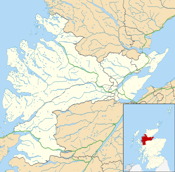
Equirectangular map projection on WGS 84 datum, with N/S stretched 180%
1058:
968:
923:
898:
813:
808:
688:
683:
668:
648:
633:
618:
1083:
1008:
988:
723:
708:
678:
658:
211:
Administrative borders and coastline data from
Boundary-Line product.
1174:
Wikiproyecto:Ilustración/Taller de
Cartografía/Realizaciones/Europa
1103:
1063:
1028:
973:
948:
918:
843:
838:
833:
823:
818:
793:
773:
768:
623:
613:
541:
Click on a date/time to view the file as it appeared at that time.
287:
Contains
Ordnance Survey data © Crown copyright and database right
1078:
1048:
978:
913:
858:
828:
778:
758:
738:
733:
703:
798:
748:
643:
638:
87:(SVG file, nominally 1,425 × 1,400 pixels, file size: 3.04 MB)
1108:
938:
848:
788:
190:
93:
1294:
Modül:Konum haritası/veri/İskoçya Ross ve
Cromarty/belge
1309:
Module:Location map/data/Scotland Ross and
Cromarty/doc
1279:
Module:Location map/data/Scotland Ross and
Cromarty/doc
380:
Add a one-line explanation of what this file represents
1264:
Module:Location map/data/Scotland Ross an
Cromarty/doc
1224:モジュール:Location map/data/Scotland Ross and Cromarty/doc
1243:
1153:
603:
1124:
539:
482:
Creative
Commons Attribution-ShareAlike 3.0 Unported
456:
Creative
Commons Attribution-ShareAlike 3.0 Unported
147:, UK in 2011, with the following information shown:
117:
Commons is a freely licensed media file repository.
1304:
Module:Location map/data/Scotland Ross and
Cromarty
1274:
Module:Location map/data/Scotland Ross and Cromarty
1253:
1179:
Plantilla:Mapa de localización de Ross and Cromarty
1289:Modül:Konum haritası/veri/İskoçya Ross ve Cromarty
1259:Module:Location map/data/Scotland Ross an Cromarty
1219:モジュール:Location map/data/Scotland Ross and Cromarty
214:All other geographic data from Meridian 2 product.
1234:ಟೆಂಪ್ಲೇಟು:Location map Scotland Ross and Cromarty
1164:Plantilya:Location map Scotland Ross and Cromarty
1249:Template:Location map Scotland Ross and Cromarty
1209:Template:Location map Scotland Ross and Cromarty
1319:Batakan:Location map Scotland Ross and Cromarty
1144:Шаблон:На карце/Вялікабрытанія Рос-энд-Кромарці
333:https://creativecommons.org/licenses/by-sa/3.0
98:
339:Creative Commons Attribution-Share Alike 3.0
257:
242:
186:
135:
1189:الگو:Location map Scotland Ross and Cromarty
1134:قالب:Location map Scotland Ross and Cromarty
352:
231:
196:
14:
299:– to copy, distribute and transmit the work
46:Size of this PNG preview of this SVG file:
1126:The following other wikis use this file:
1199:Modèle:Géolocalisation/Ross and Cromarty
357:File:Ross and Cromarty UK blank map.svg
138:Ross and Cromarty UK location map.svg
129:
280:Attribution-Share Alike 3.0 Unported
238:, created using Ordnance Survey data
532:
268:
263:
13:
1329:
591:{{Information |Description=Map of
385:
379:
254:
130:
80:
1363:
1336:
384:
370:
310:Under the following conditions:
275:This file is licensed under the
267:
262:
256:
97:
31:
21:
367:
1121:
536:
366:
219:File:Scotland location map.svg
26:
1:
36:
600:
392:Items portrayed in this file
7:
1326:
1315:Usage on war.wikipedia.org
1240:Usage on sco.wikipedia.org
1160:Usage on ceb.wikipedia.org
1069:Saltburn, Ross and Cromarty
10:
1368:
1300:Usage on uz.wikipedia.org
1285:Usage on tr.wikipedia.org
1270:Usage on si.wikipedia.org
1230:Usage on kn.wikipedia.org
1205:Usage on ja.wikipedia.org
1195:Usage on fr.wikipedia.org
1185:Usage on fa.wikipedia.org
1170:Usage on es.wikipedia.org
1150:Usage on br.wikipedia.org
1140:Usage on be.wikipedia.org
1130:Usage on ar.wikipedia.org
324:same or compatible license
132:
533:
16:
369:
290:
104:This is a file from the
41:
590:
189:
108:. Information from its
1089:Strathcarron, Highland
904:Jamestown, Easter Ross
111:description page there
984:Lonemore, Wester Ross
959:Letters, Wester Ross
74:1,425 × 1,400 pixels
70:2,085 × 2,048 pixels
66:1,042 × 1,024 pixels
1004:Milton, Easter Ross
944:Lamington, Highland
804:Duirinish, Lochalsh
569:23:31, 4 March 2011
305:– to adapt the work
217:Inset derived from
167:Geographic limits:
154:Coastline and lakes
52:Other resolutions:
1034:Newfield, Highland
754:Corran, Loch Hourn
654:Arabella, Highland
157:Roads and railways
1355:
1354:
1122:Global file usage
1014:Morvich, Highland
874:Hilton of Cadboll
854:Glenelg, Highland
674:Ardross, Highland
598:
593:Ross and Cromarty
466:copyright license
452:copyright license
378:
363:
362:
251:
248:Reusing this file
145:Ross and Cromarty
126:
125:
106:Wikimedia Commons
32:Global file usage
1359:
1337:
934:Kyle of Lochalsh
581:
543:
422:copyright status
408:copyright status
376:
346:
343:
340:
337:
334:
326:as the original.
288:
277:Creative Commons
271:
270:
266:
265:
260:
259:
245:
192:
139:
133:
122:
101:
100:
94:
88:
77:
62:782 × 768 pixels
58:489 × 480 pixels
54:244 × 240 pixels
48:610 × 599 pixels
1367:
1366:
1362:
1361:
1360:
1358:
1357:
1356:
1325:
1120:
879:Inver, Highland
599:
587:
579:
535:
534:
531:
530:
529:
528:
527:
526:
525:
524:
522:
512:
511:
510:
508:
493:
492:
491:
490:
489:
488:
487:
486:
484:
472:
471:
470:
468:
449:
448:
447:
446:
445:
444:
443:
442:
440:
428:
427:
426:
424:
405:
404:
403:
402:
401:
399:
383:
382:
381:
364:
348:
347:
344:
341:
338:
335:
332:
331:
289:
286:
283:
272:
202:Ordnance Survey
151:Ward boundaries
137:
128:
127:
116:
115:
114:is shown below.
90:
86:
79:
78:
51:
12:
11:
5:
1365:
1353:
1352:
1349:
1345:
1344:
1341:
1328:
1324:
1323:
1322:
1321:
1313:
1312:
1311:
1306:
1298:
1297:
1296:
1291:
1283:
1282:
1281:
1276:
1268:
1267:
1266:
1261:
1256:
1251:
1246:
1238:
1237:
1236:
1228:
1227:
1226:
1221:
1216:
1211:
1203:
1202:
1201:
1193:
1192:
1191:
1183:
1182:
1181:
1176:
1168:
1167:
1166:
1158:
1157:
1156:
1148:
1147:
1146:
1138:
1137:
1136:
1123:
1118:to this file.
1112:
1111:
1106:
1101:
1096:
1091:
1086:
1081:
1076:
1074:Sand, Highland
1071:
1066:
1061:
1056:
1051:
1046:
1041:
1039:Nigg, Highland
1036:
1031:
1026:
1021:
1016:
1011:
1006:
1001:
999:Mellon Udrigle
996:
994:Mellon Charles
991:
986:
981:
976:
971:
966:
961:
956:
951:
946:
941:
936:
931:
926:
921:
916:
911:
906:
901:
896:
891:
886:
881:
876:
871:
866:
861:
856:
851:
846:
841:
836:
831:
826:
821:
816:
811:
806:
801:
796:
791:
786:
781:
776:
771:
766:
761:
756:
751:
746:
741:
736:
731:
726:
721:
716:
711:
706:
701:
696:
691:
686:
681:
676:
671:
666:
661:
656:
651:
646:
641:
636:
631:
626:
621:
616:
609:is available.
602:
597:
596:
589:
585:
582:
578:1,425 × 1,400
576:
571:
566:
562:
561:
558:
555:
552:
549:
546:
538:
523:
520:
518:
517:
516:
514:
513:
509:
504:
502:
501:
500:
499:
497:
485:
480:
478:
477:
476:
474:
473:
469:
464:
462:
461:
460:
459:
457:
453:
441:
436:
434:
433:
432:
430:
429:
425:
420:
418:
417:
416:
415:
413:
409:
400:
395:
393:
390:
389:
388:
387:
375:
374:
371:
368:
361:
360:
354:
353:Other versions
350:
349:
330:
329:
328:
327:
317:
308:
307:
306:
300:
293:You are free:
284:
274:
273:
255:
252:
240:
239:
233:
229:
228:
227:
226:
215:
212:
198:
194:
193:
188:
184:
183:
182:
181:
178:
175:
172:
162:
161:
158:
155:
152:
140:
131:
124:
123:
102:
92:
91:
45:
40:
39:
34:
29:
24:
19:
9:
6:
4:
3:
2:
1364:
1350:
1347:
1346:
1342:
1339:
1338:
1335:
1332:
1320:
1317:
1316:
1314:
1310:
1307:
1305:
1302:
1301:
1299:
1295:
1292:
1290:
1287:
1286:
1284:
1280:
1277:
1275:
1272:
1271:
1269:
1265:
1262:
1260:
1257:
1255:
1252:
1250:
1247:
1245:
1242:
1241:
1239:
1235:
1232:
1231:
1229:
1225:
1222:
1220:
1217:
1215:
1212:
1210:
1207:
1206:
1204:
1200:
1197:
1196:
1194:
1190:
1187:
1186:
1184:
1180:
1177:
1175:
1172:
1171:
1169:
1165:
1162:
1161:
1159:
1155:
1152:
1151:
1149:
1145:
1142:
1141:
1139:
1135:
1132:
1131:
1129:
1128:
1127:
1119:
1117:
1110:
1107:
1105:
1102:
1100:
1097:
1095:
1094:Strathkanaird
1092:
1090:
1087:
1085:
1082:
1080:
1077:
1075:
1072:
1070:
1067:
1065:
1062:
1060:
1057:
1055:
1052:
1050:
1047:
1045:
1044:North Kessock
1042:
1040:
1037:
1035:
1032:
1030:
1027:
1025:
1022:
1020:
1017:
1015:
1012:
1010:
1007:
1005:
1002:
1000:
997:
995:
992:
990:
987:
985:
982:
980:
977:
975:
972:
970:
967:
965:
962:
960:
957:
955:
952:
950:
947:
945:
942:
940:
937:
935:
932:
930:
927:
925:
922:
920:
917:
915:
912:
910:
907:
905:
902:
900:
897:
895:
892:
890:
887:
885:
882:
880:
877:
875:
872:
870:
869:Hill of Fearn
867:
865:
864:HMS Fieldfare
862:
860:
857:
855:
852:
850:
847:
845:
842:
840:
837:
835:
832:
830:
827:
825:
822:
820:
817:
815:
812:
810:
807:
805:
802:
800:
797:
795:
792:
790:
787:
785:
782:
780:
777:
775:
772:
770:
767:
765:
764:Croftnacreich
762:
760:
757:
755:
752:
750:
747:
745:
742:
740:
737:
735:
732:
730:
727:
725:
722:
720:
717:
715:
712:
710:
707:
705:
702:
700:
697:
695:
692:
690:
687:
685:
682:
680:
677:
675:
672:
670:
667:
665:
662:
660:
657:
655:
652:
650:
647:
645:
642:
640:
637:
635:
632:
630:
627:
625:
622:
620:
617:
615:
612:
611:
610:
608:
594:
588:
583:
577:
575:
572:
570:
567:
564:
563:
559:
556:
553:
550:
547:
545:
544:
542:
519:
507:
503:
483:
479:
467:
463:
439:
435:
423:
419:
398:
394:
391:
372:
365:
358:
355:
351:
336:CC BY-SA 3.0
325:
321:
318:
315:
312:
311:
309:
304:
301:
298:
295:
294:
292:
291:
285:Attribution:
281:
278:
261:
253:
249:
244:
241:
237:
234:
230:
224:
220:
216:
213:
210:
209:
208:
206:
203:
199:
195:
185:
179:
176:
173:
170:
169:
168:
165:
159:
156:
153:
150:
149:
148:
146:
141:
134:
120:
113:
112:
107:
103:
96:
95:
89:
84:
83:Original file
75:
71:
67:
63:
59:
55:
49:
44:
38:
35:
33:
30:
28:
25:
23:
20:
18:
15:
1333:
1330:
1125:
1113:
1099:Strathpeffer
1054:Portmahomack
964:Loch Kishorn
884:Inveralligin
744:Conon Bridge
729:Camusterrach
714:Camas Luinie
604:
540:
537:File history
521:4 March 2011
319:
313:
302:
296:
223:NordNordWest
200:
191:4 March 2011
180:South: 57.0N
177:North: 58.2N
166:
163:
142:
119:You can help
109:
81:
22:File history
1024:Muir of Ord
1019:Mountgerald
954:Letterfearn
929:Knockfarrel
909:Jemimaville
894:Invergordon
889:Inverchoran
784:Cullicudden
719:Camusnagaul
699:Auchtertyre
694:Auchindrean
664:Ardcharnich
629:Achiltibuie
438:copyrighted
412:copyrighted
359:- Blank map
320:share alike
314:attribution
160:Urban areas
136:Description
1116:more links
1059:Rosemarkie
969:Lochcarron
924:Kinlochewe
899:Inverinate
814:Dundonnell
809:Duncanston
689:Artafallie
684:Arpafeelie
669:Ardindrean
649:Applecross
634:Achintraid
619:Achandunie
601:File usage
554:Dimensions
243:Permission
174:East: 3.7W
171:West: 5.9W
27:File usage
1084:Shieldaig
1009:Morefield
989:Maryburgh
724:Camusteel
709:Balmacara
679:Arnisdale
659:Ardarroch
607:full list
586:Nilfanion
580:(3.04 MB)
551:Thumbnail
548:Date/Time
506:inception
496:inception
236:Nilfanion
1327:Metadata
1154:Gairloch
1104:Ullapool
1064:Sallachy
1029:Munlochy
974:Lochslin
949:Leckmelm
919:Killilan
844:Gairloch
839:Fortrose
834:Fodderty
824:Erbusaig
819:Edderton
794:Dingwall
774:Culbokie
769:Cromarty
624:Achduart
614:Achanalt
373:Captions
303:to remix
297:to share
282:license.
205:OpenData
37:Metadata
1244:Dingwal
1079:Scoraig
1049:Poolewe
979:Londubh
914:Kildary
859:Gorstan
829:Evanton
779:Culduie
759:Coulags
739:Coigach
734:Carnach
704:Badcaul
565:current
560:Comment
397:depicts
377:English
143:Map of
85:
1348:Height
799:Dornie
749:Contin
644:Alness
639:Alcaig
232:Author
197:Source
1340:Width
1254:Urray
1214:アラプール
1114:View
1109:Urray
939:Laide
849:Garve
789:Delny
1351:1400
1343:1425
557:User
345:true
342:true
187:Date
17:File
221:by
207:.
72:|
68:|
64:|
60:|
56:|
50:.
250:)
246:(
225:.
121:.
76:.
