721:"}},"text\/plain":{"en":{"":"coordinates of the point of view"}}},"{\"value\":{\"latitude\":54.07951,\"longitude\":-7.608248,\"altitude\":null,\"precision\":1.0e-6,\"globe\":\"http:\\\/\\\/www.wikidata.org\\\/entity\\\/Q2\"},\"type\":\"globecoordinate\"}":{"text\/html":{"en":{"P1259":"54\u00b04'46.236"N, 7\u00b036'29.693"W"}},"text\/plain":{"en":{"P1259":"54\u00b04'46.236\"N, 7\u00b036'29.693\"W"}}},"{\"value\":{\"entity-type\":\"property\",\"numeric-id\":7787,\"id\":\"P7787\"},\"type\":\"wikibase-entityid\"}":{"text\/html":{"en":{"":"
946:"}},"text\/plain":{"en":{"":"coordinates of depicted place"}}},"{\"value\":{\"latitude\":54.08032,\"longitude\":-7.60885,\"altitude\":null,\"precision\":1.0e-5,\"globe\":\"http:\\\/\\\/www.wikidata.org\\\/entity\\\/Q2\"},\"type\":\"globecoordinate\"}":{"text\/html":{"en":{"P9149":"54\u00b04'49.15"N, 7\u00b036'31.86"W"}},"text\/plain":{"en":{"P9149":"54\u00b04'49.15\"N, 7\u00b036'31.86\"W"}}},"{\"value\":{\"entity-type\":\"property\",\"numeric-id\":7787,\"id\":\"P7787\"},\"type\":\"wikibase-entityid\"}":{"text\/html":{"en":{"":"
538:"}},"text\/plain":{"en":{"":"author name string"}}},"{\"value\":\"Kenneth Allen\",\"type\":\"string\"}":{"text\/html":{"en":{"P2093":"Kenneth Allen"}},"text\/plain":{"en":{"P2093":"Kenneth Allen"}}},"{\"value\":{\"entity-type\":\"property\",\"numeric-id\":3831,\"id\":\"P3831\"},\"type\":\"wikibase-entityid\"}":{"text\/html":{"en":{"":"
908:"}},"text\/plain":{"en":{"":"inception"}}},"{\"value\":{\"time\":\"+2012-03-26T00:00:00Z\",\"timezone\":0,\"before\":0,\"after\":0,\"precision\":11,\"calendarmodel\":\"http:\\\/\\\/www.wikidata.org\\\/entity\\\/Q1985727\"},\"type\":\"time\"}":{"text\/html":{"en":{"P571":"26 March 2012"}},"text\/plain":{"en":{"P571":"26 March 2012"}}}}": -->
785:
292:
242:
456:
284:
234:
942:
256:
327:
365:
370:
67:
809:"}},"text\/plain":{"en":{"P973":"https:\/\/www.geograph.org.uk\/photo\/2870431"}}},"{\"value\":{\"entity-type\":\"property\",\"numeric-id\":7384,\"id\":\"P7384\"},\"type\":\"wikibase-entityid\"}":{"text\/html":{"en":{"":"
534:"}},"text\/plain":{"en":{"P2699":"https:\/\/www.geograph.org.uk\/profile\/2282"}}},"{\"value\":{\"entity-type\":\"property\",\"numeric-id\":2093,\"id\":\"P2093\"},\"type\":\"wikibase-entityid\"}":{"text\/html":{"en":{"":"
793:"}},"text\/plain":{"en":{"P7482":"file available on the internet"}}},"{\"value\":{\"entity-type\":\"property\",\"numeric-id\":137,\"id\":\"P137\"},\"type\":\"wikibase-entityid\"}":{"text\/html":{"en":{"":"
542:"}},"text\/plain":{"en":{"":"object of statement has role"}}},"{\"value\":{\"entity-type\":\"item\",\"numeric-id\":33231,\"id\":\"Q33231\"},\"type\":\"wikibase-entityid\"}":{"text\/html":{"en":{"P3831":"
801:"}},"text\/plain":{"en":{"P137":"Geograph Britain and Ireland"}}},"{\"value\":{\"entity-type\":\"property\",\"numeric-id\":973,\"id\":\"P973\"},\"type\":\"wikibase-entityid\"}":{"text\/html":{"en":{"":"
677:"}},"text\/plain":{"en":{"":"copyright license"}}},"{\"value\":{\"entity-type\":\"item\",\"numeric-id\":19068220,\"id\":\"Q19068220\"},\"type\":\"wikibase-entityid\"}":{"text\/html":{"en":{"P275":"
633:"}},"text\/plain":{"en":{"":"copyright status"}}},"{\"value\":{\"entity-type\":\"item\",\"numeric-id\":50423863,\"id\":\"Q50423863\"},\"type\":\"wikibase-entityid\"}":{"text\/html":{"en":{"P6216":"
789:"}},"text\/plain":{"en":{"":"source of file"}}},"{\"value\":{\"entity-type\":\"item\",\"numeric-id\":74228490,\"id\":\"Q74228490\"},\"type\":\"wikibase-entityid\"}":{"text\/html":{"en":{"P7482":"
950:"}},"text\/plain":{"en":{"":"heading"}}},"{\"value\":{\"amount\":\"+337\",\"unit\":\"http:\\\/\\\/www.wikidata.org\\\/entity\\\/Q28390\"},\"type\":\"quantity\"}":{"text\/html":{"en":{"P7787":"337
797:"}},"text\/plain":{"en":{"":"operator"}}},"{\"value\":{\"entity-type\":\"item\",\"numeric-id\":1503119,\"id\":\"Q1503119\"},\"type\":\"wikibase-entityid\"}":{"text\/html":{"en":{"P137":"
725:"}},"text\/plain":{"en":{"":"heading"}}},"{\"value\":{\"amount\":\"+337\",\"unit\":\"http:\\\/\\\/www.wikidata.org\\\/entity\\\/Q28390\"},\"type\":\"quantity\"}":{"text\/html":{"en":{"P7787":"337
526:"}},"text\/plain":{"en":{"":"creator"}}},"{\"value\":{\"entity-type\":\"property\",\"numeric-id\":2699,\"id\":\"P2699\"},\"type\":\"wikibase-entityid\"}":{"text\/html":{"en":{"":"
629:
805:"}},"text\/plain":{"en":{"":"described at URL"}}},"{\"value\":\"https:\\\/\\\/www.geograph.org.uk\\\/photo\\\/2870431\",\"type\":\"string\"}":{"text\/html":{"en":{"P973":"
530:"}},"text\/plain":{"en":{"":"URL"}}},"{\"value\":\"https:\\\/\\\/www.geograph.org.uk\\\/profile\\\/2282\",\"type\":\"string\"}":{"text\/html":{"en":{"P2699":"
813:"}},"text\/plain":{"en":{"":"geograph.org.uk image ID"}}},"{\"value\":\"2870431\",\"type\":\"string\"}":{"text\/html":{"en":{"P7384":"
38:
275:
225:
417:– You must give appropriate credit, provide a link to the license, and indicate if changes were made. You may do so in any reasonable manner, but not in any way that suggests the licensor endorses you or your use.
239:
289:
814:
790:
678:
634:
798:
543:
947:
943:
810:
786:
722:
718:
630:
539:
535:
527:
806:
905:
802:
794:
674:
531:
523:
46:
78:
1062:
1208:
681:"}},"text\/plain":{"en":{"P275":"Creative Commons Attribution-ShareAlike 2.0 Generic"}}}}": -->
162:
1124:
840:
704:
660:
299:
249:
860:
334:
1094:
This file contains additional information, probably added from the digital camera or scanner used to create or digitize it.
424:
615:
988:
961:
883:
824:
763:
736:
644:
608:
595:
580:
915:
868:
853:
688:
553:
512:
1051:
1046:
37:
1239:
380:
1097:
If the file has been modified from its original state, some details may not fully reflect the modified file.
467:
423:– If you remix, transform, or build upon the material, you must distribute your contributions under the
341:
on the
Geograph website for the photographer's contact details. The copyright on this image is owned by
546:"}},"text\/plain":{"en":{"P3831":"photographer"}}}}": -->
637:"}},"text\/plain":{"en":{"P6216":"copyrighted"}}}}": -->
1079:
The following pages on the
English Knowledge use this file (pages on other projects are not listed):
954:"}},"text\/plain":{"en":{"P7787":"337 degree"}}}}": -->
729:"}},"text\/plain":{"en":{"P7787":"337 degree"}}}}": -->
817:"}},"text\/plain":{"en":{"P7384":"2870431"}}}}": -->
86:
1287:
890:
875:
587:
377:
178:
8:
1323:
1114:
321:
305:
255:
346:
73:
502:
475:, who confirmed that it was available there under the stated license on that date.
194:
121:
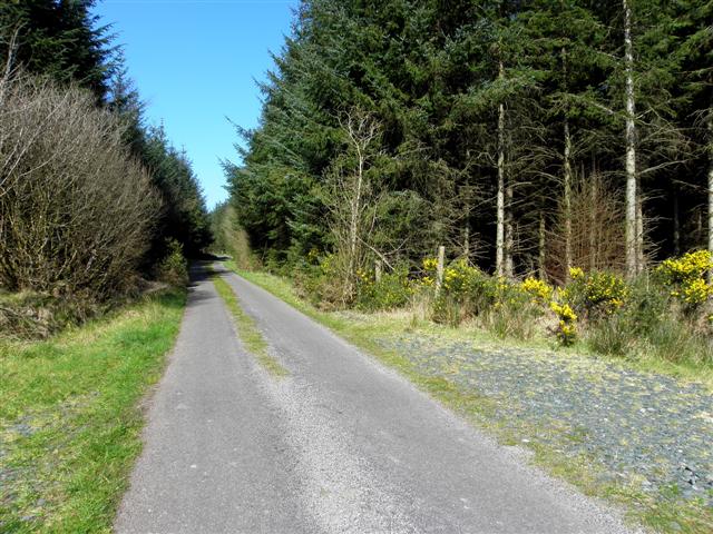
Road at
Bellaheady townland, parish of Tullyhunco, Co. Cavan, Republic of Ireland
471:
1305:
1139:
463:
141:
1179:
151:
971:
925:
834:
746:
698:
654:
563:
1341:
326:
1159:
1083:
338:
1149:
1019:
Click on a date/time to view the file as it appeared at that time.
291:
241:
276:
54° 04′ 49.2″ N, 7° 36′ 32″ W
226:
54° 04′ 46.2″ N, 7° 36′ 30″ W
130:
61:
496:
Add a one-line explanation of what this file represents
1077:
1017:
169:
Creative
Commons Attribution Share-alike license 2.0
85:
Commons is a freely licensed media file repository.
705:
Creative
Commons Attribution-ShareAlike 2.0 Generic
679:
Creative
Commons Attribution-ShareAlike 2.0 Generic
1328:Flash did not fire, compulsory flash suppression
51:(640 × 480 pixels, file size: 89 KB, MIME type:
462:This file, which was originally posted to From
434:https://creativecommons.org/licenses/by-sa/2.0
66:
807:https:\/\/www.geograph.org.uk\/photo\/2870431
440:Creative Commons Attribution-Share Alike 2.0
358:
157:
126:
108:
532:https:\/\/www.geograph.org.uk\/profile\/2282
147:
136:
14:
951:
726:
400:– to copy, distribute and transmit the work
111:Road at Bellabready (geograph 2870431).jpg
47:Road_at_Bellabready_(geograph_2870431).jpg
876:https://www.geograph.org.uk/photo/2870431
588:https://www.geograph.org.uk/profile/2282
1069:Transferred from geograph.co.uk using
298:View this and other nearby images on:
248:View this and other nearby images on:
201:
97:
345:and is licensed for reuse under the
266:
216:
1010:
381:Attribution-Share Alike 2.0 Generic
369:
364:
349:Attribution-ShareAlike 2.0 license.
13:
1092:
501:
495:
461:
355:
332:
115:
98:
44:
1374:
1099:
500:
466:, was reviewed on 2 June 2018 by
1170:Date and time of data generation
1078:
737:coordinates of the point of view
719:coordinates of the point of view
486:
454:
411:Under the following conditions:
376:This file is licensed under the
368:
363:
357:
325:
304:
290:
282:
254:
240:
232:
65:
21:
1209:Version 1.0
1106:OLYMPUS DIGITAL CAMERA
483:
116:
41:No higher resolution available.
1014:
841:file available on the internet
791:file available on the internet
482:
333:This image was taken from the
26:
1:
1362:A directly photographed image
962:coordinates of depicted place
944:coordinates of depicted place
31:
1074:
861:Geograph Britain and Ireland
799:Geograph Britain and Ireland
752:54°4'46.236"N, 7°36'29.693"W
609:object of statement has role
540:object of statement has role
508:Items portrayed in this file
317:
281:
231:
7:
1250:Date and time of digitizing
1089:
207:Kenneth Allen /
188:Kenneth Allen /
10:
1379:
1333:Supported Flashpix version
977:54°4'49.15"N, 7°36'31.86"W
450:
425:same or compatible license
105:
100:
1258:Meaning of each component
1215:File change date and time
1011:
16:
884:geograph.org.uk image ID
811:geograph.org.uk image ID
485:
391:
72:This is a file from the
36:
1125:SP590UZ
1068:
179:required by the license
129:
76:. Information from its
1279:Image compression mode
339:this photograph's page
310:54.080320; -7.608850
260:54.079510; -7.608248
79:description page there
1297:Maximum land aperture
1189:Horizontal resolution
1115:OLYMPUS IMAGING CORP.
1354:Digital still camera
1253:12:41, 26 March 2012
1218:09:51, 27 March 2012
1173:12:41, 26 March 2012
1047:10:00, 28 April 2018
1223:Y and C positioning
1197:Vertical resolution
1144:1/160 sec (0.00625)
1111:Camera manufacturer
406:– to adapt the work
209:Road at Bellabready
190:Road at Bellabready
596:author name string
536:author name string
1366:
1365:
1300:2.97 APEX (f/2.8)
1072:
953:
728:
689:copyright license
675:copyright license
494:
480:
479:
354:
353:
337:collection. See
315:
314:
265:
264:
214:
213:
182:
166:
163:Reusing this file
94:
93:
74:Wikimedia Commons
1370:
1231:Exposure Program
1100:
1059:
1021:
999:
998:
993:
893:
888:
878:
873:
869:described at URL
863:
858:
803:described at URL
774:
773:
768:
645:copyright status
631:copyright status
618:
613:
603:
600:
590:
585:
492:
458:
457:
451:
447:
444:
441:
438:
435:
427:as the original.
389:
378:Creative Commons
372:
371:
367:
366:
361:
360:
347:Creative Commons
335:Geograph project
329:
322:
311:
308:
294:
293:
287:
286:
285:
279:
278:
267:
261:
258:
244:
243:
237:
236:
235:
229:
228:
217:
176:
160:
132:
120:
112:
106:
90:
69:
68:
62:
56:
54:
1378:
1377:
1373:
1372:
1371:
1369:
1368:
1367:
1088:
1080:
1073:
1065:
1057:
1013:
1012:
1009:
1008:
1007:
1006:
1005:
1004:
1003:
1002:
1001:
1000:
996:
994:
991:
982:
981:
980:
978:
968:
967:
966:
964:
941:
940:
939:
938:
937:
936:
935:
934:
932:
922:
921:
920:
918:
903:
902:
901:
900:
899:
898:
897:
896:
895:
894:
889:
886:
880:
879:
874:
871:
865:
864:
859:
856:
847:
846:
845:
843:
831:
830:
829:
827:
784:
783:
782:
781:
780:
779:
778:
777:
776:
775:
771:
769:
766:
757:
756:
755:
753:
743:
742:
741:
739:
716:
715:
714:
713:
712:
711:
710:
709:
707:
695:
694:
693:
691:
672:
671:
670:
669:
668:
667:
666:
665:
663:
651:
650:
649:
647:
628:
627:
626:
625:
624:
623:
622:
621:
620:
619:
614:
611:
605:
604:
601:
598:
592:
591:
586:
583:
574:
573:
572:
570:
560:
559:
558:
556:
521:
520:
519:
518:
517:
515:
499:
498:
497:
476:
464:geograph.org.uk
455:
449:
448:
445:
442:
439:
436:
433:
432:
390:
387:
384:
373:
350:
320:
309:
283:
274:
273:
270:Object location
259:
233:
224:
223:
220:Camera location
215:
204:
197:
185:
142:geograph.org.uk
122:
110:
103:
96:
95:
84:
83:
82:is shown below.
58:
52:
50:
43:
42:
12:
11:
5:
1376:
1364:
1363:
1360:
1356:
1355:
1352:
1348:
1347:
1344:
1338:
1337:
1334:
1330:
1329:
1326:
1320:
1319:
1316:
1312:
1311:
1308:
1302:
1301:
1298:
1294:
1293:
1290:
1284:
1283:
1280:
1276:
1275:
1274:
1273:
1272:does not exist
1270:
1267:
1264:
1259:
1255:
1254:
1251:
1247:
1246:
1243:
1236:
1235:
1234:Normal program
1232:
1228:
1227:
1224:
1220:
1219:
1216:
1212:
1211:
1206:
1202:
1201:
1198:
1194:
1193:
1190:
1186:
1185:
1182:
1175:
1174:
1171:
1167:
1166:
1163:
1156:
1155:
1152:
1146:
1145:
1142:
1136:
1135:
1132:
1128:
1127:
1122:
1118:
1117:
1112:
1108:
1107:
1104:
1091:
1087:
1086:
1076:
1071:
1070:
1067:
1064:Cormac1cormac1
1063:
1060:
1054:
1049:
1044:
1040:
1039:
1036:
1033:
1030:
1027:
1024:
1016:
987:
986:
985:
984:
983:
979:
976:
974:
973:
972:
970:
969:
965:
960:
958:
957:
956:
955:
949:
945:
933:
930:
928:
927:
926:
924:
923:
919:
914:
912:
911:
910:
909:
907:
882:
881:
867:
866:
852:
851:
850:
849:
848:
844:
839:
837:
836:
835:
833:
832:
828:
825:source of file
823:
821:
820:
819:
818:
816:
812:
808:
804:
800:
796:
792:
788:
787:source of file
762:
761:
760:
759:
758:
754:
751:
749:
748:
747:
745:
744:
740:
735:
733:
732:
731:
730:
724:
720:
708:
703:
701:
700:
699:
697:
696:
692:
687:
685:
684:
683:
682:
680:
676:
664:
659:
657:
656:
655:
653:
652:
648:
643:
641:
640:
639:
638:
636:
632:
607:
606:
602:Kenneth Allen
594:
593:
579:
578:
577:
576:
575:
571:
568:
566:
565:
564:
562:
561:
557:
552:
550:
549:
548:
547:
545:
541:
537:
533:
529:
525:
516:
511:
509:
506:
505:
504:
503:
491:
490:
487:
484:
478:
477:
459:
431:
430:
429:
428:
418:
409:
408:
407:
401:
394:You are free:
388:Kenneth Allen
385:
375:
374:
356:
352:
351:
343:Kenneth Allen
330:
319:
316:
313:
312:
302:
296:
271:
263:
262:
252:
246:
221:
212:
211:
205:
202:
199:
198:
193:
186:
183:
171:
170:
167:
155:
154:
152:Kenneth Allen
149:
145:
144:
138:
134:
133:
128:
124:
123:
113:
104:
102:
99:
92:
91:
70:
60:
59:
40:
35:
34:
29:
24:
19:
9:
6:
4:
3:
2:
1375:
1361:
1358:
1357:
1353:
1350:
1349:
1345:
1343:
1340:
1339:
1335:
1332:
1331:
1327:
1325:
1322:
1321:
1317:
1314:
1313:
1309:
1307:
1306:Metering mode
1304:
1303:
1299:
1296:
1295:
1291:
1289:
1288:Exposure bias
1286:
1285:
1281:
1278:
1277:
1271:
1268:
1265:
1262:
1261:
1260:
1257:
1256:
1252:
1249:
1248:
1244:
1241:
1238:
1237:
1233:
1230:
1229:
1225:
1222:
1221:
1217:
1214:
1213:
1210:
1207:
1205:Software used
1204:
1203:
1199:
1196:
1195:
1191:
1188:
1187:
1183:
1181:
1177:
1176:
1172:
1169:
1168:
1164:
1161:
1158:
1157:
1153:
1151:
1148:
1147:
1143:
1141:
1140:Exposure time
1138:
1137:
1133:
1130:
1129:
1126:
1123:
1120:
1119:
1116:
1113:
1110:
1109:
1105:
1102:
1101:
1098:
1095:
1085:
1082:
1081:
1066:
1061:
1055:
1053:
1050:
1048:
1045:
1042:
1041:
1037:
1034:
1031:
1028:
1025:
1023:
1022:
1020:
990:
975:
963:
959:
931:26 March 2012
929:
917:
913:
892:
885:
877:
870:
862:
855:
842:
838:
826:
822:
765:
750:
738:
734:
706:
702:
690:
686:
662:
658:
646:
642:
617:
610:
597:
589:
582:
567:
555:
551:
514:
510:
507:
488:
481:
474:
473:
469:
465:
460:
453:
452:
437:CC BY-SA 2.0
426:
422:
419:
416:
413:
412:
410:
405:
402:
399:
396:
395:
393:
392:
386:Attribution:
382:
379:
362:
348:
344:
340:
336:
331:
328:
324:
323:
307:
303:
301:
300:OpenStreetMap
297:
295:
277:
272:
269:
268:
257:
253:
251:
250:OpenStreetMap
247:
245:
227:
222:
219:
218:
210:
206:
200:
196:
192: /
191:
187:
180:
175:
173:
172:
168:
164:
159:
156:
153:
150:
146:
143:
139:
135:
131:26 March 2012
125:
119:
114:
107:
88:
81:
80:
75:
71:
64:
63:
57:
48:
39:
33:
30:
28:
25:
23:
20:
18:
15:
1315:Light source
1180:focal length
1121:Camera model
1096:
1093:
1018:
1015:File history
616:photographer
544:photographer
470:
420:
414:
403:
397:
342:
280:
230:
208:
195:CC BY-SA 2.0
189:
117:
87:You can help
77:
45:
22:File history
1351:File source
1342:Color space
1103:Image title
661:copyrighted
635:copyrighted
421:share alike
415:attribution
174:Attribution
109:Description
1359:Scene type
1084:Bellaheady
1075:File usage
1056:640 × 480
1032:Dimensions
569:some value
158:Permission
53:image/jpeg
27:File usage
1160:ISO speed
1029:Thumbnail
1026:Date/Time
916:inception
906:inception
318:Licensing
203:InfoField
184:InfoField
118:English:
1226:Co-sited
1150:F-number
1090:Metadata
854:operator
795:operator
489:Captions
472:Leoboudv
468:reviewer
404:to remix
398:to share
383:license.
32:Metadata
1318:Unknown
1310:Pattern
1242:version
1058:(89 KB)
1043:current
1038:Comment
989:heading
948:heading
891:2870431
815:2870431
764:heading
723:heading
554:creator
524:creator
513:depicts
493:English
101:Summary
49:
1200:72 dpi
1192:72 dpi
1184:4.6 mm
1162:rating
1134:Picasa
1131:Author
997:degree
952:degree
772:degree
727:degree
288:
238:
148:Author
137:Source
1324:Flash
1178:Lens
1154:f/5.6
140:From
1346:sRGB
1245:2.21
1240:Exif
1035:User
995:337
770:337
446:true
443:true
127:Date
17:File
581:URL
528:URL
1269:Cr
1266:Cb
1165:64
992::
887::
872::
857::
767::
612::
599::
584::
1336:1
1292:0
1282:4
1263:Y
181:)
177:(
165:)
161:(
89:.
55:)
Text is available under the Creative Commons Attribution-ShareAlike License. Additional terms may apply.
.jpg)
.jpg¶ms=054.079510_N_-007.608248_E_globe:Earth_type:camera_source:geograph-irishgrid(H25691455)_heading:337.00&language=en)
.jpg¶ms=054.080320_N_-007.608850_E_globe:Earth_class:object_type:object_source:geograph-irishgrid(H25651464)_heading:337.00&language=en)
