548:"}},"text\/plain":{"en":{"":"coordinates of the point of view"}}},"{\"value\":{\"latitude\":53.5546,\"longitude\":-2.162,\"altitude\":null,\"precision\":0.0001,\"globe\":\"http:\\\/\\\/www.wikidata.org\\\/entity\\\/Q2\"},\"type\":\"globecoordinate\"}":{"text\/html":{"en":{"P1259":"53\u00b033'16.6"N, 2\u00b09'43.2"W"}},"text\/plain":{"en":{"P1259":"53\u00b033'16.6\"N, 2\u00b09'43.2\"W"}}}}": -->
586:"}},"text\/plain":{"en":{"":"coordinates of depicted place"}}},"{\"value\":{\"latitude\":53.5546,\"longitude\":-2.161,\"altitude\":null,\"precision\":0.0001,\"globe\":\"http:\\\/\\\/www.wikidata.org\\\/entity\\\/Q2\"},\"type\":\"globecoordinate\"}":{"text\/html":{"en":{"P9149":"53\u00b033'16.6"N, 2\u00b09'39.6"W"}},"text\/plain":{"en":{"P9149":"53\u00b033'16.6\"N, 2\u00b09'39.6\"W"}}}}": -->
510:"}},"text\/plain":{"en":{"":"inception"}}},"{\"value\":{\"time\":\"+2005-10-10T00:00:00Z\",\"timezone\":0,\"before\":0,\"after\":0,\"precision\":11,\"calendarmodel\":\"http:\\\/\\\/www.wikidata.org\\\/entity\\\/Q1985727\"},\"type\":\"time\"}":{"text\/html":{"en":{"P571":"10 October 2005"}},"text\/plain":{"en":{"P571":"10 October 2005"}}}}": -->
197:
353:
311:
367:
325:
165:
203:
208:
72:
466:"}},"text\/plain":{"en":{"":"copyright license"}}},"{\"value\":{\"entity-type\":\"item\",\"numeric-id\":19068220,\"id\":\"Q19068220\"},\"type\":\"wikibase-entityid\"}":{"text\/html":{"en":{"P275":"
422:"}},"text\/plain":{"en":{"":"copyright status"}}},"{\"value\":{\"entity-type\":\"item\",\"numeric-id\":50423863,\"id\":\"Q50423863\"},\"type\":\"wikibase-entityid\"}":{"text\/html":{"en":{"P6216":"
582:
344:
43:
302:
255:– You must give appropriate credit, provide a link to the license, and indicate if changes were made. You may do so in any reasonable manner, but not in any way that suggests the licensor endorses you or your use.
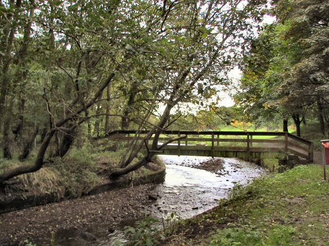
679:{{Information |Description=Footbridge over the River Irk, in Chadderton, Greater Manchester, England. |Source= |Date=10 October, 2005 |Author=Roger May |Permission={{geograph|63635|Roger May}} |ot
350:
308:
467:
423:
583:
545:
419:
507:
463:
470:"}},"text\/plain":{"en":{"P275":"Creative Commons Attribution-ShareAlike 2.0 Generic"}}}}": -->
152:
493:
449:
360:
318:
83:
51:
172:
759:
This file contains additional information, probably added from the digital camera or scanner used to create or digitize it.
262:
593:
555:
433:
517:
477:
408:
218:
762:
If the file has been modified from its original state, some details may not fully reflect the modified file.
261:– If you remix, transform, or build upon the material, you must distribute your contributions under the
179:
on the
Geograph website for the photographer's contact details. The copyright on this image is owned by
426:"}},"text\/plain":{"en":{"P6216":"copyrighted"}}}}": -->
689:
The following pages on the
English Knowledge use this file (pages on other projects are not listed):
91:
716:
661:
656:
42:
698:
215:
8:
159:
366:
324:
184:
78:
398:
726:
133:
115:
Footbridge over the River Irk, in
Chadderton, Greater Manchester, England.
603:
565:
527:
487:
443:
164:
693:
672:
176:
629:
Click on a date/time to view the file as it appeared at that time.
352:
310:
345:
53° 33′ 17″ N, 2° 09′ 40″ W
303:
53° 33′ 17″ N, 2° 09′ 43″ W
123:
66:
736:
392:
Add a one-line explanation of what this file represents
746:
687:
707:
627:
90:
Commons is a freely licensed media file repository.
494:
Creative
Commons Attribution-ShareAlike 2.0 Generic
468:
Creative
Commons Attribution-ShareAlike 2.0 Generic
56:(640 × 480 pixels, file size: 238 KB, MIME type:
272:https://creativecommons.org/licenses/by-sa/2.0
71:
278:Creative Commons Attribution-Share Alike 2.0
196:
147:
119:
108:
139:
129:
14:
238:– to copy, distribute and transmit the work
709:The following other wikis use this file:
359:View this and other nearby images on:
317:View this and other nearby images on:
102:
335:
293:
183:and is licensed for reuse under the
620:
219:Attribution-Share Alike 2.0 Generic
207:
202:
187:Attribution-ShareAlike 2.0 license.
13:
757:
397:
391:
193:
170:
103:
49:
783:
764:
396:
688:
556:coordinates of the point of view
546:coordinates of the point of view
382:
365:
351:
323:
309:
249:Under the following conditions:
214:This file is licensed under the
206:
201:
195:
163:
70:
31:
21:
379:
46:No higher resolution available.
704:
624:
378:
171:This image was taken from the
26:
1:
594:coordinates of depicted place
584:coordinates of depicted place
36:
684:
404:Items portrayed in this file
7:
754:
713:Usage on azb.wikipedia.org
10:
788:
743:Usage on www.wikidata.org
733:Usage on sv.wikipedia.org
723:Usage on fa.wikipedia.org
263:same or compatible license
105:
621:
111:River Irk, Chadderton.jpg
52:River_Irk,_Chadderton.jpg
16:
609:53°33'16.6"N, 2°9'39.6"W
571:53°33'16.6"N, 2°9'43.2"W
381:
229:
77:This is a file from the
41:
678:
122:
81:. Information from its
371:53.554600; -2.161000
329:53.554600; -2.162000
177:this photograph's page
84:description page there
657:16:36, 5 January 2009
699:Chadderton Hall Park
244:– to adapt the work
775:
774:
705:Global file usage
682:
478:copyright license
464:copyright license
390:
376:
375:
334:
333:
291:
290:
192:
191:
175:collection. See
156:
153:Reusing this file
99:
98:
79:Wikimedia Commons
32:Global file usage
779:
765:
669:
631:
434:copyright status
420:copyright status
388:
372:
369:
355:
354:
348:
347:
336:
330:
327:
313:
312:
306:
305:
294:
285:
282:
279:
276:
273:
265:as the original.
227:
216:Creative Commons
210:
209:
205:
204:
199:
198:
185:Creative Commons
173:Geograph project
167:
160:
150:
125:
112:
106:
95:
74:
73:
67:
61:
59:
787:
786:
782:
781:
780:
778:
777:
776:
753:
703:
690:
683:
675:
667:
623:
622:
619:
618:
617:
616:
615:
614:
613:
612:
610:
600:
599:
598:
596:
581:
580:
579:
578:
577:
576:
575:
574:
572:
562:
561:
560:
558:
543:
542:
541:
540:
539:
538:
537:
536:
534:
533:10 October 2005
524:
523:
522:
520:
505:
504:
503:
502:
501:
500:
499:
498:
496:
484:
483:
482:
480:
461:
460:
459:
458:
457:
456:
455:
454:
452:
440:
439:
438:
436:
417:
416:
415:
414:
413:
411:
395:
394:
393:
370:
343:
342:
339:Object location
328:
301:
300:
297:Camera location
292:
287:
286:
283:
280:
277:
274:
271:
270:
228:
225:
222:
211:
188:
134:geograph.org.uk
124:10 October 2005
110:
101:
100:
89:
88:
87:is shown below.
63:
57:
55:
48:
47:
12:
11:
5:
785:
773:
772:
769:
756:
752:
751:
750:
749:
741:
740:
739:
731:
730:
729:
721:
720:
719:
706:
702:
701:
696:
686:
681:
680:
677:
673:
670:
664:
659:
654:
650:
649:
646:
643:
640:
637:
634:
626:
611:
608:
606:
605:
604:
602:
601:
597:
592:
590:
589:
588:
587:
585:
573:
570:
568:
567:
566:
564:
563:
559:
554:
552:
551:
550:
549:
547:
535:
532:
530:
529:
528:
526:
525:
521:
516:
514:
513:
512:
511:
509:
497:
492:
490:
489:
488:
486:
485:
481:
476:
474:
473:
472:
471:
469:
465:
453:
448:
446:
445:
444:
442:
441:
437:
432:
430:
429:
428:
427:
425:
421:
412:
407:
405:
402:
401:
400:
399:
387:
386:
383:
380:
374:
373:
363:
357:
340:
332:
331:
321:
315:
298:
289:
288:
269:
268:
267:
266:
256:
247:
246:
245:
239:
232:You are free:
223:
213:
212:
194:
190:
189:
168:
157:
145:
144:
141:
137:
136:
131:
127:
126:
121:
117:
116:
113:
104:
97:
96:
75:
65:
64:
45:
40:
39:
34:
29:
24:
19:
9:
6:
4:
3:
2:
784:
770:
767:
766:
763:
760:
748:
745:
744:
742:
738:
735:
734:
732:
728:
725:
724:
722:
718:
715:
714:
712:
711:
710:
700:
697:
695:
692:
691:
676:
671:
665:
663:
660:
658:
655:
652:
651:
647:
644:
641:
638:
635:
633:
632:
630:
607:
595:
591:
569:
557:
553:
531:
519:
515:
495:
491:
479:
475:
451:
447:
435:
431:
410:
406:
403:
384:
377:
368:
364:
362:
361:OpenStreetMap
358:
356:
346:
341:
338:
337:
326:
322:
320:
319:OpenStreetMap
316:
314:
304:
299:
296:
295:
275:CC BY-SA 2.0
264:
260:
257:
254:
251:
250:
248:
243:
240:
237:
234:
233:
231:
230:
224:Attribution:
220:
217:
200:
186:
182:
178:
174:
169:
166:
162:
161:
158:
154:
149:
146:
142:
138:
135:
132:
128:
118:
114:
107:
93:
86:
85:
80:
76:
69:
68:
62:
53:
44:
38:
35:
33:
30:
28:
25:
23:
20:
18:
15:
761:
758:
708:
628:
625:File history
258:
252:
241:
235:
180:
92:You can help
82:
50:
22:File history
450:copyrighted
424:copyrighted
259:share alike
253:attribution
109:Description
768:_error
737:Chadderton
694:Chadderton
685:File usage
666:640 × 480
642:Dimensions
148:Permission
58:image/jpeg
27:File usage
717:کیو، لندن
639:Thumbnail
636:Date/Time
518:inception
508:inception
226:Roger May
181:Roger May
143:Roger May
755:Metadata
747:Q5066419
668:(238 KB)
385:Captions
242:to remix
236:to share
221:license.
37:Metadata
653:current
648:Comment
409:depicts
389:English
54:
349:
307:
140:Author
130:Source
727:چدرتن
674:Jza84
645:User
284:true
281:true
120:Date
17:File
771:0
155:)
151:(
94:.
60:)

_&language=en)
_&language=en)