269:
257:
43:
666:"}},"text\/plain":{"en":{"":"inception"}}},"{\"value\":{\"time\":\"+2011-01-01T00:00:00Z\",\"timezone\":0,\"before\":0,\"after\":0,\"precision\":9,\"calendarmodel\":\"http:\\\/\\\/www.wikidata.org\\\/entity\\\/Q1985727\"},\"type\":\"time\"}":{"text\/html":{"en":{"P571":"2011"}},"text\/plain":{"en":{"P571":"2011"}}}}": -->
345:
300:
351:
356:
99:
550:"}},"text\/plain":{"en":{"P275":"GNU Free Documentation License, version 1.2 or later"}}},"{\"value\":{\"entity-type\":\"item\",\"numeric-id\":19113751,\"id\":\"Q19113751\"},\"type\":\"wikibase-entityid\"}":{"text\/html":{"en":{"P275":"
542:"}},"text\/plain":{"en":{"P275":"Creative Commons Attribution-ShareAlike 3.0 Unported"}}},"{\"value\":{\"entity-type\":\"item\",\"numeric-id\":47001652,\"id\":\"Q47001652\"},\"type\":\"wikibase-entityid\"}":{"text\/html":{"en":{"P275":"
554:"}},"text\/plain":{"en":{"P275":"Creative Commons Attribution-ShareAlike 2.5 Generic"}}},"{\"value\":{\"entity-type\":\"item\",\"numeric-id\":19068220,\"id\":\"Q19068220\"},\"type\":\"wikibase-entityid\"}":{"text\/html":{"en":{"P275":"
546:"}},"text\/plain":{"en":{"P275":"Creative Commons Attribution-ShareAlike 1.0 Generic"}}},"{\"value\":{\"entity-type\":\"item\",\"numeric-id\":50829104,\"id\":\"Q50829104\"},\"type\":\"wikibase-entityid\"}":{"text\/html":{"en":{"P275":"
538:"}},"text\/plain":{"en":{"":"copyright license"}}},"{\"value\":{\"entity-type\":\"item\",\"numeric-id\":14946043,\"id\":\"Q14946043\"},\"type\":\"wikibase-entityid\"}":{"text\/html":{"en":{"P275":"
494:"}},"text\/plain":{"en":{"":"copyright status"}}},"{\"value\":{\"entity-type\":\"item\",\"numeric-id\":50423863,\"id\":\"Q50423863\"},\"type\":\"wikibase-entityid\"}":{"text\/html":{"en":{"P6216":"
802:
772:
862:
832:
490:
1500:
1450:
1465:
217:
410:– You must give appropriate credit, provide a link to the license, and indicate if changes were made. You may do so in any reasonable manner, but not in any way that suggests the licensor endorses you or your use.
248:
1407:
898:
555:
551:
547:
543:
539:
495:
491:
1719:
663:
535:
69:
73:
65:
61:
57:
53:
47:
317:
110:
268:
82:
558:"}},"text\/plain":{"en":{"P275":"Creative Commons Attribution-ShareAlike 2.0 Generic"}}}}": -->
872:
842:
315:; with no Invariant Sections, no Front-Cover Texts, and no Back-Cover Texts. A copy of the license is included in the section entitled
861:
856:
831:
826:
801:
796:
771:
766:
649:
632:
615:
598:
581:
521:
1730:
This file contains additional information, probably added from the digital camera or scanner used to create or digitize it.
1140:
417:
212:
505:
307:
673:
565:
480:
1195:
256:
1455:
1070:
1425:
207:
379:
375:
371:
367:
1350:
1733:
If the file has been modified from its original state, some details may not fully reflect the modified file.
1215:
897:
More than 100 pages use this file. The following list shows the first 100 pages that use this file only. A
312:
416:– If you remix, transform, or build upon the material, you must distribute your contributions under the
1055:
741:
736:
42:
1045:
1520:
498:"}},"text\/plain":{"en":{"P6216":"copyrighted"}}}}": -->
1485:
1285:
1030:
166:
1475:
118:
1075:
955:
1330:
1510:
305:
Permission is granted to copy, distribute and/or modify this document under the terms of the
1335:
920:
884:
363:
1010:
8:
1260:
1080:
154:
1390:
1110:
880:
236:
1635:
1435:
1300:
1265:
1135:
849:{{Information |Description= |Source= |Date= |Author= |Permission= |other_versions= }}
812:
782:
752:
291:
I, the copyright holder of this work, hereby publish it under the following licenses:
105:
470:
1310:
1490:
1440:
980:
975:
1660:
940:
1395:
1130:
1120:
1115:
1105:
1315:
1175:
1020:
1015:
950:
930:
218:
1680:
1145:
1400:
1185:
905:
1210:
1585:
1345:
1275:
1125:
1065:
1060:
1050:
1040:
1025:
683:
643:
626:
609:
592:
575:
515:
1620:
1385:
1365:
1295:
1280:
1180:
1095:
1090:
1085:
985:
965:
960:
883:, Deutschland. Geographische Begrenzung der Karte:}} {{en|Location map
232:
1230:
1225:
1560:
1535:
1380:
1375:
1250:
1245:
1240:
1165:
1035:
1000:
935:
915:
294:
1370:
1320:
1305:
1290:
1235:
1205:
1100:
970:
925:
709:
Click on a date/time to view the file as it appeared at that time.
1595:
1630:
1270:
1220:
1150:
995:
990:
945:
1255:
1710:
1340:
1325:
1170:
1005:
249:
Location map of the scope of the Rhein-Main-Verkehrsverbund.svg
1610:
1600:
879:== Summary == {{Information |Description= {{de|Positionskarte
1360:
1355:
1200:
1190:
1160:
910:
1645:
1555:
1530:
1155:
87:(SVG file, nominally 930 × 1,234 pixels, file size: 677 KB)
1690:
1590:
1550:
1540:
1700:
1650:
1575:
93:
1521:
Romerske monumenter, Domkirken og Vor Frue Kirke i Trier
1515:
1695:
1615:
1580:
464:
Add a one-line explanation of what this file represents
1685:
1670:
1655:
1640:
1545:
895:
1625:
1605:
1416:
707:
616:
582:
Creative
Commons Attribution-ShareAlike 3.0 Unported
548:
540:
Creative
Commons Attribution-ShareAlike 3.0 Unported
311:, Version 1.2 or any later version published by the
117:
Commons is a freely licensed media file repository.
1675:
1570:
1565:
1476:
Plantilya:Location map
Germany Rhineland-Palatinate
650:
Creative
Commons Attribution-ShareAlike 2.0 Generic
633:
Creative
Commons Attribution-ShareAlike 2.5 Generic
599:
Creative
Commons Attribution-ShareAlike 1.0 Generic
556:
Creative
Commons Attribution-ShareAlike 2.0 Generic
552:
Creative Commons Attribution-ShareAlike 2.5 Generic
544:
Creative Commons Attribution-ShareAlike 1.0 Generic
192:
1705:
1665:
157:, Deutschland. Geographische Begrenzung der Karte:
1511:Skabelon:Kortpositioner Tyskland Rheinland-Pfalz
1426:قالب:Location map Germany Rhineland-Palatinate
427:https://creativecommons.org/licenses/by-sa/3.0
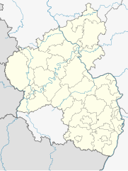
274:Rhineland-Palatinate-Saarland location map.svg
98:
433:Creative Commons Attribution-Share Alike 3.0
344:
188:
140:
242:
228:
198:
14:
393:– to copy, distribute and transmit the work
46:Size of this PNG preview of this SVG file:
445:You may select the license of your choice.
1418:The following other wikis use this file:
1501:Шаблон:ПозКартти Германи Рейнланд-Пфальц
169:, Germany. Geographic limits of the map:
1451:Ҡалып:ПозКарта Германия Рейнланд-Пфальц
247:Derivative works of this file:
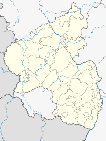
143:Rhineland-Palatinate location map.svg
129:
1141:Kirchheimbolanden (Verbandsgemeinde)
323:http://www.gnu.org/copyleft/fdl.html
1636:Neumühle (Obernheim-Kirchenarnbach)
700:
355:
350:
213:File:Landkreise Rheinland-Pfalz.svg
13:
1728:
1486:Šablona:LocMap Německo Porýní-Falc
469:
463:
444:
341:
290:
159:
147:
130:
80:
1762:
1735:
1466:Шаблон:ПК Германия Рейнланд-Пфалц
1196:Manderscheid, Bernkastel-Wittlich
468:
1071:Harbach (Landkreis Altenkirchen)
887:, Germany. Geographic limits of
454:
404:Under the following conditions:
362:This file is licensed under the
354:
349:
343:
299:
298:
267:
255:
97:
31:
21:
451:
160:
1661:Bad Münster am Stein-Ebernburg
1413:
704:
450:
329:GNU Free Documentation License
318:GNU Free Documentation License
308:GNU Free Documentation License
148:
26:
1:
1351:Stetten, Rhineland-Palatinate
208:File:Germany location map.svg
36:
892:
476:Items portrayed in this file
284:
7:
1725:
1472:Usage on ceb.wikipedia.org
1432:Usage on azb.wikipedia.org
10:
1767:
1681:Theodor-Heuss-Brücke (A 6)
1527:Usage on de.wikipedia.org
1507:Usage on da.wikipedia.org
1497:Usage on cv.wikipedia.org
1482:Usage on cs.wikipedia.org
1462:Usage on bg.wikipedia.org
1447:Usage on ba.wikipedia.org
1422:Usage on ar.wikipedia.org
1216:Neustadt an der Weinstraße
418:same or compatible license
235:, versions later 2013-11:
137:
132:
701:
16:
1536:Flughafen Frankfurt-Hahn
1286:Ruwer (Verbandsgemeinde)
1031:Ehrenbreitstein Fortress
453:
384:
366:Attribution-Share Alike
313:Free Software Foundation
104:This is a file from the
41:
1046:Forst an der Weinstraße
878:
848:
818:
788:
758:
191:
108:. Information from its
1491:Caesarův most přes Rýn
1056:Frankfurt–Hahn Airport
956:Bad Neuenahr-Ahrweiler
857:00:44, 28 January 2009
827:09:53, 28 January 2009
797:21:01, 2 November 2013
767:21:02, 2 November 2013
111:description page there
1621:Flugplatz Zweibrücken
1631:Fritz-Walter-Stadion
1336:Spangdahlem Air Base
1076:Hartenberg-Münchfeld
921:Annweiler am Trifels
885:Rhineland-Palatinate
203:own work, templates
167:Rhineland-Palatinate
70:1,543 × 2,048 pixels
1561:Wasserbilligerbrück
1331:Simmern im Hunsrück
1261:Ramstein-Miesenbach
1081:Heidesheim am Rhein
399:– to adapt the work
52:Other resolutions:
1586:Büchelberg (Wörth)
1391:Wolfsheim, Germany
1111:Ingelheim am Rhein
737:09:28, 1 July 2014
74:930 × 1,234 pixels
66:772 × 1,024 pixels
1754:
1753:
1720:more global usage
1601:Kirsch (Longuich)
1414:Global file usage
1301:Sankt Goarshausen
1266:Ramstein Air Base
1136:Kirchheimbolanden
1011:Daubach, Hunsrück
890:
566:copyright license
536:copyright license
462:
340:
339:
281:
280:
126:
125:
106:Wikimedia Commons
32:Global file usage
1758:
1736:
1596:Neubrücke (Nahe)
1311:Schmitt, Germany
869:
839:
809:
779:
749:
711:
506:copyright status
492:copyright status
460:
440:
437:
434:
431:
428:
420:as the original.
364:Creative Commons
358:
357:
353:
352:
347:
346:
336:
333:
330:
327:
324:
302:
301:
295:
271:
259:
194:
182:E: 8.58718872° O
179:W: 6.02600097° O
176:S: 48.7869615° N
173:N: 50.9796147° N
164:
152:
144:
138:
122:
101:
100:
94:
88:
77:
62:579 × 768 pixels
58:362 × 480 pixels
54:181 × 240 pixels
48:452 × 600 pixels
1766:
1765:
1761:
1760:
1759:
1757:
1756:
1755:
1724:
1646:Bruchwegstadion
1531:Benutzer:Soonix
1456:Лахер-Зее (күл)
1412:
981:Bingen am Rhein
976:Bernkastel-Kues
891:
881:Rheinland-Pfalz
875:
867:
845:
837:
815:
807:
785:
777:
755:
747:
703:
702:
699:
698:
697:
696:
695:
694:
693:
692:
690:
680:
679:
678:
676:
661:
660:
659:
658:
657:
656:
655:
654:
652:
641:
640:
639:
638:
637:
635:
624:
623:
622:
621:
620:
618:
607:
606:
605:
604:
603:
601:
590:
589:
588:
587:
586:
584:
572:
571:
570:
568:
533:
532:
531:
530:
529:
528:
527:
526:
524:
512:
511:
510:
508:
489:
488:
487:
486:
485:
483:
467:
466:
465:
448:
447:
446:
442:
441:
438:
435:
432:
429:
426:
425:
383:
359:
334:
331:
328:
325:
322:
293:
292:
287:
282:
275:
272:
263:
260:
170:
158:
155:Rheinland-Pfalz
153:Positionskarte
142:
135:
128:
127:
116:
115:
114:is shown below.
90:
86:
79:
78:
51:
12:
11:
5:
1764:
1752:
1751:
1748:
1744:
1743:
1740:
1727:
1722:of this file.
1716:
1715:
1714:
1713:
1708:
1703:
1698:
1693:
1688:
1683:
1678:
1673:
1668:
1663:
1658:
1653:
1648:
1643:
1638:
1633:
1628:
1623:
1618:
1613:
1608:
1603:
1598:
1593:
1588:
1583:
1578:
1573:
1568:
1563:
1558:
1553:
1548:
1543:
1538:
1533:
1525:
1524:
1523:
1518:
1513:
1505:
1504:
1503:
1495:
1494:
1493:
1488:
1480:
1479:
1478:
1470:
1469:
1468:
1460:
1459:
1458:
1453:
1445:
1444:
1443:
1438:
1430:
1429:
1428:
1415:
1410:to this file.
1404:
1403:
1398:
1396:Worms, Germany
1393:
1388:
1383:
1378:
1373:
1368:
1363:
1358:
1353:
1348:
1343:
1338:
1333:
1328:
1323:
1318:
1313:
1308:
1303:
1298:
1293:
1288:
1283:
1278:
1273:
1268:
1263:
1258:
1253:
1248:
1243:
1238:
1233:
1228:
1223:
1218:
1213:
1208:
1203:
1198:
1193:
1188:
1183:
1178:
1173:
1168:
1163:
1158:
1153:
1148:
1143:
1138:
1133:
1131:Kirchen (Sieg)
1128:
1123:
1121:Katzenelnbogen
1118:
1116:Kaiserslautern
1113:
1108:
1106:Idar-Oberstein
1103:
1098:
1093:
1088:
1083:
1078:
1073:
1068:
1063:
1058:
1053:
1048:
1043:
1038:
1033:
1028:
1023:
1018:
1013:
1008:
1003:
998:
993:
988:
983:
978:
973:
968:
963:
958:
953:
948:
943:
938:
933:
928:
923:
918:
913:
908:
901:is available.
894:
889:
888:
877:
873:
870:
864:
859:
854:
851:
850:
847:
843:
840:
834:
829:
824:
821:
820:
817:
813:
810:
804:
799:
794:
791:
790:
787:
783:
780:
774:
769:
764:
761:
760:
757:
753:
750:
744:
739:
734:
730:
729:
726:
723:
720:
717:
714:
706:
691:
688:
686:
685:
684:
682:
681:
677:
672:
670:
669:
668:
667:
665:
653:
648:
646:
645:
644:
642:
636:
631:
629:
628:
627:
625:
619:
614:
612:
611:
610:
608:
602:
597:
595:
594:
593:
591:
585:
580:
578:
577:
576:
574:
573:
569:
564:
562:
561:
560:
559:
557:
553:
549:
545:
541:
537:
525:
520:
518:
517:
516:
514:
513:
509:
504:
502:
501:
500:
499:
497:
493:
484:
479:
477:
474:
473:
472:
471:
459:
458:
455:
452:
443:
424:
423:
422:
421:
411:
402:
401:
400:
394:
387:You are free:
361:
360:
342:
338:
337:
303:
289:
288:
286:
283:
279:
278:
277:
276:
273:
266:
264:
262:Relief version
261:
254:
244:
243:Other versions
240:
239:
230:
226:
225:
224:
223:
220:
215:
210:
200:
196:
195:
190:
186:
185:
184:
183:
180:
177:
174:
145:
136:
134:
131:
124:
123:
102:
92:
91:
45:
40:
39:
34:
29:
24:
19:
9:
6:
4:
3:
2:
1763:
1749:
1746:
1745:
1741:
1738:
1737:
1734:
1731:
1723:
1721:
1712:
1711:Balduinbrücke
1709:
1707:
1704:
1702:
1699:
1697:
1694:
1692:
1691:Waldfischbach
1689:
1687:
1684:
1682:
1679:
1677:
1674:
1672:
1669:
1667:
1664:
1662:
1659:
1657:
1654:
1652:
1649:
1647:
1644:
1642:
1639:
1637:
1634:
1632:
1629:
1627:
1624:
1622:
1619:
1617:
1614:
1612:
1609:
1607:
1604:
1602:
1599:
1597:
1594:
1592:
1591:Bad Bodendorf
1589:
1587:
1584:
1582:
1579:
1577:
1574:
1572:
1569:
1567:
1564:
1562:
1559:
1557:
1554:
1552:
1551:Johanniskreuz
1549:
1547:
1544:
1542:
1541:Heimbach-Weis
1539:
1537:
1534:
1532:
1529:
1528:
1526:
1522:
1519:
1517:
1514:
1512:
1509:
1508:
1506:
1502:
1499:
1498:
1496:
1492:
1489:
1487:
1484:
1483:
1481:
1477:
1474:
1473:
1471:
1467:
1464:
1463:
1461:
1457:
1454:
1452:
1449:
1448:
1446:
1442:
1439:
1437:
1434:
1433:
1431:
1427:
1424:
1423:
1421:
1420:
1419:
1411:
1409:
1402:
1399:
1397:
1394:
1392:
1389:
1387:
1384:
1382:
1379:
1377:
1374:
1372:
1369:
1367:
1364:
1362:
1359:
1357:
1354:
1352:
1349:
1347:
1344:
1342:
1339:
1337:
1334:
1332:
1329:
1327:
1324:
1322:
1319:
1317:
1316:Schwarzenborn
1314:
1312:
1309:
1307:
1304:
1302:
1299:
1297:
1294:
1292:
1289:
1287:
1284:
1282:
1279:
1277:
1274:
1272:
1269:
1267:
1264:
1262:
1259:
1257:
1254:
1252:
1249:
1247:
1244:
1242:
1239:
1237:
1234:
1232:
1229:
1227:
1224:
1222:
1219:
1217:
1214:
1212:
1209:
1207:
1204:
1202:
1199:
1197:
1194:
1192:
1189:
1187:
1184:
1182:
1179:
1177:
1176:Linz am Rhein
1174:
1172:
1169:
1167:
1164:
1162:
1159:
1157:
1154:
1152:
1149:
1147:
1144:
1142:
1139:
1137:
1134:
1132:
1129:
1127:
1124:
1122:
1119:
1117:
1114:
1112:
1109:
1107:
1104:
1102:
1099:
1097:
1094:
1092:
1089:
1087:
1084:
1082:
1079:
1077:
1074:
1072:
1069:
1067:
1064:
1062:
1059:
1057:
1054:
1052:
1049:
1047:
1044:
1042:
1039:
1037:
1034:
1032:
1029:
1027:
1024:
1022:
1021:Diez, Germany
1019:
1017:
1016:Daun, Germany
1014:
1012:
1009:
1007:
1004:
1002:
999:
997:
994:
992:
989:
987:
984:
982:
979:
977:
974:
972:
969:
967:
964:
962:
959:
957:
954:
952:
951:Bad Kreuznach
949:
947:
944:
942:
939:
937:
934:
932:
931:Auen, Germany
929:
927:
924:
922:
919:
917:
914:
912:
909:
907:
904:
903:
902:
900:
886:
882:
876:
871:
865:
863:
860:
858:
855:
853:
852:
846:
841:
835:
833:
830:
828:
825:
823:
822:
816:
811:
805:
803:
800:
798:
795:
793:
792:
786:
781:
775:
773:
770:
768:
765:
763:
762:
756:
751:
745:
743:
740:
738:
735:
732:
731:
727:
724:
721:
718:
715:
713:
712:
710:
687:
675:
671:
651:
647:
634:
630:
617:
613:
600:
596:
583:
579:
567:
563:
523:
519:
507:
503:
482:
478:
475:
456:
449:
430:CC BY-SA 3.0
419:
415:
412:
409:
406:
405:
403:
398:
395:
392:
389:
388:
386:
385:
381:
377:
373:
369:
365:
348:
320:
319:
314:
310:
309:
304:
297:
296:
270:
265:
258:
253:
252:
251:
250:
245:
241:
238:
234:
231:
227:
222:OpenStreetMap
221:
219:
216:
214:
211:
209:
206:
205:
204:
201:
197:
187:
181:
178:
175:
172:
171:
168:
165:Location map
163:
156:
151:
146:
139:
120:
113:
112:
107:
103:
96:
95:
89:
84:
83:Original file
75:
71:
67:
63:
59:
55:
49:
44:
38:
35:
33:
30:
28:
25:
23:
20:
18:
15:
1732:
1729:
1717:
1701:Moselstadion
1651:Bad Neuenahr
1611:Petersbächel
1576:Rieschweiler
1417:
1405:
1401:Zell (Mosel)
1186:Ludwigshafen
941:Bad Dürkheim
906:Altenkirchen
896:
814:NordNordWest
806:930 × 1,234
784:NordNordWest
776:930 × 1,234
754:NordNordWest
746:930 × 1,234
708:
705:File history
413:
407:
396:
390:
368:3.0 Unported
316:
306:
246:
237:NordNordWest
202:
161:
149:
119:You can help
109:
81:
22:File history
1516:Speyerdomen
1346:Steinefrenz
1276:Rheinzabern
1126:Kell am See
1066:Hammerstein
1061:Germersheim
1051:Frankenthal
1041:Eltz Castle
1026:Dreikirchen
522:copyrighted
496:copyrighted
414:share alike
408:attribution
380:1.0 Generic
376:2.0 Generic
372:2.5 Generic
141:Description
1750:1234.475px
1696:Prosterath
1616:Winzenheim
1581:Dansenberg
1556:Mölschbach
1408:more links
1386:Westerburg
1366:Trier-Land
1296:Sankt Goar
1281:Rothenbach
1181:Luckenbach
1146:Klüsserath
1096:Hillesheim
1091:Herresbach
1086:Hermeskeil
986:Birkenfeld
966:Baumholder
961:Bad Salzig
893:File usage
866:708 × 913
836:708 × 913
722:Dimensions
27:File usage
1742:930.123px
1686:Erfenbach
1671:Bosenheim
1656:Ahrweiler
1641:Eifelpark
1381:Weselberg
1376:Urschmitt
1251:Pirmasens
1246:Otterberg
1241:Oppenheim
1211:Neuhäusel
1166:Lahnstein
1036:Elkenroth
1001:Budenheim
936:Bacharach
916:Andernach
899:full list
719:Thumbnail
716:Date/Time
674:inception
664:inception
285:Licensing
162:English:
150:Deutsch:
1726:Metadata
1546:Ramstein
1371:Udenheim
1321:Schweich
1306:Saulheim
1291:Saarburg
1236:Oberkail
1206:Meisburg
1101:Hontheim
971:Bellheim
926:Aremberg
868:(627 KB)
838:(626 KB)
808:(679 KB)
778:(679 KB)
748:(677 KB)
457:Captions
397:to remix
391:to share
382:license.
37:Metadata
1626:Nitztal
1606:Hetzhof
1271:Remagen
1231:Nürburg
1226:Nußbaum
1221:Neuwied
1151:Koblenz
996:Boppard
991:Bitburg
946:Bad Ems
733:current
728:Comment
481:depicts
461:English
133:Summary
85:
1747:Height
1676:Planig
1571:Rengen
1566:Namedy
1441:ماینتس
1436:ترییر
1341:Speyer
1326:Selzen
1171:Landau
1006:Cochem
229:Author
199:Source
1739:Width
1718:View
1706:Kripp
1666:Hisel
1406:View
1361:Trier
1356:Thomm
1201:Mayen
1191:Mainz
1161:Kusel
911:Alzey
1256:Prüm
1156:Konz
874:TUBS
844:TUBS
725:User
689:2011
439:true
436:true
378:and
335:true
332:true
326:GFDL
233:TUBS
193:2011
189:Date
17:File
819:upd
789:upd
759:upd
374:,
370:,
72:|
68:|
64:|
60:|
56:|
50:.
321:.
121:.
76:.
Text is available under the Creative Commons Attribution-ShareAlike License. Additional terms may apply.


