763:"}},"text\/plain":{"en":{"":"coordinates of the point of view"}}},"{\"value\":{\"latitude\":54.28643,\"longitude\":-0.4707,\"altitude\":null,\"precision\":1.0e-5,\"globe\":\"http:\\\/\\\/www.wikidata.org\\\/entity\\\/Q2\"},\"type\":\"globecoordinate\"}":{"text\/html":{"en":{"P1259":"54\u00b017'11.15"N, 0\u00b028'14.52"W"}},"text\/plain":{"en":{"P1259":"54\u00b017'11.15\"N, 0\u00b028'14.52\"W"}}},"{\"value\":{\"entity-type\":\"property\",\"numeric-id\":7787,\"id\":\"P7787\"},\"type\":\"wikibase-entityid\"}":{"text\/html":{"en":{"":"
950:"}},"text\/plain":{"en":{"":"coordinates of depicted place"}}},"{\"value\":{\"latitude\":54.28588,\"longitude\":-0.4701,\"altitude\":null,\"precision\":1.0e-5,\"globe\":\"http:\\\/\\\/www.wikidata.org\\\/entity\\\/Q2\"},\"type\":\"globecoordinate\"}":{"text\/html":{"en":{"P9149":"54\u00b017'9.17"N, 0\u00b028'12.36"W"}},"text\/plain":{"en":{"P9149":"54\u00b017'9.17\"N, 0\u00b028'12.36\"W"}}},"{\"value\":{\"entity-type\":\"property\",\"numeric-id\":7787,\"id\":\"P7787\"},\"type\":\"wikibase-entityid\"}":{"text\/html":{"en":{"":"
542:"}},"text\/plain":{"en":{"":"author name string"}}},"{\"value\":\"JThomas\",\"type\":\"string\"}":{"text\/html":{"en":{"P2093":"JThomas"}},"text\/plain":{"en":{"P2093":"JThomas"}}},"{\"value\":{\"entity-type\":\"property\",\"numeric-id\":2699,\"id\":\"P2699\"},\"type\":\"wikibase-entityid\"}":{"text\/html":{"en":{"":"
725:"}},"text\/plain":{"en":{"":"inception"}}},"{\"value\":{\"time\":\"+2009-10-20T00:00:00Z\",\"timezone\":0,\"before\":0,\"after\":0,\"precision\":11,\"calendarmodel\":\"http:\\\/\\\/www.wikidata.org\\\/entity\\\/Q1985727\"},\"type\":\"time\"}":{"text\/html":{"en":{"P571":"20 October 2009"}},"text\/plain":{"en":{"P571":"20 October 2009"}}}}": -->
450:
827:
281:
231:
946:
223:
295:
245:
316:
354:
359:
72:
835:"}},"text\/plain":{"en":{"P7482":"file available on the internet"}}},"{\"value\":{\"entity-type\":\"property\",\"numeric-id\":137,\"id\":\"P137\"},\"type\":\"wikibase-entityid\"}":{"text\/html":{"en":{"":"
843:"}},"text\/plain":{"en":{"P137":"Geograph Britain and Ireland"}}},"{\"value\":{\"entity-type\":\"property\",\"numeric-id\":7384,\"id\":\"P7384\"},\"type\":\"wikibase-entityid\"}":{"text\/html":{"en":{"":"
534:"}},"text\/plain":{"en":{"":"object of statement has role"}}},"{\"value\":{\"entity-type\":\"item\",\"numeric-id\":33231,\"id\":\"Q33231\"},\"type\":\"wikibase-entityid\"}":{"text\/html":{"en":{"P3831":"
681:"}},"text\/plain":{"en":{"":"copyright license"}}},"{\"value\":{\"entity-type\":\"item\",\"numeric-id\":19068220,\"id\":\"Q19068220\"},\"type\":\"wikibase-entityid\"}":{"text\/html":{"en":{"P275":"
637:"}},"text\/plain":{"en":{"":"copyright status"}}},"{\"value\":{\"entity-type\":\"item\",\"numeric-id\":50423863,\"id\":\"Q50423863\"},\"type\":\"wikibase-entityid\"}":{"text\/html":{"en":{"P6216":"
831:"}},"text\/plain":{"en":{"":"source of file"}}},"{\"value\":{\"entity-type\":\"item\",\"numeric-id\":74228490,\"id\":\"Q74228490\"},\"type\":\"wikibase-entityid\"}":{"text\/html":{"en":{"P7482":"
538:"}},"text\/plain":{"en":{"P3831":"photographer"}}},"{\"value\":{\"entity-type\":\"property\",\"numeric-id\":2093,\"id\":\"P2093\"},\"type\":\"wikibase-entityid\"}":{"text\/html":{"en":{"":"
954:"}},"text\/plain":{"en":{"":"heading"}}},"{\"value\":{\"amount\":\"+135\",\"unit\":\"http:\\\/\\\/www.wikidata.org\\\/entity\\\/Q28390\"},\"type\":\"quantity\"}":{"text\/html":{"en":{"P7787":"135
839:"}},"text\/plain":{"en":{"":"operator"}}},"{\"value\":{\"entity-type\":\"item\",\"numeric-id\":1503119,\"id\":\"Q1503119\"},\"type\":\"wikibase-entityid\"}":{"text\/html":{"en":{"P137":"
767:"}},"text\/plain":{"en":{"":"heading"}}},"{\"value\":{\"amount\":\"+135\",\"unit\":\"http:\\\/\\\/www.wikidata.org\\\/entity\\\/Q28390\"},\"type\":\"quantity\"}":{"text\/html":{"en":{"P7787":"135
851:"}},"text\/plain":{"en":{"P7384":"1547078"}}},"{\"value\":{\"entity-type\":\"property\",\"numeric-id\":973,\"id\":\"P973\"},\"type\":\"wikibase-entityid\"}":{"text\/html":{"en":{"":"
530:"}},"text\/plain":{"en":{"":"creator"}}},"{\"value\":{\"entity-type\":\"property\",\"numeric-id\":3831,\"id\":\"P3831\"},\"type\":\"wikibase-entityid\"}":{"text\/html":{"en":{"":"
633:
855:"}},"text\/plain":{"en":{"":"described at URL"}}},"{\"value\":\"https:\\\/\\\/www.geograph.org.uk\\\/photo\\\/1547078\",\"type\":\"string\"}":{"text\/html":{"en":{"P973":"
546:"}},"text\/plain":{"en":{"":"URL"}}},"{\"value\":\"https:\\\/\\\/www.geograph.org.uk\\\/profile\\\/35313\",\"type\":\"string\"}":{"text\/html":{"en":{"P2699":"
43:
264:
847:"}},"text\/plain":{"en":{"":"geograph.org.uk image ID"}}},"{\"value\":\"1547078\",\"type\":\"string\"}":{"text\/html":{"en":{"P7384":"
214:
406:– You must give appropriate credit, provide a link to the license, and indicate if changes were made. You may do so in any reasonable manner, but not in any way that suggests the licensor endorses you or your use.
278:
228:
848:
832:
682:
638:
840:
83:
51:
535:
951:
947:
844:
828:
764:
760:
634:
543:
539:
531:
856:
547:
470:
459:
852:
836:
722:
678:
527:
1066:
1073:== {{int:filedesc}} == {{Information |description={{en|1=Raincliffe Woods}} |date=2009-10-20 |source=From |author= |permission= |other_versions= }
685:"}},"text\/plain":{"en":{"P275":"Creative Commons Attribution-ShareAlike 2.0 Generic"}}}}": -->
550:"}},"text\/plain":{"en":{"P2699":"https:\/\/www.geograph.org.uk\/profile\/35313"}}}}": -->
859:"}},"text\/plain":{"en":{"P973":"https:\/\/www.geograph.org.uk\/photo\/1547078"}}}}": -->
882:
708:
664:
288:
238:
902:
323:
1118:
This file contains additional information, probably added from the digital camera or scanner used to create or digitize it.
413:
591:
992:
965:
910:
866:
805:
778:
648:
612:
599:
584:
925:
895:
732:
692:
557:
516:
1055:
1050:
42:
369:
1121:
If the file has been modified from its original state, some details may not fully reflect the modified file.
412:– If you remix, transform, or build upon the material, you must distribute your contributions under the
330:
on the
Geograph website for the photographer's contact details. The copyright on this image is owned by
466:
Please remove redundant categories and try to put this image in the most specific category/categories.
641:"}},"text\/plain":{"en":{"P6216":"copyrighted"}}}}": -->
1083:
The following pages on the
English Knowledge use this file (pages on other projects are not listed):
958:"}},"text\/plain":{"en":{"P7787":"135 degree"}}}}": -->
771:"}},"text\/plain":{"en":{"P7787":"135 degree"}}}}": -->
91:
183:
932:
917:
619:
366:
167:
8:
310:
294:
244:
335:
78:
506:
1087:
156:
146:
975:
876:
788:
742:
702:
658:
567:
315:
327:
1023:
Click on a date/time to view the file as it appeared at that time.
280:
230:
456:
The categories of this image need checking. You can do so
265:
54° 17′ 09″ N, 0° 28′ 12″ W
215:
54° 17′ 11″ N, 0° 28′ 15″ W
135:
66:
500:
Add a one-line explanation of what this file represents
1105:
1081:
1096:
1021:
90:
Commons is a freely licensed media file repository.
709:
Creative
Commons Attribution-ShareAlike 2.0 Generic
683:
Creative
Commons Attribution-ShareAlike 2.0 Generic
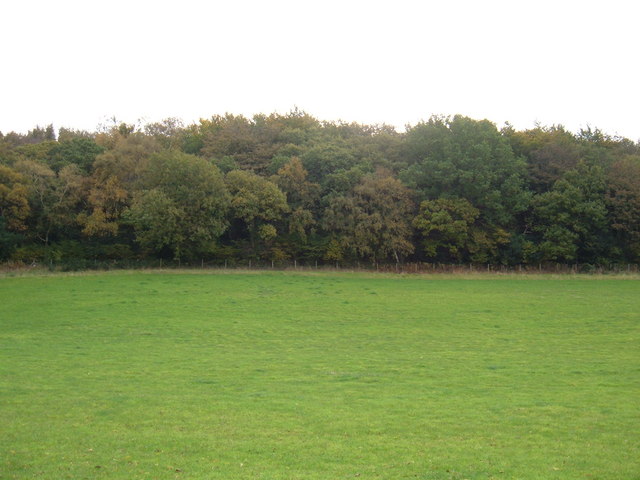
116:Raincliffe Woods - geograph.org.uk - 1547078.jpg
56:(640 × 480 pixels, file size: 60 KB, MIME type:
52:Raincliffe_Woods_-_geograph.org.uk_-_1547078.jpg
443:
423:https://creativecommons.org/licenses/by-sa/2.0
71:
857:https:\/\/www.geograph.org.uk\/photo\/1547078
548:https:\/\/www.geograph.org.uk\/profile\/35313
429:Creative Commons Attribution-Share Alike 2.0
347:
131:
113:
152:
141:
14:
955:
768:
389:– to copy, distribute and transmit the work
1098:The following other wikis use this file:
933:https://www.geograph.org.uk/photo/1547078
620:https://www.geograph.org.uk/profile/35313
469:You can remove this template by clicking
287:View this and other nearby images on:
237:View this and other nearby images on:
190:
102:
334:and is licensed for reuse under the
255:
205:
1014:
370:Attribution-Share Alike 2.0 Generic
358:
353:
338:Attribution-ShareAlike 2.0 license.
13:
1116:
505:
499:
344:
321:
120:
103:
49:
1142:
1123:
504:
1082:
779:coordinates of the point of view
761:coordinates of the point of view
490:
448:
400:Under the following conditions:
365:This file is licensed under the
357:
352:
346:
314:
293:
279:
271:
243:
229:
221:
70:
31:
21:
487:
121:
46:No higher resolution available.
1093:
1018:
883:file available on the internet
833:file available on the internet
486:
322:This image was taken from the
26:
1:
966:coordinates of depicted place
948:coordinates of depicted place
36:
1078:
903:Geograph Britain and Ireland
841:Geograph Britain and Ireland
585:object of statement has role
532:object of statement has role
512:Items portrayed in this file
306:
270:
220:
7:
1113:
794:54°17'11.15"N, 0°28'14.52"W
10:
1147:
1102:Usage on www.wikidata.org
981:54°17'9.17"N, 0°28'12.36"W
447:
414:same or compatible license
110:
105:
1015:
16:
911:geograph.org.uk image ID
845:geograph.org.uk image ID
489:
380:
77:This is a file from the
41:
1072:
473:(or on the first line).
168:required by the license
134:
81:. Information from its
328:this photograph's page
299:54.285880; -0.470100
249:54.286430; -0.470700
84:description page there
196:JThomas /
177:JThomas /
1051:10:37, 3 March 2011
395:– to adapt the work
600:author name string
540:author name string
1134:
1133:
1094:Global file usage
1076:
957:
770:
693:copyright license
679:copyright license
498:
479:
478:
343:
342:
326:collection. See
304:
303:
254:
253:
203:
202:
171:
99:
98:
79:Wikimedia Commons
32:Global file usage
1138:
1124:
1088:Raincliffe Woods
1063:
1025:
1003:
1002:
997:
935:
930:
926:described at URL
920:
915:
905:
900:
853:described at URL
816:
815:
810:
649:copyright status
635:copyright status
622:
617:
607:
604:
594:
589:
496:
452:
451:
445:
444:
436:
433:
430:
427:
424:
416:as the original.
378:
367:Creative Commons
361:
360:
356:
355:
350:
349:
336:Creative Commons
324:Geograph project
318:
311:
300:
297:
283:
282:
276:
275:
274:
268:
267:
256:
250:
247:
233:
232:
226:
225:
224:
218:
217:
206:
198:Raincliffe Woods
179:Raincliffe Woods
165:
137:
126:Raincliffe Woods
125:
117:
111:
95:
74:
73:
67:
61:
59:
1146:
1145:
1141:
1140:
1139:
1137:
1136:
1135:
1112:
1092:
1084:
1077:
1069:
1061:
1017:
1016:
1013:
1012:
1011:
1010:
1009:
1008:
1007:
1006:
1005:
1004:
1000:
998:
995:
986:
985:
984:
982:
972:
971:
970:
968:
945:
944:
943:
942:
941:
940:
939:
938:
937:
936:
931:
928:
922:
921:
916:
913:
907:
906:
901:
898:
889:
888:
887:
885:
873:
872:
871:
869:
826:
825:
824:
823:
822:
821:
820:
819:
818:
817:
813:
811:
808:
799:
798:
797:
795:
785:
784:
783:
781:
758:
757:
756:
755:
754:
753:
752:
751:
749:
748:20 October 2009
739:
738:
737:
735:
720:
719:
718:
717:
716:
715:
714:
713:
711:
699:
698:
697:
695:
676:
675:
674:
673:
672:
671:
670:
669:
667:
655:
654:
653:
651:
632:
631:
630:
629:
628:
627:
626:
625:
624:
623:
618:
615:
609:
608:
605:
602:
596:
595:
590:
587:
578:
577:
576:
574:
564:
563:
562:
560:
525:
524:
523:
522:
521:
519:
503:
502:
501:
484:
480:
449:
438:
437:
434:
431:
428:
425:
422:
421:
379:
376:
373:
362:
339:
309:
298:
272:
263:
262:
259:Object location
248:
222:
213:
212:
209:Camera location
204:
193:
186:
174:
147:geograph.org.uk
136:20 October 2009
127:
115:
108:
101:
100:
89:
88:
87:is shown below.
63:
57:
55:
48:
47:
12:
11:
5:
1144:
1132:
1131:
1128:
1115:
1111:
1110:
1109:
1108:
1095:
1091:
1090:
1080:
1075:
1074:
1071:
1067:
1064:
1058:
1053:
1048:
1044:
1043:
1040:
1037:
1034:
1031:
1028:
1020:
991:
990:
989:
988:
987:
983:
980:
978:
977:
976:
974:
973:
969:
964:
962:
961:
960:
959:
953:
949:
924:
923:
909:
908:
894:
893:
892:
891:
890:
886:
881:
879:
878:
877:
875:
874:
870:
867:source of file
865:
863:
862:
861:
860:
858:
854:
850:
846:
842:
838:
834:
830:
829:source of file
804:
803:
802:
801:
800:
796:
793:
791:
790:
789:
787:
786:
782:
777:
775:
774:
773:
772:
766:
762:
750:
747:
745:
744:
743:
741:
740:
736:
731:
729:
728:
727:
726:
724:
712:
707:
705:
704:
703:
701:
700:
696:
691:
689:
688:
687:
686:
684:
680:
668:
663:
661:
660:
659:
657:
656:
652:
647:
645:
644:
643:
642:
640:
636:
611:
610:
598:
597:
583:
582:
581:
580:
579:
575:
572:
570:
569:
568:
566:
565:
561:
556:
554:
553:
552:
551:
549:
545:
541:
537:
533:
529:
520:
515:
513:
510:
509:
508:
507:
495:
494:
491:
488:
477:
476:
475:
474:
467:
453:
442:
420:
419:
418:
417:
407:
398:
397:
396:
390:
383:You are free:
374:
364:
363:
345:
341:
340:
319:
308:
305:
302:
301:
291:
285:
260:
252:
251:
241:
235:
210:
201:
200:
194:
191:
188:
187:
182:
175:
172:
160:
159:
154:
150:
149:
143:
139:
138:
133:
129:
128:
118:
109:
107:
104:
97:
96:
75:
65:
64:
45:
40:
39:
34:
29:
24:
19:
9:
6:
4:
3:
2:
1143:
1129:
1126:
1125:
1122:
1119:
1107:
1104:
1103:
1101:
1100:
1099:
1089:
1086:
1085:
1070:
1065:
1059:
1057:
1054:
1052:
1049:
1046:
1045:
1041:
1038:
1035:
1032:
1029:
1027:
1026:
1024:
994:
979:
967:
963:
934:
927:
919:
912:
904:
897:
884:
880:
868:
864:
807:
792:
780:
776:
746:
734:
730:
710:
706:
694:
690:
666:
662:
650:
646:
621:
614:
601:
593:
586:
571:
559:
555:
518:
514:
511:
492:
485:
483:
482:
472:
468:
465:
464:
463:
461:
457:
454:
446:
441:
440:
426:CC BY-SA 2.0
415:
411:
408:
405:
402:
401:
399:
394:
391:
388:
385:
384:
382:
381:
375:Attribution:
371:
368:
351:
337:
333:
329:
325:
320:
317:
313:
312:
296:
292:
290:
289:OpenStreetMap
286:
284:
266:
261:
258:
257:
246:
242:
240:
239:OpenStreetMap
236:
234:
216:
211:
208:
207:
199:
195:
189:
185:
181: /
180:
176:
169:
164:
162:
161:
158:
155:
151:
148:
144:
140:
130:
124:
119:
112:
93:
86:
85:
80:
76:
69:
68:
62:
53:
44:
38:
35:
33:
30:
28:
25:
23:
20:
18:
15:
1120:
1117:
1097:
1022:
1019:File history
592:photographer
536:photographer
481:
458:
455:
439:
409:
403:
392:
386:
331:
269:
219:
197:
184:CC BY-SA 2.0
178:
122:
92:You can help
82:
50:
22:File history
1068:GeographBot
665:copyrighted
639:copyrighted
410:share alike
404:attribution
163:Attribution
114:Description
1127:_error
1079:File usage
1060:640 × 480
1036:Dimensions
573:some value
58:image/jpeg
27:File usage
1033:Thumbnail
1030:Date/Time
733:inception
723:inception
307:Licensing
192:InfoField
173:InfoField
123:English:
1114:Metadata
1106:Q7284767
896:operator
837:operator
493:Captions
393:to remix
387:to share
372:license.
37:Metadata
1062:(60 KB)
1047:current
1042:Comment
993:heading
952:heading
918:1547078
849:1547078
806:heading
765:heading
606:JThomas
558:creator
528:creator
517:depicts
497:English
377:JThomas
332:JThomas
157:JThomas
106:Summary
54:
1001:degree
956:degree
814:degree
769:degree
277:
227:
153:Author
142:Source
145:From
1039:User
999:135
812:135
471:here
460:here
435:true
432:true
132:Date
17:File
613:URL
544:URL
996::
929::
914::
899::
809::
616::
603::
588::
1130:0
462:.
170:)
166:(
94:.
60:)
Text is available under the Creative Commons Attribution-ShareAlike License. Additional terms may apply.
_heading:135.00&language=en)
_heading:135.00&language=en)
