303:
43:
309:
314:
103:
477:"}},"text\/plain":{"en":{"":"copyright license"}}},"{\"value\":{\"entity-type\":\"item\",\"numeric-id\":19068220,\"id\":\"Q19068220\"},\"type\":\"wikibase-entityid\"}":{"text\/html":{"en":{"P275":"
433:"}},"text\/plain":{"en":{"":"copyright status"}}},"{\"value\":{\"entity-type\":\"item\",\"numeric-id\":50423863,\"id\":\"Q50423863\"},\"type\":\"wikibase-entityid\"}":{"text\/html":{"en":{"P6216":"
429:
589:
559:
355:– You must give appropriate credit, provide a link to the license, and indicate if changes were made. You may do so in any reasonable manner, but not in any way that suggests the licensor endorses you or your use.
263:
478:
434:
430:
474:
841:
751:
481:"}},"text\/plain":{"en":{"P275":"Creative Commons Attribution-ShareAlike 2.0 Generic"}}}}": -->
229:
504:
460:
864:
This file contains additional information, probably added from the digital camera or scanner used to create or digitize it.
362:
444:
69:
211:
190:
65:
61:
57:
53:
47:
488:
419:
641:
114:
618:
613:
588:
583:
324:
82:
867:
If the file has been modified from its original state, some details may not fully reflect the modified file.
262:
361:– If you remix, transform, or build upon the material, you must distribute your contributions under the
437:"}},"text\/plain":{"en":{"P6216":"copyrighted"}}}}": -->
654:
The following pages on the
English Knowledge use this file (pages on other projects are not listed):
122:
731:
321:
8:
836:
816:
215:
206:
736:
558:
553:
73:
42:
629:
599:
569:
109:
409:
286:
895:
752:
Knowledge:Kartenwerkstatt/Archiv/Zurückgewiesene und zurückgestellte Aufträge 2016
746:
637:
154:
498:
454:
761:
658:
526:
Click on a date/time to view the file as it appeared at that time.
766:
606:
St. Gallenkirch hinzu / Panüeler hinzu / einige Höhenangaben hinzu
185:
786:
726:
701:
711:
741:
716:
776:
676:
640:}} |Source ={{own}} Map was created using: * *
826:
806:
691:
167:
97:
796:
721:
696:
756:
403:
Add a one-line explanation of what this file represents
236:
Map data (c) OpenStreetMap (and) contributors, CC-BY-SA
87:(3,154 × 3,857 pixels, file size: 2.71 MB, MIME type:
706:
652:
851:
667:
524:
121:
Commons is a freely licensed media file repository.
732:
505:
Creative
Commons Attribution-ShareAlike 2.0 Generic
479:
Creative
Commons Attribution-ShareAlike 2.0 Generic
281:
686:
289:View the georeferenced map in the Wikimaps Warper
245:
636:{{Information |Description={{de|1=Lagekarte des
372:https://creativecommons.org/licenses/by-sa/2.0
102:
378:Creative Commons Attribution-Share Alike 2.0
302:
224:
163:
139:
199:
173:
14:
338:– to copy, distribute and transmit the work
136:
737:Benutzer Diskussion:Pechristener/Archiv/1
669:The following other wikis use this file:
133:
517:
325:Attribution-Share Alike 2.0 Generic
313:
308:
13:
862:
408:
402:
299:
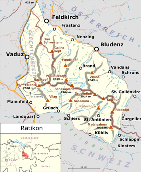
147:
134:
80:
912:
869:
407:
212:File:Switzerland location map.svg
653:
393:
349:Under the following conditions:
320:This file is licensed under the
312:
307:
301:
261:
101:
31:
21:
390:
747:Vorlage:Positionskarte Rätikon
664:
521:
389:
148:
26:
1:
287:
36:
649:
642:Switzerland location map.svg
415:Items portrayed in this file
191:Switzerland location map.svg
7:
859:
793:Usage on it.wikivoyage.org
773:Usage on de.wikivoyage.org
762:Valser Bach (Taschinasbach)
673:Usage on als.wikipedia.org
10:
917:
848:Usage on www.wikidata.org
833:Usage on uk.wikipedia.org
823:Usage on sv.wikipedia.org
813:Usage on ru.wikipedia.org
803:Usage on no.wikipedia.org
783:Usage on it.wikipedia.org
683:Usage on de.wikipedia.org
363:same or compatible license
249:
518:
272:
252:
240:
181:Map was created using:
178:
16:
392:
329:
108:This is a file from the
41:
635:
605:
575:
112:. Information from its
576:neutralere Locationmap
554:16:07, 23 October 2017
241: Geotemporal data
115:description page there
46:Size of this preview:
873:Horizontal resolution
767:Girenspitz (Schuders)
614:19:07, 17 March 2015
584:23:39, 18 March 2015
74:3,154 × 3,857 pixels
70:1,675 × 2,048 pixels
881:Vertical resolution
787:Catena del Reticone
344:– to adapt the work
52:Other resolutions:
644:for location ma...
66:837 × 1,024 pixels
904:
903:
842:Категорія:Ретікон
665:Global file usage
647:
489:copyright license
475:copyright license
401:
297:
296:
277:
276:
233:
230:Reusing this file
130:
129:
110:Wikimedia Commons
32:Global file usage
908:
898:
896:www.inkscape.org
870:
626:
596:
566:
528:
445:copyright status
431:copyright status
399:
385:
382:
379:
376:
373:
365:as the original.
322:Creative Commons
316:
315:
311:
310:
305:
304:
293:
291:
290:
265:
250:
227:
193:for location map
180:
169:
152:
143:
137:
126:
105:
104:
98:
92:
90:
77:
62:628 × 768 pixels
58:392 × 480 pixels
54:196 × 240 pixels
48:490 × 599 pixels
916:
915:
911:
910:
909:
907:
906:
905:
894:
858:
663:
655:
648:
632:
624:
602:
594:
572:
564:
520:
519:
516:
515:
514:
513:
512:
511:
510:
509:
507:
495:
494:
493:
491:
472:
471:
470:
469:
468:
467:
466:
465:
463:
451:
450:
449:
447:
428:
427:
426:
425:
424:
422:
406:
405:
404:
387:
386:
383:
380:
377:
374:
371:
370:
328:
317:
298:
288:
285:
273:S: 46.8003449°N
253:N: 47.3005677°N
220:
186:Open Street Map
159:
158:
142:Rätikon map.png
141:
132:
131:
120:
119:
118:is shown below.
94:
88:
86:
79:
78:
51:
12:
11:
5:
914:
902:
901:
900:
899:
890:
886:
885:
882:
878:
877:
874:
861:
857:
856:
855:
854:
846:
845:
844:
839:
831:
830:
829:
821:
820:
819:
811:
810:
809:
801:
800:
799:
791:
790:
789:
781:
780:
779:
771:
770:
769:
764:
759:
754:
749:
744:
739:
734:
729:
727:Carschinahütte
724:
719:
717:Alvier (Fluss)
714:
709:
704:
699:
694:
689:
681:
680:
679:
666:
662:
661:
651:
646:
645:
634:
630:
627:
623:3,364 × 4,114
621:
616:
611:
608:
607:
604:
600:
597:
593:3,364 × 4,114
591:
586:
581:
578:
577:
574:
570:
567:
563:3,154 × 3,857
561:
556:
551:
547:
546:
543:
540:
537:
534:
531:
523:
508:
503:
501:
500:
499:
497:
496:
492:
487:
485:
484:
483:
482:
480:
476:
464:
459:
457:
456:
455:
453:
452:
448:
443:
441:
440:
439:
438:
436:
432:
423:
418:
416:
413:
412:
411:
410:
398:
397:
394:
391:
369:
368:
367:
366:
356:
347:
346:
345:
339:
332:You are free:
319:
318:
300:
295:
294:
283:
282:Georeferencing
279:
278:
275:
274:
270:
269:
268:E: 9.9998828°E
266:
259:
255:
254:
247:
243:
242:
238:
237:
234:
222:
221:
219:
218:
209:
203:
201:
197:
196:
195:
194:
188:
175:
171:
170:
165:
161:
160:
153:Lagekarte des
146:
144:
135:
128:
127:
106:
96:
95:
45:
40:
39:
34:
29:
24:
19:
9:
6:
4:
3:
2:
913:
897:
893:
892:
891:
889:Software used
888:
887:
883:
880:
879:
875:
872:
871:
868:
865:
853:
850:
849:
847:
843:
840:
838:
835:
834:
832:
828:
825:
824:
822:
818:
815:
814:
812:
808:
805:
804:
802:
798:
795:
794:
792:
788:
785:
784:
782:
778:
775:
774:
772:
768:
765:
763:
760:
758:
755:
753:
750:
748:
745:
743:
740:
738:
735:
733:
730:
728:
725:
723:
720:
718:
715:
713:
710:
708:
705:
703:
702:Panüeler Kopf
700:
698:
695:
693:
690:
688:
685:
684:
682:
678:
675:
674:
672:
671:
670:
660:
657:
656:
643:
639:
633:
628:
622:
620:
617:
615:
612:
610:
609:
603:
598:
592:
590:
587:
585:
582:
580:
579:
573:
568:
562:
560:
557:
555:
552:
549:
548:
544:
541:
538:
535:
532:
530:
529:
527:
506:
502:
490:
486:
462:
458:
446:
442:
421:
417:
414:
395:
388:
375:CC BY-SA 2.0
364:
360:
357:
354:
351:
350:
348:
343:
340:
337:
334:
333:
331:
330:
326:
323:
306:
292:
284:
280:
271:
267:
264:
260:
258:W: 9.399292°E
257:
256:
251:
248:
244:
239:
235:
231:
226:
223:
217:
213:
210:
208:
205:
204:
202:
198:
192:
189:
187:
184:
183:
182:
176:
172:
168:17 March 2015
166:
162:
156:
151:
145:
138:
124:
117:
116:
111:
107:
100:
99:
93:
84:
83:Original file
75:
71:
67:
63:
59:
55:
49:
44:
38:
35:
33:
30:
28:
25:
23:
20:
18:
15:
866:
863:
668:
631:Pechristener
601:Pechristener
571:Pechristener
525:
522:File history
358:
352:
341:
335:
246:Bounding box
216:NordNordWest
207:Pechristener
177:
149:
123:You can help
113:
81:
22:File history
722:Scheienfluh
712:Totalphütte
697:Schesaplana
461:copyrighted
435:copyrighted
359:share alike
353:attribution
140:Description
797:Vorarlberg
757:Partnunsee
650:File usage
638:de:Rätikon
539:Dimensions
225:Permission
27:File usage
884:68.21 dpc
876:68.21 dpc
742:Gänglesee
625:(2.93 MB)
595:(2.99 MB)
565:(2.71 MB)
536:Thumbnail
533:Date/Time
150:Deutsch:
89:image/png
860:Metadata
707:Sulzfluh
396:Captions
342:to remix
336:to share
327:license.
179:Own work
155:Rätikons
37:Metadata
852:Q659729
837:Ретікон
827:Rätikon
817:Ретикон
807:Rätikon
777:Rätikon
692:Rätikon
677:Rätikon
659:Rätikon
550:current
545:Comment
420:depicts
400:English
200:Creator
85:
174:Source
687:Zimba
542:User
384:true
381:true
164:Date
17:File
214::
72:|
68:|
64:|
60:|
56:|
50:.
232:)
228:(
157:.
125:.
91:)
76:.
Text is available under the Creative Commons Attribution-ShareAlike License. Additional terms may apply.
