209:
215:
220:
86:
383:"}},"text\/plain":{"en":{"":"copyright license"}}},"{\"value\":{\"entity-type\":\"item\",\"numeric-id\":19068220,\"id\":\"Q19068220\"},\"type\":\"wikibase-entityid\"}":{"text\/html":{"en":{"P275":"
339:"}},"text\/plain":{"en":{"":"copyright status"}}},"{\"value\":{\"entity-type\":\"item\",\"numeric-id\":50423863,\"id\":\"Q50423863\"},\"type\":\"wikibase-entityid\"}":{"text\/html":{"en":{"P6216":"
38:
335:
465:
512:{{Information |Description= {{en|OpenSeaMap - nautical chart of Kiel Fjord (Germany) from Laboe to Mole Stickenhörn.}} {{de|OpenSeaMap - Kartenausschnitt Kieler Förde: Laboe, Leuchtfeuer Friedrichsort, Sportboothafen Stickenhörn}} |Source=[http://www.o
261:– You must give appropriate credit, provide a link to the license, and indicate if changes were made. You may do so in any reasonable manner, but not in any way that suggests the licensor endorses you or your use.
384:
340:
336:
380:
387:"}},"text\/plain":{"en":{"P275":"Creative Commons Attribution-ShareAlike 2.0 Generic"}}}}": -->
187:
168:
52:
48:
42:
410:
366:
97:
65:
268:
350:
394:
325:
494:
489:
574:
230:
267:– If you remix, transform, or build upon the material, you must distribute your contributions under the
148:
OpenSeaMap - Kartenausschnitt Kieler Förde: Laboe, Leuchtfeuer
Friedrichsort, Sportboothafen Stickenhörn
343:"}},"text\/plain":{"en":{"P6216":"copyrighted"}}}}": -->
522:
The following pages on the
English Knowledge use this file (pages on other projects are not listed):
105:
464:
459:
227:
56:
37:
8:
92:
315:
140:
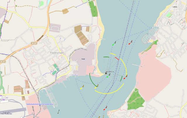
OpenSeaMap - nautical chart of Kiel Fjord (Germany) from Laboe to Mole
Stickenhörn.
526:
505:
475:
404:
360:
564:
432:
Click on a date/time to view the file as it appeared at that time.
584:
554:
80:
599:
544:
309:
Add a one-line explanation of what this file represents
520:
535:
430:
104:
Commons is a freely licensed media file repository.
411:
Creative
Commons Attribution-ShareAlike 2.0 Generic
385:
Creative
Commons Attribution-ShareAlike 2.0 Generic
70:(862 × 545 pixels, file size: 410 KB, MIME type:
594:
159:date QS:P,+2009-00-00T00:00:00Z/9,P1480,Q5727902
278:https://creativecommons.org/licenses/by-sa/2.0
85:
284:Creative Commons Attribution-Share Alike 2.0
208:
182:
153:
127:
174:
164:
14:
244:– to copy, distribute and transmit the work
537:The following other wikis use this file:
116:
423:
231:Attribution-Share Alike 2.0 Generic
219:
214:
13:
314:
308:
205:
142:
134:
117:
63:
613:
313:
521:
299:
255:Under the following conditions:
226:This file is licensed under the
218:
213:
207:
84:
31:
21:
296:
135:
532:
427:
295:
143:
26:
1:
517:
321:Items portrayed in this file
201:
7:
10:
618:
591:Usage on no.wikipedia.org
581:Usage on nl.wikipedia.org
571:Usage on mk.wikipedia.org
561:Usage on lv.wikipedia.org
551:Usage on hr.wikipedia.org
541:Usage on da.wikipedia.org
269:same or compatible license
124:
119:
424:
178:Mitarbeiter des Projekts.
130:OpenSeaMap Kiel Fjord.png
16:
298:
235:
91:This is a file from the
36:
511:
481:
156:
95:. Information from its
98:description page there
41:Size of this preview:
565:Piekrastes navigācija
585:Zichtbaarheidssector
490:09:58, 21 June 2009
460:10:02, 21 June 2009
250:– to adapt the work
47:Other resolutions:
533:Global file usage
515:
395:copyright license
381:copyright license
307:
198:
197:
191:
188:Reusing this file
113:
112:
93:Wikimedia Commons
32:Global file usage
609:
502:
472:
434:
351:copyright status
337:copyright status
305:
291:
288:
285:
282:
279:
271:as the original.
228:Creative Commons
222:
221:
217:
216:
211:
210:
185:
147:
139:
131:
125:
109:
88:
87:
81:
75:
73:
60:
57:862 × 545 pixels
53:640 × 405 pixels
49:320 × 202 pixels
43:800 × 506 pixels
617:
616:
612:
611:
610:
608:
607:
606:
531:
523:
516:
508:
500:
478:
470:
426:
425:
422:
421:
420:
419:
418:
417:
416:
415:
413:
401:
400:
399:
397:
378:
377:
376:
375:
374:
373:
372:
371:
369:
357:
356:
355:
353:
334:
333:
332:
331:
330:
328:
312:
311:
310:
293:
292:
289:
286:
283:
280:
277:
276:
234:
223:
204:
199:
160:
149:
141:
129:
122:
115:
114:
103:
102:
101:is shown below.
77:
71:
69:
62:
61:
46:
12:
11:
5:
615:
605:
604:
603:
602:
597:
589:
588:
587:
579:
578:
577:
569:
568:
567:
559:
558:
557:
549:
548:
547:
534:
530:
529:
519:
514:
513:
510:
506:
503:
497:
492:
487:
484:
483:
480:
476:
473:
467:
462:
457:
453:
452:
449:
446:
443:
440:
437:
429:
414:
409:
407:
406:
405:
403:
402:
398:
393:
391:
390:
389:
388:
386:
382:
370:
365:
363:
362:
361:
359:
358:
354:
349:
347:
346:
345:
344:
342:
338:
329:
324:
322:
319:
318:
317:
316:
304:
303:
300:
297:
275:
274:
273:
272:
262:
253:
252:
251:
245:
238:You are free:
225:
224:
206:
203:
200:
196:
195:
192:
180:
179:
176:
172:
171:
166:
162:
161:
158:
155:
151:
150:
132:
123:
121:
118:
111:
110:
89:
79:
78:
40:
35:
34:
29:
24:
19:
9:
6:
4:
3:
2:
614:
601:
598:
596:
593:
592:
590:
586:
583:
582:
580:
576:
573:
572:
570:
566:
563:
562:
560:
556:
555:Kielski förde
553:
552:
550:
546:
543:
542:
540:
539:
538:
528:
525:
524:
509:
504:
498:
496:
493:
491:
488:
486:
485:
479:
474:
468:
466:
463:
461:
458:
455:
454:
450:
447:
444:
441:
438:
436:
435:
433:
412:
408:
396:
392:
368:
364:
352:
348:
327:
323:
320:
301:
294:
281:CC BY-SA 2.0
270:
266:
263:
260:
257:
256:
254:
249:
246:
243:
240:
239:
237:
236:
232:
229:
212:
194:CC-BY-SA-2.0.
193:
189:
184:
181:
177:
173:
170:
167:
163:
152:
146:
138:
133:
126:
107:
100:
99:
94:
90:
83:
82:
76:
67:
66:Original file
58:
54:
50:
44:
39:
33:
30:
28:
25:
23:
20:
18:
15:
575:Килски Фјорд
536:
527:Kieler Förde
431:
428:File history
264:
258:
247:
241:
144:
136:
106:You can help
96:
64:
22:File history
600:Lyskarakter
545:Fyrkarakter
367:copyrighted
341:copyrighted
265:share alike
259:attribution
128:Description
518:File usage
499:400 × 400
482:other file
469:862 × 545
445:Dimensions
183:Permission
169:OpenSeaMap
157:circa 2009
27:File usage
442:Thumbnail
439:Date/Time
202:Licensing
145:Deutsch:
137:English:
72:image/png
501:(147 KB)
471:(410 KB)
302:Captions
248:to remix
242:to share
233:license.
456:current
451:Comment
326:depicts
306:English
120:Summary
68:
507:Mattes
477:Mattes
175:Author
165:Source
448:User
290:true
287:true
154:Date
17:File
595:Fyr
55:|
51:|
45:.
190:)
186:(
108:.
74:)
59:.


