781:"}},"text\/plain":{"en":{"":"coordinates of depicted place"}}},"{\"value\":{\"latitude\":54.133,\"longitude\":-3.279,\"altitude\":null,\"precision\":0.0001,\"globe\":\"http:\\\/\\\/www.wikidata.org\\\/entity\\\/Q2\"},\"type\":\"globecoordinate\"}":{"text\/html":{"en":{"P9149":"54\u00b07'58.8"N, 3\u00b016'44.4"W"}},"text\/plain":{"en":{"P9149":"54\u00b07'58.8\"N, 3\u00b016'44.4\"W"}}}}": -->
441:"}},"text\/plain":{"en":{"":"author name string"}}},"{\"value\":\"Chris Upson\",\"type\":\"string\"}":{"text\/html":{"en":{"P2093":"Chris Upson"}},"text\/plain":{"en":{"P2093":"Chris Upson"}}},"{\"value\":{\"entity-type\":\"property\",\"numeric-id\":3831,\"id\":\"P3831\"},\"type\":\"wikibase-entityid\"}":{"text\/html":{"en":{"":"
624:"}},"text\/plain":{"en":{"":"inception"}}},"{\"value\":{\"time\":\"+2006-07-24T00:00:00Z\",\"timezone\":0,\"before\":0,\"after\":0,\"precision\":11,\"calendarmodel\":\"http:\\\/\\\/www.wikidata.org\\\/entity\\\/Q1985727\"},\"type\":\"time\"}":{"text\/html":{"en":{"P571":"24 July 2006"}},"text\/plain":{"en":{"P571":"24 July 2006"}}}}": -->
658:
425:
237:
261:
299:
304:
72:
947:"}},"text\/plain":{"en":{"":"ISO speed"}}},"{\"value\":{\"amount\":\"+100\",\"unit\":\"1\"},\"type\":\"quantity\"}":{"text\/html":{"en":{"P6789":"100"}},"text\/plain":{"en":{"P6789":"100"}}}}": -->
864:"}},"text\/plain":{"en":{"":"f-number"}}},"{\"value\":{\"amount\":\"+2.8\",\"unit\":\"1\"},\"type\":\"quantity\"}":{"text\/html":{"en":{"P6790":"2.8"}},"text\/plain":{"en":{"P6790":"2.8"}}}}": -->
819:"}},"text\/plain":{"en":{"":"exposure time"}}},"{\"value\":{\"amount\":\"+0.00448631673396141767\",\"unit\":\"http:\\\/\\\/www.wikidata.org\\\/entity\\\/Q11574\"},\"type\":\"quantity\"}":{"text\/html":{"en":{"P6757":"0.00448631673396141767
437:"}},"text\/plain":{"en":{"P2699":"https:\/\/www.geograph.org.uk\/profile\/2067"}}},"{\"value\":{\"entity-type\":\"property\",\"numeric-id\":2093,\"id\":\"P2093\"},\"type\":\"wikibase-entityid\"}":{"text\/html":{"en":{"":"
666:"}},"text\/plain":{"en":{"P7482":"file available on the internet"}}},"{\"value\":{\"entity-type\":\"property\",\"numeric-id\":137,\"id\":\"P137\"},\"type\":\"wikibase-entityid\"}":{"text\/html":{"en":{"":"
674:"}},"text\/plain":{"en":{"P137":"Geograph Britain and Ireland"}}},"{\"value\":{\"entity-type\":\"property\",\"numeric-id\":7384,\"id\":\"P7384\"},\"type\":\"wikibase-entityid\"}":{"text\/html":{"en":{"":"
445:"}},"text\/plain":{"en":{"":"object of statement has role"}}},"{\"value\":{\"entity-type\":\"item\",\"numeric-id\":33231,\"id\":\"Q33231\"},\"type\":\"wikibase-entityid\"}":{"text\/html":{"en":{"P3831":"
985:"}},"text\/plain":{"en":{"":"media type"}}},"{\"value\":\"image\\\/jpeg\",\"type\":\"string\"}":{"text\/html":{"en":{"P1163":"image\/jpeg"}},"text\/plain":{"en":{"P1163":"image\/jpeg"}}}}": -->
580:"}},"text\/plain":{"en":{"":"copyright license"}}},"{\"value\":{\"entity-type\":\"item\",\"numeric-id\":19068220,\"id\":\"Q19068220\"},\"type\":\"wikibase-entityid\"}":{"text\/html":{"en":{"P275":"
536:"}},"text\/plain":{"en":{"":"copyright status"}}},"{\"value\":{\"entity-type\":\"item\",\"numeric-id\":50423863,\"id\":\"Q50423863\"},\"type\":\"wikibase-entityid\"}":{"text\/html":{"en":{"P6216":"
662:"}},"text\/plain":{"en":{"":"source of file"}}},"{\"value\":{\"entity-type\":\"item\",\"numeric-id\":74228490,\"id\":\"Q74228490\"},\"type\":\"wikibase-entityid\"}":{"text\/html":{"en":{"P7482":"
902:"}},"text\/plain":{"en":{"":"focal length"}}},"{\"value\":{\"amount\":\"+5.8\",\"unit\":\"http:\\\/\\\/www.wikidata.org\\\/entity\\\/Q174789\"},\"type\":\"quantity\"}":{"text\/html":{"en":{"P2151":"5.8
1023:"}},"text\/plain":{"en":{"":"instance of"}}},"{\"value\":{\"entity-type\":\"item\",\"numeric-id\":125191,\"id\":\"Q125191\"},\"type\":\"wikibase-entityid\"}":{"text\/html":{"en":{"P31":"
670:"}},"text\/plain":{"en":{"":"operator"}}},"{\"value\":{\"entity-type\":\"item\",\"numeric-id\":1503119,\"id\":\"Q1503119\"},\"type\":\"wikibase-entityid\"}":{"text\/html":{"en":{"P137":"
682:"}},"text\/plain":{"en":{"P7384":"209770"}}},"{\"value\":{\"entity-type\":\"property\",\"numeric-id\":973,\"id\":\"P973\"},\"type\":\"wikibase-entityid\"}":{"text\/html":{"en":{"":"
429:"}},"text\/plain":{"en":{"":"creator"}}},"{\"value\":{\"entity-type\":\"property\",\"numeric-id\":2699,\"id\":\"P2699\"},\"type\":\"wikibase-entityid\"}":{"text\/html":{"en":{"":"
1105:
981:
678:"}},"text\/plain":{"en":{"":"geograph.org.uk image ID"}}},"{\"value\":\"209770\",\"type\":\"string\"}":{"text\/html":{"en":{"P7384":"
214:
351:– You must give appropriate credit, provide a link to the license, and indicate if changes were made. You may do so in any reasonable manner, but not in any way that suggests the licensor endorses you or your use.
1122:== {{int:filedesc}} == {{Information |description={{en|1=North Walney Beach. Looking north towards Black Combe}} |date=2006-07-24 |source=From |author=[http://www.geograph.org.uk/profile/2067 Chris
220:
679:
663:
581:
537:
83:
671:
51:
1024:
446:
982:
944:
899:
861:
816:
778:
675:
659:
533:
442:
438:
430:
687:
683:
667:
621:
577:
434:
426:
1020:
1115:
584:"}},"text\/plain":{"en":{"P275":"Creative Commons Attribution-ShareAlike 2.0 Generic"}}}}": -->
1278:
690:"}},"text\/plain":{"en":{"P973":"https:\/\/www.geograph.org.uk\/photo\/209770"}}}}": -->
713:
607:
563:
230:
733:
268:
1172:
This file contains additional information, probably added from the digital camera or scanner used to create or digitize it.
1050:
358:
518:
992:
954:
913:
871:
830:
788:
741:
697:
547:
511:
498:
483:
823:"}},"text\/plain":{"en":{"P6757":"0.00448631673396141767 second"}}}}": -->
756:
726:
631:
591:
456:
415:
1034:
1104:
1099:
42:
1309:
314:
1175:
If the file has been modified from its original state, some details may not fully reflect the modified file.
906:"}},"text\/plain":{"en":{"P2151":"5.8 millimetre"}}}}": -->
357:– If you remix, transform, or build upon the material, you must distribute your contributions under the
275:
on the
Geograph website for the photographer's contact details. The copyright on this image is owned by
449:"}},"text\/plain":{"en":{"P3831":"photographer"}}}}": -->
540:"}},"text\/plain":{"en":{"P6216":"copyrighted"}}}}": -->
1159:
1132:
The following pages on the
English Knowledge use this file (pages on other projects are not listed):
1027:"}},"text\/plain":{"en":{"P31":"photograph"}}}}": -->
91:
183:
1336:
763:
748:
490:
311:
167:
8:
1372:
255:
236:
1445:
1136:
280:
78:
405:
1408:
1354:
1201:
1455:
1418:
1241:
156:
146:
1382:
1044:
1002:
964:
923:
881:
840:
798:
707:
641:
601:
557:
466:
260:
1221:
1141:
272:
1465:
1211:
1072:
Click on a date/time to view the file as it appeared at that time.
222:
1194:
1184:
215:
54° 07′ 59″ N, 3° 16′ 44″ W
135:
66:
399:
Add a one-line explanation of what this file represents
1130:
126:
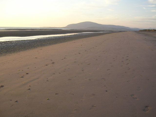
North Walney Beach. Looking north towards Black Combe
1150:
1070:
90:
Commons is a freely licensed media file repository.
608:
Creative
Commons Attribution-ShareAlike 2.0 Generic
582:
Creative
Commons Attribution-ShareAlike 2.0 Generic
116:North Walney Beach - geograph.org.uk - 209770.jpg
52:North_Walney_Beach_-_geograph.org.uk_-_209770.jpg
56:(640 × 480 pixels, file size: 74 KB, MIME type:
368:https://creativecommons.org/licenses/by-sa/2.0
71:
374:Creative Commons Attribution-Share Alike 2.0
292:
131:
113:
688:https:\/\/www.geograph.org.uk\/photo\/209770
435:https:\/\/www.geograph.org.uk\/profile\/2067
152:
141:
14:
903:
820:
334:– to copy, distribute and transmit the work
1152:The following other wikis use this file:
764:https://www.geograph.org.uk/photo/209770
491:https://www.geograph.org.uk/profile/2067
229:View this and other nearby images on:
190:
102:
279:and is licensed for reuse under the
205:
1063:
315:Attribution-Share Alike 2.0 Generic
303:
298:
283:Attribution-ShareAlike 2.0 license.
13:
1170:
404:
398:
289:
266:
120:
103:
49:
1490:
1206:10/2,229 sec (0.0044863167339614)
1177:
403:
1232:Date and time of data generation
1131:
389:
345:Under the following conditions:
310:This file is licensed under the
302:
297:
291:
259:
235:
221:
70:
31:
21:
386:
121:
46:No higher resolution available.
1147:
1067:
714:file available on the internet
664:file available on the internet
385:
267:This image was taken from the
26:
1:
1377:Flash did not fire, auto mode
789:coordinates of depicted place
779:coordinates of depicted place
36:
1127:
734:Geograph Britain and Ireland
672:Geograph Britain and Ireland
512:object of statement has role
443:object of statement has role
411:Items portrayed in this file
251:
7:
1320:Date and time of digitizing
1167:
1156:Usage on azb.wikipedia.org
10:
1495:
1429:Focal length in 35 mm film
359:same or compatible license
110:
105:
1285:File change date and time
1064:
16:
804:54°7'58.8"N, 3°16'44.4"W
742:geograph.org.uk image ID
676:geograph.org.uk image ID
388:
325:
196:Chris Upson /
177:Chris Upson /
77:This is a file from the
41:
1392:Custom image processing
1121:
846:0.00448631673396141767
168:required by the license
134:
81:. Information from its
1475:Subject distance range
1328:Image compression mode
1100:20:21, 31 January 2010
273:this photograph's page
241:54.133000; -3.279000
84:description page there
1346:Maximum land aperture
1259:Horizontal resolution
1323:20:59, 24 July 2006
1293:Y and C positioning
1288:20:59, 24 July 2006
1267:Vertical resolution
1235:20:59, 24 July 2006
1181:Camera manufacturer
340:– to adapt the work
1437:Scene capture type
1413:Auto white balance
499:author name string
439:author name string
198:North Walney Beach
179:North Walney Beach
1482:
1481:
1148:Global file usage
1137:Barrow-in-Furness
1125:
905:
822:
592:copyright license
578:copyright license
397:
288:
287:
271:collection. See
246:
245:
203:
202:
171:
99:
98:
79:Wikimedia Commons
32:Global file usage
1486:
1301:Exposure Program
1178:
1112:
1074:
932:
849:
766:
761:
757:described at URL
751:
746:
736:
731:
684:described at URL
548:copyright status
534:copyright status
521:
516:
506:
503:
493:
488:
395:
381:
378:
375:
372:
369:
361:as the original.
323:
312:Creative Commons
306:
305:
301:
300:
295:
294:
281:Creative Commons
269:Geograph project
263:
256:
242:
239:
225:
224:
218:
217:
206:
165:
137:
125:
117:
111:
95:
74:
73:
67:
61:
59:
1494:
1493:
1489:
1488:
1487:
1485:
1484:
1483:
1349:3 APEX (f/2.83)
1166:
1146:
1133:
1126:
1118:
1110:
1066:
1065:
1062:
1061:
1060:
1059:
1058:
1057:
1056:
1055:
1053:
1041:
1040:
1039:
1037:
1018:
1017:
1016:
1015:
1014:
1013:
1012:
1011:
1009:
999:
998:
997:
995:
980:
979:
978:
977:
976:
975:
974:
973:
971:
961:
960:
959:
957:
942:
941:
940:
939:
938:
937:
936:
935:
933:
930:
920:
919:
918:
916:
897:
896:
895:
894:
893:
892:
891:
890:
888:
878:
877:
876:
874:
859:
858:
857:
856:
855:
854:
853:
852:
850:
847:
837:
836:
835:
833:
814:
813:
812:
811:
810:
809:
808:
807:
805:
795:
794:
793:
791:
776:
775:
774:
773:
772:
771:
770:
769:
768:
767:
762:
759:
753:
752:
747:
744:
738:
737:
732:
729:
720:
719:
718:
716:
704:
703:
702:
700:
657:
656:
655:
654:
653:
652:
651:
650:
648:
638:
637:
636:
634:
619:
618:
617:
616:
615:
614:
613:
612:
610:
598:
597:
596:
594:
575:
574:
573:
572:
571:
570:
569:
568:
566:
554:
553:
552:
550:
531:
530:
529:
528:
527:
526:
525:
524:
523:
522:
517:
514:
508:
507:
504:
501:
495:
494:
489:
486:
477:
476:
475:
473:
463:
462:
461:
459:
424:
423:
422:
421:
420:
418:
402:
401:
400:
383:
382:
379:
376:
373:
370:
367:
366:
324:
321:
318:
307:
284:
254:
240:
213:
212:
209:Object location
204:
193:
186:
174:
147:geograph.org.uk
127:
115:
108:
101:
100:
89:
88:
87:is shown below.
63:
57:
55:
48:
47:
12:
11:
5:
1492:
1480:
1479:
1476:
1472:
1471:
1468:
1462:
1461:
1458:
1452:
1451:
1448:
1442:
1441:
1438:
1434:
1433:
1430:
1426:
1425:
1422:
1415:
1414:
1411:
1405:
1404:
1401:
1397:
1396:
1395:Normal process
1393:
1389:
1388:
1385:
1379:
1378:
1375:
1369:
1368:
1365:
1361:
1360:
1357:
1351:
1350:
1347:
1343:
1342:
1339:
1333:
1332:
1329:
1325:
1324:
1321:
1317:
1316:
1313:
1306:
1305:
1304:Normal program
1302:
1298:
1297:
1294:
1290:
1289:
1286:
1282:
1281:
1276:
1272:
1271:
1268:
1264:
1263:
1260:
1256:
1255:
1252:
1248:
1247:
1244:
1237:
1236:
1233:
1229:
1228:
1225:
1218:
1217:
1214:
1208:
1207:
1204:
1198:
1197:
1192:
1188:
1187:
1182:
1169:
1165:
1164:
1163:
1162:
1149:
1145:
1144:
1139:
1129:
1124:
1123:
1120:
1116:
1113:
1107:
1102:
1097:
1093:
1092:
1089:
1086:
1083:
1080:
1077:
1069:
1054:
1049:
1047:
1046:
1045:
1043:
1042:
1038:
1033:
1031:
1030:
1029:
1028:
1026:
1022:
1010:
1007:
1005:
1004:
1003:
1001:
1000:
996:
991:
989:
988:
987:
986:
984:
972:
969:
967:
966:
965:
963:
962:
958:
953:
951:
950:
949:
948:
946:
934:
928:
926:
925:
924:
922:
921:
917:
912:
910:
909:
908:
907:
901:
889:
886:
884:
883:
882:
880:
879:
875:
870:
868:
867:
866:
865:
863:
851:
845:
843:
842:
841:
839:
838:
834:
829:
827:
826:
825:
824:
818:
806:
803:
801:
800:
799:
797:
796:
792:
787:
785:
784:
783:
782:
780:
755:
754:
740:
739:
725:
724:
723:
722:
721:
717:
712:
710:
709:
708:
706:
705:
701:
698:source of file
696:
694:
693:
692:
691:
689:
685:
681:
677:
673:
669:
665:
661:
660:source of file
649:
646:
644:
643:
642:
640:
639:
635:
630:
628:
627:
626:
625:
623:
611:
606:
604:
603:
602:
600:
599:
595:
590:
588:
587:
586:
585:
583:
579:
567:
562:
560:
559:
558:
556:
555:
551:
546:
544:
543:
542:
541:
539:
535:
510:
509:
497:
496:
482:
481:
480:
479:
478:
474:
471:
469:
468:
467:
465:
464:
460:
455:
453:
452:
451:
450:
448:
444:
440:
436:
432:
428:
419:
414:
412:
409:
408:
407:
406:
394:
393:
390:
387:
365:
364:
363:
362:
352:
343:
342:
341:
335:
328:You are free:
319:
309:
308:
290:
286:
285:
264:
253:
250:
244:
243:
233:
227:
210:
201:
200:
194:
191:
188:
187:
182:
175:
172:
160:
159:
154:
150:
149:
143:
139:
138:
133:
129:
128:
118:
109:
107:
104:
97:
96:
75:
65:
64:
45:
40:
39:
34:
29:
24:
19:
9:
6:
4:
3:
2:
1491:
1477:
1474:
1473:
1469:
1467:
1464:
1463:
1459:
1457:
1454:
1453:
1449:
1447:
1444:
1443:
1439:
1436:
1435:
1431:
1428:
1427:
1423:
1420:
1417:
1416:
1412:
1410:
1409:White balance
1407:
1406:
1403:Auto exposure
1402:
1400:Exposure mode
1399:
1398:
1394:
1391:
1390:
1386:
1384:
1381:
1380:
1376:
1374:
1371:
1370:
1366:
1363:
1362:
1358:
1356:
1355:Metering mode
1353:
1352:
1348:
1345:
1344:
1340:
1338:
1337:Exposure bias
1335:
1334:
1330:
1327:
1326:
1322:
1319:
1318:
1314:
1311:
1308:
1307:
1303:
1300:
1299:
1295:
1292:
1291:
1287:
1284:
1283:
1280:
1277:
1275:Software used
1274:
1273:
1269:
1266:
1265:
1261:
1258:
1257:
1253:
1250:
1249:
1245:
1243:
1239:
1238:
1234:
1231:
1230:
1226:
1223:
1220:
1219:
1215:
1213:
1210:
1209:
1205:
1203:
1202:Exposure time
1200:
1199:
1196:
1193:
1190:
1189:
1186:
1183:
1180:
1179:
1176:
1173:
1161:
1158:
1157:
1155:
1154:
1153:
1143:
1140:
1138:
1135:
1134:
1119:
1114:
1108:
1106:
1103:
1101:
1098:
1095:
1094:
1090:
1087:
1084:
1081:
1078:
1076:
1075:
1073:
1052:
1048:
1036:
1032:
1006:
994:
990:
968:
956:
952:
927:
915:
911:
885:
873:
869:
844:
832:
831:exposure time
828:
817:exposure time
802:
790:
786:
765:
758:
750:
743:
735:
728:
715:
711:
699:
695:
645:
633:
629:
609:
605:
593:
589:
565:
561:
549:
545:
520:
513:
500:
492:
485:
470:
458:
454:
417:
413:
410:
391:
384:
371:CC BY-SA 2.0
360:
356:
353:
350:
347:
346:
344:
339:
336:
333:
330:
329:
327:
326:
320:Attribution:
316:
313:
296:
282:
278:
274:
270:
265:
262:
258:
257:
249:
248:
238:
234:
232:
231:OpenStreetMap
228:
226:
216:
211:
208:
207:
199:
195:
189:
185:
181: /
180:
176:
169:
164:
162:
161:
158:
155:
151:
148:
144:
140:
130:
124:
119:
112:
93:
86:
85:
80:
76:
69:
68:
62:
53:
44:
38:
35:
33:
30:
28:
25:
23:
20:
18:
15:
1419:Digital zoom
1364:Light source
1242:focal length
1191:Camera model
1174:
1171:
1151:
1071:
1068:File history
914:focal length
900:focal length
647:24 July 2006
519:photographer
447:photographer
354:
348:
337:
331:
276:
247:
197:
184:CC BY-SA 2.0
178:
136:24 July 2006
122:
92:You can help
82:
50:
22:File history
1383:Color space
1251:Orientation
1117:GeographBot
1035:instance of
1021:instance of
564:copyrighted
538:copyrighted
505:Chris Upson
355:share alike
349:attribution
322:Chris Upson
277:Chris Upson
163:Attribution
157:Chris Upson
114:Description
1456:Saturation
1142:Earnse Bay
1128:File usage
1109:640 × 480
1085:Dimensions
1051:photograph
1025:photograph
1008:image/jpeg
993:media type
983:media type
931:millimetre
904:millimetre
472:some value
58:image/jpeg
27:File usage
1466:Sharpness
1279:E3100v1.2
1222:ISO speed
1160:کرکینتیلف
1082:Thumbnail
1079:Date/Time
955:ISO speed
945:ISO speed
632:inception
622:inception
252:Licensing
192:InfoField
173:InfoField
123:English:
1446:Contrast
1440:Standard
1296:Co-sited
1212:F-number
1168:Metadata
872:f-number
862:f-number
727:operator
668:operator
392:Captions
338:to remix
332:to share
317:license.
37:Metadata
1478:Unknown
1367:Unknown
1359:Pattern
1312:version
1270:300 dpi
1262:300 dpi
1111:(74 KB)
1096:current
1091:Comment
457:creator
427:creator
416:depicts
396:English
106:Summary
54:
1470:Normal
1460:Normal
1450:Normal
1254:Normal
1246:5.8 mm
1224:rating
848:second
821:second
749:209770
680:209770
219:
153:Author
142:Source
1432:38 mm
1421:ratio
1373:Flash
1240:Lens
1216:f/2.8
1195:E3100
1185:NIKON
145:From
1387:sRGB
1310:Exif
1088:User
929:5.8
380:true
377:true
132:Date
17:File
1315:2.2
1227:100
970:100
887:2.8
484:URL
431:URL
760::
745::
730::
515::
502::
487::
1424:0
1341:0
1331:2
170:)
166:(
94:.
60:)
_&language=en)
