870:"}},"text\/plain":{"en":{"":"coordinates of the point of view"}}},"{\"value\":{\"latitude\":51.375178,\"longitude\":-0.092518,\"altitude\":null,\"precision\":1.0e-6,\"globe\":\"http:\\\/\\\/www.wikidata.org\\\/entity\\\/Q2\"},\"type\":\"globecoordinate\"}":{"text\/html":{"en":{"P1259":"51\u00b022'30.641"N, 0\u00b05'33.065"W"}},"text\/plain":{"en":{"P1259":"51\u00b022'30.641\"N, 0\u00b05'33.065\"W"}}},"{\"value\":{\"entity-type\":\"property\",\"numeric-id\":7787,\"id\":\"P7787\"},\"type\":\"wikibase-entityid\"}":{"text\/html":{"en":{"":"
938:"}},"text\/plain":{"en":{"":"coordinates of depicted place"}}},"{\"value\":{\"latitude\":51.3752,\"longitude\":-0.091,\"altitude\":null,\"precision\":0.0001,\"globe\":\"http:\\\/\\\/www.wikidata.org\\\/entity\\\/Q2\"},\"type\":\"globecoordinate\"}":{"text\/html":{"en":{"P9149":"51\u00b022'30.7"N, 0\u00b05'27.6"W"}},"text\/plain":{"en":{"P9149":"51\u00b022'30.7\"N, 0\u00b05'27.6\"W"}}},"{\"value\":{\"entity-type\":\"property\",\"numeric-id\":7787,\"id\":\"P7787\"},\"type\":\"wikibase-entityid\"}":{"text\/html":{"en":{"":"
486:"}},"text\/plain":{"en":{"":"author name string"}}},"{\"value\":\"Danny Robinson\",\"type\":\"string\"}":{"text\/html":{"en":{"P2093":"Danny Robinson"}},"text\/plain":{"en":{"P2093":"Danny Robinson"}}},"{\"value\":{\"entity-type\":\"property\",\"numeric-id\":3831,\"id\":\"P3831\"},\"type\":\"wikibase-entityid\"}":{"text\/html":{"en":{"":"
788:"}},"text\/plain":{"en":{"":"inception"}}},"{\"value\":{\"time\":\"+2007-06-21T00:00:00Z\",\"timezone\":0,\"before\":0,\"after\":0,\"precision\":11,\"calendarmodel\":\"http:\\\/\\\/www.wikidata.org\\\/entity\\\/Q1985727\"},\"type\":\"time\"}":{"text\/html":{"en":{"P571":"21 June 2007"}},"text\/plain":{"en":{"P571":"21 June 2007"}}}}": -->
665:
470:
221:
934:
213:
285:
235:
306:
344:
349:
87:
1051:"}},"text\/plain":{"en":{"":"f-number"}}},"{\"value\":{\"amount\":\"+4.8\",\"unit\":\"1\"},\"type\":\"quantity\"}":{"text\/html":{"en":{"P6790":"4.8"}},"text\/plain":{"en":{"P6790":"4.8"}}}}": -->
1006:"}},"text\/plain":{"en":{"":"exposure time"}}},"{\"value\":{\"amount\":\"+0.00266453503863575806\",\"unit\":\"http:\\\/\\\/www.wikidata.org\\\/entity\\\/Q11574\"},\"type\":\"quantity\"}":{"text\/html":{"en":{"P6757":"0.00266453503863575806
1134:"}},"text\/plain":{"en":{"":"ISO speed"}}},"{\"value\":{\"amount\":\"+50\",\"unit\":\"1\"},\"type\":\"quantity\"}":{"text\/html":{"en":{"P6789":"50"}},"text\/plain":{"en":{"P6789":"50"}}}}": -->
482:"}},"text\/plain":{"en":{"P2699":"https:\/\/www.geograph.org.uk\/profile\/5299"}}},"{\"value\":{\"entity-type\":\"property\",\"numeric-id\":2093,\"id\":\"P2093\"},\"type\":\"wikibase-entityid\"}":{"text\/html":{"en":{"":"
689:"}},"text\/plain":{"en":{"P973":"https:\/\/www.geograph.org.uk\/photo\/474579"}}},"{\"value\":{\"entity-type\":\"property\",\"numeric-id\":7384,\"id\":\"P7384\"},\"type\":\"wikibase-entityid\"}":{"text\/html":{"en":{"":"
673:"}},"text\/plain":{"en":{"P7482":"file available on the internet"}}},"{\"value\":{\"entity-type\":\"property\",\"numeric-id\":137,\"id\":\"P137\"},\"type\":\"wikibase-entityid\"}":{"text\/html":{"en":{"":"
490:"}},"text\/plain":{"en":{"":"object of statement has role"}}},"{\"value\":{\"entity-type\":\"item\",\"numeric-id\":33231,\"id\":\"Q33231\"},\"type\":\"wikibase-entityid\"}":{"text\/html":{"en":{"P3831":"
681:"}},"text\/plain":{"en":{"P137":"Geograph Britain and Ireland"}}},"{\"value\":{\"entity-type\":\"property\",\"numeric-id\":973,\"id\":\"P973\"},\"type\":\"wikibase-entityid\"}":{"text\/html":{"en":{"":"
1172:"}},"text\/plain":{"en":{"":"media type"}}},"{\"value\":\"image\\\/jpeg\",\"type\":\"string\"}":{"text\/html":{"en":{"P1163":"image\/jpeg"}},"text\/plain":{"en":{"P1163":"image\/jpeg"}}}}": -->
625:"}},"text\/plain":{"en":{"":"copyright license"}}},"{\"value\":{\"entity-type\":\"item\",\"numeric-id\":19068220,\"id\":\"Q19068220\"},\"type\":\"wikibase-entityid\"}":{"text\/html":{"en":{"P275":"
581:"}},"text\/plain":{"en":{"":"copyright status"}}},"{\"value\":{\"entity-type\":\"item\",\"numeric-id\":50423863,\"id\":\"Q50423863\"},\"type\":\"wikibase-entityid\"}":{"text\/html":{"en":{"P6216":"
669:"}},"text\/plain":{"en":{"":"source of file"}}},"{\"value\":{\"entity-type\":\"item\",\"numeric-id\":74228490,\"id\":\"Q74228490\"},\"type\":\"wikibase-entityid\"}":{"text\/html":{"en":{"P7482":"
1089:"}},"text\/plain":{"en":{"":"focal length"}}},"{\"value\":{\"amount\":\"+7.8\",\"unit\":\"http:\\\/\\\/www.wikidata.org\\\/entity\\\/Q174789\"},\"type\":\"quantity\"}":{"text\/html":{"en":{"P2151":"7.8
826:"}},"text\/plain":{"en":{"":"captured with"}}},"{\"value\":{\"entity-type\":\"item\",\"numeric-id\":3341760,\"id\":\"Q3341760\"},\"type\":\"wikibase-entityid\"}":{"text\/html":{"en":{"P4082":"
1210:"}},"text\/plain":{"en":{"":"instance of"}}},"{\"value\":{\"entity-type\":\"item\",\"numeric-id\":125191,\"id\":\"Q125191\"},\"type\":\"wikibase-entityid\"}":{"text\/html":{"en":{"P31":"
677:"}},"text\/plain":{"en":{"":"operator"}}},"{\"value\":{\"entity-type\":\"item\",\"numeric-id\":1503119,\"id\":\"Q1503119\"},\"type\":\"wikibase-entityid\"}":{"text\/html":{"en":{"P137":"
942:"}},"text\/plain":{"en":{"":"heading"}}},"{\"value\":{\"amount\":\"+90\",\"unit\":\"http:\\\/\\\/www.wikidata.org\\\/entity\\\/Q28390\"},\"type\":\"quantity\"}":{"text\/html":{"en":{"P7787":"90
874:"}},"text\/plain":{"en":{"":"heading"}}},"{\"value\":{\"amount\":\"+90\",\"unit\":\"http:\\\/\\\/www.wikidata.org\\\/entity\\\/Q28390\"},\"type\":\"quantity\"}":{"text\/html":{"en":{"P7787":"90
474:"}},"text\/plain":{"en":{"":"creator"}}},"{\"value\":{\"entity-type\":\"property\",\"numeric-id\":2699,\"id\":\"P2699\"},\"type\":\"wikibase-entityid\"}":{"text\/html":{"en":{"":"
1168:
478:"}},"text\/plain":{"en":{"":"URL"}}},"{\"value\":\"https:\\\/\\\/www.geograph.org.uk\\\/profile\\\/5299\",\"type\":\"string\"}":{"text\/html":{"en":{"P2699":"
1292:
693:"}},"text\/plain":{"en":{"":"geograph.org.uk image ID"}}},"{\"value\":\"474579\",\"type\":\"string\"}":{"text\/html":{"en":{"P7384":"
254:
396:– You must give appropriate credit, provide a link to the license, and indicate if changes were made. You may do so in any reasonable manner, but not in any way that suggests the licensor endorses you or your use.
218:
268:
204:
1399:
1409:
694:
670:
626:
582:
827:
678:
1211:
491:
1169:
1131:
1086:
1048:
1003:
939:
935:
871:
867:
823:
690:
666:
578:
487:
483:
475:
785:
686:
682:
674:
622:
479:
471:
1207:
629:"}},"text\/plain":{"en":{"P275":"Creative Commons Attribution-ShareAlike 2.0 Generic"}}}}": -->
182:
1548:
720:
652:
608:
278:
228:
853:
740:
313:
1442:
This file contains additional information, probably added from the digital camera or scanner used to create or digitize it.
1237:
403:
563:
1179:
1141:
1100:
1058:
1017:
980:
953:
912:
885:
837:
763:
704:
592:
556:
543:
528:
1010:"}},"text\/plain":{"en":{"P6757":"0.00266453503863575806 second"}}}}": -->
795:
748:
733:
636:
501:
460:
1221:
1331:
1579:
359:
1445:
If the file has been modified from its original state, some details may not fully reflect the modified file.
830:"}},"text\/plain":{"en":{"P4082":"Nikon Coolpix 7600"}}}}": -->
53:
47:
1093:"}},"text\/plain":{"en":{"P2151":"7.8 millimetre"}}}}": -->
402:– If you remix, transform, or build upon the material, you must distribute your contributions under the
320:
on the
Geograph website for the photographer's contact details. The copyright on this image is owned by
1310:
98:
494:"}},"text\/plain":{"en":{"P3831":"photographer"}}}}": -->
585:"}},"text\/plain":{"en":{"P6216":"copyrighted"}}}}": -->
66:
1322:
The following pages on the
English Knowledge use this file (pages on other projects are not listed):
946:"}},"text\/plain":{"en":{"P7787":"90 degree"}}}}": -->
878:"}},"text\/plain":{"en":{"P7787":"90 degree"}}}}": -->
1214:"}},"text\/plain":{"en":{"P31":"photograph"}}}}": -->
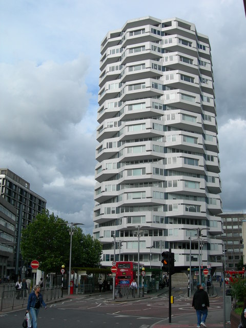
106:
697:"}},"text\/plain":{"en":{"P7384":"474579"}}}}": -->
1627:
770:
755:
535:
356:
8:
1663:
300:
284:
234:
1768:
325:
93:
450:
1302:
1419:
1291:
1286:
57:
42:
1723:
1645:
1471:
1778:
1733:
1511:
171:
161:
1681:
1231:
1189:
1151:
1110:
1068:
1027:
963:
895:
847:
805:
714:
646:
602:
511:
305:
1354:
1491:
1384:
1369:
1349:
317:
1788:
1481:
1259:
Click on a date/time to view the file as it appeared at that time.
1326:
270:
220:
205:
51° 22′ 30.64″ N, 0° 05′ 33.06″ W
1464:
1454:
1389:
1359:
1374:
255:
51° 22′ 31″ N, 0° 05′ 28″ W
150:
81:
444:
Add a one-line explanation of what this file represents
1429:
1320:
1340:
1257:
189:
Creative
Commons Attribution Share-alike license 2.0
105:
Commons is a freely licensed media file repository.
653:
Creative
Commons Attribution-ShareAlike 2.0 Generic
627:
Creative
Commons Attribution-ShareAlike 2.0 Generic
71:(480 × 640 pixels, file size: 85 KB, MIME type:
1309:{{geograph|474579|Danny Robinson}} NLA Tower
413:https://creativecommons.org/licenses/by-sa/2.0
86:
419:Creative Commons Attribution-Share Alike 2.0
337:
177:
146:
128:
687:https:\/\/www.geograph.org.uk\/photo\/474579
480:https:\/\/www.geograph.org.uk\/profile\/5299
167:
156:
14:
1090:
1007:
943:
875:
379:– to copy, distribute and transmit the work
1549:Adobe Photoshop Album Starter Edition 3.0
1342:The following other wikis use this file:
141:NLA Tower, 12-16 Addiscombe Road, Croydon
756:https://www.geograph.org.uk/photo/474579
536:https://www.geograph.org.uk/profile/5299
277:View this and other nearby images on:
227:View this and other nearby images on:
117:
324:and is licensed for reuse under the
245:
195:
1250:
360:Attribution-Share Alike 2.0 Generic
348:
343:
328:Attribution-ShareAlike 2.0 license.
13:
1440:
449:
443:
334:
311:
135:
118:
64:
1813:
1476:10/3,753 sec (0.0026645350386358)
1447:
448:
1502:Date and time of data generation
1321:
886:coordinates of the point of view
868:coordinates of the point of view
434:
390:Under the following conditions:
355:This file is licensed under the
347:
342:
336:
304:
283:
269:
261:
233:
219:
211:
85:
31:
21:
1332:User:Pafcool2/Images of Croydon
431:
136:
1337:
1254:
721:file available on the internet
671:file available on the internet
430:
312:This image was taken from the
26:
1:
1702:A directly photographed image
1668:Flash did not fire, auto mode
954:coordinates of depicted place
936:coordinates of depicted place
36:
1317:
901:51°22'30.641"N, 0°5'33.065"W
741:Geograph Britain and Ireland
679:Geograph Britain and Ireland
557:object of statement has role
488:object of statement has role
456:Items portrayed in this file
296:
7:
1590:Date and time of digitizing
1437:
1355:Richard Seifert (Architekt)
260:
210:
10:
1818:
1744:Focal length in 35 mm film
1673:Supported Flashpix version
1426:Usage on www.wikidata.org
1416:Usage on ur.wikipedia.org
1406:Usage on uk.wikipedia.org
1400:Чёрное зеркало: Брандашмыг
1396:Usage on ru.wikipedia.org
1385:Black Mirror: Bandersnatch
1381:Usage on it.wikipedia.org
1370:Black Mirror: Bandersnatch
1366:Usage on fr.wikipedia.org
1346:Usage on de.wikipedia.org
1311:Category:Towers in England
404:same or compatible license
125:
120:
1598:Meaning of each component
1555:File change date and time
1410:Бузогриз (Чорне дзеркало)
1350:London Borough of Croydon
1251:
16:
969:51°22'30.7"N, 0°5'27.6"W
764:geograph.org.uk image ID
691:geograph.org.uk image ID
433:
370:
92:This is a file from the
41:
1707:Custom image processing
1308:
1287:19:01, 24 November 2007
1033:0.00266453503863575806
149:
96:. Information from its
1798:Subject distance range
1619:Image compression mode
318:this photograph's page
289:51.375200; -0.091000
239:51.375178; -0.092518
99:description page there
46:Size of this preview:
1637:Maximum land aperture
1529:Horizontal resolution
1694:Digital still camera
1593:18:10, 21 June 2007
1563:Y and C positioning
1558:20:42, 22 June 2007
1537:Vertical resolution
1505:18:10, 21 June 2007
1451:Camera manufacturer
385:– to adapt the work
52:Other resolutions:
1752:Scene capture type
1728:Auto white balance
854:Nikon Coolpix 7600
828:Nikon Coolpix 7600
544:author name string
484:author name string
1805:
1804:
1338:Global file usage
1315:
1092:
1009:
945:
877:
637:copyright license
623:copyright license
442:
333:
332:
316:collection. See
294:
293:
244:
243:
193:
192:
186:
183:Reusing this file
114:
113:
94:Wikimedia Commons
32:Global file usage
1809:
1571:Exposure Program
1448:
1299:
1261:
1119:
1036:
991:
990:
985:
923:
922:
917:
773:
768:
758:
753:
749:described at URL
743:
738:
683:described at URL
593:copyright status
579:copyright status
566:
561:
551:
548:
538:
533:
440:
426:
423:
420:
417:
414:
406:as the original.
368:
357:Creative Commons
351:
350:
346:
345:
340:
339:
326:Creative Commons
314:Geograph project
308:
301:
290:
287:
273:
272:
266:
265:
264:
258:
257:
246:
240:
237:
223:
222:
216:
215:
214:
208:
207:
196:
180:
152:
140:
132:
126:
110:
89:
88:
82:
76:
74:
61:
58:480 × 640 pixels
54:180 × 240 pixels
48:450 × 600 pixels
1817:
1816:
1812:
1811:
1810:
1808:
1807:
1806:
1640:3 APEX (f/2.83)
1436:
1336:
1323:
1316:
1305:
1297:
1253:
1252:
1249:
1248:
1247:
1246:
1245:
1244:
1243:
1242:
1240:
1228:
1227:
1226:
1224:
1205:
1204:
1203:
1202:
1201:
1200:
1199:
1198:
1196:
1186:
1185:
1184:
1182:
1167:
1166:
1165:
1164:
1163:
1162:
1161:
1160:
1158:
1148:
1147:
1146:
1144:
1129:
1128:
1127:
1126:
1125:
1124:
1123:
1122:
1120:
1117:
1107:
1106:
1105:
1103:
1084:
1083:
1082:
1081:
1080:
1079:
1078:
1077:
1075:
1065:
1064:
1063:
1061:
1046:
1045:
1044:
1043:
1042:
1041:
1040:
1039:
1037:
1034:
1024:
1023:
1022:
1020:
1001:
1000:
999:
998:
997:
996:
995:
994:
993:
992:
988:
986:
983:
974:
973:
972:
970:
960:
959:
958:
956:
933:
932:
931:
930:
929:
928:
927:
926:
925:
924:
920:
918:
915:
906:
905:
904:
902:
892:
891:
890:
888:
865:
864:
863:
862:
861:
860:
859:
858:
856:
844:
843:
842:
840:
821:
820:
819:
818:
817:
816:
815:
814:
812:
802:
801:
800:
798:
783:
782:
781:
780:
779:
778:
777:
776:
775:
774:
769:
766:
760:
759:
754:
751:
745:
744:
739:
736:
727:
726:
725:
723:
711:
710:
709:
707:
664:
663:
662:
661:
660:
659:
658:
657:
655:
643:
642:
641:
639:
620:
619:
618:
617:
616:
615:
614:
613:
611:
599:
598:
597:
595:
576:
575:
574:
573:
572:
571:
570:
569:
568:
567:
562:
559:
553:
552:
549:
546:
540:
539:
534:
531:
522:
521:
520:
518:
508:
507:
506:
504:
469:
468:
467:
466:
465:
463:
447:
446:
445:
428:
427:
424:
421:
418:
415:
412:
411:
369:
366:
363:
352:
329:
299:
288:
262:
253:
252:
249:Object location
238:
212:
203:
202:
199:Camera location
194:
162:geograph.org.uk
142:
130:
123:
116:
115:
104:
103:
102:is shown below.
78:
72:
70:
63:
62:
51:
12:
11:
5:
1815:
1803:
1802:
1799:
1795:
1794:
1791:
1785:
1784:
1781:
1775:
1774:
1771:
1765:
1764:
1761:
1757:
1756:
1753:
1749:
1748:
1745:
1741:
1740:
1737:
1730:
1729:
1726:
1720:
1719:
1716:
1712:
1711:
1710:Normal process
1708:
1704:
1703:
1700:
1696:
1695:
1692:
1688:
1687:
1684:
1678:
1677:
1674:
1670:
1669:
1666:
1660:
1659:
1656:
1652:
1651:
1648:
1642:
1641:
1638:
1634:
1633:
1630:
1624:
1623:
1620:
1616:
1615:
1614:
1613:
1612:does not exist
1610:
1607:
1604:
1599:
1595:
1594:
1591:
1587:
1586:
1583:
1576:
1575:
1574:Normal program
1572:
1568:
1567:
1564:
1560:
1559:
1556:
1552:
1551:
1546:
1542:
1541:
1538:
1534:
1533:
1530:
1526:
1525:
1522:
1518:
1517:
1514:
1507:
1506:
1503:
1499:
1498:
1495:
1488:
1487:
1484:
1478:
1477:
1474:
1468:
1467:
1462:
1458:
1457:
1452:
1439:
1435:
1434:
1433:
1432:
1424:
1423:
1422:
1414:
1413:
1412:
1404:
1403:
1402:
1394:
1393:
1392:
1387:
1379:
1378:
1377:
1372:
1364:
1363:
1362:
1357:
1352:
1339:
1335:
1334:
1329:
1319:
1314:
1313:
1307:
1303:
1300:
1294:
1289:
1284:
1280:
1279:
1276:
1273:
1270:
1267:
1264:
1256:
1241:
1236:
1234:
1233:
1232:
1230:
1229:
1225:
1220:
1218:
1217:
1216:
1215:
1213:
1209:
1197:
1194:
1192:
1191:
1190:
1188:
1187:
1183:
1178:
1176:
1175:
1174:
1173:
1171:
1159:
1156:
1154:
1153:
1152:
1150:
1149:
1145:
1140:
1138:
1137:
1136:
1135:
1133:
1121:
1115:
1113:
1112:
1111:
1109:
1108:
1104:
1099:
1097:
1096:
1095:
1094:
1088:
1076:
1073:
1071:
1070:
1069:
1067:
1066:
1062:
1057:
1055:
1054:
1053:
1052:
1050:
1038:
1032:
1030:
1029:
1028:
1026:
1025:
1021:
1016:
1014:
1013:
1012:
1011:
1005:
979:
978:
977:
976:
975:
971:
968:
966:
965:
964:
962:
961:
957:
952:
950:
949:
948:
947:
941:
937:
911:
910:
909:
908:
907:
903:
900:
898:
897:
896:
894:
893:
889:
884:
882:
881:
880:
879:
873:
869:
857:
852:
850:
849:
848:
846:
845:
841:
836:
834:
833:
832:
831:
829:
825:
813:
810:
808:
807:
806:
804:
803:
799:
794:
792:
791:
790:
789:
787:
762:
761:
747:
746:
732:
731:
730:
729:
728:
724:
719:
717:
716:
715:
713:
712:
708:
705:source of file
703:
701:
700:
699:
698:
696:
692:
688:
684:
680:
676:
672:
668:
667:source of file
656:
651:
649:
648:
647:
645:
644:
640:
635:
633:
632:
631:
630:
628:
624:
612:
607:
605:
604:
603:
601:
600:
596:
591:
589:
588:
587:
586:
584:
580:
555:
554:
550:Danny Robinson
542:
541:
527:
526:
525:
524:
523:
519:
516:
514:
513:
512:
510:
509:
505:
500:
498:
497:
496:
495:
493:
489:
485:
481:
477:
473:
464:
459:
457:
454:
453:
452:
451:
439:
438:
435:
432:
410:
409:
408:
407:
397:
388:
387:
386:
380:
373:You are free:
367:Danny Robinson
364:
354:
353:
335:
331:
330:
322:Danny Robinson
309:
298:
295:
292:
291:
281:
275:
250:
242:
241:
231:
225:
200:
191:
190:
187:
175:
174:
172:Danny Robinson
169:
165:
164:
158:
154:
153:
148:
144:
143:
133:
124:
122:
119:
112:
111:
90:
80:
79:
45:
40:
39:
34:
29:
24:
19:
9:
6:
4:
3:
2:
1814:
1800:
1797:
1796:
1792:
1790:
1787:
1786:
1782:
1780:
1777:
1776:
1772:
1770:
1767:
1766:
1762:
1760:Scene control
1759:
1758:
1754:
1751:
1750:
1746:
1743:
1742:
1738:
1735:
1732:
1731:
1727:
1725:
1724:White balance
1722:
1721:
1718:Auto exposure
1717:
1715:Exposure mode
1714:
1713:
1709:
1706:
1705:
1701:
1698:
1697:
1693:
1690:
1689:
1685:
1683:
1680:
1679:
1675:
1672:
1671:
1667:
1665:
1662:
1661:
1657:
1654:
1653:
1649:
1647:
1646:Metering mode
1644:
1643:
1639:
1636:
1635:
1631:
1629:
1628:Exposure bias
1626:
1625:
1621:
1618:
1617:
1611:
1608:
1605:
1602:
1601:
1600:
1597:
1596:
1592:
1589:
1588:
1584:
1581:
1578:
1577:
1573:
1570:
1569:
1565:
1562:
1561:
1557:
1554:
1553:
1550:
1547:
1545:Software used
1544:
1543:
1539:
1536:
1535:
1531:
1528:
1527:
1523:
1520:
1519:
1515:
1513:
1509:
1508:
1504:
1501:
1500:
1496:
1493:
1490:
1489:
1485:
1483:
1480:
1479:
1475:
1473:
1472:Exposure time
1470:
1469:
1466:
1463:
1460:
1459:
1456:
1453:
1450:
1449:
1446:
1443:
1431:
1428:
1427:
1425:
1421:
1418:
1417:
1415:
1411:
1408:
1407:
1405:
1401:
1398:
1397:
1395:
1391:
1390:No. 1 Croydon
1388:
1386:
1383:
1382:
1380:
1376:
1373:
1371:
1368:
1367:
1365:
1361:
1360:No. 1 Croydon
1358:
1356:
1353:
1351:
1348:
1347:
1345:
1344:
1343:
1333:
1330:
1328:
1325:
1324:
1312:
1306:
1301:
1295:
1293:
1290:
1288:
1285:
1282:
1281:
1277:
1274:
1271:
1268:
1265:
1263:
1262:
1260:
1239:
1235:
1223:
1219:
1193:
1181:
1177:
1155:
1143:
1139:
1114:
1102:
1098:
1072:
1060:
1056:
1031:
1019:
1018:exposure time
1015:
1004:exposure time
982:
967:
955:
951:
914:
899:
887:
883:
855:
851:
839:
838:captured with
835:
824:captured with
809:
797:
793:
772:
765:
757:
750:
742:
735:
722:
718:
706:
702:
654:
650:
638:
634:
610:
606:
594:
590:
565:
558:
545:
537:
530:
515:
503:
499:
462:
458:
455:
436:
429:
416:CC BY-SA 2.0
405:
401:
398:
395:
392:
391:
389:
384:
381:
378:
375:
374:
372:
371:
365:Attribution:
361:
358:
341:
327:
323:
319:
315:
310:
307:
303:
302:
286:
282:
280:
279:OpenStreetMap
276:
274:
256:
251:
248:
247:
236:
232:
230:
229:OpenStreetMap
226:
224:
206:
201:
198:
197:
188:
184:
179:
176:
173:
170:
166:
163:
159:
155:
145:
139:
134:
131:NLA Tower.jpg
127:
108:
101:
100:
95:
91:
84:
83:
77:
68:
67:Original file
59:
55:
49:
44:
38:
35:
33:
30:
28:
25:
23:
20:
18:
15:
1734:Digital zoom
1655:Light source
1512:focal length
1461:Camera model
1444:
1441:
1375:No.1 Croydon
1341:
1258:
1255:File history
1101:focal length
1087:focal length
811:21 June 2007
564:photographer
492:photographer
399:
393:
382:
376:
321:
259:
209:
151:21 June 2007
137:
107:You can help
97:
65:
22:File history
1691:File source
1682:Color space
1521:Orientation
1304:Lamberhurst
1222:instance of
1208:instance of
609:copyrighted
583:copyrighted
400:share alike
394:attribution
129:Description
1779:Saturation
1699:Scene type
1318:File usage
1296:480 × 640
1272:Dimensions
1238:photograph
1212:photograph
1195:image/jpeg
1180:media type
1170:media type
1118:millimetre
1091:millimetre
517:some value
178:Permission
73:image/jpeg
27:File usage
1789:Sharpness
1492:ISO speed
1269:Thumbnail
1266:Date/Time
1142:ISO speed
1132:ISO speed
796:inception
786:inception
297:Licensing
138:English:
1769:Contrast
1755:Standard
1566:Co-sited
1482:F-number
1438:Metadata
1430:Q7043088
1059:f-number
1049:f-number
734:operator
675:operator
437:Captions
383:to remix
377:to share
362:license.
37:Metadata
1801:Unknown
1658:Unknown
1650:Pattern
1582:version
1540:300 dpi
1532:300 dpi
1327:Croydon
1298:(85 KB)
1283:current
1278:Comment
981:heading
940:heading
913:heading
872:heading
502:creator
472:creator
461:depicts
441:English
121:Summary
69:
1793:Normal
1783:Normal
1773:Normal
1524:Normal
1516:7.8 mm
1494:rating
1420:کروئڈن
1035:second
1008:second
989:degree
944:degree
921:degree
876:degree
771:474579
695:474579
267:
217:
168:Author
157:Source
1747:38 mm
1736:ratio
1664:Flash
1510:Lens
1486:f/4.8
1465:E7600
1455:NIKON
160:From
1763:None
1686:sRGB
1580:Exif
1275:User
1116:7.8
425:true
422:true
147:Date
17:File
1585:2.2
1074:4.8
987:90
919:90
529:URL
476:URL
1609:Cr
1606:Cb
1497:50
1157:50
984::
916::
767::
752::
737::
560::
547::
532::
56:|
50:.
1739:0
1676:1
1632:0
1622:2
1603:Y
185:)
181:(
109:.
75:)
60:.
Text is available under the Creative Commons Attribution-ShareAlike License. Additional terms may apply.
_region:GB-ENG_heading:90.00&language=en)
