739:"}},"text\/plain":{"en":{"":"coordinates of the point of view"}}},"{\"value\":{\"latitude\":50.38718,\"longitude\":-4.1309,\"altitude\":null,\"precision\":1.0e-5,\"globe\":\"http:\\\/\\\/www.wikidata.org\\\/entity\\\/Q2\"},\"type\":\"globecoordinate\"}":{"text\/html":{"en":{"P1259":"50\u00b023'13.85"N, 4\u00b07'51.24"W"}},"text\/plain":{"en":{"P1259":"50\u00b023'13.85\"N, 4\u00b07'51.24\"W"}}},"{\"value\":{\"entity-type\":\"property\",\"numeric-id\":7787,\"id\":\"P7787\"},\"type\":\"wikibase-entityid\"}":{"text\/html":{"en":{"":"
1014:"}},"text\/plain":{"en":{"":"coordinates of depicted place"}}},"{\"value\":{\"latitude\":50.38691,\"longitude\":-4.1313,\"altitude\":null,\"precision\":1.0e-5,\"globe\":\"http:\\\/\\\/www.wikidata.org\\\/entity\\\/Q2\"},\"type\":\"globecoordinate\"}":{"text\/html":{"en":{"P9149":"50\u00b023'12.88"N, 4\u00b07'52.68"W"}},"text\/plain":{"en":{"P9149":"50\u00b023'12.88\"N, 4\u00b07'52.68\"W"}}},"{\"value\":{\"entity-type\":\"property\",\"numeric-id\":7787,\"id\":\"P7787\"},\"type\":\"wikibase-entityid\"}":{"text\/html":{"en":{"":"
518:"}},"text\/plain":{"en":{"":"author name string"}}},"{\"value\":\"Hugh Venables\",\"type\":\"string\"}":{"text\/html":{"en":{"P2093":"Hugh Venables"}},"text\/plain":{"en":{"P2093":"Hugh Venables"}}},"{\"value\":{\"entity-type\":\"property\",\"numeric-id\":2699,\"id\":\"P2699\"},\"type\":\"wikibase-entityid\"}":{"text\/html":{"en":{"":"
701:"}},"text\/plain":{"en":{"":"inception"}}},"{\"value\":{\"time\":\"+2009-06-07T00:00:00Z\",\"timezone\":0,\"before\":0,\"after\":0,\"precision\":11,\"calendarmodel\":\"http:\\\/\\\/www.wikidata.org\\\/entity\\\/Q1985727\"},\"type\":\"time\"}":{"text\/html":{"en":{"P571":"7 June 2009"}},"text\/plain":{"en":{"P571":"7 June 2009"}}}}": -->
803:
276:
226:
1010:
218:
290:
240:
311:
349:
354:
67:
811:"}},"text\/plain":{"en":{"P7482":"file available on the internet"}}},"{\"value\":{\"entity-type\":\"property\",\"numeric-id\":137,\"id\":\"P137\"},\"type\":\"wikibase-entityid\"}":{"text\/html":{"en":{"":"
819:"}},"text\/plain":{"en":{"P137":"Geograph Britain and Ireland"}}},"{\"value\":{\"entity-type\":\"property\",\"numeric-id\":7384,\"id\":\"P7384\"},\"type\":\"wikibase-entityid\"}":{"text\/html":{"en":{"":"
510:"}},"text\/plain":{"en":{"":"object of statement has role"}}},"{\"value\":{\"entity-type\":\"item\",\"numeric-id\":33231,\"id\":\"Q33231\"},\"type\":\"wikibase-entityid\"}":{"text\/html":{"en":{"P3831":"
657:"}},"text\/plain":{"en":{"":"copyright license"}}},"{\"value\":{\"entity-type\":\"item\",\"numeric-id\":19068220,\"id\":\"Q19068220\"},\"type\":\"wikibase-entityid\"}":{"text\/html":{"en":{"P275":"
613:"}},"text\/plain":{"en":{"":"copyright status"}}},"{\"value\":{\"entity-type\":\"item\",\"numeric-id\":50423863,\"id\":\"Q50423863\"},\"type\":\"wikibase-entityid\"}":{"text\/html":{"en":{"P6216":"
926:"}},"text\/plain":{"en":{"":"location of creation"}}},"{\"value\":{\"entity-type\":\"item\",\"numeric-id\":43382,\"id\":\"Q43382\"},\"type\":\"wikibase-entityid\"}":{"text\/html":{"en":{"P1071":"
807:"}},"text\/plain":{"en":{"":"source of file"}}},"{\"value\":{\"entity-type\":\"item\",\"numeric-id\":74228490,\"id\":\"Q74228490\"},\"type\":\"wikibase-entityid\"}":{"text\/html":{"en":{"P7482":"
970:"}},"text\/plain":{"en":{"":"captured with"}}},"{\"value\":{\"entity-type\":\"item\",\"numeric-id\":20888981,\"id\":\"Q20888981\"},\"type\":\"wikibase-entityid\"}":{"text\/html":{"en":{"P4082":"
514:"}},"text\/plain":{"en":{"P3831":"photographer"}}},"{\"value\":{\"entity-type\":\"property\",\"numeric-id\":2093,\"id\":\"P2093\"},\"type\":\"wikibase-entityid\"}":{"text\/html":{"en":{"":"
1018:"}},"text\/plain":{"en":{"":"heading"}}},"{\"value\":{\"amount\":\"+225\",\"unit\":\"http:\\\/\\\/www.wikidata.org\\\/entity\\\/Q28390\"},\"type\":\"quantity\"}":{"text\/html":{"en":{"P7787":"225
815:"}},"text\/plain":{"en":{"":"operator"}}},"{\"value\":{\"entity-type\":\"item\",\"numeric-id\":1503119,\"id\":\"Q1503119\"},\"type\":\"wikibase-entityid\"}":{"text\/html":{"en":{"P137":"
743:"}},"text\/plain":{"en":{"":"heading"}}},"{\"value\":{\"amount\":\"+225\",\"unit\":\"http:\\\/\\\/www.wikidata.org\\\/entity\\\/Q28390\"},\"type\":\"quantity\"}":{"text\/html":{"en":{"P7787":"225
827:"}},"text\/plain":{"en":{"P7384":"1521737"}}},"{\"value\":{\"entity-type\":\"property\",\"numeric-id\":973,\"id\":\"P973\"},\"type\":\"wikibase-entityid\"}":{"text\/html":{"en":{"":"
459:"}},"text\/plain":{"en":{"":"depicts"}}},"{\"value\":{\"entity-type\":\"item\",\"numeric-id\":34442,\"id\":\"Q34442\"},\"type\":\"wikibase-entityid\"}":{"text\/html":{"en":{"P180":"
506:"}},"text\/plain":{"en":{"":"creator"}}},"{\"value\":{\"entity-type\":\"property\",\"numeric-id\":3831,\"id\":\"P3831\"},\"type\":\"wikibase-entityid\"}":{"text\/html":{"en":{"":"
966:
831:"}},"text\/plain":{"en":{"":"described at URL"}}},"{\"value\":\"https:\\\/\\\/www.geograph.org.uk\\\/photo\\\/1521737\",\"type\":\"string\"}":{"text\/html":{"en":{"P973":"
522:"}},"text\/plain":{"en":{"":"URL"}}},"{\"value\":\"https:\\\/\\\/www.geograph.org.uk\\\/profile\\\/3176\",\"type\":\"string\"}":{"text\/html":{"en":{"P2699":"
38:
823:"}},"text\/plain":{"en":{"":"geograph.org.uk image ID"}}},"{\"value\":\"1521737\",\"type\":\"string\"}":{"text\/html":{"en":{"P7384":"
259:
209:
401:– You must give appropriate credit, provide a link to the license, and indicate if changes were made. You may do so in any reasonable manner, but not in any way that suggests the licensor endorses you or your use.
273:
223:
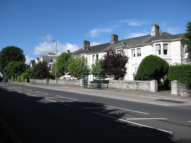
1137:== {{int:filedesc}} == {{Information |description={{en|1=Mannamead Road Bus stop and some of the large houses along the road.}} |date=2009-06-07 |source=From |author=[http://www.geograph.org.uk/pr
824:
971:
808:
658:
614:
816:
927:
511:
460:
78:
1015:
1011:
967:
923:
820:
804:
740:
736:
610:
519:
515:
507:
46:
832:
828:
812:
698:
654:
523:
503:
456:
1130:
661:"}},"text\/plain":{"en":{"P275":"Creative Commons Attribution-ShareAlike 2.0 Generic"}}}}": -->
835:"}},"text\/plain":{"en":{"P973":"https:\/\/www.geograph.org.uk\/photo\/1521737"}}}}": -->
526:"}},"text\/plain":{"en":{"P2699":"https:\/\/www.geograph.org.uk\/profile\/3176"}}}}": -->
997:
858:
684:
640:
283:
233:
878:
318:
1162:
This file contains additional information, probably added from the digital camera or scanner used to create or digitize it.
408:
953:
567:
489:
1056:
1029:
981:
937:
886:
842:
781:
754:
624:
588:
575:
560:
901:
871:
708:
668:
533:
473:
974:"}},"text\/plain":{"en":{"P4082":"Canon Digital IXUS 870 IS"}}}}": -->
1119:
1114:
37:
1265:
364:
1165:
If the file has been modified from its original state, some details may not fully reflect the modified file.
407:– If you remix, transform, or build upon the material, you must distribute your contributions under the
325:
on the
Geograph website for the photographer's contact details. The copyright on this image is owned by
1184:
617:"}},"text\/plain":{"en":{"P6216":"copyrighted"}}}}": -->
1147:
The following pages on the
English Knowledge use this file (pages on other projects are not listed):
1022:"}},"text\/plain":{"en":{"P7787":"225 degree"}}}}": -->
747:"}},"text\/plain":{"en":{"P7787":"225 degree"}}}}": -->
930:"}},"text\/plain":{"en":{"P1071":"Plymouth"}}}}": -->
86:
178:
1302:
463:"}},"text\/plain":{"en":{"P180":"road"}}}}": -->
908:
893:
595:
361:
162:
8:
1330:
305:
289:
239:
330:
73:
1174:
1388:
1320:
1284:
1191:
141:
1398:
1231:
151:
1039:
991:
947:
852:
764:
718:
678:
634:
543:
483:
310:
1211:
322:
1151:
121:
Mannamead Road Bus stop and some of the large houses along the road.
1201:
1087:
Click on a date/time to view the file as it appeared at that time.
275:
225:
260:
50° 23′ 13″ N, 4° 07′ 53″ W
210:
50° 23′ 14″ N, 4° 07′ 51″ W
130:
61:
449:
Add a one-line explanation of what this file represents
1145:
1085:
85:
Commons is a freely licensed media file repository.
685:
Creative
Commons Attribution-ShareAlike 2.0 Generic
659:
Creative
Commons Attribution-ShareAlike 2.0 Generic
51:(640 × 480 pixels, file size: 155 KB, MIME type:
1335:Flash did not fire, compulsory flash suppression
418:https://creativecommons.org/licenses/by-sa/2.0
111:Mannamead Road - geograph.org.uk - 1521737.jpg
66:
47:Mannamead_Road_-_geograph.org.uk_-_1521737.jpg
833:https:\/\/www.geograph.org.uk\/photo\/1521737
424:Creative Commons Attribution-Share Alike 2.0
342:
126:
108:
524:https:\/\/www.geograph.org.uk\/profile\/3176
147:
136:
14:
1019:
744:
384:– to copy, distribute and transmit the work
909:https://www.geograph.org.uk/photo/1521737
596:https://www.geograph.org.uk/profile/3176
282:View this and other nearby images on:
232:View this and other nearby images on:
185:
97:
329:and is licensed for reuse under the
250:
200:
1078:
365:Attribution-Share Alike 2.0 Generic
353:
348:
333:Attribution-ShareAlike 2.0 license.
13:
1160:
454:
448:
339:
316:
115:
98:
44:
1424:
1167:
453:
1222:Date and time of data generation
1146:
755:coordinates of the point of view
737:coordinates of the point of view
439:
395:Under the following conditions:
360:This file is licensed under the
352:
347:
341:
309:
288:
274:
266:
238:
224:
216:
65:
21:
436:
116:
41:No higher resolution available.
1082:
859:file available on the internet
809:file available on the internet
435:
317:This image was taken from the
26:
1:
1030:coordinates of depicted place
1012:coordinates of depicted place
31:
1142:
879:Geograph Britain and Ireland
817:Geograph Britain and Ireland
561:object of statement has role
508:object of statement has role
469:Items portrayed in this file
301:
265:
215:
7:
1356:Focal plane resolution unit
1276:Date and time of digitizing
1157:
10:
1429:
1367:One-chip color area sensor
1045:50°23'12.88"N, 4°7'52.68"W
770:50°23'13.85"N, 4°7'51.24"W
409:same or compatible license
191:Hugh Venables /
172:Hugh Venables /
105:
100:
1257:File change date and time
1185:Canon DIGITAL IXUS 870 IS
1079:
998:Canon Digital IXUS 870 IS
972:Canon Digital IXUS 870 IS
16:
1348:Focal plane Y resolution
1340:Focal plane X resolution
887:geograph.org.uk image ID
821:geograph.org.uk image ID
438:
375:
72:This is a file from the
36:
1372:Custom image processing
1136:
163:required by the license
129:
76:. Information from its
323:this photograph's page
294:50.386910; -4.131300
244:50.387180; -4.130900
79:description page there
1312:Maximum land aperture
1260:21:51, 1 October 2009
1241:Horizontal resolution
1315:2.96875 APEX (f/2.8)
938:location of creation
924:location of creation
1249:Vertical resolution
1171:Camera manufacturer
1115:03:41, 3 March 2011
390:– to adapt the work
1409:Scene capture type
1393:Auto white balance
1279:10:14, 7 June 2009
1225:10:14, 7 June 2009
1196:1/400 sec (0.0025)
576:author name string
516:author name string
1416:
1415:
1140:
1021:
746:
669:copyright license
655:copyright license
447:
338:
337:
321:collection. See
299:
298:
249:
248:
198:
197:
166:
94:
93:
74:Wikimedia Commons
1420:
1351:15,116.022099448
1343:15,136.929460581
1168:
1127:
1089:
1067:
1066:
1061:
911:
906:
902:described at URL
896:
891:
881:
876:
829:described at URL
792:
791:
786:
625:copyright status
611:copyright status
598:
593:
583:
580:
570:
565:
445:
431:
428:
425:
422:
419:
411:as the original.
373:
362:Creative Commons
356:
355:
351:
350:
345:
344:
331:Creative Commons
319:Geograph project
313:
306:
295:
292:
278:
277:
271:
270:
269:
263:
262:
251:
245:
242:
228:
227:
221:
220:
219:
213:
212:
201:
160:
132:
120:
112:
106:
90:
69:
68:
62:
56:
54:
1428:
1427:
1423:
1422:
1421:
1419:
1418:
1417:
1156:
1148:
1141:
1133:
1125:
1081:
1080:
1077:
1076:
1075:
1074:
1073:
1072:
1071:
1070:
1069:
1068:
1064:
1062:
1059:
1050:
1049:
1048:
1046:
1036:
1035:
1034:
1032:
1009:
1008:
1007:
1006:
1005:
1004:
1003:
1002:
1000:
988:
987:
986:
984:
965:
964:
963:
962:
961:
960:
959:
958:
956:
944:
943:
942:
940:
921:
920:
919:
918:
917:
916:
915:
914:
913:
912:
907:
904:
898:
897:
892:
889:
883:
882:
877:
874:
865:
864:
863:
861:
849:
848:
847:
845:
802:
801:
800:
799:
798:
797:
796:
795:
794:
793:
789:
787:
784:
775:
774:
773:
771:
761:
760:
759:
757:
734:
733:
732:
731:
730:
729:
728:
727:
725:
715:
714:
713:
711:
696:
695:
694:
693:
692:
691:
690:
689:
687:
675:
674:
673:
671:
652:
651:
650:
649:
648:
647:
646:
645:
643:
631:
630:
629:
627:
608:
607:
606:
605:
604:
603:
602:
601:
600:
599:
594:
591:
585:
584:
581:
578:
572:
571:
566:
563:
554:
553:
552:
550:
540:
539:
538:
536:
501:
500:
499:
498:
497:
496:
495:
494:
492:
480:
479:
478:
476:
452:
451:
450:
433:
432:
429:
426:
423:
420:
417:
416:
374:
371:
368:
357:
334:
304:
293:
267:
258:
257:
254:Object location
243:
217:
208:
207:
204:Camera location
199:
188:
181:
169:
142:geograph.org.uk
122:
110:
103:
96:
95:
84:
83:
82:is shown below.
58:
52:
50:
43:
42:
12:
11:
5:
1426:
1414:
1413:
1410:
1406:
1405:
1402:
1395:
1394:
1391:
1385:
1384:
1381:
1377:
1376:
1375:Normal process
1373:
1369:
1368:
1365:
1364:Sensing method
1361:
1360:
1357:
1353:
1352:
1349:
1345:
1344:
1341:
1337:
1336:
1333:
1327:
1326:
1323:
1317:
1316:
1313:
1309:
1308:
1305:
1299:
1298:
1295:
1291:
1290:
1287:
1281:
1280:
1277:
1273:
1272:
1269:
1262:
1261:
1258:
1254:
1253:
1250:
1246:
1245:
1242:
1238:
1237:
1234:
1227:
1226:
1223:
1219:
1218:
1215:
1208:
1207:
1204:
1198:
1197:
1194:
1188:
1187:
1182:
1178:
1177:
1172:
1159:
1155:
1154:
1144:
1139:
1138:
1135:
1131:
1128:
1122:
1117:
1112:
1108:
1107:
1104:
1101:
1098:
1095:
1092:
1084:
1055:
1054:
1053:
1052:
1051:
1047:
1044:
1042:
1041:
1040:
1038:
1037:
1033:
1028:
1026:
1025:
1024:
1023:
1017:
1013:
1001:
996:
994:
993:
992:
990:
989:
985:
980:
978:
977:
976:
975:
973:
969:
957:
952:
950:
949:
948:
946:
945:
941:
936:
934:
933:
932:
931:
929:
925:
900:
899:
885:
884:
870:
869:
868:
867:
866:
862:
857:
855:
854:
853:
851:
850:
846:
843:source of file
841:
839:
838:
837:
836:
834:
830:
826:
822:
818:
814:
810:
806:
805:source of file
780:
779:
778:
777:
776:
772:
769:
767:
766:
765:
763:
762:
758:
753:
751:
750:
749:
748:
742:
738:
726:
723:
721:
720:
719:
717:
716:
712:
707:
705:
704:
703:
702:
700:
688:
683:
681:
680:
679:
677:
676:
672:
667:
665:
664:
663:
662:
660:
656:
644:
639:
637:
636:
635:
633:
632:
628:
623:
621:
620:
619:
618:
616:
612:
587:
586:
574:
573:
559:
558:
557:
556:
555:
551:
548:
546:
545:
544:
542:
541:
537:
532:
530:
529:
528:
527:
525:
521:
517:
513:
509:
505:
493:
488:
486:
485:
484:
482:
481:
477:
472:
470:
467:
466:
465:
464:
462:
458:
444:
443:
440:
437:
415:
414:
413:
412:
402:
393:
392:
391:
385:
378:You are free:
369:
359:
358:
340:
336:
335:
314:
303:
300:
297:
296:
286:
280:
255:
247:
246:
236:
230:
205:
196:
195:
193:Mannamead Road
189:
186:
183:
182:
177:
174:Mannamead Road
170:
167:
155:
154:
149:
145:
144:
138:
134:
133:
128:
124:
123:
113:
104:
102:
99:
92:
91:
70:
60:
59:
40:
35:
34:
29:
24:
19:
9:
6:
4:
3:
2:
1425:
1411:
1408:
1407:
1403:
1400:
1397:
1396:
1392:
1390:
1389:White balance
1387:
1386:
1383:Auto exposure
1382:
1380:Exposure mode
1379:
1378:
1374:
1371:
1370:
1366:
1363:
1362:
1358:
1355:
1354:
1350:
1347:
1346:
1342:
1339:
1338:
1334:
1332:
1329:
1328:
1324:
1322:
1321:Metering mode
1319:
1318:
1314:
1311:
1310:
1306:
1304:
1303:Exposure bias
1301:
1300:
1296:
1294:APEX aperture
1293:
1292:
1288:
1286:
1285:Shutter speed
1283:
1282:
1278:
1275:
1274:
1270:
1267:
1264:
1263:
1259:
1256:
1255:
1251:
1248:
1247:
1243:
1240:
1239:
1235:
1233:
1229:
1228:
1224:
1221:
1220:
1216:
1213:
1210:
1209:
1205:
1203:
1200:
1199:
1195:
1193:
1192:Exposure time
1190:
1189:
1186:
1183:
1180:
1179:
1176:
1173:
1170:
1169:
1166:
1163:
1153:
1150:
1149:
1134:
1129:
1123:
1121:
1118:
1116:
1113:
1110:
1109:
1105:
1102:
1099:
1096:
1093:
1091:
1090:
1088:
1058:
1043:
1031:
1027:
999:
995:
983:
982:captured with
979:
968:captured with
955:
951:
939:
935:
910:
903:
895:
888:
880:
873:
860:
856:
844:
840:
783:
768:
756:
752:
722:
710:
706:
686:
682:
670:
666:
642:
638:
626:
622:
597:
590:
582:Hugh Venables
577:
569:
562:
547:
535:
531:
491:
487:
475:
471:
468:
441:
434:
421:CC BY-SA 2.0
410:
406:
403:
400:
397:
396:
394:
389:
386:
383:
380:
379:
377:
376:
372:Hugh Venables
370:Attribution:
366:
363:
346:
332:
328:
327:Hugh Venables
324:
320:
315:
312:
308:
307:
291:
287:
285:
284:OpenStreetMap
281:
279:
261:
256:
253:
252:
241:
237:
235:
234:OpenStreetMap
231:
229:
211:
206:
203:
202:
194:
190:
184:
180:
176: /
175:
171:
164:
159:
157:
156:
153:
152:Hugh Venables
150:
146:
143:
139:
135:
125:
119:
114:
107:
88:
81:
80:
75:
71:
64:
63:
57:
48:
39:
33:
30:
28:
25:
23:
20:
18:
15:
1399:Digital zoom
1232:focal length
1181:Camera model
1164:
1161:
1086:
1083:File history
568:photographer
512:photographer
404:
398:
387:
381:
326:
264:
214:
192:
179:CC BY-SA 2.0
173:
117:
87:You can help
77:
45:
22:File history
1132:GeographBot
724:7 June 2009
641:copyrighted
615:copyrighted
405:share alike
399:attribution
158:Attribution
131:7 June 2009
109:Description
1143:File usage
1124:640 × 480
1100:Dimensions
549:some value
53:image/jpeg
27:File usage
1212:ISO speed
1152:Mannamead
1097:Thumbnail
1094:Date/Time
709:inception
699:inception
302:Licensing
187:InfoField
168:InfoField
118:English:
1412:Standard
1297:4.970854
1289:8.643856
1202:F-number
1158:Metadata
1126:(155 KB)
954:Plymouth
928:Plymouth
872:operator
813:operator
442:Captions
388:to remix
382:to share
367:license.
32:Metadata
1325:Pattern
1268:version
1252:240 dpi
1244:240 dpi
1111:current
1106:Comment
1057:heading
1016:heading
894:1521737
825:1521737
782:heading
741:heading
534:creator
504:creator
474:depicts
457:depicts
446:English
101:Summary
49:
1359:inches
1214:rating
1065:degree
1020:degree
790:degree
745:degree
272:
222:
148:Author
137:Source
1401:ratio
1331:Flash
1230:Lens
1206:f/5.6
1175:Canon
140:From
1271:2.21
1266:Exif
1236:5 mm
1103:User
1063:225
788:225
490:road
461:road
430:true
427:true
127:Date
17:File
589:URL
520:URL
1217:80
1060::
905::
890::
875::
785::
592::
579::
564::
1404:1
1307:0
165:)
161:(
89:.
55:)
_heading:225.00&language=en)
_heading:225.00&language=en)
