836:"}},"text\/plain":{"en":{"":"coordinates of the point of view"}}},"{\"value\":{\"latitude\":50.91085,\"longitude\":-2.501,\"altitude\":null,\"precision\":1.0e-5,\"globe\":\"http:\\\/\\\/www.wikidata.org\\\/entity\\\/Q2\"},\"type\":\"globecoordinate\"}":{"text\/html":{"en":{"P1259":"50\u00b054'39.06"N, 2\u00b030'3.60"W"}},"text\/plain":{"en":{"P1259":"50\u00b054'39.06\"N, 2\u00b030'3.60\"W"}}},"{\"value\":{\"entity-type\":\"property\",\"numeric-id\":7787,\"id\":\"P7787\"},\"type\":\"wikibase-entityid\"}":{"text\/html":{"en":{"":"
904:"}},"text\/plain":{"en":{"":"coordinates of depicted place"}}},"{\"value\":{\"latitude\":50.91085,\"longitude\":-2.501,\"altitude\":null,\"precision\":1.0e-5,\"globe\":\"http:\\\/\\\/www.wikidata.org\\\/entity\\\/Q2\"},\"type\":\"globecoordinate\"}":{"text\/html":{"en":{"P9149":"50\u00b054'39.06"N, 2\u00b030'3.60"W"}},"text\/plain":{"en":{"P9149":"50\u00b054'39.06\"N, 2\u00b030'3.60\"W"}}},"{\"value\":{\"entity-type\":\"property\",\"numeric-id\":7787,\"id\":\"P7787\"},\"type\":\"wikibase-entityid\"}":{"text\/html":{"en":{"":"
496:"}},"text\/plain":{"en":{"":"author name string"}}},"{\"value\":\"Val Ghose\",\"type\":\"string\"}":{"text\/html":{"en":{"P2093":"Val Ghose"}},"text\/plain":{"en":{"P2093":"Val Ghose"}}},"{\"value\":{\"entity-type\":\"property\",\"numeric-id\":2699,\"id\":\"P2699\"},\"type\":\"wikibase-entityid\"}":{"text\/html":{"en":{"":"
798:"}},"text\/plain":{"en":{"":"inception"}}},"{\"value\":{\"time\":\"+2007-01-20T00:00:00Z\",\"timezone\":0,\"before\":0,\"after\":0,\"precision\":11,\"calendarmodel\":\"http:\\\/\\\/www.wikidata.org\\\/entity\\\/Q1985727\"},\"type\":\"time\"}":{"text\/html":{"en":{"P571":"20 January 2007"}},"text\/plain":{"en":{"P571":"20 January 2007"}}}}": -->
675:
281:
231:
900:
223:
295:
245:
316:
354:
359:
72:
972:"}},"text\/plain":{"en":{"":"ISO speed"}}},"{\"value\":{\"amount\":\"+100\",\"unit\":\"1\"},\"type\":\"quantity\"}":{"text\/html":{"en":{"P6789":"100"}},"text\/plain":{"en":{"P6789":"100"}}}}": -->
1055:"}},"text\/plain":{"en":{"":"f-number"}}},"{\"value\":{\"amount\":\"+4.3\",\"unit\":\"1\"},\"type\":\"quantity\"}":{"text\/html":{"en":{"P6790":"4.3"}},"text\/plain":{"en":{"P6790":"4.3"}}}}": -->
1176:
1010:"}},"text\/plain":{"en":{"":"exposure time"}}},"{\"value\":{\"amount\":\"+0.0020833333333333\",\"unit\":\"http:\\\/\\\/www.wikidata.org\\\/entity\\\/Q11574\"},\"type\":\"quantity\"}":{"text\/html":{"en":{"P6757":"0.0020833333333333
691:"}},"text\/plain":{"en":{"P973":"https:\/\/www.geograph.org.uk\/photo\/316860"}}},"{\"value\":{\"entity-type\":\"property\",\"numeric-id\":7384,\"id\":\"P7384\"},\"type\":\"wikibase-entityid\"}":{"text\/html":{"en":{"":"
683:"}},"text\/plain":{"en":{"P7482":"file available on the internet"}}},"{\"value\":{\"entity-type\":\"property\",\"numeric-id\":973,\"id\":\"P973\"},\"type\":\"wikibase-entityid\"}":{"text\/html":{"en":{"":"
488:"}},"text\/plain":{"en":{"":"object of statement has role"}}},"{\"value\":{\"entity-type\":\"item\",\"numeric-id\":33231,\"id\":\"Q33231\"},\"type\":\"wikibase-entityid\"}":{"text\/html":{"en":{"P3831":"
635:"}},"text\/plain":{"en":{"":"copyright license"}}},"{\"value\":{\"entity-type\":\"item\",\"numeric-id\":19068220,\"id\":\"Q19068220\"},\"type\":\"wikibase-entityid\"}":{"text\/html":{"en":{"P275":"
591:"}},"text\/plain":{"en":{"":"copyright status"}}},"{\"value\":{\"entity-type\":\"item\",\"numeric-id\":50423863,\"id\":\"Q50423863\"},\"type\":\"wikibase-entityid\"}":{"text\/html":{"en":{"P6216":"
679:"}},"text\/plain":{"en":{"":"source of file"}}},"{\"value\":{\"entity-type\":\"item\",\"numeric-id\":74228490,\"id\":\"Q74228490\"},\"type\":\"wikibase-entityid\"}":{"text\/html":{"en":{"P7482":"
1093:"}},"text\/plain":{"en":{"":"focal length"}}},"{\"value\":{\"amount\":\"+18.1\",\"unit\":\"http:\\\/\\\/www.wikidata.org\\\/entity\\\/Q174789\"},\"type\":\"quantity\"}":{"text\/html":{"en":{"P2151":"18.1
492:"}},"text\/plain":{"en":{"P3831":"photographer"}}},"{\"value\":{\"entity-type\":\"property\",\"numeric-id\":2093,\"id\":\"P2093\"},\"type\":\"wikibase-entityid\"}":{"text\/html":{"en":{"":"
703:"}},"text\/plain":{"en":{"":"operator"}}},"{\"value\":{\"entity-type\":\"item\",\"numeric-id\":1503119,\"id\":\"Q1503119\"},\"type\":\"wikibase-entityid\"}":{"text\/html":{"en":{"P137":"
908:"}},"text\/plain":{"en":{"":"heading"}}},"{\"value\":{\"amount\":\"+67\",\"unit\":\"http:\\\/\\\/www.wikidata.org\\\/entity\\\/Q28390\"},\"type\":\"quantity\"}":{"text\/html":{"en":{"P7787":"67
840:"}},"text\/plain":{"en":{"":"heading"}}},"{\"value\":{\"amount\":\"+67\",\"unit\":\"http:\\\/\\\/www.wikidata.org\\\/entity\\\/Q28390\"},\"type\":\"quantity\"}":{"text\/html":{"en":{"P7787":"67
699:"}},"text\/plain":{"en":{"P7384":"316860"}}},"{\"value\":{\"entity-type\":\"property\",\"numeric-id\":137,\"id\":\"P137\"},\"type\":\"wikibase-entityid\"}":{"text\/html":{"en":{"":"
484:"}},"text\/plain":{"en":{"":"creator"}}},"{\"value\":{\"entity-type\":\"property\",\"numeric-id\":3831,\"id\":\"P3831\"},\"type\":\"wikibase-entityid\"}":{"text\/html":{"en":{"":"
1089:
687:"}},"text\/plain":{"en":{"":"described at URL"}}},"{\"value\":\"https:\\\/\\\/www.geograph.org.uk\\\/photo\\\/316860\",\"type\":\"string\"}":{"text\/html":{"en":{"P973":"
264:
500:"}},"text\/plain":{"en":{"":"URL"}}},"{\"value\":\"https:\\\/\\\/www.geograph.org.uk\\\/profile\\\/9382\",\"type\":\"string\"}":{"text\/html":{"en":{"P2699":"
214:
695:"}},"text\/plain":{"en":{"":"geograph.org.uk image ID"}}},"{\"value\":\"316860\",\"type\":\"string\"}":{"text\/html":{"en":{"P7384":"
1193:== {{int:filedesc}} == {{Information |description={{en|1=Longburton traffic lights on the narrow bend The road goes around this lovely house and is so narrow that it is only one lane wide and traffic lights have had to be installed.}} |date=2007-01-20 |so
83:
51:
406:– You must give appropriate credit, provide a link to the license, and indicate if changes were made. You may do so in any reasonable manner, but not in any way that suggests the licensor endorses you or your use.
278:
228:
1364:
696:
680:
636:
592:
126:
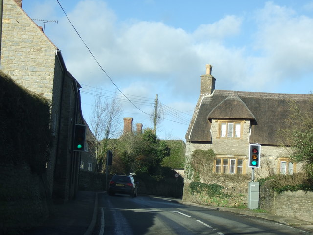
Longburton traffic lights on the narrow bend The road goes around this lovely house and is so narrow that it is only one lane wide and traffic lights have had to be installed.
704:
489:
1090:
1052:
1007:
969:
905:
901:
837:
833:
692:
676:
588:
497:
493:
485:
795:
700:
688:
684:
632:
501:
481:
1186:
1175:
1170:
42:
639:"}},"text\/plain":{"en":{"P275":"Creative Commons Attribution-ShareAlike 2.0 Generic"}}}}": -->
504:"}},"text\/plain":{"en":{"P2699":"https:\/\/www.geograph.org.uk\/profile\/9382"}}}}": -->
730:
662:
618:
288:
238:
780:
323:
1258:
This file contains additional information, probably added from the digital camera or scanner used to create or digitize it.
413:
545:
1104:
1062:
1021:
979:
946:
919:
878:
851:
758:
714:
602:
566:
553:
538:
805:
773:
743:
646:
511:
470:
707:"}},"text\/plain":{"en":{"P137":"Geograph Britain and Ireland"}}}}": -->
1014:"}},"text\/plain":{"en":{"P6757":"0.0020833333333333 second"}}}}": -->
1395:
369:
1261:
If the file has been modified from its original state, some details may not fully reflect the modified file.
1097:"}},"text\/plain":{"en":{"P2151":"18.1 millimetre"}}}}": -->
412:– If you remix, transform, or build upon the material, you must distribute your contributions under the
330:
on the
Geograph website for the photographer's contact details. The copyright on this image is owned by
595:"}},"text\/plain":{"en":{"P6216":"copyrighted"}}}}": -->
1203:
The following pages on the
English Knowledge use this file (pages on other projects are not listed):
1225:
912:"}},"text\/plain":{"en":{"P7787":"67 degree"}}}}": -->
844:"}},"text\/plain":{"en":{"P7787":"67 degree"}}}}": -->
91:
183:
1448:
765:
750:
573:
366:
167:
8:
1484:
310:
294:
244:
335:
78:
460:
1552:
1466:
1422:
1287:
1327:
156:
146:
116:
Longburton traffic lights on the narrow bend - geograph.org.uk - 316860.jpg
52:
Longburton_traffic_lights_on_the_narrow_bend_-_geograph.org.uk_-_316860.jpg
1114:
1072:
1031:
989:
929:
861:
815:
724:
656:
612:
521:
1494:
1280:
315:
1307:
1207:
327:
1570:
1297:
1270:
1143:
Click on a date/time to view the file as it appeared at that time.
280:
230:
265:
50° 54′ 39″ N, 2° 30′ 04″ W
215:
50° 54′ 39″ N, 2° 30′ 04″ W
135:
66:
1245:
1235:
454:
Add a one-line explanation of what this file represents
1201:
1216:
1141:
90:
Commons is a freely licensed media file repository.
663:
Creative
Commons Attribution-ShareAlike 2.0 Generic
637:
Creative
Commons Attribution-ShareAlike 2.0 Generic
56:(640 × 480 pixels, file size: 77 KB, MIME type:
423:https://creativecommons.org/licenses/by-sa/2.0
71:
429:Creative Commons Attribution-Share Alike 2.0
347:
131:
113:
689:https:\/\/www.geograph.org.uk\/photo\/316860
502:https:\/\/www.geograph.org.uk\/profile\/9382
198:Longburton traffic lights on the narrow bend
179:Longburton traffic lights on the narrow bend
152:
141:
14:
1094:
1011:
909:
841:
389:– to copy, distribute and transmit the work
1218:The following other wikis use this file:
751:https://www.geograph.org.uk/photo/316860
574:https://www.geograph.org.uk/profile/9382
1365:Digital Camera FinePix F30 Ver1.02
287:View this and other nearby images on:
237:View this and other nearby images on:
190:
102:
334:and is licensed for reuse under the
255:
205:
1134:
370:Attribution-Share Alike 2.0 Generic
358:
353:
338:Attribution-ShareAlike 2.0 license.
13:
1256:
459:
453:
344:
321:
120:
103:
49:
1595:
1263:
458:
1318:Date and time of data generation
1202:
852:coordinates of the point of view
834:coordinates of the point of view
444:
400:Under the following conditions:
365:This file is licensed under the
357:
352:
346:
314:
293:
279:
271:
243:
229:
221:
70:
31:
21:
441:
121:
46:No higher resolution available.
1292:1/480 sec (0.0020833333333333)
1213:
1138:
731:file available on the internet
681:file available on the internet
440:
322:This image was taken from the
26:
1:
1489:Flash did not fire, auto mode
920:coordinates of depicted place
902:coordinates of depicted place
36:
1198:
781:Geograph Britain and Ireland
705:Geograph Britain and Ireland
539:object of statement has role
486:object of statement has role
466:Items portrayed in this file
306:
7:
1520:Focal plane resolution unit
1406:Date and time of digitizing
1253:
270:
220:
10:
1600:
1531:One-chip color area sensor
1242:Usage on pl.wikipedia.org
1232:Usage on nl.wikipedia.org
1222:Usage on fa.wikipedia.org
935:50°54'39.06"N, 2°30'3.60"W
867:50°54'39.06"N, 2°30'3.60"W
414:same or compatible license
110:
105:
1371:File change date and time
1135:
16:
1512:Focal plane Y resolution
1504:Focal plane X resolution
759:geograph.org.uk image ID
693:geograph.org.uk image ID
443:
380:
77:This is a file from the
41:
1536:Custom image processing
1192:
1171:15:14, 30 December 2010
168:required by the license
134:
81:. Information from its
1580:Subject distance range
1414:Image compression mode
1409:12:20, 20 January 2007
1374:12:20, 20 January 2007
1321:12:20, 20 January 2007
328:this photograph's page
299:50.910850; -2.501000
249:50.910850; -2.501000
196:Val Ghose /
177:Val Ghose /
84:description page there
1458:Maximum land aperture
1345:Horizontal resolution
1379:Y and C positioning
1353:Vertical resolution
1267:Camera manufacturer
1037:0.0020833333333333
395:– to adapt the work
1562:Scene capture type
1557:Auto white balance
554:author name string
494:author name string
1587:
1586:
1214:Global file usage
1196:
1096:
1013:
911:
843:
647:copyright license
633:copyright license
452:
343:
342:
326:collection. See
304:
303:
254:
253:
203:
202:
171:
99:
98:
79:Wikimedia Commons
32:Global file usage
1591:
1387:Exposure Program
1264:
1183:
1145:
1123:
1040:
957:
956:
951:
889:
888:
883:
783:
778:
768:
763:
753:
748:
744:described at URL
685:described at URL
603:copyright status
589:copyright status
576:
571:
561:
558:
548:
543:
450:
436:
433:
430:
427:
424:
416:as the original.
378:
367:Creative Commons
361:
360:
356:
355:
350:
349:
336:Creative Commons
324:Geograph project
318:
311:
300:
297:
283:
282:
276:
275:
274:
268:
267:
256:
250:
247:
233:
232:
226:
225:
224:
218:
217:
206:
165:
137:
125:
117:
111:
95:
74:
73:
67:
61:
59:
1599:
1598:
1594:
1593:
1592:
1590:
1589:
1588:
1461:3 APEX (f/2.83)
1440:APEX brightness
1281:FinePix F30
1252:
1212:
1204:
1197:
1189:
1181:
1137:
1136:
1133:
1132:
1131:
1130:
1129:
1128:
1127:
1126:
1124:
1121:
1111:
1110:
1109:
1107:
1088:
1087:
1086:
1085:
1084:
1083:
1082:
1081:
1079:
1069:
1068:
1067:
1065:
1050:
1049:
1048:
1047:
1046:
1045:
1044:
1043:
1041:
1038:
1028:
1027:
1026:
1024:
1005:
1004:
1003:
1002:
1001:
1000:
999:
998:
996:
986:
985:
984:
982:
967:
966:
965:
964:
963:
962:
961:
960:
959:
958:
954:
952:
949:
940:
939:
938:
936:
926:
925:
924:
922:
899:
898:
897:
896:
895:
894:
893:
892:
891:
890:
886:
884:
881:
872:
871:
870:
868:
858:
857:
856:
854:
831:
830:
829:
828:
827:
826:
825:
824:
822:
821:20 January 2007
812:
811:
810:
808:
793:
792:
791:
790:
789:
788:
787:
786:
785:
784:
779:
776:
770:
769:
764:
761:
755:
754:
749:
746:
737:
736:
735:
733:
721:
720:
719:
717:
674:
673:
672:
671:
670:
669:
668:
667:
665:
653:
652:
651:
649:
630:
629:
628:
627:
626:
625:
624:
623:
621:
609:
608:
607:
605:
586:
585:
584:
583:
582:
581:
580:
579:
578:
577:
572:
569:
563:
562:
559:
556:
550:
549:
544:
541:
532:
531:
530:
528:
518:
517:
516:
514:
479:
478:
477:
476:
475:
473:
457:
456:
455:
438:
437:
434:
431:
428:
425:
422:
421:
379:
376:
373:
362:
339:
309:
298:
272:
263:
262:
259:Object location
248:
222:
213:
212:
209:Camera location
204:
193:
186:
174:
147:geograph.org.uk
136:20 January 2007
127:
115:
108:
101:
100:
89:
88:
87:is shown below.
63:
57:
55:
48:
47:
12:
11:
5:
1597:
1585:
1584:
1581:
1577:
1576:
1573:
1567:
1566:
1563:
1559:
1558:
1555:
1549:
1548:
1545:
1541:
1540:
1539:Normal process
1537:
1533:
1532:
1529:
1528:Sensing method
1525:
1524:
1521:
1517:
1516:
1513:
1509:
1508:
1505:
1501:
1500:
1497:
1491:
1490:
1487:
1481:
1480:
1477:
1473:
1472:
1469:
1463:
1462:
1459:
1455:
1454:
1451:
1445:
1444:
1441:
1437:
1436:
1433:
1429:
1428:
1425:
1419:
1418:
1415:
1411:
1410:
1407:
1403:
1402:
1399:
1392:
1391:
1390:Normal program
1388:
1384:
1383:
1380:
1376:
1375:
1372:
1368:
1367:
1362:
1358:
1357:
1354:
1350:
1349:
1346:
1342:
1341:
1338:
1334:
1333:
1330:
1323:
1322:
1319:
1315:
1314:
1311:
1304:
1303:
1300:
1294:
1293:
1290:
1284:
1283:
1278:
1274:
1273:
1268:
1255:
1251:
1250:
1249:
1248:
1240:
1239:
1238:
1230:
1229:
1228:
1215:
1211:
1210:
1200:
1195:
1194:
1191:
1187:
1184:
1178:
1173:
1168:
1164:
1163:
1160:
1157:
1154:
1151:
1148:
1140:
1125:
1119:
1117:
1116:
1115:
1113:
1112:
1108:
1103:
1101:
1100:
1099:
1098:
1092:
1080:
1077:
1075:
1074:
1073:
1071:
1070:
1066:
1061:
1059:
1058:
1057:
1056:
1054:
1042:
1036:
1034:
1033:
1032:
1030:
1029:
1025:
1020:
1018:
1017:
1016:
1015:
1009:
997:
994:
992:
991:
990:
988:
987:
983:
978:
976:
975:
974:
973:
971:
945:
944:
943:
942:
941:
937:
934:
932:
931:
930:
928:
927:
923:
918:
916:
915:
914:
913:
907:
903:
877:
876:
875:
874:
873:
869:
866:
864:
863:
862:
860:
859:
855:
850:
848:
847:
846:
845:
839:
835:
823:
820:
818:
817:
816:
814:
813:
809:
804:
802:
801:
800:
799:
797:
772:
771:
757:
756:
742:
741:
740:
739:
738:
734:
729:
727:
726:
725:
723:
722:
718:
715:source of file
713:
711:
710:
709:
708:
706:
702:
698:
694:
690:
686:
682:
678:
677:source of file
666:
661:
659:
658:
657:
655:
654:
650:
645:
643:
642:
641:
640:
638:
634:
622:
617:
615:
614:
613:
611:
610:
606:
601:
599:
598:
597:
596:
594:
590:
565:
564:
552:
551:
537:
536:
535:
534:
533:
529:
526:
524:
523:
522:
520:
519:
515:
510:
508:
507:
506:
505:
503:
499:
495:
491:
487:
483:
474:
469:
467:
464:
463:
462:
461:
449:
448:
445:
442:
420:
419:
418:
417:
407:
398:
397:
396:
390:
383:You are free:
374:
364:
363:
345:
341:
340:
319:
308:
305:
302:
301:
291:
285:
260:
252:
251:
241:
235:
210:
201:
200:
194:
191:
188:
187:
182:
175:
172:
160:
159:
154:
150:
149:
143:
139:
138:
133:
129:
128:
118:
109:
107:
104:
97:
96:
75:
65:
64:
45:
40:
39:
34:
29:
24:
19:
9:
6:
4:
3:
2:
1596:
1582:
1579:
1578:
1574:
1572:
1569:
1568:
1564:
1561:
1560:
1556:
1554:
1553:White balance
1551:
1550:
1547:Auto exposure
1546:
1544:Exposure mode
1543:
1542:
1538:
1535:
1534:
1530:
1527:
1526:
1522:
1519:
1518:
1514:
1511:
1510:
1506:
1503:
1502:
1498:
1496:
1493:
1492:
1488:
1486:
1483:
1482:
1478:
1475:
1474:
1470:
1468:
1467:Metering mode
1465:
1464:
1460:
1457:
1456:
1452:
1450:
1449:Exposure bias
1447:
1446:
1442:
1439:
1438:
1434:
1432:APEX aperture
1431:
1430:
1426:
1424:
1423:Shutter speed
1421:
1420:
1416:
1413:
1412:
1408:
1405:
1404:
1400:
1397:
1394:
1393:
1389:
1386:
1385:
1381:
1378:
1377:
1373:
1370:
1369:
1366:
1363:
1361:Software used
1360:
1359:
1355:
1352:
1351:
1347:
1344:
1343:
1339:
1336:
1335:
1331:
1329:
1325:
1324:
1320:
1317:
1316:
1312:
1309:
1306:
1305:
1301:
1299:
1296:
1295:
1291:
1289:
1288:Exposure time
1286:
1285:
1282:
1279:
1276:
1275:
1272:
1269:
1266:
1265:
1262:
1259:
1247:
1244:
1243:
1241:
1237:
1234:
1233:
1231:
1227:
1224:
1223:
1221:
1220:
1219:
1209:
1206:
1205:
1190:
1185:
1179:
1177:
1174:
1172:
1169:
1166:
1165:
1161:
1158:
1155:
1152:
1149:
1147:
1146:
1144:
1118:
1106:
1102:
1076:
1064:
1060:
1035:
1023:
1022:exposure time
1019:
1008:exposure time
993:
981:
977:
948:
933:
921:
917:
880:
865:
853:
849:
819:
807:
803:
782:
775:
767:
760:
752:
745:
732:
728:
716:
712:
664:
660:
648:
644:
620:
616:
604:
600:
575:
568:
555:
547:
540:
525:
513:
509:
472:
468:
465:
446:
439:
426:CC BY-SA 2.0
415:
411:
408:
405:
402:
401:
399:
394:
391:
388:
385:
384:
382:
381:
375:Attribution:
371:
368:
351:
337:
333:
329:
325:
320:
317:
313:
312:
296:
292:
290:
289:OpenStreetMap
286:
284:
266:
261:
258:
257:
246:
242:
240:
239:OpenStreetMap
236:
234:
216:
211:
208:
207:
199:
195:
189:
185:
181: /
180:
176:
169:
164:
162:
161:
158:
155:
151:
148:
144:
140:
130:
124:
119:
112:
93:
86:
85:
80:
76:
69:
68:
62:
53:
44:
38:
35:
33:
30:
28:
25:
23:
20:
18:
15:
1476:Light source
1328:focal length
1277:Camera model
1260:
1257:
1217:
1142:
1139:File history
1105:focal length
1091:focal length
546:photographer
490:photographer
409:
403:
392:
386:
331:
269:
219:
197:
184:CC BY-SA 2.0
178:
122:
92:You can help
82:
50:
22:File history
1495:Color space
1337:Orientation
1188:GeographBot
619:copyrighted
593:copyrighted
410:share alike
404:attribution
163:Attribution
114:Description
1246:Longburton
1236:Longburton
1208:Longburton
1199:File usage
1180:640 × 480
1156:Dimensions
1122:millimetre
1095:millimetre
527:some value
58:image/jpeg
27:File usage
1571:Sharpness
1308:ISO speed
1226:لانگبرتون
1153:Thumbnail
1150:Date/Time
980:ISO speed
970:ISO speed
806:inception
796:inception
560:Val Ghose
377:Val Ghose
332:Val Ghose
307:Licensing
192:InfoField
173:InfoField
157:Val Ghose
123:English:
1565:Standard
1382:Co-sited
1298:F-number
1271:FUJIFILM
1254:Metadata
1063:f-number
1053:f-number
774:operator
701:operator
447:Captions
393:to remix
387:to share
372:license.
37:Metadata
1583:Unknown
1479:Unknown
1471:Pattern
1398:version
1332:18.1 mm
1182:(77 KB)
1167:current
1162:Comment
947:heading
906:heading
879:heading
838:heading
512:creator
482:creator
471:depicts
451:English
106:Summary
54:
1356:72 dpi
1348:72 dpi
1340:Normal
1310:rating
1039:second
1012:second
955:degree
910:degree
887:degree
842:degree
766:316860
697:316860
277:
227:
153:Author
142:Source
1515:3,703
1507:3,703
1485:Flash
1326:Lens
1302:f/4.3
1120:18.1
145:From
1499:sRGB
1443:8.91
1427:8.93
1396:Exif
1159:User
435:true
432:true
132:Date
17:File
1435:4.2
1401:2.2
1313:100
1078:4.3
995:100
953:67
885:67
567:URL
498:URL
950::
882::
777::
762::
747::
570::
557::
542::
1575:3
1523:3
1453:0
1417:2
170:)
166:(
94:.
60:)
Text is available under the Creative Commons Attribution-ShareAlike License. Additional terms may apply.
_heading:67.00&language=en)
_heading:67.00&language=en)
