43:
204:
210:
215:
99:
402:"}},"text\/plain":{"en":{"":"copyright license"}}},"{\"value\":{\"entity-type\":\"item\",\"numeric-id\":19068220,\"id\":\"Q19068220\"},\"type\":\"wikibase-entityid\"}":{"text\/html":{"en":{"P275":"
358:"}},"text\/plain":{"en":{"":"copyright status"}}},"{\"value\":{\"entity-type\":\"item\",\"numeric-id\":50423863,\"id\":\"Q50423863\"},\"type\":\"wikibase-entityid\"}":{"text\/html":{"en":{"P6216":"
514:
544:
354:
256:– You must give appropriate credit, provide a link to the license, and indicate if changes were made. You may do so in any reasonable manner, but not in any way that suggests the licensor endorses you or your use.
565:
959:
403:
359:
993:
759:
676:
355:
399:
73:
69:
65:
61:
57:
53:
47:
671:
110:
82:
909:
934:
524:
494:
869:
406:"}},"text\/plain":{"en":{"P275":"Creative Commons Attribution-ShareAlike 2.0 Generic"}}}}": -->
889:
864:
914:
824:
188:
543:
538:
513:
508:
879:
849:
429:
385:
809:
1004:
This file contains additional information, probably added from the digital camera or scanner used to create or digitize it.
894:
263:
369:
974:
954:
844:
829:
413:
344:
729:
694:
562:
964:
939:
814:
225:
1007:
If the file has been modified from its original state, some details may not fully reflect the modified file.
929:
979:
779:
709:
483:
478:
42:
984:
949:
944:
819:
749:
794:
262:– If you remix, transform, or build upon the material, you must distribute your contributions under the
744:
362:"}},"text\/plain":{"en":{"P6216":"copyrighted"}}}}": -->
789:
577:
The following pages on the
English Knowledge use this file (pages on other projects are not listed):
969:
899:
719:
616:
769:
118:
586:
924:
859:
839:
804:
222:
149:
This map may be incomplete, and may contain errors. Don't rely solely on it for navigation.
8:
651:
646:
904:
834:
596:
196:
105:
621:
334:
297:
854:
666:
606:
144:
739:
704:
591:
581:
919:
874:
423:
379:
884:
631:
554:
636:
451:
Click on a date/time to view the file as it appeared at that time.
661:
641:
611:
601:
167:
87:(SVG file, nominally 3,030 × 2,033 pixels, file size: 61.5 MB)
656:
626:
795:
Module:Location map/data/Croatia
Krapina-Zagorje County/doc
677:
Module:Location map/data/Croatia
Krapina-Zagorje County/doc
143:
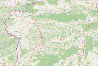
This map of
Krapinsko-zagorska županija was created from
93:
790:
Module:Location map/data/Croatia
Krapina-Zagorje County
750:
Modul:Location map/data/Krapinsko-zagorska županija/doc
672:
Module:Location map/data/Croatia
Krapina-Zagorje County
561:{{OpenStreetMap|location=Krapinsko-zagorska županija}}
328:
Add a one-line explanation of what this file represents
306:
If inappropriate please set warp_status = skip to hide.
760:ಟೆಂಪ್ಲೇಟು:Location map Croatia Krapina-Zagorje County
720:
Plantilya:Location map
Croatia Krapina-Zagorje County
575:
770:
Template:Location map
Croatia Krapina-Zagorje County
685:
449:
117:
Commons is a freely licensed media file repository.
780:Šablon:Lokacijska karta Krapinsko-zagorska županija
745:
Modul:Location map/data/Krapinsko-zagorska županija
710:Šablon:Lokacijska karta Krapinsko-zagorska županija
430:
Creative
Commons Attribution-ShareAlike 2.0 Generic
404:
Creative
Commons Attribution-ShareAlike 2.0 Generic
292:
199:Attribution-ShareAlike 2.0 license (CC-BY-SA 2.0).
195:OpenStreetMap data and maps are licensed under the
730:الگو:Location map Croatia Krapina-Zagorje County
695:قالب:Location map Croatia Krapina-Zagorje County
810:Шаблон:Location map Krapinsko-zagorska županija
273:https://creativecommons.org/licenses/by-sa/2.0
98:
279:Creative Commons Attribution-Share Alike 2.0
203:
183:
155:
135:
173:
163:
14:
239:– to copy, distribute and transmit the work
46:Size of this PNG preview of this SVG file:
147:project data, collected by the community.
132:
687:The following other wikis use this file:
138:Krapina-Zagorje County OpenStreetMap.svg
300:Georeference the map in Wikimaps Warper
129:
566:Category:Maps of counties of Croatia
442:
226:Attribution-Share Alike 2.0 Generic
214:
209:
13:
1002:
333:
327:
200:
130:
80:
1036:
1009:
332:
576:
318:
250:Under the following conditions:
221:This file is licensed under the
213:
208:
202:
97:
31:
21:
563:Category:Krapina-Zagorje County
315:
682:
446:
314:
26:
1:
298:
36:
572:
340:Items portrayed in this file
7:
999:
766:Usage on sco.wikipedia.org
740:Krapinsko-zagorska županija
716:Usage on ceb.wikipedia.org
705:Krapinsko-zagorska županija
10:
1041:
801:Usage on sr.wikipedia.org
786:Usage on si.wikipedia.org
776:Usage on sh.wikipedia.org
756:Usage on kn.wikipedia.org
736:Usage on hr.wikipedia.org
726:Usage on fa.wikipedia.org
701:Usage on bs.wikipedia.org
691:Usage on ar.wikipedia.org
264:same or compatible license
178:OpenStreetMap contributors
960:Селница (Марија Бистрица)
501:An updated version of map
443:
16:
617:Krapina Neanderthal site
317:
230:
104:This is a file from the
41:
560:
530:
500:
108:. Information from its
531:Updated version of map
509:07:19, 23 January 2015
111:description page there
587:Brestovec Orehovički
479:15:55, 18 April 2017
74:3,030 × 2,033 pixels
70:2,560 × 1,718 pixels
910:Свети Криж Зачретје
539:13:50, 7 March 2010
245:– to adapt the work
52:Other resolutions:
935:Подгорје Бистричко
890:Миховљан (општина)
597:Jasenovac Zagorski
159:(see file history)
66:1,280 × 859 pixels
62:1,024 × 687 pixels
1028:
1027:
994:more global usage
870:Крапинске Топлице
865:Краљевец на Сутли
683:Global file usage
570:
414:copyright license
400:copyright license
326:
311:
310:
307:
192:
189:Reusing this file
168:openstreetmap.org
150:
126:
125:
106:Wikimedia Commons
32:Global file usage
1032:
1010:
915:Стубичке Топлице
825:Велико Трговишће
652:Stubičke Toplice
647:Stubička Slatina
551:
521:
491:
453:
370:copyright status
356:copyright status
324:
305:
304:
302:
301:
286:
283:
280:
277:
274:
266:as the original.
223:Creative Commons
217:
216:
212:
211:
206:
205:
197:Creative Commons
186:
148:
139:
133:
122:
101:
100:
94:
88:
77:
58:640 × 429 pixels
54:320 × 215 pixels
48:800 × 537 pixels
1040:
1039:
1035:
1034:
1033:
1031:
1030:
1029:
998:
880:Марија Бистрица
850:Златар Бистрица
681:
667:Zlatar, Croatia
607:Kostel, Croatia
578:
571:
557:
549:
527:
519:
497:
489:
445:
444:
441:
440:
439:
438:
437:
436:
435:
434:
432:
420:
419:
418:
416:
397:
396:
395:
394:
393:
392:
391:
390:
388:
376:
375:
374:
372:
353:
352:
351:
350:
349:
347:
331:
330:
329:
312:
299:
296:
288:
287:
284:
281:
278:
275:
272:
271:
229:
218:
179:
151:
137:
128:
127:
116:
115:
114:is shown below.
90:
86:
79:
78:
51:
12:
11:
5:
1038:
1026:
1025:
1022:
1018:
1017:
1014:
1001:
996:of this file.
990:
989:
988:
987:
982:
977:
972:
967:
962:
957:
952:
947:
942:
937:
932:
927:
922:
917:
912:
907:
902:
897:
895:Нови Голубовец
892:
887:
882:
877:
872:
867:
862:
857:
852:
847:
842:
837:
832:
827:
822:
817:
812:
807:
799:
798:
797:
792:
784:
783:
782:
774:
773:
772:
764:
763:
762:
754:
753:
752:
747:
742:
734:
733:
732:
724:
723:
722:
714:
713:
712:
707:
699:
698:
697:
684:
680:
679:
674:
669:
664:
659:
654:
649:
644:
639:
634:
629:
624:
622:Krušljevo Selo
619:
614:
609:
604:
599:
594:
589:
584:
574:
569:
568:
559:
555:
552:
546:
541:
536:
533:
532:
529:
525:
522:
518:2,820 × 1,899
516:
511:
506:
503:
502:
499:
495:
492:
488:3,030 × 2,033
486:
481:
476:
472:
471:
468:
465:
462:
459:
456:
448:
433:
428:
426:
425:
424:
422:
421:
417:
412:
410:
409:
408:
407:
405:
401:
389:
384:
382:
381:
380:
378:
377:
373:
368:
366:
365:
364:
363:
361:
357:
348:
343:
341:
338:
337:
336:
335:
323:
322:
319:
316:
309:
308:
294:
293:Georeferencing
290:
289:
270:
269:
268:
267:
257:
248:
247:
246:
240:
233:You are free:
220:
219:
201:
193:
181:
180:
177:
175:
171:
170:
165:
161:
160:
157:
153:
152:
142:
140:
131:
124:
123:
102:
92:
91:
45:
40:
39:
34:
29:
24:
19:
9:
6:
4:
3:
2:
1037:
1023:
1020:
1019:
1015:
1012:
1011:
1008:
1005:
997:
995:
986:
983:
981:
978:
976:
975:Доња Пачетина
973:
971:
968:
966:
963:
961:
958:
956:
955:Лаз Бистрички
953:
951:
948:
946:
943:
941:
938:
936:
933:
931:
928:
926:
923:
921:
918:
916:
913:
911:
908:
906:
903:
901:
898:
896:
893:
891:
888:
886:
883:
881:
878:
876:
873:
871:
868:
866:
863:
861:
858:
856:
853:
851:
848:
846:
845:Загорска Села
843:
841:
838:
836:
833:
831:
830:Горња Стубица
828:
826:
823:
821:
818:
816:
813:
811:
808:
806:
803:
802:
800:
796:
793:
791:
788:
787:
785:
781:
778:
777:
775:
771:
768:
767:
765:
761:
758:
757:
755:
751:
748:
746:
743:
741:
738:
737:
735:
731:
728:
727:
725:
721:
718:
717:
715:
711:
708:
706:
703:
702:
700:
696:
693:
692:
690:
689:
688:
678:
675:
673:
670:
668:
665:
663:
660:
658:
655:
653:
650:
648:
645:
643:
640:
638:
635:
633:
630:
628:
625:
623:
620:
618:
615:
613:
610:
608:
605:
603:
600:
598:
595:
593:
592:Donja Stubica
590:
588:
585:
583:
580:
579:
567:
564:
558:
553:
547:
545:
542:
540:
537:
535:
534:
528:
523:
517:
515:
512:
510:
507:
505:
504:
498:
493:
487:
485:
482:
480:
477:
474:
473:
469:
466:
463:
460:
457:
455:
454:
452:
431:
427:
415:
411:
387:
383:
371:
367:
346:
342:
339:
320:
313:
303:
295:
291:
276:CC BY-SA 2.0
265:
261:
258:
255:
252:
251:
249:
244:
241:
238:
235:
234:
232:
231:
227:
224:
207:
198:
194:
190:
185:
182:
176:
172:
169:
166:
162:
158:
154:
146:
145:OpenStreetMap
141:
134:
120:
113:
112:
107:
103:
96:
95:
89:
84:
83:Original file
75:
71:
67:
63:
59:
55:
49:
44:
38:
35:
33:
30:
28:
25:
23:
20:
18:
15:
1006:
1003:
991:
965:Горње Јесење
940:Доња Шемница
930:Хум на Сутли
686:
450:
447:File history
259:
253:
242:
236:
119:You can help
109:
81:
22:File history
980:Мала Ерпења
815:Бедековчина
386:copyrighted
360:copyrighted
260:share alike
254:attribution
136:Description
985:Шпичковина
950:Андрашевец
945:Познановец
820:Будиншчина
582:Andraševec
573:File usage
548:831 × 676
520:(19.35 MB)
464:Dimensions
184:Permission
27:File usage
970:Шкарићево
900:Петровско
632:Oroslavje
550:(1.48 MB)
490:(61.5 MB)
461:Thumbnail
458:Date/Time
1000:Metadata
925:Храшћина
860:Коњшчина
840:Ђурманец
805:Кумровец
637:Pregrada
526:Vedran V
496:Vedran V
321:Captions
243:to remix
237:to share
228:license.
37:Metadata
905:Радобој
835:Десинић
662:Zajezda
642:Radoboj
612:Krapina
602:Klanjec
475:current
470:Comment
345:depicts
325:English
174:Creator
85:
1024:1626pt
1021:Height
1016:2424pt
855:Јесење
164:Source
1013:Width
992:View
920:Тухељ
875:Лобор
657:Zabok
627:Lobor
885:Маче
556:Ex13
467:User
285:true
282:true
156:Date
17:File
72:|
68:|
64:|
60:|
56:|
50:.
191:)
187:(
121:.
76:.
