43:
441:"}},"text\/plain":{"en":{"":"inception"}}},"{\"value\":{\"time\":\"+2013-09-01T00:00:00Z\",\"timezone\":0,\"before\":0,\"after\":0,\"precision\":11,\"calendarmodel\":\"http:\\\/\\\/www.wikidata.org\\\/entity\\\/Q1985727\"},\"type\":\"time\"}":{"text\/html":{"en":{"P571":"1 September 2013"}},"text\/plain":{"en":{"P571":"1 September 2013"}}}}": -->
212:
218:
223:
99:
397:"}},"text\/plain":{"en":{"":"copyright license"}}},"{\"value\":{\"entity-type\":\"item\",\"numeric-id\":14946043,\"id\":\"Q14946043\"},\"type\":\"wikibase-entityid\"}":{"text\/html":{"en":{"P275":"
353:"}},"text\/plain":{"en":{"":"copyright status"}}},"{\"value\":{\"entity-type\":\"item\",\"numeric-id\":50423863,\"id\":\"Q50423863\"},\"type\":\"wikibase-entityid\"}":{"text\/html":{"en":{"P6216":"
349:
620:
270:– You must give appropriate credit, provide a link to the license, and indicate if changes were made. You may do so in any reasonable manner, but not in any way that suggests the licensor endorses you or your use.
398:
354:
625:
350:
438:
394:
580:
73:
69:
65:
61:
57:
53:
47:
110:
82:
401:"}},"text\/plain":{"en":{"P275":"Creative Commons Attribution-ShareAlike 3.0 Unported"}}}}": -->
570:
201:
610:
424:
380:
538:, UK with Kingston upon Hull highlighted. Equirectangular map projection on WGS 84 datum, with N/S stretched 165% |Source=...
708:
This file contains additional information, probably added from the digital camera or scanner used to create or digitize it.
277:
364:
685:
448:
408:
339:
174:
233:
711:
If the file has been modified from its original state, some details may not fully reflect the modified file.
276:– If you remix, transform, or build upon the material, you must distribute your contributions under the
516:
511:
42:
357:"}},"text\/plain":{"en":{"P6216":"copyrighted"}}}}": -->
144:
548:
The following pages on the
English Knowledge use this file (pages on other projects are not listed):
535:
170:
118:
173:. Most data from Boundary-Line product. Lake data from Meridian 2 product. Inset derived from
230:
8:
552:
105:
329:
167:
189:
527:
178:
458:
418:
374:
665:
149:
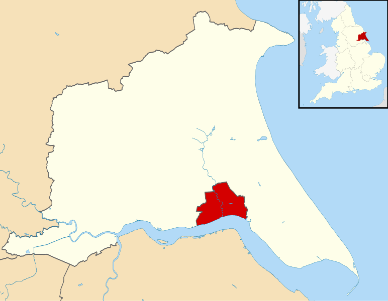
Equirectangular map projection on WGS 84 datum, with N/S stretched 165%
590:
695:
655:
484:
Click on a date/time to view the file as it appeared at that time.
241:
Contains
Ordnance Survey data © Crown copyright and database right
635:
675:
645:
600:
87:(SVG file, nominally 1,425 × 1,107 pixels, file size: 767 KB)
157:
93:
323:
Add a one-line explanation of what this file represents
546:
561:
482:
425:
Creative
Commons Attribution-ShareAlike 3.0 Unported
399:
Creative
Commons Attribution-ShareAlike 3.0 Unported
117:
Commons is a freely licensed media file repository.
287:https://creativecommons.org/licenses/by-sa/3.0
98:
293:Creative Commons Attribution-Share Alike 3.0
211:
196:
153:
135:
185:
163:
14:
253:– to copy, distribute and transmit the work
46:Size of this PNG preview of this SVG file:
147:, UK with Kingston upon Hull highlighted.
563:The following other wikis use this file:
534:{{Information |Description=Map of the
138:Kingston upon Hull UK locator map.svg
129:
234:Attribution-Share Alike 3.0 Unported
192:, created using Ordnance Survey data
475:
222:
217:
13:
706:
328:
322:
208:
130:
80:
740:
713:
327:
547:
313:
264:Under the following conditions:
229:This file is licensed under the
221:
216:
210:
97:
31:
21:
310:
692:Usage on zh-yue.wikipedia.org
652:Usage on simple.wikipedia.org
558:
479:
309:
26:
1:
36:
543:
335:Items portrayed in this file
7:
703:
621:Category:キングストン・アポン・ハル出身の人物
567:Usage on azb.wikipedia.org
10:
745:
682:Usage on ur.wikipedia.org
672:Usage on tr.wikipedia.org
666:City of Kingston upon Hull
662:Usage on sv.wikipedia.org
642:Usage on nl.wikipedia.org
632:Usage on lv.wikipedia.org
617:Usage on ja.wikipedia.org
607:Usage on he.wikipedia.org
597:Usage on fi.wikipedia.org
587:Usage on cy.wikipedia.org
577:Usage on bn.wikipedia.org
278:same or compatible license
132:
476:
16:
591:Dinas Kingston upon Hull
536:East Riding of Yorkshire
312:
244:
175:England location map.svg
145:East Riding of Yorkshire
104:This is a file from the
41:
533:
512:20:50, 1 September 2013
156:
108:. Information from its
626:Category:キングストン・アポン・ハル
111:description page there
636:Kingstona pie Hallas
74:1,425 × 1,107 pixels
70:2,560 × 1,989 pixels
259:– to adapt the work
52:Other resolutions:
676:Kingston upon Hull
656:Kingston upon Hull
646:Kingston upon Hull
601:Kingston upon Hull
553:Kingston upon Hull
66:1,280 × 994 pixels
732:
731:
571:کینقستون آپون هال
559:Global file usage
541:
409:copyright license
395:copyright license
321:
306:
305:
205:
202:Reusing this file
126:
125:
106:Wikimedia Commons
32:Global file usage
736:
714:
611:קינגסטון על ההאל
524:
486:
464:1 September 2013
365:copyright status
351:copyright status
319:
300:
297:
294:
291:
288:
280:as the original.
242:
231:Creative Commons
225:
224:
220:
219:
214:
213:
199:
159:
158:1 September 2013
139:
133:
122:
101:
100:
94:
88:
77:
62:989 × 768 pixels
58:618 × 480 pixels
54:309 × 240 pixels
48:772 × 600 pixels
744:
743:
739:
738:
737:
735:
734:
733:
702:
581:কিংস্টন আপন হাল
557:
549:
542:
530:
522:
478:
477:
474:
473:
472:
471:
470:
469:
468:
467:
465:
455:
454:
453:
451:
436:
435:
434:
433:
432:
431:
430:
429:
427:
415:
414:
413:
411:
392:
391:
390:
389:
388:
387:
386:
385:
383:
371:
370:
369:
367:
348:
347:
346:
345:
344:
342:
326:
325:
324:
307:
302:
301:
298:
295:
292:
289:
286:
285:
243:
240:
237:
226:
168:Ordnance Survey
137:
128:
127:
116:
115:
114:is shown below.
90:
86:
79:
78:
51:
12:
11:
5:
742:
730:
729:
726:
722:
721:
718:
705:
701:
700:
699:
698:
690:
689:
688:
686:کنگسٹن اپون ہل
680:
679:
678:
670:
669:
668:
660:
659:
658:
650:
649:
648:
640:
639:
638:
630:
629:
628:
623:
615:
614:
613:
605:
604:
603:
595:
594:
593:
585:
584:
583:
575:
574:
573:
560:
556:
555:
545:
540:
539:
532:
528:
525:
521:1,425 × 1,107
519:
514:
509:
505:
504:
501:
498:
495:
492:
489:
481:
466:
463:
461:
460:
459:
457:
456:
452:
447:
445:
444:
443:
442:
440:
428:
423:
421:
420:
419:
417:
416:
412:
407:
405:
404:
403:
402:
400:
396:
384:
379:
377:
376:
375:
373:
372:
368:
363:
361:
360:
359:
358:
356:
352:
343:
338:
336:
333:
332:
331:
330:
318:
317:
314:
311:
304:
303:
284:
283:
282:
281:
271:
262:
261:
260:
254:
247:You are free:
238:
228:
227:
209:
206:
194:
193:
187:
183:
182:
165:
161:
160:
155:
151:
150:
140:
131:
124:
123:
102:
92:
91:
45:
40:
39:
34:
29:
24:
19:
9:
6:
4:
3:
2:
741:
727:
724:
723:
719:
716:
715:
712:
709:
697:
694:
693:
691:
687:
684:
683:
681:
677:
674:
673:
671:
667:
664:
663:
661:
657:
654:
653:
651:
647:
644:
643:
641:
637:
634:
633:
631:
627:
624:
622:
619:
618:
616:
612:
609:
608:
606:
602:
599:
598:
596:
592:
589:
588:
586:
582:
579:
578:
576:
572:
569:
568:
566:
565:
564:
554:
551:
550:
537:
531:
526:
520:
518:
515:
513:
510:
507:
506:
502:
499:
496:
493:
490:
488:
487:
485:
462:
450:
446:
426:
422:
410:
406:
382:
378:
366:
362:
341:
337:
334:
315:
308:
290:CC BY-SA 3.0
279:
275:
272:
269:
266:
265:
263:
258:
255:
252:
249:
248:
246:
245:
239:Attribution:
235:
232:
215:
207:
203:
198:
195:
191:
188:
184:
180:
176:
172:
169:
166:
162:
152:
148:
146:
141:
134:
120:
113:
112:
107:
103:
96:
95:
89:
84:
83:Original file
75:
71:
67:
63:
59:
55:
49:
44:
38:
35:
33:
30:
28:
25:
23:
20:
18:
15:
710:
707:
562:
483:
480:File history
273:
267:
256:
250:
142:
119:You can help
109:
81:
22:File history
381:copyrighted
355:copyrighted
274:share alike
268:attribution
143:Map of the
136:Description
544:File usage
497:Dimensions
197:Permission
27:File usage
529:Nilfanion
494:Thumbnail
491:Date/Time
449:inception
439:inception
190:Nilfanion
704:Metadata
523:(767 KB)
316:Captions
257:to remix
251:to share
236:license.
179:Spischot
171:OpenData
37:Metadata
508:current
503:Comment
340:depicts
320:English
85:
725:Height
186:Author
164:Source
717:Width
728:1107
720:1425
500:User
299:true
296:true
154:Date
17:File
177:by
696:侯城
72:|
68:|
64:|
60:|
56:|
50:.
204:)
200:(
181:.
121:.
76:.
