43:
723:"}},"text\/plain":{"en":{"":"inception"}}},"{\"value\":{\"time\":\"+2022-01-12T00:00:00Z\",\"timezone\":0,\"before\":0,\"after\":0,\"precision\":11,\"calendarmodel\":\"http:\\\/\\\/www.wikidata.org\\\/entity\\\/Q1985727\"},\"type\":\"time\"}":{"text\/html":{"en":{"P571":"12 January 2022"}},"text\/plain":{"en":{"P571":"12 January 2022"}}}}": -->
436:
313:
267:
442:
319:
447:
324:
95:
662:"}},"text\/plain":{"en":{"P275":"Creative Commons Attribution-ShareAlike 2.0 Generic"}}},"{\"value\":{\"entity-type\":\"item\",\"numeric-id\":18199165,\"id\":\"Q18199165\"},\"type\":\"wikibase-entityid\"}":{"text\/html":{"en":{"P275":"
550:"}},"text\/plain":{"en":{"P180":"Arunachal Pradesh"}}},"{\"value\":{\"entity-type\":\"item\",\"numeric-id\":97357292,\"id\":\"Q97357292\"},\"type\":\"wikibase-entityid\"}":{"text\/html":{"en":{"P180":"
658:"}},"text\/plain":{"en":{"":"copyright license"}}},"{\"value\":{\"entity-type\":\"item\",\"numeric-id\":19068220,\"id\":\"Q19068220\"},\"type\":\"wikibase-entityid\"}":{"text\/html":{"en":{"P275":"
614:"}},"text\/plain":{"en":{"":"copyright status"}}},"{\"value\":{\"entity-type\":\"item\",\"numeric-id\":50423863,\"id\":\"Q50423863\"},\"type\":\"wikibase-entityid\"}":{"text\/html":{"en":{"P6216":"
761:"}},"text\/plain":{"en":{"":"media type"}}},"{\"value\":\"image\\\/png\",\"type\":\"string\"}":{"text\/html":{"en":{"P1163":"image\/png"}},"text\/plain":{"en":{"P1163":"image\/png"}}}}": -->
546:"}},"text\/plain":{"en":{"":"depicts"}}},"{\"value\":{\"entity-type\":\"item\",\"numeric-id\":1162,\"id\":\"Q1162\"},\"type\":\"wikibase-entityid\"}":{"text\/html":{"en":{"P180":"
757:
886:
488:– You must give appropriate credit, provide a link to the license, and indicate if changes were made. You may do so in any reasonable manner, but not in any way that suggests the licensor endorses you or your use.
365:– You must give appropriate credit, provide a link to the license, and indicate if changes were made. You may do so in any reasonable manner, but not in any way that suggests the licensor endorses you or your use.
286:
The ODbL does not require any particular license for maps produced from ODbL data. Prior to 1 August 2020, map tiles produced by the OpenStreetMap
Foundation were licensed under the
663:
659:
615:
551:
758:
611:
547:
61:
720:
655:
543:
57:
53:
47:
106:
74:
666:"}},"text\/plain":{"en":{"P275":"Creative Commons Attribution-ShareAlike 4.0 International"}}}}": -->
243:
706:
689:
641:
597:
899:
This file contains additional information, probably added from the digital camera or scanner used to create or digitize it.
495:
372:
768:
625:
580:
730:
673:
564:
854:
Uploaded a work by {{openstreetmap}} from {{url|overpass-turbo.eu}}, {{url|umap.openstreetmap.fr}} with UploadWizard
554:"}},"text\/plain":{"en":{"P180":"India-China Border Roads"}}}}": -->
457:
334:
836:
831:
65:
42:
902:
If the file has been modified from its original state, some details may not fully reflect the modified file.
868:
259:). Map tiles are licensed under the Creative Commons Attribution-ShareAlike 2.0 license (CC-BY-SA 2.0).
494:– If you remix, transform, or build upon the material, you must distribute your contributions under the
371:– If you remix, transform, or build upon the material, you must distribute your contributions under the
847:
618:"}},"text\/plain":{"en":{"P6216":"copyrighted"}}}}": -->
864:
The following pages on the
English Knowledge use this file (pages on other projects are not listed):
114:
454:
331:
204:
This map may be incomplete, and may contain errors. Don't rely solely on it for navigation.
8:
406:
101:
287:
279:
199:
252:
778:
740:
700:
683:
635:
591:
574:
256:
266:
261:
804:
Click on a date/time to view the file as it appeared at that time.
290:. Maps produced by other people may be subject to other licences.
275:
222:
175:
169:
707:
Creative
Commons Attribution-ShareAlike 4.0 International
664:
Creative
Commons Attribution-ShareAlike 4.0 International
158:
89:
415:
If inappropriate please set warp_status = skip to hide.
862:
877:
802:
113:
Commons is a freely licensed media file repository.
690:
Creative
Commons Attribution-ShareAlike 2.0 Generic
660:
Creative
Commons Attribution-ShareAlike 2.0 Generic
401:
79:(1,620 × 831 pixels, file size: 481 KB, MIME type:
505:https://creativecommons.org/licenses/by-sa/4.0
382:https://creativecommons.org/licenses/by-sa/2.0
94:
511:Creative Commons Attribution-Share Alike 4.0
435:
388:Creative Commons Attribution-Share Alike 2.0
312:
299:http://opendatacommons.org/licenses/odbl/1.0/
238:
210:
190:
154:
136:
228:
218:
182:
164:
14:
471:– to copy, distribute and transmit the work
348:– to copy, distribute and transmit the work
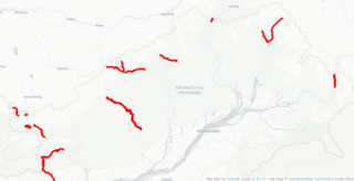
193:ICBR Roads in Arunachal Pradesh Phase 1.png
139:ICBR Roads in Arunachal Pradesh Phase 1.png
251:OpenStreetMap data is available under the
202:project data, collected by the community.
187:
879:The following other wikis use this file:
458:Attribution-Share Alike 4.0 International
409:Georeference the map in Wikimaps Warper
536:ICB Roads in Arunachal Pradesh Phase 1
149:ICB Roads in Arunachal Pradesh Phase 1
125:
278:, which is made available under the
274:This work contains information from
795:
446:
441:
335:Attribution-Share Alike 2.0 Generic
323:
318:
13:
897:
541:
535:
432:
309:
143:
126:
72:
931:
904:
540:
863:
526:
482:Under the following conditions:
453:This file is licensed under the
445:
440:
434:
359:Under the following conditions:
330:This file is licensed under the
322:
317:
311:
265:
93:
31:
21:
523:
144:
874:
799:
522:
26:
1:
407:
36:
859:
560:Items portrayed in this file
428:
280:Open Database License (ODbL)
264:
7:
894:
198:This map was created from
10:
936:
883:Usage on te.wikipedia.org
496:same or compatible license
373:same or compatible license
233:OpenStreetMap contributors
133:
128:
887:భారత చైనా సరిహద్దు రోడ్లు
796:
16:
869:India–China Border Roads
598:India-China Border Roads
552:India-China Border Roads
525:
462:
339:
100:This is a file from the
41:
853:
157:
104:. Information from its
832:13:51, 12 January 2022
107:description page there
46:Size of this preview:
908:Horizontal resolution
293:Open Database License
253:Open Database License
176:umap.openstreetmap.fr
849:FacetsOfNonStickPans
288:CC-BY-SA-2.0 license
916:Vertical resolution
477:– to adapt the work
354:– to adapt the work
52:Other resolutions:
214:(see file history)
66:1,620 × 831 pixels
62:1,024 × 525 pixels
923:
922:
875:Global file usage
857:
674:copyright license
656:copyright license
581:Arunachal Pradesh
548:Arunachal Pradesh
534:
425:
424:
420:
419:
416:
308:
307:
291:
247:
244:Reusing this file
223:openstreetmap.org
205:
170:overpass-turbo.eu
122:
121:
102:Wikimedia Commons
32:Global file usage
927:
905:
844:
806:
626:copyright status
612:copyright status
532:
518:
515:
512:
509:
506:
498:as the original.
455:Creative Commons
449:
448:
444:
443:
438:
437:
414:
413:
411:
410:
395:
392:
389:
386:
383:
375:as the original.
332:Creative Commons
326:
325:
321:
320:
315:
314:
303:
300:
297:
294:
285:
269:
262:
241:
203:
194:
188:
178:
172:
160:
148:
140:
134:
118:
97:
96:
90:
84:
82:
69:
58:640 × 328 pixels
54:320 × 164 pixels
48:800 × 410 pixels
935:
934:
930:
929:
928:
926:
925:
924:
893:
873:
865:
858:
850:
842:
798:
797:
794:
793:
792:
791:
790:
789:
788:
787:
785:
775:
774:
773:
771:
756:
755:
754:
753:
752:
751:
750:
749:
747:
746:12 January 2022
737:
736:
735:
733:
718:
717:
716:
715:
714:
713:
712:
711:
709:
698:
697:
696:
695:
694:
692:
680:
679:
678:
676:
653:
652:
651:
650:
649:
648:
647:
646:
644:
632:
631:
630:
628:
609:
608:
607:
606:
605:
604:
603:
602:
600:
589:
588:
587:
586:
585:
583:
571:
570:
569:
567:
539:
538:
537:
520:
519:
516:
513:
510:
507:
504:
503:
461:
450:
431:
426:
421:
408:
405:
397:
396:
393:
390:
387:
384:
381:
380:
338:
327:
301:
298:
295:
292:
234:
206:
192:
174:
168:
159:12 January 2022
150:
138:
131:
124:
123:
112:
111:
110:is shown below.
86:
80:
78:
71:
70:
51:
12:
11:
5:
933:
921:
920:
917:
913:
912:
909:
896:
892:
891:
890:
889:
876:
872:
871:
861:
856:
855:
852:
848:
845:
839:
834:
829:
825:
824:
821:
818:
815:
812:
809:
801:
786:
783:
781:
780:
779:
777:
776:
772:
767:
765:
764:
763:
762:
760:
748:
745:
743:
742:
741:
739:
738:
734:
729:
727:
726:
725:
724:
722:
710:
705:
703:
702:
701:
699:
693:
688:
686:
685:
684:
682:
681:
677:
672:
670:
669:
668:
667:
665:
661:
657:
645:
640:
638:
637:
636:
634:
633:
629:
624:
622:
621:
620:
619:
617:
613:
601:
596:
594:
593:
592:
590:
584:
579:
577:
576:
575:
573:
572:
568:
563:
561:
558:
557:
556:
555:
553:
549:
545:
531:
530:
527:
524:
502:
501:
500:
499:
489:
480:
479:
478:
472:
465:You are free:
452:
451:
433:
430:
427:
423:
422:
418:
417:
403:
402:Georeferencing
399:
398:
379:
378:
377:
376:
366:
357:
356:
355:
349:
342:You are free:
329:
328:
310:
306:
305:
272:
270:
248:
236:
235:
232:
230:
226:
225:
220:
216:
215:
212:
208:
207:
197:
195:
186:
184:
180:
179:
166:
162:
161:
156:
152:
151:
141:
132:
130:
127:
120:
119:
98:
88:
87:
45:
40:
39:
34:
29:
24:
19:
9:
6:
4:
3:
2:
932:
918:
915:
914:
910:
907:
906:
903:
900:
888:
885:
884:
882:
881:
880:
870:
867:
866:
851:
846:
840:
838:
835:
833:
830:
827:
826:
822:
819:
816:
813:
810:
808:
807:
805:
782:
770:
766:
744:
732:
728:
708:
704:
691:
687:
675:
671:
643:
639:
627:
623:
599:
595:
582:
578:
566:
562:
559:
528:
521:
508:CC BY-SA 4.0
497:
493:
490:
487:
484:
483:
481:
476:
473:
470:
467:
466:
464:
463:
459:
456:
439:
412:
404:
400:
385:CC BY-SA 2.0
374:
370:
367:
364:
361:
360:
358:
353:
350:
347:
344:
343:
341:
340:
336:
333:
316:
304:
289:
283:
281:
277:
276:OpenStreetMap
273:
271:
268:
263:
260:
258:
254:
249:
245:
240:
237:
231:
227:
224:
221:
217:
213:
209:
201:
200:OpenStreetMap
196:
189:
185:
181:
177:
171:
167:
163:
153:
147:
142:
135:
116:
109:
108:
103:
99:
92:
91:
85:
76:
75:Original file
67:
63:
59:
55:
49:
44:
38:
35:
33:
30:
28:
25:
23:
20:
18:
15:
901:
898:
878:
841:1,620 × 831
803:
800:File history
491:
485:
474:
468:
368:
362:
351:
345:
284:
250:
145:
115:You can help
105:
73:
22:File history
642:copyrighted
616:copyrighted
492:share alike
486:attribution
369:share alike
363:attribution
191:Description
137:Description
860:File usage
817:Dimensions
769:media type
759:media type
239:Permission
27:File usage
919:56.69 dpc
911:56.69 dpc
814:Thumbnail
811:Date/Time
784:image/png
731:inception
721:inception
429:Licensing
146:English:
81:image/png
895:Metadata
843:(481 KB)
529:Captions
475:to remix
469:to share
460:license.
352:to remix
346:to share
337:license.
37:Metadata
828:current
823:Comment
565:depicts
544:depicts
533:English
257:details
229:Creator
129:Summary
77:
219:Source
183:Author
165:Source
820:User
517:true
514:true
394:true
391:true
302:true
296:ODbL
211:Date
155:Date
17:File
282:.
173:,
64:|
60:|
56:|
50:.
255:(
246:)
242:(
117:.
83:)
68:.
Text is available under the Creative Commons Attribution-ShareAlike License. Additional terms may apply.
