613:"}},"text\/plain":{"en":{"":"inception"}}},"{\"value\":{\"time\":\"+2009-09-01T00:00:00Z\",\"timezone\":0,\"before\":0,\"after\":0,\"precision\":11,\"calendarmodel\":\"http:\\\/\\\/www.wikidata.org\\\/entity\\\/Q1985727\"},\"type\":\"time\"}":{"text\/html":{"en":{"P571":"1 September 2009"}},"text\/plain":{"en":{"P571":"1 September 2009"}}}}": -->
395:
272:
401:
278:
38:
406:
283:
90:
569:"}},"text\/plain":{"en":{"":"copyright license"}}},"{\"value\":{\"entity-type\":\"item\",\"numeric-id\":19068220,\"id\":\"Q19068220\"},\"type\":\"wikibase-entityid\"}":{"text\/html":{"en":{"P275":"
525:"}},"text\/plain":{"en":{"":"copyright status"}}},"{\"value\":{\"entity-type\":\"item\",\"numeric-id\":50423863,\"id\":\"Q50423863\"},\"type\":\"wikibase-entityid\"}":{"text\/html":{"en":{"P6216":"
651:"}},"text\/plain":{"en":{"":"media type"}}},"{\"value\":\"image\\\/png\",\"type\":\"string\"}":{"text\/html":{"en":{"P1163":"image\/png"}},"text\/plain":{"en":{"P1163":"image\/png"}}}}": -->
647:
447:– You must give appropriate credit, provide a link to the license, and indicate if changes were made. You may do so in any reasonable manner, but not in any way that suggests the licensor endorses you or your use.
324:– You must give appropriate credit, provide a link to the license, and indicate if changes were made. You may do so in any reasonable manner, but not in any way that suggests the licensor endorses you or your use.
570:
526:
648:
522:
610:
566:
573:"}},"text\/plain":{"en":{"P275":"Creative Commons Attribution-ShareAlike 2.0 Generic"}}}}": -->
748:}} |Source=http://www.openstreetmap.org/?lat=41.7595&lon=-87.5838&zoom=12&layers=B000FTF |Author=OpenStreetMap and edited by
256:
187:
144:
745:
596:
552:
165:
454:
331:
56:
52:
48:
42:
101:
658:
536:
69:
620:
580:
511:
416:
293:
766:
453:– If you remix, transform, or build upon the material, you must distribute your contributions under the
330:– If you remix, transform, or build upon the material, you must distribute your contributions under the
529:"}},"text\/plain":{"en":{"P6216":"copyrighted"}}}}": -->
762:
The following pages on the
English Knowledge use this file (pages on other projects are not listed):
109:
413:
290:
212:
This map may be incomplete, and may contain errors. Don't rely solely on it for navigation.
8:
771:
166:
http://www.openstreetmap.org/?lat=41.7595&lon=-87.5838&zoom=12&layers=B000FTF
726:
721:
60:
37:
176:
749:
737:
264:
96:
501:
365:
207:
235:
668:
630:
590:
546:
694:
Click on a date/time to view the file as it appeared at that time.
155:
84:
495:
Add a one-line explanation of what this file represents
374:
If inappropriate please set warp_status = skip to hide.
789:
760:
74:(1,206 × 1,146 pixels, file size: 979 KB, MIME type:
780:
692:
108:
Commons is a freely licensed media file repository.
597:
Creative
Commons Attribution-ShareAlike 2.0 Generic
571:
Creative
Commons Attribution-ShareAlike 2.0 Generic
360:
267:Attribution-ShareAlike 2.0 license (CC-BY-SA 2.0).
263:OpenStreetMap data and maps are licensed under the
464:https://creativecommons.org/licenses/by-sa/2.0
341:https://creativecommons.org/licenses/by-sa/2.0
89:
470:Creative Commons Attribution-Share Alike 2.0
394:
347:Creative Commons Attribution-Share Alike 2.0
271:
251:
218:
198:
182:
151:
131:
241:
226:
171:
161:
14:
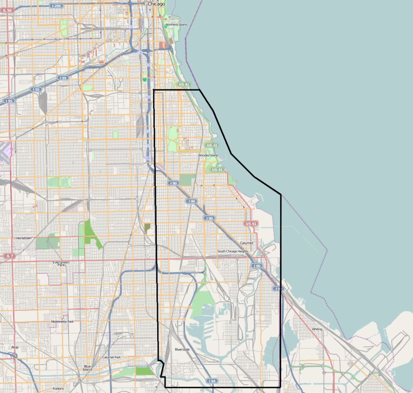
746:w:Hyde Park Township, Cook County, Illinois
430:– to copy, distribute and transmit the work
307:– to copy, distribute and transmit the work
145:w:Hyde Park Township, Cook County, Illinois
210:project data, collected by the community.
195:
782:The following other wikis use this file:
368:Georeference the map in Wikimaps Warper
236:OpenStreetMap wiki page for Cambridge
120:
685:
417:Attribution-Share Alike 2.0 Generic
405:
400:
294:Attribution-Share Alike 2.0 Generic
282:
277:
13:
744:{{Information |Description={{en|1=
500:
494:
391:
268:
138:
121:
67:
803:
499:
761:
485:
441:Under the following conditions:
412:This file is licensed under the
404:
399:
393:
318:Under the following conditions:
289:This file is licensed under the
281:
276:
270:
88:
31:
21:
482:
139:
777:
689:
481:
26:
1:
366:
767:Hyde Park Township, Illinois
757:
507:Items portrayed in this file
387:
175:OpenStreetMap and edited by
7:
206:This map was created from
10:
808:
786:Usage on www.wikidata.org
455:same or compatible license
332:same or compatible license
246:OpenStreetMap contributors
128:
123:
686:
16:
484:
421:
298:
95:This is a file from the
36:
752:|Date=2009-09-01 |Permi
743:
722:03:10, 1 September 2009
154:
99:. Information from its
201:Hyde Park Township.PNG
134:Hyde Park Township.PNG
102:description page there
41:Size of this preview:
61:1,206 × 1,146 pixels
772:South Side, Chicago
750:w:User:TonyTheTiger
436:– to adapt the work
313:– to adapt the work
234:find a page on the
177:w:User:TonyTheTiger
47:Other resolutions:
222:(see file history)
778:Global file usage
755:
581:copyright license
567:copyright license
493:
384:
383:
379:
378:
375:
260:
257:Reusing this file
213:
191:
188:Reusing this file
117:
116:
97:Wikimedia Commons
32:Global file usage
799:
734:
696:
636:1 September 2009
537:copyright status
523:copyright status
491:
477:
474:
471:
468:
465:
457:as the original.
414:Creative Commons
408:
407:
403:
402:
397:
396:
373:
372:
370:
369:
354:
351:
348:
345:
342:
334:as the original.
291:Creative Commons
285:
284:
280:
279:
274:
273:
265:Creative Commons
254:
211:
202:
196:
185:
157:
156:1 September 2009
143:
135:
129:
113:
92:
91:
85:
79:
77:
64:
57:808 × 768 pixels
53:505 × 480 pixels
49:253 × 240 pixels
43:631 × 600 pixels
807:
806:
802:
801:
800:
798:
797:
796:
776:
763:
756:
740:
732:
688:
687:
684:
683:
682:
681:
680:
679:
678:
677:
675:
665:
664:
663:
661:
646:
645:
644:
643:
642:
641:
640:
639:
637:
627:
626:
625:
623:
608:
607:
606:
605:
604:
603:
602:
601:
599:
587:
586:
585:
583:
564:
563:
562:
561:
560:
559:
558:
557:
555:
543:
542:
541:
539:
520:
519:
518:
517:
516:
514:
498:
497:
496:
479:
478:
475:
472:
469:
466:
463:
462:
420:
409:
390:
385:
380:
367:
364:
356:
355:
352:
349:
346:
343:
340:
339:
297:
286:
247:
214:
200:
147:
133:
126:
119:
118:
107:
106:
105:is shown below.
81:
75:
73:
66:
65:
46:
12:
11:
5:
805:
795:
794:
793:
792:
779:
775:
774:
769:
759:
754:
753:
742:
738:
735:
731:1,206 × 1,146
729:
724:
719:
715:
714:
711:
708:
705:
702:
699:
691:
676:
673:
671:
670:
669:
667:
666:
662:
657:
655:
654:
653:
652:
650:
638:
635:
633:
632:
631:
629:
628:
624:
619:
617:
616:
615:
614:
612:
600:
595:
593:
592:
591:
589:
588:
584:
579:
577:
576:
575:
574:
572:
568:
556:
551:
549:
548:
547:
545:
544:
540:
535:
533:
532:
531:
530:
528:
524:
515:
510:
508:
505:
504:
503:
502:
490:
489:
486:
483:
461:
460:
459:
458:
448:
439:
438:
437:
431:
424:You are free:
411:
410:
392:
389:
386:
382:
381:
377:
376:
362:
361:Georeferencing
358:
357:
338:
337:
336:
335:
325:
316:
315:
314:
308:
301:You are free:
288:
287:
269:
261:
249:
248:
245:
243:
239:
238:
228:
224:
223:
220:
216:
215:
205:
203:
194:
192:
180:
179:
173:
169:
168:
163:
159:
158:
153:
149:
148:
136:
127:
125:
122:
115:
114:
93:
83:
82:
40:
35:
34:
29:
24:
19:
9:
6:
4:
3:
2:
804:
791:
788:
787:
785:
784:
783:
773:
770:
768:
765:
764:
751:
747:
741:
736:
730:
728:
725:
723:
720:
717:
716:
712:
709:
706:
703:
700:
698:
697:
695:
672:
660:
656:
634:
622:
618:
598:
594:
582:
578:
554:
550:
538:
534:
513:
509:
506:
487:
480:
467:CC BY-SA 2.0
456:
452:
449:
446:
443:
442:
440:
435:
432:
429:
426:
425:
423:
422:
418:
415:
398:
371:
363:
359:
344:CC BY-SA 2.0
333:
329:
326:
323:
320:
319:
317:
312:
309:
306:
303:
302:
300:
299:
295:
292:
275:
266:
262:
258:
253:
250:
244:
240:
237:
233:
229:
225:
221:
217:
209:
208:OpenStreetMap
204:
197:
193:
189:
184:
181:
178:
174:
170:
167:
164:
160:
150:
146:
142:
137:
130:
111:
104:
103:
98:
94:
87:
86:
80:
71:
70:Original file
62:
58:
54:
50:
44:
39:
33:
30:
28:
25:
23:
20:
18:
15:
781:
739:TonyTheTiger
693:
690:File history
450:
444:
433:
427:
327:
321:
310:
304:
231:
140:
110:You can help
100:
68:
22:File history
553:copyrighted
527:copyrighted
451:share alike
445:attribution
328:share alike
322:attribution
199:Description
132:Description
758:File usage
707:Dimensions
659:media type
649:media type
252:Permission
183:Permission
27:File usage
704:Thumbnail
701:Date/Time
674:image/png
621:inception
611:inception
388:Licensing
141:English:
76:image/png
790:Q5953729
733:(979 KB)
488:Captions
434:to remix
428:to share
419:license.
311:to remix
305:to share
296:license.
718:current
713:Comment
512:depicts
492:English
242:Creator
124:Summary
72:
227:Source
172:Author
162:Source
710:User
476:true
473:true
353:true
350:true
230:You
219:Date
152:Date
17:File
232:may
59:|
55:|
51:|
45:.
259:)
255:(
190:)
186:(
112:.
78:)
63:.
Text is available under the Creative Commons Attribution-ShareAlike License. Additional terms may apply.
