989:"}},"text\/plain":{"en":{"":"inception"}}},"{\"value\":{\"time\":\"+2013-11-11T00:00:00Z\",\"timezone\":0,\"before\":0,\"after\":0,\"precision\":11,\"calendarmodel\":\"http:\\\/\\\/www.wikidata.org\\\/entity\\\/Q1985727\"},\"type\":\"time\"}":{"text\/html":{"en":{"P571":"11 November 2013"}},"text\/plain":{"en":{"P571":"11 November 2013"}}}}": -->
43:
625:
267:
631:
335:
729:
636:
587:
99:
313:
292:
945:"}},"text\/plain":{"en":{"":"copyright license"}}},"{\"value\":{\"entity-type\":\"item\",\"numeric-id\":42716613,\"id\":\"Q42716613\"},\"type\":\"wikibase-entityid\"}":{"text\/html":{"en":{"P275":"
901:"}},"text\/plain":{"en":{"":"copyright status"}}},"{\"value\":{\"entity-type\":\"item\",\"numeric-id\":50423863,\"id\":\"Q50423863\"},\"type\":\"wikibase-entityid\"}":{"text\/html":{"en":{"P6216":"
897:
1065:
694:– You must give appropriate credit, provide a link to the license, and indicate if changes were made. You may do so in any reasonable manner, but not in any way that suggests the licensor endorses you or your use.
303:
1623:
946:
902:
1778:
898:
986:
942:
1640:
1131:
1613:
1608:
1603:
1922:
1888:
1818:
69:
73:
65:
61:
57:
53:
47:
949:"}},"text\/plain":{"en":{"P275":"Creative Commons Attribution-ShareAlike 3.0 Germany"}}}}": -->
349:
1868:
1683:
1138:
1633:
1408:
110:
82:
972:
928:
1628:
1773:
1933:
This file contains additional information, probably added from the digital camera or scanner used to create or digitize it.
1448:
701:
1120:}} Geografische Begrenzung der Karte: * N: 51.756153° N * S: 49.31706° N * W: 7.597045° O * O: 10.3364° O {{en|Locatio...
1094:
1089:
912:
1743:
996:
956:
887:
1748:
646:
1618:
1813:
1853:
574:
1936:
If the file has been modified from its original state, some details may not fully reflect the modified file.
1348:
1298:
1130:
More than 100 pages use this file. The following list shows the first 100 pages that use this file only. A
342:
233:
1913:
1718:
1808:
1738:
1723:
1538:
1498:
700:– If you remix, transform, or build upon the material, you must distribute your contributions under the
1423:
1763:
266:
1583:
1568:
1523:
1518:
1483:
1148:
905:"}},"text\/plain":{"en":{"P6216":"copyrighted"}}}}": -->
1893:
1908:
1833:
1388:
1253:
1503:
1248:
118:
1588:
1268:
1064:
1059:
42:
663:
1898:
1878:
1873:
1848:
1803:
1793:
1768:
1698:
1573:
1543:
1508:
1228:
1533:
1373:
1243:
1158:
655:
643:
8:
1493:
1263:
1238:
1218:
334:
1478:
1858:
1838:
1828:
1823:
1783:
1728:
1693:
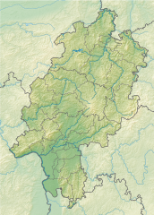
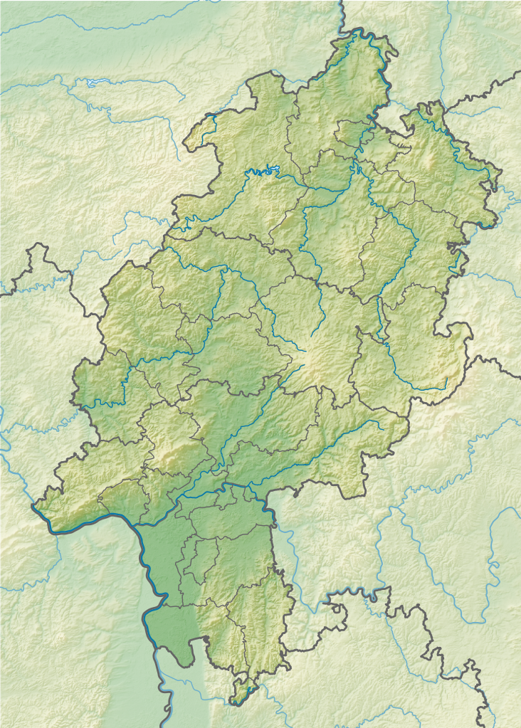
1688:
1658:
1593:
1548:
1413:
1368:
323:
248:
1668:
1343:
1338:
1598:
1393:
1308:
1293:
1273:
1213:
1105:
1075:
105:
877:
748:
384:
1433:
1418:
1383:
1318:
1168:
1143:
600:
1513:
1883:
1863:
1843:
1788:
1758:
1713:
1278:
1208:
1288:
1223:
1398:
1183:
1117:
659:
158:
1353:
492:
456:
1528:
1488:
1378:
1363:
1333:
1323:
1203:
564:
555:
546:
537:
528:
519:
510:
501:
483:
474:
465:
447:
438:
429:
420:
411:
402:
393:
375:
366:
357:
1753:
1708:
1703:
1553:
1453:
1258:
1233:
1198:
1112:== {{int:filedesc}} == {{Information |Description= {{de|Positionskarte für
252:
1006:
966:
922:
1578:
1558:
1328:
604:
1283:
1163:
1468:
1428:
1313:
1798:
1733:
1473:
1463:
1458:
1443:
1403:
1358:
1113:
298:
154:
1438:
1188:
1178:
1153:
1032:
Click on a date/time to view the file as it appeared at that time.
190:
1624:
Template:Rheingau
Members Verband Deutscher Prädikatsweingüter Map
1563:
586:
1303:
1173:
1903:
186:
312:
1193:
291:
87:(SVG file, nominally 744 × 1,040 pixels, file size: 2.69 MB)
596:
593:
319:
711:
https://creativecommons.org/licenses/by-sa/3.0/de/deed.en
218:
93:
1673:
871:
Add a one-line explanation of what this file represents
1128:
341:
This SVG map has been made or improved in the German
1649:
1614:
Knowledge:Graphics Lab/Map workshop/Archive/Jan 2022
1609:
Knowledge:Graphics Lab/Map workshop/Archive/Dec 2021
1604:
User:Michael!/Project:Location map templates/Germany
1030:
117:
Commons is a freely licensed media file repository.
973:
Creative
Commons Attribution-ShareAlike 3.0 Germany
947:
Creative
Commons Attribution-ShareAlike 3.0 Germany
847:
822:
797:
772:
844:
819:
794:
769:
717:Creative Commons Attribution-Share Alike 3.0 de
850:
825:
800:
775:
98:
841:
838:
835:
832:
816:
813:
810:
807:
791:
788:
785:
782:
766:
763:
760:
757:
624:
214:
140:
1139:2003 European Ladies' Team Championship
258:
244:
224:
14:
831:
806:
781:
756:
677:– to copy, distribute and transmit the work
46:Size of this PNG preview of this SVG file:
1634:Module:Location map/data/Germany Hesse/doc
1409:International Technical Development Center
1659:Vorlage:Positionskarte Deutschland Hessen
1651:The following other wikis use this file:
1669:Vorlog:Positionskarte Deutschland Hessen
1629:Module:Location map/data/Germany Hesse
129:
1449:List of mountains and hills of Hesse
736:
1023:
647:Attribution-Share Alike 3.0 Germany
635:
630:
163:Geografische Begrenzung der Karte:
13:
1931:
876:
870:
727:
621:
591:
340:
317:
296:
179:
147:
130:
80:
1965:
1938:
875:
861:
688:Under the following conditions:
642:This file is licensed under the
634:
629:
623:
585:
333:
311:
290:
265:
97:
31:
21:
1619:Template:Infobox Berg/testcases
858:
749:View the annotations at Commons
385:
180:
1646:
1299:Darmstadt Artists' Colony
1027:
857:
195:Geographic limits of the map:
148:
26:
1:
664:Creative Commons by-sa-3.0 de
143:Hesse relief location map.svg
36:
1125:
883:Items portrayed in this file
617:
7:
1928:
1665:Usage on bar.wikipedia.org
1655:Usage on als.wikipedia.org
1539:Staufenberg (Reinhardswald)
1499:Riesenstein (Wolfershausen)
234:File:Hesse location map.svg
10:
1970:
1680:Usage on bg.wikipedia.org
1424:Katzenstein (Habichtswald)
1349:Grüner See (Hundelshausen)
702:same or compatible license
329:
137:
132:
1584:Wattenberg (Habichtswald)
1569:Toter Mann (Seulingswald)
1524:Schweinskopf (Hinterland)
1519:Schwarzer Berg (Spessart)
1484:New Synagogue (Darmstadt)
1149:Ahrensberg (Habichtswald)
1024:
746:This image is annotated:
493:
457:
16:
1779:Шаблон:ПК Германия Хесен
860:
668:
565:
556:
547:
538:
529:
520:
511:
502:
484:
475:
466:
448:
439:
430:
421:
412:
403:
394:
376:
367:
358:
104:This is a file from the
41:
1504:Rohrberg (Habichtswald)
1249:Bellevue Palace, Kassel
1111:
1090:20:43, 11 November 2013
1081:
1060:08:26, 12 November 2013
852:Франкфурт - на - Майне
217:
108:. Information from its
1589:Wintersberg (Spessart)
1269:Burgberg (Schauenburg)
732:
273:Administrative version
111:description page there
1574:Vogelsberg (Feldatal)
1544:Staufenberg (Vellmar)
1509:Sackpfeife (mountain)
1389:Höllberg (Westerwald)
1254:Bergpark Wilhelmshöhe
1229:Augraben (Liederbach)
731:
1374:Hohe Wurzel (Taunus)
1244:Beilstein (Spessart)
1159:Altenberg (Hohenahr)
352:to improve as well.
282:SVG development
70:1,465 × 2,048 pixels
1889:Бабенхаузен (Хесен)
1494:Riedsee bei Leeheim
1264:Burgberg (Baunatal)
1239:Battle of Dettingen
1219:Auersberg (Hilders)
683:– to adapt the work
153:Positionskarte für
52:Other resolutions:
1869:Лимбург ан дер Лан
1819:Ротенбург на Фулда
1594:Wotanstein (Hesse)
1549:Steinkopf (Taunus)
1534:Southern High Rhön
1414:Kappe (Hinterland)
1369:Hohe Egge (Upland)
733:
662:, Lizenz/Licence:
386:Deutsch (Sie-Form)
74:744 × 1,040 pixels
66:732 × 1,024 pixels
1957:
1956:
1923:more global usage
1684:Франкфурт на Майн
1647:Global file usage
1599:User:Grimes2/Maps
1309:Eschenburg (hill)
1294:Dammersfeld Ridge
1274:Burghasunger Berg
1214:Auerbach (Kinzig)
1123:
957:copyright license
943:copyright license
869:
755:
754:
614:
613:
583:
582:
577:
324:Adobe Illustrator
322:was created with
126:
125:
106:Wikimedia Commons
32:Global file usage
1961:
1939:
1479:Neunkircher Höhe
1434:Kleiner Feldberg
1419:Kassel Synagogue
1384:Horst (Spessart)
1319:Frau-Holle-Teich
1224:Auf'm Knoll
1169:Angelburg (hill)
1144:Abtsrodaer Kuppe
1102:
1072:
1034:
1012:11 November 2013
913:copyright status
899:copyright status
867:
737:
730:
724:
721:
718:
715:
712:
704:as the original.
666:
644:Creative Commons
638:
637:
633:
632:
627:
626:
589:
578:
573:
337:
330:
315:
306:
294:
269:
229:Own work using:
220:
219:11 November 2013
185:Location map of
184:
152:
144:
138:
122:
101:
100:
94:
88:
77:
62:549 × 768 pixels
58:343 × 480 pixels
54:172 × 240 pixels
48:429 × 600 pixels
1969:
1968:
1964:
1963:
1962:
1960:
1959:
1958:
1927:
1774:Офенбах на Майн
1645:
1344:Großer Feldberg
1339:Große Aschkoppe
1279:Burgholz (hill)
1209:Auer (Odenwald)
1124:
1108:
1100:
1078:
1070:
1026:
1025:
1022:
1021:
1020:
1019:
1018:
1017:
1016:
1015:
1013:
1003:
1002:
1001:
999:
984:
983:
982:
981:
980:
979:
978:
977:
975:
963:
962:
961:
959:
940:
939:
938:
937:
936:
935:
934:
933:
931:
919:
918:
917:
915:
896:
895:
894:
893:
892:
890:
874:
873:
872:
855:
854:
849:
846:
843:
840:
837:
834:
830:
829:
824:
821:
818:
815:
812:
809:
805:
804:
799:
796:
793:
790:
787:
784:
780:
779:
777:Эстрих-Винкель
774:
771:
768:
765:
762:
759:
743:
735:
734:
728:
725:
722:
719:
716:
714:CC BY-SA 3.0 de
713:
710:
709:
667:
653:
650:
639:
620:
615:
610:
609:
608:
601:raster graphics
579:
567:
558:
549:
540:
531:
522:
513:
504:
495:
486:
477:
468:
459:
450:
441:
432:
423:
414:
405:
396:
387:
378:
369:
360:
356:
353:
343:Kartenwerkstatt
328:
327:
309:
308:
302:
285:
275:
274:
270:
238:SRTM30 v.2 data
199:N: 51.756153° N
193:
167:N: 51.756153° N
161:
142:
135:
128:
127:
116:
115:
114:is shown below.
90:
86:
79:
78:
51:
12:
11:
5:
1967:
1955:
1954:
1951:
1947:
1946:
1943:
1930:
1925:of this file.
1919:
1918:
1917:
1916:
1911:
1906:
1901:
1896:
1891:
1886:
1881:
1876:
1871:
1866:
1861:
1856:
1851:
1846:
1841:
1836:
1831:
1826:
1821:
1816:
1811:
1806:
1801:
1796:
1791:
1786:
1781:
1776:
1771:
1766:
1761:
1756:
1751:
1746:
1741:
1736:
1731:
1726:
1721:
1716:
1711:
1706:
1701:
1696:
1691:
1686:
1678:
1677:
1676:
1671:
1663:
1662:
1661:
1648:
1643:to this file.
1637:
1636:
1631:
1626:
1621:
1616:
1611:
1606:
1601:
1596:
1591:
1586:
1581:
1576:
1571:
1566:
1561:
1556:
1551:
1546:
1541:
1536:
1531:
1526:
1521:
1516:
1511:
1506:
1501:
1496:
1491:
1486:
1481:
1476:
1471:
1466:
1461:
1456:
1451:
1446:
1441:
1436:
1431:
1426:
1421:
1416:
1411:
1406:
1401:
1399:Iberg (Upland)
1396:
1391:
1386:
1381:
1376:
1371:
1366:
1361:
1356:
1351:
1346:
1341:
1336:
1331:
1326:
1321:
1316:
1311:
1306:
1301:
1296:
1291:
1286:
1281:
1276:
1271:
1266:
1261:
1256:
1251:
1246:
1241:
1236:
1231:
1226:
1221:
1216:
1211:
1206:
1201:
1196:
1191:
1186:
1184:Arnsbach (Usa)
1181:
1176:
1171:
1166:
1161:
1156:
1151:
1146:
1141:
1134:is available.
1127:
1122:
1121:
1110:
1106:
1103:
1097:
1092:
1087:
1084:
1083:
1080:
1076:
1073:
1067:
1062:
1057:
1053:
1052:
1049:
1046:
1043:
1040:
1037:
1029:
1014:
1011:
1009:
1008:
1007:
1005:
1004:
1000:
995:
993:
992:
991:
990:
988:
976:
971:
969:
968:
967:
965:
964:
960:
955:
953:
952:
951:
950:
948:
944:
932:
927:
925:
924:
923:
921:
920:
916:
911:
909:
908:
907:
906:
904:
900:
891:
886:
884:
881:
880:
879:
878:
866:
865:
862:
859:
753:
752:
744:
741:
726:
708:
707:
706:
705:
695:
686:
685:
684:
678:
671:You are free:
651:
641:
640:
622:
619:
616:
612:
611:
599:uses embedded
584:
581:
580:
355:
338:
310:
289:
288:
286:
283:
279:
278:
277:
276:
272:
271:
264:
260:
259:Other versions
256:
255:
246:
242:
241:
240:
239:
236:
226:
222:
221:
216:
212:
211:
210:
209:
206:
205:W: 7.597045° E
203:
202:S: 49.31706° N
200:
178:
177:
174:
173:W: 7.597045° O
171:
170:S: 49.31706° N
168:
145:
136:
134:
131:
124:
123:
102:
92:
91:
45:
40:
39:
34:
29:
24:
19:
9:
6:
4:
3:
2:
1966:
1952:
1949:
1948:
1944:
1941:
1940:
1937:
1934:
1926:
1924:
1915:
1912:
1910:
1907:
1905:
1902:
1900:
1897:
1895:
1892:
1890:
1887:
1885:
1882:
1880:
1877:
1875:
1872:
1870:
1867:
1865:
1862:
1860:
1857:
1855:
1852:
1850:
1847:
1845:
1842:
1840:
1837:
1835:
1832:
1830:
1827:
1825:
1822:
1820:
1817:
1815:
1812:
1810:
1807:
1805:
1802:
1800:
1797:
1795:
1792:
1790:
1787:
1785:
1782:
1780:
1777:
1775:
1772:
1770:
1767:
1765:
1762:
1760:
1757:
1755:
1752:
1750:
1747:
1745:
1744:Бад Вилдунген
1742:
1740:
1737:
1735:
1732:
1730:
1727:
1725:
1722:
1720:
1717:
1715:
1712:
1710:
1707:
1705:
1702:
1700:
1697:
1695:
1692:
1690:
1687:
1685:
1682:
1681:
1679:
1675:
1672:
1670:
1667:
1666:
1664:
1660:
1657:
1656:
1654:
1653:
1652:
1644:
1642:
1635:
1632:
1630:
1627:
1625:
1622:
1620:
1617:
1615:
1612:
1610:
1607:
1605:
1602:
1600:
1597:
1595:
1592:
1590:
1587:
1585:
1582:
1580:
1577:
1575:
1572:
1570:
1567:
1565:
1562:
1560:
1557:
1555:
1552:
1550:
1547:
1545:
1542:
1540:
1537:
1535:
1532:
1530:
1529:Singliser See
1527:
1525:
1522:
1520:
1517:
1515:
1514:Schläferskopf
1512:
1510:
1507:
1505:
1502:
1500:
1497:
1495:
1492:
1490:
1489:Niederwaldsee
1487:
1485:
1482:
1480:
1477:
1475:
1472:
1470:
1467:
1465:
1462:
1460:
1457:
1455:
1452:
1450:
1447:
1445:
1442:
1440:
1437:
1435:
1432:
1430:
1427:
1425:
1422:
1420:
1417:
1415:
1412:
1410:
1407:
1405:
1402:
1400:
1397:
1395:
1392:
1390:
1387:
1385:
1382:
1380:
1379:Hornungskuppe
1377:
1375:
1372:
1370:
1367:
1365:
1364:Hermannskoppe
1362:
1360:
1357:
1355:
1352:
1350:
1347:
1345:
1342:
1340:
1337:
1335:
1334:Gombether See
1332:
1330:
1327:
1325:
1324:Gehilfersberg
1322:
1320:
1317:
1315:
1312:
1310:
1307:
1305:
1302:
1300:
1297:
1295:
1292:
1290:
1287:
1285:
1282:
1280:
1277:
1275:
1272:
1270:
1267:
1265:
1262:
1260:
1257:
1255:
1252:
1250:
1247:
1245:
1242:
1240:
1237:
1235:
1232:
1230:
1227:
1225:
1222:
1220:
1217:
1215:
1212:
1210:
1207:
1205:
1204:Aubach (Dill)
1202:
1200:
1197:
1195:
1192:
1190:
1187:
1185:
1182:
1180:
1177:
1175:
1172:
1170:
1167:
1165:
1162:
1160:
1157:
1155:
1152:
1150:
1147:
1145:
1142:
1140:
1137:
1136:
1135:
1133:
1119:
1115:
1109:
1104:
1098:
1096:
1093:
1091:
1088:
1086:
1085:
1079:
1074:
1068:
1066:
1063:
1061:
1058:
1055:
1054:
1050:
1047:
1044:
1041:
1038:
1036:
1035:
1033:
1010:
998:
994:
974:
970:
958:
954:
930:
926:
914:
910:
889:
885:
882:
863:
856:
853:
828:
803:
778:
751:
750:
745:
739:
738:
703:
699:
696:
693:
690:
689:
687:
682:
679:
676:
673:
672:
670:
669:
665:
661:
657:
652:Attribution:
648:
645:
628:
606:
602:
598:
595:
588:
576:
572:
568:
563:
559:
554:
550:
545:
541:
536:
532:
527:
523:
518:
514:
509:
505:
500:
496:
491:
487:
482:
478:
473:
469:
464:
460:
455:
451:
446:
442:
437:
433:
428:
424:
419:
415:
410:
406:
401:
397:
392:
388:
383:
379:
374:
370:
365:
361:
354:
351:
347:
344:
339:
336:
332:
331:
325:
321:
314:
305:
300:
293:
287:
281:
280:
268:
263:
262:
261:
257:
254:
250:
247:
243:
237:
235:
232:
231:
230:
227:
223:
213:
208:E: 10.3364° E
207:
204:
201:
198:
197:
196:
192:
188:
183:
176:O: 10.3364° O
175:
172:
169:
166:
165:
164:
160:
156:
151:
146:
139:
120:
113:
112:
107:
103:
96:
95:
89:
84:
83:Original file
75:
71:
67:
63:
59:
55:
49:
44:
38:
35:
33:
30:
28:
25:
23:
20:
18:
15:
1935:
1932:
1920:
1814:Бад Херсфелд
1764:Фулда (град)
1749:Нидернхаузен
1650:
1638:
1554:Stellbergsee
1454:Lorsch Abbey
1394:Hühnerküppel
1289:Central Rhön
1259:Borkener See
1234:Aula (river)
1199:Aubach (Aar)
1129:
1107:NordNordWest
1099:744 × 1,040
1077:NordNordWest
1069:744 × 1,040
1031:
1028:File history
851:
826:
801:
776:
747:
697:
691:
680:
674:
656:NordNordWest
603:to show its
592: This
570:
561:
552:
543:
534:
525:
516:
507:
498:
489:
480:
471:
462:
458:Plattdüütsch
453:
444:
435:
426:
417:
408:
399:
390:
381:
372:
363:
359:azərbaycanca
350:propose maps
345:
249:NordNordWest
228:
194:
181:
162:
149:
119:You can help
109:
81:
22:File history
1914:Бад Хомбург
1854:Шпангенберг
1719:Бад Швалбах
1579:Wasserkuppe
1559:Stockelache
1354:Götzenstein
1329:Gickelsburg
1118:Deutschland
929:copyrighted
903:copyrighted
740:Annotations
698:share alike
692:attribution
654:Karte/Map:
607:structures.
605:topographic
503:slovenščina
159:Deutschland
141:Description
1953:1040.459px
1894:Бад Кьониг
1809:Гуденсберг
1739:Амьонебург
1724:Зелигенщат
1641:more links
1469:Messel pit
1429:Kellerwald
1314:Ettelsberg
1126:File usage
1045:Dimensions
521:македонски
449:Nederlands
348:. You can
27:File usage
1945:744.095px
1909:Кауфунген
1834:Диленбург
1674:Glooskopf
1474:Milseburg
1464:Melibokus
1459:Maulkuppe
1444:Lichtberg
1404:Igelsbett
1359:Haferberg
1132:full list
1101:(2.69 MB)
1071:(2.69 MB)
1042:Thumbnail
1039:Date/Time
997:inception
987:inception
827:Висбаден
742:InfoField
618:Licensing
494:sicilianu
476:português
346:(Map Lab)
284:InfoField
182:English:
150:Deutsch:
1929:Metadata
1899:Михелщат
1879:Шаафхайм
1874:Вайлбург
1849:Байлщайн
1804:Бюдинген
1794:Фритцлар
1769:Бенсхайм
1699:Висбаден
1439:Krehberg
1284:Büraberg
1189:Aselbach
1179:Arennest
1164:Altkönig
1154:Alheimer
864:Captions
681:to remix
675:to share
649:license.
431:latviešu
422:italiano
413:français
301:code is
37:Metadata
1859:Хюнфелд
1839:Ванфрид
1829:Дридорф
1824:Хадамар
1784:Херборн
1729:Бирщайн
1694:Дармщат
1689:Марбург
1304:Edersee
1174:Antrift
1056:current
1051:Comment
888:depicts
868:English
548:հայերեն
539:ქართული
530:русский
404:español
395:English
377:Deutsch
368:čeština
191:Germany
133:Summary
85:
1950:Height
1884:Дибург
1864:Рункел
1844:Ешвеге
1789:Епщайн
1759:Идщайн
1714:Вецлар
1114:Hessen
802:Майнц
660:Lencer
590:
569:
560:
551:
542:
533:
524:
515:
506:
497:
488:
485:română
479:
470:
467:polski
461:
452:
443:
440:magyar
434:
425:
416:
407:
398:
389:
380:
371:
362:
318:This
316:
295:
253:Lencer
245:Author
225:Source
155:Hessen
1942:Width
1921:View
1754:Гисен
1709:Ханау
1704:Касел
1639:View
1564:Söhre
1194:Asphe
557:বাংলা
512:suomi
304:valid
187:Hesse
1799:Нида
1734:Лорш
1048:User
848:1040
823:1040
798:1040
773:1040
723:true
720:true
297:The
215:Date
17:File
1904:Лих
845:744
836:716
833:227
820:744
811:716
808:160
795:744
786:742
783:166
770:744
761:735
758:111
597:map
594:SVG
575:+/−
566:ไทย
320:map
299:SVG
1116:,
842:14
839:14
817:14
814:14
792:14
789:14
767:14
764:14
251:+
189:,
157:,
72:|
68:|
64:|
60:|
56:|
50:.
1082:c
658:/
571:∙
562:∙
553:∙
544:∙
535:∙
526:∙
517:∙
508:∙
499:∙
490:∙
481:∙
472:∙
463:∙
454:∙
445:∙
436:∙
427:∙
418:∙
409:∙
400:∙
391:∙
382:∙
373:∙
364:∙
326:.
307:.
121:.
76:.
Text is available under the Creative Commons Attribution-ShareAlike License. Additional terms may apply.

