38:
672:"}},"text\/plain":{"en":{"":"inception"}}},"{\"value\":{\"time\":\"+2010-11-16T00:00:00Z\",\"timezone\":0,\"before\":0,\"after\":0,\"precision\":11,\"calendarmodel\":\"http:\\\/\\\/www.wikidata.org\\\/entity\\\/Q1985727\"},\"type\":\"time\"}":{"text\/html":{"en":{"P571":"16 November 2010"}},"text\/plain":{"en":{"P571":"16 November 2010"}}}}": -->
452:
364:
309:
224:
472:","P2093":"Nilfanion"}},"text\/plain":{"en":{"P4174":"Nilfanion","P2093":"Nilfanion"}}},"{\"value\":{\"entity-type\":\"property\",\"numeric-id\":2093,\"id\":\"P2093\"},\"type\":\"wikibase-entityid\"}":{"text\/html":{"en":{"":"
229:
94:
611:"}},"text\/plain":{"en":{"P275":"Creative Commons Attribution-ShareAlike 3.0 Unported"}}},"{\"value\":{\"entity-type\":\"item\",\"numeric-id\":50829104,\"id\":\"Q50829104\"},\"type\":\"wikibase-entityid\"}":{"text\/html":{"en":{"P275":"
464:"}},"text\/plain":{"en":{"P2699":"https:\/\/commons.wikimedia.org\/wiki\/user:Nilfanion"}}},"{\"value\":{\"entity-type\":\"property\",\"numeric-id\":4174,\"id\":\"P4174\"},\"type\":\"wikibase-entityid\"}":{"text\/html":{"en":{"":"
607:"}},"text\/plain":{"en":{"":"copyright license"}}},"{\"value\":{\"entity-type\":\"item\",\"numeric-id\":14946043,\"id\":\"Q14946043\"},\"type\":\"wikibase-entityid\"}":{"text\/html":{"en":{"P275":"
563:"}},"text\/plain":{"en":{"":"copyright status"}}},"{\"value\":{\"entity-type\":\"item\",\"numeric-id\":50423863,\"id\":\"Q50423863\"},\"type\":\"wikibase-entityid\"}":{"text\/html":{"en":{"P6216":"
456:"}},"text\/plain":{"en":{"":"creator"}}},"{\"value\":{\"entity-type\":\"property\",\"numeric-id\":2699,\"id\":\"P2699\"},\"type\":\"wikibase-entityid\"}":{"text\/html":{"en":{"":"
559:
460:"}},"text\/plain":{"en":{"":"URL"}}},"{\"value\":\"https:\\\/\\\/commons.wikimedia.org\\\/wiki\\\/user:Nilfanion\",\"type\":\"string\"}":{"text\/html":{"en":{"P2699":"
468:"}},"text\/plain":{"en":{"":"Wikimedia username"}}},"{\"value\":\"Nilfanion\",\"type\":\"string\"}":{"text\/html":{"en":{"P4174":"
270:– You must give appropriate credit, provide a link to the license, and indicate if changes were made. You may do so in any reasonable manner, but not in any way that suggests the licensor endorses you or your use.
401:
469:
376:
1576:
1293:
784:
612:
608:
564:
461:
560:
473:
465:
457:
1775:
669:
604:
453:
68:
64:
60:
56:
52:
48:
42:
326:
105:
77:
615:"}},"text\/plain":{"en":{"P275":"GNU Free Documentation License, version 1.2 or later"}}}}": -->
382:
1571:
324:; with no Invariant Sections, no Front-Cover Texts, and no Back-Cover Texts. A copy of the license is included in the section entitled
179:
655:
638:
590:
1566:
277:
574:
540:
525:
510:
316:
1341:
971:
679:
622:
483:
442:
1021:
393:
1696:
532:
1756:
1656:
1351:
239:
896:
783:
More than 100 pages use this file. The following list shows the first 100 pages that use this file only. A
321:
1321:
276:– If you remix, transform, or build upon the material, you must distribute your contributions under the
1426:
1421:
1206:
1156:
861:
806:
747:
742:
476:"}},"text\/plain":{"en":{"":"author name string"}}}}": -->
37:
1226:
1216:
1136:
1041:
567:"}},"text\/plain":{"en":{"P6216":"copyrighted"}}}}": -->
1586:
1171:
1076:
1016:
168:
113:
1176:
996:
981:
956:
931:
851:
846:
517:
370:
1481:
1251:
1246:
1211:
1201:
1161:
1121:
1111:
1081:
1071:
916:
314:
Permission is granted to copy, distribute and/or modify this document under the terms of the
921:
911:
236:
8:
1386:
1026:
1416:
1006:
966:
1461:
856:
1166:
1091:
1036:
211:
I, the copyright holder of this work, hereby publish it under the following licenses:
100:
1646:
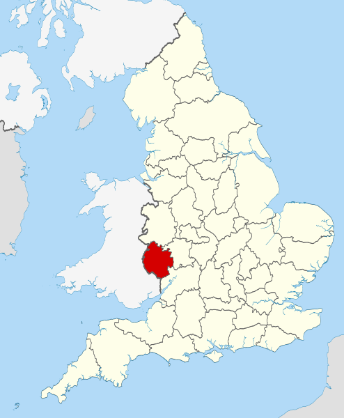
841:
432:
1361:
1236:
1051:
165:
1031:
1046:
801:
770:
195:
1496:
1231:
1221:
1191:
1181:
1141:
1131:
1101:
991:
901:
886:
758:
143:
765:== Summary == {{Information |Description=Location of the ceremonial county of
1271:
1256:
1241:
1126:
1116:
1056:
1011:
986:
826:
766:
1146:
866:
402:
Commons:Valued image candidates/Locator maps of
English ceremonial counties
689:
649:
632:
584:
493:
1186:
1151:
961:
926:
1061:
946:
836:
831:
811:
791:
185:
Irish, French and Isle of Man coastlines, Lough Neagh and Irish border
1596:
1261:
1196:
1096:
871:
821:
816:
358:
303:
1626:
1276:
1266:
1001:
951:
881:
876:
796:
715:
Click on a date/time to view the file as it appeared at that time.
1436:
1281:
1106:
941:
891:
381:
on
Wikimedia Commons. The image set has been assessed under the
1616:
1086:
1066:
976:
936:
906:
1746:
1286:
82:(SVG file, nominally 1,108 × 1,345 pixels, file size: 302 KB)
1726:
1686:
1676:
1606:
1536:
1516:
1396:
1371:
1331:
1766:
1736:
1716:
1706:
1666:
1636:
1556:
1546:
1526:
1506:
1491:
1471:
1456:
1446:
1406:
1381:
1311:
154:
88:
426:
Add a one-line explanation of what this file represents
781:
462:
https:\/\/commons.wikimedia.org\/wiki\/user:Nilfanion
1302:
713:
656:
639:
Creative
Commons Attribution-ShareAlike 3.0 Unported
613:
609:
Creative
Commons Attribution-ShareAlike 3.0 Unported
320:, Version 1.2 or any later version published by the
112:
Commons is a freely licensed media file repository.
377:Locator maps of the Ceremonial counties of England
1427:Grade II* listed buildings in Herefordshire (M–Z)
1422:Grade II* listed buildings in Herefordshire (A–L)
1387:Llista de comtats cerimonials d'Anglaterra
369:This is one of the images forming part of the
287:https://creativecommons.org/licenses/by-sa/3.0
93:
293:Creative Commons Attribution-Share Alike 3.0
217:
150:
135:
518:https://commons.wikimedia.org/user:Nilfanion
191:
160:
14:
253:– to copy, distribute and transmit the work
41:Size of this PNG preview of this SVG file:
352:You may select the license of your choice.
1462:Anexo:Condados ceremoniales de Inglaterra
1417:Grade I listed buildings in Herefordshire
1304:The following other wikis use this file:
180:National Geospatial-Intelligence Agency
1647:Comtats ceremonials d'Anglatèrra
142:Location of the ceremonial county of
138:Herefordshire UK locator map 2010.svg
124:
1362:Lec'hanvioù kembraek e Bro-Saoz
332:http://www.gnu.org/copyleft/fdl.html
240:Attribution-Share Alike 3.0 Unported
972:Fiddler's Green, Herefordshire
706:
228:
223:
13:
1497:Englannin muodolliset kreivikunnat
431:
425:
390:
351:
214:
210:
175:County boundaries and GB coastline
125:
75:
1787:
1338:Usage on be-tarask.wikipedia.org
430:
416:
362:
308:
307:
264:Under the following conditions:
235:This file is licensed under the
227:
222:
216:
92:
31:
21:
1022:Hole-in-the-Wall, Herefordshire
413:
363:
1743:Usage on simple.wikipedia.org
1299:
710:
412:
399:You can see its nomination at
394:Ceremonial counties of England
387:the most valued set on Commons
338:GNU Free Documentation License
327:GNU Free Documentation License
317:GNU Free Documentation License
26:
1:
897:Brockhampton (near Bromyard)
778:
438:Items portrayed in this file
204:
7:
1723:Usage on sco.wikipedia.org
1693:Usage on pnb.wikipedia.org
1683:Usage on pl.wiktionary.org
1673:Usage on pl.wikivoyage.org
1603:Usage on lld.wikipedia.org
1533:Usage on hak.wikipedia.org
1513:Usage on fr.wiktionary.org
1413:Usage on dag.wikipedia.org
1393:Usage on ceb.wikipedia.org
1368:Usage on br.wiktionary.org
1328:Usage on ast.wikipedia.org
10:
1792:
1763:Usage on sv.wikipedia.org
1753:Usage on sr.wikipedia.org
1733:Usage on sh.wikipedia.org
1713:Usage on ro.wikipedia.org
1703:Usage on pt.wikipedia.org
1663:Usage on pl.wikipedia.org
1653:Usage on os.wikipedia.org
1643:Usage on oc.wikipedia.org
1633:Usage on nl.wikipedia.org
1623:Usage on lv.wikipedia.org
1613:Usage on lt.wikipedia.org
1593:Usage on la.wikipedia.org
1583:Usage on ko.wikipedia.org
1563:Usage on ja.wikipedia.org
1553:Usage on ia.wikipedia.org
1543:Usage on hu.wikipedia.org
1523:Usage on ga.wikipedia.org
1503:Usage on fr.wikipedia.org
1488:Usage on fi.wikipedia.org
1478:Usage on fa.wikipedia.org
1468:Usage on eu.wikipedia.org
1453:Usage on es.wikipedia.org
1443:Usage on eo.wikipedia.org
1403:Usage on cs.wikipedia.org
1378:Usage on ca.wikipedia.org
1358:Usage on br.wikipedia.org
1348:Usage on bg.wikipedia.org
1318:Usage on ar.wikipedia.org
1308:Usage on af.wikipedia.org
1207:Walford, Letton and Newton
1157:Stoke Prior, Herefordshire
862:Bishopstone, Herefordshire
807:Acton Green, Herefordshire
278:same or compatible license
132:
127:
1433:Usage on en.wikinews.org
1227:Whitchurch, Herefordshire
1217:Wellington, Herefordshire
1137:Priory Church, Leominster
1042:Linton (near Ross-on-Wye)
707:
383:valued image set criteria
16:
1597:Herefordiensis comitatus
1172:Thornbury, Herefordshire
1077:Marlbrook, Herefordshire
1017:Hoarwithy, Herefordshire
769:within England. |Source=
415:
374:
322:Free Software Foundation
244:
99:This is a file from the
36:
1577:Category:ヘレフォードシャー出身の人物
764:
743:22:38, 23 November 2010
153:
103:. Information from its
1437:Category:Herefordshire
1177:Trumpet, Herefordshire
997:Haywood, Herefordshire
982:Grafton, Herefordshire
957:Eastnor, Herefordshire
932:Cornett, Herefordshire
852:Birtley, Herefordshire
847:Birley with Upper Hill
400:
106:description page there
1252:Wilton, Herefordshire
1247:Willey, Herefordshire
1212:Warham, Herefordshire
1202:Wacton, Herefordshire
1162:Sunset, Herefordshire
1122:Pixley, Herefordshire
1112:Perton, Herefordshire
1082:Mathon, Herefordshire
1072:Marden, Herefordshire
917:Callow, Herefordshire
922:Combe, Herefordshire
912:Byton, Herefordshire
392:Locator maps of the
69:1,108 × 1,345 pixels
65:1,687 × 2,048 pixels
1027:Huntington, Kington
857:Bishop's Frome
259:– to adapt the work
47:Other resolutions:
1572:Category:ヘレフォードシャー
1007:Hereford Cathedral
967:Eye, Herefordshire
842:Beavan's Hill
541:author name string
526:Wikimedia username
474:author name string
466:Wikimedia username
389:within the scope:
385:and is considered
61:843 × 1,024 pixels
1776:more global usage
1300:Global file usage
1167:Tedstone Delamere
1092:Monnington on Wye
1037:Leinthall Starkes
1032:King's Caple
776:
623:copyright license
605:copyright license
424:
410:
409:
349:
348:
201:
200:
121:
120:
101:Wikimedia Commons
32:Global file usage
1783:
1237:Widemarsh Common
1052:Lower Bullingham
755:
717:
695:16 November 2010
575:copyright status
561:copyright status
548:
545:
535:
530:
520:
515:
422:
371:Valued image set
366:
365:
359:
345:
342:
339:
336:
333:
311:
310:
304:
300:
297:
294:
291:
288:
280:as the original.
237:Creative Commons
231:
230:
226:
225:
220:
219:
156:
155:16 November 2010
139:
133:
117:
96:
95:
89:
83:
72:
57:633 × 768 pixels
53:395 × 480 pixels
49:198 × 240 pixels
43:494 × 600 pixels
1791:
1790:
1786:
1785:
1784:
1782:
1781:
1780:
1298:
1047:Little Hereford
802:Acton Beauchamp
777:
771:Ordnance Survey
761:
753:
709:
708:
705:
704:
703:
702:
701:
700:
699:
698:
696:
686:
685:
684:
682:
667:
666:
665:
664:
663:
662:
661:
660:
658:
647:
646:
645:
644:
643:
641:
629:
628:
627:
625:
602:
601:
600:
599:
598:
597:
596:
595:
593:
581:
580:
579:
577:
558:
557:
556:
555:
554:
553:
552:
551:
550:
549:
546:
543:
537:
536:
531:
528:
522:
521:
516:
513:
504:
503:
502:
500:
490:
489:
488:
486:
451:
450:
449:
448:
447:
445:
429:
428:
427:
404:
397:
380:
355:
354:
353:
343:
340:
337:
334:
331:
302:
301:
298:
295:
292:
289:
286:
285:
243:
232:
213:
212:
207:
202:
166:Ordnance Survey
146:within England.
137:
130:
123:
122:
111:
110:
109:is shown below.
85:
81:
74:
73:
46:
12:
11:
5:
1789:
1778:of this file.
1772:
1771:
1770:
1769:
1761:
1760:
1759:
1751:
1750:
1749:
1741:
1740:
1739:
1731:
1730:
1729:
1721:
1720:
1719:
1711:
1710:
1709:
1701:
1700:
1699:
1691:
1690:
1689:
1681:
1680:
1679:
1671:
1670:
1669:
1661:
1660:
1659:
1651:
1650:
1649:
1641:
1640:
1639:
1631:
1630:
1629:
1621:
1620:
1619:
1611:
1610:
1609:
1601:
1600:
1599:
1591:
1590:
1589:
1581:
1580:
1579:
1574:
1569:
1561:
1560:
1559:
1551:
1550:
1549:
1541:
1540:
1539:
1531:
1530:
1529:
1521:
1520:
1519:
1511:
1510:
1509:
1501:
1500:
1499:
1494:
1486:
1485:
1484:
1476:
1475:
1474:
1466:
1465:
1464:
1459:
1451:
1450:
1449:
1441:
1440:
1439:
1431:
1430:
1429:
1424:
1419:
1411:
1410:
1409:
1401:
1400:
1399:
1391:
1390:
1389:
1384:
1376:
1375:
1374:
1366:
1365:
1364:
1356:
1355:
1354:
1346:
1345:
1344:
1336:
1335:
1334:
1326:
1325:
1324:
1316:
1315:
1314:
1301:
1296:to this file.
1290:
1289:
1284:
1279:
1274:
1269:
1264:
1259:
1254:
1249:
1244:
1239:
1234:
1232:Whitney-on-Wye
1229:
1224:
1222:Weston Beggard
1219:
1214:
1209:
1204:
1199:
1194:
1192:Urishay Castle
1189:
1184:
1182:Upper Breinton
1179:
1174:
1169:
1164:
1159:
1154:
1149:
1144:
1142:River Kenwater
1139:
1134:
1132:Preston on Wye
1129:
1124:
1119:
1114:
1109:
1104:
1102:Much Dewchurch
1099:
1094:
1089:
1084:
1079:
1074:
1069:
1064:
1059:
1054:
1049:
1044:
1039:
1034:
1029:
1024:
1019:
1014:
1009:
1004:
999:
994:
992:Hampton Bishop
989:
984:
979:
974:
969:
964:
959:
954:
949:
944:
939:
934:
929:
924:
919:
914:
909:
904:
902:Bromyard Downs
899:
894:
889:
887:Bridge Sollers
884:
879:
874:
869:
864:
859:
854:
849:
844:
839:
834:
829:
824:
819:
814:
809:
804:
799:
794:
787:is available.
780:
775:
774:
763:
759:
756:
752:1,108 × 1,345
750:
745:
740:
736:
735:
732:
729:
726:
723:
720:
712:
697:
694:
692:
691:
690:
688:
687:
683:
678:
676:
675:
674:
673:
671:
659:
654:
652:
651:
650:
648:
642:
637:
635:
634:
633:
631:
630:
626:
621:
619:
618:
617:
616:
614:
610:
606:
594:
589:
587:
586:
585:
583:
582:
578:
573:
571:
570:
569:
568:
566:
562:
539:
538:
524:
523:
509:
508:
507:
506:
505:
501:
498:
496:
495:
494:
492:
491:
487:
482:
480:
479:
478:
477:
475:
471:
467:
463:
459:
455:
446:
441:
439:
436:
435:
434:
433:
421:
420:
417:
414:
408:
407:
367:
350:
347:
346:
312:
284:
283:
282:
281:
271:
262:
261:
260:
254:
247:You are free:
234:
233:
215:
209:
208:
206:
203:
199:
198:
193:
189:
188:
187:
186:
177:
176:
162:
158:
157:
152:
148:
147:
140:
131:
129:
126:
119:
118:
97:
87:
86:
40:
35:
34:
29:
24:
19:
9:
6:
4:
3:
2:
1788:
1779:
1777:
1768:
1767:Herefordshire
1765:
1764:
1762:
1758:
1755:
1754:
1752:
1748:
1747:Herefordshire
1745:
1744:
1742:
1738:
1737:Herefordshire
1735:
1734:
1732:
1728:
1727:Herefordshire
1725:
1724:
1722:
1718:
1717:Herefordshire
1715:
1714:
1712:
1708:
1707:Herefordshire
1705:
1704:
1702:
1698:
1695:
1694:
1692:
1688:
1687:Herefordshire
1685:
1684:
1682:
1678:
1677:Herefordshire
1675:
1674:
1672:
1668:
1667:Herefordshire
1665:
1664:
1662:
1658:
1655:
1654:
1652:
1648:
1645:
1644:
1642:
1638:
1637:Herefordshire
1635:
1634:
1632:
1628:
1625:
1624:
1622:
1618:
1617:Herefordšyras
1615:
1614:
1612:
1608:
1607:Herefordshire
1605:
1604:
1602:
1598:
1595:
1594:
1592:
1588:
1585:
1584:
1582:
1578:
1575:
1573:
1570:
1568:
1565:
1564:
1562:
1558:
1557:Herefordshire
1555:
1554:
1552:
1548:
1547:Herefordshire
1545:
1544:
1542:
1538:
1537:Herefordshire
1535:
1534:
1532:
1528:
1527:Herefordshire
1525:
1524:
1522:
1518:
1517:Herefordshire
1515:
1514:
1512:
1508:
1507:Herefordshire
1505:
1504:
1502:
1498:
1495:
1493:
1492:Herefordshire
1490:
1489:
1487:
1483:
1480:
1479:
1477:
1473:
1472:Herefordshire
1470:
1469:
1467:
1463:
1460:
1458:
1457:Herefordshire
1455:
1454:
1452:
1448:
1447:Herefordshire
1445:
1444:
1442:
1438:
1435:
1434:
1432:
1428:
1425:
1423:
1420:
1418:
1415:
1414:
1412:
1408:
1407:Herefordshire
1405:
1404:
1402:
1398:
1397:Herefordshire
1395:
1394:
1392:
1388:
1385:
1383:
1382:Herefordshire
1380:
1379:
1377:
1373:
1372:Herefordshire
1370:
1369:
1367:
1363:
1360:
1359:
1357:
1353:
1350:
1349:
1347:
1343:
1340:
1339:
1337:
1333:
1332:Herefordshire
1330:
1329:
1327:
1323:
1320:
1319:
1317:
1313:
1312:Herefordshire
1310:
1309:
1307:
1306:
1305:
1297:
1295:
1288:
1285:
1283:
1280:
1278:
1275:
1273:
1272:Wormelow Tump
1270:
1268:
1265:
1263:
1260:
1258:
1257:Wilton Castle
1255:
1253:
1250:
1248:
1245:
1243:
1242:Wigmore Abbey
1240:
1238:
1235:
1233:
1230:
1228:
1225:
1223:
1220:
1218:
1215:
1213:
1210:
1208:
1205:
1203:
1200:
1198:
1195:
1193:
1190:
1188:
1185:
1183:
1180:
1178:
1175:
1173:
1170:
1168:
1165:
1163:
1160:
1158:
1155:
1153:
1150:
1148:
1145:
1143:
1140:
1138:
1135:
1133:
1130:
1128:
1127:Preston Wynne
1125:
1123:
1120:
1118:
1117:Pipe and Lyde
1115:
1113:
1110:
1108:
1105:
1103:
1100:
1098:
1095:
1093:
1090:
1088:
1085:
1083:
1080:
1078:
1075:
1073:
1070:
1068:
1065:
1063:
1060:
1058:
1057:Lower Todding
1055:
1053:
1050:
1048:
1045:
1043:
1040:
1038:
1035:
1033:
1030:
1028:
1025:
1023:
1020:
1018:
1015:
1013:
1012:Herefordshire
1010:
1008:
1005:
1003:
1000:
998:
995:
993:
990:
988:
987:Grandmontines
985:
983:
980:
978:
975:
973:
970:
968:
965:
963:
960:
958:
955:
953:
950:
948:
945:
943:
940:
938:
935:
933:
930:
928:
925:
923:
920:
918:
915:
913:
910:
908:
905:
903:
900:
898:
895:
893:
890:
888:
885:
883:
880:
878:
875:
873:
870:
868:
865:
863:
860:
858:
855:
853:
850:
848:
845:
843:
840:
838:
835:
833:
830:
828:
827:Bagwyllydiart
825:
823:
820:
818:
815:
813:
810:
808:
805:
803:
800:
798:
795:
793:
790:
789:
788:
786:
772:
768:
767:Herefordshire
762:
757:
751:
749:
746:
744:
741:
738:
737:
733:
730:
727:
724:
721:
719:
718:
716:
693:
681:
677:
657:
653:
640:
636:
624:
620:
592:
588:
576:
572:
542:
534:
527:
519:
512:
497:
485:
481:
444:
440:
437:
418:
411:
406:
403:
396:
395:
388:
384:
379:
378:
372:
368:
361:
360:
357:
329:
328:
323:
319:
318:
313:
306:
305:
290:CC BY-SA 3.0
279:
275:
272:
269:
266:
265:
263:
258:
255:
252:
249:
248:
246:
245:
241:
238:
221:
197:
194:
190:
184:
183:
182:
181:
174:
173:
172:
170:
167:
163:
159:
149:
145:
144:Herefordshire
141:
134:
115:
108:
107:
102:
98:
91:
90:
84:
79:
78:Original file
70:
66:
62:
58:
54:
50:
44:
39:
33:
30:
28:
25:
23:
20:
18:
15:
1773:
1627:Herefordšīra
1303:
1291:
1147:Sapey Common
867:Blackwardine
782:
714:
711:File history
398:
391:
386:
375:
356:
325:
315:
273:
267:
256:
250:
178:
164:
114:You can help
104:
76:
22:File history
1757:Херефордшир
1697:ہیرفورڈشائر
1657:Херефордшир
1352:Херефордшър
1342:Гэрэфардшыр
1187:Upper Sapey
1152:Stoke Edith
962:Edvin Loach
927:Coppet Hill
591:copyrighted
565:copyrighted
274:share alike
268:attribution
136:Description
1322:هيرفوردشير
1294:more links
1062:Lugwardine
947:Dore Abbey
837:Bartestree
832:Ballingham
812:Allensmore
792:Abbey Dore
779:File usage
728:Dimensions
499:some value
27:File usage
1567:ヘレフォードシャー
1262:Wolferlow
1197:Vowchurch
1097:Mordiford
872:Blakemere
822:Aymestrey
817:Ashperton
785:full list
760:Nilfanion
725:Thumbnail
722:Date/Time
680:inception
670:inception
547:Nilfanion
533:Nilfanion
470:Nilfanion
205:Licensing
196:Nilfanion
1482:هرفوردشر
1277:Yarkhill
1267:Woolhope
1002:Hentland
952:Dorstone
882:Bolstone
877:Bodenham
797:Aconbury
754:(302 KB)
419:Captions
257:to remix
251:to share
242:license.
169:OpenData
1282:Yarpole
1107:Orleton
942:Dinedor
892:Brilley
773:: *Coun
739:current
734:Comment
484:creator
454:creator
443:depicts
423:English
128:Summary
80:
1587:헤리퍼드셔주
1087:Moccas
1067:Luxley
977:Garway
937:Dilwyn
907:Byford
192:Author
161:Source
1774:View
1292:View
1287:Yazor
731:User
344:true
341:true
335:GFDL
299:true
296:true
151:Date
17:File
511:URL
458:URL
544::
529::
514::
405:.
373::
171::
67:|
63:|
59:|
55:|
51:|
45:.
330:.
116:.
71:.
Text is available under the Creative Commons Attribution-ShareAlike License. Additional terms may apply.
