704:"}},"text\/plain":{"en":{"":"coordinates of the point of view"}}},"{\"value\":{\"latitude\":37.354175,\"longitude\":-121.917111,\"altitude\":null,\"precision\":1.0e-6,\"globe\":\"http:\\\/\\\/www.wikidata.org\\\/entity\\\/Q2\"},\"type\":\"globecoordinate\"}":{"text\/html":{"en":{"P1259":"37\u00b021'15.030"N, 121\u00b055'1.600"W"}},"text\/plain":{"en":{"P1259":"37\u00b021'15.030\"N, 121\u00b055'1.600\"W"}}},"{\"value\":{\"entity-type\":\"property\",\"numeric-id\":7787,\"id\":\"P7787\"},\"type\":\"wikibase-entityid\"}":{"text\/html":{"en":{"":"
43:
666:"}},"text\/plain":{"en":{"":"inception"}}},"{\"value\":{\"time\":\"+2019-01-23T00:00:00Z\",\"timezone\":0,\"before\":0,\"after\":0,\"precision\":11,\"calendarmodel\":\"http:\\\/\\\/www.wikidata.org\\\/entity\\\/Q1985727\"},\"type\":\"time\"}":{"text\/html":{"en":{"P571":"23 January 2019"}},"text\/plain":{"en":{"P571":"23 January 2019"}}}}": -->
467:
274:
199:
266:
700:
319:
324:
99:
487:"}},"text\/plain":{"en":{"P2093":"Dicklyon","P4174":"Dicklyon"}}},"{\"value\":{\"entity-type\":\"property\",\"numeric-id\":4174,\"id\":\"P4174\"},\"type\":\"wikibase-entityid\"}":{"text\/html":{"en":{"":"
475:"}},"text\/plain":{"en":{"":"object of statement has role"}}},"{\"value\":{\"entity-type\":\"item\",\"numeric-id\":33231,\"id\":\"Q33231\"},\"type\":\"wikibase-entityid\"}":{"text\/html":{"en":{"P3831":"
622:"}},"text\/plain":{"en":{"":"copyright license"}}},"{\"value\":{\"entity-type\":\"item\",\"numeric-id\":18199165,\"id\":\"Q18199165\"},\"type\":\"wikibase-entityid\"}":{"text\/html":{"en":{"P275":"
578:"}},"text\/plain":{"en":{"":"copyright status"}}},"{\"value\":{\"entity-type\":\"item\",\"numeric-id\":50423863,\"id\":\"Q50423863\"},\"type\":\"wikibase-entityid\"}":{"text\/html":{"en":{"P6216":"
772:"}},"text\/plain":{"en":{"":"source of file"}}},"{\"value\":{\"entity-type\":\"item\",\"numeric-id\":66458942,\"id\":\"Q66458942\"},\"type\":\"wikibase-entityid\"}":{"text\/html":{"en":{"P7482":"
479:"}},"text\/plain":{"en":{"P3831":"photographer"}}},"{\"value\":{\"entity-type\":\"property\",\"numeric-id\":2093,\"id\":\"P2093\"},\"type\":\"wikibase-entityid\"}":{"text\/html":{"en":{"":"
708:"}},"text\/plain":{"en":{"":"heading"}}},"{\"value\":{\"amount\":\"+327\",\"unit\":\"http:\\\/\\\/www.wikidata.org\\\/entity\\\/Q28390\"},\"type\":\"quantity\"}":{"text\/html":{"en":{"P7787":"327
424:"}},"text\/plain":{"en":{"":"depicts"}}},"{\"value\":{\"entity-type\":\"item\",\"numeric-id\":355304,\"id\":\"Q355304\"},\"type\":\"wikibase-entityid\"}":{"text\/html":{"en":{"P180":"
471:"}},"text\/plain":{"en":{"":"creator"}}},"{\"value\":{\"entity-type\":\"property\",\"numeric-id\":3831,\"id\":\"P3831\"},\"type\":\"wikibase-entityid\"}":{"text\/html":{"en":{"":"
228:
854:
768:
365:– You must give appropriate credit, provide a link to the license, and indicate if changes were made. You may do so in any reasonable manner, but not in any way that suggests the licensor endorses you or your use.
271:
484:
216:
65:
61:
57:
53:
47:
110:
78:
773:
623:
579:
425:
476:
769:
705:
701:
575:
488:
480:
472:
663:
619:
468:
421:
1072:
626:"}},"text\/plain":{"en":{"P275":"Creative Commons Attribution-ShareAlike 4.0 International"}}}}": -->
799:
649:
605:
281:
231:
926:
This file contains additional information, probably added from the digital camera or scanner used to create or digitize it.
454:
372:
219:
532:
783:
746:
719:
589:
553:
540:
525:
776:"}},"text\/plain":{"en":{"P7482":"original creation by uploader"}}}}": -->
853:
848:
673:
633:
498:
438:
69:
42:
1103:
560:
334:
929:
If the file has been modified from its original state, some details may not fully reflect the modified file.
885:
371:– If you remix, transform, or build upon the material, you must distribute your contributions under the
491:"}},"text\/plain":{"en":{"":"Wikimedia username"}}}}": -->
582:"}},"text\/plain":{"en":{"P6216":"copyrighted"}}}}": -->
881:
The following pages on the
English Knowledge use this file (pages on other projects are not listed):
712:"}},"text\/plain":{"en":{"P7787":"327 degree"}}}}": -->
428:"}},"text\/plain":{"en":{"P180":"watercourse"}}}}": -->
118:
1169:
331:
8:
1205:
287:
1326:
105:
306:
I, the copyright holder of this work, hereby publish it under the following license:
227:
890:
215:
183:
1289:
1195:
1143:
955:
895:
864:
1336:
1299:
995:
793:
729:
683:
643:
599:
508:
448:
1247:
198:
975:
1346:
965:
821:
Click on a date/time to view the file as it appeared at that time.
414:
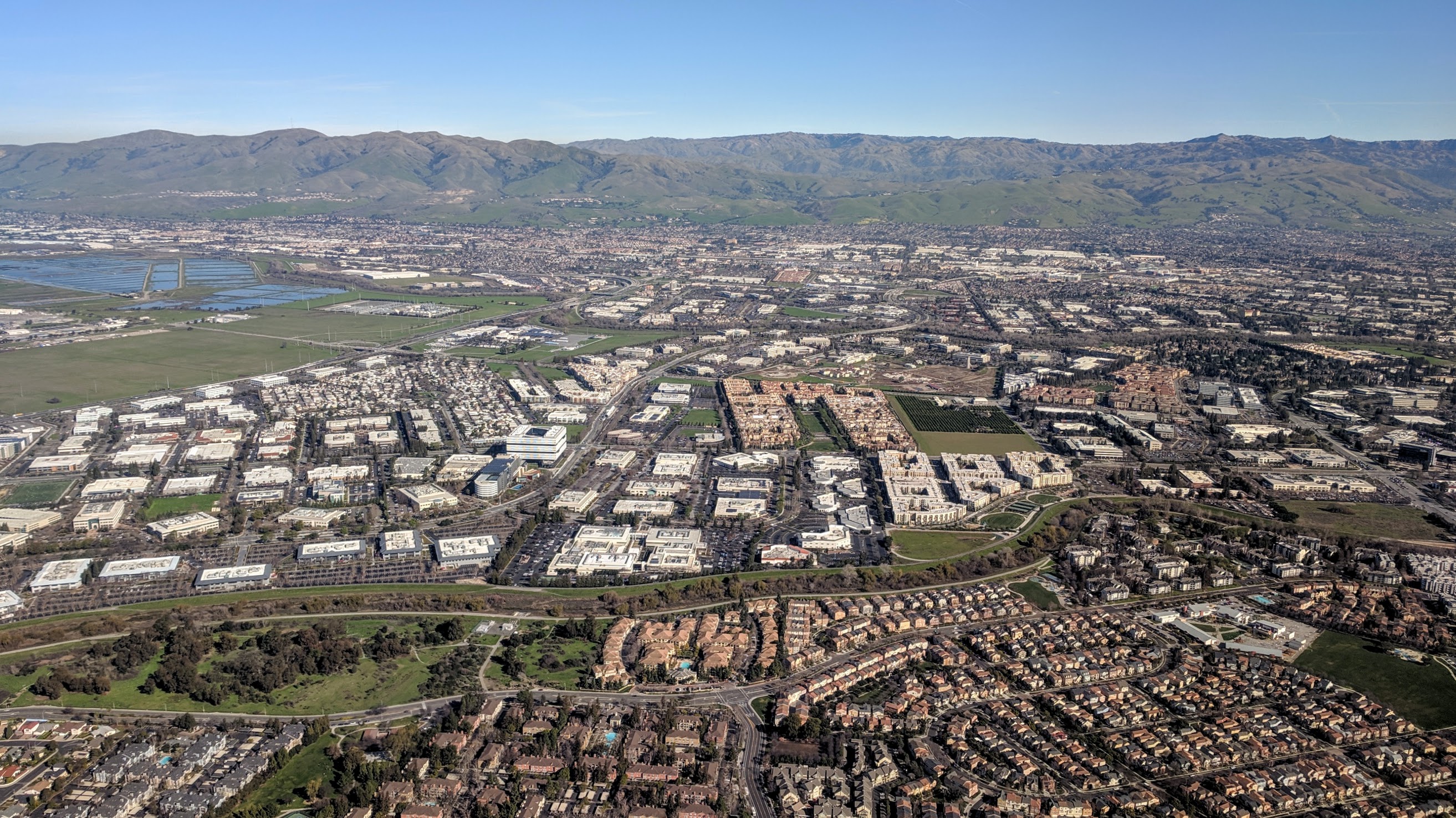
Guadalupe River and Tasman Drive, San Jose and Santa Clara, aerial
163:
273:
258:
37° 21′ 15.03″ N, 121° 55′ 01.6″ W
938:
948:
650:
Creative
Commons Attribution-ShareAlike 4.0 International
624:
Creative
Commons Attribution-ShareAlike 4.0 International
93:
913:
83:(2,627 × 1,477 pixels, file size: 1.17 MB, MIME type:
879:
904:
819:
143:
Guadalupe River and Tasman Drive San Jose aerial.jpg
117:
Commons is a freely licensed media file repository.
1210:Flash did not fire, compulsory flash suppression
382:https://creativecommons.org/licenses/by-sa/4.0
98:
388:Creative Commons Attribution-Share Alike 4.0
312:
159:
140:
189:
179:
169:
14:
709:
348:– to copy, distribute and transmit the work
906:The following other wikis use this file:
335:Attribution-Share Alike 4.0 International
226:
214:
280:View this and other nearby images on:
129:
248:
193:
871:User created page with UploadWizard
812:
323:
318:
13:
924:
419:
413:
309:
305:
147:
130:
76:
1427:
931:
418:
1388:Reference for direction of image
1367:cc26762311d9118b0000000000000000
986:Date and time of data generation
880:
720:coordinates of the point of view
702:coordinates of the point of view
404:
359:Under the following conditions:
330:This file is licensed under the
322:
317:
311:
286:
272:
264:
232:Riverview Park (aerial view).jpg
197:
97:
31:
21:
401:
148:
901:
816:
735:37°21'15.030"N, 121°55'1.600"W
400:
220:Moitozo Park (aerial view).jpg
26:
1:
1268:A directly photographed image
800:original creation by uploader
774:original creation by uploader
36:
1231:DateTimeDigitized subseconds
886:Guadalupe River (California)
876:
526:object of statement has role
473:object of statement has role
434:Items portrayed in this file
299:
263:
7:
1223:DateTimeOriginal subseconds
1114:Date and time of digitizing
921:
10:
1432:
1310:Focal length in 35 mm film
1260:One-chip color area sensor
1239:Supported Flashpix version
960:159/200,000 sec (0.000795)
910:Usage on www.wikidata.org
373:same or compatible license
137:
132:
1122:Meaning of each component
1079:File change date and time
813:
173:
164:23 January 2019, 12:45:41
16:
1024:3 meters below sea level
403:
339:
104:This is a file from the
41:
1372:GPS time (atomic clock)
1273:Custom image processing
1200:Center weighted average
870:
205:This file has multiple
196:
162:
108:. Information from its
1356:Subject distance range
1117:12:45, 23 January 2019
1082:12:45, 23 January 2019
989:12:45, 23 January 2019
292:37.354175; -121.917111
234:
222:
111:description page there
46:Size of this preview:
1380:Measurement precision
1179:Maximum land aperture
1053:Horizontal resolution
230:
218:
1073:HDR+ 1.0.229626132zr
70:2,627 × 1,477 pixels
1215:DateTime subseconds
1087:Y and C positioning
1061:Vertical resolution
935:Camera manufacturer
354:– to adapt the work
52:Other resolutions:
1396:Direction of image
1391:Magnetic direction
1318:Scene capture type
1294:Auto white balance
554:Wikimedia username
541:author name string
489:Wikimedia username
481:author name string
235:
223:
66:1,280 × 720 pixels
62:1,024 × 576 pixels
1419:
1418:
902:Global file usage
874:
849:04:18, 8 May 2019
711:
634:copyright license
620:copyright license
412:
297:
296:
246:
245:
242:
241:
126:
125:
106:Wikimedia Commons
32:Global file usage
1423:
1187:Subject distance
1095:Exposure Program
1008:37° 21′ 15.03″ N
932:
861:
823:
757:
756:
751:
590:copyright status
576:copyright status
563:
558:
548:
545:
535:
530:
410:
395:
392:
389:
386:
383:
375:as the original.
332:Creative Commons
326:
325:
321:
320:
315:
314:
293:
290:
276:
275:
269:
268:
267:
261:
260:
249:
207:extracted images
201:
194:
175:
165:
152:
144:
138:
122:
101:
100:
94:
88:
86:
73:
58:640 × 360 pixels
54:320 × 180 pixels
48:800 × 450 pixels
1431:
1430:
1426:
1425:
1424:
1422:
1421:
1420:
1412:GPS tag version
1407:23 January 2019
1364:Unique image ID
1161:APEX brightness
1016:121° 55′ 1.6″ W
920:
900:
882:
875:
867:
859:
815:
814:
811:
810:
809:
808:
807:
806:
805:
804:
802:
790:
789:
788:
786:
767:
766:
765:
764:
763:
762:
761:
760:
759:
758:
754:
752:
749:
740:
739:
738:
736:
726:
725:
724:
722:
699:
698:
697:
696:
695:
694:
693:
692:
690:
689:23 January 2019
680:
679:
678:
676:
661:
660:
659:
658:
657:
656:
655:
654:
652:
640:
639:
638:
636:
617:
616:
615:
614:
613:
612:
611:
610:
608:
596:
595:
594:
592:
573:
572:
571:
570:
569:
568:
567:
566:
565:
564:
559:
556:
550:
549:
546:
543:
537:
536:
531:
528:
519:
518:
517:
515:
505:
504:
503:
501:
466:
465:
464:
463:
462:
461:
460:
459:
457:
445:
444:
443:
441:
417:
416:
415:
398:
397:
396:
393:
390:
387:
384:
381:
380:
338:
327:
308:
307:
302:
291:
265:
256:
255:
252:Camera location
247:
238:
155:
142:
135:
128:
127:
116:
115:
114:is shown below.
90:
84:
82:
75:
74:
51:
12:
11:
5:
1429:
1417:
1416:
1413:
1409:
1408:
1405:
1401:
1400:
1397:
1393:
1392:
1389:
1385:
1384:
1381:
1377:
1376:
1373:
1369:
1368:
1365:
1361:
1360:
1357:
1353:
1352:
1349:
1343:
1342:
1339:
1333:
1332:
1329:
1323:
1322:
1319:
1315:
1314:
1311:
1307:
1306:
1303:
1296:
1295:
1292:
1286:
1285:
1282:
1278:
1277:
1276:Custom process
1274:
1270:
1269:
1266:
1262:
1261:
1258:
1257:Sensing method
1254:
1253:
1250:
1244:
1243:
1240:
1236:
1235:
1232:
1228:
1227:
1224:
1220:
1219:
1216:
1212:
1211:
1208:
1202:
1201:
1198:
1192:
1191:
1188:
1184:
1183:
1180:
1176:
1175:
1172:
1166:
1165:
1162:
1158:
1157:
1154:
1150:
1149:
1146:
1140:
1139:
1138:
1137:
1136:does not exist
1134:
1131:
1128:
1123:
1119:
1118:
1115:
1111:
1110:
1107:
1100:
1099:
1098:Normal program
1096:
1092:
1091:
1088:
1084:
1083:
1080:
1076:
1075:
1070:
1066:
1065:
1062:
1058:
1057:
1054:
1050:
1049:
1046:
1042:
1041:
1038:
1034:
1033:
1030:
1026:
1025:
1022:
1018:
1017:
1014:
1010:
1009:
1006:
1002:
1001:
998:
991:
990:
987:
983:
982:
979:
972:
971:
968:
962:
961:
958:
952:
951:
946:
942:
941:
936:
923:
919:
918:
917:
916:
903:
899:
898:
893:
891:North San Jose
888:
878:
873:
872:
869:
865:
862:
858:2,627 × 1,477
856:
851:
846:
842:
841:
838:
835:
832:
829:
826:
818:
803:
798:
796:
795:
794:
792:
791:
787:
784:source of file
782:
780:
779:
778:
777:
775:
771:
770:source of file
745:
744:
743:
742:
741:
737:
734:
732:
731:
730:
728:
727:
723:
718:
716:
715:
714:
713:
707:
703:
691:
688:
686:
685:
684:
682:
681:
677:
672:
670:
669:
668:
667:
665:
653:
648:
646:
645:
644:
642:
641:
637:
632:
630:
629:
628:
627:
625:
621:
609:
604:
602:
601:
600:
598:
597:
593:
588:
586:
585:
584:
583:
581:
577:
552:
551:
539:
538:
524:
523:
522:
521:
520:
516:
513:
511:
510:
509:
507:
506:
502:
497:
495:
494:
493:
492:
490:
486:
482:
478:
474:
470:
458:
453:
451:
450:
449:
447:
446:
442:
437:
435:
432:
431:
430:
429:
427:
423:
409:
408:
405:
402:
379:
378:
377:
376:
366:
357:
356:
355:
349:
342:You are free:
329:
328:
310:
304:
303:
301:
298:
295:
294:
284:
278:
253:
244:
243:
240:
239:
237:
236:
224:
211:
202:
191:
190:Other versions
187:
186:
181:
177:
176:
171:
167:
166:
161:
157:
156:
145:
136:
134:
131:
124:
123:
102:
92:
91:
45:
40:
39:
34:
29:
24:
19:
9:
6:
4:
3:
2:
1428:
1414:
1411:
1410:
1406:
1403:
1402:
1398:
1395:
1394:
1390:
1387:
1386:
1382:
1379:
1378:
1374:
1371:
1370:
1366:
1363:
1362:
1358:
1355:
1354:
1350:
1348:
1345:
1344:
1340:
1338:
1335:
1334:
1330:
1328:
1325:
1324:
1320:
1317:
1316:
1312:
1309:
1308:
1304:
1301:
1298:
1297:
1293:
1291:
1290:White balance
1288:
1287:
1284:Auto exposure
1283:
1281:Exposure mode
1280:
1279:
1275:
1272:
1271:
1267:
1264:
1263:
1259:
1256:
1255:
1251:
1249:
1246:
1245:
1241:
1238:
1237:
1233:
1230:
1229:
1225:
1222:
1221:
1217:
1214:
1213:
1209:
1207:
1204:
1203:
1199:
1197:
1196:Metering mode
1194:
1193:
1189:
1186:
1185:
1181:
1178:
1177:
1173:
1171:
1170:Exposure bias
1168:
1167:
1163:
1160:
1159:
1155:
1153:APEX aperture
1152:
1151:
1147:
1145:
1144:Shutter speed
1142:
1141:
1135:
1132:
1129:
1126:
1125:
1124:
1121:
1120:
1116:
1113:
1112:
1108:
1105:
1102:
1101:
1097:
1094:
1093:
1089:
1086:
1085:
1081:
1078:
1077:
1074:
1071:
1069:Software used
1068:
1067:
1063:
1060:
1059:
1055:
1052:
1051:
1047:
1044:
1043:
1039:
1036:
1035:
1031:
1028:
1027:
1023:
1020:
1019:
1015:
1012:
1011:
1007:
1004:
1003:
999:
997:
993:
992:
988:
985:
984:
980:
977:
974:
973:
969:
967:
964:
963:
959:
957:
956:Exposure time
954:
953:
950:
947:
944:
943:
940:
937:
934:
933:
930:
927:
915:
912:
911:
909:
908:
907:
897:
896:User:Dicklyon
894:
892:
889:
887:
884:
883:
868:
863:
857:
855:
852:
850:
847:
844:
843:
839:
836:
833:
830:
827:
825:
824:
822:
801:
797:
785:
781:
748:
733:
721:
717:
687:
675:
671:
651:
647:
635:
631:
607:
603:
591:
587:
562:
555:
542:
534:
527:
512:
500:
496:
456:
452:
440:
436:
433:
406:
399:
385:CC BY-SA 4.0
374:
370:
367:
364:
361:
360:
358:
353:
350:
347:
344:
343:
341:
340:
336:
333:
316:
289:
285:
283:
282:OpenStreetMap
279:
277:
259:
254:
251:
250:
233:
229:
225:
221:
217:
213:
212:
210:
208:
203:
200:
195:
192:
188:
185:
182:
178:
172:
168:
158:
151:
146:
139:
120:
113:
112:
107:
103:
96:
95:
89:
80:
79:Original file
71:
67:
63:
59:
55:
49:
44:
38:
35:
33:
30:
28:
25:
23:
20:
18:
15:
1300:Digital zoom
1190:1.946 meters
1182:2 APEX (f/2)
996:focal length
945:Camera model
928:
925:
905:
820:
817:File history
533:photographer
477:photographer
368:
362:
351:
345:
262:
206:
204:
149:
119:You can help
109:
77:
22:File history
1248:Color space
1045:Orientation
606:copyrighted
580:copyrighted
455:watercourse
426:watercourse
369:share alike
363:attribution
141:Description
1359:Close view
1337:Saturation
1265:Scene type
914:Q117090129
877:File usage
834:Dimensions
514:some value
85:image/jpeg
27:File usage
1383:Poor (41)
1347:Sharpness
1013:Longitude
976:ISO speed
860:(1.17 MB)
831:Thumbnail
828:Date/Time
674:inception
664:inception
300:Licensing
150:English:
1404:GPS date
1327:Contrast
1321:Standard
1090:Centered
1040:1,512 px
1032:2,688 px
1021:Altitude
1005:Latitude
966:F-number
922:Metadata
866:Dicklyon
561:Dicklyon
547:Dicklyon
485:Dicklyon
407:Captions
352:to remix
346:to share
337:license.
184:Dicklyon
174:Own work
37:Metadata
1415:0.0.2.2
1106:version
1000:4.67 mm
845:current
840:Comment
747:heading
706:heading
499:creator
469:creator
439:depicts
422:depicts
411:English
133:Summary
81:
1351:Normal
1341:Normal
1331:Normal
1234:857844
1226:857844
1218:857844
1064:72 dpi
1056:72 dpi
1048:Normal
1037:Height
978:rating
939:Google
755:degree
710:degree
270:
180:Author
170:Source
1375:20:44
1313:26 mm
1302:ratio
1206:Flash
1029:Width
994:Lens
949:Pixel
154:Area.
1252:sRGB
1164:8.24
1148:10.3
1104:Exif
837:User
753:327
394:true
391:true
160:Date
17:File
1399:327
1109:2.2
970:f/2
1133:Cr
1130:Cb
981:52
750::
557::
544::
529::
68:|
64:|
60:|
56:|
50:.
1305:0
1242:1
1174:0
1156:2
1127:Y
209::
121:.
87:)
72:.
.jpg)
.jpg)