847:"}},"text\/plain":{"en":{"":"coordinates of the point of view"}}},"{\"value\":{\"latitude\":51.045208,\"longitude\":0.63478,\"altitude\":null,\"precision\":1.0e-6,\"globe\":\"http:\\\/\\\/www.wikidata.org\\\/entity\\\/Q2\"},\"type\":\"globecoordinate\"}":{"text\/html":{"en":{"P1259":"51\u00b02'42.749"N, 0\u00b038'5.208"E"}},"text\/plain":{"en":{"P1259":"51\u00b02'42.749\"N, 0\u00b038'5.208\"E"}}},"{\"value\":{\"entity-type\":\"property\",\"numeric-id\":7787,\"id\":\"P7787\"},\"type\":\"wikibase-entityid\"}":{"text\/html":{"en":{"":"
915:"}},"text\/plain":{"en":{"":"coordinates of depicted place"}}},"{\"value\":{\"latitude\":51.04499,\"longitude\":0.6344,\"altitude\":null,\"precision\":1.0e-5,\"globe\":\"http:\\\/\\\/www.wikidata.org\\\/entity\\\/Q2\"},\"type\":\"globecoordinate\"}":{"text\/html":{"en":{"P9149":"51\u00b02'41.96"N, 0\u00b038'3.84"E"}},"text\/plain":{"en":{"P9149":"51\u00b02'41.96\"N, 0\u00b038'3.84\"E"}}},"{\"value\":{\"entity-type\":\"property\",\"numeric-id\":7787,\"id\":\"P7787\"},\"type\":\"wikibase-entityid\"}":{"text\/html":{"en":{"":"
507:"}},"text\/plain":{"en":{"":"author name string"}}},"{\"value\":\"Stephen Nunney\",\"type\":\"string\"}":{"text\/html":{"en":{"P2093":"Stephen Nunney"}},"text\/plain":{"en":{"P2093":"Stephen Nunney"}}},"{\"value\":{\"entity-type\":\"property\",\"numeric-id\":3831,\"id\":\"P3831\"},\"type\":\"wikibase-entityid\"}":{"text\/html":{"en":{"":"
809:"}},"text\/plain":{"en":{"":"inception"}}},"{\"value\":{\"time\":\"+2003-10-01T00:00:00Z\",\"timezone\":0,\"before\":0,\"after\":0,\"precision\":10,\"calendarmodel\":\"http:\\\/\\\/www.wikidata.org\\\/entity\\\/Q1985727\"},\"type\":\"time\"}":{"text\/html":{"en":{"P571":"October 2003"}},"text\/plain":{"en":{"P571":"October 2003"}}}}": -->
686:
491:
244:
911:
236:
308:
258:
327:
365:
370:
72:
503:"}},"text\/plain":{"en":{"P2699":"https:\/\/www.geograph.org.uk\/profile\/7267"}}},"{\"value\":{\"entity-type\":\"property\",\"numeric-id\":2093,\"id\":\"P2093\"},\"type\":\"wikibase-entityid\"}":{"text\/html":{"en":{"":"
694:"}},"text\/plain":{"en":{"P7482":"file available on the internet"}}},"{\"value\":{\"entity-type\":\"property\",\"numeric-id\":137,\"id\":\"P137\"},\"type\":\"wikibase-entityid\"}":{"text\/html":{"en":{"":"
702:"}},"text\/plain":{"en":{"P137":"Geograph Britain and Ireland"}}},"{\"value\":{\"entity-type\":\"property\",\"numeric-id\":7384,\"id\":\"P7384\"},\"type\":\"wikibase-entityid\"}":{"text\/html":{"en":{"":"
511:"}},"text\/plain":{"en":{"":"object of statement has role"}}},"{\"value\":{\"entity-type\":\"item\",\"numeric-id\":33231,\"id\":\"Q33231\"},\"type\":\"wikibase-entityid\"}":{"text\/html":{"en":{"P3831":"
646:"}},"text\/plain":{"en":{"":"copyright license"}}},"{\"value\":{\"entity-type\":\"item\",\"numeric-id\":19068220,\"id\":\"Q19068220\"},\"type\":\"wikibase-entityid\"}":{"text\/html":{"en":{"P275":"
602:"}},"text\/plain":{"en":{"":"copyright status"}}},"{\"value\":{\"entity-type\":\"item\",\"numeric-id\":50423863,\"id\":\"Q50423863\"},\"type\":\"wikibase-entityid\"}":{"text\/html":{"en":{"P6216":"
690:"}},"text\/plain":{"en":{"":"source of file"}}},"{\"value\":{\"entity-type\":\"item\",\"numeric-id\":74228490,\"id\":\"Q74228490\"},\"type\":\"wikibase-entityid\"}":{"text\/html":{"en":{"P7482":"
1021:
919:"}},"text\/plain":{"en":{"":"heading"}}},"{\"value\":{\"amount\":\"+225\",\"unit\":\"http:\\\/\\\/www.wikidata.org\\\/entity\\\/Q28390\"},\"type\":\"quantity\"}":{"text\/html":{"en":{"P7787":"225
851:"}},"text\/plain":{"en":{"":"heading"}}},"{\"value\":{\"amount\":\"+225\",\"unit\":\"http:\\\/\\\/www.wikidata.org\\\/entity\\\/Q28390\"},\"type\":\"quantity\"}":{"text\/html":{"en":{"P7787":"225
698:"}},"text\/plain":{"en":{"":"operator"}}},"{\"value\":{\"entity-type\":\"item\",\"numeric-id\":1503119,\"id\":\"Q1503119\"},\"type\":\"wikibase-entityid\"}":{"text\/html":{"en":{"P137":"
710:"}},"text\/plain":{"en":{"P7384":"228928"}}},"{\"value\":{\"entity-type\":\"property\",\"numeric-id\":973,\"id\":\"P973\"},\"type\":\"wikibase-entityid\"}":{"text\/html":{"en":{"":"
495:"}},"text\/plain":{"en":{"":"creator"}}},"{\"value\":{\"entity-type\":\"property\",\"numeric-id\":2699,\"id\":\"P2699\"},\"type\":\"wikibase-entityid\"}":{"text\/html":{"en":{"":"
598:
43:
706:"}},"text\/plain":{"en":{"":"geograph.org.uk image ID"}}},"{\"value\":\"228928\",\"type\":\"string\"}":{"text\/html":{"en":{"P7384":"
227:
417:– You must give appropriate credit, provide a link to the license, and indicate if changes were made. You may do so in any reasonable manner, but not in any way that suggests the licensor endorses you or your use.
241:
1099:
1089:
291:
1031:
83:
51:
707:
691:
647:
603:
699:
512:
916:
912:
848:
844:
703:
687:
599:
508:
504:
496:
806:
715:
711:
695:
643:
500:
492:
1079:
650:"}},"text\/plain":{"en":{"P275":"Creative Commons Attribution-ShareAlike 2.0 Generic"}}}}": -->
164:
718:"}},"text\/plain":{"en":{"P973":"https:\/\/www.geograph.org.uk\/photo\/228928"}}}}": -->
741:
673:
629:
301:
251:
1139:
761:
334:
1162:
This file contains additional information, probably added from the digital camera or scanner used to create or digitize it.
424:
1020:
1015:
584:
42:
1149:
957:
930:
889:
862:
769:
725:
613:
577:
564:
549:
1119:
816:
784:
754:
657:
522:
481:
1205:
380:
1165:
If the file has been modified from its original state, some details may not fully reflect the modified file.
423:– If you remix, transform, or build upon the material, you must distribute your contributions under the
341:
on the
Geograph website for the photographer's contact details. The copyright on this image is owned by
515:"}},"text\/plain":{"en":{"P3831":"photographer"}}}}": -->
606:"}},"text\/plain":{"en":{"P6216":"copyrighted"}}}}": -->
1052:
The following pages on the
English Knowledge use this file (pages on other projects are not listed):
923:"}},"text\/plain":{"en":{"P7787":"225 degree"}}}}": -->
855:"}},"text\/plain":{"en":{"P7787":"225 degree"}}}}": -->
91:
196:
791:
776:
556:
377:
180:
8:
1190:
138:
321:
1056:
1039:
307:
257:
1061:
346:
78:
471:
1038:{{Information |Description=Great Maytham Hall Garden |Source=From ; transferd by
153:
134:
1129:
1245:
940:
872:
826:
735:
667:
623:
532:
326:
338:
988:
Click on a date/time to view the file as it appeared at that time.
293:
243:
1109:
228:
51° 02′ 42.75″ N, 0° 38′ 05.21″ E
142:
278:
51° 02′ 42″ N, 0° 38′ 04″ E
66:
111:
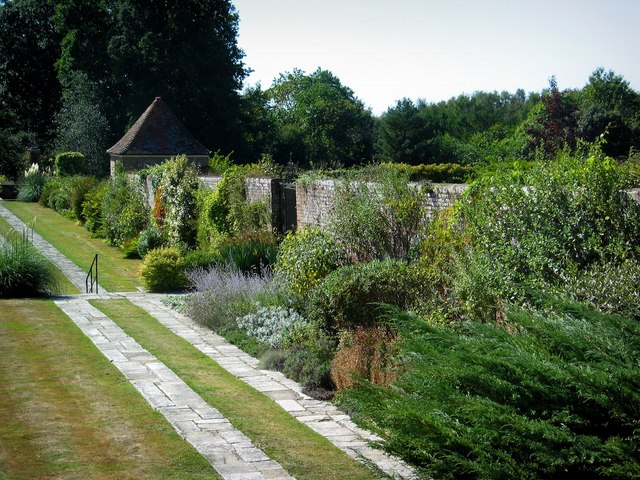
Great
Maytham Hall Garden - geograph.org.uk - 228928.jpg
52:
Great_Maytham_Hall_Garden_-_geograph.org.uk_-_228928.jpg
465:
Add a one-line explanation of what this file represents
123:
1050:
1070:
986:
171:
Creative
Commons Attribution Share-alike license 2.0
90:
Commons is a freely licensed media file repository.
674:
Creative
Commons Attribution-ShareAlike 2.0 Generic
648:
Creative
Commons Attribution-ShareAlike 2.0 Generic
56:(640 × 480 pixels, file size: 125 KB, MIME type:
434:https://creativecommons.org/licenses/by-sa/2.0
71:
440:Creative Commons Attribution-Share Alike 2.0
358:
159:
119:
108:
716:https:\/\/www.geograph.org.uk\/photo\/228928
501:https:\/\/www.geograph.org.uk\/profile\/7267
149:
129:
14:
920:
852:
400:– to copy, distribute and transmit the work
1072:The following other wikis use this file:
792:https://www.geograph.org.uk/photo/228928
557:https://www.geograph.org.uk/profile/7267
300:View this and other nearby images on:
250:View this and other nearby images on:
203:
102:
345:and is licensed for reuse under the
268:
218:
979:
381:Attribution-Share Alike 2.0 Generic
369:
364:
349:Attribution-ShareAlike 2.0 license.
13:
1160:
470:
464:
355:
332:
103:
49:
1262:
1167:
469:
1051:
863:coordinates of the point of view
845:coordinates of the point of view
455:
411:Under the following conditions:
376:This file is licensed under the
368:
363:
357:
325:
306:
292:
284:
256:
242:
234:
70:
31:
21:
1033:File Upload Bot (Magnus Manske)
452:
46:No higher resolution available.
1067:
983:
742:file available on the internet
692:file available on the internet
451:
333:This image was taken from the
26:
1:
1130:Il giardino segreto (Burnett)
931:coordinates of depicted place
913:coordinates of depicted place
36:
1047:
762:Geograph Britain and Ireland
700:Geograph Britain and Ireland
578:object of statement has role
509:object of statement has role
477:Items portrayed in this file
283:
233:
7:
1157:
878:51°2'42.749"N, 0°38'5.208"E
209:Stephen Nunney /
190:Stephen Nunney /
10:
1267:
1237:Supported Flashpix version
1146:Usage on zh.wikipedia.org
1136:Usage on th.wikipedia.org
1126:Usage on it.wikipedia.org
1116:Usage on fa.wikipedia.org
1106:Usage on cs.wikipedia.org
1096:Usage on bn.wikipedia.org
1086:Usage on as.wikipedia.org
1076:Usage on ar.wikipedia.org
425:same or compatible license
105:
1216:Meaning of each component
1197:File change date and time
980:
946:51°2'41.96"N, 0°38'3.84"E
211:Great Maytham Hall Garden
192:Great Maytham Hall Garden
115:Great Maytham Hall Garden
16:
770:geograph.org.uk image ID
704:geograph.org.uk image ID
454:
391:
77:This is a file from the
41:
1037:
1016:20:41, 27 February 2009
181:required by the license
122:
81:. Information from its
1200:15:04, 13 October 2003
1080:الحديقة السرية (رواية)
339:this photograph's page
312:51.044990; 0.634400
262:51.045208; 0.634780
84:description page there
1171:Horizontal resolution
143:geograph_org2commons
1191:Adobe Photoshop 7.0
1179:Vertical resolution
1100:দ্য সিক্রেট গার্ডেন
1090:দ্য চিক্ৰেট গাৰ্ডেন
406:– to adapt the work
1057:Great Maytham Hall
1040:User:Magnus Manske
565:author name string
505:author name string
139:User:Magnus Manske
1254:
1253:
1068:Global file usage
1062:The Secret Garden
1045:
922:
854:
658:copyright license
644:copyright license
463:
354:
353:
337:collection. See
317:
316:
267:
266:
216:
215:
184:
168:
165:Reusing this file
137:; transferred by
99:
98:
79:Wikimedia Commons
32:Global file usage
1258:
1168:
1042:using . |Date=20
1028:
990:
968:
967:
962:
900:
899:
894:
794:
789:
785:described at URL
779:
774:
764:
759:
712:described at URL
614:copyright status
600:copyright status
587:
582:
572:
569:
559:
554:
461:
447:
444:
441:
438:
435:
427:as the original.
389:
378:Creative Commons
372:
371:
367:
366:
361:
360:
347:Creative Commons
335:Geograph project
329:
322:
313:
310:
296:
295:
289:
288:
287:
281:
280:
269:
263:
260:
246:
245:
239:
238:
237:
231:
230:
219:
178:
162:
125:
112:
106:
95:
74:
73:
67:
61:
59:
1266:
1265:
1261:
1260:
1259:
1257:
1256:
1255:
1156:
1066:
1053:
1046:
1034:
1026:
982:
981:
978:
977:
976:
975:
974:
973:
972:
971:
970:
969:
965:
963:
960:
951:
950:
949:
947:
937:
936:
935:
933:
910:
909:
908:
907:
906:
905:
904:
903:
902:
901:
897:
895:
892:
883:
882:
881:
879:
869:
868:
867:
865:
842:
841:
840:
839:
838:
837:
836:
835:
833:
823:
822:
821:
819:
804:
803:
802:
801:
800:
799:
798:
797:
796:
795:
790:
787:
781:
780:
775:
772:
766:
765:
760:
757:
748:
747:
746:
744:
732:
731:
730:
728:
685:
684:
683:
682:
681:
680:
679:
678:
676:
664:
663:
662:
660:
641:
640:
639:
638:
637:
636:
635:
634:
632:
620:
619:
618:
616:
597:
596:
595:
594:
593:
592:
591:
590:
589:
588:
583:
580:
574:
573:
570:
567:
561:
560:
555:
552:
543:
542:
541:
539:
529:
528:
527:
525:
490:
489:
488:
487:
486:
484:
468:
467:
466:
449:
448:
445:
442:
439:
436:
433:
432:
390:
387:
384:
373:
350:
311:
285:
276:
275:
272:Object location
261:
235:
226:
225:
222:Camera location
217:
206:
199:
187:
135:geograph.org.uk
110:
101:
100:
89:
88:
87:is shown below.
63:
57:
55:
48:
47:
12:
11:
5:
1264:
1252:
1251:
1248:
1242:
1241:
1238:
1234:
1233:
1232:
1231:
1230:does not exist
1228:
1225:
1222:
1217:
1213:
1212:
1209:
1202:
1201:
1198:
1194:
1193:
1188:
1184:
1183:
1180:
1176:
1175:
1172:
1159:
1155:
1154:
1153:
1152:
1144:
1143:
1142:
1134:
1133:
1132:
1124:
1123:
1122:
1114:
1113:
1112:
1104:
1103:
1102:
1094:
1093:
1092:
1084:
1083:
1082:
1069:
1065:
1064:
1059:
1049:
1044:
1043:
1036:
1032:
1029:
1023:
1018:
1013:
1009:
1008:
1005:
1002:
999:
996:
993:
985:
956:
955:
954:
953:
952:
948:
945:
943:
942:
941:
939:
938:
934:
929:
927:
926:
925:
924:
918:
914:
888:
887:
886:
885:
884:
880:
877:
875:
874:
873:
871:
870:
866:
861:
859:
858:
857:
856:
850:
846:
834:
831:
829:
828:
827:
825:
824:
820:
815:
813:
812:
811:
810:
808:
783:
782:
768:
767:
753:
752:
751:
750:
749:
745:
740:
738:
737:
736:
734:
733:
729:
726:source of file
724:
722:
721:
720:
719:
717:
713:
709:
705:
701:
697:
693:
689:
688:source of file
677:
672:
670:
669:
668:
666:
665:
661:
656:
654:
653:
652:
651:
649:
645:
633:
628:
626:
625:
624:
622:
621:
617:
612:
610:
609:
608:
607:
605:
601:
576:
575:
571:Stephen Nunney
563:
562:
548:
547:
546:
545:
544:
540:
537:
535:
534:
533:
531:
530:
526:
521:
519:
518:
517:
516:
514:
510:
506:
502:
498:
494:
485:
480:
478:
475:
474:
473:
472:
460:
459:
456:
453:
431:
430:
429:
428:
418:
409:
408:
407:
401:
394:You are free:
388:Stephen Nunney
385:
375:
374:
356:
352:
351:
343:Stephen Nunney
330:
315:
314:
304:
298:
273:
265:
264:
254:
248:
223:
214:
213:
207:
204:
201:
200:
195:
188:
185:
173:
172:
169:
157:
156:
154:Stephen Nunney
151:
147:
146:
131:
127:
126:
121:
117:
116:
113:
104:
97:
96:
75:
65:
64:
45:
40:
39:
34:
29:
24:
19:
9:
6:
4:
3:
2:
1263:
1249:
1247:
1244:
1243:
1239:
1236:
1235:
1229:
1226:
1223:
1220:
1219:
1218:
1215:
1214:
1210:
1207:
1204:
1203:
1199:
1196:
1195:
1192:
1189:
1187:Software used
1186:
1185:
1181:
1178:
1177:
1173:
1170:
1169:
1166:
1163:
1151:
1148:
1147:
1145:
1141:
1138:
1137:
1135:
1131:
1128:
1127:
1125:
1121:
1120:باغ اسرارآمیز
1118:
1117:
1115:
1111:
1110:Tajná zahrada
1108:
1107:
1105:
1101:
1098:
1097:
1095:
1091:
1088:
1087:
1085:
1081:
1078:
1077:
1075:
1074:
1073:
1063:
1060:
1058:
1055:
1054:
1041:
1035:
1030:
1024:
1022:
1019:
1017:
1014:
1011:
1010:
1006:
1003:
1000:
997:
994:
992:
991:
989:
959:
944:
932:
928:
891:
876:
864:
860:
830:
818:
814:
793:
786:
778:
771:
763:
756:
743:
739:
727:
723:
675:
671:
659:
655:
631:
627:
615:
611:
586:
579:
566:
558:
551:
536:
524:
520:
483:
479:
476:
457:
450:
437:CC BY-SA 2.0
426:
422:
419:
416:
413:
412:
410:
405:
402:
399:
396:
395:
393:
392:
386:Attribution:
382:
379:
362:
348:
344:
340:
336:
331:
328:
324:
323:
320:
319:
309:
305:
303:
302:OpenStreetMap
299:
297:
279:
274:
271:
270:
259:
255:
253:
252:OpenStreetMap
249:
247:
229:
224:
221:
220:
212:
208:
202:
198:
194: /
193:
189:
182:
177:
175:
174:
170:
166:
161:
158:
155:
152:
148:
144:
140:
136:
132:
128:
118:
114:
107:
93:
86:
85:
80:
76:
69:
68:
62:
53:
44:
38:
35:
33:
30:
28:
25:
23:
20:
18:
15:
1250:Uncalibrated
1164:
1161:
1071:
987:
984:File history
832:October 2003
585:photographer
513:photographer
420:
414:
403:
397:
342:
318:
282:
232:
210:
197:CC BY-SA 2.0
191:
124:October 2003
92:You can help
82:
50:
22:File history
1246:Color space
1150:秘密花園 (英語小說)
630:copyrighted
604:copyrighted
421:share alike
415:attribution
176:Attribution
109:Description
1048:File usage
1025:640 × 480
1001:Dimensions
538:some value
160:Permission
58:image/jpeg
27:File usage
1140:สวนปริศนา
998:Thumbnail
995:Date/Time
817:inception
807:inception
205:InfoField
186:InfoField
1158:Metadata
1027:(125 KB)
755:operator
696:operator
458:Captions
404:to remix
398:to share
383:license.
37:Metadata
1208:version
1012:current
1007:Comment
958:heading
917:heading
890:heading
849:heading
523:creator
493:creator
482:depicts
462:English
54:
1182:72 dpi
1174:72 dpi
966:degree
921:degree
898:degree
853:degree
777:228928
708:228928
290:
240:
150:Author
141:using
130:Source
133:From
1211:2.21
1206:Exif
1004:User
964:225
896:225
446:true
443:true
120:Date
17:File
550:URL
497:URL
1227:Cr
1224:Cb
961::
893::
788::
773::
758::
581::
568::
553::
1240:1
1221:Y
183:)
179:(
167:)
163:(
145:.
94:.
60:)
Text is available under the Creative Commons Attribution-ShareAlike License. Additional terms may apply.
_region:GB-GBN_heading:225.00&language=en)
