262:
691:"}},"text\/plain":{"en":{"":"inception"}}},"{\"value\":{\"time\":\"+2015-10-04T00:00:00Z\",\"timezone\":0,\"before\":0,\"after\":0,\"precision\":11,\"calendarmodel\":\"http:\\\/\\\/www.wikidata.org\\\/entity\\\/Q1985727\"},\"type\":\"time\"}":{"text\/html":{"en":{"P571":"4 October 2015"}},"text\/plain":{"en":{"P571":"4 October 2015"}}}}": -->
43:
448:
327:
1385:
282:
332:
1380:
99:
460:"}},"text\/plain":{"en":{"P2699":"https:\/\/commons.wikimedia.org\/wiki\/user:Flappiefh"}}},"{\"value\":{\"entity-type\":\"property\",\"numeric-id\":2093,\"id\":\"P2093\"},\"type\":\"wikibase-entityid\"}":{"text\/html":{"en":{"":"
468:"}},"text\/plain":{"en":{"P2093":"Flappiefh","P4174":"Flappiefh"}}},"{\"value\":{\"entity-type\":\"property\",\"numeric-id\":4174,\"id\":\"P4174\"},\"type\":\"wikibase-entityid\"}":{"text\/html":{"en":{"":"
729:"}},"text\/plain":{"en":{"":"media type"}}},"{\"value\":\"image\\\/svg+xml\",\"type\":\"string\"}":{"text\/html":{"en":{"P1163":"image\/svg+xml"}},"text\/plain":{"en":{"P1163":"image\/svg+xml"}}}}": -->
603:"}},"text\/plain":{"en":{"":"copyright license"}}},"{\"value\":{\"entity-type\":\"item\",\"numeric-id\":18199165,\"id\":\"Q18199165\"},\"type\":\"wikibase-entityid\"}":{"text\/html":{"en":{"P275":"
559:"}},"text\/plain":{"en":{"":"copyright status"}}},"{\"value\":{\"entity-type\":\"item\",\"numeric-id\":50423863,\"id\":\"Q50423863\"},\"type\":\"wikibase-entityid\"}":{"text\/html":{"en":{"P6216":"
647:"}},"text\/plain":{"en":{"":"source of file"}}},"{\"value\":{\"entity-type\":\"item\",\"numeric-id\":66458942,\"id\":\"Q66458942\"},\"type\":\"wikibase-entityid\"}":{"text\/html":{"en":{"P7482":"
452:"}},"text\/plain":{"en":{"":"creator"}}},"{\"value\":{\"entity-type\":\"property\",\"numeric-id\":2699,\"id\":\"P2699\"},\"type\":\"wikibase-entityid\"}":{"text\/html":{"en":{"":"
725:
464:"}},"text\/plain":{"en":{"":"author name string"}}},"{\"value\":\"Flappiefh\",\"type\":\"string\"}":{"text\/html":{"en":{"P2093":"Flappiefh","P4174":"
456:"}},"text\/plain":{"en":{"":"URL"}}},"{\"value\":\"https:\\\/\\\/commons.wikimedia.org\\\/wiki\\\/user:Flappiefh\",\"type\":\"string\"}":{"text\/html":{"en":{"P2699":"
373:– You must give appropriate credit, provide a link to the license, and indicate if changes were made. You may do so in any reasonable manner, but not in any way that suggests the licensor endorses you or your use.
465:
1370:
648:
604:
560:
457:
1342:
833:
726:
644:
556:
469:
461:
453:
688:
600:
449:
1639:
73:
69:
65:
61:
57:
53:
47:
607:"}},"text\/plain":{"en":{"P275":"Creative Commons Attribution-ShareAlike 4.0 International"}}}}": -->
110:
297:
82:
1390:
261:
674:
630:
586:
1650:
This file contains additional information, probably added from the digital camera or scanner used to create or digitize it.
380:
736:
658:
570:
534:
521:
506:
651:"}},"text\/plain":{"en":{"P7482":"original creation by uploader"}}}}": -->
698:
614:
479:
438:
293:
541:
342:
1653:
If the file has been modified from its original state, some details may not fully reflect the modified file.
1120:
870:
832:
More than 100 pages use this file. The following list shows the first 100 pages that use this file only. A
955:
379:– If you remix, transform, or build upon the material, you must distribute your contributions under the
472:"}},"text\/plain":{"en":{"":"Wikimedia username"}}}}": -->
222:
1075:
925:
563:"}},"text\/plain":{"en":{"P6216":"copyrighted"}}}}": -->
1305:
804:
799:
154:
42:
1175:
289:
118:
1200:
940:
1205:
513:
945:
1415:
1325:
995:
930:
970:
168:
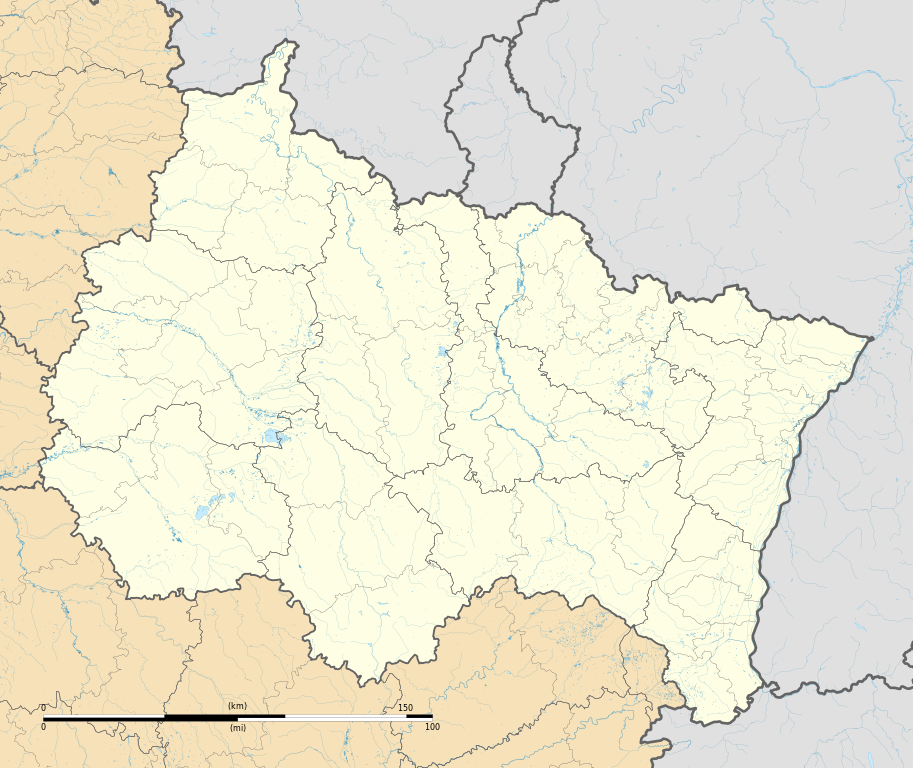
Projection "Géoportail" (projection équirectangulaire à la latitude de référence 46.5° Nord)
1320:
980:
339:
1505:
8:
1360:
1310:
910:
1620:
1610:
1480:
1460:
1150:
1135:
1100:
1465:
935:
281:
105:
1145:
428:
314:
I, the copyright holder of this work, hereby publish it under the following license:
1130:
1070:
218:
NASA Shuttle Radar
Topography Mission (SRTM3 v.2 & SWBD) (public domain) ;
1470:
960:
1400:
1395:
1265:
1240:
247:
1245:
1065:
855:
815:
1170:
1330:
1225:
1140:
1110:
1020:
1575:
1215:
1210:
1195:
880:
157:
1485:
1060:
746:
708:
668:
624:
580:
489:
1335:
1030:
1010:
1005:
885:
840:
1275:
1090:
1490:
1280:
1270:
1220:
1160:
1115:
1000:
895:
875:
1550:
1545:
1625:
1295:
1255:
1180:
1025:
975:
900:
161:
1580:
1450:
1235:
1095:
1085:
1015:
920:
845:
772:
Click on a date/time to view the file as it appeared at that time.
1445:
1410:
1590:
1495:
1230:
1190:
1125:
1035:
985:
890:
1600:
1440:
1315:
1290:
1260:
1250:
1185:
1165:
1105:
1055:
1045:
950:
905:
850:
1605:
1560:
1455:
1425:
87:(SVG file, nominally 1,724 × 1,451 pixels, file size: 4.21 MB)
1300:
1155:
1050:
1040:
990:
965:
860:
1585:
1475:
865:
232:
1285:
1080:
915:
1595:
1530:
1420:
631:
Creative
Commons Attribution-ShareAlike 4.0 International
605:
Creative
Commons Attribution-ShareAlike 4.0 International
197:
93:
1615:
1565:
1515:
1430:
422:
Add a one-line explanation of what this file represents
1555:
1435:
830:
458:
https:\/\/commons.wikimedia.org\/wiki\/user:Flappiefh
1630:
1351:
770:
117:
Commons is a freely licensed media file repository.
1570:
1540:
1386:মডিউল:অবস্থান মানচিত্র/উপাত্ত/ফ্রান্স গ্যঁ এস্ট/নথি
300:to clean up, improve, create or translate as well.
1525:
1520:
1535:
1416:Knowledge:Kartenwerkstatt/Positionskarten/Europa
1381:মডিউল:অবস্থান মানচিত্র/উপাত্ত/ফ্রান্স গ্যঁ এস্ট
390:https://creativecommons.org/licenses/by-sa/4.0
98:
396:Creative Commons Attribution-Share Alike 4.0
320:
193:
140:
514:https://commons.wikimedia.org/user:Flappiefh
253:
243:
203:
14:
1611:Anexo:Patrimonio de la Humanidad en Francia
1481:Vorlage:Positionskarte Frankreich Grand Est
1361:Vorlage:Positionskarte Frankreich Grand Est
356:– to copy, distribute and transmit the work
46:Size of this PNG preview of this SVG file:
1353:The following other wikis use this file:
343:Attribution-Share Alike 4.0 International
288:This map was improved or created by the
1506:Ŝablono:Situo sur mapo Francio Grand Est
170:Limites géogrpahiques de la carte :
1621:Jardín de altura de la cumbre Chitelet
1461:Militärflugplatz Saint-Dizier-Robinson
129:
822:User created page with UploadWizard
763:
331:
326:
13:
1648:
427:
421:
317:
313:
287:
153:Carte administrative vierge de la
147:
130:
80:
1690:
1655:
426:
143:Grand Est region location map.svg
1471:Militärflugplatz Reims-Champagne
412:
367:Under the following conditions:
338:This file is licensed under the
330:
325:
319:
280:
260:
164:, destinée à la géolocalisation.
97:
31:
21:
409:
1466:Militärflugplatz Toul-Rosières
1348:
767:
408:
148:
26:
1:
1486:Flugplatz Chaumont-Semoutiers
675:original creation by uploader
649:original creation by uploader
36:
871:Baccarat, Meurthe-et-Moselle
827:
434:Items portrayed in this file
307:
7:
1645:
1371:Шаблон:ПК Франция Гранд Ест
1357:Usage on als.wikipedia.org
10:
1695:
1512:Usage on es.wikipedia.org
1502:Usage on eo.wikipedia.org
1491:Flugplatz Marigny-le-Grand
1407:Usage on de.wikipedia.org
1377:Usage on bn.wikipedia.org
1367:Usage on bg.wikipedia.org
1121:Oberhoffen-lès-Wissembourg
381:same or compatible license
137:
132:
1076:Mamey, Meurthe-et-Moselle
956:Colombey-les-Deux-Églises
764:
223:Directive Cadre sur l'Eau
208:
16:
1626:Maron (Meurthe y Mosela)
411:
347:
104:This is a file from the
41:
1581:Catedral de Estrasburgo
821:
279:
196:
108:. Information from its
1206:Saint-Louis, Haut-Rhin
111:description page there
1446:Stade Louis-Dugauguez
1411:Stade Auguste-Delaune
1326:Villers-le-Sec, Meuse
1176:Rimbach-près-Masevaux
996:Goncourt, Haute-Marne
931:Chaumont, Haute-Marne
800:12:33, 4 October 2015
1576:Charleville-Mézières
1551:Châlons-en-Champagne
1546:Saint-Dié-des-Vosges
1496:Viadukt von Chaumont
1321:Villeneuve-au-Chemin
1201:Saint-Dié-des-Vosges
981:Feldkirch, Haut-Rhin
941:Châlons-en-Champagne
926:Charleville-Mézières
74:1,724 × 1,451 pixels
70:2,433 × 2,048 pixels
66:1,217 × 1,024 pixels
1601:Ciudadela de Bitche
1311:Varennes-en-Argonne
1306:Vandœuvre-lès-Nancy
946:Châtillon-sur-Marne
911:Bourbonne-les-Bains
362:– to adapt the work
296:(fr). You can
52:Other resolutions:
1441:Stade Marcel-Picot
1136:Orges, Haute-Marne
1101:Munster, Haut-Rhin
971:Domrémy-la-Pucelle
535:Wikimedia username
522:author name string
470:Wikimedia username
462:author name string
1682:
1681:
1662:Generated with Qt
1640:more global usage
1606:Winkel (Alto Rin)
1561:Catedral de Reims
1456:Stade Paul Gasser
1426:Le Magny (Vosges)
1349:Global file usage
1151:Raon-l'Étape
936:Chaumont-la-Ville
825:
615:copyright license
601:copyright license
420:
305:
304:
274:
273:
235:(foreign rivers).
233:OpenStreetMap.org
126:
125:
106:Wikimedia Commons
32:Global file usage
1686:
1656:
1131:Olizy-sur-Chiers
1071:Mailly-Champagne
812:
774:
571:copyright status
557:copyright status
544:
539:
529:
526:
516:
511:
418:
403:
400:
397:
394:
391:
383:as the original.
340:Creative Commons
334:
333:
329:
328:
323:
322:
284:
277:
276:
264:
214:Sources of data:
210:
199:
152:
150:Français :
144:
138:
122:
101:
100:
94:
88:
77:
62:913 × 768 pixels
58:570 × 480 pixels
54:285 × 240 pixels
48:712 × 599 pixels
1694:
1693:
1689:
1688:
1687:
1685:
1684:
1683:
1644:
1591:Sedán (Ardenas)
1586:Barr (Bajo Rin)
1476:Flugplatz Athis
1451:Stade de l’Aube
1347:
1266:Still, Bas-Rhin
1241:Sedan, Ardennes
826:
818:
810:
766:
765:
762:
761:
760:
759:
758:
757:
756:
755:
753:
743:
742:
741:
739:
724:
723:
722:
721:
720:
719:
718:
717:
715:
705:
704:
703:
701:
686:
685:
684:
683:
682:
681:
680:
679:
677:
665:
664:
663:
661:
642:
641:
640:
639:
638:
637:
636:
635:
633:
621:
620:
619:
617:
598:
597:
596:
595:
594:
593:
592:
591:
589:
577:
576:
575:
573:
554:
553:
552:
551:
550:
549:
548:
547:
546:
545:
540:
537:
531:
530:
527:
524:
518:
517:
512:
509:
500:
499:
498:
496:
486:
485:
484:
482:
447:
446:
445:
444:
443:
441:
425:
424:
423:
406:
405:
404:
401:
398:
395:
392:
389:
388:
346:
335:
316:
315:
310:
301:
275:
268:
265:
187:South: 47.257 N
183:North: 50.320 N
165:
142:
135:
128:
127:
116:
115:
114:is shown below.
90:
86:
79:
78:
51:
12:
11:
5:
1692:
1680:
1679:
1676:
1672:
1671:
1668:
1664:
1663:
1660:
1647:
1642:of this file.
1636:
1635:
1634:
1633:
1628:
1623:
1618:
1613:
1608:
1603:
1598:
1593:
1588:
1583:
1578:
1573:
1568:
1563:
1558:
1553:
1548:
1543:
1538:
1533:
1528:
1523:
1518:
1510:
1509:
1508:
1500:
1499:
1498:
1493:
1488:
1483:
1478:
1473:
1468:
1463:
1458:
1453:
1448:
1443:
1438:
1433:
1428:
1423:
1418:
1413:
1405:
1404:
1403:
1398:
1393:
1388:
1383:
1375:
1374:
1373:
1365:
1364:
1363:
1350:
1345:to this file.
1339:
1338:
1333:
1328:
1323:
1318:
1313:
1308:
1303:
1298:
1293:
1288:
1283:
1278:
1273:
1268:
1263:
1258:
1253:
1248:
1246:Sillery, Marne
1243:
1238:
1233:
1228:
1223:
1218:
1213:
1208:
1203:
1198:
1193:
1188:
1183:
1178:
1173:
1168:
1163:
1158:
1153:
1148:
1146:Pont-à-Mousson
1143:
1138:
1133:
1128:
1123:
1118:
1113:
1108:
1103:
1098:
1093:
1088:
1083:
1078:
1073:
1068:
1066:Magenta, Marne
1063:
1058:
1053:
1048:
1043:
1038:
1033:
1028:
1023:
1018:
1013:
1008:
1003:
998:
993:
988:
983:
978:
973:
968:
963:
958:
953:
948:
943:
938:
933:
928:
923:
918:
913:
908:
903:
898:
893:
888:
883:
878:
873:
868:
863:
858:
856:Arcis-sur-Aube
853:
848:
843:
836:is available.
829:
824:
823:
820:
816:
813:
809:1,724 × 1,451
807:
802:
797:
793:
792:
789:
786:
783:
780:
777:
769:
754:
751:
749:
748:
747:
745:
744:
740:
735:
733:
732:
731:
730:
728:
716:
714:4 October 2015
713:
711:
710:
709:
707:
706:
702:
697:
695:
694:
693:
692:
690:
678:
673:
671:
670:
669:
667:
666:
662:
659:source of file
657:
655:
654:
653:
652:
650:
646:
645:source of file
634:
629:
627:
626:
625:
623:
622:
618:
613:
611:
610:
609:
608:
606:
602:
590:
585:
583:
582:
581:
579:
578:
574:
569:
567:
566:
565:
564:
562:
558:
533:
532:
520:
519:
505:
504:
503:
502:
501:
497:
494:
492:
491:
490:
488:
487:
483:
478:
476:
475:
474:
473:
471:
467:
463:
459:
455:
451:
442:
437:
435:
432:
431:
430:
429:
417:
416:
413:
410:
387:
386:
385:
384:
374:
365:
364:
363:
357:
350:You are free:
337:
336:
318:
312:
311:
309:
306:
303:
302:
298:propose images
285:
272:
271:
270:
269:
266:
259:
255:
254:Other versions
251:
250:
245:
241:
240:
239:
238:
237:
236:
230:
227:
220:
205:
201:
200:
198:4 October 2015
195:
191:
190:
189:
188:
185:
181:
177:
145:
136:
134:
131:
124:
123:
102:
92:
91:
45:
40:
39:
34:
29:
24:
19:
9:
6:
4:
3:
2:
1691:
1677:
1674:
1673:
1669:
1666:
1665:
1661:
1658:
1657:
1654:
1651:
1643:
1641:
1632:
1629:
1627:
1624:
1622:
1619:
1617:
1614:
1612:
1609:
1607:
1604:
1602:
1599:
1597:
1596:Heiligenstein
1594:
1592:
1589:
1587:
1584:
1582:
1579:
1577:
1574:
1572:
1569:
1567:
1564:
1562:
1559:
1557:
1554:
1552:
1549:
1547:
1544:
1542:
1539:
1537:
1534:
1532:
1529:
1527:
1524:
1522:
1519:
1517:
1514:
1513:
1511:
1507:
1504:
1503:
1501:
1497:
1494:
1492:
1489:
1487:
1484:
1482:
1479:
1477:
1474:
1472:
1469:
1467:
1464:
1462:
1459:
1457:
1454:
1452:
1449:
1447:
1444:
1442:
1439:
1437:
1434:
1432:
1429:
1427:
1424:
1422:
1419:
1417:
1414:
1412:
1409:
1408:
1406:
1402:
1399:
1397:
1394:
1392:
1389:
1387:
1384:
1382:
1379:
1378:
1376:
1372:
1369:
1368:
1366:
1362:
1359:
1358:
1356:
1355:
1354:
1346:
1344:
1337:
1334:
1332:
1331:Waldweistroff
1329:
1327:
1324:
1322:
1319:
1317:
1314:
1312:
1309:
1307:
1304:
1302:
1299:
1297:
1294:
1292:
1289:
1287:
1284:
1282:
1279:
1277:
1274:
1272:
1269:
1267:
1264:
1262:
1259:
1257:
1254:
1252:
1249:
1247:
1244:
1242:
1239:
1237:
1234:
1232:
1229:
1227:
1226:Sarreguemines
1224:
1222:
1219:
1217:
1214:
1212:
1209:
1207:
1204:
1202:
1199:
1197:
1194:
1192:
1189:
1187:
1184:
1182:
1179:
1177:
1174:
1172:
1169:
1167:
1164:
1162:
1159:
1157:
1154:
1152:
1149:
1147:
1144:
1142:
1141:Pfaffenhoffen
1139:
1137:
1134:
1132:
1129:
1127:
1124:
1122:
1119:
1117:
1114:
1112:
1111:Nancy, France
1109:
1107:
1104:
1102:
1099:
1097:
1094:
1092:
1089:
1087:
1084:
1082:
1079:
1077:
1074:
1072:
1069:
1067:
1064:
1062:
1059:
1057:
1054:
1052:
1049:
1047:
1044:
1042:
1039:
1037:
1034:
1032:
1029:
1027:
1024:
1022:
1021:Hombourg-Haut
1019:
1017:
1014:
1012:
1009:
1007:
1004:
1002:
999:
997:
994:
992:
989:
987:
984:
982:
979:
977:
974:
972:
969:
967:
964:
962:
961:Contrexéville
959:
957:
954:
952:
949:
947:
944:
942:
939:
937:
934:
932:
929:
927:
924:
922:
919:
917:
914:
912:
909:
907:
904:
902:
899:
897:
894:
892:
889:
887:
884:
882:
879:
877:
874:
872:
869:
867:
864:
862:
859:
857:
854:
852:
849:
847:
844:
842:
839:
838:
837:
835:
819:
814:
808:
806:
803:
801:
798:
795:
794:
790:
787:
784:
781:
778:
776:
775:
773:
752:image/svg+xml
750:
738:
734:
712:
700:
696:
676:
672:
660:
656:
632:
628:
616:
612:
588:
584:
572:
568:
543:
536:
523:
515:
508:
493:
481:
477:
440:
436:
433:
414:
407:
393:CC BY-SA 4.0
382:
378:
375:
372:
369:
368:
366:
361:
358:
355:
352:
351:
349:
348:
344:
341:
324:
299:
295:
291:
290:Wikigraphists
286:
283:
278:
263:
258:
257:
256:
252:
249:
246:
242:
234:
231:
228:
226:
224:
221:
219:
217:
216:
215:
213:
212:
211:
206:
202:
192:
186:
184:
182:
180:
179:East: 8.465 E
178:
176:
174:
173:
172:
171:
169:
166:
163:
159:
156:
151:
146:
139:
120:
113:
112:
107:
103:
96:
95:
89:
84:
83:Original file
75:
71:
67:
63:
59:
55:
49:
44:
38:
35:
33:
30:
28:
25:
23:
20:
18:
15:
1652:
1649:
1637:
1531:Schiltigheim
1421:Moselviadukt
1352:
1340:
1216:Saint-Mihiel
1211:Saint-Menges
1196:Saint-Dizier
881:Bar-sur-Aube
831:
771:
768:File history
376:
370:
359:
353:
267:Physical map
207:
175:West: 3.17 E
167:
149:
119:You can help
109:
81:
22:File history
1678:409.63553mm
1670:486.54129mm
1659:Image title
1616:Hautvillers
1516:Estrasburgo
1336:Wissembourg
1171:Ribeauvillé
1031:Kaysersberg
1011:Guevenatten
1006:Grostenquin
886:Baudricourt
841:Aix-en-Othe
587:copyrighted
561:copyrighted
377:share alike
371:attribution
294:Graphic Lab
141:Description
1431:Hautmougey
1391:স্ত্রাসবুর
1343:more links
1281:Thionville
1271:Strasbourg
1221:Sarrebourg
1161:Remiremont
1116:Natzwiller
1001:Gravelotte
896:Bettviller
876:Bar-le-Duc
828:File usage
785:Dimensions
737:media type
727:media type
495:some value
27:File usage
1296:Turckheim
1256:Sommesous
1181:Riquewihr
1061:Lunéville
1026:Issenheim
976:Douaumont
901:Bezonvaux
834:full list
817:Flappiefh
811:(4.21 MB)
782:Thumbnail
779:Date/Time
699:inception
689:inception
542:Flappiefh
528:Flappiefh
466:Flappiefh
308:Licensing
248:Flappiefh
158:Grand Est
1646:Metadata
1556:Mulhouse
1436:Harsault
1276:Sélestat
1236:Schweyen
1096:Mulhouse
1091:Montmédy
1086:Molsheim
1016:Haguenau
921:Chaource
846:Altkirch
415:Captions
360:to remix
354:to share
345:license.
209:Own work
37:Metadata
1631:Bassuet
1231:Saverne
1191:Rosheim
1126:Obernai
1036:Langres
986:Forbach
891:Benfeld
796:current
791:Comment
480:creator
450:creator
439:depicts
419:English
292:of the
229:GEOFLA;
133:Summary
85:
1675:Height
1571:Troyes
1566:Épinal
1541:Colmar
1316:Verdun
1291:Troyes
1261:Sorbon
1251:Sionne
1186:Rocroi
1166:Rethel
1106:Mutzig
1056:Ludres
1046:Longwy
951:Colmar
906:Bitche
851:Altorf
244:Author
204:Source
162:France
155:région
1667:Width
1638:View
1526:Nancy
1521:Reims
1341:View
1301:Valmy
1156:Reims
1051:Ludes
1041:Lirey
991:Givet
966:Crion
861:Atton
1536:Metz
1401:রাঁস
1396:নঁসি
1286:Toul
1081:Metz
916:Bouy
788:User
402:true
399:true
194:Date
17:File
507:URL
454:URL
866:Aÿ
538::
525::
510::
160:,
72:|
68:|
64:|
60:|
56:|
50:.
225:;
121:.
76:.
Text is available under the Creative Commons Attribution-ShareAlike License. Additional terms may apply.

