699:"}},"text\/plain":{"en":{"":"coordinates of the point of view"}}},"{\"value\":{\"latitude\":55.761685,\"longitude\":-2.372866,\"altitude\":null,\"precision\":1.0e-6,\"globe\":\"http:\\\/\\\/www.wikidata.org\\\/entity\\\/Q2\"},\"type\":\"globecoordinate\"}":{"text\/html":{"en":{"P1259":"55\u00b045'42.066"N, 2\u00b022'22.318"W"}},"text\/plain":{"en":{"P1259":"55\u00b045'42.066\"N, 2\u00b022'22.318\"W"}}}}": -->
737:"}},"text\/plain":{"en":{"":"inception"}}},"{\"value\":{\"time\":\"+2006-02-05T00:00:00Z\",\"timezone\":0,\"before\":0,\"after\":0,\"precision\":11,\"calendarmodel\":\"http:\\\/\\\/www.wikidata.org\\\/entity\\\/Q1985727\"},\"type\":\"time\"}":{"text\/html":{"en":{"P571":"5 February 2006"}},"text\/plain":{"en":{"P571":"5 February 2006"}}}}": -->
576:
381:
196:
217:
255:
260:
72:
393:"}},"text\/plain":{"en":{"P2699":"https:\/\/www.geograph.org.uk\/profile\/196"}}},"{\"value\":{\"entity-type\":\"property\",\"numeric-id\":3831,\"id\":\"P3831\"},\"type\":\"wikibase-entityid\"}":{"text\/html":{"en":{"":"
592:"}},"text\/plain":{"en":{"P973":"https:\/\/www.geograph.org.uk\/photo\/118810"}}},"{\"value\":{\"entity-type\":\"property\",\"numeric-id\":137,\"id\":\"P137\"},\"type\":\"wikibase-entityid\"}":{"text\/html":{"en":{"":"
405:"}},"text\/plain":{"en":{"":"author name string"}}},"{\"value\":\"Richard Webb\",\"type\":\"string\"}":{"text\/html":{"en":{"P2093":"Richard Webb"}},"text\/plain":{"en":{"P2093":"Richard Webb"}}}}": -->
584:"}},"text\/plain":{"en":{"P7482":"file available on the internet"}}},"{\"value\":{\"entity-type\":\"property\",\"numeric-id\":973,\"id\":\"P973\"},\"type\":\"wikibase-entityid\"}":{"text\/html":{"en":{"":"
600:"}},"text\/plain":{"en":{"P137":"Geograph Britain and Ireland"}}},"{\"value\":{\"entity-type\":\"property\",\"numeric-id\":7384,\"id\":\"P7384\"},\"type\":\"wikibase-entityid\"}":{"text\/html":{"en":{"":"
397:"}},"text\/plain":{"en":{"":"object of statement has role"}}},"{\"value\":{\"entity-type\":\"item\",\"numeric-id\":33231,\"id\":\"Q33231\"},\"type\":\"wikibase-entityid\"}":{"text\/html":{"en":{"P3831":"
536:"}},"text\/plain":{"en":{"":"copyright license"}}},"{\"value\":{\"entity-type\":\"item\",\"numeric-id\":19068220,\"id\":\"Q19068220\"},\"type\":\"wikibase-entityid\"}":{"text\/html":{"en":{"P275":"
492:"}},"text\/plain":{"en":{"":"copyright status"}}},"{\"value\":{\"entity-type\":\"item\",\"numeric-id\":50423863,\"id\":\"Q50423863\"},\"type\":\"wikibase-entityid\"}":{"text\/html":{"en":{"P6216":"
580:"}},"text\/plain":{"en":{"":"source of file"}}},"{\"value\":{\"entity-type\":\"item\",\"numeric-id\":74228490,\"id\":\"Q74228490\"},\"type\":\"wikibase-entityid\"}":{"text\/html":{"en":{"P7482":"
401:"}},"text\/plain":{"en":{"P3831":"photographer"}}},"{\"value\":{\"entity-type\":\"property\",\"numeric-id\":2093,\"id\":\"P2093\"},\"type\":\"wikibase-entityid\"}":{"text\/html":{"en":{"":"
596:"}},"text\/plain":{"en":{"":"operator"}}},"{\"value\":{\"entity-type\":\"item\",\"numeric-id\":1503119,\"id\":\"Q1503119\"},\"type\":\"wikibase-entityid\"}":{"text\/html":{"en":{"P137":"
385:"}},"text\/plain":{"en":{"":"creator"}}},"{\"value\":{\"entity-type\":\"property\",\"numeric-id\":2699,\"id\":\"P2699\"},\"type\":\"wikibase-entityid\"}":{"text\/html":{"en":{"":"
695:
604:"}},"text\/plain":{"en":{"":"geograph.org.uk image ID"}}},"{\"value\":\"118810\",\"type\":\"string\"}":{"text\/html":{"en":{"P7384":"
307:– You must give appropriate credit, provide a link to the license, and indicate if changes were made. You may do so in any reasonable manner, but not in any way that suggests the licensor endorses you or your use.
179:
43:
831:
830:{{Information |Description={{en|1=Gavinton Main Street}} |Source=http://www.geograph.org.uk/photo/118810 |Author=Richard Webb |Date=2006.02.05 |Permission= |other_versions= }}
605:
581:
537:
493:
597:
398:
173:
696:
601:
577:
489:
402:
394:
386:
734:
593:
589:
585:
533:
382:
390:
540:"}},"text\/plain":{"en":{"P275":"Creative Commons Attribution-ShareAlike 2.0 Generic"}}}}": -->
631:
563:
519:
189:
666:
224:
889:
This file contains additional information, probably added from the digital camera or scanner used to create or digitize it.
314:
461:
706:
674:
615:
503:
469:
454:
439:
744:
659:
644:
547:
412:
371:
270:
892:
If the file has been modified from its original state, some details may not fully reflect the modified file.
313:– If you remix, transform, or build upon the material, you must distribute your contributions under the
231:
on the
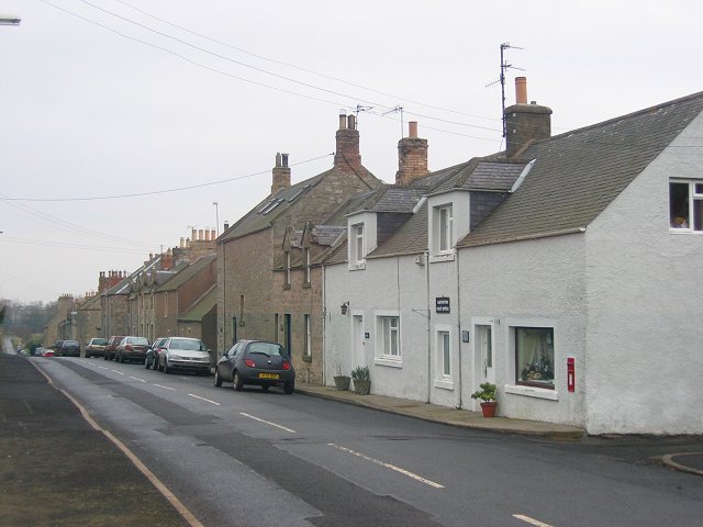
Geograph website for the photographer's contact details. The copyright on this image is owned by
496:"}},"text\/plain":{"en":{"P6216":"copyrighted"}}}}": -->
83:
844:
The following pages on the
English Knowledge use this file (pages on other projects are not listed):
51:
91:
608:"}},"text\/plain":{"en":{"P7384":"118810"}}}}": -->
681:
651:
267:
446:
8:
211:
195:
236:
78:
361:
823:
812:
807:
42:
146:
156:
754:
716:
625:
557:
513:
422:
216:
228:
866:
848:
780:
Click on a date/time to view the file as it appeared at that time.
181:
174:
55° 45′ 42.07″ N, 2° 22′ 22.32″ W
135:
66:
355:
Add a one-line explanation of what this file represents
876:
842:
857:
778:
90:
Commons is a freely licensed media file repository.
564:
Creative
Commons Attribution-ShareAlike 2.0 Generic
538:
Creative
Commons Attribution-ShareAlike 2.0 Generic
56:(640 × 480 pixels, file size: 52 KB, MIME type:
324:https://creativecommons.org/licenses/by-sa/2.0
71:
330:Creative Commons Attribution-Share Alike 2.0
248:
131:
113:
590:https:\/\/www.geograph.org.uk\/photo\/118810
152:
141:
14:
391:https:\/\/www.geograph.org.uk\/profile\/196
290:– to copy, distribute and transmit the work
859:The following other wikis use this file:
126:Gavinton. View east past the post office.
834:[[Category:Places in the Scottish Border
652:https://www.geograph.org.uk/photo/118810
447:https://www.geograph.org.uk/profile/196
188:View this and other nearby images on:
102:
235:and is licensed for reuse under the
164:
771:
271:Attribution-Share Alike 2.0 Generic
259:
254:
239:Attribution-ShareAlike 2.0 license.
13:
887:
360:
354:
245:
222:
120:
103:
49:
913:
894:
832:Category:Villages in Berwickshire
359:
843:
707:coordinates of the point of view
697:coordinates of the point of view
345:
301:Under the following conditions:
266:This file is licensed under the
258:
253:
247:
215:
194:
180:
70:
31:
21:
342:
121:
46:No higher resolution available.
854:
775:
632:file available on the internet
582:file available on the internet
341:
223:This image was taken from the
26:
1:
722:55°45'42.066"N, 2°22'22.318"W
36:
839:
667:Geograph Britain and Ireland
598:Geograph Britain and Ireland
455:object of statement has role
395:object of statement has role
367:Items portrayed in this file
207:
7:
884:
10:
918:
873:Usage on www.wikidata.org
863:Usage on eu.wikipedia.org
315:same or compatible license
110:
105:
772:
16:
675:geograph.org.uk image ID
602:geograph.org.uk image ID
344:
281:
77:This is a file from the
41:
867:Gavinton (Berwickshire)
829:
134:
81:. Information from its
808:14:44, 6 November 2009
229:this photograph's page
200:55.761685; -2.372866
84:description page there
296:– to adapt the work
470:author name string
403:author name string
905:
904:
855:Global file usage
837:
548:copyright license
534:copyright license
353:
244:
243:
227:collection. See
205:
204:
162:
161:
99:
98:
79:Wikimedia Commons
32:Global file usage
909:
895:
820:
782:
684:
679:
669:
664:
654:
649:
645:described at URL
586:described at URL
504:copyright status
490:copyright status
477:
474:
464:
459:
449:
444:
351:
337:
334:
331:
328:
325:
317:as the original.
279:
268:Creative Commons
262:
261:
257:
256:
251:
250:
237:Creative Commons
225:Geograph project
219:
212:
201:
198:
184:
183:
177:
176:
165:
137:
125:
117:
111:
95:
74:
73:
67:
61:
59:
917:
916:
912:
911:
910:
908:
907:
906:
883:
853:
845:
838:
826:
818:
774:
773:
770:
769:
768:
767:
766:
765:
764:
763:
761:
760:5 February 2006
751:
750:
749:
747:
732:
731:
730:
729:
728:
727:
726:
725:
723:
713:
712:
711:
709:
694:
693:
692:
691:
690:
689:
688:
687:
686:
685:
680:
677:
671:
670:
665:
662:
656:
655:
650:
647:
638:
637:
636:
634:
622:
621:
620:
618:
575:
574:
573:
572:
571:
570:
569:
568:
566:
554:
553:
552:
550:
531:
530:
529:
528:
527:
526:
525:
524:
522:
510:
509:
508:
506:
487:
486:
485:
484:
483:
482:
481:
480:
479:
478:
475:
472:
466:
465:
460:
457:
451:
450:
445:
442:
433:
432:
431:
429:
419:
418:
417:
415:
380:
379:
378:
377:
376:
374:
358:
357:
356:
339:
338:
335:
332:
329:
326:
323:
322:
280:
277:
274:
263:
240:
210:
199:
172:
171:
168:Camera location
163:
147:geograph.org.uk
136:5 February 2006
127:
115:
108:
101:
100:
89:
88:
87:is shown below.
63:
57:
55:
48:
47:
12:
11:
5:
915:
903:
902:
899:
886:
882:
881:
880:
879:
871:
870:
869:
856:
852:
851:
841:
836:
835:
828:
824:
821:
815:
810:
805:
801:
800:
797:
794:
791:
788:
785:
777:
762:
759:
757:
756:
755:
753:
752:
748:
743:
741:
740:
739:
738:
736:
724:
721:
719:
718:
717:
715:
714:
710:
705:
703:
702:
701:
700:
698:
673:
672:
658:
657:
643:
642:
641:
640:
639:
635:
630:
628:
627:
626:
624:
623:
619:
616:source of file
614:
612:
611:
610:
609:
607:
603:
599:
595:
591:
587:
583:
579:
578:source of file
567:
562:
560:
559:
558:
556:
555:
551:
546:
544:
543:
542:
541:
539:
535:
523:
518:
516:
515:
514:
512:
511:
507:
502:
500:
499:
498:
497:
495:
491:
468:
467:
453:
452:
438:
437:
436:
435:
434:
430:
427:
425:
424:
423:
421:
420:
416:
411:
409:
408:
407:
406:
404:
400:
396:
392:
388:
384:
375:
370:
368:
365:
364:
363:
362:
350:
349:
346:
343:
321:
320:
319:
318:
308:
299:
298:
297:
291:
284:You are free:
275:
265:
264:
246:
242:
241:
220:
209:
206:
203:
202:
192:
186:
169:
160:
159:
154:
150:
149:
143:
139:
138:
133:
129:
128:
118:
109:
107:
104:
97:
96:
75:
65:
64:
45:
40:
39:
34:
29:
24:
19:
9:
6:
4:
3:
2:
914:
900:
897:
896:
893:
890:
878:
875:
874:
872:
868:
865:
864:
862:
861:
860:
850:
847:
846:
833:
827:
822:
816:
814:
811:
809:
806:
803:
802:
798:
795:
792:
789:
786:
784:
783:
781:
758:
746:
742:
720:
708:
704:
683:
676:
668:
661:
653:
646:
633:
629:
617:
613:
565:
561:
549:
545:
521:
517:
505:
501:
471:
463:
456:
448:
441:
426:
414:
410:
373:
369:
366:
347:
340:
327:CC BY-SA 2.0
316:
312:
309:
306:
303:
302:
300:
295:
292:
289:
286:
285:
283:
282:
276:Attribution:
272:
269:
252:
238:
234:
230:
226:
221:
218:
214:
213:
197:
193:
191:
190:OpenStreetMap
187:
185:
175:
170:
167:
166:
158:
155:
151:
148:
144:
140:
130:
124:
119:
112:
93:
86:
85:
80:
76:
69:
68:
62:
53:
44:
38:
35:
33:
30:
28:
25:
23:
20:
18:
15:
891:
888:
858:
779:
776:File history
476:Richard Webb
462:photographer
399:photographer
310:
304:
293:
287:
278:Richard Webb
233:Richard Webb
232:
157:Richard Webb
122:
116:Gavinton.jpg
92:You can help
82:
52:Gavinton.jpg
50:
22:File history
825:Jimmydenham
520:copyrighted
494:copyrighted
311:share alike
305:attribution
114:Description
898:_error
840:File usage
817:640 × 480
793:Dimensions
428:some value
58:image/jpeg
27:File usage
790:Thumbnail
787:Date/Time
745:inception
735:inception
208:Licensing
123:English:
885:Metadata
877:Q5528322
849:Gavinton
660:operator
594:operator
348:Captions
294:to remix
288:to share
273:license.
37:Metadata
819:(52 KB)
804:current
799:Comment
413:creator
383:creator
372:depicts
352:English
106:Summary
54:
682:118810
606:118810
178:
153:Author
142:Source
145:From
796:User
336:true
333:true
132:Date
17:File
440:URL
387:URL
678::
663::
648::
473::
458::
443::
901:0
94:.
60:)
