759:"}},"text\/plain":{"en":{"":"coordinates of the point of view"}}},"{\"value\":{\"latitude\":51.07185,\"longitude\":-4.1231,\"altitude\":null,\"precision\":1.0e-5,\"globe\":\"http:\\\/\\\/www.wikidata.org\\\/entity\\\/Q2\"},\"type\":\"globecoordinate\"}":{"text\/html":{"en":{"P1259":"51\u00b04'18.66"N, 4\u00b07'23.16"W"}},"text\/plain":{"en":{"P1259":"51\u00b04'18.66\"N, 4\u00b07'23.16\"W"}}},"{\"value\":{\"entity-type\":\"property\",\"numeric-id\":7787,\"id\":\"P7787\"},\"type\":\"wikibase-entityid\"}":{"text\/html":{"en":{"":"
990:"}},"text\/plain":{"en":{"":"coordinates of depicted place"}}},"{\"value\":{\"latitude\":51.07212,\"longitude\":-4.1231,\"altitude\":null,\"precision\":1.0e-5,\"globe\":\"http:\\\/\\\/www.wikidata.org\\\/entity\\\/Q2\"},\"type\":\"globecoordinate\"}":{"text\/html":{"en":{"P9149":"51\u00b04'19.63"N, 4\u00b07'23.16"W"}},"text\/plain":{"en":{"P9149":"51\u00b04'19.63\"N, 4\u00b07'23.16\"W"}}},"{\"value\":{\"entity-type\":\"property\",\"numeric-id\":7787,\"id\":\"P7787\"},\"type\":\"wikibase-entityid\"}":{"text\/html":{"en":{"":"
538:"}},"text\/plain":{"en":{"":"author name string"}}},"{\"value\":\"Eirian Evans\",\"type\":\"string\"}":{"text\/html":{"en":{"P2093":"Eirian Evans"}},"text\/plain":{"en":{"P2093":"Eirian Evans"}}},"{\"value\":{\"entity-type\":\"property\",\"numeric-id\":2699,\"id\":\"P2699\"},\"type\":\"wikibase-entityid\"}":{"text\/html":{"en":{"":"
721:"}},"text\/plain":{"en":{"":"inception"}}},"{\"value\":{\"time\":\"+2009-11-24T00:00:00Z\",\"timezone\":0,\"before\":0,\"after\":0,\"precision\":11,\"calendarmodel\":\"http:\\\/\\\/www.wikidata.org\\\/entity\\\/Q1985727\"},\"type\":\"time\"}":{"text\/html":{"en":{"P571":"24 November 2009"}},"text\/plain":{"en":{"P571":"24 November 2009"}}}}": -->
823:
296:
246:
986:
238:
43:
310:
260:
331:
369:
374:
87:
831:"}},"text\/plain":{"en":{"P7482":"file available on the internet"}}},"{\"value\":{\"entity-type\":\"property\",\"numeric-id\":137,\"id\":\"P137\"},\"type\":\"wikibase-entityid\"}":{"text\/html":{"en":{"":"
839:"}},"text\/plain":{"en":{"P137":"Geograph Britain and Ireland"}}},"{\"value\":{\"entity-type\":\"property\",\"numeric-id\":7384,\"id\":\"P7384\"},\"type\":\"wikibase-entityid\"}":{"text\/html":{"en":{"":"
530:"}},"text\/plain":{"en":{"":"object of statement has role"}}},"{\"value\":{\"entity-type\":\"item\",\"numeric-id\":33231,\"id\":\"Q33231\"},\"type\":\"wikibase-entityid\"}":{"text\/html":{"en":{"P3831":"
946:"}},"text\/plain":{"en":{"":"location of creation"}}},"{\"value\":{\"entity-type\":\"item\",\"numeric-id\":2424368,\"id\":\"Q2424368\"},\"type\":\"wikibase-entityid\"}":{"text\/html":{"en":{"P1071":"
677:"}},"text\/plain":{"en":{"":"copyright license"}}},"{\"value\":{\"entity-type\":\"item\",\"numeric-id\":19068220,\"id\":\"Q19068220\"},\"type\":\"wikibase-entityid\"}":{"text\/html":{"en":{"P275":"
633:"}},"text\/plain":{"en":{"":"copyright status"}}},"{\"value\":{\"entity-type\":\"item\",\"numeric-id\":50423863,\"id\":\"Q50423863\"},\"type\":\"wikibase-entityid\"}":{"text\/html":{"en":{"P6216":"
827:"}},"text\/plain":{"en":{"":"source of file"}}},"{\"value\":{\"entity-type\":\"item\",\"numeric-id\":74228490,\"id\":\"Q74228490\"},\"type\":\"wikibase-entityid\"}":{"text\/html":{"en":{"P7482":"
534:"}},"text\/plain":{"en":{"P3831":"photographer"}}},"{\"value\":{\"entity-type\":\"property\",\"numeric-id\":2093,\"id\":\"P2093\"},\"type\":\"wikibase-entityid\"}":{"text\/html":{"en":{"":"
835:"}},"text\/plain":{"en":{"":"operator"}}},"{\"value\":{\"entity-type\":\"item\",\"numeric-id\":1503119,\"id\":\"Q1503119\"},\"type\":\"wikibase-entityid\"}":{"text\/html":{"en":{"P137":"
479:"}},"text\/plain":{"en":{"":"depicts"}}},"{\"value\":{\"entity-type\":\"item\",\"numeric-id\":1211272,\"id\":\"Q1211272\"},\"type\":\"wikibase-entityid\"}":{"text\/html":{"en":{"P180":"
1096:
994:"}},"text\/plain":{"en":{"":"heading"}}},"{\"value\":{\"amount\":\"+0\",\"unit\":\"http:\\\/\\\/www.wikidata.org\\\/entity\\\/Q28390\"},\"type\":\"quantity\"}":{"text\/html":{"en":{"P7787":"0
847:"}},"text\/plain":{"en":{"P7384":"1595945"}}},"{\"value\":{\"entity-type\":\"property\",\"numeric-id\":973,\"id\":\"P973\"},\"type\":\"wikibase-entityid\"}":{"text\/html":{"en":{"":"
763:"}},"text\/plain":{"en":{"":"heading"}}},"{\"value\":{\"amount\":\"+0\",\"unit\":\"http:\\\/\\\/www.wikidata.org\\\/entity\\\/Q28390\"},\"type\":\"quantity\"}":{"text\/html":{"en":{"P7787":"0
526:"}},"text\/plain":{"en":{"":"creator"}}},"{\"value\":{\"entity-type\":\"property\",\"numeric-id\":3831,\"id\":\"P3831\"},\"type\":\"wikibase-entityid\"}":{"text\/html":{"en":{"":"
942:
843:"}},"text\/plain":{"en":{"":"geograph.org.uk image ID"}}},"{\"value\":\"1595945\",\"type\":\"string\"}":{"text\/html":{"en":{"P7384":"
229:
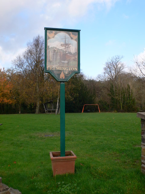
1113:== {{int:filedesc}} == {{Information |description={{en|1=Fremington Village Sign Shows a ship at anchor at Fremington Quay. The sign stands on the corner of the village green.}} |date=2009-11-24 |source=From [http://www.geograph.org.uk/photo/1595945 geogr
421:– You must give appropriate credit, provide a link to the license, and indicate if changes were made. You may do so in any reasonable manner, but not in any way that suggests the licensor endorses you or your use.
293:
243:
53:
47:
98:
66:
844:
828:
678:
634:
947:
836:
480:
531:
991:
987:
943:
840:
824:
760:
756:
630:
539:
535:
527:
852:
848:
832:
718:
674:
543:
523:
476:
1106:
681:"}},"text\/plain":{"en":{"P275":"Creative Commons Attribution-ShareAlike 2.0 Generic"}}}}": -->
1215:
855:"}},"text\/plain":{"en":{"P973":"https:\/\/www.geograph.org.uk\/photo\/1595945"}}}}": -->
546:"}},"text\/plain":{"en":{"P2699":"https:\/\/www.geograph.org.uk\/profile\/4582"}}}}": -->
1175:
878:
704:
660:
303:
253:
973:
898:
509:
338:
1258:
This file contains additional information, probably added from the digital camera or scanner used to create or digitize it.
428:
587:
1095:
1090:
57:
42:
1032:
1005:
957:
906:
862:
801:
774:
644:
608:
595:
580:
921:
891:
728:
688:
553:
493:
141:
Fremington
Village Sign Shows a ship at anchor at Fremington Quay. The sign stands on the corner of the village green.
384:
1261:
If the file has been modified from its original state, some details may not fully reflect the modified file.
427:– If you remix, transform, or build upon the material, you must distribute your contributions under the
345:
on the
Geograph website for the photographer's contact details. The copyright on this image is owned by
637:"}},"text\/plain":{"en":{"P6216":"copyrighted"}}}}": -->
1123:
The following pages on the
English Knowledge use this file (pages on other projects are not listed):
950:"}},"text\/plain":{"en":{"P1071":"Fremington"}}}}": -->
998:"}},"text\/plain":{"en":{"P7787":"0 degree"}}}}": -->
767:"}},"text\/plain":{"en":{"P7787":"0 degree"}}}}": -->
106:
483:"}},"text\/plain":{"en":{"P180":"signage"}}}}": -->
198:
928:
913:
615:
381:
182:
8:
325:
309:
259:
1127:
350:
93:
161:
171:
1015:
967:
872:
784:
738:
698:
654:
563:
503:
330:
342:
1063:
Click on a date/time to view the file as it appeared at that time.
1145:
1155:
295:
245:
1245:
1205:
1185:
280:
51° 04′ 20″ N, 4° 07′ 23″ W
230:
51° 04′ 19″ N, 4° 07′ 23″ W
150:
81:
1195:
1225:
1165:
469:
Add a one-line explanation of what this file represents
131:
Fremington
Village Sign - geograph.org.uk - 1595945.jpg
1235:
1121:
1136:
1061:
105:
Commons is a freely licensed media file repository.
705:
Creative
Commons Attribution-ShareAlike 2.0 Generic
679:
Creative
Commons Attribution-ShareAlike 2.0 Generic
71:(480 × 640 pixels, file size: 69 KB, MIME type:
438:https://creativecommons.org/licenses/by-sa/2.0
86:
853:https:\/\/www.geograph.org.uk\/photo\/1595945
444:Creative Commons Attribution-Share Alike 2.0
362:
146:
128:
544:https:\/\/www.geograph.org.uk\/profile\/4582
167:
156:
14:
995:
764:
404:– to copy, distribute and transmit the work
1138:The following other wikis use this file:
929:https://www.geograph.org.uk/photo/1595945
616:https://www.geograph.org.uk/profile/4582
302:View this and other nearby images on:
252:View this and other nearby images on:
205:
117:
349:and is licensed for reuse under the
270:
220:
1054:
385:Attribution-Share Alike 2.0 Generic
373:
368:
353:Attribution-ShareAlike 2.0 license.
13:
1256:
1242:Usage on zh-min-nan.wikipedia.org
474:
468:
359:
336:
135:
118:
64:
1282:
1263:
473:
1122:
775:coordinates of the point of view
757:coordinates of the point of view
459:
415:Under the following conditions:
380:This file is licensed under the
372:
367:
361:
329:
308:
294:
286:
258:
244:
236:
85:
31:
21:
456:
136:
1133:
1058:
879:file available on the internet
829:file available on the internet
455:
337:This image was taken from the
26:
1:
1006:coordinates of depicted place
988:coordinates of depicted place
36:
1118:
899:Geograph Britain and Ireland
837:Geograph Britain and Ireland
581:object of statement has role
528:object of statement has role
489:Items portrayed in this file
321:
7:
1253:
1192:Usage on lld.wikipedia.org
1142:Usage on ceb.wikipedia.org
10:
1287:
1232:Usage on www.wikidata.org
1222:Usage on sv.wikipedia.org
1212:Usage on ru.wikipedia.org
1202:Usage on pl.wikipedia.org
1182:Usage on fr.wikipedia.org
1172:Usage on fa.wikipedia.org
1162:Usage on es.wikipedia.org
1152:Usage on cy.wikipedia.org
429:same or compatible license
285:
235:
125:
120:
1055:
1021:51°4'19.63"N, 4°7'23.16"W
790:51°4'18.66"N, 4°7'23.16"W
211:Eirian Evans /
192:Eirian Evans /
16:
907:geograph.org.uk image ID
841:geograph.org.uk image ID
458:
395:
92:This is a file from the
41:
1112:
213:Fremington Village Sign
194:Fremington Village Sign
183:required by the license
149:
96:. Information from its
343:this photograph's page
314:51.072120; -4.123100
264:51.071850; -4.123100
99:description page there
46:Size of this preview:
1156:Fremington, Dyfnaint
1146:Fremington (lungsod)
958:location of creation
944:location of creation
1091:03:10, 4 March 2011
410:– to adapt the work
52:Other resolutions:
1216:Фремингтон (Девон)
1206:Fremington (Devon)
1186:Fremington (Devon)
596:author name string
536:author name string
1274:
1273:
1134:Global file usage
1128:Fremington, Devon
1116:
997:
766:
689:copyright license
675:copyright license
467:
358:
357:
341:collection. See
319:
318:
269:
268:
218:
217:
186:
114:
113:
94:Wikimedia Commons
32:Global file usage
1278:
1264:
1103:
1065:
1043:
1042:
1037:
931:
926:
922:described at URL
916:
911:
901:
896:
849:described at URL
812:
811:
806:
744:24 November 2009
645:copyright status
631:copyright status
618:
613:
603:
600:
590:
585:
465:
451:
448:
445:
442:
439:
431:as the original.
393:
382:Creative Commons
376:
375:
371:
370:
365:
364:
351:Creative Commons
339:Geograph project
333:
326:
315:
312:
298:
297:
291:
290:
289:
283:
282:
271:
265:
262:
248:
247:
241:
240:
239:
233:
232:
221:
180:
152:
151:24 November 2009
140:
132:
126:
110:
89:
88:
82:
76:
74:
61:
58:480 × 640 pixels
54:180 × 240 pixels
48:450 × 600 pixels
1286:
1285:
1281:
1280:
1279:
1277:
1276:
1275:
1252:
1176:فرمینگتون، دوون
1132:
1124:
1117:
1109:
1101:
1057:
1056:
1053:
1052:
1051:
1050:
1049:
1048:
1047:
1046:
1045:
1044:
1040:
1038:
1035:
1026:
1025:
1024:
1022:
1012:
1011:
1010:
1008:
985:
984:
983:
982:
981:
980:
979:
978:
976:
964:
963:
962:
960:
941:
940:
939:
938:
937:
936:
935:
934:
933:
932:
927:
924:
918:
917:
912:
909:
903:
902:
897:
894:
885:
884:
883:
881:
869:
868:
867:
865:
822:
821:
820:
819:
818:
817:
816:
815:
814:
813:
809:
807:
804:
795:
794:
793:
791:
781:
780:
779:
777:
754:
753:
752:
751:
750:
749:
748:
747:
745:
735:
734:
733:
731:
716:
715:
714:
713:
712:
711:
710:
709:
707:
695:
694:
693:
691:
672:
671:
670:
669:
668:
667:
666:
665:
663:
651:
650:
649:
647:
628:
627:
626:
625:
624:
623:
622:
621:
620:
619:
614:
611:
605:
604:
601:
598:
592:
591:
586:
583:
574:
573:
572:
570:
560:
559:
558:
556:
521:
520:
519:
518:
517:
516:
515:
514:
512:
500:
499:
498:
496:
472:
471:
470:
453:
452:
449:
446:
443:
440:
437:
436:
394:
391:
388:
377:
354:
324:
313:
287:
278:
277:
274:Object location
263:
237:
228:
227:
224:Camera location
219:
208:
201:
189:
162:geograph.org.uk
142:
130:
123:
116:
115:
104:
103:
102:is shown below.
78:
72:
70:
63:
62:
51:
12:
11:
5:
1284:
1272:
1271:
1268:
1255:
1251:
1250:
1249:
1248:
1240:
1239:
1238:
1230:
1229:
1228:
1220:
1219:
1218:
1210:
1209:
1208:
1200:
1199:
1198:
1190:
1189:
1188:
1180:
1179:
1178:
1170:
1169:
1168:
1160:
1159:
1158:
1150:
1149:
1148:
1135:
1131:
1130:
1120:
1115:
1114:
1111:
1107:
1104:
1098:
1093:
1088:
1084:
1083:
1080:
1077:
1074:
1071:
1068:
1060:
1031:
1030:
1029:
1028:
1027:
1023:
1020:
1018:
1017:
1016:
1014:
1013:
1009:
1004:
1002:
1001:
1000:
999:
993:
989:
977:
972:
970:
969:
968:
966:
965:
961:
956:
954:
953:
952:
951:
949:
945:
920:
919:
905:
904:
890:
889:
888:
887:
886:
882:
877:
875:
874:
873:
871:
870:
866:
863:source of file
861:
859:
858:
857:
856:
854:
850:
846:
842:
838:
834:
830:
826:
825:source of file
800:
799:
798:
797:
796:
792:
789:
787:
786:
785:
783:
782:
778:
773:
771:
770:
769:
768:
762:
758:
746:
743:
741:
740:
739:
737:
736:
732:
727:
725:
724:
723:
722:
720:
708:
703:
701:
700:
699:
697:
696:
692:
687:
685:
684:
683:
682:
680:
676:
664:
659:
657:
656:
655:
653:
652:
648:
643:
641:
640:
639:
638:
636:
632:
607:
606:
594:
593:
579:
578:
577:
576:
575:
571:
568:
566:
565:
564:
562:
561:
557:
552:
550:
549:
548:
547:
545:
541:
537:
533:
529:
525:
513:
508:
506:
505:
504:
502:
501:
497:
492:
490:
487:
486:
485:
484:
482:
478:
464:
463:
460:
457:
435:
434:
433:
432:
422:
413:
412:
411:
405:
398:You are free:
389:
379:
378:
360:
356:
355:
334:
323:
320:
317:
316:
306:
300:
275:
267:
266:
256:
250:
225:
216:
215:
209:
206:
203:
202:
197:
190:
187:
175:
174:
169:
165:
164:
158:
154:
153:
148:
144:
143:
133:
124:
122:
119:
112:
111:
90:
80:
79:
45:
40:
39:
34:
29:
24:
19:
9:
6:
4:
3:
2:
1283:
1269:
1266:
1265:
1262:
1259:
1247:
1244:
1243:
1241:
1237:
1234:
1233:
1231:
1227:
1224:
1223:
1221:
1217:
1214:
1213:
1211:
1207:
1204:
1203:
1201:
1197:
1194:
1193:
1191:
1187:
1184:
1183:
1181:
1177:
1174:
1173:
1171:
1167:
1164:
1163:
1161:
1157:
1154:
1153:
1151:
1147:
1144:
1143:
1141:
1140:
1139:
1129:
1126:
1125:
1110:
1105:
1099:
1097:
1094:
1092:
1089:
1086:
1085:
1081:
1078:
1075:
1072:
1069:
1067:
1066:
1064:
1034:
1019:
1007:
1003:
975:
971:
959:
955:
930:
923:
915:
908:
900:
893:
880:
876:
864:
860:
803:
788:
776:
772:
742:
730:
726:
706:
702:
690:
686:
662:
658:
646:
642:
617:
610:
597:
589:
582:
567:
555:
551:
511:
507:
495:
491:
488:
461:
454:
441:CC BY-SA 2.0
430:
426:
423:
420:
417:
416:
414:
409:
406:
403:
400:
399:
397:
396:
390:Attribution:
386:
383:
366:
352:
348:
344:
340:
335:
332:
328:
327:
311:
307:
305:
304:OpenStreetMap
301:
299:
281:
276:
273:
272:
261:
257:
255:
254:OpenStreetMap
251:
249:
231:
226:
223:
222:
214:
210:
204:
200:
196: /
195:
191:
184:
179:
177:
176:
173:
170:
166:
163:
159:
155:
145:
139:
134:
127:
108:
101:
100:
95:
91:
84:
83:
77:
68:
67:Original file
59:
55:
49:
44:
38:
35:
33:
30:
28:
25:
23:
20:
18:
15:
1260:
1257:
1137:
1062:
1059:File history
602:Eirian Evans
588:photographer
532:photographer
424:
418:
407:
401:
392:Eirian Evans
347:Eirian Evans
346:
284:
234:
212:
199:CC BY-SA 2.0
193:
172:Eirian Evans
137:
107:You can help
97:
65:
22:File history
1108:GeographBot
661:copyrighted
635:copyrighted
425:share alike
419:attribution
178:Attribution
129:Description
1267:_error
1246:Fremington
1226:Fremington
1196:Fremington
1166:Fremington
1119:File usage
1100:480 × 640
1076:Dimensions
974:Fremington
948:Fremington
569:some value
73:image/jpeg
27:File usage
1073:Thumbnail
1070:Date/Time
729:inception
719:inception
322:Licensing
207:InfoField
188:InfoField
138:English:
1254:Metadata
1236:Q2424368
892:operator
833:operator
462:Captions
408:to remix
402:to share
387:license.
37:Metadata
1102:(69 KB)
1087:current
1082:Comment
1033:heading
992:heading
914:1595945
845:1595945
802:heading
761:heading
554:creator
524:creator
510:signage
494:depicts
481:signage
477:depicts
466:English
121:Summary
69:
1041:degree
996:degree
810:degree
765:degree
292:
242:
168:Author
157:Source
160:From
1079:User
450:true
447:true
147:Date
17:File
609:URL
540:URL
1039:0
1036::
925::
910::
895::
808:0
805::
612::
599::
584::
56:|
50:.
1270:0
185:)
181:(
109:.
75:)
60:.
Text is available under the Creative Commons Attribution-ShareAlike License. Additional terms may apply.
_heading:0.00&language=en)
_heading:0.00&language=en)
