861:"}},"text\/plain":{"en":{"":"coordinates of the point of view"}}},"{\"value\":{\"latitude\":53.786617,\"longitude\":-1.625681,\"altitude\":null,\"precision\":1.0e-6,\"globe\":\"http:\\\/\\\/www.wikidata.org\\\/entity\\\/Q2\"},\"type\":\"globecoordinate\"}":{"text\/html":{"en":{"P1259":"53\u00b047'11.821"N, 1\u00b037'32.452"W"}},"text\/plain":{"en":{"P1259":"53\u00b047'11.821\"N, 1\u00b037'32.452\"W"}}},"{\"value\":{\"entity-type\":\"property\",\"numeric-id\":7787,\"id\":\"P7787\"},\"type\":\"wikibase-entityid\"}":{"text\/html":{"en":{"":"
929:"}},"text\/plain":{"en":{"":"coordinates of depicted place"}}},"{\"value\":{\"latitude\":53.78725,\"longitude\":-1.62659,\"altitude\":null,\"precision\":1.0e-5,\"globe\":\"http:\\\/\\\/www.wikidata.org\\\/entity\\\/Q2\"},\"type\":\"globecoordinate\"}":{"text\/html":{"en":{"P9149":"53\u00b047'14.10"N, 1\u00b037'35.72"W"}},"text\/plain":{"en":{"P9149":"53\u00b047'14.10\"N, 1\u00b037'35.72\"W"}}},"{\"value\":{\"entity-type\":\"property\",\"numeric-id\":7787,\"id\":\"P7787\"},\"type\":\"wikibase-entityid\"}":{"text\/html":{"en":{"":"
1170:"}},"text\/plain":{"en":{"":"checksum"}}},"{\"value\":\"c99b8e8528bb7099533d0c1e2632deef96cb932a\",\"type\":\"string\"}":{"text\/html":{"en":{"P4092":"c99b8e8528bb7099533d0c1e2632deef96cb932a"}},"text\/plain":{"en":{"P4092":"c99b8e8528bb7099533d0c1e2632deef96cb932a"}}},"{\"value\":{\"entity-type\":\"property\",\"numeric-id\":459,\"id\":\"P459\"},\"type\":\"wikibase-entityid\"}":{"text\/html":{"en":{"":"
513:"}},"text\/plain":{"en":{"":"author name string"}}},"{\"value\":\"Schlosser67\",\"type\":\"string\"}":{"text\/html":{"en":{"P2093":"Schlosser67"}},"text\/plain":{"en":{"P2093":"Schlosser67"}}},"{\"value\":{\"entity-type\":\"property\",\"numeric-id\":2699,\"id\":\"P2699\"},\"type\":\"wikibase-entityid\"}":{"text\/html":{"en":{"":"
823:"}},"text\/plain":{"en":{"":"inception"}}},"{\"value\":{\"time\":\"+2016-10-02T00:00:00Z\",\"timezone\":0,\"before\":0,\"after\":0,\"precision\":11,\"calendarmodel\":\"http:\\\/\\\/www.wikidata.org\\\/entity\\\/Q1985727\"},\"type\":\"time\"}":{"text\/html":{"en":{"P571":"2 October 2016"}},"text\/plain":{"en":{"P571":"2 October 2016"}}}}": -->
700:
306:
256:
1166:
248:
320:
270:
341:
379:
384:
81:
33:
521:"}},"text\/plain":{"en":{"P2699":"https:\/\/www.geograph.org.uk\/profile\/123289"}}},"{\"value\":{\"entity-type\":\"property\",\"numeric-id\":3831,\"id\":\"P3831\"},\"type\":\"wikibase-entityid\"}":{"text\/html":{"en":{"":"
724:"}},"text\/plain":{"en":{"P973":"https:\/\/www.geograph.org.uk\/photo\/5162174"}}},"{\"value\":{\"entity-type\":\"property\",\"numeric-id\":137,\"id\":\"P137\"},\"type\":\"wikibase-entityid\"}":{"text\/html":{"en":{"":"
708:"}},"text\/plain":{"en":{"P7482":"file available on the internet"}}},"{\"value\":{\"entity-type\":\"property\",\"numeric-id\":7384,\"id\":\"P7384\"},\"type\":\"wikibase-entityid\"}":{"text\/html":{"en":{"":"
525:"}},"text\/plain":{"en":{"":"object of statement has role"}}},"{\"value\":{\"entity-type\":\"item\",\"numeric-id\":33231,\"id\":\"Q33231\"},\"type\":\"wikibase-entityid\"}":{"text\/html":{"en":{"P3831":"
1174:"}},"text\/plain":{"en":{"":"determination method"}}},"{\"value\":{\"entity-type\":\"item\",\"numeric-id\":13414952,\"id\":\"Q13414952\"},\"type\":\"wikibase-entityid\"}":{"text\/html":{"en":{"P459":"
997:"}},"text\/plain":{"en":{"":"media type"}}},"{\"value\":\"image\\\/jpeg\",\"type\":\"string\"}":{"text\/html":{"en":{"P1163":"image\/jpeg"}},"text\/plain":{"en":{"P1163":"image\/jpeg"}}}}": -->
660:"}},"text\/plain":{"en":{"":"copyright license"}}},"{\"value\":{\"entity-type\":\"item\",\"numeric-id\":19068220,\"id\":\"Q19068220\"},\"type\":\"wikibase-entityid\"}":{"text\/html":{"en":{"P275":"
616:"}},"text\/plain":{"en":{"":"copyright status"}}},"{\"value\":{\"entity-type\":\"item\",\"numeric-id\":50423863,\"id\":\"Q50423863\"},\"type\":\"wikibase-entityid\"}":{"text\/html":{"en":{"P6216":"
704:"}},"text\/plain":{"en":{"":"source of file"}}},"{\"value\":{\"entity-type\":\"item\",\"numeric-id\":74228490,\"id\":\"Q74228490\"},\"type\":\"wikibase-entityid\"}":{"text\/html":{"en":{"P7482":"
1035:"}},"text\/plain":{"en":{"":"data size"}}},"{\"value\":{\"amount\":\"+149502\",\"unit\":\"http:\\\/\\\/www.wikidata.org\\\/entity\\\/Q8799\"},\"type\":\"quantity\"}":{"text\/html":{"en":{"P3575":"149,502
1125:"}},"text\/plain":{"en":{"":"width"}}},"{\"value\":{\"amount\":\"+1024\",\"unit\":\"http:\\\/\\\/www.wikidata.org\\\/entity\\\/Q355198\"},\"type\":\"quantity\"}":{"text\/html":{"en":{"P2049":"1,024
1080:"}},"text\/plain":{"en":{"":"height"}}},"{\"value\":{\"amount\":\"+768\",\"unit\":\"http:\\\/\\\/www.wikidata.org\\\/entity\\\/Q355198\"},\"type\":\"quantity\"}":{"text\/html":{"en":{"P2048":"768
933:"}},"text\/plain":{"en":{"":"heading"}}},"{\"value\":{\"amount\":\"+315\",\"unit\":\"http:\\\/\\\/www.wikidata.org\\\/entity\\\/Q28390\"},\"type\":\"quantity\"}":{"text\/html":{"en":{"P7787":"315
865:"}},"text\/plain":{"en":{"":"heading"}}},"{\"value\":{\"amount\":\"+315\",\"unit\":\"http:\\\/\\\/www.wikidata.org\\\/entity\\\/Q28390\"},\"type\":\"quantity\"}":{"text\/html":{"en":{"P7787":"315
728:"}},"text\/plain":{"en":{"":"operator"}}},"{\"value\":{\"entity-type\":\"item\",\"numeric-id\":1503119,\"id\":\"Q1503119\"},\"type\":\"wikibase-entityid\"}":{"text\/html":{"en":{"P137":"
716:"}},"text\/plain":{"en":{"P7384":"5162174"}}},"{\"value\":{\"entity-type\":\"property\",\"numeric-id\":973,\"id\":\"P973\"},\"type\":\"wikibase-entityid\"}":{"text\/html":{"en":{"":"
509:"}},"text\/plain":{"en":{"":"creator"}}},"{\"value\":{\"entity-type\":\"property\",\"numeric-id\":2093,\"id\":\"P2093\"},\"type\":\"wikibase-entityid\"}":{"text\/html":{"en":{"":"
1121:
720:"}},"text\/plain":{"en":{"":"described at URL"}}},"{\"value\":\"https:\\\/\\\/www.geograph.org.uk\\\/photo\\\/5162174\",\"type\":\"string\"}":{"text\/html":{"en":{"P973":"
517:"}},"text\/plain":{"en":{"":"URL"}}},"{\"value\":\"https:\\\/\\\/www.geograph.org.uk\\\/profile\\\/123289\",\"type\":\"string\"}":{"text\/html":{"en":{"P2699":"
712:"}},"text\/plain":{"en":{"":"geograph.org.uk image ID"}}},"{\"value\":\"5162174\",\"type\":\"string\"}":{"text\/html":{"en":{"P7384":"
289:
239:
431:– You must give appropriate credit, provide a link to the license, and indicate if changes were made. You may do so in any reasonable manner, but not in any way that suggests the licensor endorses you or your use.
253:
303:
713:
1175:
705:
661:
617:
729:
526:
1167:
1122:
1077:
1032:
994:
930:
926:
862:
858:
709:
701:
613:
522:
518:
514:
510:
721:
1171:
820:
725:
717:
657:
506:
47:
43:
37:
60:
92:
664:"}},"text\/plain":{"en":{"P275":"Creative Commons Attribution-ShareAlike 2.0 Generic"}}}}": -->
176:
1219:
755:
687:
643:
313:
263:
805:
348:
438:
598:
1185:
1136:
1091:
1046:
1004:
971:
944:
903:
876:
768:
739:
627:
591:
576:
563:
1212:
830:
798:
783:
671:
536:
495:
732:"}},"text\/plain":{"en":{"P137":"Geograph Britain and Ireland"}}}}": -->
394:
1306:
1274:
1269:
51:
32:
437:– If you remix, transform, or build upon the material, you must distribute your contributions under the
355:
on the
Geograph website for the photographer's contact details. The copyright on this image is owned by
1039:"}},"text\/plain":{"en":{"P3575":"149,502 byte"}}}}": -->
529:"}},"text\/plain":{"en":{"P3831":"photographer"}}}}": -->
1129:"}},"text\/plain":{"en":{"P2049":"1,024 pixel"}}}}": -->
620:"}},"text\/plain":{"en":{"P6216":"copyrighted"}}}}": -->
1302:
The following pages on the
English Knowledge use this file (pages on other projects are not listed):
937:"}},"text\/plain":{"en":{"P7787":"315 degree"}}}}": -->
869:"}},"text\/plain":{"en":{"P7787":"315 degree"}}}}": -->
1084:"}},"text\/plain":{"en":{"P2048":"768 pixel"}}}}": -->
100:
1178:"}},"text\/plain":{"en":{"P459":"SHA-1"}}}}": -->
583:
790:
775:
391:
192:
8:
335:
319:
269:
360:
87:
485:
208:
165:
155:
1195:
1146:
1101:
1056:
1014:
954:
886:
840:
749:
681:
637:
546:
340:
1285:
352:
1242:
Click on a date/time to view the file as it appeared at that time.
305:
255:
290:
53° 47′ 14.1″ N, 1° 37′ 36″ W
240:
53° 47′ 11.8″ N, 1° 37′ 32″ W
144:
75:
479:
Add a one-line explanation of what this file represents
1300:
1240:
183:
Creative
Commons Attribution Share-alike license 2.0
99:
Commons is a freely licensed media file repository.
688:
Creative
Commons Attribution-ShareAlike 2.0 Generic
662:
Creative
Commons Attribution-ShareAlike 2.0 Generic
65:(1,024 × 768 pixels, file size: 146 KB, MIME type:
519:https:\/\/www.geograph.org.uk\/profile\/123289
448:https://creativecommons.org/licenses/by-sa/2.0
80:
722:https:\/\/www.geograph.org.uk\/photo\/5162174
454:Creative Commons Attribution-Share Alike 2.0
372:
171:
140:
122:
161:
150:
14:
1126:
1081:
1036:
934:
866:
414:– to copy, distribute and transmit the work
584:https://www.geograph.org.uk/profile/123289
791:https://www.geograph.org.uk/photo/5162174
1201:c99b8e8528bb7099533d0c1e2632deef96cb932a
1292:Transferred from geograph.co.uk using
312:View this and other nearby images on:
262:View this and other nearby images on:
215:
111:
359:and is licensed for reuse under the
280:
230:
1233:
395:Attribution-Share Alike 2.0 Generic
383:
378:
363:Attribution-ShareAlike 2.0 license.
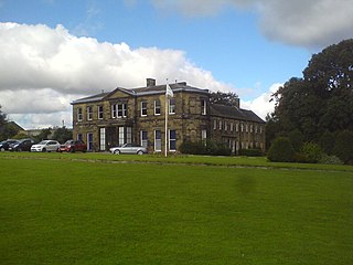
125:Farnley Hall (geograph 5162174).jpg
13:
484:
478:
369:
346:
129:
112:
58:
1318:
483:
1301:
877:coordinates of the point of view
859:coordinates of the point of view
469:
425:Under the following conditions:
390:This file is licensed under the
382:
377:
371:
339:
318:
304:
296:
268:
254:
246:
79:
21:
466:
130:
1237:
756:file available on the internet
706:file available on the internet
465:
347:This image was taken from the
26:
1:
945:coordinates of depicted place
927:coordinates of depicted place
892:53°47'11.821"N, 1°37'32.452"W
1307:Farnley Hall, West Yorkshire
1297:
806:Geograph Britain and Ireland
730:Geograph Britain and Ireland
592:object of statement has role
523:object of statement has role
491:Items portrayed in this file
331:
295:
245:
7:
960:53°47'14.10"N, 1°37'35.72"W
10:
1323:
439:same or compatible license
119:
114:
1234:
16:
769:geograph.org.uk image ID
710:geograph.org.uk image ID
468:
405:
221:Schlosser67 /
202:Schlosser67 /
86:This is a file from the
31:
1291:
1270:23:50, 23 November 2018
193:required by the license
143:
90:. Information from its
353:this photograph's page
324:53.787250; -1.626590
274:53.786617; -1.625681
93:description page there
36:Size of this preview:
1213:determination method
1172:determination method
420:– to adapt the work
42:Other resolutions:
564:author name string
511:author name string
52:1,024 × 768 pixels
1295:
1128:
1083:
1038:
936:
868:
672:copyright license
658:copyright license
477:
368:
367:
351:collection. See
329:
328:
279:
278:
228:
227:
196:
180:
177:Reusing this file
108:
107:
88:Wikimedia Commons
1314:
1282:
1244:
1222:
1217:
1155:
1110:
1065:
982:
981:
976:
914:
913:
908:
808:
803:
793:
788:
784:described at URL
778:
773:
718:described at URL
628:copyright status
614:copyright status
601:
596:
586:
581:
571:
568:
475:
461:
458:
455:
452:
449:
441:as the original.
403:
392:Creative Commons
386:
385:
381:
380:
375:
374:
361:Creative Commons
349:Geograph project
343:
336:
325:
322:
308:
307:
301:
300:
299:
293:
292:
281:
275:
272:
258:
257:
251:
250:
249:
243:
242:
231:
190:
174:
146:
134:
126:
120:
104:
83:
82:
76:
70:
68:
55:
48:640 × 480 pixels
44:320 × 240 pixels
38:800 × 600 pixels
1322:
1321:
1317:
1316:
1315:
1313:
1312:
1311:
1303:
1296:
1288:
1280:
1236:
1235:
1232:
1231:
1230:
1229:
1228:
1227:
1226:
1225:
1224:
1223:
1218:
1215:
1206:
1205:
1204:
1202:
1192:
1191:
1190:
1188:
1165:
1164:
1163:
1162:
1161:
1160:
1159:
1158:
1156:
1153:
1143:
1142:
1141:
1139:
1120:
1119:
1118:
1117:
1116:
1115:
1114:
1113:
1111:
1108:
1098:
1097:
1096:
1094:
1075:
1074:
1073:
1072:
1071:
1070:
1069:
1068:
1066:
1063:
1053:
1052:
1051:
1049:
1030:
1029:
1028:
1027:
1026:
1025:
1024:
1023:
1021:
1011:
1010:
1009:
1007:
992:
991:
990:
989:
988:
987:
986:
985:
984:
983:
979:
977:
974:
965:
964:
963:
961:
951:
950:
949:
947:
924:
923:
922:
921:
920:
919:
918:
917:
916:
915:
911:
909:
906:
897:
896:
895:
893:
883:
882:
881:
879:
856:
855:
854:
853:
852:
851:
850:
849:
847:
837:
836:
835:
833:
818:
817:
816:
815:
814:
813:
812:
811:
810:
809:
804:
801:
795:
794:
789:
786:
780:
779:
774:
771:
762:
761:
760:
758:
746:
745:
744:
742:
699:
698:
697:
696:
695:
694:
693:
692:
690:
678:
677:
676:
674:
655:
654:
653:
652:
651:
650:
649:
648:
646:
634:
633:
632:
630:
611:
610:
609:
608:
607:
606:
605:
604:
603:
602:
597:
594:
588:
587:
582:
579:
573:
572:
569:
566:
557:
556:
555:
553:
543:
542:
541:
539:
504:
503:
502:
501:
500:
498:
482:
481:
480:
463:
462:
459:
456:
453:
450:
447:
446:
404:
401:
398:
387:
364:
334:
323:
297:
288:
287:
284:Object location
273:
247:
238:
237:
234:Camera location
229:
218:
211:
199:
156:geograph.org.uk
136:
124:
117:
110:
109:
98:
97:
96:is shown below.
72:
66:
64:
57:
56:
41:
12:
11:
5:
1320:
1310:
1309:
1299:
1294:
1293:
1290:
1286:
1283:
1277:
1272:
1267:
1263:
1262:
1259:
1256:
1253:
1250:
1247:
1239:
1211:
1210:
1209:
1208:
1207:
1203:
1200:
1198:
1197:
1196:
1194:
1193:
1189:
1184:
1182:
1181:
1180:
1179:
1177:
1173:
1169:
1157:
1151:
1149:
1148:
1147:
1145:
1144:
1140:
1135:
1133:
1132:
1131:
1130:
1124:
1112:
1106:
1104:
1103:
1102:
1100:
1099:
1095:
1090:
1088:
1087:
1086:
1085:
1079:
1067:
1061:
1059:
1058:
1057:
1055:
1054:
1050:
1045:
1043:
1042:
1041:
1040:
1034:
1022:
1019:
1017:
1016:
1015:
1013:
1012:
1008:
1003:
1001:
1000:
999:
998:
996:
970:
969:
968:
967:
966:
962:
959:
957:
956:
955:
953:
952:
948:
943:
941:
940:
939:
938:
932:
928:
902:
901:
900:
899:
898:
894:
891:
889:
888:
887:
885:
884:
880:
875:
873:
872:
871:
870:
864:
860:
848:
846:2 October 2016
845:
843:
842:
841:
839:
838:
834:
829:
827:
826:
825:
824:
822:
797:
796:
782:
781:
767:
766:
765:
764:
763:
759:
754:
752:
751:
750:
748:
747:
743:
740:source of file
738:
736:
735:
734:
733:
731:
727:
723:
719:
715:
711:
707:
703:
702:source of file
691:
686:
684:
683:
682:
680:
679:
675:
670:
668:
667:
666:
665:
663:
659:
647:
642:
640:
639:
638:
636:
635:
631:
626:
624:
623:
622:
621:
619:
615:
590:
589:
575:
574:
562:
561:
560:
559:
558:
554:
551:
549:
548:
547:
545:
544:
540:
535:
533:
532:
531:
530:
528:
524:
520:
516:
512:
508:
499:
494:
492:
489:
488:
487:
486:
474:
473:
470:
467:
445:
444:
443:
442:
432:
423:
422:
421:
415:
408:You are free:
399:
389:
388:
370:
366:
365:
344:
333:
330:
327:
326:
316:
310:
285:
277:
276:
266:
260:
235:
226:
225:
219:
216:
213:
212:
207:
200:
197:
185:
184:
181:
169:
168:
163:
159:
158:
152:
148:
147:
145:2 October 2016
142:
138:
137:
127:
118:
116:
113:
106:
105:
84:
74:
73:
35:
30:
29:
24:
19:
9:
6:
4:
3:
2:
1319:
1308:
1305:
1304:
1289:
1284:
1278:
1276:
1273:
1271:
1268:
1265:
1264:
1260:
1257:
1254:
1251:
1248:
1246:
1245:
1243:
1221:
1214:
1199:
1187:
1183:
1150:
1138:
1134:
1105:
1093:
1089:
1060:
1048:
1044:
1018:
1006:
1002:
973:
958:
946:
942:
905:
890:
878:
874:
844:
832:
828:
807:
800:
792:
785:
777:
770:
757:
753:
741:
737:
689:
685:
673:
669:
645:
641:
629:
625:
600:
593:
585:
578:
565:
550:
538:
534:
497:
493:
490:
471:
464:
451:CC BY-SA 2.0
440:
436:
433:
430:
427:
426:
424:
419:
416:
413:
410:
409:
407:
406:
400:Attribution:
396:
393:
376:
362:
358:
354:
350:
345:
342:
338:
337:
321:
317:
315:
314:OpenStreetMap
311:
309:
291:
286:
283:
282:
271:
267:
265:
264:OpenStreetMap
261:
259:
241:
236:
233:
232:
224:
220:
214:
210:
206: /
205:
201:
194:
189:
187:
186:
182:
178:
173:
170:
167:
164:
160:
157:
153:
149:
139:
133:
128:
121:
102:
95:
94:
89:
85:
78:
77:
71:
62:
61:Original file
53:
49:
45:
39:
34:
28:
25:
23:
20:
18:
15:
1279:1,024 × 768
1241:
1238:File history
599:photographer
527:photographer
434:
428:
417:
411:
356:
294:
244:
223:Farnley Hall
222:
209:CC BY-SA 2.0
204:Farnley Hall
203:
135:Farnley Hall
131:
101:You can help
91:
59:
22:File history
644:copyrighted
618:copyrighted
570:Schlosser67
435:share alike
429:attribution
402:Schlosser67
357:Schlosser67
188:Attribution
166:Schlosser67
123:Description
1298:File usage
1255:Dimensions
1020:image/jpeg
1005:media type
995:media type
552:some value
172:Permission
67:image/jpeg
27:File usage
1252:Thumbnail
1249:Date/Time
1047:data size
1033:data size
831:inception
821:inception
332:Licensing
217:InfoField
198:InfoField
132:English:
1281:(146 KB)
1186:checksum
1168:checksum
1062:149,502
799:operator
726:operator
472:Captions
418:to remix
412:to share
397:license.
1266:current
1261:Comment
972:heading
931:heading
904:heading
863:heading
776:5162174
714:5162174
537:creator
507:creator
496:depicts
476:English
115:Summary
63:
1152:1,024
1092:height
1078:height
980:degree
935:degree
912:degree
867:degree
302:
252:
162:Author
151:Source
1287:Maypm
1220:SHA-1
1176:SHA-1
1154:pixel
1137:width
1127:pixel
1123:width
1109:pixel
1082:pixel
154:From
1258:User
1107:768
1064:byte
1037:byte
978:315
910:315
460:true
457:true
141:Date
17:File
577:URL
515:URL
1216::
975::
907::
802::
787::
772::
595::
580::
567::
50:|
46:|
40:.
195:)
191:(
179:)
175:(
103:.
69:)
54:.
Text is available under the Creative Commons Attribution-ShareAlike License. Additional terms may apply.

.jpg)
.jpg¶ms=053.786617_N_-001.625681_E_globe:Earth_type:camera_source:geograph-osgb36(SE24763232)_heading:315.00&language=en)
.jpg¶ms=053.787250_N_-001.626590_E_globe:Earth_class:object_type:object_source:geograph-osgb36(SE24703239)_heading:315.00&language=en)
