815:"}},"text\/plain":{"en":{"":"coordinates of the point of view"}}},"{\"value\":{\"latitude\":56.910597,\"longitude\":-2.442875,\"altitude\":null,\"precision\":1.0e-6,\"globe\":\"http:\\\/\\\/www.wikidata.org\\\/entity\\\/Q2\"},\"type\":\"globecoordinate\"}":{"text\/html":{"en":{"P1259":"56\u00b054'38.149"N, 2\u00b026'34.350"W"}},"text\/plain":{"en":{"P1259":"56\u00b054'38.149\"N, 2\u00b026'34.350\"W"}}},"{\"value\":{\"entity-type\":\"property\",\"numeric-id\":7787,\"id\":\"P7787\"},\"type\":\"wikibase-entityid\"}":{"text\/html":{"en":{"":"
883:"}},"text\/plain":{"en":{"":"coordinates of depicted place"}}},"{\"value\":{\"latitude\":56.9115,\"longitude\":-2.4382,\"altitude\":null,\"precision\":1.0e-5,\"globe\":\"http:\\\/\\\/www.wikidata.org\\\/entity\\\/Q2\"},\"type\":\"globecoordinate\"}":{"text\/html":{"en":{"P9149":"56\u00b054'41.40"N, 2\u00b026'17.52"W"}},"text\/plain":{"en":{"P9149":"56\u00b054'41.40\"N, 2\u00b026'17.52\"W"}}},"{\"value\":{\"entity-type\":\"property\",\"numeric-id\":7787,\"id\":\"P7787\"},\"type\":\"wikibase-entityid\"}":{"text\/html":{"en":{"":"
989:"}},"text\/plain":{"en":{"":"checksum"}}},"{\"value\":\"bfe435670f74f83bc6fdfaa62ca23b024fd3ee4d\",\"type\":\"string\"}":{"text\/html":{"en":{"P4092":"bfe435670f74f83bc6fdfaa62ca23b024fd3ee4d"}},"text\/plain":{"en":{"P4092":"bfe435670f74f83bc6fdfaa62ca23b024fd3ee4d"}}},"{\"value\":{\"entity-type\":\"property\",\"numeric-id\":459,\"id\":\"P459\"},\"type\":\"wikibase-entityid\"}":{"text\/html":{"en":{"":"
658:"}},"text\/plain":{"en":{"":"inception"}}},"{\"value\":{\"time\":\"+2008-06-30T00:00:00Z\",\"timezone\":0,\"before\":0,\"after\":0,\"precision\":11,\"calendarmodel\":\"http:\\\/\\\/www.wikidata.org\\\/entity\\\/Q1985727\"},\"type\":\"time\"}":{"text\/html":{"en":{"P571":"30 June 2008"}},"text\/plain":{"en":{"P571":"30 June 2008"}}}}": -->
692:
459:
210:
252:
202:
985:
224:
295:
333:
338:
67:
1229:
479:"}},"text\/plain":{"en":{"P2699":"https:\/\/www.geograph.org.uk\/profile\/16833"}}},"{\"value\":{\"entity-type\":\"property\",\"numeric-id\":2093,\"id\":\"P2093\"},\"type\":\"wikibase-entityid\"}":{"text\/html":{"en":{"":"
708:"}},"text\/plain":{"en":{"P973":"https:\/\/www.geograph.org.uk\/photo\/866360"}}},"{\"value\":{\"entity-type\":\"property\",\"numeric-id\":7384,\"id\":\"P7384\"},\"type\":\"wikibase-entityid\"}":{"text\/html":{"en":{"":"
483:"}},"text\/plain":{"en":{"":"author name string"}}},"{\"value\":\"C Michael Hogan\",\"type\":\"string\"}":{"text\/html":{"en":{"P2093":"C Michael Hogan"}},"text\/plain":{"en":{"P2093":"C Michael Hogan"}}}}": -->
700:"}},"text\/plain":{"en":{"P7482":"file available on the internet"}}},"{\"value\":{\"entity-type\":\"property\",\"numeric-id\":973,\"id\":\"P973\"},\"type\":\"wikibase-entityid\"}":{"text\/html":{"en":{"":"
467:"}},"text\/plain":{"en":{"":"object of statement has role"}}},"{\"value\":{\"entity-type\":\"item\",\"numeric-id\":33231,\"id\":\"Q33231\"},\"type\":\"wikibase-entityid\"}":{"text\/html":{"en":{"P3831":"
993:"}},"text\/plain":{"en":{"":"determination method"}}},"{\"value\":{\"entity-type\":\"item\",\"numeric-id\":13414952,\"id\":\"Q13414952\"},\"type\":\"wikibase-entityid\"}":{"text\/html":{"en":{"P459":"
951:"}},"text\/plain":{"en":{"":"media type"}}},"{\"value\":\"image\\\/jpeg\",\"type\":\"string\"}":{"text\/html":{"en":{"P1163":"image\/jpeg"}},"text\/plain":{"en":{"P1163":"image\/jpeg"}}}}": -->
614:"}},"text\/plain":{"en":{"":"copyright license"}}},"{\"value\":{\"entity-type\":\"item\",\"numeric-id\":19068220,\"id\":\"Q19068220\"},\"type\":\"wikibase-entityid\"}":{"text\/html":{"en":{"P275":"
570:"}},"text\/plain":{"en":{"":"copyright status"}}},"{\"value\":{\"entity-type\":\"item\",\"numeric-id\":50423863,\"id\":\"Q50423863\"},\"type\":\"wikibase-entityid\"}":{"text\/html":{"en":{"P6216":"
696:"}},"text\/plain":{"en":{"":"source of file"}}},"{\"value\":{\"entity-type\":\"item\",\"numeric-id\":74228490,\"id\":\"Q74228490\"},\"type\":\"wikibase-entityid\"}":{"text\/html":{"en":{"P7482":"
1056:"}},"text\/plain":{"en":{"":"data size"}}},"{\"value\":{\"amount\":\"+113559\",\"unit\":\"http:\\\/\\\/www.wikidata.org\\\/entity\\\/Q8799\"},\"type\":\"quantity\"}":{"text\/html":{"en":{"P3575":"113,559
471:"}},"text\/plain":{"en":{"P3831":"photographer"}}},"{\"value\":{\"entity-type\":\"property\",\"numeric-id\":2699,\"id\":\"P2699\"},\"type\":\"wikibase-entityid\"}":{"text\/html":{"en":{"":"
1101:"}},"text\/plain":{"en":{"":"height"}}},"{\"value\":{\"amount\":\"+480\",\"unit\":\"http:\\\/\\\/www.wikidata.org\\\/entity\\\/Q355198\"},\"type\":\"quantity\"}":{"text\/html":{"en":{"P2048":"480
720:"}},"text\/plain":{"en":{"":"operator"}}},"{\"value\":{\"entity-type\":\"item\",\"numeric-id\":1503119,\"id\":\"Q1503119\"},\"type\":\"wikibase-entityid\"}":{"text\/html":{"en":{"P137":"
1146:"}},"text\/plain":{"en":{"":"width"}}},"{\"value\":{\"amount\":\"+640\",\"unit\":\"http:\\\/\\\/www.wikidata.org\\\/entity\\\/Q355198\"},\"type\":\"quantity\"}":{"text\/html":{"en":{"P2049":"640
887:"}},"text\/plain":{"en":{"":"heading"}}},"{\"value\":{\"amount\":\"+67\",\"unit\":\"http:\\\/\\\/www.wikidata.org\\\/entity\\\/Q28390\"},\"type\":\"quantity\"}":{"text\/html":{"en":{"P7787":"67
819:"}},"text\/plain":{"en":{"":"heading"}}},"{\"value\":{\"amount\":\"+67\",\"unit\":\"http:\\\/\\\/www.wikidata.org\\\/entity\\\/Q28390\"},\"type\":\"quantity\"}":{"text\/html":{"en":{"P7787":"67
716:"}},"text\/plain":{"en":{"P7384":"866360"}}},"{\"value\":{\"entity-type\":\"property\",\"numeric-id\":137,\"id\":\"P137\"},\"type\":\"wikibase-entityid\"}":{"text\/html":{"en":{"":"
463:"}},"text\/plain":{"en":{"":"creator"}}},"{\"value\":{\"entity-type\":\"property\",\"numeric-id\":3831,\"id\":\"P3831\"},\"type\":\"wikibase-entityid\"}":{"text\/html":{"en":{"":"
1142:
243:
704:"}},"text\/plain":{"en":{"":"described at URL"}}},"{\"value\":\"https:\\\/\\\/www.geograph.org.uk\\\/photo\\\/866360\",\"type\":\"string\"}":{"text\/html":{"en":{"P973":"
475:"}},"text\/plain":{"en":{"":"URL"}}},"{\"value\":\"https:\\\/\\\/www.geograph.org.uk\\\/profile\\\/16833\",\"type\":\"string\"}":{"text\/html":{"en":{"P2699":"
193:
712:"}},"text\/plain":{"en":{"":"geograph.org.uk image ID"}}},"{\"value\":\"866360\",\"type\":\"string\"}":{"text\/html":{"en":{"P7384":"
78:
46:
385:– You must give appropriate credit, provide a link to the license, and indicate if changes were made. You may do so in any reasonable manner, but not in any way that suggests the licensor endorses you or your use.
207:
257:
1239:
994:
713:
697:
615:
571:
721:
468:
1143:
1098:
1053:
986:
948:
884:
880:
816:
812:
709:
693:
567:
480:
472:
464:
476:
990:
717:
705:
701:
655:
611:
460:
1228:
1223:
37:
618:"}},"text\/plain":{"en":{"P275":"Creative Commons Attribution-ShareAlike 2.0 Generic"}}}}": -->
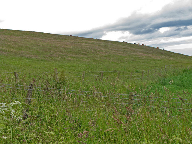
1246:== {{int:filedesc}} == {{Information |Description={{en|1=Cows grazing on the southern slopes of Hersha Hill}} |Source=From ; transferd by
171:
1038:
747:
641:
597:
267:
217:
797:
302:
1275:
This file contains additional information, probably added from the digital camera or scanner used to create or digitize it.
392:
524:
1157:
1112:
1067:
1004:
958:
925:
898:
857:
830:
775:
731:
581:
547:
532:
517:
1031:
790:
760:
665:
625:
490:
449:
724:"}},"text\/plain":{"en":{"P137":"Geograph Britain and Ireland"}}}}": -->
348:
1278:
If the file has been modified from its original state, some details may not fully reflect the modified file.
391:– If you remix, transform, or build upon the material, you must distribute your contributions under the
309:
on the
Geograph website for the photographer's contact details. The copyright on this image is owned by
1060:"}},"text\/plain":{"en":{"P3575":"113,559 byte"}}}}": -->
574:"}},"text\/plain":{"en":{"P6216":"copyrighted"}}}}": -->
1260:
The following pages on the
English Knowledge use this file (pages on other projects are not listed):
1150:"}},"text\/plain":{"en":{"P2049":"640 pixel"}}}}": -->
1105:"}},"text\/plain":{"en":{"P2048":"480 pixel"}}}}": -->
891:"}},"text\/plain":{"en":{"P7787":"67 degree"}}}}": -->
823:"}},"text\/plain":{"en":{"P7787":"67 degree"}}}}": -->
86:
997:"}},"text\/plain":{"en":{"P459":"SHA-1"}}}}": -->
539:
782:
767:
345:
8:
289:
273:
223:
314:
73:
439:
145:
1247:
111:
Cows grazing on the southern slopes of Hersha Hill - geograph.org.uk - 866360.jpg
47:
Cows_grazing_on_the_southern_slopes_of_Hersha_Hill_-_geograph.org.uk_-_866360.jpg
160:
1264:
141:
1167:
1122:
1077:
1014:
968:
908:
840:
741:
675:
635:
591:
500:
294:
306:
1196:
Click on a date/time to view the file as it appeared at that time.
259:
209:
194:
56° 54′ 38.15″ N, 2° 26′ 34.35″ W
149:
244:
56° 54′ 41″ N, 2° 26′ 18″ W
130:
61:
433:
Add a one-line explanation of what this file represents
1258:
1194:
178:
Creative
Commons Attribution Share-alike license 2.0
85:
Commons is a freely licensed media file repository.
642:
Creative
Commons Attribution-ShareAlike 2.0 Generic
616:
Creative
Commons Attribution-ShareAlike 2.0 Generic
121:Cows grazing on the southern slopes of Hersha Hill
51:(640 × 480 pixels, file size: 111 KB, MIME type:
402:https://creativecommons.org/licenses/by-sa/2.0
66:
477:https:\/\/www.geograph.org.uk\/profile\/16833
408:Creative Commons Attribution-Share Alike 2.0
326:
166:
126:
108:
706:https:\/\/www.geograph.org.uk\/photo\/866360
156:
136:
14:
1147:
1102:
1057:
888:
820:
368:– to copy, distribute and transmit the work
540:https://www.geograph.org.uk/profile/16833
1250:using [http://toolserver.org/~magnus/geo
1020:bfe435670f74f83bc6fdfaa62ca23b024fd3ee4d
768:https://www.geograph.org.uk/photo/866360
266:View this and other nearby images on:
216:View this and other nearby images on:
97:
313:and is licensed for reuse under the
234:
184:
1187:
349:Attribution-Share Alike 2.0 Generic
337:
332:
317:Attribution-ShareAlike 2.0 license.
13:
1273:
438:
432:
323:
300:
115:
98:
44:
1299:
1280:
437:
1259:
831:coordinates of the point of view
813:coordinates of the point of view
423:
379:Under the following conditions:
344:This file is licensed under the
336:
331:
325:
293:
272:
258:
250:
222:
208:
200:
65:
21:
1241:File Upload Bot (Magnus Manske)
420:
116:
41:No higher resolution available.
1191:
748:file available on the internet
698:file available on the internet
419:
301:This image was taken from the
26:
1:
899:coordinates of depicted place
881:coordinates of depicted place
846:56°54'38.149"N, 2°26'34.350"W
31:
1255:
798:Geograph Britain and Ireland
722:Geograph Britain and Ireland
518:object of statement has role
465:object of statement has role
445:Items portrayed in this file
285:
7:
1270:
914:56°54'41.40"N, 2°26'17.52"W
249:
199:
10:
1304:
393:same or compatible license
105:
100:
1188:
16:
776:geograph.org.uk image ID
710:geograph.org.uk image ID
422:
359:
72:This is a file from the
36:
1245:
129:
76:. Information from its
1224:14:27, 30 January 2010
307:this photograph's page
278:56.911500; -2.438200
228:56.910597; -2.442875
79:description page there
1032:determination method
991:determination method
150:geograph_org2commons
374:– to adapt the work
548:author name string
481:author name string
1291:
1290:
1253:
1149:
1104:
1059:
890:
822:
626:copyright license
612:copyright license
431:
322:
321:
305:collection. See
283:
282:
233:
232:
182:
181:
175:
172:Reusing this file
144:; transferred by
94:
93:
74:Wikimedia Commons
1295:
1281:
1236:
1198:
1176:
1131:
1086:
1041:
1036:
936:
935:
930:
868:
867:
862:
800:
795:
785:
780:
770:
765:
761:described at URL
702:described at URL
582:copyright status
568:copyright status
555:
552:
542:
537:
527:
522:
429:
415:
412:
409:
406:
403:
395:as the original.
357:
346:Creative Commons
340:
339:
335:
334:
329:
328:
315:Creative Commons
303:Geograph project
297:
290:
279:
276:
262:
261:
255:
254:
253:
247:
246:
235:
229:
226:
212:
211:
205:
204:
203:
197:
196:
185:
169:
132:
120:
112:
106:
90:
69:
68:
62:
56:
54:
1303:
1302:
1298:
1297:
1296:
1294:
1293:
1292:
1269:
1261:
1254:
1248:User:Multichill
1242:
1234:
1190:
1189:
1186:
1185:
1184:
1183:
1182:
1181:
1180:
1179:
1177:
1174:
1164:
1163:
1162:
1160:
1141:
1140:
1139:
1138:
1137:
1136:
1135:
1134:
1132:
1129:
1119:
1118:
1117:
1115:
1096:
1095:
1094:
1093:
1092:
1091:
1090:
1089:
1087:
1084:
1074:
1073:
1072:
1070:
1051:
1050:
1049:
1048:
1047:
1046:
1045:
1044:
1043:
1042:
1037:
1034:
1025:
1024:
1023:
1021:
1011:
1010:
1009:
1007:
984:
983:
982:
981:
980:
979:
978:
977:
975:
965:
964:
963:
961:
946:
945:
944:
943:
942:
941:
940:
939:
938:
937:
933:
931:
928:
919:
918:
917:
915:
905:
904:
903:
901:
878:
877:
876:
875:
874:
873:
872:
871:
870:
869:
865:
863:
860:
851:
850:
849:
847:
837:
836:
835:
833:
810:
809:
808:
807:
806:
805:
804:
803:
802:
801:
796:
793:
787:
786:
781:
778:
772:
771:
766:
763:
754:
753:
752:
750:
738:
737:
736:
734:
691:
690:
689:
688:
687:
686:
685:
684:
682:
672:
671:
670:
668:
653:
652:
651:
650:
649:
648:
647:
646:
644:
632:
631:
630:
628:
609:
608:
607:
606:
605:
604:
603:
602:
600:
588:
587:
586:
584:
565:
564:
563:
562:
561:
560:
559:
558:
557:
556:
554:C Michael Hogan
553:
550:
544:
543:
538:
535:
529:
528:
523:
520:
511:
510:
509:
507:
497:
496:
495:
493:
458:
457:
456:
455:
454:
452:
436:
435:
434:
417:
416:
413:
410:
407:
404:
401:
400:
358:
356:C Michael Hogan
355:
352:
341:
318:
311:C Michael Hogan
288:
277:
251:
242:
241:
238:Object location
227:
201:
192:
191:
188:Camera location
183:
161:C Michael Hogan
146:User:Multichill
142:geograph.org.uk
122:
110:
103:
96:
95:
84:
83:
82:is shown below.
58:
52:
50:
43:
42:
12:
11:
5:
1301:
1289:
1288:
1285:
1272:
1268:
1267:
1257:
1252:
1251:
1244:
1240:
1237:
1231:
1226:
1221:
1217:
1216:
1213:
1210:
1207:
1204:
1201:
1193:
1178:
1172:
1170:
1169:
1168:
1166:
1165:
1161:
1156:
1154:
1153:
1152:
1151:
1145:
1133:
1127:
1125:
1124:
1123:
1121:
1120:
1116:
1111:
1109:
1108:
1107:
1106:
1100:
1088:
1082:
1080:
1079:
1078:
1076:
1075:
1071:
1066:
1064:
1063:
1062:
1061:
1055:
1030:
1029:
1028:
1027:
1026:
1022:
1019:
1017:
1016:
1015:
1013:
1012:
1008:
1003:
1001:
1000:
999:
998:
996:
992:
988:
976:
973:
971:
970:
969:
967:
966:
962:
957:
955:
954:
953:
952:
950:
924:
923:
922:
921:
920:
916:
913:
911:
910:
909:
907:
906:
902:
897:
895:
894:
893:
892:
886:
882:
856:
855:
854:
853:
852:
848:
845:
843:
842:
841:
839:
838:
834:
829:
827:
826:
825:
824:
818:
814:
789:
788:
774:
773:
759:
758:
757:
756:
755:
751:
746:
744:
743:
742:
740:
739:
735:
732:source of file
730:
728:
727:
726:
725:
723:
719:
715:
711:
707:
703:
699:
695:
694:source of file
683:
680:
678:
677:
676:
674:
673:
669:
664:
662:
661:
660:
659:
657:
645:
640:
638:
637:
636:
634:
633:
629:
624:
622:
621:
620:
619:
617:
613:
601:
596:
594:
593:
592:
590:
589:
585:
580:
578:
577:
576:
575:
573:
569:
546:
545:
531:
530:
516:
515:
514:
513:
512:
508:
505:
503:
502:
501:
499:
498:
494:
489:
487:
486:
485:
484:
482:
478:
474:
470:
466:
462:
453:
448:
446:
443:
442:
441:
440:
428:
427:
424:
421:
399:
398:
397:
396:
386:
377:
376:
375:
369:
362:You are free:
353:
343:
342:
324:
320:
319:
298:
287:
284:
281:
280:
270:
264:
239:
231:
230:
220:
214:
189:
180:
179:
176:
164:
163:
158:
154:
153:
138:
134:
133:
128:
124:
123:
113:
104:
102:
99:
92:
91:
70:
60:
59:
40:
35:
34:
29:
24:
19:
9:
6:
4:
3:
2:
1300:
1286:
1283:
1282:
1279:
1276:
1266:
1263:
1262:
1249:
1243:
1238:
1232:
1230:
1227:
1225:
1222:
1219:
1218:
1214:
1211:
1208:
1205:
1202:
1200:
1199:
1197:
1171:
1159:
1155:
1126:
1114:
1110:
1081:
1069:
1065:
1040:
1033:
1018:
1006:
1002:
972:
960:
956:
927:
912:
900:
896:
859:
844:
832:
828:
799:
792:
784:
777:
769:
762:
749:
745:
733:
729:
679:
667:
663:
643:
639:
627:
623:
599:
595:
583:
579:
549:
541:
534:
526:
519:
504:
492:
488:
451:
447:
444:
425:
418:
405:CC BY-SA 2.0
394:
390:
387:
384:
381:
380:
378:
373:
370:
367:
364:
363:
361:
360:
354:Attribution:
350:
347:
330:
316:
312:
308:
304:
299:
296:
292:
291:
275:
271:
269:
268:OpenStreetMap
265:
263:
245:
240:
237:
236:
225:
221:
219:
218:OpenStreetMap
215:
213:
195:
190:
187:
186:
177:
173:
168:
165:
162:
159:
155:
151:
147:
143:
139:
135:
125:
119:
114:
107:
88:
81:
80:
75:
71:
64:
63:
57:
48:
39:
33:
30:
28:
25:
23:
20:
18:
15:
1277:
1274:
1265:Herscha Hill
1195:
1192:File history
681:30 June 2008
525:photographer
469:photographer
388:
382:
371:
365:
310:
248:
198:
131:30 June 2008
117:
87:You can help
77:
45:
22:File history
598:copyrighted
572:copyrighted
389:share alike
383:attribution
109:Description
1284:_error
1256:File usage
1233:640 × 480
1209:Dimensions
974:image/jpeg
959:media type
949:media type
506:some value
167:Permission
53:image/jpeg
27:File usage
1206:Thumbnail
1203:Date/Time
1068:data size
1054:data size
666:inception
656:inception
286:Licensing
118:English:
1271:Metadata
1235:(111 KB)
1083:113,559
1005:checksum
987:checksum
791:operator
718:operator
426:Captions
372:to remix
366:to share
351:license.
32:Metadata
1220:current
1215:Comment
926:heading
885:heading
858:heading
817:heading
491:creator
461:creator
450:depicts
430:English
101:Summary
49:
1113:height
1099:height
934:degree
889:degree
866:degree
821:degree
783:866360
714:866360
256:
206:
157:Author
148:using
137:Source
1175:pixel
1158:width
1148:pixel
1144:width
1130:pixel
1103:pixel
1039:SHA-1
995:SHA-1
140:From
1212:User
1173:640
1128:480
1085:byte
1058:byte
414:true
411:true
127:Date
17:File
932:67
864:67
533:URL
473:URL
1035::
929::
861::
794::
779::
764::
551::
536::
521::
1287:0
174:)
170:(
152:.
89:.
55:)
Text is available under the Creative Commons Attribution-ShareAlike License. Additional terms may apply.
_region:GB-GBN_heading:67.00&language=en)
