813:"}},"text\/plain":{"en":{"":"checksum"}}},"{\"value\":\"57ddc7bca88ca3398ea70a938a53de4379c371dc\",\"type\":\"string\"}":{"text\/html":{"en":{"P4092":"57ddc7bca88ca3398ea70a938a53de4379c371dc"}},"text\/plain":{"en":{"P4092":"57ddc7bca88ca3398ea70a938a53de4379c371dc"}}},"{\"value\":{\"entity-type\":\"property\",\"numeric-id\":459,\"id\":\"P459\"},\"type\":\"wikibase-entityid\"}":{"text\/html":{"en":{"":"
737:"}},"text\/plain":{"en":{"":"coordinates of the point of view"}}},"{\"value\":{\"latitude\":53.084134,\"longitude\":-2.798691,\"altitude\":null,\"precision\":1.0e-6,\"globe\":\"http:\\\/\\\/www.wikidata.org\\\/entity\\\/Q2\"},\"type\":\"globecoordinate\"}":{"text\/html":{"en":{"P1259":"53\u00b05'2.882"N, 2\u00b047'55.288"W"}},"text\/plain":{"en":{"P1259":"53\u00b05'2.882\"N, 2\u00b047'55.288\"W"}}}}": -->
397:"}},"text\/plain":{"en":{"":"author name string"}}},"{\"value\":\"John Harding\",\"type\":\"string\"}":{"text\/html":{"en":{"P2093":"John Harding"}},"text\/plain":{"en":{"P2093":"John Harding"}}},"{\"value\":{\"entity-type\":\"property\",\"numeric-id\":3831,\"id\":\"P3831\"},\"type\":\"wikibase-entityid\"}":{"text\/html":{"en":{"":"
580:"}},"text\/plain":{"en":{"":"inception"}}},"{\"value\":{\"time\":\"+2004-08-21T00:00:00Z\",\"timezone\":0,\"before\":0,\"after\":0,\"precision\":11,\"calendarmodel\":\"http:\\\/\\\/www.wikidata.org\\\/entity\\\/Q1985727\"},\"type\":\"time\"}":{"text\/html":{"en":{"P571":"21 August 2004"}},"text\/plain":{"en":{"P571":"21 August 2004"}}}}": -->
614:
381:
809:
217:
255:
260:
72:
393:"}},"text\/plain":{"en":{"P2699":"https:\/\/www.geograph.org.uk\/profile\/7180"}}},"{\"value\":{\"entity-type\":\"property\",\"numeric-id\":2093,\"id\":\"P2093\"},\"type\":\"wikibase-entityid\"}":{"text\/html":{"en":{"":"
622:"}},"text\/plain":{"en":{"P7482":"file available on the internet"}}},"{\"value\":{\"entity-type\":\"property\",\"numeric-id\":137,\"id\":\"P137\"},\"type\":\"wikibase-entityid\"}":{"text\/html":{"en":{"":"
630:"}},"text\/plain":{"en":{"P137":"Geograph Britain and Ireland"}}},"{\"value\":{\"entity-type\":\"property\",\"numeric-id\":7384,\"id\":\"P7384\"},\"type\":\"wikibase-entityid\"}":{"text\/html":{"en":{"":"
401:"}},"text\/plain":{"en":{"":"object of statement has role"}}},"{\"value\":{\"entity-type\":\"item\",\"numeric-id\":33231,\"id\":\"Q33231\"},\"type\":\"wikibase-entityid\"}":{"text\/html":{"en":{"P3831":"
817:"}},"text\/plain":{"en":{"":"determination method"}}},"{\"value\":{\"entity-type\":\"item\",\"numeric-id\":13414952,\"id\":\"Q13414952\"},\"type\":\"wikibase-entityid\"}":{"text\/html":{"en":{"P459":"
775:"}},"text\/plain":{"en":{"":"media type"}}},"{\"value\":\"image\\\/jpeg\",\"type\":\"string\"}":{"text\/html":{"en":{"P1163":"image\/jpeg"}},"text\/plain":{"en":{"P1163":"image\/jpeg"}}}}": -->
536:"}},"text\/plain":{"en":{"":"copyright license"}}},"{\"value\":{\"entity-type\":\"item\",\"numeric-id\":19068220,\"id\":\"Q19068220\"},\"type\":\"wikibase-entityid\"}":{"text\/html":{"en":{"P275":"
492:"}},"text\/plain":{"en":{"":"copyright status"}}},"{\"value\":{\"entity-type\":\"item\",\"numeric-id\":50423863,\"id\":\"Q50423863\"},\"type\":\"wikibase-entityid\"}":{"text\/html":{"en":{"P6216":"
618:"}},"text\/plain":{"en":{"":"source of file"}}},"{\"value\":{\"entity-type\":\"item\",\"numeric-id\":74228490,\"id\":\"Q74228490\"},\"type\":\"wikibase-entityid\"}":{"text\/html":{"en":{"P7482":"
880:"}},"text\/plain":{"en":{"":"data size"}}},"{\"value\":{\"amount\":\"+168878\",\"unit\":\"http:\\\/\\\/www.wikidata.org\\\/entity\\\/Q8799\"},\"type\":\"quantity\"}":{"text\/html":{"en":{"P3575":"168,878
925:"}},"text\/plain":{"en":{"":"height"}}},"{\"value\":{\"amount\":\"+427\",\"unit\":\"http:\\\/\\\/www.wikidata.org\\\/entity\\\/Q355198\"},\"type\":\"quantity\"}":{"text\/html":{"en":{"P2048":"427
626:"}},"text\/plain":{"en":{"":"operator"}}},"{\"value\":{\"entity-type\":\"item\",\"numeric-id\":1503119,\"id\":\"Q1503119\"},\"type\":\"wikibase-entityid\"}":{"text\/html":{"en":{"P137":"
970:"}},"text\/plain":{"en":{"":"width"}}},"{\"value\":{\"amount\":\"+640\",\"unit\":\"http:\\\/\\\/www.wikidata.org\\\/entity\\\/Q355198\"},\"type\":\"quantity\"}":{"text\/html":{"en":{"P2049":"640
638:"}},"text\/plain":{"en":{"P7384":"225908"}}},"{\"value\":{\"entity-type\":\"property\",\"numeric-id\":973,\"id\":\"P973\"},\"type\":\"wikibase-entityid\"}":{"text\/html":{"en":{"":"
385:"}},"text\/plain":{"en":{"":"creator"}}},"{\"value\":{\"entity-type\":\"property\",\"numeric-id\":2699,\"id\":\"P2699\"},\"type\":\"wikibase-entityid\"}":{"text\/html":{"en":{"":"
966:
642:"}},"text\/plain":{"en":{"":"described at URL"}}},"{\"value\":\"https:\\\/\\\/www.geograph.org.uk\\\/photo\\\/225908\",\"type\":\"string\"}":{"text\/html":{"en":{"P973":"
389:"}},"text\/plain":{"en":{"":"URL"}}},"{\"value\":\"https:\\\/\\\/www.geograph.org.uk\\\/profile\\\/7180\",\"type\":\"string\"}":{"text\/html":{"en":{"P2699":"
634:"}},"text\/plain":{"en":{"":"geograph.org.uk image ID"}}},"{\"value\":\"225908\",\"type\":\"string\"}":{"text\/html":{"en":{"P7384":"
43:
307:– You must give appropriate credit, provide a link to the license, and indicate if changes were made. You may do so in any reasonable manner, but not in any way that suggests the licensor endorses you or your use.
179:
173:
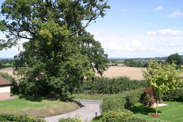
1070:{{Information |Description={{en|1=High Cross Lane, Clutton}} |Source=http://www.geograph.org.uk/photo/225908 |Author=John Harding |Date=2004-08-21 |Permission= |other_versions= }}
818:
635:
619:
537:
493:
627:
1071:
402:
967:
922:
877:
810:
772:
734:
631:
615:
489:
398:
394:
386:
814:
643:
639:
623:
577:
533:
390:
382:
1092:
540:"}},"text\/plain":{"en":{"P275":"Creative Commons Attribution-ShareAlike 2.0 Generic"}}}}": -->
83:
646:"}},"text\/plain":{"en":{"P973":"https:\/\/www.geograph.org.uk\/photo\/225908"}}}}": -->
51:
862:
669:
563:
519:
189:
689:
224:
1203:
This file contains additional information, probably added from the digital camera or scanner used to create or digitize it.
314:
474:
1110:
981:
936:
891:
828:
782:
744:
697:
653:
503:
467:
454:
439:
855:
712:
682:
587:
547:
412:
371:
1130:
1332:
270:
1206:
If the file has been modified from its original state, some details may not fully reflect the modified file.
1309:
313:– If you remix, transform, or build upon the material, you must distribute your contributions under the
231:
on the
Geograph website for the photographer's contact details. The copyright on this image is owned by
884:"}},"text\/plain":{"en":{"P3575":"168,878 byte"}}}}": -->
405:"}},"text\/plain":{"en":{"P3831":"photographer"}}}}": -->
496:"}},"text\/plain":{"en":{"P6216":"copyrighted"}}}}": -->
1083:
The following pages on the
English Knowledge use this file (pages on other projects are not listed):
974:"}},"text\/plain":{"en":{"P2049":"640 pixel"}}}}": -->
929:"}},"text\/plain":{"en":{"P2048":"427 pixel"}}}}": -->
91:
1052:
1047:
42:
821:"}},"text\/plain":{"en":{"P459":"SHA-1"}}}}": -->
1377:
719:
704:
446:
267:
8:
1405:
211:
195:
1087:
236:
78:
361:
1120:
1215:
1063:
1473:
1395:
1359:
1232:
1225:
1272:
156:
146:
1415:
991:
946:
901:
838:
792:
754:
663:
597:
557:
513:
422:
216:
1252:
1131:
Clutton (distrito sa
Hiniusang Gingharian, Cheshire West and Chester)
228:
1242:
1020:
Click on a date/time to view the file as it appeared at that time.
1160:
1140:
181:
1170:
1150:
174:
53° 05′ 02.88″ N, 2° 47′ 55.29″ W
1180:
135:
66:
355:
Add a one-line explanation of what this file represents
1190:
1081:
1101:
1018:
90:
Commons is a freely licensed media file repository.
564:
Creative
Commons Attribution-ShareAlike 2.0 Generic
538:
Creative
Commons Attribution-ShareAlike 2.0 Generic
56:(640 × 427 pixels, file size: 165 KB, MIME type:
1410:Flash did not fire, compulsory flash suppression
1093:User:Skinsmoke/Sandbox/Civil parishes/Cheshire
324:https://creativecommons.org/licenses/by-sa/2.0
71:
330:Creative Commons Attribution-Share Alike 2.0
248:
131:
113:
644:https:\/\/www.geograph.org.uk\/photo\/225908
391:https:\/\/www.geograph.org.uk\/profile\/7180
152:
141:
14:
971:
926:
881:
290:– to copy, distribute and transmit the work
1103:The following other wikis use this file:
844:57ddc7bca88ca3398ea70a938a53de4379c371dc
720:https://www.geograph.org.uk/photo/225908
447:https://www.geograph.org.uk/profile/7180
188:View this and other nearby images on:
102:
235:and is licensed for reuse under the
164:
1011:
271:Attribution-Share Alike 2.0 Generic
259:
254:
239:Attribution-ShareAlike 2.0 license.
13:
1201:
360:
354:
245:
222:
120:
103:
49:
1498:
1208:
359:
1263:Date and time of data generation
1082:
745:coordinates of the point of view
735:coordinates of the point of view
345:
301:Under the following conditions:
266:This file is licensed under the
258:
253:
247:
215:
194:
180:
70:
31:
21:
342:
121:
46:No higher resolution available.
1237:1/180 sec (0.0055555555555556)
1098:
1015:
670:file available on the internet
620:file available on the internet
341:
223:This image was taken from the
26:
1:
116:Clutton - High Cross Lane.jpg
52:Clutton_-_High_Cross_Lane.jpg
36:
1390:3.6147155761719 APEX (f/3.5)
1078:
690:Geograph Britain and Ireland
628:Geograph Britain and Ireland
468:object of statement has role
399:object of statement has role
367:Items portrayed in this file
207:
7:
1441:Focal plane resolution unit
1343:Date and time of digitizing
1310:Adobe Photoshop CS2 Windows
1198:
1157:Usage on lld.wikipedia.org
1127:Usage on ceb.wikipedia.org
1117:Usage on arz.wikipedia.org
760:53°5'2.882"N, 2°47'55.288"W
10:
1503:
1452:One-chip color area sensor
1187:Usage on www.wikidata.org
1177:Usage on tr.wikipedia.org
1167:Usage on pl.wikipedia.org
1147:Usage on fr.wikipedia.org
1137:Usage on cy.wikipedia.org
1107:Usage on ar.wikipedia.org
1072:Category:Clutton, Cheshire
315:same or compatible license
110:
105:
1316:File change date and time
1012:
16:
1433:Focal plane Y resolution
1425:Focal plane X resolution
698:geograph.org.uk image ID
632:geograph.org.uk image ID
344:
281:
126:High Cross Lane, Clutton
77:This is a file from the
41:
1457:Custom image processing
1069:
1048:17:58, 13 December 2009
134:
81:. Information from its
1351:Image compression mode
229:this photograph's page
200:53.084134; -2.798691
84:description page there
1387:Maximum land aperture
1346:13:52, 21 August 2004
1319:22:08, 25 August 2006
1290:Horizontal resolution
1266:13:52, 21 August 2004
856:determination method
815:determination method
1324:Y and C positioning
1298:Vertical resolution
1212:Camera manufacturer
1141:Clutton, Swydd Gaer
296:– to adapt the work
1483:Scene capture type
1478:Auto white balance
1171:Clutton (Cheshire)
1161:Clutton (Cheshire)
1151:Clutton (Cheshire)
455:author name string
395:author name string
1490:
1489:
1181:Clutton, Cheshire
1099:Global file usage
1088:Clutton, Cheshire
1076:
973:
928:
883:
548:copyright license
534:copyright license
353:
244:
243:
227:collection. See
205:
204:
162:
161:
99:
98:
79:Wikimedia Commons
32:Global file usage
1494:
1436:3,442.0168067227
1428:3,443.9461883408
1209:
1060:
1022:
1000:
955:
910:
865:
860:
722:
717:
713:described at URL
707:
702:
692:
687:
640:described at URL
504:copyright status
490:copyright status
477:
472:
462:
459:
449:
444:
351:
337:
334:
331:
328:
325:
317:as the original.
279:
268:Creative Commons
262:
261:
257:
256:
251:
250:
237:Creative Commons
225:Geograph project
219:
212:
201:
198:
184:
183:
177:
176:
165:
137:
125:
117:
111:
95:
74:
73:
67:
61:
59:
1502:
1501:
1497:
1496:
1495:
1493:
1492:
1491:
1364:7.4918518066406
1197:
1111:كلوتون (تشيشير)
1097:
1084:
1077:
1066:
1058:
1014:
1013:
1010:
1009:
1008:
1007:
1006:
1005:
1004:
1003:
1001:
998:
988:
987:
986:
984:
965:
964:
963:
962:
961:
960:
959:
958:
956:
953:
943:
942:
941:
939:
920:
919:
918:
917:
916:
915:
914:
913:
911:
908:
898:
897:
896:
894:
875:
874:
873:
872:
871:
870:
869:
868:
867:
866:
861:
858:
849:
848:
847:
845:
835:
834:
833:
831:
808:
807:
806:
805:
804:
803:
802:
801:
799:
789:
788:
787:
785:
770:
769:
768:
767:
766:
765:
764:
763:
761:
751:
750:
749:
747:
732:
731:
730:
729:
728:
727:
726:
725:
724:
723:
718:
715:
709:
708:
703:
700:
694:
693:
688:
685:
676:
675:
674:
672:
660:
659:
658:
656:
613:
612:
611:
610:
609:
608:
607:
606:
604:
594:
593:
592:
590:
575:
574:
573:
572:
571:
570:
569:
568:
566:
554:
553:
552:
550:
531:
530:
529:
528:
527:
526:
525:
524:
522:
510:
509:
508:
506:
487:
486:
485:
484:
483:
482:
481:
480:
479:
478:
473:
470:
464:
463:
460:
457:
451:
450:
445:
442:
433:
432:
431:
429:
419:
418:
417:
415:
380:
379:
378:
377:
376:
374:
358:
357:
356:
339:
338:
335:
332:
329:
326:
323:
322:
280:
277:
274:
263:
240:
210:
199:
172:
171:
168:Camera location
163:
147:geograph.org.uk
127:
115:
108:
101:
100:
89:
88:
87:is shown below.
63:
57:
55:
48:
47:
12:
11:
5:
1500:
1488:
1487:
1484:
1480:
1479:
1476:
1470:
1469:
1466:
1462:
1461:
1460:Normal process
1458:
1454:
1453:
1450:
1449:Sensing method
1446:
1445:
1442:
1438:
1437:
1434:
1430:
1429:
1426:
1422:
1421:
1418:
1412:
1411:
1408:
1402:
1401:
1398:
1392:
1391:
1388:
1384:
1383:
1380:
1374:
1373:
1370:
1366:
1365:
1362:
1356:
1355:
1352:
1348:
1347:
1344:
1340:
1339:
1336:
1329:
1328:
1325:
1321:
1320:
1317:
1313:
1312:
1307:
1303:
1302:
1299:
1295:
1294:
1291:
1287:
1286:
1283:
1279:
1278:
1275:
1268:
1267:
1264:
1260:
1259:
1256:
1249:
1248:
1245:
1239:
1238:
1235:
1229:
1228:
1223:
1219:
1218:
1213:
1200:
1196:
1195:
1194:
1193:
1185:
1184:
1183:
1175:
1174:
1173:
1165:
1164:
1163:
1155:
1154:
1153:
1145:
1144:
1143:
1135:
1134:
1133:
1125:
1124:
1123:
1115:
1114:
1113:
1100:
1096:
1095:
1090:
1080:
1075:
1074:
1068:
1064:
1061:
1055:
1050:
1045:
1041:
1040:
1037:
1034:
1031:
1028:
1025:
1017:
1002:
996:
994:
993:
992:
990:
989:
985:
980:
978:
977:
976:
975:
969:
957:
951:
949:
948:
947:
945:
944:
940:
935:
933:
932:
931:
930:
924:
912:
906:
904:
903:
902:
900:
899:
895:
890:
888:
887:
886:
885:
879:
854:
853:
852:
851:
850:
846:
843:
841:
840:
839:
837:
836:
832:
827:
825:
824:
823:
822:
820:
816:
812:
800:
797:
795:
794:
793:
791:
790:
786:
781:
779:
778:
777:
776:
774:
762:
759:
757:
756:
755:
753:
752:
748:
743:
741:
740:
739:
738:
736:
711:
710:
696:
695:
681:
680:
679:
678:
677:
673:
668:
666:
665:
664:
662:
661:
657:
654:source of file
652:
650:
649:
648:
647:
645:
641:
637:
633:
629:
625:
621:
617:
616:source of file
605:
603:21 August 2004
602:
600:
599:
598:
596:
595:
591:
586:
584:
583:
582:
581:
579:
567:
562:
560:
559:
558:
556:
555:
551:
546:
544:
543:
542:
541:
539:
535:
523:
518:
516:
515:
514:
512:
511:
507:
502:
500:
499:
498:
497:
495:
491:
466:
465:
453:
452:
438:
437:
436:
435:
434:
430:
427:
425:
424:
423:
421:
420:
416:
411:
409:
408:
407:
406:
404:
400:
396:
392:
388:
384:
375:
370:
368:
365:
364:
363:
362:
350:
349:
346:
343:
321:
320:
319:
318:
308:
299:
298:
297:
291:
284:You are free:
275:
265:
264:
246:
242:
241:
220:
209:
206:
203:
202:
192:
186:
169:
160:
159:
154:
150:
149:
143:
139:
138:
136:21 August 2004
133:
129:
128:
118:
109:
107:
104:
97:
96:
75:
65:
64:
45:
40:
39:
34:
29:
24:
19:
9:
6:
4:
3:
2:
1499:
1485:
1482:
1481:
1477:
1475:
1474:White balance
1472:
1471:
1468:Auto exposure
1467:
1465:Exposure mode
1464:
1463:
1459:
1456:
1455:
1451:
1448:
1447:
1443:
1440:
1439:
1435:
1432:
1431:
1427:
1424:
1423:
1419:
1417:
1414:
1413:
1409:
1407:
1404:
1403:
1399:
1397:
1396:Metering mode
1394:
1393:
1389:
1386:
1385:
1381:
1379:
1378:Exposure bias
1376:
1375:
1371:
1369:APEX aperture
1368:
1367:
1363:
1361:
1360:Shutter speed
1358:
1357:
1353:
1350:
1349:
1345:
1342:
1341:
1337:
1334:
1331:
1330:
1326:
1323:
1322:
1318:
1315:
1314:
1311:
1308:
1306:Software used
1305:
1304:
1300:
1297:
1296:
1292:
1289:
1288:
1284:
1281:
1280:
1276:
1274:
1270:
1269:
1265:
1262:
1261:
1257:
1254:
1251:
1250:
1246:
1244:
1241:
1240:
1236:
1234:
1233:Exposure time
1231:
1230:
1227:
1226:Canon EOS 10D
1224:
1221:
1220:
1217:
1214:
1211:
1210:
1207:
1204:
1192:
1189:
1188:
1186:
1182:
1179:
1178:
1176:
1172:
1169:
1168:
1166:
1162:
1159:
1158:
1156:
1152:
1149:
1148:
1146:
1142:
1139:
1138:
1136:
1132:
1129:
1128:
1126:
1122:
1119:
1118:
1116:
1112:
1109:
1108:
1106:
1105:
1104:
1094:
1091:
1089:
1086:
1085:
1073:
1067:
1062:
1056:
1054:
1051:
1049:
1046:
1043:
1042:
1038:
1035:
1032:
1029:
1026:
1024:
1023:
1021:
995:
983:
979:
950:
938:
934:
905:
893:
889:
864:
857:
842:
830:
826:
796:
784:
780:
758:
746:
742:
721:
714:
706:
699:
691:
684:
671:
667:
655:
651:
601:
589:
585:
565:
561:
549:
545:
521:
517:
505:
501:
476:
469:
456:
448:
441:
426:
414:
410:
373:
369:
366:
347:
340:
327:CC BY-SA 2.0
316:
312:
309:
306:
303:
302:
300:
295:
292:
289:
286:
285:
283:
282:
276:Attribution:
272:
269:
252:
238:
234:
230:
226:
221:
218:
214:
213:
197:
193:
191:
190:OpenStreetMap
187:
185:
175:
170:
167:
166:
158:
155:
151:
148:
144:
140:
130:
124:
119:
112:
93:
86:
85:
80:
76:
69:
68:
62:
53:
44:
38:
35:
33:
30:
28:
25:
23:
20:
18:
15:
1273:focal length
1222:Camera model
1205:
1202:
1102:
1019:
1016:File history
475:photographer
461:John Harding
403:photographer
310:
304:
293:
287:
278:John Harding
233:John Harding
232:
157:John Harding
122:
92:You can help
82:
50:
22:File history
1416:Color space
1282:Orientation
520:copyrighted
494:copyrighted
311:share alike
305:attribution
114:Description
1079:File usage
1057:640 × 427
1033:Dimensions
798:image/jpeg
783:media type
773:media type
428:some value
58:image/jpeg
27:File usage
1486:Landscape
1253:ISO speed
1065:Skinsmoke
1030:Thumbnail
1027:Date/Time
892:data size
878:data size
588:inception
578:inception
208:Licensing
123:English:
1327:Centered
1243:F-number
1199:Metadata
1191:Q5136780
1059:(165 KB)
907:168,878
829:checksum
811:checksum
683:operator
624:operator
348:Captions
294:to remix
288:to share
273:license.
37:Metadata
1400:Pattern
1335:version
1301:180 dpi
1293:180 dpi
1044:current
1039:Comment
413:creator
383:creator
372:depicts
352:English
106:Summary
54:
1444:inches
1285:Normal
1255:rating
1121:كلوتون
937:height
923:height
705:225908
636:225908
178:
153:Author
142:Source
1406:Flash
1277:24 mm
1271:Lens
1216:Canon
999:pixel
982:width
972:pixel
968:width
954:pixel
927:pixel
863:SHA-1
819:SHA-1
145:From
1420:sRGB
1338:2.21
1333:Exif
1036:User
997:640
952:427
909:byte
882:byte
336:true
333:true
132:Date
17:File
1258:100
1247:f/8
440:URL
387:URL
859::
716::
701::
686::
471::
458::
443::
1382:0
1372:6
1354:3
94:.
60:)
