836:"}},"text\/plain":{"en":{"":"coordinates of the point of view"}}},"{\"value\":{\"latitude\":50.05938,\"longitude\":-5.2751,\"altitude\":null,\"precision\":1.0e-5,\"globe\":\"http:\\\/\\\/www.wikidata.org\\\/entity\\\/Q2\"},\"type\":\"globecoordinate\"}":{"text\/html":{"en":{"P1259":"50\u00b03'33.77"N, 5\u00b016'30.36"W"}},"text\/plain":{"en":{"P1259":"50\u00b03'33.77\"N, 5\u00b016'30.36\"W"}}},"{\"value\":{\"entity-type\":\"property\",\"numeric-id\":7787,\"id\":\"P7787\"},\"type\":\"wikibase-entityid\"}":{"text\/html":{"en":{"":"
904:"}},"text\/plain":{"en":{"":"coordinates of depicted place"}}},"{\"value\":{\"latitude\":50.05966,\"longitude\":-5.2748,\"altitude\":null,\"precision\":1.0e-5,\"globe\":\"http:\\\/\\\/www.wikidata.org\\\/entity\\\/Q2\"},\"type\":\"globecoordinate\"}":{"text\/html":{"en":{"P9149":"50\u00b03'34.78"N, 5\u00b016'29.28"W"}},"text\/plain":{"en":{"P9149":"50\u00b03'34.78\"N, 5\u00b016'29.28\"W"}}},"{\"value\":{\"entity-type\":\"property\",\"numeric-id\":7787,\"id\":\"P7787\"},\"type\":\"wikibase-entityid\"}":{"text\/html":{"en":{"":"
1010:"}},"text\/plain":{"en":{"":"checksum"}}},"{\"value\":\"e0b8261f91158861c536df8d3be2559100246ef6\",\"type\":\"string\"}":{"text\/html":{"en":{"P4092":"e0b8261f91158861c536df8d3be2559100246ef6"}},"text\/plain":{"en":{"P4092":"e0b8261f91158861c536df8d3be2559100246ef6"}}},"{\"value\":{\"entity-type\":\"property\",\"numeric-id\":459,\"id\":\"P459\"},\"type\":\"wikibase-entityid\"}":{"text\/html":{"en":{"":"
679:"}},"text\/plain":{"en":{"":"inception"}}},"{\"value\":{\"time\":\"+2008-09-26T00:00:00Z\",\"timezone\":0,\"before\":0,\"after\":0,\"precision\":11,\"calendarmodel\":\"http:\\\/\\\/www.wikidata.org\\\/entity\\\/Q1985727\"},\"type\":\"time\"}":{"text\/html":{"en":{"P571":"26 September 2008"}},"text\/plain":{"en":{"P571":"26 September 2008"}}}}": -->
713:
281:
231:
1006:
223:
295:
245:
316:
354:
359:
72:
500:"}},"text\/plain":{"en":{"P2699":"https:\/\/www.geograph.org.uk\/profile\/22976"}}},"{\"value\":{\"entity-type\":\"property\",\"numeric-id\":2093,\"id\":\"P2093\"},\"type\":\"wikibase-entityid\"}":{"text\/html":{"en":{"":"
729:"}},"text\/plain":{"en":{"P973":"https:\/\/www.geograph.org.uk\/photo\/980531"}}},"{\"value\":{\"entity-type\":\"property\",\"numeric-id\":7384,\"id\":\"P7384\"},\"type\":\"wikibase-entityid\"}":{"text\/html":{"en":{"":"
721:"}},"text\/plain":{"en":{"P7482":"file available on the internet"}}},"{\"value\":{\"entity-type\":\"property\",\"numeric-id\":973,\"id\":\"P973\"},\"type\":\"wikibase-entityid\"}":{"text\/html":{"en":{"":"
488:"}},"text\/plain":{"en":{"":"object of statement has role"}}},"{\"value\":{\"entity-type\":\"item\",\"numeric-id\":33231,\"id\":\"Q33231\"},\"type\":\"wikibase-entityid\"}":{"text\/html":{"en":{"P3831":"
504:"}},"text\/plain":{"en":{"":"author name string"}}},"{\"value\":\"Rod Allday\",\"type\":\"string\"}":{"text\/html":{"en":{"P2093":"Rod Allday"}},"text\/plain":{"en":{"P2093":"Rod Allday"}}}}": -->
1014:"}},"text\/plain":{"en":{"":"determination method"}}},"{\"value\":{\"entity-type\":\"item\",\"numeric-id\":13414952,\"id\":\"Q13414952\"},\"type\":\"wikibase-entityid\"}":{"text\/html":{"en":{"P459":"
972:"}},"text\/plain":{"en":{"":"media type"}}},"{\"value\":\"image\\\/jpeg\",\"type\":\"string\"}":{"text\/html":{"en":{"P1163":"image\/jpeg"}},"text\/plain":{"en":{"P1163":"image\/jpeg"}}}}": -->
635:"}},"text\/plain":{"en":{"":"copyright license"}}},"{\"value\":{\"entity-type\":\"item\",\"numeric-id\":19068220,\"id\":\"Q19068220\"},\"type\":\"wikibase-entityid\"}":{"text\/html":{"en":{"P275":"
591:"}},"text\/plain":{"en":{"":"copyright status"}}},"{\"value\":{\"entity-type\":\"item\",\"numeric-id\":50423863,\"id\":\"Q50423863\"},\"type\":\"wikibase-entityid\"}":{"text\/html":{"en":{"P6216":"
717:"}},"text\/plain":{"en":{"":"source of file"}}},"{\"value\":{\"entity-type\":\"item\",\"numeric-id\":74228490,\"id\":\"Q74228490\"},\"type\":\"wikibase-entityid\"}":{"text\/html":{"en":{"P7482":"
1077:"}},"text\/plain":{"en":{"":"data size"}}},"{\"value\":{\"amount\":\"+80718\",\"unit\":\"http:\\\/\\\/www.wikidata.org\\\/entity\\\/Q8799\"},\"type\":\"quantity\"}":{"text\/html":{"en":{"P3575":"80,718
492:"}},"text\/plain":{"en":{"P3831":"photographer"}}},"{\"value\":{\"entity-type\":\"property\",\"numeric-id\":2699,\"id\":\"P2699\"},\"type\":\"wikibase-entityid\"}":{"text\/html":{"en":{"":"
1122:"}},"text\/plain":{"en":{"":"height"}}},"{\"value\":{\"amount\":\"+480\",\"unit\":\"http:\\\/\\\/www.wikidata.org\\\/entity\\\/Q355198\"},\"type\":\"quantity\"}":{"text\/html":{"en":{"P2048":"480
741:"}},"text\/plain":{"en":{"":"operator"}}},"{\"value\":{\"entity-type\":\"item\",\"numeric-id\":1503119,\"id\":\"Q1503119\"},\"type\":\"wikibase-entityid\"}":{"text\/html":{"en":{"P137":"
1167:"}},"text\/plain":{"en":{"":"width"}}},"{\"value\":{\"amount\":\"+640\",\"unit\":\"http:\\\/\\\/www.wikidata.org\\\/entity\\\/Q355198\"},\"type\":\"quantity\"}":{"text\/html":{"en":{"P2049":"640
908:"}},"text\/plain":{"en":{"":"heading"}}},"{\"value\":{\"amount\":\"+22\",\"unit\":\"http:\\\/\\\/www.wikidata.org\\\/entity\\\/Q28390\"},\"type\":\"quantity\"}":{"text\/html":{"en":{"P7787":"22
840:"}},"text\/plain":{"en":{"":"heading"}}},"{\"value\":{\"amount\":\"+22\",\"unit\":\"http:\\\/\\\/www.wikidata.org\\\/entity\\\/Q28390\"},\"type\":\"quantity\"}":{"text\/html":{"en":{"P7787":"22
737:"}},"text\/plain":{"en":{"P7384":"980531"}}},"{\"value\":{\"entity-type\":\"property\",\"numeric-id\":137,\"id\":\"P137\"},\"type\":\"wikibase-entityid\"}":{"text\/html":{"en":{"":"
484:"}},"text\/plain":{"en":{"":"creator"}}},"{\"value\":{\"entity-type\":\"property\",\"numeric-id\":3831,\"id\":\"P3831\"},\"type\":\"wikibase-entityid\"}":{"text\/html":{"en":{"":"
1163:
675:
733:"}},"text\/plain":{"en":{"":"geograph.org.uk image ID"}}},"{\"value\":\"980531\",\"type\":\"string\"}":{"text\/html":{"en":{"P7384":"
264:
214:
406:– You must give appropriate credit, provide a link to the license, and indicate if changes were made. You may do so in any reasonable manner, but not in any way that suggests the licensor endorses you or your use.
278:
228:
1015:
734:
718:
636:
592:
742:
83:
489:
51:
1164:
1119:
1074:
1007:
969:
905:
901:
837:
833:
730:
714:
588:
501:
493:
485:
497:
1011:
738:
726:
722:
676:
632:
481:
1260:
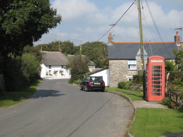
1267:== {{int:filedesc}} == {{Information |description={{en|1=Berepper village}} |date=2008-09-26 |source=From |author= |permission= |other_versions=
639:"}},"text\/plain":{"en":{"P275":"Creative Commons Attribution-ShareAlike 2.0 Generic"}}}}": -->
1059:
768:
662:
618:
288:
238:
818:
323:
1377:
This file contains additional information, probably added from the digital camera or scanner used to create or digitize it.
413:
545:
1299:
1178:
1133:
1088:
1025:
979:
946:
919:
878:
851:
796:
752:
602:
568:
553:
538:
1052:
811:
781:
686:
646:
511:
470:
745:"}},"text\/plain":{"en":{"P137":"Geograph Britain and Ireland"}}}}": -->
1249:
1244:
42:
369:
1380:
If the file has been modified from its original state, some details may not fully reflect the modified file.
412:– If you remix, transform, or build upon the material, you must distribute your contributions under the
330:
on the
Geograph website for the photographer's contact details. The copyright on this image is owned by
1081:"}},"text\/plain":{"en":{"P3575":"80,718 byte"}}}}": -->
595:"}},"text\/plain":{"en":{"P6216":"copyrighted"}}}}": -->
1277:
The following pages on the
English Knowledge use this file (pages on other projects are not listed):
1171:"}},"text\/plain":{"en":{"P2049":"640 pixel"}}}}": -->
1126:"}},"text\/plain":{"en":{"P2048":"480 pixel"}}}}": -->
912:"}},"text\/plain":{"en":{"P7787":"22 degree"}}}}": -->
844:"}},"text\/plain":{"en":{"P7787":"22 degree"}}}}": -->
91:
183:
1018:"}},"text\/plain":{"en":{"P459":"SHA-1"}}}}": -->
560:
803:
788:
366:
167:
8:
310:
294:
244:
335:
78:
460:
1309:
156:
146:
1188:
1143:
1098:
1035:
989:
929:
861:
762:
696:
656:
612:
521:
315:
327:
1281:
1217:
Click on a date/time to view the file as it appeared at that time.
280:
230:
1344:
1339:
265:
50° 03′ 35″ N, 5° 16′ 29″ W
215:
50° 03′ 34″ N, 5° 16′ 30″ W
135:
66:
454:
Add a one-line explanation of what this file represents
1364:
1354:
1329:
1319:
1275:
1290:
1215:
90:
Commons is a freely licensed media file repository.
663:
Creative
Commons Attribution-ShareAlike 2.0 Generic
637:
Creative
Commons Attribution-ShareAlike 2.0 Generic
56:(640 × 480 pixels, file size: 79 KB, MIME type:
116:Berepper village - geograph.org.uk - 980531.jpg
52:Berepper_village_-_geograph.org.uk_-_980531.jpg
423:https://creativecommons.org/licenses/by-sa/2.0
71:
498:https:\/\/www.geograph.org.uk\/profile\/22976
429:Creative Commons Attribution-Share Alike 2.0
347:
131:
113:
727:https:\/\/www.geograph.org.uk\/photo\/980531
152:
141:
14:
1168:
1123:
1078:
909:
841:
389:– to copy, distribute and transmit the work
1292:The following other wikis use this file:
561:https://www.geograph.org.uk/profile/22976
1041:e0b8261f91158861c536df8d3be2559100246ef6
789:https://www.geograph.org.uk/photo/980531
287:View this and other nearby images on:
237:View this and other nearby images on:
190:
102:
334:and is licensed for reuse under the
255:
205:
1208:
370:Attribution-Share Alike 2.0 Generic
358:
353:
338:Attribution-ShareAlike 2.0 license.
13:
1375:
459:
453:
344:
321:
120:
103:
49:
1401:
1382:
458:
1276:
852:coordinates of the point of view
834:coordinates of the point of view
444:
400:Under the following conditions:
365:This file is licensed under the
357:
352:
346:
314:
293:
279:
271:
243:
229:
221:
70:
31:
21:
441:
121:
46:No higher resolution available.
1287:
1212:
769:file available on the internet
719:file available on the internet
440:
322:This image was taken from the
26:
1:
920:coordinates of depicted place
902:coordinates of depicted place
36:
1272:
819:Geograph Britain and Ireland
743:Geograph Britain and Ireland
539:object of statement has role
486:object of statement has role
466:Items portrayed in this file
306:
7:
1372:
1306:Usage on arz.wikipedia.org
270:
220:
10:
1406:
1361:Usage on www.wikidata.org
1351:Usage on pl.wikipedia.org
1336:Usage on kw.wikipedia.org
1326:Usage on eu.wikipedia.org
1316:Usage on cy.wikipedia.org
1296:Usage on ar.wikipedia.org
935:50°3'34.78"N, 5°16'29.28"W
867:50°3'33.77"N, 5°16'30.36"W
414:same or compatible license
110:
105:
1209:
16:
797:geograph.org.uk image ID
731:geograph.org.uk image ID
443:
380:
77:This is a file from the
41:
1266:
1245:23:13, 22 February 2011
196:Rod Allday /
177:Rod Allday /
168:required by the license
134:
81:. Information from its
328:this photograph's page
299:50.059660; -5.274800
249:50.059380; -5.275100
84:description page there
1053:determination method
1012:determination method
395:– to adapt the work
1345:Knowledge:Kernow/B
569:author name string
502:author name string
1393:
1392:
1288:Global file usage
1270:
1170:
1125:
1080:
911:
843:
702:26 September 2008
647:copyright license
633:copyright license
452:
343:
342:
326:collection. See
304:
303:
254:
253:
203:
202:
171:
136:26 September 2008
99:
98:
79:Wikimedia Commons
32:Global file usage
1397:
1383:
1340:Knowledge:Kernow
1257:
1219:
1197:
1152:
1107:
1062:
1057:
957:
956:
951:
889:
888:
883:
821:
816:
806:
801:
791:
786:
782:described at URL
723:described at URL
603:copyright status
589:copyright status
576:
573:
563:
558:
548:
543:
450:
436:
433:
430:
427:
424:
416:as the original.
378:
367:Creative Commons
361:
360:
356:
355:
350:
349:
336:Creative Commons
324:Geograph project
318:
311:
300:
297:
283:
282:
276:
275:
274:
268:
267:
256:
250:
247:
233:
232:
226:
225:
224:
218:
217:
206:
198:Berepper village
179:Berepper village
165:
137:
126:Berepper village
125:
117:
111:
95:
74:
73:
67:
61:
59:
1405:
1404:
1400:
1399:
1398:
1396:
1395:
1394:
1371:
1300:برببر (كورنوال)
1286:
1278:
1271:
1263:
1255:
1211:
1210:
1207:
1206:
1205:
1204:
1203:
1202:
1201:
1200:
1198:
1195:
1185:
1184:
1183:
1181:
1162:
1161:
1160:
1159:
1158:
1157:
1156:
1155:
1153:
1150:
1140:
1139:
1138:
1136:
1117:
1116:
1115:
1114:
1113:
1112:
1111:
1110:
1108:
1105:
1095:
1094:
1093:
1091:
1072:
1071:
1070:
1069:
1068:
1067:
1066:
1065:
1064:
1063:
1058:
1055:
1046:
1045:
1044:
1042:
1032:
1031:
1030:
1028:
1005:
1004:
1003:
1002:
1001:
1000:
999:
998:
996:
986:
985:
984:
982:
967:
966:
965:
964:
963:
962:
961:
960:
959:
958:
954:
952:
949:
940:
939:
938:
936:
926:
925:
924:
922:
899:
898:
897:
896:
895:
894:
893:
892:
891:
890:
886:
884:
881:
872:
871:
870:
868:
858:
857:
856:
854:
831:
830:
829:
828:
827:
826:
825:
824:
823:
822:
817:
814:
808:
807:
802:
799:
793:
792:
787:
784:
775:
774:
773:
771:
759:
758:
757:
755:
712:
711:
710:
709:
708:
707:
706:
705:
703:
693:
692:
691:
689:
674:
673:
672:
671:
670:
669:
668:
667:
665:
653:
652:
651:
649:
630:
629:
628:
627:
626:
625:
624:
623:
621:
609:
608:
607:
605:
586:
585:
584:
583:
582:
581:
580:
579:
578:
577:
574:
571:
565:
564:
559:
556:
550:
549:
544:
541:
532:
531:
530:
528:
518:
517:
516:
514:
479:
478:
477:
476:
475:
473:
457:
456:
455:
438:
437:
434:
431:
428:
425:
422:
421:
379:
376:
373:
362:
339:
309:
298:
272:
263:
262:
259:Object location
248:
222:
213:
212:
209:Camera location
204:
193:
186:
174:
147:geograph.org.uk
127:
115:
108:
101:
100:
89:
88:
87:is shown below.
63:
57:
55:
48:
47:
12:
11:
5:
1403:
1391:
1390:
1387:
1374:
1370:
1369:
1368:
1367:
1359:
1358:
1357:
1349:
1348:
1347:
1342:
1334:
1333:
1332:
1324:
1323:
1322:
1314:
1313:
1312:
1304:
1303:
1302:
1289:
1285:
1284:
1274:
1269:
1268:
1265:
1261:
1258:
1252:
1247:
1242:
1238:
1237:
1234:
1231:
1228:
1225:
1222:
1214:
1199:
1193:
1191:
1190:
1189:
1187:
1186:
1182:
1177:
1175:
1174:
1173:
1172:
1166:
1154:
1148:
1146:
1145:
1144:
1142:
1141:
1137:
1132:
1130:
1129:
1128:
1127:
1121:
1109:
1103:
1101:
1100:
1099:
1097:
1096:
1092:
1087:
1085:
1084:
1083:
1082:
1076:
1051:
1050:
1049:
1048:
1047:
1043:
1040:
1038:
1037:
1036:
1034:
1033:
1029:
1024:
1022:
1021:
1020:
1019:
1017:
1013:
1009:
997:
994:
992:
991:
990:
988:
987:
983:
978:
976:
975:
974:
973:
971:
945:
944:
943:
942:
941:
937:
934:
932:
931:
930:
928:
927:
923:
918:
916:
915:
914:
913:
907:
903:
877:
876:
875:
874:
873:
869:
866:
864:
863:
862:
860:
859:
855:
850:
848:
847:
846:
845:
839:
835:
810:
809:
795:
794:
780:
779:
778:
777:
776:
772:
767:
765:
764:
763:
761:
760:
756:
753:source of file
751:
749:
748:
747:
746:
744:
740:
736:
732:
728:
724:
720:
716:
715:source of file
704:
701:
699:
698:
697:
695:
694:
690:
685:
683:
682:
681:
680:
678:
666:
661:
659:
658:
657:
655:
654:
650:
645:
643:
642:
641:
640:
638:
634:
622:
617:
615:
614:
613:
611:
610:
606:
601:
599:
598:
597:
596:
594:
590:
567:
566:
552:
551:
537:
536:
535:
534:
533:
529:
526:
524:
523:
522:
520:
519:
515:
510:
508:
507:
506:
505:
503:
499:
495:
491:
487:
483:
474:
469:
467:
464:
463:
462:
461:
449:
448:
445:
442:
420:
419:
418:
417:
407:
398:
397:
396:
390:
383:You are free:
374:
364:
363:
345:
341:
340:
319:
308:
305:
302:
301:
291:
285:
260:
252:
251:
241:
235:
210:
201:
200:
194:
191:
188:
187:
182:
175:
172:
160:
159:
154:
150:
149:
143:
139:
138:
133:
129:
128:
118:
109:
107:
104:
97:
96:
75:
65:
64:
45:
40:
39:
34:
29:
24:
19:
9:
6:
4:
3:
2:
1402:
1388:
1385:
1384:
1381:
1378:
1366:
1363:
1362:
1360:
1356:
1353:
1352:
1350:
1346:
1343:
1341:
1338:
1337:
1335:
1331:
1328:
1327:
1325:
1321:
1318:
1317:
1315:
1311:
1308:
1307:
1305:
1301:
1298:
1297:
1295:
1294:
1293:
1283:
1280:
1279:
1264:
1259:
1253:
1251:
1248:
1246:
1243:
1240:
1239:
1235:
1232:
1229:
1226:
1223:
1221:
1220:
1218:
1192:
1180:
1176:
1147:
1135:
1131:
1102:
1090:
1086:
1061:
1054:
1039:
1027:
1023:
993:
981:
977:
948:
933:
921:
917:
880:
865:
853:
849:
820:
813:
805:
798:
790:
783:
770:
766:
754:
750:
700:
688:
684:
664:
660:
648:
644:
620:
616:
604:
600:
570:
562:
555:
547:
540:
525:
513:
509:
472:
468:
465:
446:
439:
426:CC BY-SA 2.0
415:
411:
408:
405:
402:
401:
399:
394:
391:
388:
385:
384:
382:
381:
375:Attribution:
371:
368:
351:
337:
333:
329:
325:
320:
317:
313:
312:
296:
292:
290:
289:OpenStreetMap
286:
284:
266:
261:
258:
257:
246:
242:
240:
239:OpenStreetMap
236:
234:
216:
211:
208:
207:
199:
195:
189:
185:
181: /
180:
176:
169:
164:
162:
161:
158:
155:
151:
148:
144:
140:
130:
124:
119:
112:
93:
86:
85:
80:
76:
69:
68:
62:
53:
44:
38:
35:
33:
30:
28:
25:
23:
20:
18:
15:
1379:
1376:
1291:
1216:
1213:File history
546:photographer
490:photographer
409:
403:
392:
386:
331:
269:
219:
197:
184:CC BY-SA 2.0
178:
122:
92:You can help
82:
50:
22:File history
1262:GeographBot
619:copyrighted
593:copyrighted
410:share alike
404:attribution
163:Attribution
114:Description
1386:_error
1273:File usage
1254:640 × 480
1230:Dimensions
995:image/jpeg
980:media type
970:media type
575:Rod Allday
527:some value
377:Rod Allday
332:Rod Allday
157:Rod Allday
58:image/jpeg
27:File usage
1227:Thumbnail
1224:Date/Time
1089:data size
1075:data size
687:inception
677:inception
307:Licensing
192:InfoField
173:InfoField
123:English:
1373:Metadata
1365:Q4891289
1355:Berepper
1330:Berepper
1320:Berepper
1282:Berepper
1026:checksum
1008:checksum
812:operator
739:operator
447:Captions
393:to remix
387:to share
372:license.
37:Metadata
1256:(79 KB)
1241:current
1236:Comment
1104:80,718
947:heading
906:heading
879:heading
838:heading
512:creator
482:creator
471:depicts
451:English
106:Summary
54:
1134:height
1120:height
955:degree
910:degree
887:degree
842:degree
804:980531
735:980531
277:
227:
153:Author
142:Source
1310:برببر
1196:pixel
1179:width
1169:pixel
1165:width
1151:pixel
1124:pixel
1060:SHA-1
1016:SHA-1
145:From
1233:User
1194:640
1149:480
1106:byte
1079:byte
435:true
432:true
132:Date
17:File
953:22
885:22
554:URL
494:URL
1056::
950::
882::
815::
800::
785::
572::
557::
542::
1389:0
170:)
166:(
94:.
60:)
Text is available under the Creative Commons Attribution-ShareAlike License. Additional terms may apply.
_heading:22.00&language=en)
_heading:22.00&language=en)
