851:"}},"text\/plain":{"en":{"":"coordinates of the point of view"}}},"{\"value\":{\"latitude\":53.32652,\"longitude\":-0.1714,\"altitude\":null,\"precision\":1.0e-5,\"globe\":\"http:\\\/\\\/www.wikidata.org\\\/entity\\\/Q2\"},\"type\":\"globecoordinate\"}":{"text\/html":{"en":{"P1259":"53\u00b019'35.47"N, 0\u00b010'17.04"W"}},"text\/plain":{"en":{"P1259":"53\u00b019'35.47\"N, 0\u00b010'17.04\"W"}}},"{\"value\":{\"entity-type\":\"property\",\"numeric-id\":7787,\"id\":\"P7787\"},\"type\":\"wikibase-entityid\"}":{"text\/html":{"en":{"":"
919:"}},"text\/plain":{"en":{"":"coordinates of depicted place"}}},"{\"value\":{\"latitude\":53.33596,\"longitude\":-0.1719,\"altitude\":null,\"precision\":1.0e-5,\"globe\":\"http:\\\/\\\/www.wikidata.org\\\/entity\\\/Q2\"},\"type\":\"globecoordinate\"}":{"text\/html":{"en":{"P9149":"53\u00b020'9.46"N, 0\u00b010'18.84"W"}},"text\/plain":{"en":{"P9149":"53\u00b020'9.46\"N, 0\u00b010'18.84\"W"}}},"{\"value\":{\"entity-type\":\"property\",\"numeric-id\":7787,\"id\":\"P7787\"},\"type\":\"wikibase-entityid\"}":{"text\/html":{"en":{"":"
1025:"}},"text\/plain":{"en":{"":"checksum"}}},"{\"value\":\"63f38d1b73eac92017ab4ba125c354f5c48948a1\",\"type\":\"string\"}":{"text\/html":{"en":{"P4092":"63f38d1b73eac92017ab4ba125c354f5c48948a1"}},"text\/plain":{"en":{"P4092":"63f38d1b73eac92017ab4ba125c354f5c48948a1"}}},"{\"value\":{\"entity-type\":\"property\",\"numeric-id\":459,\"id\":\"P459\"},\"type\":\"wikibase-entityid\"}":{"text\/html":{"en":{"":"
503:"}},"text\/plain":{"en":{"":"author name string"}}},"{\"value\":\"Richard Croft\",\"type\":\"string\"}":{"text\/html":{"en":{"P2093":"Richard Croft"}},"text\/plain":{"en":{"P2093":"Richard Croft"}}},"{\"value\":{\"entity-type\":\"property\",\"numeric-id\":2699,\"id\":\"P2699\"},\"type\":\"wikibase-entityid\"}":{"text\/html":{"en":{"":"
813:"}},"text\/plain":{"en":{"":"inception"}}},"{\"value\":{\"time\":\"+2007-11-23T00:00:00Z\",\"timezone\":0,\"before\":0,\"after\":0,\"precision\":11,\"calendarmodel\":\"http:\\\/\\\/www.wikidata.org\\\/entity\\\/Q1985727\"},\"type\":\"time\"}":{"text\/html":{"en":{"P571":"23 November 2007"}},"text\/plain":{"en":{"P571":"23 November 2007"}}}}": -->
690:
296:
246:
1021:
238:
310:
260:
331:
369:
374:
87:
1354:
43:
511:"}},"text\/plain":{"en":{"P2699":"https:\/\/www.geograph.org.uk\/profile\/1904"}}},"{\"value\":{\"entity-type\":\"property\",\"numeric-id\":3831,\"id\":\"P3831\"},\"type\":\"wikibase-entityid\"}":{"text\/html":{"en":{"":"
698:"}},"text\/plain":{"en":{"P7482":"file available on the internet"}}},"{\"value\":{\"entity-type\":\"property\",\"numeric-id\":7384,\"id\":\"P7384\"},\"type\":\"wikibase-entityid\"}":{"text\/html":{"en":{"":"
515:"}},"text\/plain":{"en":{"":"object of statement has role"}}},"{\"value\":{\"entity-type\":\"item\",\"numeric-id\":33231,\"id\":\"Q33231\"},\"type\":\"wikibase-entityid\"}":{"text\/html":{"en":{"P3831":"
714:"}},"text\/plain":{"en":{"P137":"Geograph Britain and Ireland"}}},"{\"value\":{\"entity-type\":\"property\",\"numeric-id\":973,\"id\":\"P973\"},\"type\":\"wikibase-entityid\"}":{"text\/html":{"en":{"":"
1029:"}},"text\/plain":{"en":{"":"determination method"}}},"{\"value\":{\"entity-type\":\"item\",\"numeric-id\":13414952,\"id\":\"Q13414952\"},\"type\":\"wikibase-entityid\"}":{"text\/html":{"en":{"P459":"
987:"}},"text\/plain":{"en":{"":"media type"}}},"{\"value\":\"image\\\/jpeg\",\"type\":\"string\"}":{"text\/html":{"en":{"P1163":"image\/jpeg"}},"text\/plain":{"en":{"P1163":"image\/jpeg"}}}}": -->
650:"}},"text\/plain":{"en":{"":"copyright license"}}},"{\"value\":{\"entity-type\":\"item\",\"numeric-id\":19068220,\"id\":\"Q19068220\"},\"type\":\"wikibase-entityid\"}":{"text\/html":{"en":{"P275":"
606:"}},"text\/plain":{"en":{"":"copyright status"}}},"{\"value\":{\"entity-type\":\"item\",\"numeric-id\":50423863,\"id\":\"Q50423863\"},\"type\":\"wikibase-entityid\"}":{"text\/html":{"en":{"P6216":"
694:"}},"text\/plain":{"en":{"":"source of file"}}},"{\"value\":{\"entity-type\":\"item\",\"numeric-id\":74228490,\"id\":\"Q74228490\"},\"type\":\"wikibase-entityid\"}":{"text\/html":{"en":{"P7482":"
1092:"}},"text\/plain":{"en":{"":"data size"}}},"{\"value\":{\"amount\":\"+24319\",\"unit\":\"http:\\\/\\\/www.wikidata.org\\\/entity\\\/Q8799\"},\"type\":\"quantity\"}":{"text\/html":{"en":{"P3575":"24,319
1137:"}},"text\/plain":{"en":{"":"height"}}},"{\"value\":{\"amount\":\"+640\",\"unit\":\"http:\\\/\\\/www.wikidata.org\\\/entity\\\/Q355198\"},\"type\":\"quantity\"}":{"text\/html":{"en":{"P2048":"640
710:"}},"text\/plain":{"en":{"":"operator"}}},"{\"value\":{\"entity-type\":\"item\",\"numeric-id\":1503119,\"id\":\"Q1503119\"},\"type\":\"wikibase-entityid\"}":{"text\/html":{"en":{"P137":"
1182:"}},"text\/plain":{"en":{"":"width"}}},"{\"value\":{\"amount\":\"+427\",\"unit\":\"http:\\\/\\\/www.wikidata.org\\\/entity\\\/Q355198\"},\"type\":\"quantity\"}":{"text\/html":{"en":{"P2049":"427
923:"}},"text\/plain":{"en":{"":"heading"}}},"{\"value\":{\"amount\":\"+0\",\"unit\":\"http:\\\/\\\/www.wikidata.org\\\/entity\\\/Q28390\"},\"type\":\"quantity\"}":{"text\/html":{"en":{"P7787":"0
855:"}},"text\/plain":{"en":{"":"heading"}}},"{\"value\":{\"amount\":\"+0\",\"unit\":\"http:\\\/\\\/www.wikidata.org\\\/entity\\\/Q28390\"},\"type\":\"quantity\"}":{"text\/html":{"en":{"P7787":"0
706:"}},"text\/plain":{"en":{"P7384":"619487"}}},"{\"value\":{\"entity-type\":\"property\",\"numeric-id\":137,\"id\":\"P137\"},\"type\":\"wikibase-entityid\"}":{"text\/html":{"en":{"":"
499:"}},"text\/plain":{"en":{"":"creator"}}},"{\"value\":{\"entity-type\":\"property\",\"numeric-id\":2093,\"id\":\"P2093\"},\"type\":\"wikibase-entityid\"}":{"text\/html":{"en":{"":"
1178:
718:"}},"text\/plain":{"en":{"":"described at URL"}}},"{\"value\":\"https:\\\/\\\/www.geograph.org.uk\\\/photo\\\/619487\",\"type\":\"string\"}":{"text\/html":{"en":{"P973":"
507:"}},"text\/plain":{"en":{"":"URL"}}},"{\"value\":\"https:\\\/\\\/www.geograph.org.uk\\\/profile\\\/1904\",\"type\":\"string\"}":{"text\/html":{"en":{"P2699":"
702:"}},"text\/plain":{"en":{"":"geograph.org.uk image ID"}}},"{\"value\":\"619487\",\"type\":\"string\"}":{"text\/html":{"en":{"P7384":"
279:
229:
421:– You must give appropriate credit, provide a link to the license, and indicate if changes were made. You may do so in any reasonable manner, but not in any way that suggests the licensor endorses you or your use.
293:
243:
1282:== {{int:filedesc}} == {{Information |description={{en|1=Belmont Belmont transmitter seen from near Benniworth}} |date=2007-11-23 |source=From |author=[http://www.geograph.org.uk/profile/1904 Richa
1030:
703:
695:
651:
607:
711:
516:
1179:
1134:
1089:
1022:
984:
920:
916:
852:
848:
699:
691:
603:
512:
504:
500:
1026:
810:
719:
715:
707:
647:
508:
496:
53:
47:
98:
1275:
66:
1301:
654:"}},"text\/plain":{"en":{"P275":"Creative Commons Attribution-ShareAlike 2.0 Generic"}}}}": -->
722:"}},"text\/plain":{"en":{"P973":"https:\/\/www.geograph.org.uk\/photo\/619487"}}}}": -->
1074:
745:
677:
633:
303:
253:
780:
338:
1377:
This file contains additional information, probably added from the digital camera or scanner used to create or digitize it.
428:
588:
1193:
1148:
1103:
1040:
994:
961:
934:
893:
866:
758:
729:
617:
581:
566:
553:
1067:
820:
788:
773:
661:
526:
485:
384:
1380:
If the file has been modified from its original state, some details may not fully reflect the modified file.
1296:
1264:
1259:
427:– If you remix, transform, or build upon the material, you must distribute your contributions under the
345:
on the
Geograph website for the photographer's contact details. The copyright on this image is owned by
57:
42:
519:"}},"text\/plain":{"en":{"P3831":"photographer"}}}}": -->
1096:"}},"text\/plain":{"en":{"P3575":"24,319 byte"}}}}": -->
610:"}},"text\/plain":{"en":{"P6216":"copyrighted"}}}}": -->
1292:
The following pages on the
English Knowledge use this file (pages on other projects are not listed):
1186:"}},"text\/plain":{"en":{"P2049":"427 pixel"}}}}": -->
1141:"}},"text\/plain":{"en":{"P2048":"640 pixel"}}}}": -->
927:"}},"text\/plain":{"en":{"P7787":"0 degree"}}}}": -->
859:"}},"text\/plain":{"en":{"P7787":"0 degree"}}}}": -->
106:
198:
1033:"}},"text\/plain":{"en":{"P459":"SHA-1"}}}}": -->
795:
765:
573:
381:
182:
8:
325:
309:
259:
350:
93:
1344:
475:
171:
161:
1203:
1158:
1113:
1050:
1004:
944:
876:
830:
739:
671:
627:
536:
330:
1329:
342:
1232:
Click on a date/time to view the file as it appeared at that time.
1355:Участник:Анатолич1/Список самых высоких сооружений Великобритании
295:
245:
1339:
1319:
280:
53° 20′ 09″ N, 0° 10′ 19″ W
230:
53° 19′ 35″ N, 0° 10′ 17″ W
150:
81:
469:
Add a one-line explanation of what this file represents
1364:
1290:
141:
Belmont
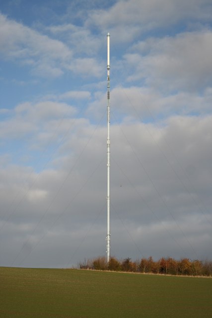
Belmont transmitter seen from near Benniworth
1310:
1230:
105:
Commons is a freely licensed media file repository.
678:
Creative
Commons Attribution-ShareAlike 2.0 Generic
652:
Creative
Commons Attribution-ShareAlike 2.0 Generic
1302:List of tallest structures in the United Kingdom
71:(427 × 640 pixels, file size: 24 KB, MIME type:
438:https://creativecommons.org/licenses/by-sa/2.0
86:
444:Creative Commons Attribution-Share Alike 2.0
362:
146:
128:
720:https:\/\/www.geograph.org.uk\/photo\/619487
509:https:\/\/www.geograph.org.uk\/profile\/1904
167:
156:
14:
1183:
1138:
1093:
924:
856:
404:– to copy, distribute and transmit the work
1312:The following other wikis use this file:
1056:63f38d1b73eac92017ab4ba125c354f5c48948a1
796:https://www.geograph.org.uk/photo/619487
574:https://www.geograph.org.uk/profile/1904
1345:Lijst van hoogste zendmasten ter wereld
302:View this and other nearby images on:
252:View this and other nearby images on:
131:Belmont - geograph.org.uk - 619487.jpg
205:
117:
349:and is licensed for reuse under the
270:
220:
1223:
385:Attribution-Share Alike 2.0 Generic
373:
368:
353:Attribution-ShareAlike 2.0 license.
13:
1375:
474:
468:
359:
336:
135:
118:
64:
1401:
1382:
473:
1291:
867:coordinates of the point of view
849:coordinates of the point of view
459:
415:Under the following conditions:
380:This file is licensed under the
372:
367:
361:
329:
308:
294:
286:
258:
244:
236:
85:
31:
21:
456:
136:
1307:
1227:
746:file available on the internet
696:file available on the internet
455:
337:This image was taken from the
26:
1:
935:coordinates of depicted place
917:coordinates of depicted place
36:
1297:Belmont transmitting station
1287:
781:Geograph Britain and Ireland
712:Geograph Britain and Ireland
582:object of statement has role
513:object of statement has role
481:Items portrayed in this file
321:
7:
1372:
882:53°19'35.47"N, 0°10'17.04"W
10:
1406:
1361:Usage on www.wikidata.org
1351:Usage on ru.wikipedia.org
1336:Usage on nl.wikipedia.org
1326:Usage on fr.wikipedia.org
1316:Usage on de.wikipedia.org
950:53°20'9.46"N, 0°10'18.84"W
429:same or compatible license
285:
235:
211:Richard Croft /
192:Richard Croft /
125:
120:
1224:
16:
759:geograph.org.uk image ID
700:geograph.org.uk image ID
458:
395:
92:This is a file from the
41:
1281:
183:required by the license
149:
96:. Information from its
1260:01:58, 7 February 2011
343:this photograph's page
314:53.335960; -0.171900
264:53.326520; -0.171400
99:description page there
46:Size of this preview:
1068:determination method
1027:determination method
1330:Émetteur de Belmont
410:– to adapt the work
52:Other resolutions:
554:author name string
501:author name string
1393:
1392:
1308:Global file usage
1285:
1185:
1140:
1095:
926:
858:
662:copyright license
648:copyright license
467:
358:
357:
341:collection. See
319:
318:
269:
268:
218:
217:
186:
114:
113:
94:Wikimedia Commons
32:Global file usage
1397:
1383:
1272:
1234:
1212:
1167:
1122:
1077:
1072:
972:
971:
966:
904:
903:
898:
836:23 November 2007
798:
793:
789:described at URL
783:
778:
768:
763:
716:described at URL
618:copyright status
604:copyright status
591:
586:
576:
571:
561:
558:
465:
451:
448:
445:
442:
439:
431:as the original.
393:
382:Creative Commons
376:
375:
371:
370:
365:
364:
351:Creative Commons
339:Geograph project
333:
326:
315:
312:
298:
297:
291:
290:
289:
283:
282:
271:
265:
262:
248:
247:
241:
240:
239:
233:
232:
221:
180:
152:
151:23 November 2007
140:
132:
126:
110:
89:
88:
82:
76:
74:
61:
58:427 × 640 pixels
54:160 × 240 pixels
48:400 × 600 pixels
1405:
1404:
1400:
1399:
1398:
1396:
1395:
1394:
1371:
1306:
1293:
1286:
1278:
1270:
1226:
1225:
1222:
1221:
1220:
1219:
1218:
1217:
1216:
1215:
1213:
1210:
1200:
1199:
1198:
1196:
1177:
1176:
1175:
1174:
1173:
1172:
1171:
1170:
1168:
1165:
1155:
1154:
1153:
1151:
1132:
1131:
1130:
1129:
1128:
1127:
1126:
1125:
1123:
1120:
1110:
1109:
1108:
1106:
1087:
1086:
1085:
1084:
1083:
1082:
1081:
1080:
1079:
1078:
1073:
1070:
1061:
1060:
1059:
1057:
1047:
1046:
1045:
1043:
1020:
1019:
1018:
1017:
1016:
1015:
1014:
1013:
1011:
1001:
1000:
999:
997:
982:
981:
980:
979:
978:
977:
976:
975:
974:
973:
969:
967:
964:
955:
954:
953:
951:
941:
940:
939:
937:
914:
913:
912:
911:
910:
909:
908:
907:
906:
905:
901:
899:
896:
887:
886:
885:
883:
873:
872:
871:
869:
846:
845:
844:
843:
842:
841:
840:
839:
837:
827:
826:
825:
823:
808:
807:
806:
805:
804:
803:
802:
801:
800:
799:
794:
791:
785:
784:
779:
776:
770:
769:
764:
761:
752:
751:
750:
748:
736:
735:
734:
732:
689:
688:
687:
686:
685:
684:
683:
682:
680:
668:
667:
666:
664:
645:
644:
643:
642:
641:
640:
639:
638:
636:
624:
623:
622:
620:
601:
600:
599:
598:
597:
596:
595:
594:
593:
592:
587:
584:
578:
577:
572:
569:
563:
562:
559:
556:
547:
546:
545:
543:
533:
532:
531:
529:
494:
493:
492:
491:
490:
488:
472:
471:
470:
453:
452:
449:
446:
443:
440:
437:
436:
394:
391:
388:
377:
354:
324:
313:
287:
278:
277:
274:Object location
263:
237:
228:
227:
224:Camera location
219:
208:
201:
189:
162:geograph.org.uk
142:
130:
123:
116:
115:
104:
103:
102:is shown below.
78:
72:
70:
63:
62:
51:
12:
11:
5:
1403:
1391:
1390:
1387:
1374:
1370:
1369:
1368:
1367:
1359:
1358:
1357:
1349:
1348:
1347:
1342:
1340:Zender Belmont
1334:
1333:
1332:
1324:
1323:
1322:
1320:Sender Belmont
1309:
1305:
1304:
1299:
1289:
1284:
1283:
1280:
1276:
1273:
1267:
1262:
1257:
1253:
1252:
1249:
1246:
1243:
1240:
1237:
1229:
1214:
1208:
1206:
1205:
1204:
1202:
1201:
1197:
1192:
1190:
1189:
1188:
1187:
1181:
1169:
1163:
1161:
1160:
1159:
1157:
1156:
1152:
1147:
1145:
1144:
1143:
1142:
1136:
1124:
1118:
1116:
1115:
1114:
1112:
1111:
1107:
1102:
1100:
1099:
1098:
1097:
1091:
1066:
1065:
1064:
1063:
1062:
1058:
1055:
1053:
1052:
1051:
1049:
1048:
1044:
1039:
1037:
1036:
1035:
1034:
1032:
1028:
1024:
1012:
1009:
1007:
1006:
1005:
1003:
1002:
998:
993:
991:
990:
989:
988:
986:
960:
959:
958:
957:
956:
952:
949:
947:
946:
945:
943:
942:
938:
933:
931:
930:
929:
928:
922:
918:
892:
891:
890:
889:
888:
884:
881:
879:
878:
877:
875:
874:
870:
865:
863:
862:
861:
860:
854:
850:
838:
835:
833:
832:
831:
829:
828:
824:
819:
817:
816:
815:
814:
812:
787:
786:
772:
771:
757:
756:
755:
754:
753:
749:
744:
742:
741:
740:
738:
737:
733:
730:source of file
728:
726:
725:
724:
723:
721:
717:
713:
709:
705:
701:
697:
693:
692:source of file
681:
676:
674:
673:
672:
670:
669:
665:
660:
658:
657:
656:
655:
653:
649:
637:
632:
630:
629:
628:
626:
625:
621:
616:
614:
613:
612:
611:
609:
605:
580:
579:
565:
564:
552:
551:
550:
549:
548:
544:
541:
539:
538:
537:
535:
534:
530:
525:
523:
522:
521:
520:
518:
514:
510:
506:
502:
498:
489:
484:
482:
479:
478:
477:
476:
464:
463:
460:
457:
435:
434:
433:
432:
422:
413:
412:
411:
405:
398:You are free:
389:
379:
378:
360:
356:
355:
334:
323:
320:
317:
316:
306:
300:
275:
267:
266:
256:
250:
225:
216:
215:
209:
206:
203:
202:
197:
190:
187:
175:
174:
169:
165:
164:
158:
154:
153:
148:
144:
143:
133:
124:
122:
119:
112:
111:
90:
80:
79:
45:
40:
39:
34:
29:
24:
19:
9:
6:
4:
3:
2:
1402:
1388:
1385:
1384:
1381:
1378:
1366:
1363:
1362:
1360:
1356:
1353:
1352:
1350:
1346:
1343:
1341:
1338:
1337:
1335:
1331:
1328:
1327:
1325:
1321:
1318:
1317:
1315:
1314:
1313:
1303:
1300:
1298:
1295:
1294:
1279:
1274:
1268:
1266:
1263:
1261:
1258:
1255:
1254:
1250:
1247:
1244:
1241:
1238:
1236:
1235:
1233:
1207:
1195:
1191:
1162:
1150:
1146:
1117:
1105:
1101:
1076:
1069:
1054:
1042:
1038:
1008:
996:
992:
963:
948:
936:
932:
895:
880:
868:
864:
834:
822:
818:
797:
790:
782:
775:
767:
760:
747:
743:
731:
727:
679:
675:
663:
659:
635:
631:
619:
615:
590:
583:
575:
568:
560:Richard Croft
555:
540:
528:
524:
487:
483:
480:
461:
454:
441:CC BY-SA 2.0
430:
426:
423:
420:
417:
416:
414:
409:
406:
403:
400:
399:
397:
396:
392:Richard Croft
390:Attribution:
386:
383:
366:
352:
348:
347:Richard Croft
344:
340:
335:
332:
328:
327:
311:
307:
305:
304:OpenStreetMap
301:
299:
281:
276:
273:
272:
261:
257:
255:
254:OpenStreetMap
251:
249:
231:
226:
223:
222:
214:
210:
204:
200:
196: /
195:
191:
184:
179:
177:
176:
173:
172:Richard Croft
170:
166:
163:
159:
155:
145:
139:
134:
127:
108:
101:
100:
95:
91:
84:
83:
77:
68:
67:Original file
59:
55:
49:
44:
38:
35:
33:
30:
28:
25:
23:
20:
18:
15:
1379:
1376:
1311:
1231:
1228:File history
589:photographer
517:photographer
424:
418:
407:
401:
346:
284:
234:
212:
199:CC BY-SA 2.0
193:
137:
107:You can help
97:
65:
22:File history
1277:GeographBot
634:copyrighted
608:copyrighted
425:share alike
419:attribution
178:Attribution
129:Description
1386:_error
1288:File usage
1269:427 × 640
1245:Dimensions
1010:image/jpeg
995:media type
985:media type
542:some value
73:image/jpeg
27:File usage
1242:Thumbnail
1239:Date/Time
1104:data size
1090:data size
821:inception
811:inception
322:Licensing
207:InfoField
188:InfoField
138:English:
1373:Metadata
1365:Q1755026
1041:checksum
1023:checksum
774:operator
708:operator
462:Captions
408:to remix
402:to share
387:license.
37:Metadata
1271:(24 KB)
1256:current
1251:Comment
1119:24,319
962:heading
921:heading
894:heading
853:heading
527:creator
497:creator
486:depicts
466:English
213:Belmont
194:Belmont
121:Summary
69:
1149:height
1135:height
970:degree
925:degree
902:degree
857:degree
766:619487
704:619487
292:
242:
168:Author
157:Source
1211:pixel
1194:width
1184:pixel
1180:width
1166:pixel
1139:pixel
1075:SHA-1
1031:SHA-1
160:From
1248:User
1209:427
1164:640
1121:byte
1094:byte
450:true
447:true
147:Date
17:File
567:URL
505:URL
1071::
968:0
965::
900:0
897::
792::
777::
762::
585::
570::
557::
56:|
50:.
1389:0
185:)
181:(
109:.
75:)
60:.
Text is available under the Creative Commons Attribution-ShareAlike License. Additional terms may apply.
_heading:0.00&language=en)
_heading:0.00&language=en)
