737:"}},"text\/plain":{"en":{"":"coordinates of the point of view"}}},"{\"value\":{\"latitude\":55.143047,\"longitude\":-2.262903,\"altitude\":null,\"precision\":1.0e-6,\"globe\":\"http:\\\/\\\/www.wikidata.org\\\/entity\\\/Q2\"},\"type\":\"globecoordinate\"}":{"text\/html":{"en":{"P1259":"55\u00b08'34.969"N, 2\u00b015'46.451"W"}},"text\/plain":{"en":{"P1259":"55\u00b08'34.969\"N, 2\u00b015'46.451\"W"}}},"{\"value\":{\"entity-type\":\"property\",\"numeric-id\":7787,\"id\":\"P7787\"},\"type\":\"wikibase-entityid\"}":{"text\/html":{"en":{"":"
43:
962:"}},"text\/plain":{"en":{"":"checksum"}}},"{\"value\":\"82c19168c8a38d0acdcfc654b5488f4ed708098f\",\"type\":\"string\"}":{"text\/html":{"en":{"P4092":"82c19168c8a38d0acdcfc654b5488f4ed708098f"}},"text\/plain":{"en":{"P4092":"82c19168c8a38d0acdcfc654b5488f4ed708098f"}}},"{\"value\":{\"entity-type\":\"property\",\"numeric-id\":459,\"id\":\"P459\"},\"type\":\"wikibase-entityid\"}":{"text\/html":{"en":{"":"
516:"}},"text\/plain":{"en":{"":"author name string"}}},"{\"value\":\"Les Hull\",\"type\":\"string\"}":{"text\/html":{"en":{"P2093":"Les Hull"}},"text\/plain":{"en":{"P2093":"Les Hull"}}},"{\"value\":{\"entity-type\":\"property\",\"numeric-id\":2699,\"id\":\"P2699\"},\"type\":\"wikibase-entityid\"}":{"text\/html":{"en":{"":"
699:"}},"text\/plain":{"en":{"":"inception"}}},"{\"value\":{\"time\":\"+2006-03-08T00:00:00Z\",\"timezone\":0,\"before\":0,\"after\":0,\"precision\":11,\"calendarmodel\":\"http:\\\/\\\/www.wikidata.org\\\/entity\\\/Q1985727\"},\"type\":\"time\"}":{"text\/html":{"en":{"P571":"8 March 2006"}},"text\/plain":{"en":{"P571":"8 March 2006"}}}}": -->
801:
274:
266:
958:
309:
347:
352:
99:
1232:
809:"}},"text\/plain":{"en":{"P7482":"file available on the internet"}}},"{\"value\":{\"entity-type\":\"property\",\"numeric-id\":137,\"id\":\"P137\"},\"type\":\"wikibase-entityid\"}":{"text\/html":{"en":{"":"
817:"}},"text\/plain":{"en":{"P137":"Geograph Britain and Ireland"}}},"{\"value\":{\"entity-type\":\"property\",\"numeric-id\":7384,\"id\":\"P7384\"},\"type\":\"wikibase-entityid\"}":{"text\/html":{"en":{"":"
1202:
508:"}},"text\/plain":{"en":{"":"object of statement has role"}}},"{\"value\":{\"entity-type\":\"item\",\"numeric-id\":33231,\"id\":\"Q33231\"},\"type\":\"wikibase-entityid\"}":{"text\/html":{"en":{"P3831":"
966:"}},"text\/plain":{"en":{"":"determination method"}}},"{\"value\":{\"entity-type\":\"item\",\"numeric-id\":13414952,\"id\":\"Q13414952\"},\"type\":\"wikibase-entityid\"}":{"text\/html":{"en":{"P459":"
924:"}},"text\/plain":{"en":{"":"media type"}}},"{\"value\":\"image\\\/jpeg\",\"type\":\"string\"}":{"text\/html":{"en":{"P1163":"image\/jpeg"}},"text\/plain":{"en":{"P1163":"image\/jpeg"}}}}": -->
655:"}},"text\/plain":{"en":{"":"copyright license"}}},"{\"value\":{\"entity-type\":\"item\",\"numeric-id\":19068220,\"id\":\"Q19068220\"},\"type\":\"wikibase-entityid\"}":{"text\/html":{"en":{"P275":"
611:"}},"text\/plain":{"en":{"":"copyright status"}}},"{\"value\":{\"entity-type\":\"item\",\"numeric-id\":50423863,\"id\":\"Q50423863\"},\"type\":\"wikibase-entityid\"}":{"text\/html":{"en":{"P6216":"
805:"}},"text\/plain":{"en":{"":"source of file"}}},"{\"value\":{\"entity-type\":\"item\",\"numeric-id\":74228490,\"id\":\"Q74228490\"},\"type\":\"wikibase-entityid\"}":{"text\/html":{"en":{"P7482":"
1029:"}},"text\/plain":{"en":{"":"data size"}}},"{\"value\":{\"amount\":\"+567267\",\"unit\":\"http:\\\/\\\/www.wikidata.org\\\/entity\\\/Q8799\"},\"type\":\"quantity\"}":{"text\/html":{"en":{"P3575":"567,267
1074:"}},"text\/plain":{"en":{"":"height"}}},"{\"value\":{\"amount\":\"+1064\",\"unit\":\"http:\\\/\\\/www.wikidata.org\\\/entity\\\/Q355198\"},\"type\":\"quantity\"}":{"text\/html":{"en":{"P2048":"1,064
512:"}},"text\/plain":{"en":{"P3831":"photographer"}}},"{\"value\":{\"entity-type\":\"property\",\"numeric-id\":2093,\"id\":\"P2093\"},\"type\":\"wikibase-entityid\"}":{"text\/html":{"en":{"":"
1119:"}},"text\/plain":{"en":{"":"width"}}},"{\"value\":{\"amount\":\"+2064\",\"unit\":\"http:\\\/\\\/www.wikidata.org\\\/entity\\\/Q355198\"},\"type\":\"quantity\"}":{"text\/html":{"en":{"P2049":"2,064
457:"}},"text\/plain":{"en":{"":"depicts"}}},"{\"value\":{\"entity-type\":\"item\",\"numeric-id\":26297055,\"id\":\"Q26297055\"},\"type\":\"wikibase-entityid\"}":{"text\/html":{"en":{"P180":"
813:"}},"text\/plain":{"en":{"":"operator"}}},"{\"value\":{\"entity-type\":\"item\",\"numeric-id\":1503119,\"id\":\"Q1503119\"},\"type\":\"wikibase-entityid\"}":{"text\/html":{"en":{"P137":"
741:"}},"text\/plain":{"en":{"":"heading"}}},"{\"value\":{\"amount\":\"+112\",\"unit\":\"http:\\\/\\\/www.wikidata.org\\\/entity\\\/Q28390\"},\"type\":\"quantity\"}":{"text\/html":{"en":{"P7787":"112
825:"}},"text\/plain":{"en":{"P7384":"1695705"}}},"{\"value\":{\"entity-type\":\"property\",\"numeric-id\":973,\"id\":\"P973\"},\"type\":\"wikibase-entityid\"}":{"text\/html":{"en":{"":"
504:"}},"text\/plain":{"en":{"":"creator"}}},"{\"value\":{\"entity-type\":\"property\",\"numeric-id\":3831,\"id\":\"P3831\"},\"type\":\"wikibase-entityid\"}":{"text\/html":{"en":{"":"
1115:
399:– You must give appropriate credit, provide a link to the license, and indicate if changes were made. You may do so in any reasonable manner, but not in any way that suggests the licensor endorses you or your use.
271:
65:
61:
57:
53:
47:
78:
110:
822:
967:
806:
656:
612:
458:
814:
509:
1212:
1116:
1071:
1026:
959:
921:
818:
802:
738:
734:
608:
517:
513:
505:
830:
963:
826:
810:
696:
652:
521:
501:
454:
1281:
1321:
1231:
1226:
1249:== {{int:filedesc}} == {{Information |Description={{en|1=Bellingham Bridge}} |Source=From |Date=2006-03-08 |Author= |Permission=Creative Commons A
659:"}},"text\/plain":{"en":{"P275":"Creative Commons Attribution-ShareAlike 2.0 Generic"}}}}": -->
194:
833:"}},"text\/plain":{"en":{"P973":"https:\/\/www.geograph.org.uk\/photo\/1695705"}}}}": -->
524:"}},"text\/plain":{"en":{"P2699":"https:\/\/www.geograph.org.uk\/profile\/3612"}}}}": -->
1391:
1201:
1196:
1011:
856:
682:
638:
487:
281:
69:
42:
876:
316:
1404:
This file contains additional information, probably added from the digital camera or scanner used to create or digitize it.
406:
565:
1130:
1085:
1040:
977:
931:
884:
840:
779:
752:
622:
586:
573:
558:
1004:
899:
869:
706:
666:
531:
471:
362:
1407:
If the file has been modified from its original state, some details may not fully reflect the modified file.
461:"}},"text\/plain":{"en":{"P180":"Bellingham Bridge"}}}}": -->
405:– If you remix, transform, or build upon the material, you must distribute your contributions under the
323:
on the
Geograph website for the photographer's contact details. The copyright on this image is owned by
1263:
1033:"}},"text\/plain":{"en":{"P3575":"567,267 byte"}}}}": -->
1123:"}},"text\/plain":{"en":{"P2049":"2,064 pixel"}}}}": -->
1078:"}},"text\/plain":{"en":{"P2048":"1,064 pixel"}}}}": -->
615:"}},"text\/plain":{"en":{"P6216":"copyrighted"}}}}": -->
1259:
The following pages on the
English Knowledge use this file (pages on other projects are not listed):
745:"}},"text\/plain":{"en":{"P7787":"112 degree"}}}}": -->
118:
226:
970:"}},"text\/plain":{"en":{"P459":"SHA-1"}}}}": -->
906:
891:
593:
359:
210:
8:
303:
287:
328:
105:
1381:
1242:
173:
183:
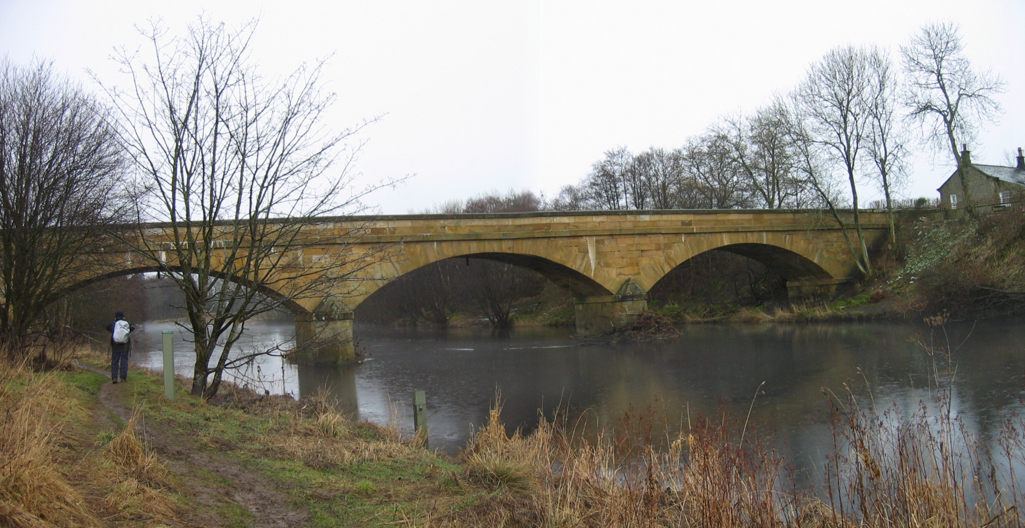
1140:
1095:
1050:
987:
941:
850:
762:
716:
676:
632:
541:
481:
308:
1361:
1341:
1331:
1311:
1301:
320:
1291:
1169:
Click on a date/time to view the file as it appeared at that time.
273:
258:
55° 08′ 34.97″ N, 2° 15′ 46.45″ W
1351:
162:
93:
143:
Bellingham Bridge, Northumberland (geograph 1695705).jpg
447:
Add a one-line explanation of what this file represents
1257:
83:(2,064 × 1,064 pixels, file size: 554 KB, MIME type:
1371:
1272:
1167:
201:
Creative
Commons Attribution Share-alike license 2.0
117:
Commons is a freely licensed media file repository.
683:
Creative
Commons Attribution-ShareAlike 2.0 Generic
657:
Creative
Commons Attribution-ShareAlike 2.0 Generic
416:https://creativecommons.org/licenses/by-sa/2.0
98:
831:https:\/\/www.geograph.org.uk\/photo\/1695705
422:Creative Commons Attribution-Share Alike 2.0
340:
189:
158:
140:
522:https:\/\/www.geograph.org.uk\/profile\/3612
179:
168:
14:
1120:
1075:
1030:
742:
382:– to copy, distribute and transmit the work
1274:The following other wikis use this file:
907:https://www.geograph.org.uk/photo/1695705
1219:Higher-resolution version from Geograph.
993:82c19168c8a38d0acdcfc654b5488f4ed708098f
594:https://www.geograph.org.uk/profile/3612
280:View this and other nearby images on:
233:
129:
327:and is licensed for reuse under the
248:
1160:
363:Attribution-Share Alike 2.0 Generic
351:
346:
331:Attribution-ShareAlike 2.0 license.
13:
1402:
1378:Usage on zh-min-nan.wikipedia.org
452:
446:
337:
314:
147:
130:
76:
1428:
1409:
451:
1258:
753:coordinates of the point of view
735:coordinates of the point of view
437:
393:Under the following conditions:
358:This file is licensed under the
350:
345:
339:
307:
286:
272:
264:
97:
31:
21:
434:
148:
1269:
1164:
857:file available on the internet
807:file available on the internet
433:
315:This image was taken from the
26:
1:
36:
1416:LEAD Technologies Inc. V1.01
1254:
877:Geograph Britain and Ireland
815:Geograph Britain and Ireland
768:55°8'34.969"N, 2°15'46.451"W
559:object of statement has role
506:object of statement has role
467:Items portrayed in this file
299:
263:
7:
1399:
1382:Bellingham (Northumberland)
1362:Bellingham (Northumberland)
1342:Bellingham (Northumberland)
1332:Bellingham (Northumberland)
1312:Bellingham (Northumberland)
1288:Usage on ceb.wikipedia.org
1278:Usage on azb.wikipedia.org
10:
1433:
1388:Usage on zh.wikipedia.org
1368:Usage on www.wikidata.org
1358:Usage on nl.wikipedia.org
1348:Usage on lt.wikipedia.org
1338:Usage on it.wikipedia.org
1328:Usage on fr.wikipedia.org
1318:Usage on fa.wikipedia.org
1308:Usage on eu.wikipedia.org
1302:Bellingham, Northumberland
1298:Usage on cy.wikipedia.org
1264:Bellingham, Northumberland
407:same or compatible license
137:
132:
1161:
16:
885:geograph.org.uk image ID
819:geograph.org.uk image ID
436:
373:
104:This is a file from the
41:
1248:
1218:
1197:19:04, 9 September 2017
211:required by the license
161:
108:. Information from its
321:this photograph's page
292:55.143047; -2.262903
111:description page there
46:Size of this preview:
1322:بلینگام (نورثامبرلند)
1292:Bellingham (distrito)
239:Les Hull /
220:Les Hull /
1282:بلینقام، نورثامبرلند
1005:determination method
964:determination method
70:2,064 × 1,064 pixels
1214:Geograph Update Bot
388:– to adapt the work
52:Other resolutions:
1227:16:08, 19 May 2011
574:author name string
514:author name string
66:1,280 × 660 pixels
62:1,024 × 528 pixels
1420:
1419:
1413:JPEG file comment
1270:Global file usage
1252:
1122:
1077:
1032:
744:
667:copyright license
653:copyright license
488:Bellingham Bridge
459:Bellingham Bridge
445:
336:
335:
319:collection. See
297:
296:
246:
245:
241:Bellingham Bridge
222:Bellingham Bridge
214:
198:
195:Reusing this file
153:Bellingham Bridge
126:
125:
106:Wikimedia Commons
32:Global file usage
1424:
1410:
1239:
1209:
1171:
1149:
1104:
1059:
1014:
1009:
909:
904:
900:described at URL
894:
889:
879:
874:
827:described at URL
790:
789:
784:
623:copyright status
609:copyright status
596:
591:
581:
578:
568:
563:
443:
429:
426:
423:
420:
417:
409:as the original.
371:
360:Creative Commons
354:
353:
349:
348:
343:
342:
329:Creative Commons
317:Geograph project
311:
304:
293:
290:
276:
275:
269:
268:
267:
261:
260:
249:
208:
192:
164:
152:
144:
138:
122:
101:
100:
94:
88:
86:
73:
58:640 × 330 pixels
54:320 × 165 pixels
48:800 × 412 pixels
1432:
1431:
1427:
1426:
1425:
1423:
1422:
1421:
1398:
1268:
1260:
1253:
1245:
1237:
1215:
1207:
1163:
1162:
1159:
1158:
1157:
1156:
1155:
1154:
1153:
1152:
1150:
1147:
1137:
1136:
1135:
1133:
1114:
1113:
1112:
1111:
1110:
1109:
1108:
1107:
1105:
1102:
1092:
1091:
1090:
1088:
1069:
1068:
1067:
1066:
1065:
1064:
1063:
1062:
1060:
1057:
1047:
1046:
1045:
1043:
1024:
1023:
1022:
1021:
1020:
1019:
1018:
1017:
1016:
1015:
1010:
1007:
998:
997:
996:
994:
984:
983:
982:
980:
957:
956:
955:
954:
953:
952:
951:
950:
948:
938:
937:
936:
934:
919:
918:
917:
916:
915:
914:
913:
912:
911:
910:
905:
902:
896:
895:
890:
887:
881:
880:
875:
872:
863:
862:
861:
859:
847:
846:
845:
843:
800:
799:
798:
797:
796:
795:
794:
793:
792:
791:
787:
785:
782:
773:
772:
771:
769:
759:
758:
757:
755:
732:
731:
730:
729:
728:
727:
726:
725:
723:
713:
712:
711:
709:
694:
693:
692:
691:
690:
689:
688:
687:
685:
673:
672:
671:
669:
650:
649:
648:
647:
646:
645:
644:
643:
641:
629:
628:
627:
625:
606:
605:
604:
603:
602:
601:
600:
599:
598:
597:
592:
589:
583:
582:
579:
576:
570:
569:
564:
561:
552:
551:
550:
548:
538:
537:
536:
534:
499:
498:
497:
496:
495:
494:
493:
492:
490:
478:
477:
476:
474:
450:
449:
448:
431:
430:
427:
424:
421:
418:
415:
414:
372:
369:
366:
355:
332:
302:
291:
265:
256:
255:
252:Camera location
247:
236:
229:
217:
174:geograph.org.uk
154:
142:
135:
128:
127:
116:
115:
114:is shown below.
90:
84:
82:
75:
74:
51:
12:
11:
5:
1430:
1418:
1417:
1414:
1401:
1397:
1396:
1395:
1394:
1386:
1385:
1384:
1376:
1375:
1374:
1366:
1365:
1364:
1356:
1355:
1354:
1346:
1345:
1344:
1336:
1335:
1334:
1326:
1325:
1324:
1316:
1315:
1314:
1306:
1305:
1304:
1296:
1295:
1294:
1286:
1285:
1284:
1271:
1267:
1266:
1256:
1251:
1250:
1247:
1243:
1240:
1234:
1229:
1224:
1221:
1220:
1217:
1213:
1210:
1206:2,064 × 1,064
1204:
1199:
1194:
1190:
1189:
1186:
1183:
1180:
1177:
1174:
1166:
1151:
1145:
1143:
1142:
1141:
1139:
1138:
1134:
1129:
1127:
1126:
1125:
1124:
1118:
1106:
1100:
1098:
1097:
1096:
1094:
1093:
1089:
1084:
1082:
1081:
1080:
1079:
1073:
1061:
1055:
1053:
1052:
1051:
1049:
1048:
1044:
1039:
1037:
1036:
1035:
1034:
1028:
1003:
1002:
1001:
1000:
999:
995:
992:
990:
989:
988:
986:
985:
981:
976:
974:
973:
972:
971:
969:
965:
961:
949:
946:
944:
943:
942:
940:
939:
935:
930:
928:
927:
926:
925:
923:
898:
897:
883:
882:
868:
867:
866:
865:
864:
860:
855:
853:
852:
851:
849:
848:
844:
841:source of file
839:
837:
836:
835:
834:
832:
828:
824:
820:
816:
812:
808:
804:
803:source of file
778:
777:
776:
775:
774:
770:
767:
765:
764:
763:
761:
760:
756:
751:
749:
748:
747:
746:
740:
736:
724:
721:
719:
718:
717:
715:
714:
710:
705:
703:
702:
701:
700:
698:
686:
681:
679:
678:
677:
675:
674:
670:
665:
663:
662:
661:
660:
658:
654:
642:
637:
635:
634:
633:
631:
630:
626:
621:
619:
618:
617:
616:
614:
610:
585:
584:
572:
571:
557:
556:
555:
554:
553:
549:
546:
544:
543:
542:
540:
539:
535:
530:
528:
527:
526:
525:
523:
519:
515:
511:
507:
503:
491:
486:
484:
483:
482:
480:
479:
475:
470:
468:
465:
464:
463:
462:
460:
456:
442:
441:
438:
435:
413:
412:
411:
410:
400:
391:
390:
389:
383:
376:You are free:
367:
357:
356:
338:
334:
333:
312:
301:
298:
295:
294:
284:
278:
253:
244:
243:
237:
234:
231:
230:
225:
218:
215:
203:
202:
199:
187:
186:
181:
177:
176:
170:
166:
165:
160:
156:
155:
145:
136:
134:
131:
124:
123:
102:
92:
91:
45:
40:
39:
34:
29:
24:
19:
9:
6:
4:
3:
2:
1429:
1415:
1412:
1411:
1408:
1405:
1393:
1390:
1389:
1387:
1383:
1380:
1379:
1377:
1373:
1370:
1369:
1367:
1363:
1360:
1359:
1357:
1353:
1350:
1349:
1347:
1343:
1340:
1339:
1337:
1333:
1330:
1329:
1327:
1323:
1320:
1319:
1317:
1313:
1310:
1309:
1307:
1303:
1300:
1299:
1297:
1293:
1290:
1289:
1287:
1283:
1280:
1279:
1277:
1276:
1275:
1265:
1262:
1261:
1246:
1241:
1235:
1233:
1230:
1228:
1225:
1223:
1222:
1216:
1211:
1205:
1203:
1200:
1198:
1195:
1192:
1191:
1187:
1184:
1181:
1178:
1175:
1173:
1172:
1170:
1144:
1132:
1128:
1099:
1087:
1083:
1054:
1042:
1038:
1013:
1006:
991:
979:
975:
945:
933:
929:
908:
901:
893:
886:
878:
871:
858:
854:
842:
838:
781:
766:
754:
750:
720:
708:
704:
684:
680:
668:
664:
640:
636:
624:
620:
595:
588:
575:
567:
560:
545:
533:
529:
489:
485:
473:
469:
466:
439:
432:
419:CC BY-SA 2.0
408:
404:
401:
398:
395:
394:
392:
387:
384:
381:
378:
377:
375:
374:
368:Attribution:
364:
361:
344:
330:
326:
322:
318:
313:
310:
306:
305:
289:
285:
283:
282:OpenStreetMap
279:
277:
259:
254:
251:
250:
242:
238:
232:
228:
224: /
223:
219:
212:
207:
205:
204:
200:
196:
191:
188:
185:
182:
178:
175:
171:
167:
157:
151:
146:
139:
120:
113:
112:
107:
103:
96:
95:
89:
80:
79:Original file
71:
67:
63:
59:
55:
49:
44:
38:
35:
33:
30:
28:
25:
23:
20:
18:
15:
1406:
1403:
1392:貝靈漢姆 (諾森伯蘭郡)
1273:
1168:
1165:File history
722:8 March 2006
566:photographer
510:photographer
402:
396:
385:
379:
324:
262:
240:
227:CC BY-SA 2.0
221:
163:8 March 2006
149:
119:You can help
109:
77:
22:File history
1352:Belindžamas
639:copyrighted
613:copyrighted
403:share alike
397:attribution
206:Attribution
141:Description
1255:File usage
1236:640 × 330
1182:Dimensions
947:image/jpeg
932:media type
922:media type
547:some value
190:Permission
85:image/jpeg
27:File usage
1179:Thumbnail
1176:Date/Time
1041:data size
1027:data size
707:inception
697:inception
300:Licensing
235:InfoField
216:InfoField
150:English:
1400:Metadata
1244:Paravane
1208:(554 KB)
1056:567,267
978:checksum
960:checksum
870:operator
811:operator
580:Les Hull
440:Captions
386:to remix
380:to share
370:Les Hull
365:license.
325:Les Hull
184:Les Hull
37:Metadata
1372:Q451687
1238:(70 KB)
1193:current
1188:Comment
892:1695705
823:1695705
780:heading
739:heading
532:creator
502:creator
472:depicts
455:depicts
444:English
133:Summary
81:
1146:2,064
1101:1,064
1086:height
1072:height
788:degree
743:degree
270:
180:Author
169:Source
1148:pixel
1131:width
1121:pixel
1117:width
1103:pixel
1076:pixel
1012:SHA-1
968:SHA-1
172:From
1185:User
1058:byte
1031:byte
786:112
428:true
425:true
159:Date
17:File
587:URL
518:URL
1008::
903::
888::
873::
783::
590::
577::
562::
68:|
64:|
60:|
56:|
50:.
213:)
209:(
197:)
193:(
121:.
87:)
72:.
Text is available under the Creative Commons Attribution-ShareAlike License. Additional terms may apply.
.jpg)
.jpg¶ms=055.143047_N_-002.262903_E_globe:Earth_type:camera_heading:112.00&language=en)
