666:"}},"text\/plain":{"en":{"":"checksum"}}},"{\"value\":\"cfe52e05caf1638cbdd8da108b32c18893cf6f2f\",\"type\":\"string\"}":{"text\/html":{"en":{"P4092":"cfe52e05caf1638cbdd8da108b32c18893cf6f2f"}},"text\/plain":{"en":{"P4092":"cfe52e05caf1638cbdd8da108b32c18893cf6f2f"}}},"{\"value\":{\"entity-type\":\"property\",\"numeric-id\":459,\"id\":\"P459\"},\"type\":\"wikibase-entityid\"}":{"text\/html":{"en":{"":"
38:
590:"}},"text\/plain":{"en":{"":"inception"}}},"{\"value\":{\"time\":\"+2009-05-26T00:00:00Z\",\"timezone\":0,\"before\":0,\"after\":0,\"precision\":11,\"calendarmodel\":\"http:\\\/\\\/www.wikidata.org\\\/entity\\\/Q1985727\"},\"type\":\"time\"}":{"text\/html":{"en":{"P571":"26 May 2009"}},"text\/plain":{"en":{"P571":"26 May 2009"}}}}": -->
298:
662:
304:
309:
261:
94:
529:"}},"text\/plain":{"en":{"P275":"GNU Free Documentation License, version 1.2 or later"}}},"{\"value\":{\"entity-type\":\"item\",\"numeric-id\":14946043,\"id\":\"Q14946043\"},\"type\":\"wikibase-entityid\"}":{"text\/html":{"en":{"P275":"
240:
628:"}},"text\/plain":{"en":{"":"media type"}}},"{\"value\":\"image\\\/svg+xml\",\"type\":\"string\"}":{"text\/html":{"en":{"P1163":"image\/svg+xml"}},"text\/plain":{"en":{"P1163":"image\/svg+xml"}}}}": -->
670:"}},"text\/plain":{"en":{"":"determination method"}}},"{\"value\":{\"entity-type\":\"item\",\"numeric-id\":13414952,\"id\":\"Q13414952\"},\"type\":\"wikibase-entityid\"}":{"text\/html":{"en":{"P459":"
525:"}},"text\/plain":{"en":{"":"copyright license"}}},"{\"value\":{\"entity-type\":\"item\",\"numeric-id\":50829104,\"id\":\"Q50829104\"},\"type\":\"wikibase-entityid\"}":{"text\/html":{"en":{"P275":"
481:"}},"text\/plain":{"en":{"":"copyright status"}}},"{\"value\":{\"entity-type\":\"item\",\"numeric-id\":50423863,\"id\":\"Q50423863\"},\"type\":\"wikibase-entityid\"}":{"text\/html":{"en":{"P6216":"
733:"}},"text\/plain":{"en":{"":"data size"}}},"{\"value\":{\"amount\":\"+98352\",\"unit\":\"http:\\\/\\\/www.wikidata.org\\\/entity\\\/Q8799\"},\"type\":\"quantity\"}":{"text\/html":{"en":{"P3575":"98,352
778:"}},"text\/plain":{"en":{"":"height"}}},"{\"value\":{\"amount\":\"+672\",\"unit\":\"http:\\\/\\\/www.wikidata.org\\\/entity\\\/Q355198\"},\"type\":\"quantity\"}":{"text\/html":{"en":{"P2048":"672
823:"}},"text\/plain":{"en":{"":"width"}}},"{\"value\":{\"amount\":\"+760\",\"unit\":\"http:\\\/\\\/www.wikidata.org\\\/entity\\\/Q355198\"},\"type\":\"quantity\"}":{"text\/html":{"en":{"P2049":"760
966:
936:
819:
1124:
1094:
350:– You must give appropriate credit, provide a link to the license, and indicate if changes were made. You may do so in any reasonable manner, but not in any way that suggests the licensor endorses you or your use.
1109:
251:
1229:
1184:
1189:
1149:
671:
530:
526:
482:
1334:
1358:
820:
775:
730:
663:
625:
478:
667:
587:
522:
1214:
1194:
64:
60:
68:
56:
52:
48:
42:
987:
Quadratische
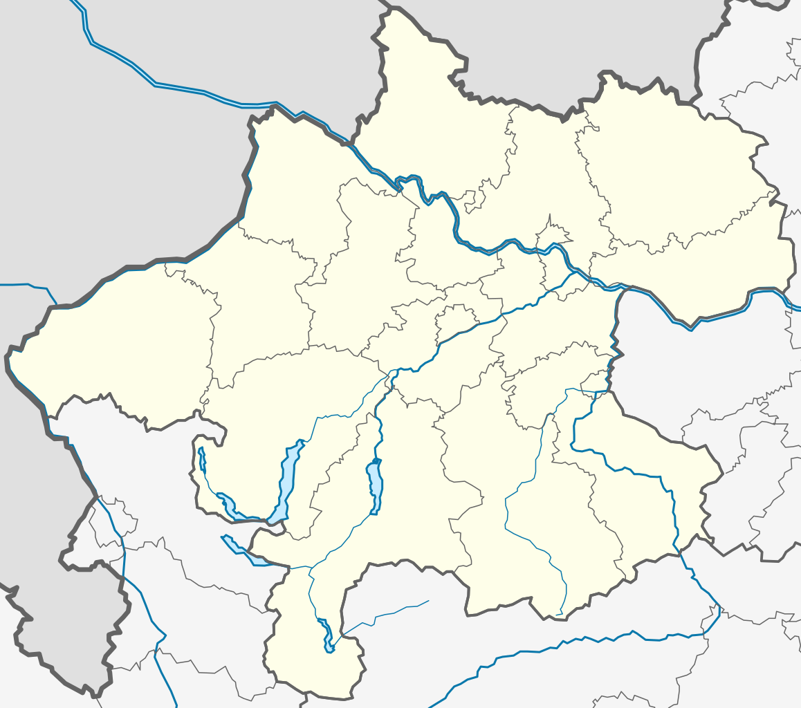
Plattkarte. Geographische Begrenzung der Karte: * N: 49.06847° N * S: 47.36394° N * W: 14.44427° O * O: 17.06623° O}} {{en|1=Location map of [[:e
1304:
406:
105:
1314:
1254:
1076:
77:
1199:
1159:
1319:
1264:
1279:
1071:
533:"}},"text\/plain":{"en":{"P275":"Creative Commons Attribution-ShareAlike 3.0 Unported"}}}}": -->
1299:
404:; with no Invariant Sections, no Front-Cover Texts, and no Back-Cover Texts. A copy of the license is included in the section entitled
1329:
1324:
965:
960:
935:
930:
715:
573:
556:
508:
1294:
1139:
1274:
1204:
357:
834:
789:
744:
681:
635:
492:
1134:
396:
708:
597:
540:
467:
1249:
1209:
1006:
1001:
1269:
1016:
1099:
1239:
1169:
1056:
319:
1011:
401:
1349:
1339:
1244:
1219:
905:
900:
356:– If you remix, transform, or build upon the material, you must distribute your contributions under the
37:
737:"}},"text\/plain":{"en":{"P3575":"98,352 byte"}}}}": -->
485:"}},"text\/plain":{"en":{"P6216":"copyrighted"}}}}": -->
997:
The following pages on the
English Knowledge use this file (pages on other projects are not listed):
1284:
1224:
1179:
1164:
827:"}},"text\/plain":{"en":{"P2049":"760 pixel"}}}}": -->
782:"}},"text\/plain":{"en":{"P2048":"672 pixel"}}}}": -->
113:
674:"}},"text\/plain":{"en":{"P459":"SHA-1"}}}}": -->
1154:
1144:
1129:
394:
Permission is granted to copy, distribute and/or modify this document under the terms of the
316:
984:
149:
8:
1344:
1259:
1174:
291:
I, the copyright holder of this work, hereby publish it under the following licenses:
223:
100:
457:
976:
946:
916:
1309:
1289:
1234:
177:
1031:
844:
799:
754:
691:
645:
607:
567:
550:
502:
1036:
1041:
1119:
1046:
1026:
271:
246:
383:
1021:
873:
Click on a date/time to view the file as it appeared at that time.
260:
1061:
1051:
153:
Quadratische
Plattkarte. Geographische Begrenzung der Karte:
239:
1066:
267:
181:
Equirectangular projection. Geographic limits of the map:
205:
88:
82:(SVG file, nominally 760 × 672 pixels, file size: 96 KB)
451:
Add a one-line explanation of what this file represents
995:
983:{{Information |Description={{de|1=Positionskarte von
1085:
871:
574:
Creative
Commons Attribution-ShareAlike 3.0 Unported
557:
531:
Creative
Commons Attribution-ShareAlike 3.0 Unported
527:
400:, Version 1.2 or any later version published by the
112:
Commons is a freely licensed media file repository.
1077:Module:Location map/data/Austria Upper Austria/doc
1072:Module:Location map/data/Austria Upper Austria
367:https://creativecommons.org/licenses/by-sa/3.0
93:
373:Creative Commons Attribution-Share Alike 3.0
297:
201:
135:
219:
211:
14:
824:
779:
734:
333:– to copy, distribute and transmit the work
41:Size of this PNG preview of this SVG file:
432:You may select the license of your choice.
1087:The following other wikis use this file:
697:cfe52e05caf1638cbdd8da108b32c18893cf6f2f
1125:Кеп:Меттиган карта Австри Лакха Австри
138:Austria Upper Austria location map.svg
124:
412:http://www.gnu.org/copyleft/fdl.html
320:Attribution-Share Alike 3.0 Unported
1095:Ҡалып:ПозКарта Австрия Үрге Австрия
864:
308:
303:
13:
456:
450:
431:
294:
290:
265:
244:
170:
142:
125:
75:
1370:
455:
996:
441:
388:
387:
344:Under the following conditions:
315:This file is licensed under the
307:
302:
296:
259:
238:
92:
31:
21:
1110:Шаблон:ПК Австрия Горна Австрия
438:
171:
1082:
868:
437:
418:GNU Free Documentation License
407:GNU Free Documentation License
397:GNU Free Documentation License
143:
26:
1:
1017:Bad Goisern am Hallstättersee
1012:Austrian Regionalliga Central
1007:2018–19 Austrian Regionalliga
1002:2017–18 Austrian Regionalliga
992:
463:Items portrayed in this file
284:
7:
1230:Ампфльванг-им-Хаусрукквальд
1185:Аллерхайлиген-им-Муьлькрайс
1057:Schwarzenberg am Böhmerwald
10:
1375:
1190:Альберндорф-ин-дер-Ридмарк
1150:Гайерсберг (Оберэстеррайх)
1116:Usage on ce.wikipedia.org
1106:Usage on bg.wikipedia.org
1091:Usage on ba.wikipedia.org
358:same or compatible license
132:
127:
865:
16:
440:
402:Free Software Foundation
324:
99:This is a file from the
36:
1335:Бад-Вимсбах-Найдхартинг
1215:Альтхайм (Лакха Австри)
1195:Алькофен (Лакха Австри)
982:
952:
922:
204:
103:. Information from its
1305:Ауэрбах (Лакха Австри)
106:description page there
1315:АхӀорн (Лакха Австри)
1255:Арбинг (Лакха Австри)
1320:Ацбах (Лакха Австри)
1265:Аспах (Лакха Австри)
709:determination method
668:determination method
230:SVG development
215:Own work by uploader
65:2,316 × 2,048 pixels
61:1,158 × 1,024 pixels
1200:Альтенберг-бай-Линц
1160:Айген-им-Муьлькрайс
339:– to adapt the work
148:Positionskarte von
47:Other resolutions:
1280:Аттерзе-ам-Аттерзе
961:13:24, 26 May 2009
931:13:27, 26 May 2009
901:12:08, 27 May 2009
1359:more global usage
1330:Ашах-ан-дер-Штайр
1325:Ашах-ан-дер-Донау
1083:Global file usage
990:
923:colour correction
826:
781:
736:
541:copyright license
523:copyright license
449:
429:
428:
281:
280:
270:was created with
121:
120:
101:Wikimedia Commons
32:Global file usage
1366:
973:
943:
913:
875:
853:
808:
763:
718:
713:
493:copyright status
479:copyright status
447:
425:
422:
419:
416:
413:
391:
390:
384:
380:
377:
374:
371:
368:
360:as the original.
317:Creative Commons
311:
310:
306:
305:
300:
299:
263:
254:
242:
207:
176:Location map of
175:
147:
139:
133:
117:
96:
95:
89:
83:
72:
69:760 × 672 pixels
57:869 × 768 pixels
53:543 × 480 pixels
49:271 × 240 pixels
43:678 × 599 pixels
1374:
1373:
1369:
1368:
1367:
1365:
1364:
1363:
1300:Аурольцмуьнстер
1295:Аурах-ам-Хонгар
1140:Орт-им-Иннкрайс
1081:
998:
991:
979:
971:
949:
941:
919:
911:
867:
866:
863:
862:
861:
860:
859:
858:
857:
856:
854:
851:
841:
840:
839:
837:
818:
817:
816:
815:
814:
813:
812:
811:
809:
806:
796:
795:
794:
792:
773:
772:
771:
770:
769:
768:
767:
766:
764:
761:
751:
750:
749:
747:
728:
727:
726:
725:
724:
723:
722:
721:
720:
719:
714:
711:
702:
701:
700:
698:
688:
687:
686:
684:
661:
660:
659:
658:
657:
656:
655:
654:
652:
642:
641:
640:
638:
623:
622:
621:
620:
619:
618:
617:
616:
614:
604:
603:
602:
600:
585:
584:
583:
582:
581:
580:
579:
578:
576:
565:
564:
563:
562:
561:
559:
547:
546:
545:
543:
520:
519:
518:
517:
516:
515:
514:
513:
511:
499:
498:
497:
495:
476:
475:
474:
473:
472:
470:
454:
453:
452:
435:
434:
433:
423:
420:
417:
414:
411:
382:
381:
378:
375:
372:
369:
366:
365:
323:
312:
293:
292:
287:
282:
277:
276:
275:
257:
256:
250:
233:
197:
169:
137:
130:
123:
122:
111:
110:
109:is shown below.
85:
81:
74:
73:
46:
12:
11:
5:
1372:
1361:of this file.
1355:
1354:
1353:
1352:
1347:
1342:
1337:
1332:
1327:
1322:
1317:
1312:
1307:
1302:
1297:
1292:
1287:
1282:
1277:
1275:Атнанг-Пуххайм
1272:
1270:Астен (Австри)
1267:
1262:
1257:
1252:
1247:
1242:
1237:
1232:
1227:
1222:
1217:
1212:
1207:
1202:
1197:
1192:
1187:
1182:
1177:
1172:
1167:
1162:
1157:
1152:
1147:
1142:
1137:
1135:Браунау-ам-Инн
1132:
1127:
1122:
1114:
1113:
1112:
1104:
1103:
1102:
1097:
1084:
1080:
1079:
1074:
1069:
1064:
1059:
1054:
1049:
1044:
1039:
1034:
1029:
1024:
1019:
1014:
1009:
1004:
994:
989:
988:
985:Oberösterreich
981:
977:
974:
968:
963:
958:
955:
954:
951:
947:
944:
938:
933:
928:
925:
924:
921:
917:
914:
908:
903:
898:
894:
893:
890:
887:
884:
881:
878:
870:
855:
849:
847:
846:
845:
843:
842:
838:
833:
831:
830:
829:
828:
822:
810:
804:
802:
801:
800:
798:
797:
793:
788:
786:
785:
784:
783:
777:
765:
759:
757:
756:
755:
753:
752:
748:
743:
741:
740:
739:
738:
732:
707:
706:
705:
704:
703:
699:
696:
694:
693:
692:
690:
689:
685:
680:
678:
677:
676:
675:
673:
669:
665:
653:
650:
648:
647:
646:
644:
643:
639:
634:
632:
631:
630:
629:
627:
615:
612:
610:
609:
608:
606:
605:
601:
596:
594:
593:
592:
591:
589:
577:
572:
570:
569:
568:
566:
560:
555:
553:
552:
551:
549:
548:
544:
539:
537:
536:
535:
534:
532:
528:
524:
512:
507:
505:
504:
503:
501:
500:
496:
491:
489:
488:
487:
486:
484:
480:
471:
466:
464:
461:
460:
459:
458:
446:
445:
442:
439:
430:
427:
426:
392:
364:
363:
362:
361:
351:
342:
341:
340:
334:
327:You are free:
314:
313:
295:
289:
288:
286:
283:
279:
278:
258:
237:
236:
234:
231:
227:
226:
221:
217:
216:
213:
209:
208:
203:
199:
198:
196:
195:
194:E: 15.00183° E
192:
191:W: 12.73041° E
189:
188:S: 47.44388° N
186:
185:N: 48.78063° N
168:
167:
166:O: 15.00183° O
164:
163:W: 12.73041° O
161:
160:S: 47.44388° N
158:
157:N: 48.78063° N
150:Oberösterreich
140:
131:
129:
126:
119:
118:
97:
87:
86:
40:
35:
34:
29:
24:
19:
9:
6:
4:
3:
2:
1371:
1362:
1360:
1351:
1348:
1346:
1343:
1341:
1338:
1336:
1333:
1331:
1328:
1326:
1323:
1321:
1318:
1316:
1313:
1311:
1308:
1306:
1303:
1301:
1298:
1296:
1293:
1291:
1288:
1286:
1283:
1281:
1278:
1276:
1273:
1271:
1268:
1266:
1263:
1261:
1258:
1256:
1253:
1251:
1248:
1246:
1243:
1241:
1238:
1236:
1233:
1231:
1228:
1226:
1223:
1221:
1218:
1216:
1213:
1211:
1208:
1206:
1205:Альтенфельден
1203:
1201:
1198:
1196:
1193:
1191:
1188:
1186:
1183:
1181:
1178:
1176:
1173:
1171:
1168:
1166:
1163:
1161:
1158:
1156:
1153:
1151:
1148:
1146:
1143:
1141:
1138:
1136:
1133:
1131:
1128:
1126:
1123:
1121:
1118:
1117:
1115:
1111:
1108:
1107:
1105:
1101:
1098:
1096:
1093:
1092:
1090:
1089:
1088:
1078:
1075:
1073:
1070:
1068:
1065:
1063:
1060:
1058:
1055:
1053:
1050:
1048:
1045:
1043:
1040:
1038:
1035:
1033:
1030:
1028:
1025:
1023:
1020:
1018:
1015:
1013:
1010:
1008:
1005:
1003:
1000:
999:
986:
980:
975:
969:
967:
964:
962:
959:
957:
956:
950:
945:
939:
937:
934:
932:
929:
927:
926:
920:
915:
909:
907:
904:
902:
899:
896:
895:
891:
888:
885:
882:
879:
877:
876:
874:
848:
836:
832:
803:
791:
787:
758:
746:
742:
717:
710:
695:
683:
679:
651:image/svg+xml
649:
637:
633:
611:
599:
595:
575:
571:
558:
554:
542:
538:
510:
506:
494:
490:
469:
465:
462:
443:
436:
409:
408:
403:
399:
398:
393:
386:
385:
370:CC BY-SA 3.0
359:
355:
352:
349:
346:
345:
343:
338:
335:
332:
329:
328:
326:
325:
321:
318:
301:
273:
269:
262:
253:
248:
241:
235:
229:
228:
225:
222:
218:
214:
210:
200:
193:
190:
187:
184:
183:
182:
179:
178:Upper Austria
174:
165:
162:
159:
156:
155:
154:
151:
146:
141:
134:
115:
108:
107:
102:
98:
91:
90:
84:
79:
78:Original file
70:
66:
62:
58:
54:
50:
44:
39:
33:
30:
28:
25:
23:
20:
18:
15:
1356:
1250:Антизенхофен
1210:Альтмуьнстер
1100:Үрге Австрия
1086:
872:
869:File history
405:
395:
353:
347:
336:
330:
180:
172:
152:
144:
114:You can help
104:
76:
22:File history
1350:Бад-Кройцен
1340:Бад-Гойзерн
1240:Андриксфурт
1170:Айстерсхайм
1032:Fuckersberg
978:Rosso Robot
948:Rosso Robot
918:Rosso Robot
613:26 May 2009
509:copyrighted
483:copyrighted
354:share alike
348:attribution
224:Rosso Robot
206:26 May 2009
136:Description
1245:Ансфельден
1220:Альтшвендт
1037:Helfenberg
993:File usage
970:760 × 672
940:760 × 672
910:760 × 672
886:Dimensions
636:media type
626:media type
27:File usage
1285:Атцесберг
1225:Альхаминг
1180:Айхкирхен
1165:Айденберг
1047:Pregarten
1027:Freistadt
953:plain svg
883:Thumbnail
880:Date/Time
745:data size
731:data size
598:inception
588:inception
285:Licensing
232:InfoField
173:English:
145:Deutsch:
1345:Бад-Ишль
1155:Адльванг
1145:Валдцелл
1130:Леондинг
1022:Eferding
682:checksum
664:checksum
444:Captions
337:to remix
331:to share
322:license.
272:Inkscape
249:code is
1260:Арнрайт
1175:Айтцинг
1042:OÖ Liga
972:(94 KB)
942:(94 KB)
912:(96 KB)
897:current
892:Comment
760:98,352
468:depicts
448:English
128:Summary
80:
1310:Афисль
1290:Ауберг
1235:Андорф
790:height
776:height
266:This
264:
243:
220:Author
212:Source
1357:View
1062:Steyr
1052:Sandl
852:pixel
835:width
825:pixel
821:width
807:pixel
780:pixel
716:SHA-1
672:SHA-1
252:valid
1120:Линц
1067:Wels
889:User
850:760
805:672
762:byte
735:byte
424:true
421:true
415:GFDL
379:true
376:true
245:The
202:Date
17:File
268:map
247:SVG
712::
67:|
63:|
59:|
55:|
51:|
45:.
410:.
274:.
255:.
116:.
71:.
Text is available under the Creative Commons Attribution-ShareAlike License. Additional terms may apply.
