743:"}},"text\/plain":{"en":{"":"coordinates of the point of view"}}},"{\"value\":{\"latitude\":50.601685,\"longitude\":-1.20159,\"altitude\":null,\"precision\":1.0e-6,\"globe\":\"http:\\\/\\\/www.wikidata.org\\\/entity\\\/Q2\"},\"type\":\"globecoordinate\"}":{"text\/html":{"en":{"P1259":"50\u00b036'6.066"N, 1\u00b012'5.724"W"}},"text\/plain":{"en":{"P1259":"50\u00b036'6.066\"N, 1\u00b012'5.724\"W"}}}}": -->
403:"}},"text\/plain":{"en":{"":"author name string"}}},"{\"value\":\"Barrie\",\"type\":\"string\"}":{"text\/html":{"en":{"P2093":"Barrie"}},"text\/plain":{"en":{"P2093":"Barrie"}}},"{\"value\":{\"entity-type\":\"property\",\"numeric-id\":3831,\"id\":\"P3831\"},\"type\":\"wikibase-entityid\"}":{"text\/html":{"en":{"":"
586:"}},"text\/plain":{"en":{"":"inception"}}},"{\"value\":{\"time\":\"+2004-06-03T00:00:00Z\",\"timezone\":0,\"before\":0,\"after\":0,\"precision\":11,\"calendarmodel\":\"http:\\\/\\\/www.wikidata.org\\\/entity\\\/Q1985727\"},\"type\":\"time\"}":{"text\/html":{"en":{"P571":"3 June 2004"}},"text\/plain":{"en":{"P571":"3 June 2004"}}}}": -->
620:
387:
202:
223:
261:
266:
72:
399:"}},"text\/plain":{"en":{"P2699":"https:\/\/www.geograph.org.uk\/profile\/3320"}}},"{\"value\":{\"entity-type\":\"property\",\"numeric-id\":2093,\"id\":\"P2093\"},\"type\":\"wikibase-entityid\"}":{"text\/html":{"en":{"":"
628:"}},"text\/plain":{"en":{"P7482":"file available on the internet"}}},"{\"value\":{\"entity-type\":\"property\",\"numeric-id\":137,\"id\":\"P137\"},\"type\":\"wikibase-entityid\"}":{"text\/html":{"en":{"":"
636:"}},"text\/plain":{"en":{"P137":"Geograph Britain and Ireland"}}},"{\"value\":{\"entity-type\":\"property\",\"numeric-id\":7384,\"id\":\"P7384\"},\"type\":\"wikibase-entityid\"}":{"text\/html":{"en":{"":"
407:"}},"text\/plain":{"en":{"":"object of statement has role"}}},"{\"value\":{\"entity-type\":\"item\",\"numeric-id\":33231,\"id\":\"Q33231\"},\"type\":\"wikibase-entityid\"}":{"text\/html":{"en":{"P3831":"
542:"}},"text\/plain":{"en":{"":"copyright license"}}},"{\"value\":{\"entity-type\":\"item\",\"numeric-id\":19068220,\"id\":\"Q19068220\"},\"type\":\"wikibase-entityid\"}":{"text\/html":{"en":{"P275":"
498:"}},"text\/plain":{"en":{"":"copyright status"}}},"{\"value\":{\"entity-type\":\"item\",\"numeric-id\":50423863,\"id\":\"Q50423863\"},\"type\":\"wikibase-entityid\"}":{"text\/html":{"en":{"P6216":"
624:"}},"text\/plain":{"en":{"":"source of file"}}},"{\"value\":{\"entity-type\":\"item\",\"numeric-id\":74228490,\"id\":\"Q74228490\"},\"type\":\"wikibase-entityid\"}":{"text\/html":{"en":{"P7482":"
632:"}},"text\/plain":{"en":{"":"operator"}}},"{\"value\":{\"entity-type\":\"item\",\"numeric-id\":1503119,\"id\":\"Q1503119\"},\"type\":\"wikibase-entityid\"}":{"text\/html":{"en":{"P137":"
644:"}},"text\/plain":{"en":{"P7384":"85998"}}},"{\"value\":{\"entity-type\":\"property\",\"numeric-id\":973,\"id\":\"P973\"},\"type\":\"wikibase-entityid\"}":{"text\/html":{"en":{"":"
391:"}},"text\/plain":{"en":{"":"creator"}}},"{\"value\":{\"entity-type\":\"property\",\"numeric-id\":2699,\"id\":\"P2699\"},\"type\":\"wikibase-entityid\"}":{"text\/html":{"en":{"":"
739:
648:"}},"text\/plain":{"en":{"":"described at URL"}}},"{\"value\":\"https:\\\/\\\/www.geograph.org.uk\\\/photo\\\/85998\",\"type\":\"string\"}":{"text\/html":{"en":{"P973":"
395:"}},"text\/plain":{"en":{"":"URL"}}},"{\"value\":\"https:\\\/\\\/www.geograph.org.uk\\\/profile\\\/3320\",\"type\":\"string\"}":{"text\/html":{"en":{"P2699":"
819:
640:"}},"text\/plain":{"en":{"":"geograph.org.uk image ID"}}},"{\"value\":\"85998\",\"type\":\"string\"}":{"text\/html":{"en":{"P7384":"
313:– You must give appropriate credit, provide a link to the license, and indicate if changes were made. You may do so in any reasonable manner, but not in any way that suggests the licensor endorses you or your use.
43:
185:
997:
625:
543:
499:
641:
633:
179:
408:
740:
637:
621:
495:
404:
400:
392:
645:
629:
583:
539:
396:
388:
649:
836:{{Information |Description={{geograph|85998|Barrie}} |Source=Originally from ; description page is/was . |Date=2005-12-16 (original upload date
546:"}},"text\/plain":{"en":{"P275":"Creative Commons Attribution-ShareAlike 2.0 Generic"}}}}": -->
652:"}},"text\/plain":{"en":{"P973":"https:\/\/www.geograph.org.uk\/photo\/85998"}}}}": -->
675:
569:
525:
195:
695:
230:
891:
This file contains additional information, probably added from the digital camera or scanner used to create or digitize it.
320:
480:
750:
703:
659:
509:
473:
460:
445:
718:
688:
593:
553:
418:
377:
1028:
83:
276:
51:
894:
If the file has been modified from its original state, some details may not fully reflect the modified file.
319:– If you remix, transform, or build upon the material, you must distribute your contributions under the
237:
on the
Geograph website for the photographer's contact details. The copyright on this image is owned by
411:"}},"text\/plain":{"en":{"P3831":"photographer"}}}}": -->
502:"}},"text\/plain":{"en":{"P6216":"copyrighted"}}}}": -->
846:
The following pages on the
English Knowledge use this file (pages on other projects are not listed):
91:
1102:
452:
273:
725:
710:
8:
1138:
217:
829:
201:
242:
78:
367:
850:
818:
813:
42:
1230:
1120:
1076:
920:
913:
130:
960:
162:
152:
1156:
760:
669:
603:
563:
519:
428:
222:
940:
234:
1248:
930:
903:
786:
Click on a date/time to view the file as it appeared at that time.
187:
180:
50° 36′ 06.07″ N, 1° 12′ 05.72″ W
126:
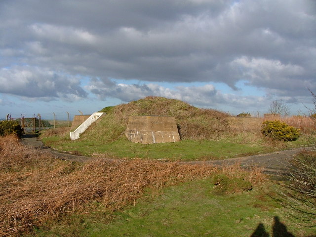
Ventnor Radar Stn Now up for sale, so it might be developed.
141:
66:
361:
Add a one-line explanation of what this file represents
869:Список участков особого научного значения острова Уайт
878:
844:
859:
784:
90:
Commons is a freely licensed media file repository.
570:
Creative
Commons Attribution-ShareAlike 2.0 Generic
544:
Creative
Commons Attribution-ShareAlike 2.0 Generic
1143:Flash did not fire, compulsory flash suppression
56:(640 × 480 pixels, file size: 94 KB, MIME type:
330:https://creativecommons.org/licenses/by-sa/2.0
71:
336:Creative Commons Attribution-Share Alike 2.0
254:
137:
113:
397:https:\/\/www.geograph.org.uk\/profile\/3320
158:
147:
14:
650:https:\/\/www.geograph.org.uk\/photo\/85998
296:– to copy, distribute and transmit the work
861:The following other wikis use this file:
131:http://www.westwight.clara.co.uk/Acks.htm
453:https://www.geograph.org.uk/profile/3320
726:https://www.geograph.org.uk/photo/85998
194:View this and other nearby images on:
102:
998:Digital Camera FinePix S5000 Ver3.00
241:and is licensed for reuse under the
170:
777:
277:Attribution-Share Alike 2.0 Generic
265:
260:
245:Attribution-ShareAlike 2.0 license.
13:
889:
366:
360:
251:
228:
120:
103:
49:
1273:
896:
365:
951:Date and time of data generation
845:
751:coordinates of the point of view
741:coordinates of the point of view
351:
307:Under the following conditions:
272:This file is licensed under the
264:
259:
253:
221:
200:
186:
70:
31:
21:
348:
121:
46:No higher resolution available.
925:1/750 sec (0.0013333333333333)
856:
781:
676:file available on the internet
626:file available on the internet
347:
229:This image was taken from the
26:
1:
1209:A directly photographed image
36:
841:
696:Geograph Britain and Ireland
634:Geograph Britain and Ireland
474:object of statement has role
405:object of statement has role
373:Items portrayed in this file
213:
7:
1182:Focal plane resolution unit
1039:Date and time of digitizing
886:
766:50°36'6.066"N, 1°12'5.724"W
10:
1278:
1193:One-chip color area sensor
1148:Supported Flashpix version
875:Usage on www.wikidata.org
865:Usage on ru.wikipedia.org
321:same or compatible license
110:
105:
1047:Meaning of each component
1004:File change date and time
778:
16:
1174:Focal plane Y resolution
1166:Focal plane X resolution
704:geograph.org.uk image ID
638:geograph.org.uk image ID
350:
287:
77:This is a file from the
41:
1214:Custom image processing
835:
140:
81:. Information from its
1258:Subject distance range
1068:Image compression mode
235:this photograph's page
206:50.601685; -1.201590
84:description page there
1112:Maximum land aperture
1042:00:00, 1 January 2003
1007:00:00, 1 January 2003
978:Horizontal resolution
954:00:00, 1 January 2003
1201:Digital still camera
814:18:35, 31 March 2007
1012:Y and C positioning
986:Vertical resolution
900:Camera manufacturer
302:– to adapt the work
1240:Scene capture type
1235:Auto white balance
461:author name string
401:author name string
1265:
1264:
857:Global file usage
839:
554:copyright license
540:copyright license
359:
250:
249:
233:collection. See
211:
210:
168:
167:
116:Ventnor Radar.jpg
99:
98:
79:Wikimedia Commons
52:Ventnor_Radar.jpg
32:Global file usage
1269:
1020:Exposure Program
897:
851:St Boniface Down
826:
788:
728:
723:
719:described at URL
713:
708:
698:
693:
646:described at URL
510:copyright status
496:copyright status
483:
478:
468:
465:
455:
450:
357:
343:
340:
337:
334:
331:
323:as the original.
285:
274:Creative Commons
268:
267:
263:
262:
257:
256:
243:Creative Commons
231:Geograph project
225:
218:
207:
204:
190:
189:
183:
182:
171:
143:
125:
117:
111:
95:
74:
73:
67:
61:
59:
1277:
1276:
1272:
1271:
1270:
1268:
1267:
1266:
1115:3 APEX (f/2.83)
1094:APEX brightness
885:
855:
847:
840:
832:
824:
780:
779:
776:
775:
774:
773:
772:
771:
770:
769:
767:
757:
756:
755:
753:
738:
737:
736:
735:
734:
733:
732:
731:
730:
729:
724:
721:
715:
714:
709:
706:
700:
699:
694:
691:
682:
681:
680:
678:
666:
665:
664:
662:
619:
618:
617:
616:
615:
614:
613:
612:
610:
600:
599:
598:
596:
581:
580:
579:
578:
577:
576:
575:
574:
572:
560:
559:
558:
556:
537:
536:
535:
534:
533:
532:
531:
530:
528:
516:
515:
514:
512:
493:
492:
491:
490:
489:
488:
487:
486:
485:
484:
479:
476:
470:
469:
466:
463:
457:
456:
451:
448:
439:
438:
437:
435:
425:
424:
423:
421:
386:
385:
384:
383:
382:
380:
364:
363:
362:
345:
344:
341:
338:
335:
332:
329:
328:
286:
283:
280:
269:
246:
216:
205:
178:
177:
174:Camera location
169:
153:geograph.org.uk
133:
115:
108:
101:
100:
89:
88:
87:is shown below.
63:
57:
55:
48:
47:
12:
11:
5:
1275:
1263:
1262:
1259:
1255:
1254:
1251:
1245:
1244:
1241:
1237:
1236:
1233:
1227:
1226:
1223:
1219:
1218:
1217:Normal process
1215:
1211:
1210:
1207:
1203:
1202:
1199:
1195:
1194:
1191:
1190:Sensing method
1187:
1186:
1183:
1179:
1178:
1175:
1171:
1170:
1167:
1163:
1162:
1159:
1153:
1152:
1149:
1145:
1144:
1141:
1135:
1134:
1131:
1127:
1126:
1123:
1117:
1116:
1113:
1109:
1108:
1105:
1099:
1098:
1095:
1091:
1090:
1087:
1083:
1082:
1079:
1073:
1072:
1069:
1065:
1064:
1063:
1062:
1061:does not exist
1059:
1056:
1053:
1048:
1044:
1043:
1040:
1036:
1035:
1032:
1025:
1024:
1023:Normal program
1021:
1017:
1016:
1013:
1009:
1008:
1005:
1001:
1000:
995:
991:
990:
987:
983:
982:
979:
975:
974:
971:
967:
966:
963:
956:
955:
952:
948:
947:
944:
937:
936:
933:
927:
926:
923:
917:
916:
914:FinePix S5000
911:
907:
906:
901:
888:
884:
883:
882:
881:
873:
872:
871:
858:
854:
853:
843:
838:
837:
834:
830:
827:
821:
816:
811:
807:
806:
803:
800:
797:
794:
791:
783:
768:
765:
763:
762:
761:
759:
758:
754:
749:
747:
746:
745:
744:
742:
717:
716:
702:
701:
687:
686:
685:
684:
683:
679:
674:
672:
671:
670:
668:
667:
663:
660:source of file
658:
656:
655:
654:
653:
651:
647:
643:
639:
635:
631:
627:
623:
622:source of file
611:
608:
606:
605:
604:
602:
601:
597:
592:
590:
589:
588:
587:
585:
573:
568:
566:
565:
564:
562:
561:
557:
552:
550:
549:
548:
547:
545:
541:
529:
524:
522:
521:
520:
518:
517:
513:
508:
506:
505:
504:
503:
501:
497:
472:
471:
459:
458:
444:
443:
442:
441:
440:
436:
433:
431:
430:
429:
427:
426:
422:
417:
415:
414:
413:
412:
410:
406:
402:
398:
394:
390:
381:
376:
374:
371:
370:
369:
368:
356:
355:
352:
349:
327:
326:
325:
324:
314:
305:
304:
303:
297:
290:You are free:
281:
271:
270:
252:
248:
247:
226:
215:
212:
209:
208:
198:
192:
175:
166:
165:
160:
156:
155:
149:
145:
144:
139:
135:
134:
118:
109:
107:
104:
97:
96:
75:
65:
64:
45:
40:
39:
34:
29:
24:
19:
9:
6:
4:
3:
2:
1274:
1260:
1257:
1256:
1252:
1250:
1247:
1246:
1242:
1239:
1238:
1234:
1232:
1231:White balance
1229:
1228:
1225:Auto exposure
1224:
1222:Exposure mode
1221:
1220:
1216:
1213:
1212:
1208:
1205:
1204:
1200:
1197:
1196:
1192:
1189:
1188:
1184:
1181:
1180:
1176:
1173:
1172:
1168:
1165:
1164:
1160:
1158:
1155:
1154:
1150:
1147:
1146:
1142:
1140:
1137:
1136:
1132:
1129:
1128:
1124:
1122:
1121:Metering mode
1119:
1118:
1114:
1111:
1110:
1106:
1104:
1103:Exposure bias
1101:
1100:
1096:
1093:
1092:
1088:
1086:APEX aperture
1085:
1084:
1080:
1078:
1077:Shutter speed
1075:
1074:
1070:
1067:
1066:
1060:
1057:
1054:
1051:
1050:
1049:
1046:
1045:
1041:
1038:
1037:
1033:
1030:
1027:
1026:
1022:
1019:
1018:
1014:
1011:
1010:
1006:
1003:
1002:
999:
996:
994:Software used
993:
992:
988:
985:
984:
980:
977:
976:
972:
969:
968:
964:
962:
958:
957:
953:
950:
949:
945:
942:
939:
938:
934:
932:
929:
928:
924:
922:
921:Exposure time
919:
918:
915:
912:
909:
908:
905:
902:
899:
898:
895:
892:
880:
877:
876:
874:
870:
867:
866:
864:
863:
862:
852:
849:
848:
833:
831:Angusmclellan
828:
822:
820:
817:
815:
812:
809:
808:
804:
801:
798:
795:
792:
790:
789:
787:
764:
752:
748:
727:
720:
712:
705:
697:
690:
677:
673:
661:
657:
607:
595:
591:
571:
567:
555:
551:
527:
523:
511:
507:
482:
475:
462:
454:
447:
432:
420:
416:
379:
375:
372:
353:
346:
333:CC BY-SA 2.0
322:
318:
315:
312:
309:
308:
306:
301:
298:
295:
292:
291:
289:
288:
282:Attribution:
278:
275:
258:
244:
240:
236:
232:
227:
224:
220:
219:
203:
199:
197:
196:OpenStreetMap
193:
191:
181:
176:
173:
172:
164:
161:
157:
154:
150:
146:
136:
132:
129:
124:
119:
112:
93:
86:
85:
80:
76:
69:
68:
62:
53:
44:
38:
35:
33:
30:
28:
25:
23:
20:
18:
15:
1130:Light source
961:focal length
910:Camera model
893:
890:
860:
785:
782:File history
481:photographer
409:photographer
316:
310:
299:
293:
238:
127:
122:
92:You can help
82:
50:
22:File history
1198:File source
1157:Color space
970:Orientation
609:3 June 2004
526:copyrighted
500:copyrighted
317:share alike
311:attribution
142:3 June 2004
114:Description
1206:Scene type
842:File usage
823:640 × 480
799:Dimensions
434:some value
58:image/jpeg
27:File usage
1249:Sharpness
941:ISO speed
796:Thumbnail
793:Date/Time
594:inception
584:inception
214:Licensing
123:English:
1243:Standard
1015:Co-sited
931:F-number
904:FUJIFILM
887:Metadata
879:Q7592680
689:operator
630:operator
354:Captions
300:to remix
294:to share
279:license.
37:Metadata
1261:Unknown
1133:Unknown
1125:Pattern
1031:version
825:(94 KB)
810:current
805:Comment
419:creator
389:creator
378:depicts
358:English
106:Summary
54:
1253:Normal
989:72 dpi
981:72 dpi
973:Normal
965:5.7 mm
943:rating
467:Barrie
284:Barrie
239:Barrie
184:
163:Barrie
159:Author
148:Source
1177:2,405
1169:2,405
1139:Flash
959:Lens
935:f/5.6
711:85998
642:85998
151:From
128:Link
1161:sRGB
1097:8.83
1029:Exif
802:User
342:true
339:true
138:Date
17:File
1081:9.5
1034:2.2
946:160
446:URL
393:URL
1058:Cr
1055:Cb
722::
707::
692::
477::
464::
449::
1185:3
1151:1
1107:0
1089:5
1071:3
1052:Y
94:.
60:)
